- Home
- About
- Map
- Trips
- Bringing Boat West
- Migration West
- Solo Motorcycle Ride
- Final Family XC Trip
- Colorado Rockies
- Graduates' XC Trip
- Yosemite & Nevada
- Colorado & Utah
- Best of Utah
- Southern Loop
- Pacific Northwest
- Northern Loop
- Los Angeles to NYC
- East Coast Trips
- Martha's Vineyard
- 1 Week in Quebec
- Southeast Coast
- NH Backpacking
- Martha's Vineyard
- Canadian Maritimes
- Ocracoke Island
- Edisto Island
- First Landing '02
- Hunting Island '02
- Stowe in Winter
- Hunting Island '01
- Lake Placid
- Chesapeake
- Provincetown
- Hunting Island '00
- Acadia in Winter
- Boston Suburbs
- Niagara Falls
- First Landing '99
- Cape Hatteras
- West Coast Trips
- Burning Man
- Utah Off-Roading
- Maui
- Mojave 4WD Course
- Colorado River Rafting
- Bishop & Death Valley
- Kauai
- Yosemite Fall
- Utah Off-Road
- Lost Coast
- Yosemite Valley
- Arizona and New Mexico
- Pescadero & Capitola
- Bishop & Death Valley
- San Diego, Anza Borrego, Joshua Tree
- Carmel
- Death Valley in Fall
- Yosemite in the Fall
- Pacific Northwest
- Utah Off-Roading
- Southern CA Deserts
- Yosemite & Covid
- Lake Powell Covid
- Eastern Sierra & Covid
- Bishop & Death Valley
- Central & SE Oregon
- Mojave Road
- Eastern Sierra
- Trinity Alps
- Tuolumne Meadows
- Lake Powell Boating
- Eastern Sierra
- Yosemite Winter
- Hawaii
- 4WD Eastern Sierra
- 4WD Death Valley +
- Southern CA Deserts
- Christmas in Tahoe
- Yosemite & Pinnacles
- Totality
- Yosemite & Sierra
- Yosemite Christmas
- Yosemite, San Diego
- Yosemite & North CA
- Seattle to Sierra
- Southwest Deserts
- Yosemite & Sierra
- Pacific Northwest
- Yosemite & South CA
- Pacific Northwest
- Northern California
- Southern Alaska
- Vancouver Island
- International Trips
- Index
- Tips
- Books
- Photos/Videos
- Search
- Contact
Tofino
Wednesday, August 16, 2023 - 3:30pm by Lolo200 miles and 5 hours from our last stop - 2 night stay
Travelogue
.thumbnail.jpg) Our cozy cabin at the Mackenzie Beach ResortWe boarded the 8:30 ferry from Port Angeles, which would take us on a 90-minute scenic journey through the Strait of Juan de Fuca to Victoria on Vancouver Island.
Our cozy cabin at the Mackenzie Beach ResortWe boarded the 8:30 ferry from Port Angeles, which would take us on a 90-minute scenic journey through the Strait of Juan de Fuca to Victoria on Vancouver Island.
As we drove onto the ferry, I got very nostalgic thinking back to our 30 years of annual trips to Martha’s Vineyard. Time to make new memories on an island of a very different sort that we had never been to before.
 Sunset stroll along Mackenzie BeachOur plan was to stay 2 nights in Tofino, 2 in Ucluelet, and 1 in Victoria. Unbeknownst to us when we made our reservations, there was a pretty serious periodic road closure situation on Highway 4 to Tofino, which would impact us. Crews were working on rock scaling, a labor-intensive process to remove dangerous rock material from cliff faces along the Cameron Bluff.
Our hotel informed us that the highway would be open from 11:30 am to 1:30 pm and then again after 5 pm. What they neglected to tell us was that the “flush” (movement of cars) switched at 12:30 pm from going towards Tofino to going towards Victoria.
 Herb and his hot tubIt took us a while to get through the ferry unloading process and customs, so we didn’t arrive at the closure point until 12:50 pm, meaning we had just missed our “flush.” Now we had to wait until 5:00 pm to go through.
We sat in the hot car for a while, but then I noticed that some people were walking a short distance through a wooded section alongside the road to get to the shores of nearby Cameron Lake, which we could just see through the trees from our car.
 Along our morning runWe decided to make the best of a pretty bad situation and take our beach chairs out to the small beach and read for a while. It certainly beat sitting in a hot car getting aggravated.
Finally, at 5:00 pm they let us through and we drove the 2+ hours to our hotel on MacKenzie Beach in Tofino. Fortunately, our MacKenzie Beach Resort cabin (#7) was worth all the effort getting there - beautiful ocean views and a hot tub and fire pit on our private deck.
.thumbnail.jpg) Lunch out in TofinoTofino is a very popular destination, so we were very lucky to get such a great place to stay on such short notice. It wasn’t exactly cheap though. It cost $750 USD for 2 nights. Herb and I spend most of our vacations in a motorhome or camping in the back of our 4Runner, so we rationalized that if we amortized our cost per night vacationing, it was pretty cheap. It’s good to splurge once in a while.
Lunch out in TofinoTofino is a very popular destination, so we were very lucky to get such a great place to stay on such short notice. It wasn’t exactly cheap though. It cost $750 USD for 2 nights. Herb and I spend most of our vacations in a motorhome or camping in the back of our 4Runner, so we rationalized that if we amortized our cost per night vacationing, it was pretty cheap. It’s good to splurge once in a while.
And the best part was that the heat wave had hit Tofino, meaning that it was a balmy 80 degrees, very unusual for what is normally a cool, wet climate. Herb hates cold and damp and would happily spend every vacation in a desert if I gave him the chance, so he was quite happy with the Tofino heat wave.
 Surfers in Cox BayIt was already past 7:00 pm when we finally got here, so we immediately poured ourselves a glass of wine and walked out to the beach to enjoy the sunset. There were still dozens of paddle boarders and surfers out on the water enjoying the last minutes of daylight.
Once the sun was down, we scurried back to our cabin and spent an hour soaking in our private hot tub. It was a really cute hot tub - oval, made of wood, and 4 steps to get into it. It was definitely only a hot tub for 2. I kept trying to think where we could put one of these in our small yard.
 Crazy "non"-trail up to Cox Bay LookoutAt one point I left the hot tub to go into our room to get my phone. Not realizing that the sliding glass door was closed, I smashed my nose really hard into the glass. Herb and I felt the next few minutes feeling it to see if it was broken, but everything seemed in its proper place. It didn’t swell too much, but I did feel it for over a week. I am such a clutz.
The next morning we set out on a run from our beach (MacKenzie Beach) and tried to make our way north to the town of Tofino. It required some navigating through woods, scrambling on rocks, climbing down stairs down to beaches, but we did manage to get to Middle Beach, Third Beach, and Tonquin Beach before turning around. It was a very fun and well-needed 5-mile run.
 View from Cox Bay LookoutAfter a shower and another dip in the hot tub, we headed into town to explore and have lunch.
The town was pretty busy, and we didn’t really feel like waiting around for a table in a sit-down restaurant, so we chose the very highly-rated Al’oha Poke and Tostada take-out restaurant at the end of Campbell Street.
It’s not really a food truck, but rather set in one of a group of six container businesses with shared outdoor seating. Except for the bees vying for our lunch, it was great.
 Made it down the Cox Bay trailI had the Aloha Bowl, which had Salmon, Shrimp, Calamari, rice edamame, shallots, avocado, pickled radishes, spicy aioli, teriyaki sauce, and I can’t even remember what else. Herb had the Tuna Bowl with Mahi Mahi, sweet onion, avocado, sesame seeds, garlic mayo, and more stuff that he can’t remember either. It was absolutely delicious.
Later that afternoon, we drove down to Cox Bay Beach, one of the most beautiful beaches on the Island and the best place to learn to surf in all of Canada, because of the consistent, medium-sized waves. Our son and daughter-in-law took surfing lessons here last year and absolutely loved it. Well, we weren’t doing that, but we were going to try to do what is considered the best hike in Tofino - the scramble up to the Cox Bay Lookout for a fabulous view of Cox Bay and the surrounding beaches, islands, and mountains.
 Evening on our deckBut first, we spent a few hours just relaxing on this beautiful beach watching several groups taking surfing lessons.
As sunset approached, we decided it was time to head up to the lookout. Not wanting to carry our beach chairs and cooler up a difficult trail, Herb hid them in a small cave behind the sandy beach. Hopefully, we would be able to find them later.
The trail was not signed or marked in any way, so we relied on the Gaia app, which showed the trail as well as our progress along it. Gaia has been an extremely valuable tool for us to find some great trails, as well as to not get lost.
 Morning farewell stroll on Mackenzie BeachThe trail (if you could call it that) started at the southern end of the beach. We looked for the biggest opening in the forest that looked like a path and started up. The first third of the trail wasn’t very steep, but had exposed roots and rocks to navigate around.
The next section is where the canopy thickens and the terrain becomes steeper, with fallen trees to climb over or under. The last third of the hike gets very steep with some exposed rock.
Every once in a while we noticed on Gaia that we were getting off trail, but we figured if we just kept going up towards the top of the ridge we were generally going in the right direction.
 Herb fighting the jungleEventually, we came out to a beautiful viewpoint overlooking Cox Bay, the mountains, and an endless pine forest in between. I’m not sure if we had reached the official lookout, as Gaia seemed to show that we should be more to the right, but there was a giant ravine between us and where it wanted us to go.
It was an incredible spot though, so we declared it was good enough, as did about a dozen other people who joined us. We stayed for the golden hour of sunset, but left in time to not have to go down this crazy trail in the dark. Surprisingly, going down wasn’t as bad as I thought it would be.
As we strolled back along the beach toward the parking lot, we remembered to pick up our hidden chairs and cooler along the way.
 Mackenzie Beach RhinoOf course when we got back to our cabin, we soaked in the hot tub for a while. Herb stayed in much longer than me, squeezing out the last minutes of hot tub warmth. I think I was already asleep by the time he got into bed. He must have been as wrinkled as a prune.
It was going to be hard to leave this place tomorrow morning. It was pretty ideal.
Before leaving Tofino, we took one more stroll on MacKenzie Beach, this time heading south. We thought we could possibly find a path through the jungle-like border of our beach to get to Chesterman Beach, but it was just too thick.
We did, however, meet a sand rhinoceros, complete with driftwood horn.
Lake Crescent - Olympic National Park
Tuesday, August 15, 2023 - 3:15pm by Lolo210 miles and 4 hours from our last stop - 1 night stay
Travelogue
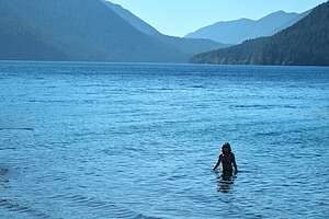 Lake CrescentSince it would take us only 4 hours to get to Port Angeles, where we needed to spend the night to catch an early morning ferry to Vancouver Island, we had plenty of time to have some fun along the way.
Fortunately, Port Angeles is right near the northern end of Olympic National Park, so we decided to drive into the park and spend some time at Crescent Lake. It was still ridiculously hot, so spending time relaxing at a lake sounded perfect.
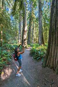 Hike to Marymere FallsThis was not our first visit to Crescent Lake. 33 years ago we traveled here on a vacation with our then one-year-old son Andrew. We lived in New Jersey then, so it was a very long day of travel - flight from Newark Airport to Seattle, rental car pickup, ferry to Bremerton, and then a drive to Crescent Lake. Despite our long travel day, it was still light out when we arrived, as we had gained 3 hours traveling West.
Herb often accuses me of trying to pack 10 pounds in a 5 pound bag when we travel. Well, I was about to pack 15. Somehow I convinced Herb that hiking to nearby Marymere falls (less than a mile from our cabin) would be a good idea. After all, we needed to stretch our legs a bit after so much sitting.
Somewhat reluctantly Herb loaded Andrew into the baby backpack and off we went to show him his first waterfall. Unfortunately, by the time we got there he was totally slumped over in the backpack fast asleep. Smart kid. We should have been too.
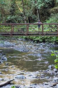 Bridge to Marymere FallsWell, today would be more relaxing than that.
Lake Crescent is absolutely stunning. It was formed when glaciers carved out deep valleys during the last Ice Age. The lake is 900-feet deep, one of the deepest in Washington state. Its waters are a brilliant blue and exceptionally clear, due to the low levels of nitrogen in the water, which inhibit the growth of algae.
It looked extremely inviting, but first lunch in the historic Lake Crescent Lodge with its stone fireplace and sunroom overlooking the azure waters of the lake. I’ve never met a national park lodge that I didn’t like. They are always so cozy and warm.
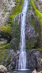 Marymere FallsAfter lunch, we got our chairs and headed to the small beach along the lake’s shoreline. Since the heat wave was still with us, I enjoyed dipping in and out of the lake to keep cool. It was so pleasant and relaxing after 3 long driving days.
Later that afternoon, we hiked from the beach to Marymere Falls, where we had brought our cute little Andrew so long ago. It’s a lovely short hike, about 0.9 miles each way, through an old-growth, moss-laden forest, across two scenic bridges over flowing creeks, and then 200-feet up a set of stairs to two picturesque viewpoints of 90-foot high Marymere Falls.
Lots of nice scenery for such an easy short hike.
Then it was on to the Angeles Motel, which we chose for its proximity to the Black Ball Ferry to Vancouver Island. Hotels in Port Angeles are pretty pricey because they have a captive audience of early ferry goers. It killed me to have to pay $200 for a crappy little room, when we later spent the same amount for a lovely room on the harbor in Ucluelet. Oh well.
Sauvie Island
Monday, August 14, 2023 - 2:30pm by Lolo288 miles and 5 hours from our last stop - 1 night stay
Travelogue
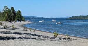 Sauvie IslandWe had to get to Port Angeles on the 3rd night of our adventure to catch an early ferry to Vancouver Island on the following morning.
That meant we could slow the driving pace down a bit and try to squeeze in some fun activity today. It was ridiculously hot out all the way up along the coast. Portland was a record breaking 106 degrees, tied with their previous record two years ago, when we coincidentally were in Portland as well. I have only been to Portland twice in my life and both times it was 106.
During that last hot Portland visit, we had discovered Sauvie Island, just ten miles northwest of Portland at the confluence of the Willamette and Columbia Rivers. It was hard to believe that this pristine oasis of farmland and beaches was so near to the city.
While the southern half of the island is predominantly rural farmland, the northeastern side has beautiful sandy beaches along the Columbia River with some shade trees further back from the water. The perfect place to spend a scorching day.
We were early enough to easily find a parking spot along a lovely sandy beach, where we spent the day relaxing, reading, and dipping ourselves in the Columbia River to get cool.
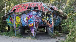 Sauvie Island "floating saucer"Two years ago we had discovered the Sauvie Island "floating saucer," a large submarine / flying saucer like object colorfully painted all over with graffiti. I set off in search of it again and found it tucked in at the edge of the woods.
A nearby sign gave its history: This 31-foot paddle wheel boat was built in 1973 in Hubbard, Oregon, by an engineer named Richard Ensign. It took him two years and cost $10,000. It could sleep 12 people and had a wood stove. It was launched on the Willamette River, went through the locks at Willamette Falls, and was on the front page of the Oregonian. It was dubbed the "floating saucer." It most likely was left here by the February 1996 flood.
After a little more dipping in and out of the water - I love the cooling evaporation process on a hot day - we headed out to find a place to stay for the night.
We drove for about a half hour to a Best Western in the little town of Oak Meadows. Only 4 more hours to Port Angeles.
Grants Pass
Sunday, August 13, 2023 - 2:00pm by Lolo370 miles and 6.5 hours from our last stop - 1 night stay
Travelogue
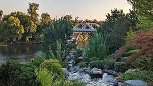 Gardens near Riverside InnThis was pretty much just a driving day towards the ferry in Port Angeles (860 miles from home). We conquered 388 of those miles by getting to Grants Pass, just over the border into Oregon. It has often served as a stopping point on our trips up the Pacific Coast.
We stayed this time at the Riverside Inn, right alongside the Rogue River, known for its exciting white water rafting trip.
Unfortunately, the Twisted Cork, the great restaurant we discovered the last time we were here, was closed on Sunday, so we wound up eating the salads that we had brought along on our lovely balcony overlooking the river.
The Lost Coast
Wednesday, July 26, 2023 - 8:15am by Lolo230 miles and 8 hours from our last stop - 3 night stay
Travelogue
Day 1 - St. Orres to Usal Beach
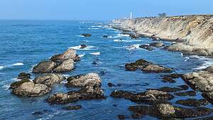 Point ArenaIt was hard to get to the Lost Cost because there were so many beautiful distractions along the way. The drive north from Jenner to Fort Bragg on the Pacific Coast Highway (Route 1) had to be one of the most beautiful stretches of highway I have ever been on.
We stopped briefly at an old favorite, the headlands overlooking the Point Arena Lighthouse, before continuing on.
It was getting near lunchtime, so I looked on Google Maps to find a place that might be nice to have a picnic. I found a photo icon near a place called Pomo Bluffs Park, set on a rocky bluff just south of the Noyo River in Fort Bragg.
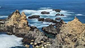 Pomo Bluffs ParkAlthough we have been to Mendocino many times, we have never really stopped or even gone through Fort Bragg.
The two towns are quite different. Mendocino is a tiny, quaint, upscale “New England” type village, set atop a beautiful headland. It is mostly a tourist town and can be quite expensive.
On the other hand, Fort Bragg is a full-service town with about 6,000 residents. However, it too has beautiful headlands, oceanfront walking paths, and lovely beaches - including the famous Glass Beach. Plenty of tourists flock here as well, and the prices are much more reasonable than Mendocino.
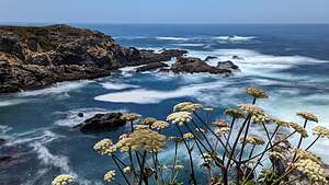 Pomo Bluffs ParkHowever, the views from atop Pomo Bluffs Park are equally, if perhaps even more, beautiful than the headlands along Mendocino.
There was a paved path along the bluff’s edge with several dirt trails branching off to the end of points jutting out over the surf, with waves crashing on the rocks below.
I decided to take this opportunity to play with the Long Exposure feature of my Google Pixel phone to slow down the action of the waves to a softer effect. Wow! It actually worked quite nicely.
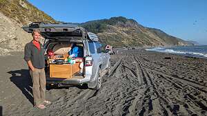 Usal Beach campingI soon became obsessed with it and started taking everything in Long Exposure - not great if Herb walked through my picture though.
Enough distractions - now onto the Lost Coast, one of the only places along the beautiful California coastline that we haven’t seen.
It’s called the Lost Coast, because it is a 50-mile stretch of beautiful coastline from just north of Fort Bragg to the tiny town of Petrolia, which is pretty much inaccessible except for backpackers and 4WD vehicles.
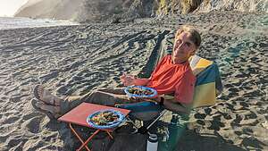 Brats on the BeachEven with a 4WD vehicle, most of the roads are high up along the ridge of the King Range so you can only get down to the coastline in a few places.
Herb and I had watched several YouTube videos of 4WD groups traveling through the Lost Coast, so we pretty much knew what to expect.
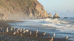 Usal BeachWe were starting our journey at the southern terminus of the park in Usal with the plan of staying overnight at the Usal Campground, or even better yet on Usal Beach.
That still remained to be determined, because there were several blogs that either said you are not allowed to camp on the beach, or worse yet, you were but it was filled with noisy ATVs and people playing with guns. We would just have to wait and see.
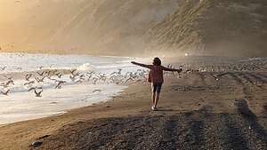 Usal BeachIt’s very easy to miss Usal Road from Route 1, as it is not signed out in any way, and it is merely a narrow dirt road surrounded by bushes. Fortunately, we had navigated to it with Google while we still had cell coverage.
As we turned onto the bumpy, dirt road, we were entering the Sinkyone Wilderness State Park, which borders the Pacific Ocean to the west and the King Range National Conservation Area to the north. The road was only wide enough for one car, so thankfully we didn’t pass anyone on their way out. From Highway 1 it was about a 6.5-mile drive to Usal Beach.
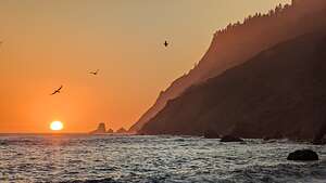 Usal BeachTechnically, you are supposed to camp in the official Usal Campground, in a forest area, but we very much preferred camping on the beach itself, so we continued on. When we got there, there were no “No Camping” signs and there were already three trucks camping on the beach. No sign of ATVs or the potential for wild parties, but just families with kids playing in the surf and building castles on the beach. It looked perfect.
We knew more campers would be arriving as the day went on, so we positioned ourselves near the end so that we would have some degree of privacy and quiet.
Herb cooked some bratwurst on the grill (our go-to meal on our camping trip around Iceland) and then we took a sunset walk along the beach. There was lots of bird activity - pelicans diving and seagulls strutting along the beach.
The sunset was lovely, painting the sky a bright orange. Much better than sitting in our camper in the woods.
Day 2 - Usal Beach to Shelter Cove
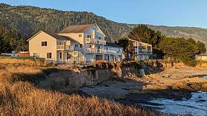 Black Sands InnAfter a very pleasant stay at Usal Beach, we headed out fairly early in the morning to drive the 25-miles of 4WD bumpy, dirt roads over the mountains towards Shelter Cove.
However, that was not meant to be. When we left the beach and turned left on Usal Road, we were stopped by a road block saying Usal Road was closed. Now what? This had pretty much been our purpose for coming up to the Lost Coast in the first place.
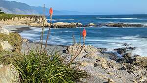 View from Black Sands InnWe saw a ranger on our way out, and he told us that the road was closed so that they could clear some fallen trees. He thought there was a possibility it would re-open today, but we chose not to wait around and see.
Since we had no other choice, we turned around and drove the 6.5 miles that we drove yesterday on Usal Road back out to Highway 1.
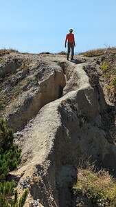 Promontory by Black Sands BeachSince we still wanted to go to Shelter Cove and eventually Mattole, we took the truck out of 4WD and did it the asphalt way. It was quite a big work around. Rather than the 25-mile 4WD road, which would have taken us up along Timber Ridge and Jackass Ridge to get to 4 Corners, we drove north 6.5 miles back on Usal Road from whence we came, then on Highway 1 for 15 miles to the town of Leggett, then another 23 miles north on US 101 to the town of Garberville, before taking the Briceland Road for another 15 miles back towards the Sinkyone Wilderness to Four Corners (also known as Thorn Junction).
I’m not sure how long the more direct, bumpy, 25-mile 4WD Usal Road drive would have taken us, but the asphalt detour version took us 2 hours and 15 minutes.
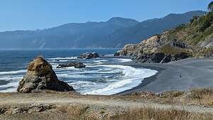 Black Sands BeachIt wasn’t only the extra miles and time that bothered us, but rather missing the opportunity to drive through the southern section of the Lost Coast.
4 Corners is called that because there are 4 roads that meet here: the one we just came down on from Garberville, the one we would have taken if the Usal Road had not been blocked by fallen trees, the Mountain Road to Shelter Cove, and the road to the Needle Rock Visitor Center and Bear Harbor.
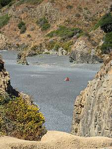 Me looking "Lost"We took a brief detour down to the Needle Rock Visitor Center before turning back and heading to Shelter Cove, the only bit of civilization along the Lost Coast. It’s located in a beautiful location, set on a large south-facing cove, and surrounded by the King Range National Conservation Area.
It is reachable by the 35-mile, paved Shelter Cove Road from the town of Garberville on US 101, the road we partially took before turning off at 4 Corners for a detour to the Visitor Center.
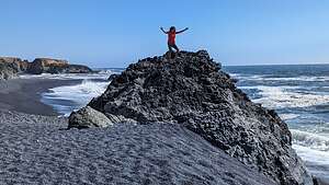 Black Sands BeachShelter Cove is a tiny little seaside town with a campground, several very nice hotels and restaurants, and a very good brewery called the Gyppo Ale Mill.
We knew we wanted to stay here for the night, so we had to make the choice: campground or seaside hotel. Well, that decision took a total of about 5 minutes, and before long we were checking into the Black Sands Hotel right on the water. It was only $218, which isn’t bad for a really nice room right on the water, with a hot tub (not in the room, but pretty close).
Plus, it was low tide and there were tide pools on the beach right in front of us.
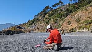 Lost shoes on the Lost CoastHerb has found that alternating camping in the truck with nice hotels every other or 3rd night keeps me happy.
After eating lunch in our room, we drove the short distance to the trailhead for Black Sands Beach, which is the starting (or ending) point for the 25-mile Lost Coast backpacking trip north to Mattole.
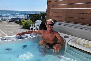 Herb enjoying the hot tubBefore heading out on the beach, Herb crossed an extremely narrow and precarious piece of land to get out onto a promontory with a wonderful view.I did not follow. My hands sweat just watching him.
He did admit that it was probably a very foolish thing to do, with a rather large downside to it, and that the way back was even worse, because it was downsloping and more difficult to control your speed.
He did get a photo of me on the beach from up there looking pretty “Lost”
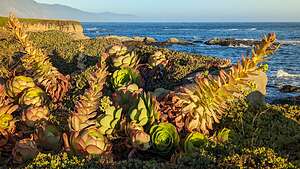 View from Black Sands InnBack on flat ground, we strolled for about a mile and a half north on the beach. Sand is tough to hike on, so kudos to those that backpack this for 25 miles.
Although I was not brave enough to go out on the promontory, I did climb atop a large rock on the beach. I like to climb things.
There were several very nice houses near the edge of the bluff above the beach, looking somewhat precarious as well. We’ve seen what has happened to bluff houses along the Sonoma Coast. It seems to be only a matter of time before erosion takes its toll.
Back from our walk along Black Sands Beach, we spent some time sipping wine (plastic cups of course) in the hotel’s hot tub.
For dinner this evening, we selected the Gyppo Ale Mill, which in addition to a very fine list of beers, had a good food menu as well. Plus, it was the only brewery in town and just a short walk from our hotel
.thumbnail.jpg) Gyppo Ale MillIt turned out to be very good. I had a delicious salmon burger and Herb had his boringly predictable fish and chips, which was also very good. I would have loved to play cornhole, but it was already occupied by other customers.
Gyppo Ale MillIt turned out to be very good. I had a delicious salmon burger and Herb had his boringly predictable fish and chips, which was also very good. I would have loved to play cornhole, but it was already occupied by other customers.
On our way back from the brewery, we passed the Cape Mendocino Lighthouse, which was a bit confusing because we were not on Cape Mendocino.
However, this lighthouse once located on Cape Mendocino before it was moved here. Built in 1868 on the westernmost point of California, it took a beating from storms and even earthquakes for 130 years, before the wise decision was made to save it and relocate it 35 miles south in Shelter Cove.
.thumbnail.jpg) Cape Mendocino LighthouseIn 1998, a National Guard helicopter lifted the lantern room off the lighthouse and flew it to Shelter Cove. The rest of the pieces were dismantled, numbered, and sent by truck to a construction yard where it was reassembled, painted, and fitted with new glass. It was opened to the public in 2001.
Cape Mendocino LighthouseIn 1998, a National Guard helicopter lifted the lantern room off the lighthouse and flew it to Shelter Cove. The rest of the pieces were dismantled, numbered, and sent by truck to a construction yard where it was reassembled, painted, and fitted with new glass. It was opened to the public in 2001.
The original Fresnel lens had a different fate. When the lighthouse was automated in 1947, it was removed and loaned to the city of Ferndale and displayed at the Humboldt County Fairgrounds.
Fearing the lens (valued at $2 million) was not being properly preserved, the Coast Guard has taken it back and placed it in a facility to help preserve it. Ferndale wants to keep it, so it has become quite a controversy. I’m not exactly sure where it is now.
Shelter Cove had been a great stop, and I was now charged up and ready for another day of 4-wheeling and sleeping in the truck.
Day 3 - Shelter Cove to Mattole
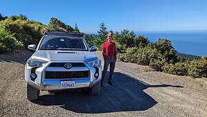 Along King Peaks RoadAfter leaving the Black Sands Inn, we drove about 5 miles on Shelter Cove Road before making a left onto the dirt Kings Peak Road, which would bring us up and over the mountains of the King Range National Conservation Area in the Lost Coast Wilderness..
The beach along the coast that backpackers follow is not very wide, as the mountains of the King Range rise abruptly, practically out of the surf, to a height of 4,088 feet, with King Peak just 3 miles from the ocean. It is a spectacular meeting between land and sea. Literally surf and turf.
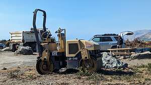 Mattole Campground under constructionThere are really only two ways to experience the King Range area: backpacking along the coast trail (as it is famous for) or driving a 4WD vehicle up and down through the mountains as we were doing.
There are several hiking trails that connect the two, but that was not on our agenda for the day.
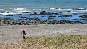 Heading off along the Lost CoastEventually King Peak Road became narrower and bumpier and climbed steeper and steeper along a series of hairpin switchbacks.
After 7 miles, which felt like 20, we got to the junction with Saddle Mountain Road. We had watched an Overtrails YouTube video, in which the 4WD guide said that Saddle Mountain was his favorite part of the trip, so we decided to take it. It joins back up with the King Peak Road in a few miles.
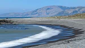 Along the Lost CoastThe video was right. Saddle Mountain Road brought us out of the woods and into the open for sweeping vistas of the Pacific Ocean in one direction and King’s Peak in the other. In a few more miles, we were back on the King Peak Road.
Then it was just a few more miles of dirt before we reached the paved Wilder Ridge Road, which took us to Mattole Road in the little town of Honeydew. From there it took us about 40 minutes to drive the 20 miles to the Mattole Campground.
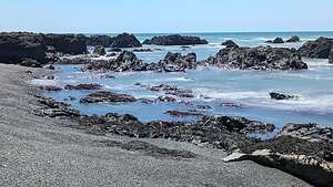 Along the Lost CoastWe passed the A.W. Way County Park along the way, which was another camping choice along the Mattole River. However, we wanted to go all the way to the beach on the actual Lost Coast.
All told, the drive from Shelter Cove to Mattole had taken us about 2 and ½ hours to cover 47 miles, 25 of which were steep, twisting, 4WD dirt roads.
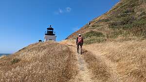 Approaching Punta Gorda LighthouseSo even though we missed the chance to 4WD through the southern portion of the Lost Coast on the Usal Road the other day because of fallen trees, we got our fair chair of bouncing around through the wilderness today.
When we finally got to the Mattole Campground we were shocked to find most of its 14 sites full of construction trucks, plus a sign saying that the campground was closed for renovation. However, several campers had tucked themselves in between the trucks.
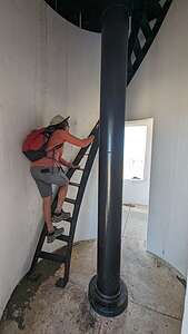 Climbing up the LighthouseNot wanting to drive any more today, and very much wanting to hike along the beach to the Punta Gorda lighthouse, we settled ourselves between a dump truck and a backhoe. We chose an end site so that we would have at least some semblance of a natural surrounding. We didn’t plan to spend much time in the campground anyway.
We packed a lunch and headed out on the Lost Coast trail, which started right from the campground.
Our goal was to hike 3.5 miles to the Punta Gorda Lighthouse and back. Part of this route is under water during high tide, but we were starting our hike just one hour after low tide, so we would have no problem.
.thumbnail.jpg) Punta Gorda LighthouseWalking on sand is not easy, so we give kudos to anyone venturing the 25-mile hike from Mattole to Shelter Cove. We tried to find the easiest surface to walk on. First we tried the wet sand along the water’s edge and eventually transitioned up to the trail that ran along the foothills of the mountains. That too was pretty sandy though.
Punta Gorda LighthouseWalking on sand is not easy, so we give kudos to anyone venturing the 25-mile hike from Mattole to Shelter Cove. We tried to find the easiest surface to walk on. First we tried the wet sand along the water’s edge and eventually transitioned up to the trail that ran along the foothills of the mountains. That too was pretty sandy though.
When we approached the lighthouse, we saw a structure fenced off and covered with scaffolding. Oh no! Thwarted by construction again??
Fortunately, that was not the lighthouse, but the old oil house building. The lighthouse itself was not covered in scaffolding, and we were even able to enter it and climb up to its balcony.
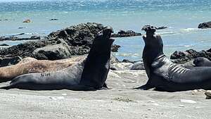 Elephant Seals determining dominanceThis lighthouse, which was built in 1911, is located along a very treacherous section of the Northern California coast, with many dangerous sunken rocks off the shore. In fact, we were admiring some of those rocks right now that weren’t so sunken during low tide.
The overhanging mountains behind us made navigating even more difficult, because the shadows they cast over the shoreline made it hard for ships to see how far they were from shore.
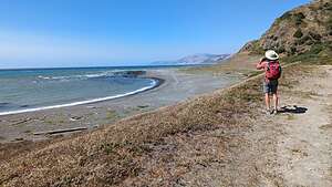 Back to the Mattole CampgroundNine ships were lost along this isolated section of the Lost Coast before the Punta Gorda Lighthouse was finally constructed.
Originally, there were many more structures here: three dwellings, a concrete oil house, a wooden fog signal building, a blacksmith/carpenter shop, three storage sheds and a barn. Today, all that remains is the lighthouse and the oil house, which is the one undergoing renovation today.
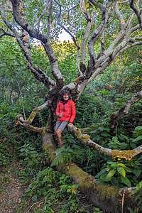 My secret world in Mattole CampgroundAfter World War II, it was decided that this lighthouse was too expensive to maintain, so its functionality was replaced with a lighted buoy offshore. In 1951, the Fresnel lens was removed (they are quite valuable), and the lighthouse was boarded up and deactivated. No one seems to know where that Fresnel lens wound up.
In the late 60s, hippies moved into the quarters and improved them. The Bureau of Land Management, which now had jurisdiction fo this land, booted them out and burned all the buildings except for the two that we see today - the lighthouse and the oil house.
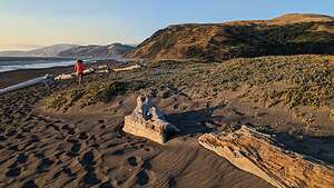 Beach Walk by Mattole CampgroundThe sandy beach by the lighthouse is a popular place for elephant seals to congregate because the rocks in the surf give them some protection from crashing waves.
We found a nice piece of driftwood to sit on and eat our lunch while watching about a dozen elephant seals putting on a show, posturing and sometimes even fighting, in their attempt to establish male dominance. The stakes were high, because the dominant male will get to mate with a majority of the ladies when they arrive.
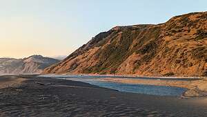 Where the Mattole River flows into the seaThey are large animals, weighing between 1,000 and 3,000 pounds so we made sure to keep our distance. We could have hung around and watched them for hours, but we still had 3 and ½ miles of sand to trudge through on our way back to the campground.
We hiked back in plenty of time to avoid the impassable-during-high-tide portion of the beach. However, what we weren’t able to avoid was the intense wind and sand blowing in our face, which is the reason why many backpackers choose to hike from north to south in order to have the prevailing northwest wind at their backs.
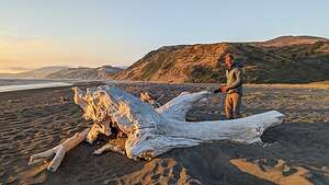 Beach by Mattole CampgroundBack at our campsite, we ate dinner facing the woods behind us rather than the construction trucks to either side. We noticed a small opening in the bushes and decided to check it out.
What we found was a magical little sanctuary, totally hidden from the campground. It looked like a place that elves and gnomes would frequent - you have to excuse me, but we just came back from Iceland where elves, gnomes, and the occasional troll run rampant. It was very peaceful and serene.
.thumbnail.jpg) Sunset on Mattole BeachTowards sunset we took a walk out to the beach and walked down towards where the Mattole River flows into the sea.
Sunset on Mattole BeachTowards sunset we took a walk out to the beach and walked down towards where the Mattole River flows into the sea.
Now we had seen all three of the places that non-backpackers can access the stunning remote Lost Coast - Usal Beach, Shelter Cove, and Mattole.
We were done with the 4WDing portion of our trip, but the 42 miles along Mattole Road up to Ferndale was pretty exciting in its own right, with lots of steep hills and twisty roads.
From Ferndale it was less than 4 hours to get home, although it had taken us at least 12.5 to get here - but those 12.5 were a lot more fun!
St. Orres
Tuesday, July 25, 2023 - 9:45pm by Lolo7 miles and 0.2 hours from our last stop - 1 night stay
Travelogue
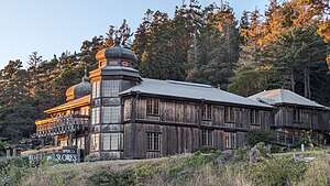 St. OrresI was really looking forward to spending the night at Saint Orres, a hotel plus cabins, and cottages along the stunning Mendocino Coast.
Besides the hotel with a unique Russian architecture, there were several cottages and cabins situated on a hill above the hotel, some of which had balconies overlooking the ocean.
We had booked the Rose Cottage because of that promised view, and it was absolutely lovely. The cottage had a breakfast nook, a sitting area with a Franklin Fireplace opening out to the sundeck overlooking the ocean, skylights, and a bedroom on the second floor looking down on the area below and also out to the ocean.
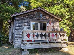 Rose Cottage at St. OrresThere was such an attention to detail everywhere we looked. Even the bathroom windows framed fabulous views of the surrounding trees.
For the past 37 years, this place has been a labor of love for Rosemary Campiformio and Eric Black, the co-owners. Eric designs and builds the unique structures that honor the area’s Russian heritage, and Rosemary is the Executive Chef serving her highly acclaimed North Coast Cuisine in the Saint Orres Restaurant.
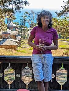 View from our sundeckUnfortunately for us, the restaurant is only open on weekends, but we knew that ahead of time and packed some sushi, sesame noodles, and salad. So that night we sat on our ocean-view sundeck sipping wine and eating our modest dinner. Not bad.
Afterwards, we took a walk around the grounds and across the street to the small Cook’s Beach to watch the sunset. Then it was back to our cozy Rose Cottage.
When we checked in, we were told that a vegetarian breakfast would be delivered to our door between 8:30 and 9:00.
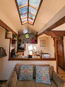 Rose CottageWe woke up to a view of the ocean from our bed, which was pretty unique. Herb made some coffee and then, right on time, there was a knock on our door with our breakfast delivery.
Out on our doorstep was a very large wooden box. I felt like it was Christmas morning when opening it and just as thrilled. There was a veggie omelet, granola and milk, melon, kiwi, and other fruits. It was delicious.
I have a funny feeling that we will be back, but next time when the restaurant is open!
When I returned home, I did some googling to find out a bit about St. Orres history and how it got its name:
In the 1830’s a man named George St. Ores immigrated here from Russia via Canada and homesteaded on the property that is now the St. Ores hotel.
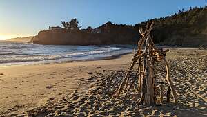 Cook's BeachDuring the gold rush years and beyond, this area of the California rocky coastline was filled with dozens of settlements that shipped goods to the fast-growing city of San Francisco.
However, many of those harbors and ports were so small and rocky that only small, two-masted schooners with shallow draft could navigate in and out of them. These schooners were called dog hole schooners and the ports they entered got the name dog holes because they were so small that only a dog could turn around in them.
Well, good ole’ George St. Ores built and designed the wire-rope “chutes” that were used to load the dog hole schooners along this challenging shoreline, including the one used at Bourn’s landing just to the south.
Sea Ranch Chapel
Tuesday, July 25, 2023 - 9:30pm by Lolo11 miles and 0.25 hours from our last stop
Travelogue
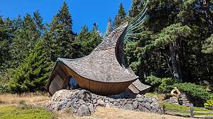 Sea Ranch ChapelAfter leaving Salt Point State Park, we continued on California 1 towards St. Orres, where we would spend the night.
But first, a stop at a hidden gem that we found in Atlas Obscura, which is a great source for unusual, quirky, mysterious, etc., places all around the world. With all the big world out there, Atlas Obscura chose to include the Sea Ranch Chapel, a tiny non-denominational sanctuary for prayer, meditation, and spiritual renewal.
It’s easy to miss, so keep your eye out for the small parking lot on the east side of the road as you approach mile marker 55.5.
It’s open to the public from sunrise to sunset every day of the year, except during private events.
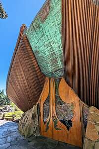 Doors of the Sea Ranch ChapelThe chapel, which was completed in 1985, as well as the beautiful grounds surrounding it were the gifts of Sea Ranch residents, Robert and Betty Buffum, in memory of Kirk Ditzler, a navy aviator and artist.
In fact, it was Ditzler’s drawings that inspired architect James T. Hubbell’s design of this amazing structure. Hubbell also designed and crafted the windows, chandelier, doors, fountain, mosaics, and other elements in the chapel.
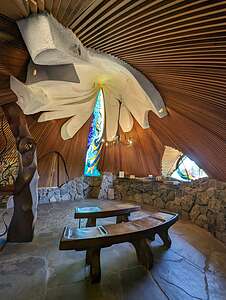 Interior of Sea Ranch ChapelHubbel is known for his ability to blend art, architecture, and nature in his work, and he has certainly succeeded here. The chapel was modeled on the form of a murex shell, but to me it looked more like a conquistador’s helmet or a fairy tale cottage.
The chapel was constructed by local carpenters using local materials - redwood, cedar, and local stone.
We entered the chapel through beautiful teak doors with stained glass cutouts. The interior was so peaceful and serene, with hand-carved redwood benches to sit down on and pray, contemplate, or simply just enjoy the beauty that surrounded us.
There were bright-colored stained glass windows, a white plaster sculptured ceiling embedded with sea shells and sea urchins, a chandelier, and many other artistic accents.
Thank you Atlas Obscura for leading us to this amazing hidden gem.
Salt Point State Park
Tuesday, July 25, 2023 - 9:00pm by Lolo60 miles and 1.5 hours from our last stop
Travelogue
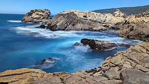 Salt Point State ParkAs I mentioned in the Trip Overview, we have been fortunate enough to have seen much of the incredibly beautiful California coast, but our all-time favorite spot of all is Salt Point State Park, just 100 miles north of San Francisco.
The park covers 6,000 acres along the Northern California coast, with 6 miles of rough rocky coastline. And what a unique coastline it is!!
 Salt Point State ParkIt’s only an hour and a half drive from our home, but most of that drive is extremely winding and twisty, so it was good to take a break and stretch our legs.
Our favorite place to hike in Salt Point State Park is the 3-mile out and back trail from Gerstle Cove to Stump Beach. It’s probably one of the most unique and dramatic sections of the California coast, and that is saying a lot.
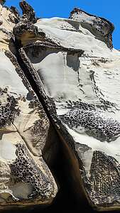 Tafoni Salt Point State ParkWhat this beach is most well known for, and the reason we love to come here over and over again, is that it is one of the few places on the coast that has tafoni - uniquely textured sandstone with holes and honeycomb-like structures - sort of like Swiss cheese. The other place we have seen these intriguing rocks is Pescadero State Beach, about a half hour south of Half Moon Bay.
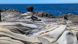 Salt Point State ParkThere are several theories as to how these amazing rocks were formed, but the most common one is salt weathering. According to this theory, saltwater collects on the surface of the permeable sandstone from the nearby waves and mist.
As the saltwater evaporates, the salt it leaves behind works its way into the rock pores, where it crystallizes and pushes the pores open further. Wind, rain, and tidal water also contribute to their weathering.
Many of the rocks have weird shapes that we have come to recognize each time we visit. Many of them look like heads standing on pedestals. There is even a set of eyes set in the stone. Oh, and of course there is our old friend, the pig.
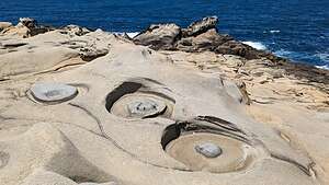 The Eyes of Salt PointAt one point, I came across a pile of the park’s namesake “salt" in a depression of rock. The name of this park comes from these salt crystals that have formed over millions of years in the crevices and nooks and crannies of this rocky coastline.
The native Kashaya Pomo collected salt from this area for many years. They used abalone chisels to scrape the salt off the rocks.
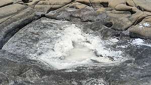 "Salt" Point State ParkSalt was not the only resource they found at Salt Point. Shellfish, including abalone, were gathered along the coastline, and seaweed was collected and dried.
The Eyes of Salt PointAn estimated 1,500 Kashia people inhabited this area along the Sonoma Coast until the arrival of Russian American Company settlers in the 19th century. The Russians did not really make use of the scarce quantity of salt found along the shoreline, but purchased it from the Spanish instead. However, salt remains an important enough part of its history to include it in its name.
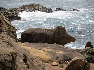 The "Piggy"; of Salt PointIn the 1850s a San Francisco company quarried the sandstone from this park to create the streets and buildings in the fast-growing city of San Francisco.
Today, Salt Point’s major resource is its stunning beauty, which we very much enjoyed along our stroll along its coastline.
It would have been nice to spend the night here because the rocky formations light up in beautiful colors during the golden hour, but we had reservations to spend the night at St. Orres. More on that later.
We will have to come back soon and camp at Gerstle Cove so we can enjoy this beautiful place in both evening and morning light.
Blue Lagoon
Monday, June 12, 2023 - 6:15pm by Lolo4 miles and 0.2 hours from our last stop
Travelogue
.thumbnail.jpg) Blue LagoonWe thought it fitting to end our journey at the famous Blue Lagoon. How could we possibly go to Iceland and not.
Blue LagoonWe thought it fitting to end our journey at the famous Blue Lagoon. How could we possibly go to Iceland and not.
It is one of the most visited attractions in Iceland, with well over a million visitors per year. The Keflavik airport is only 12 miles away, so tour buses bring people directly there and back if they have a long enough layover to squeeze in a soak. That is why you need to book tickets at least a few days in advance, as time slots do fill up.
We waited a little too long and were only able to get a reservation for 6:00 pm, which actually worked out good for us, as we would be really relaxed for our flight home tomorrow morning.
.thumbnail.jpg) Herb sporting his silica maskIt’s easy to see why it’s so popular.
Herb sporting his silica maskIt’s easy to see why it’s so popular.
It’s called the “Blue” Lagoon because of the water’s milky blue shade, which is due to its high silica content. The silica forms soft white mud found on the bottom of the lake lava rocks around it. The water is a comfortable 99–102 °F. What’s not to like?
We bought the Comfort Package (the least expensive one), which included entrance to the lagoon, a silica mud mask, a towel, and a free drink of our choice. For our date and time slot that was $104 per person.
.thumbnail.jpg) Example of bad application of silicaThe premium package would have given us two additional facial masks and a bathrobe for another $20 or so, but we thought the Comfort package was decadent enough.
Example of bad application of silicaThe premium package would have given us two additional facial masks and a bathrobe for another $20 or so, but we thought the Comfort package was decadent enough.
After our obligatory showers, HIlda and I met the guys who were already comfortably settled in the pool.
Our first order of business was to get in the line for the free silica mask. There was also an anti-aging mask, which I was considering, but that was not part of our package. The silica one, which promised to boost our skin’s barrier function and tighten our pores for a fresh and improved complexion, would have to be good enough
.thumbnail.jpg) Sides of Blue LagoonOnce it was our turn, we scooped a big blob of a white gooey substance out of a bucket and proceeded to apply it to our faces with various degrees of skill.
Sides of Blue LagoonOnce it was our turn, we scooped a big blob of a white gooey substance out of a bucket and proceeded to apply it to our faces with various degrees of skill.
Herb, Hilda, and Paul looked so cute and glamorous I, however, looked like a sad clown or a rabid albino racoon.
.thumbnail.jpg) Along the edges of the Blue LagoonAs instructed, we kept the mask on for only 10 minutes before removing it by using one of the fresh water spigots alongside the pool.
Along the edges of the Blue LagoonAs instructed, we kept the mask on for only 10 minutes before removing it by using one of the fresh water spigots alongside the pool.
Time for our next freebie (although it’s hard to think of it as really a freebie after paying $104) - a glass of wine or in Herb’s case, a beer.
I was so much happier with a wine in my hand and that stuff off my face.
.thumbnail.jpg) Sides of the Blue LagoonThe edges of the pool are black lava rock covered with white silica, the same stuff we had on our faces not too long ago. We could have easily just scraped some off and reapplied it to our faces.
Sides of the Blue LagoonThe edges of the pool are black lava rock covered with white silica, the same stuff we had on our faces not too long ago. We could have easily just scraped some off and reapplied it to our faces.
It’s really quite beautiful and colorful.
Despite its natural beauty, the Blue Lagoon is actually partially man-made. It dates back to 1976 when the pool of water, which is now the Blue Lagoon, was formed next to nearby Svartsengi geothermal power station.
.thumbnail.jpg) Svartsengi geothermal power stationIt is not a natural hot spring – in fact, the water within is wastewater from the power plant!
Svartsengi geothermal power stationIt is not a natural hot spring – in fact, the water within is wastewater from the power plant!
After we were done with our soak, Herb and I took a "behind the scenes" stroll along a path near the geothermal plant.
That's not the official "Blue Lagoon" in the foreground, but a wastewater pool from the front. Maybe it would have been better not to know, but then again, it's good to know that that plant can both provide geothermal energy and a lovely experience for travelers.
Fagradalsfjall
Monday, June 12, 2023 - 8:15am by Lolo40 miles and 0.2 hours from our last stop
Travelogue
.thumbnail.jpg) FagradalsfjallIceland is still a very volcanically active place, so this morning we set off to explore the site of its most recent eruption - the Fagradalsfjall volcano, which erupted in 2021 and again in August of 2022, just 10 months ago.
FagradalsfjallIceland is still a very volcanically active place, so this morning we set off to explore the site of its most recent eruption - the Fagradalsfjall volcano, which erupted in 2021 and again in August of 2022, just 10 months ago.
We kidded that hopefully it wouldn’t choose today to erupt again. Perhaps we were prescient, because 4 weeks after we returned from Iceland, Fagradalsfjall erupted again, and it is still erupting now as I write this.
The latest eruption is close to the Fagradalsfjall volcano, but a little further north. This time, the lava is flowing from fissures in the ground between the peaks of Litli-Hrútur and Keilir. This is where scientists predicted the next one would occur.
.thumbnail.jpg) FagradalsfjallFortunately, the volcano is in an uninhabited area of the Reykjanes peninsula, so there was no loss of life or damage to homes or infrastructure.
FagradalsfjallFortunately, the volcano is in an uninhabited area of the Reykjanes peninsula, so there was no loss of life or damage to homes or infrastructure.
In Iceland volcanic eruptions are kind of a spectator sport, drawing thousands of people whenever one occurs, especially when it’s near Reykjavik, as this one was.
There is even the term: “tourist eruption,” which Icelanders use to describe a minor eruption that can be easily accessed. While my first reaction would be to get as far away from one as possible, Icelanders flee to it to watch the spectacular show nature is putting on.
.thumbnail.jpg) FagradalsfjallOf course, geologists and authorities are constantly monitoring the safety of various areas and closing off those that are not safe.
FagradalsfjallOf course, geologists and authorities are constantly monitoring the safety of various areas and closing off those that are not safe.
So although we didn’t get to see red hot magma plumes and molten rock the size of cars shooting into the sky during our visit, we did get to see some pretty cool pitch-black lava flows, formed when the lava boiled up through the vents in the earth and poured down into the valley below, like a thick syrup. The lava flow from the 2022 eruption was massive.
.thumbnail.jpg) PāhoehoeThe shiny blackness of the lava flow shows that it was from a recent eruption (in this case, it was about 10 months old). As time passes it will turn to a battleship gray and even a dull yellow-brown.
PāhoehoeThe shiny blackness of the lava flow shows that it was from a recent eruption (in this case, it was about 10 months old). As time passes it will turn to a battleship gray and even a dull yellow-brown.
Signs warned us to stay off the lava as some of it is still hot. So, it didn’t even get time to cool off completely before the next eruption delivered some more.
The type of lava here is Pāhoehoe, a basaltic lava that has a smooth, undulating, or ropy surface. The ropy surfaces form as very fluid lava moves downstream dragging the cooling, congealing surface crust along with it.
The colors and textures are beautiful.
.thumbnail.jpg) Fire and IceSince this volcano is only 25 minutes from Reykjavik, it became a "hot" attraction and crowds gathered to see it erupting. It must have been quite a sight, probably similar to what people are observing today.
Fire and IceSince this volcano is only 25 minutes from Reykjavik, it became a "hot" attraction and crowds gathered to see it erupting. It must have been quite a sight, probably similar to what people are observing today.
I always thought
Iceland is often called the land of Fire and Ice, so we decided to take it literally.
With much sadness, we emptied our camper freezer and left our remaining glacial ice, plucked by my and Paul's own hands from the Jökulsárlón Glacier Lagoon, to spend its remaining days (or more correctly minutes) melting on volcanic rock recently spewed from a volcano.
It served us well during cocktail hour and will be missed.
Now back to Grindavik to do some packing.
