- Home
- About
- Map
- Trips
- Bringing Boat West
- Migration West
- Solo Motorcycle Ride
- Final Family XC Trip
- Colorado Rockies
- Graduates' XC Trip
- Yosemite & Nevada
- Colorado & Utah
- Best of Utah
- Southern Loop
- Pacific Northwest
- Northern Loop
- Los Angeles to NYC
- East Coast Trips
- Martha's Vineyard
- 1 Week in Quebec
- Southeast Coast
- NH Backpacking
- Martha's Vineyard
- Canadian Maritimes
- Ocracoke Island
- Edisto Island
- First Landing '02
- Hunting Island '02
- Stowe in Winter
- Hunting Island '01
- Lake Placid
- Chesapeake
- Provincetown
- Hunting Island '00
- Acadia in Winter
- Boston Suburbs
- Niagara Falls
- First Landing '99
- Cape Hatteras
- West Coast Trips
- Burning Man
- Utah Off-Roading
- Maui
- Mojave 4WD Course
- Colorado River Rafting
- Bishop & Death Valley
- Kauai
- Yosemite Fall
- Utah Off-Road
- Lost Coast
- Yosemite Valley
- Arizona and New Mexico
- Pescadero & Capitola
- Bishop & Death Valley
- San Diego, Anza Borrego, Joshua Tree
- Carmel
- Death Valley in Fall
- Yosemite in the Fall
- Pacific Northwest
- Utah Off-Roading
- Southern CA Deserts
- Yosemite & Covid
- Lake Powell Covid
- Eastern Sierra & Covid
- Bishop & Death Valley
- Central & SE Oregon
- Mojave Road
- Eastern Sierra
- Trinity Alps
- Tuolumne Meadows
- Lake Powell Boating
- Eastern Sierra
- Yosemite Winter
- Hawaii
- 4WD Eastern Sierra
- 4WD Death Valley +
- Southern CA Deserts
- Christmas in Tahoe
- Yosemite & Pinnacles
- Totality
- Yosemite & Sierra
- Yosemite Christmas
- Yosemite, San Diego
- Yosemite & North CA
- Seattle to Sierra
- Southwest Deserts
- Yosemite & Sierra
- Pacific Northwest
- Yosemite & South CA
- Pacific Northwest
- Northern California
- Southern Alaska
- Vancouver Island
- International Trips
- Index
- Tips
- Books
- Photos/Videos
- Search
- Contact
Yosemite Valley
Thursday, October 26, 2023 - 10:00am by Lolo256 miles and 5.5 hours from our last stop - 10 night stay
Travelogue
Day 1 - Arrival and walk from the campground
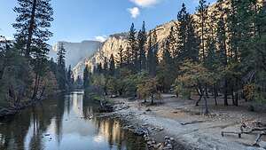 Evening stroll from campgroundThe drive to the Valley from our home in Sonoma Valley takes about 5.5 hours via Highway 140 through the El Portal entrance.
We weren’t too far from our house before the motorhome started bucking and misfiring, a problem that Herb had sporadically noticed in the past. This time, it wasn’t sporadic but pretty consistent whenever we were going uphill or accelerating quickly.
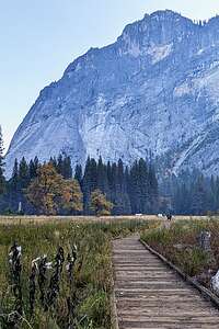 Evening stroll from campgroundHerb pretty much knew that it was most likely the spark plugs and coils that needed to be changed. We even questioned whether we should continue on or go back home.
We decided to continue on, especially because Tommy and Erin would be joining us the following weekend, and it is always so much fun to spend time with them in Yosemite.
It was, however, a bit of a stressful drive for Herb as he wondered if we would be able to make it. We were towing our Subaru, which we use to get around the Valley when we are there, so we vowed to try to not think about the motorhome’s problems until it was time to go home.
Easier said than done though, as I saw it cast a bit of a cloud over Herb.
There was still about an hour of daylight when we arrived at the Upper Pines Campground, so I headed out for a walk just across the bridge to the North Pines Campground and then back to the meadow just beyond the Lower Pines Campground.
I always feel the need to greet the Valley upon my arrival.
Day 2 - Morning in El Cap Meadow and Valley Floor Bike Ride in the afternoon
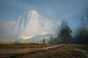 Smoky El Cap MeadowOur favorite place to photograph in the morning is the El Cap Meadow. It has such lovely trees - California Black Oak, ponderosa pine, incense-cedar, white fir, aspen, and many more that I can’t identify.
And if you get there early enough, and conditions are right, there is usually mist in the meadow creating a very dreamy atmosphere just where the El Cap crossover road meets Southside Drive.
Although it did create an interesting effect, it made it difficult to breathe, especially for an asthmatic like Herb.
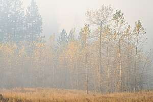 Smoky El Cap MeadowWe parked along the Northside Drive, near the base of El Cap, and then headed out into the meadows towards the trees along the river.
There is an especially pretty stand of aspen that was beginning to show its yellow fall colors. An interesting fact about aspens is that a stand of aspen trees is actually considered a singular organism with the main life force underground in the extensive root system.
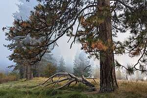 Smoky El Cap MeadowBefore a single aspen trunk appears above the surface, the root system may lie dormant for many years until the conditions are just right.
There are also some lovely large ponderosa (or lodgepole?) pines along the river, which I gravitated to. They are so majestic and interesting to photograph.
Herb and I have different approaches when photographing an area. When Herb finds something he likes, he will spend hours in that one spot, photographing its details. I, however, like to survey an entire area so I don’t regret missing something later.
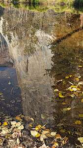 El Cap ReflectionsSo, we soon lost each other, and I crossed the crossover road and followed a path along the river, eventually getting to Cathedral Beach, where there are usually nice reflections of El Cap in the Merced River.
Herb and I eventually met up back by the aspen along the river. The mist was gone but the air was still quite smoky, so we called it a morning and headed back to the campground.
Later that afternoon, we moved the Subaru over to the Sentinel Bridge parking area to set up a base camp for the rest of the day.
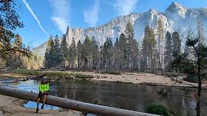 Valley Loop bike rideWe set off on our bikes and headed towards Yosemite Village. From there we got on the Valley Loop trail and followed it as far as the beach before the El Cap Crossover Road.
Our intention was to take the El Cap Crossover Road to Southside Drive to do a complete loop, but the smoke was so bad that we had to turn around and go back.
When we got near Yosemite Lodge, we decided to go over Swinging Bridge and get on the Southside Drive.
From there we biked back on the bike path that paralleled the road, passing the cute little Yosemite Chapel along the way.
Because of the smoke, it was not exactly the ride we planned, but it was still a fun 8+ miles, so at least we got to get a little exercise in.
Day 3 - Tuolumne Meadows - Lembert Dome hike and Tuolumne Meadow stroll
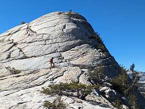 Hiking up Lembert DomeSince the smoke was so bad in the Valley, we decided to go up to Tuolumne Meadows where the air would hopefully be better.
Sure enough, the air up here was clear and the skies were blue.
We have done most of the hikes in Tuolumne, but we hadn’t done the Lembert Dome hike since 2016, when our rock climbing sons and daughter-in-law did it the hard way, while we met them at the top.
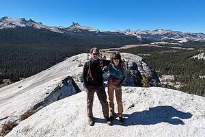 Atop Lambert DomeIt is definitely a hike worth repeating. In the land of domes which Tuolumne is, Lembert Dome is the most iconic and the one you can see rising 800-feet above Tuolumne Meadows.
Like most domes, Lembert Dome has a steep face, which rock climbers like to play on, and a gentler, yet still steep, backside that hikers can scramble up. We were going for the gentler side, but even that wasn’t so gentle.
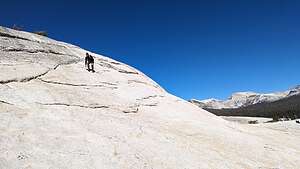 What goes up must come downAlthough a little bit intimidating, it was nothing compared to going up the backside of Half Dome. That it is so steep that they have installed cables to hold onto as you ascend. Still even on this dome, your heart does get pumping, and not just from the physical exertion.
From the summit there is a wonderful panoramic view - Cathedral Range to the South, the Sierra crest to the east, and Tuolumne Meadows to the west.
There were two fellow hikers on the summit - the only other people we had seen all day.
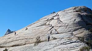 A little butt crab walkingAs with many steep climbs, going down is worse than up, and there was the occasional need to get down on my butt and do a bit of a crab walk.
All in all the hike was 2.4 miles with a 700-foot elevation gain.
While we were up in Tuolumne, we decided to stop at another one of our favorite spots - lovely Tuolumne Meadows.
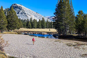 Tuolumne MeadowsThere’s definitely a very different feel to Tuolumne than the Valley. Both have beautiful meadows with rivers running through them, but Tuolumne’s meadow is surrounded by dozens of glacially-carved granite domes rather than the steep, dramatic granite walls that enclose the Valley. It’s also a lot less crowded and, as a result, more peaceful and serene.
We started on the trail by the Visitor Center, and in about a 1/2 mile crossed a footbridge over the river, where we were treated to lovely views of Cathedral Peak, Unicorn Peak, the Cockscomb, and Echo Peaks to the south and Lembert Dome to the north.
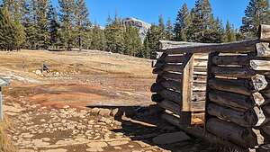 Soda Spring CabinA short distance past the bridge, we turned right towards the Soda Spring Cabin, a small log cabin built by John Baptiste Lembert over a bubbling, naturally carbonated spring, surrounded by a cluster of mineral-crusted, rust-red puddles.
A surprising fact is that geologists have no idea how or why the springs formed.
It was here that I learned that Lembert was not just the name of a dome, but of the first white settler in the Tuolumne Meadows, who in 1885 filed a claim for 160 acres. He must have been pretty lonely living out here alone each summer tending his goats. In 1889 he built the structure over the spring to keep the animals out.
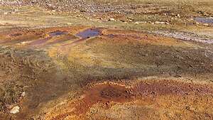 Mineral-crusted, rust-red puddlesBesides playing with his goat herd, Lembert gained fame as a guide and naturalist throughout the Tuolumne region, being the sole resident there in the summer and wintering in a small cabin near Cascade Creek in Yosemite Valley.
Tragically, he was murdered in this cabin in 1897, apparently for a small amount of money.
This hike had been so interesting. The only thing I love more than pristine, natural beauty is having some history thrown in.
It had been a great day in Tuolumne. I love it up here - such a different kind of beauty than in the valley.
Time to head back to the valley.
Day 4 - More Valley Wanderings
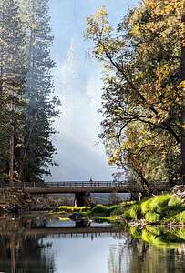 Near El Cap MeadowIt’s nice to have been to Yosemite Valley so many times, that we don’t feel compelled to run around frantically trying to see everything - because we already have.
Instead we like to leisurely wander around photographing from the various meadows.
We started our day with our morning commute to El Cap Meadow to enjoy the atmospherics of the morning mist (and smoke).
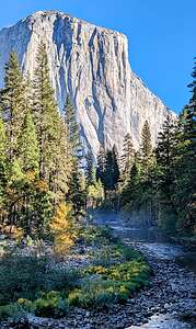 Along the Southside DriveThis time we spent less time in the meadow and more time strolling along the northern shore of the Merced River, where you can get some great reflections of El Cap.
We had some blue skies over El Cap today, so perhaps the smoke was getting better. I certainly hope so.
We decided to drive the whole Valley Loop this morning, stopping at the iconic Valley View pullout.
On the way back along the Southside Drive, we parked in a pullout near Bridalveil Falls and strolled along the river a bit to one of our favorite spots where there is a nice bend in the river with El Cap in the background.
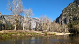 Sentinel BeachWe’re kind of nostalgic about this spot, because Tommy and Erin (who would be arriving in a few days) had some wedding photos taken here.
After lunch back in the campground, we decided to take advantage of the little beach right near the campground, just over the bridge. Ready to settle in for the afternoon, we brought beach chairs, books, and a cooler.
An important thing to remember about Yosemite Valley in the winter, is that the sun drops below the tops of the mountains very early in the day - in this case, 2:09 pm, just 5 minutes after setting up our beach chairs.
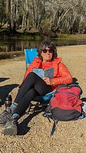 Relaxing on Sentinel BeachHaving our hearts set on just relaxing with a book on a beach, we drove over to Sentinel Beach where we knew we could get 2 more hours of sun.
Herb wandered the beach with his camera while I settle myself in a chair with a book. We were both very happy with our situation.
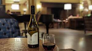 Ahwahnee Grand LoungeThat evening, rather than spending it in the motorhome in the campground, we drove over to the Ahwahnee Lounge to hang out with our books and a bottle of wine. We settled into two comfy chairs right near the piano player
I love historic national park lodges, and in my opinion, the Ahwahnee, with its rustic wooden-beamed ceiling, giant fireplace, and plenty of cozy nooks to hide away in, is one of its finest. I have so many fond memories of spending time here in the evenings with the boys reading, playing cards, or just chatting. It’s my happy place.
Day 5 - Sentinel Dome / Taft Point Hike
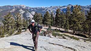 Climbing up Sentinel DomeFor a change of pace, we decided to drive up to the Glacier Point Road to do the Sentinel Dome / Taft Point hike.
Of course, we couldn’t just drive right past El Cap Meadow for our “morning constitutional” stroll through the mist and smoke. Those beautiful trees were much too alluring to ignore.
We dragged ourselves away after about a half hour this time though and got as far as Tunnel View before stopping again. The parking is just before the tunnel to Wawona and it is pretty much always full, and it’s easy to understand why.
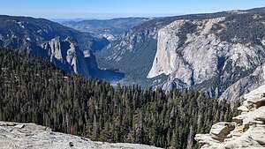 View of El Cap from atop Sentinel DomeFrom the low brick wall at the end of the parking lot is the iconic and breathtaking view of El Capitan, Half Dome, and Yosemite Valley in between. However, today the entire valley floor was covered with a layer of smoke, making it picturesque, as if it was a fine mist, but we knew what it was and knew we had made the right decision today to go up to Glacier Point Road to get above it.
The trailhead for the Sentinel Dome / Taft Point hike is 13.2 miles from the start of Glacier Point Road. The last time we were here, the parking lot was practically full, but today it was pretty quiet.
.thumbnail.jpg) Us atop Sentinel DomeFrom the parking lot, we walked about 100 feet before coming to a split in the trail, left to Taft Point and right to Sentinel Dome. Unlike last time, this time we would go to Sentinel Dome first and then Taft Point afterwards.
Us atop Sentinel DomeFrom the parking lot, we walked about 100 feet before coming to a split in the trail, left to Taft Point and right to Sentinel Dome. Unlike last time, this time we would go to Sentinel Dome first and then Taft Point afterwards.
Continuing right, we went down into a section of trees, crossed a small bridge, and then spent the next mile on a gradual uphill before getting our first glance of Sentinel Dome in the distance.
We continued through a section of trees again and found ourselves at the base of the dome.
 Taft Point FissuresLike Lembert Dome, there was no real path, so we just continued up the smooth granite surface wherever it looked easiest.
After only about 100 yards we were at the summit and treated to a fantastic 360-degree view.
What a lot of bang for our buck, especially compared to Yosemite’s other hikes to Valley viewpoints.
 Taft PointThe hike up the backside of Half Dome is about a 17-mile roundtrip, and the hike to the top of Yosemite Falls is a strenuous 7.4-mile one, but getting to the top of Sentinel Dome takes about 2 miles of level walking and just a brief scramble to the top.
And, the views are just as spectacular, if not even more so with El Cap and Yosemite Falls to the north (too bad it wasn’t flowing); Half Dome, Clouds Rest, and Nevada Fall to the east; and the most famous dead tree right there on top of the summit (the one Ansel Adams photographed when it looked a little livelier).
.thumbnail.jpg) Herb and Sentinel RockHerb and I don’t take many photos of the two of us together when we travel, so I urged him to set up the tripod so we could get a shot of the two of us with this magnificent scenery as a backdrop. He enthusiastically obliged.
Herb and Sentinel RockHerb and I don’t take many photos of the two of us together when we travel, so I urged him to set up the tripod so we could get a shot of the two of us with this magnificent scenery as a backdrop. He enthusiastically obliged.
From the summit we simply walked back down the dome the way we came up, but when we got to its base, rather than turn right and take the same way back to the trailhead where we could do Taft Point as a separate hike, we turned left onto the Pohono Trail towards Taft Point making it a longer loop hike with some new scenery.
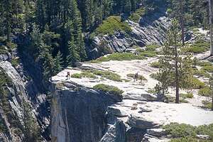
After about 2 miles of hiking along the Pohono Trail, we came to the Taft Point fissures, which are these immense vertical gashes in the granite that plunge hundreds of feet to the Valley—kind of like crevasses minus the snow. There were no guard rails around them, so we were free to get up close and gaze down and down. It still makes my palms sweat thinking about it.
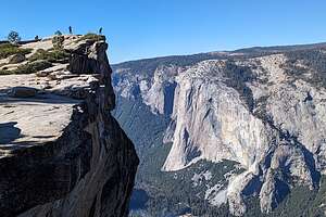
 Swinging BridgeA short distance ahead was Taft Point itself, where we stood at the edge of a cliff - kind of like the one atop Half Dome, but this one had a metal railing. From there we safely gazed down at all of Yosemite Valley.
From this vantage point, we were actually looking down on El Cap rather than craning our necks skyward to take in its immensity. The view would have been even more spectacular if Yosemite Falls wasn’t dry.
From Taft Point we returned to the car, completing our 6.2 mile with a 1,220-foot elevation gain loop hike.
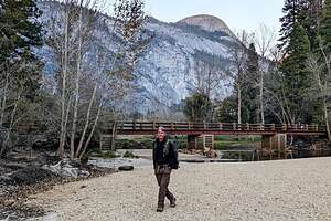
On the drive back to the campground, we stopped to catch the sunset near Swinging Bridge. It had been a pretty full day.
Day 6 - Halloween in Yosemite
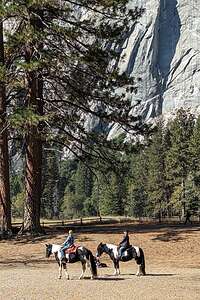 Horses by Swinging BridgeHalloween in Yosemite!! No trick or treaters so far. The big event for the day was going to be the Yosemite Cemetery tour given by interpretive guides from the Yosemite Conservancy. We had to meet at the cemetery at 8:00 tonight. Spooky!!
We made this a pretty chill day, parking the RV along the Southside Drive near Swinging Bridge and venturing out from there. The air seemed pretty clear of smoke, at least from here.
.thumbnail.jpg) North Dome from Swinging BridgeWhile walking towards Swinging Bridge, I came upon two women on horseback. I had never seen that in the Valley before.
North Dome from Swinging BridgeWhile walking towards Swinging Bridge, I came upon two women on horseback. I had never seen that in the Valley before.
There was also a very nice reflection of North Dome in the Merced River.
Our Halloween event wasn't until 8:00 tonight, so we had plenty of time to hang around and watch a really nice sunset in the meadow.
Then we put the motorhome back in the campground and took the Subaru over to Yosemite Village for our Cemetery Tour.
At 8:00 pm a group of about 20 gathered at the cemetery. Right on time a tour guide in period costume holding a lantern appeared, explaining that tonight we would be visiting the grave sites of several people that had been important to the history of Yosemite.
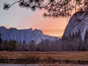 Sunset in the ValleyHe told us that our task that evening was to find the guardian of Yosemite, the person or persons that would protect it for future generations.
He then proceeded to lead us through the cemetery which was lit by his lantern and candles along the way.
He would stop at a grave and its resident ghost would appear and talk to us about his or her experiences in and contributions to what is now Yosemite National Park.
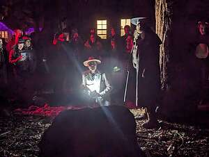 Halloween Yosemite Cemetery TourThat evening we met four ghosts:
Florence Hutching - the first non-Ahwahnechee to be born in Yosemite Valley. She was an adventurous tomboy who defied the conventions of her time, riding bareback and dressing like a man. She tragically died when a large boulder loosed and hit her while guiding a party up to Glacier Point.
Her ghost looked like she was once a lot of fun and, as a tomboy myself, I would have loved to have spent time with her in Yosemite Valley
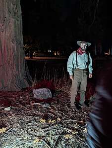 Ghost of George AndersonGalen Clark - the first Guardian of the Yosemite Grant, a position that he held for the next 35 years. During his tenure as Yosemite's guardian, Clark accompanied John Muir, Ralph Waldo Emerson, and other well-known scientists, writers, painters, and tourists on outings around the park.
I certainly wouldn't have minded being a fly on the canyon wall listening to him and Muir around a campfire
George Anderson - mountaineer known for making the first ascent to the summit of Half Dome in 1875. Without the benefit of modern climbing gear or techniques, he climbed barefoot and drilled holes to place eye bolts through which he could attach his rope for protection from falls. Those holes eventually came to house the cables of the popular cable route up Half Dome.
He was also very funny and said that John Muir would have been too distracted admiring the splendors of Yosemite to complete the climb.
Claire Marie Hodges - the first woman ranger in Yosemite and the person most responsible for developing the extensive trail system through the park
At the end, we learned that we are the "guardians" of Yosemite and must do our best to keep it as it is for future generations to enjoy.
Day 7 - Ahwahnee Meadow Wanderings, Valley Bike Ride, and Dinner at Yosemite Lodge
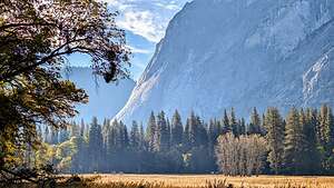 Ahwahnee MeadowIn winter, Yosemite Valley takes a while to wake up, as its high peaks block the rising run. The campground is often dark until 10 am.
So, we often drive over to the Church Bowl picnic area on Ahwahnee Drive, one of the few spots in the Valley that get early morning sun, so it was a good place to charge up our solar panels. We weren’t the only ones with this idea, so we pretty much had to get there by 8:30 to nail a parking space. Most of the other occupants of the spot were twenty- or thirty-something climbers in white vans (like both of our sons) prepping for a big wall climb the following day. In fact, one out of five vehicles in the Valley were white Promaster vans.
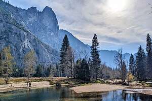 Hanging out along the MercedFrom there, Herb and I each wandered our own separate ways. There is a wonderful view of Half Dome from here, but we have so many photos of it that we now find ourselves more interested in photographing the beautiful trees in the meadow.
I also found some time to poke into the lovely Ahwahnee Hotel and sit for a bit by its cozy fireplace.
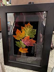 My skeletonized leavesLater that day, we moved the motorhome and parked it on Southside Drive near the Yosemite Chapel where we would use it as a base camp for the day.
We decided to go for a bike ride, and I suggested something different - riding the Valley Loop trail starting behind the Chapel.
At first the trail was flat, but it gradually became so steep and rocky that we turned around in about a mile and a half and then decided to ride over to Yosemite Village instead to visit the Ansel Adams Gallery. I usually like to pay a visit here each year to see anything new on display.
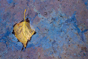 Herb's LeafThe gallery is run by his son Michael Adams, and there are many wonderful prints on exhibit—actually they are for sale, but I treat this place more like a museum—both by Ansel Adams himself, as well as several contemporary landscape photographers.
Every time I come here, I find myself gravitating to colorful, skeletonized leaves set in a frame. I have literally admired these for years. Herb said that if I had admired them for that long, it was time for me to bring them home, so we bought them. They are currently sitting in a prominent spot on my bookshelf and I am happily looking at them now.
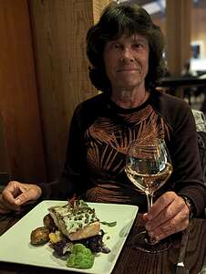 Dinner at Yosemite LodgeWe spent the remainder of the afternoon sitting in our beach chairs along a stretch of the Merced River. Well, I sat, but Herb wandered up and down along the river's edge photographing leaves in the river. I thought it was silly at first, but then I saw his result. A simple yellow leaf floating on the iridescent purples and blues formed by the decaying oils.
When we got home, Herb made a print of his leaf and framed it. I think it's even more beautiful than the one I bought in the Answel Adams Gallery.
That evening we had dinner reservations at the Mountain Room in the Yosemite Valley Lodge, which has a very cozy dining room and very good food. In many ways, I think it is even better than the elegant Ahwahnee Dining room (especially in terms of price), but that wasn’t even a choice as it has been closed for months while it undergoes a seismic upgrade that would allow it to withstand earthquakes.
I had a delicious Rainbow Trout and Herb had the Kurobuta Pork Chop.
I highly recommend the Mountain Room for dinner, but be sure to make a reservation well in advance, as they were turning walk-ins away.
Day 8 - El Cap Meadow Wanderings, Hetch Hetchy, Lunch at Evergreen Lodge
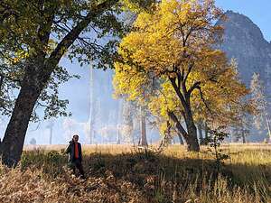 Morning in El Cap MeadowEvery couple days or so, we figured we would mix it up and explore places outside the Valley. Today the plan was to drive up to Hetch Hetchy for a hike and then lunch at the Evergreen Lodge, where our son and daughter-in-law got married 2 years ago.
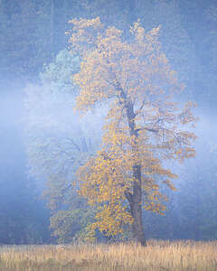 Lovely trees of El Cap MeadowBut, of course, we couldn’t get out of the Valley without stopping to see what was happening (with the light and smoke) in the El Cap Meadow.
Hmm…It looked too good to just pass by, so we stopped for an hour to photograph our favorite trees. Every day, depending on the lighting and the smoke, they looked different.
Then it was on to Hetch Hetchy.
Hetch Hetchy was the place that famed conservationist John Muir thought rivaled Yosemite Valley in grandeur and fought so hard to protect from the politically powerful men in San Francisco that wanted to dam the river and turn its valley into a reservoir. As we all know, Muir lost the good fight and many believe that the loss hastened his death in 1914, a year after a bill was signed to fund the dam project.
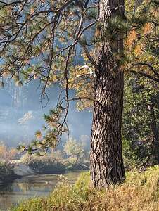 Trees of El Cap MeadowAnyone interested in learning more about this controversial battle should definitely attend one of the weekly performances of “Conversation with a Tramp: An Evening with John Muir” given every Wednesday night at the Yosemite Theater (behind the Visitor Center). It is such an unbelievably worthwhile experience. The actor, Lee Stetson, has been playing the role of John Muir since 1983, and trust me, he will keep you mesmerized and totally convinced that you are back in 1913 anxiously waiting with him in his study for the news of Hetch Hetchy’s fate.
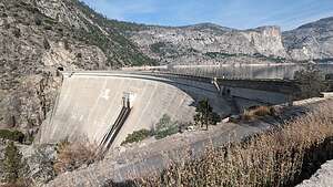 Hetch Hetchy O’Shaughnessy DamIronically, this part of the park is so much less visited than the Valley that the feeling of solitude and remoteness that surrounds one here is probably much closer to the way John Muir had experienced Yosemite.
The 40-mile drive from the Valley takes about an hour and a half. We took the Big Oak Flat Road north, but rather than turn west onto 120, we continued on Evergreen Road through the Stanislaus National Forest.
We passed the Evergreen Lodge and Tavern (for now) where Tommy and Erin had their wedding. We would stop here for lunch on the way back.
.thumbnail.jpg) View from O’Shaughnessy DamAt the end of Evergreen Road, we came to the Yosemite entrance station -- that’s right, you actually have to leave Yosemite and re-enter it again to get to Hetch Hetchy.
View from O’Shaughnessy DamAt the end of Evergreen Road, we came to the Yosemite entrance station -- that’s right, you actually have to leave Yosemite and re-enter it again to get to Hetch Hetchy.
From the entrance gate, we drove another 8 miles along the twisty, narrow Hetch Hetchy Road to the Day Hikers parking area by the O’Shaughnessy Dam.
As we walked across the dam and gazed out across the reservoir (squinting a little to block out the water), we could definitely see how John Muir compared this place to Yosemite Valley. There was even a little El Cap, just to the left of Wapama Falls. Later, we even found a miniature Half Dome. I guess we shouldn’t have been so surprised, as the same forces that formed Yosemite Valley shaped and created this valley as well.
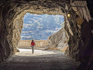 Hetch Hetchy TunnelAt the end of the dam, we walked through a 500-foot, dark tunnel, before turning right onto the trail towards Wapama and Rancheria Falls.
Since the falls would not be running now, we turned around after about a mile and headed back. We were very anxious to get back to Evergreen Lodge, where we had such wonderful memories of our son’s wedding there.
The Evergreen Lodge has strong ties to Hetch Hetchy in that it was originally built in the 1920s as housing for the workers building the O'Shaughnessy Dam.
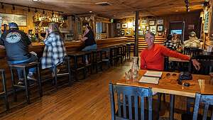 Evergreen Lodge historical tavernIn the early years, the Evergreen was a post office, restaurant and general store. Lore has it that moonshine was brewed in the basement of the lodge during Prohibition.
It was fun sitting in the cozy wooden tavern, eating a delicious burger and fries, looking back on its history and all the moonshine that must have been drunk here - and that’s just during Tommy and Erin’s wedding!
On the way back through the Valley, we stopped at our secret spot near Sentinel Bridge to capture some reflections of Half Dome in the river.
Day 9 - Tenaya Creek HIke
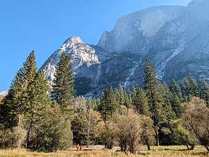 Half Dome and Mt. WatkinsDuring our more than 20 visits to Yosemite Valley, we had pretty much hiked every trail there was to hike in the Valley, although there are still a few more we need to conquer in Tuolumne Meadows.
However, there was one that we hadn’t done completely, and that’s the Mirror Lake / Tenaya Creek Loop.
What most first-time visitors to the Valley don’t know is that Mirror Lake is not really a lake at all, but rather a large, shallow pool in Tenaya Creek. Each year as sand and gravel washes into it from Tenaya Creek, in a process called sedimentation, it shrinks a little more.
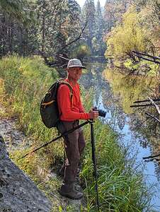 Happy Herb along Tenaya CreekWe have hiked to Mirror Lake many times but only saw it filled with water once, back on October of 2021 - the same year that the October “atmospheric rivers” of rain had brought the Firefall to life in October. It was amazing to be able to see a reflection of North Dome in what was now truly a lake. It was absolutely lovely.
We set out from the Upper Pine Campground, crossed the bridge over the Merced towards the North Pine Campground, and turned right onto the Mirror Lake Loop trail. For the next mile we traced the south side of Tenaya Creek, doing the loop in a counter-clockwise direction.
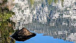 Reflections in Tenaya CreekIn about a mile we came to Mirror “Lake,” which, as expected, was not a lake today, but more of a meadow. Most visitors turn back here after asking “Where’s the Lake?” Too bad, because the best was yet to come.
However, those, like us, that continue on are treated to an uncrowded, quiet nature experience that’s hard to find in Yosemite these days.
All along the way we had spectacular views of Half Dome and Mt. Watkins looming over us to our right.
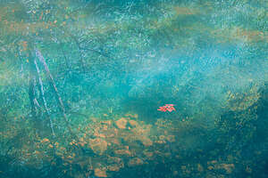 Herb finds another leafWe intentionally got off Mirror Lake Loop Trail a few times to get closer to the river, where we were able to see interesting reflections of the surrounding granite cliffs in the Creek. Herb became especially enamored with a floating leaf that he stalked for some time.
Eventually, we had to get back onto the Mirror Lake Loop trail, which required a bit of bushwhacking.
About 3 miles from the trailhead, we crossed over a footbridge to the other side of Tenaya Creek.
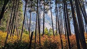 Mt. Watkins through the treesFrom there we continued on through a very pretty wooded section with colorful ground foliage and tall trees with glimpses of Mt. Watkins in between the trunks.
From there we traced the northern edge of the Creek, once again passing what would more appropriately be called Mirror “Meadow” in its current state.
In total, it was a 7-mile hike (starting and ending in Upper Pines Campground), with lots of great views and the type of peace and serenity you don’t expect in Yosemite any more.
Day 10 - A relaxing day of visiting many meadows
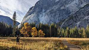 Meadow near our campgroundToday was our last day on our own in the Valley. Late tonight, well after we would be sound asleep, Tommy would arrive in the Valley and stay on a campsite with Dr. Peter, his best friend from college. We would not see him until tomorrow morning.
We had covered a lot of ground over the last 9 days, visiting some old favorite places, and even discovering one or two new ones.
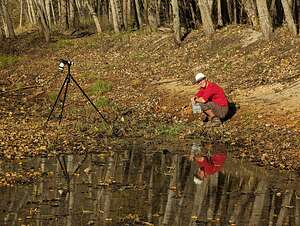 Herb stalking a leafSo, today would be a day of just relaxing - sitting in our beach chairs along the river reading our kindles, strolling through various meadows, photographing, listening to the piano player in the Ahwahnee.
In the morning we just walked from our campsite, through the Lower Pines Campground, and out to a meadow that was already having early morning sunlight paint the trees in an orange glow.
 Evening walk to the AhwahneeLater that afternoon moved the motorhome to a spot along Southside Drive near the Yosemite Chapel.
From there, we took our beach chairs down to the river where I read and Herb continued stalking leaves - his new supermodel.
Herb has always been mainly a landscape photographer, but we had been to Yosemite so many times and taken all the iconic shots, that he found it more interesting to focus on closeups of some of the more overlooked lovely details of the Valley.
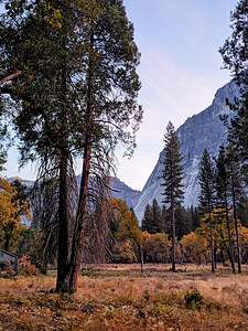
That evening, we parked over at the Church Bowl Picnic area and walked to the Ahwahnee with a bottle of wine to listen to the piano player. It's so great that this elegant Grand Lounge is open to not just guests of the hotel, but the public. After all, this is a National Park.
We had been here so long that it was beginning to feel more like home than a vacation.
We were very much looking forward to Tommy and Erin's arrival. They definitely liven things up.
Day 11 - Tommy and Erin are here!!
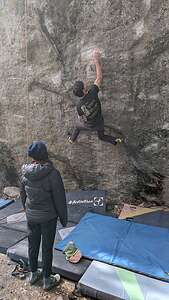 Tommy bouldering in Camp 4The next morning, Tommy, Erin, Tommy’s college friend Peter, and his friend came over to our motorhome for bagels and coffee. No matter how old Tommy gets, I love feeding and spending time with his friends.
The agenda for today was, as it always is when we are with the kids in the Valley, rock climbing. They had several places in mind.
Our first stop was Camp 4, the famous rock climbers' camp located near the base of Lower Yosemite Falls, which some of the world’s most renowned climbers have used as their base when climbing in Yosemite.
It’s even listed on the National Register of Historic Places because of its nationally significant role in the development of rock climbing as a sport.
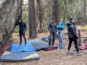 Hanging out boulderingThere are three types of climbing: bouldering, sport climbing, and trad climbing. The kids (who are no longer kids) would be doing the first two. Erin would only be doing sport climbing on a rope because she is 4 months pregnant and Tommy won’t let her boulder any more for fear of her hurting herself and my grandchild.
Tommy, Peter, and Hooper spent some time “projecting” some boulders in Camp 4, before we move on to another bouldering location near the LeConte Memorial, now called the Yosemite Conservation Heritage Center, because apparently LeConte has said some racist things in his past.
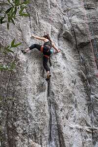 Erin's turnOh, funny story. When we were at Camp 4 Herb, who has tendinitis issues, started talking about a YouTube channel he had found called “Hooper’s Beta,” in which a Physical Therapist addresses how to avoid and rehab injuries from rock climbing. Herb then proceeded to ask if they had heard of it and whether this guy was “legit?”
Peter kind of smiled and said yes, and he’s right over there, pointing at his friend, who I had given a bagel and coffee to earlier.
Well, that was awkward, or it could have been if Herb had said anything bad. But Herb loves Hooper Beta and watches it religiously.
Then it was Erin’s turn. We moved to a sport climbing area located on the cliff behind the Yosemite Chapel. It was 5.12a, which is a pretty difficult climb, even if you’re not pregnant.
Tommy led it and Erin and Peter did it afterwards. Not bad for 4-months pregnant.
We had a fun day hanging out with Tommy and Erin and their friends. Always makes me feel younger just being around them.
Day 12 - Drive Home
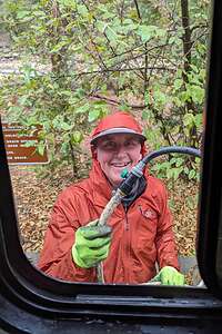 TIme to go homeI know it’s time to go home when I see Herb with the poop hose in his hand.
It had been a great trip but 11 days in the Valley is a long time, so we were ready to go home. We just hoped the motorhome’s spark plugs would cooperate.
Postscript.
A bit of sadness had hung over us the entire trip, because we thought our Lazy Daze might finally be ready to put to pasture because of the problems we had on the drive here.
But $3,000 later, it was back! It needed new spark plugs, coils, cables, and I don’t know what else. Yay!
Death Valley National Park
Tuesday, February 13, 2024 - 8:00am by Lolo163 miles and 3 hours from our last stop - 4 night stay
Travelogue
Day 1 - Father Crowley Vista Point, Badwater Basin (Lake Manly), and Artist's Palette
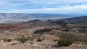 View from Father Crowley Vista PointOn the drive into Death Valley along Highway 190, near the western boundary of the Park, we stopped at the Father Crowley Vista Point where there are stunning views over Rainbow Canyon, a colorfully striped canyon created by ancient volcanic activity.
Most visitors stop at the first parking lot, but we continued to drive the additional ¼ mile on a dirt road to Padre Point, overlooking the Panamint Valley and the twisty roads we would soon be driving on.
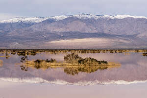 Ephemeral Pond near Panamint SpringsThere are many places in the Eastern Sierra named after the beloved Father Crowley, a catholic priest who in the 1930s was responsible for ministering to the people of the Inyo County Parish, traveling hundreds of miles to serve his parishioners.
He would often stop at this beautiful spot to admire the views on his way to or from visiting parishioners in Death Valley, and his home in Lone Pine, CA.
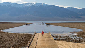 Badwater Basin (Lake Manly)Continuing along Highway 190 on our way to Furnace Creek, we came across a beautiful ephemeral pond created by the “atmospheric rivers” that had been hitting California. It was beautiful.
Now onto the main event and the major reason we just had to get over to Death Valley - seeing the once in a lifetime phenomenon of seeing Lake Manly covering the Badwater Basin.
As anyone who has visited Death Valley before, the Badwater Basin is normally a vast, surreal salt flat with beautiful crystalline patterns caused by salt crystals expanding and pushing through the surface. The salt formations stretch for nearly 200 square miles.
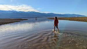 Badwater Basin (Lake Manly)But now, because of the recent crazy weather pattern in the West of “atmospheric river” after “atmospheric river,” after 10,000 years, Lake Manly was back! reminding us that Death Valley was not always the dry place we think of today.
In fact, later we would discover even more ephemeral lakes and ponds popping up on the normally bone dry valley floor. It was now one big oasis!
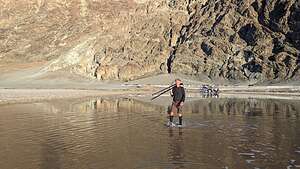 Badwater Basin (Lake Manly)Visitors to Badwater Basin have always strolled out onto the flats, and they weren’t going to let a little water stop them from doing that.
We just had to join them. While many chose to go barefoot, I charged in with my trail runners, which are now white rather than black from the residue of salt crystals in the water.
Herb smartly wore neoprene socks in anticipation of this activity.
.thumbnail.jpg) Artist's PaletteJust north of Badwater, there is a turnoff for Artist's Drive, a 9 ½ mile scenic drive where when the lighting is right, the rock turns multi-colored. Hence the name palette. It is one of the most photographed spots in Death Valley.
Artist's PaletteJust north of Badwater, there is a turnoff for Artist's Drive, a 9 ½ mile scenic drive where when the lighting is right, the rock turns multi-colored. Hence the name palette. It is one of the most photographed spots in Death Valley.
However, we were disappointed to see that this was one of the many roads marked as closed due to flooding on the NPS website.
Fortunately, as we were driving past the Artist's Drive turnoff, I glanced over and saw that the entry gates were open. We quickly turned in before any rangers could change their minds.
.thumbnail.jpg) Artist's Palette at sunsetAlthough there are many interesting geologic formations along Artist’s Drive, none of them are as dramatic as the vibrant multi-colored Artist’s Palette.
Artist's Palette at sunsetAlthough there are many interesting geologic formations along Artist’s Drive, none of them are as dramatic as the vibrant multi-colored Artist’s Palette.
Unlike the more subdued golds and browns of the Golden Canyon we hiked through yesterday, these hills are painted in turquoise, purple, red, pink, yellow, and green.
The vibrant colors of the Artist’s Palette are caused by the oxidation of different metals in the rock. Iron oxides produce reds, pinks, and yellows, while manganese minerals create lavender and purple hues. The decomposition of mica adds green tones to the palette.
It is absolutely stunning.
Day 2 - Zabriskie Point Sunrise and Ridge Hike, Furnace Creek Ranch Pool, and back to Artist's Palette
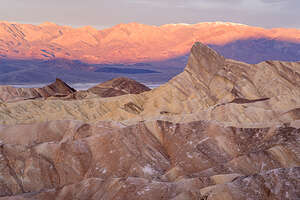 Sunrise at Zabriskie PointThe next morning we got up early to get to Zabriskie Point in time for sunrise. It is definitely the most spectacular viewpoint in the park with its stunning panoramic view of Golden Canyon and the surrounding vibrantly colored badlands.
However, we were not the only ones with this idea. While most people stay on the concrete viewing platform, we like to hike down below for more unobstructed views.
That pointy rock formation is 7,196-foot-high Manly Peak, named after William Lewis Manly, an early pioneer who scouted this area in 1849, while searching for a viable wagon train route out of Death Valley.
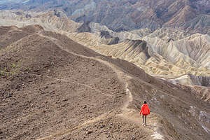 Setting out on the Zabriskie Ridge TrailThis Manly guy must have been pretty important, because the flooded Badwater Basin is also called Lake Manly.
To the left of Manly Peak, there are some beautiful yellow, tan, and brown badlands. As we looked down, we could see tiny people hiking through the badlands.
We planned to do that later this week along our favorite trail in the Valley, through Golden Canyon from the Valley floor up Gower Gulch and through the Badlands and along the base of the other side of Manly Peak.
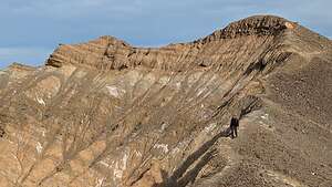 Zabriskie Ridge TrailAs we walked back towards the car, we noticed several people hiking up on the ridge just to the west of the parking lot. Gee, we had never thought of going up there before.
We discovered that we could walk along a somewhat precarious trail along the ridge to the right of the viewing platform.
It rose quite steeply at first requiring a little bit of scrambling over rocks. After a while the trail continued along a series of undulating with steep drop-offs on either side of the narrow trail.
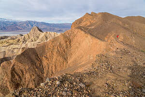 Tiny me on the Zabriskie Ridge TrailPlus, the trail was covered with loose rocks (scree) causing us to slip and slide a bit, especially on the downhills.
The views, however, were breathtaking, except you don’t want to walk and look at the same time or you risk taking a pretty bad tumble.
Golden Canyon and Manly Peak were constantly before us and presented a different perspective than that at the viewing platform.
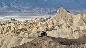 Herb taking a break on the Zabriskie Ridge TrailThe area below is where the Golden Canyon hike would take us in a few days, where we would actually get to hike along the base of the backside of Manly Peak.
This trail seemed to go on and on with no end in sight, but we decided to turn around after a little less than a mile, knowing that downhill would be harder than up because of the scree.
So glad we discovered this gem of a trail after so many years coming here, but better late than never.
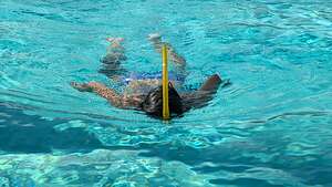 Furnace Creek Ranch poolAfter our ambitious sunrise event, we headed back to the Furnace Creek Ranch where we were staying for a well-needed nap. Normally, we like to camp out in the remoter parts of Death Valley in our 4Runner, but not this time of year, when it gets dark by 6:00 pm.
The Furnace Creek Ranch is quite nice - comfortable rooms, very nice grounds, a large pool, two restaurants, an ice cream parlor, a general store, and even a Borax mining museum.
Rather than rushing right out again after our nape, we thought it would be a nice change to have a little down time and relax poolside on a lounge chair for a few hours.
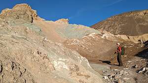 Wandering through Artists PaletteOf course, we don’t do well with downtime, so Herb and I both decided to swim a mile (54 laps) in the pool. We must have been inspiring, because by the time we were done there were three more people that had joined us.
Our plan for the late afternoon / evening was to return to Artist’s Palette, but this time hike down from the parking area into the badlands to wander amongst the colorful rocks.
Before leaving the Furnace Creek Ranch, I suggested we stop in at the two restaurants to see what we might want to do for dinner tonight. We were suprised to find how pricey they were with somewhat limited options. All I wanted was a hamburger and a salad.
.thumbnail.jpg) Wandering over Artists PaletteWhen I stopped in at the Last Kind Words Saloon, I was told that a reservation was required, but the first one available was for 8:00. Wow! So, I grabbed it. It was pretty pricey, with most of the steaks over $50, but they have a very captive audience here, so we were kind of stuck.
Wandering over Artists PaletteWhen I stopped in at the Last Kind Words Saloon, I was told that a reservation was required, but the first one available was for 8:00. Wow! So, I grabbed it. It was pretty pricey, with most of the steaks over $50, but they have a very captive audience here, so we were kind of stuck.
We then checked out the 1849 Buffet, but the pickings didn’t look very appetizing, especially for $34 per person, so I guess we would just stick with our reservation for the Saloon later.
On our drive to Artist’s Palette, we noticed that the exit for the one-way drive was blocked off by cones. Oh no! Did they close it again?
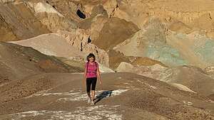 Wandering through Artists PaletteWe figured we would just continue on and go to Badwater Basin again. However, when we got to the entrance to Artist’s Drive, we saw that the gate was open, so we quickly drove in.
On our way to Artist’s Palette, we passed only two cars, and when we got to the parking lot, there was nobody there. This lot is usually packed, especially at this time of day.
Were we perhaps the only ones that got through the open gates?
We headed down into the canyon from the parking area and began wandering around and over the colorful hills. There really were no set trails, so we just went whichever way looked good.
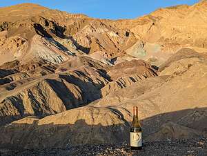 Good place for cocktail hourSometimes that meant climbing up steep hills to see what was on the other side, which did often reap rewards. However, that also meant slipping and sliding, and even getting on my butt, to get down them again.
The whole time we were there, we only saw 4 more people - very different from the usual crowds. We began to think that they might have closed the entry gate to the road again.
We probably wandered around for about a mile before returning up the hill to the parking lot, where the view out across the expanse of the badlands was really the best.
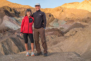 Artists PaletteThere was no other car in the parking lot and it was sunset. Were we locked in? We weren’t too worried because while the entry was blocked by a locked gate, the exit just had a few construction cones indicating closure which we could easily move.
We figured we might as well enjoy having the place to ourselves, so we grabbed a bottle of wine and climbed up the steep hill just to the right of the parking lot.
From there we watched as the golden hour literally turned some rocks gold and others and amazing turquoise and purple. It seemed unreal.
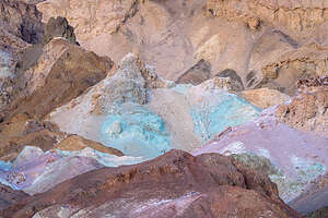 Sunset at Artists PaletteBy the time we left it was already getting dark. As we got to the Artist’s Drive exit, sure enough there were construction cones blocking our way. So we had managed to squeeze a visit in during the short time it was open. How lucky for us.
We had dinner that night at 8:00 at the Last Kind Word Saloon. Someone had warned us to stay away from the $50 - $80 steaks and just get the more reasonable Flat iron steak, which we did. It was pretty good, but didn’t arrive until well after 8:30 because they were short staffed in the kitchen.
Boy did we miss Andrew and Celeste’s hospitality and great cooking. Tomorrow night we would resort to our stash of backpacking mails which we always have packed in our truck.
Day 3 - Zabriskie Point Sunrise again, Random Salt Flats, Badwater Basin (Lake Manly), and Golden Canyon Hike
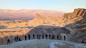 Sunrise gang at Zabriskie PointThe next morning we arose at 6:00 again to get to Zabriskie Point in time to watch the sun rise. This time there was a whole gang of photographers down below the viewing platform, where most people stay, where we normally like to position ourselves.
Plenty of room for all of us though. Besides, Herb wanted to focus (no pun intended) on the area of badlands down below to the left.
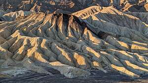 Badlands below Zabriskie PointWe decided to not go back out on the Ridge today, because we already had a big hike planned for the day, the Gower Gulch / Golden Canyon hike, where we would be down in those views rather than above looking down on them.
The light in Golden Canyon is best in the late afternoon, so we had plenty of time to kill before going over there to hike.
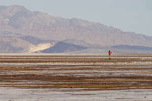 Random salt flatsWe decided to check out Lake Manly again, hoping that morning light would provide us with more reflections than the other day.
On the way there, we stopped on the side of the road at some interesting salt flats that were not underwater, although Lake Manly did extend this far north.
Knowing there would be plenty of mud to get through on the way across the flats to the lake, I decided to put on my snow boots, which I had packed for our time in Bishop.
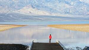 Lake ManlyGood thing I did, because it definitely did get quite muddy the closer we got to water.
It was extremely pretty and serene. No crowds here, and no kayakers out on the lake this far up.
When we got to the main Badwater Basin parking lot there was only one other car there. Morning was obviously the best time to be here.
Besides the lack of crowds, or maybe because of, the water was calm and flat as glass, making a perfect surface for reflections.
.thumbnail.jpg) Lake Manly reflectionsI quickly ran down to the end of the ramp - funny, it’s actually not a ramp, but now that Badwater is a lake, that seemed like an appropriate term. I wanted to have this view to myself.
Lake Manly reflectionsI quickly ran down to the end of the ramp - funny, it’s actually not a ramp, but now that Badwater is a lake, that seemed like an appropriate term. I wanted to have this view to myself.
Herb wasted no time, except for making him take a photo of me on the ramp, getting out in the water to take photos of the Panamint Range reflected in the “lake.”
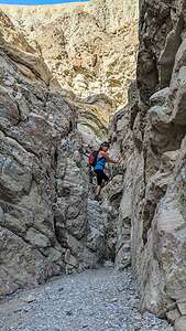 Lolo scrambling up Gower GulchThe purples of the early morning light were stunning.
What a full day it had already been, and it was only 9:30. We had earned the right to just sit by the pool all day, but that wasn't going to happen, as Golden Canyon in afternoon light was calling out to us.
We headed back to the Ranch for a quick lunch and a nap (we were up well before sunrise) before heading out for our main event of the day - the Golden Canyon hike, probably Death Valley’s most popular hike. We had done this hike numerous times before, but it was definitely worth a repeat.
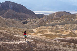 Along the Badlands LoopIt gets dark by 5:30 this time of year, so we headed out around 1:00, which would give us plenty of time to cover the 7+ miles we had planned, plus time to just enjoy and photograph the magnificent scenery.
Since the Golden Canyon is the most spectacular section of the hike, we decided to do it in reverse, so we would hit it in the golden hour right before sunset.
This meant starting off along the trail that ran parallel to Badwater Road for about three-quarters of a mile before turning left into Gowers Gulch.
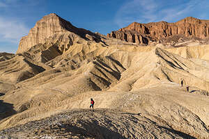 Approaching Manly PeakThere was a bit of scrambling and climbing up rocks in the beginning of the Gulch, but then we pretty much followed a wide, gravel-filled wash before coming to a choice at 2.3 miles.
We could go left on the Gower Gulch Cutoff, which would make the entire hike about 4.5 miles, or continue on to Zabriskie Point. We had done both in the past.
Even though we didn’t plan on going all the way to the viewing platform at Zabriskie Point, as we had been there several times already on this trip, including this morning, we went that direction anyway because we knew the views were better than along the Gulch Cutoff.
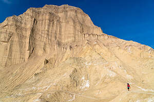 Intimidating Manly Peak3.1 miles into our hike, we came to another junction - right to the Zabriskie Point viewing platform or left onto the Badlands Loop, which would bring us across the badlands and eventually down to Golden Canyon.
"Badlands" seemed like such an inaccurate name for something so beautiful. I guess from a settler’s point of view, these were "bad" lands because of their inhospitable conditions: extreme temperatures, barrenness, lack of water, and exposed rugged terrain.
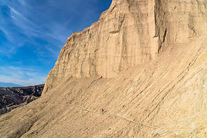 Traversing narrow trail at Manly Peak baseI prefer to think of them as “goodlands” because they are so restorative to the soul.
The section over to the top of the Golden Canyon Trail is probably the most dramatic, with its colorful rock formations - Red Cathedral, Manly Peak, and other ones that I didn’t know the names of.
There were several places where we got off the main trail to climb up a short spur trail to a better vantage point. Most of them were pretty short out-and-backs, but another one, which was a new one for us, was ½-mile out-and-back to a perspective of the badlands that we hadn’t seen before.
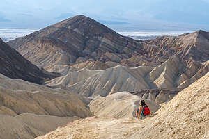 Not too dignified to crab crawl on buttWe were now getting into the area of badlands that we had looked down on from Zabriskie Point this morning, but now, rather than looking down on Manly Peak from afar, we were up quite close and personal to its backside, traversing its base on a rather precariously narrow trail. At 7,162 feet it's pretty impressive and intimidating.
It was hard to keep our eyes on the trail because the scenery was so beautiful, but we had to as there were parts of the way down that were a bit sketchy, with loose scree and steep drop-offs. I was not too proud to get down on my butt and crab walk when necessary.
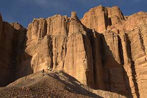 Red CathedralAs we approached the Golden Canyon, we debated whether we had time before it got dark to take the Red Cathedral spur. The trailhead sign said it was only ½ mile, so we figured we could knock off the 1-mile, out-and-back in a half hour.
The first four tenths of a mile we moved at a pretty good clip, and I thought the hike was over because we stood at the base of the tall red-rock columns, which we assumed to be the Red Cathedral.
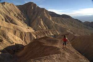 Promontory at end of Red Cathedral trailAt first I thought that the hike was over - after all, we were standing at the base of what was obviously the Red Cathedral. But then Herb discovered a small trail against the back wall.
Curious as to where it could possibly lead, we followed it, and spent the next tenth of a mile rock scrambling and clawing our way up a steep hill of loose rocks. I didn’t even want to think about how we would get down from here.
The last part involved us navigating our way to the end of a promontory along a narrow trail with steep drop-offs on either side. Assuming I make it safely back to the car, I would say that this spur trail definitely did not disappoint.
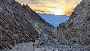 Barely making it out by sunsetIt took us a while to get back down to the base of the Red Cathedral, most of which was spent sliding on my butt, because it was so steep (probably more than 45 degrees) and covered in scree that I could not walk upright like the primate I was without risking breaking something.
Well, obviously we did make it back and just in time to see the sun dipping behind the mountains as we approached the end of Golden Canyon.
Wow! That was some hike - 7.7 miles with over 1,300 feet elevation gain and a very high Wows to miles ratio.
Now it was back to the Furnace Creek Ranch where Herb cooked me a delicious dinner of Mountain House Pad Thai.
Day 4 - More salt flats, Mosaic Canyon, and Mesquite Dunes
.thumbnail.jpg) Salt FlatsFor our last day in Death Valley we were switching hotels and moving to Stovepipe Wells for a change of scenery and easy access to the Mesquite Dunes.
Salt FlatsFor our last day in Death Valley we were switching hotels and moving to Stovepipe Wells for a change of scenery and easy access to the Mesquite Dunes.
On the drive up, we stopped at another salt flat, one that was not covered with water as the Badwater Basin was.
So why is Death Valley so salty? After some googling, I learned the following:
.thumbnail.jpg) Herb of the Salt FlatsDeath Valley was once covered by a 600-foot deep massive lake, called Lake Manly (which has temporarily come back to life in a smaller form).
Herb of the Salt FlatsDeath Valley was once covered by a 600-foot deep massive lake, called Lake Manly (which has temporarily come back to life in a smaller form).
As the water evaporated after the last Ice Age (10,000 to 15,000 years ago), salts and other minerals that had been deposited in the lake were concentrated and left as a thick layer of salt on the valley floor.
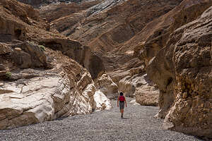 Heading into Mosaic CanyonThese salts continue to get replenished today as floods rush down the surrounding mountains bringing dissolved minerals along the way and depositing them in the enclosed Badwater Basin. Since this basin has no outlet to the sea, the salts remain there and form a dense salt layer on the ground.
While not dramatic like the Golden Canyon, these salt flats are beautiful in their own way, with interesting patterns created by the salt.
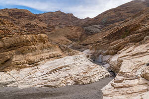 Mosaic CanyonSince it was too early to check in to our Stovepipe Wells Room, we continued past the hotel to the nearby trailhead for Mosaic Canyon, considered by many to be Death Valley’s best hike, or at least a close second to Golden Canyon.
Mosaic is more of a slot canyon compared to Golden with much narrower passageways and rocks to scramble over.
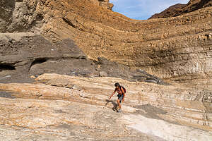 Mosaic CanyonThe trailhead is at the end of Mosaic Canyon Road, a 2-mile dirt road (navigable by most passenger cars) just across the street from the Stovepipe Wells Village Hotel.
After parking, we headed into the mouth of Lower Mosaic Canyon, a narrow slot that weaves its way between wavy white walls of water-polished white marble and blue-gray conglomerate rocks.
The reason the marble is so polished in this canyon, as opposed to other canyons in Death Valley, is that the ground is much more gravely. During flash floods, the fast moving water mixes with the gravel, scouring the sides of the canyon walls, or “polishing” it. As a result, this rock is very slippery, so we had to be careful when scrambling over it.
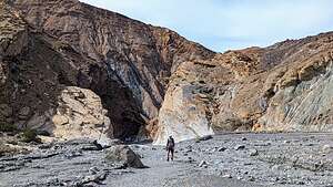 Mosaic CanyonThe conglomerate rocks get water polished as well, giving them the appearance of mosaic tiles grouted into the canyon wall, hence the name Mosaic Canyon.
The best examples of polished marble occur in the first quarter mile into the hike, so you could turn around here and still consider it a wonderful hike.
 The real Stovepipe WellsAt about a half mile, the canyon opened up to an expansive gravel wash, marking the top of the lower canyon, and the place where many people turn around, making it a very rewarding, short 1-mile hike.
We decided to do the same, because we had a longer hike planned for this afternoon at Mesquite Dunes.
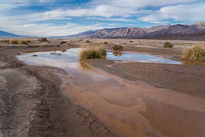 Ephemeral Pond by Mesequite DunesWe stopped back at the Stovepipe Wells Village Hotel where our room was not ready to make lunch before heading out again to hike the Mesquite Dunes, but from around the backside rather than from the parking lot just across the road.
The lighting on the dunes is dependent on the season. In the winter time, which we were now closest to, sunrise is best on the front side of the dunes (by the main parking lot), but sunset is best on the back side, reached via a longer walk from the Historic Stovepipe Well.
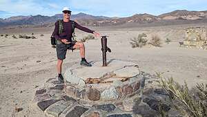
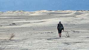 Dune Ho!So, since better lighting, and less crowds, is important to us, we headed out to the Old Stovepipe Wells site, where there is an historical marker and the actual “Stovepipe Well” which Stovepipe Wells is named for.
It was now obvious to us where the name “Stovepipe” came from, as there was an actual pipe extending up from the well. The story goes that early prospectors used a length of stovepipe to mark the location of the spring because it often got obscured by blowing sand.
 Mysterious circlesThis particular waterhole stood at the junction of two Indian trails. During the bonanza days of Rhyolite and Skidoo it was the only known water source on the cross-valley road.
From here we started walking out towards the dunes, which were much smaller than the ones seen from the main parking lot.
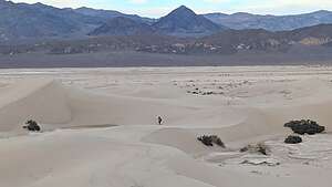 Mesquite DunesThe Mesquite sand dunes stretch over 7 miles, so we knew we were not going to get to the main dune area and the tallest “Star Dune.”
In fact, it was close to a one mile walk just to get to the beginning of them. Walking was easy however, as much of the surface was hard
packed dirt rather than deep sand.
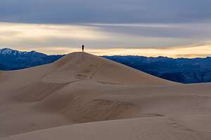 Lolo of the dunesHowever, unlike the last time we were here, we did have to cross the occasional pond or mud that had sprung up from the recent “atmospheric rivers” of rain.
The presence of water had also created some very interesting patterns in the sand that Herb became fascinated with photographing.
Eventually we came to the dunes, and began climbing up them, so much easier than the taller ones at Eureka or even at the main Mesquite Dunes section.
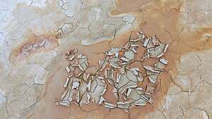 Patterns in the sandThese smaller dunes were beautiful in their own way - less dramatic, but more intimate and peaceful. There wasn’t another soul to be seen for miles. I think very few people explore this section of the dunes.
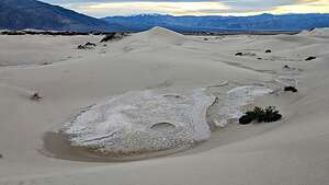
We were determined to find an interesting feature that we had stumbled upon last time, a rocky section at the base of several small dunes with two crater-like circles, about 8 feet in diameter. We had been so intrigued by them that Herb had actually sent a photo to the National Park Service a few years back to see if they could get an explanation as to what created them. They were unable to do so. It looked to us very much like small meteorites.
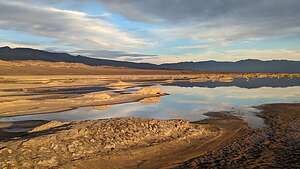 Ephemeral Lake near Mesquite DunesI think we had a better answer this time - water pooling on the surface. Or, it still could be aliens.
After almost two hours of hiking, we decided it was time to head back if we wanted to make it before it got dark. Hmm…which way did we come?
We really weren’t worried about finding out way back because we were using both Strava and Gaia to record our hike. Both of these apps provide tracks which allow you to follow the breadcrumbs back home.
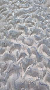 Patterns in the sandWhen we were almost back, I noticed what looked like a pretty good-sized body of water off to our right. I called to Herb, but he was too busy photographing patterns in the sand to come with me to check it out.
It was pretty amazing. Hard to believe we were in Death Valley.
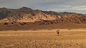 Back before sunsetGreat hike. We felt like we were the only people in the world, or at least our small part of it.
Back at Stovepipe Wells Village Hotel, we walked over to the Badwater Saloon, hoping for a better experience than the Last Kind Words Saloon in Furnace Creek. It was. At least they had hamburger options, which were very good.
Another great day. What an awesome trip it had been!
Bishop
Wednesday, February 7, 2024 - 4:45pm by Lolo575 miles and 9.5 hours from our last stop - 6 night stay
Travelogue
Day 1 - Arrival
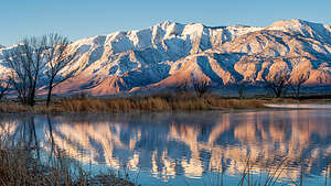 The Sierra at sunriseAs I have mentioned in the past, our son Andrew and his wife Celeste, moved from San Francisco to Bishop in 2019 to try out a less-urban lifestyle in what is a world-class rock climbing destination. They were fortunate enough to be able to take their San Francisco jobs with them - and this was before Covid.
Bishop and all of the Eastern Sierra is stunningly beautiful, so even though they are 6 ½ hours away from us now, it is not a hardship to go over the mountains to visit them. Their home is often the first or last stop on one of our road trips.
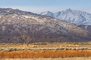 Along the Bishop Canal at sunriseCalifornia was experiencing multiple atmospheric rivers bringing heavy rain to the central and coastal parts of the state and lots of snow in the mountains. So, we had to look for a window of opportunity to get over the Sierra mountains.
There really wasn’t any day for the whole next week without forecasted snow along the mountain passes, so we decided to take the long journey south down I5 to Bakersfield, across Tehachapi pass, and then up 14 and 395 to Bishop, adding 2 hours to the our usual more direct route through South Lake Tahoe.
We arrived in Bishop right about dinner time, but Andrew and Celeste had a delicious dinner ready for us. They are incredible hosts and serve the best food in Bishop.
Day 2 - Cross Country Skiing at Rock Creek
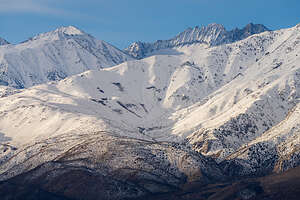 Snow-capped SierraWhen we lived on the East Coast, Herb and I loved to cross country ski, but since we moved to Sonoma Valley, where it never snows, we haven’t had as much opportunity.
However, although Bishop doesn’t get much snow, a mere 30-minute drive north up 395 can get you to tons of it.
So, since Andrew and Celeste had to work today, Herb and I decided to drive up to Rock Creek, a place where we have cross country skied in the past.
Wow! What a difference 30 miles can make. There was easily over 3 feet of snow.
Our first order of business was carrying our gear over a 6-foot pile of snow created by the snow plow. It was so deep on the other side that we were postholing up to our thighs, making putting our skis on extremely difficult. I had a new pair of skis that I was not used to, so it took Herb’s help and about 20 minutes to get them on me. He made me promise not to take them off until we were done.
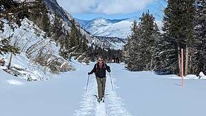 Rock CreekThe last time we skied here, the road was nicely groomed by a snowmobile making nice tracks for us to follow, but this time all there was was a Mish Mosh of tracks made by a few previous skiers. They were not nearly as easy to maneuver along as groomed tracks.
Spirits were high as we set off on the trail, which was really a snow-covered road, which just kept going up and up. Well, I thought, at least the way back would be easy.
One thing we had neglected to consider was that we were at an elevation of 9500 feet, and we had been near sea level yesterday, so no time to acclimate. No wonder why we were breathing heavy and feeling a bit light-headed.
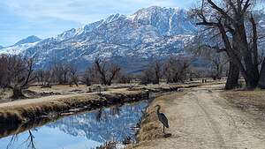 Along the Bishop CanalInstead of going all the way to Rock Creek Lake (an additional mile out), we decided to turn around at the 2.5 mile point.
I was psyched to enjoy the continuous downhill on the way back. Last time we had done this trail, I barely had to move my legs. Rather, it was like gliding along one of those moving walkways in an airport.
However, that was not to be my experience today. Because of warmer temperatures, snow clumps were clinging to the bottom of our skis, making gliding an impossibility. Plus like last time, there were no nicely groomed tracks to follow.
 Our wonderful hostsSo between the snow clumps on my skis, the messy tracks, and the lightheadedness from the altitude, I proceeded to fall about a dozen times. The falls weren’t bad, but getting up was extremely difficult. With one ski sprawled out behind me and the other to the front, I was so tempted to just take them off and start over, but I remembered my promise to Herb - who unfortunately was about 100 yards ahead of me. So, I stuck my pole in the snow to use as a lever up, but the snow was so deep that all that was above the snow was the top of the handle.
I called for him to help, but he told me I had to learn to get up myself. Well, usually that was not a problem but today everything was against me. After straining most of the muscles in my lower back and abdomen, I managed to right myself and continue on, only to repeat this debacle another half dozen times.
Eventually I made it back to the car wounded but intact. We agreed that next time we would only ski groomed or at least tightly packed snow trails.
I guess this story will get better with age. Andrew and Celeste already thought it was pretty amusing. A glass of wine and another delicious dinner made things much better.
Day 3 - Sunrise photoshoot and the Secret Petroglyph Sky Rock
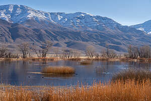 Morning photo shootEvery morning before sunrise, Herb would quietly get out of bed, make himself a cup of coffee, and head out with his 4Runner on the dirt roads east of Bishop. From here the views of the snow-capped Sierra to the west and the Whites to the west were stunning.
In the afternoon, we decided to head out on an exploratory hike in the Volcanic Tablelands in search of a hidden petroglyph called Sky Rock that we had heard about from two photographers we had met during a trip to Utah.
The Volcanic Tablelands are located just north of Bishop in a stunning area where the floor of the Owens Valley rises abruptly, forming a 300 foot-high volcanic plateau. It is a premier rock climbing destination for climbers from around the world.
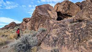 Looking for Sky RockHowever, long before climbers took over this area, it was home to the Paiute-Shoshone peoples, who carved numerous petroglyphs on the volcanic rock throughout the tablelands. Although the exact ages of the petroglyph panels is unknown, they are generally accepted as between 1000 and 8000 years old.
Today, our mission was to find the very secretive and well-hidden petroglyph panel known as Sky Rock. It is such a close-guarded secret for fear of vandalism of this very archaeologically-significant site.
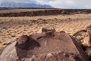 Sky Rock from aboveWhen we were in Goblin Valley we had met two photographers who told us about Sky Rock when they learned our son lived in Bishop. Even with the GPS coordinates they shared with us, it was still a challenge finding it, since, as its name implies, the panel faces the sky, so it is not visible from any trail. You have to climb above it to see it.
After much rock scrambling, we finally found it, covering the top surface of a boulder. It was amazing, especially in light of the fact that it was created thousands of years ago. There are still many Paiutes living in Bishop - perhaps the descendents of the artists the created these panels.
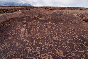 Sky Rock PetroglyphWe had to climb up pretty high on a nearby boulder to see as much of the extensive panel as we could. A drone certainly would have come in handy. It would be wonderful to know what the symbols mean. What story were they trying to tell?
This was worth every bit of scrambling to get to.
We learned later that there is another secret petroglyph in the area known as 13 Moons. That would give us something to look forward to on our next trip to Bishop.
When we got back to Andrew and Celeste’s, we were so excited to tell them about what we had discovered and encouraged them as Bishop residents to go out and do the same.
Then we ate another one of Celeste’s delicious dinners.
Day 4 - Hike through the Alabama Hills
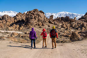 Alabama Hills HikeIt was Saturday, so Andrew and Celeste didn’t have to work and could spend the entire day with us.
At first we planned to do a hike in the nearby Druids, but then Andrew suggested that we try something new - a 6-mile hike through the Alabama Hills outside of Lone Pine, which he had found in an Eastern Sierra trail running guide.
We all loved the idea, especially me because I figured if it was supposed to be a trail run, there couldn’t be too much rock scrambling. I had had about enough of that yesterday when trying to find Sky Rock.
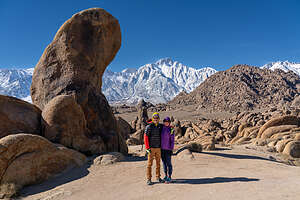 Alabama Hills HikeSo, we piled into Andrew’s car and drove for about an hour from Bishop, through Big Pine and Independence, past the Manzanar Historic Site (World War II Japanese internment camp), and into Lone Pine before turning right to get into the heart of the Alabama Hills, a range of hills and rock formations that lie at the foot of the eastern Sierra Nevada Mountains, with Mount Whitney, the tallest mountain in the continental U.S. towering above.
The outstanding and dramatic scenery of the hills also attracted Hollywood filmmakers from the 1920s to the present. Hundreds of movies (particularly westerns), TV shows, and commercials have been filmed here over the past century.
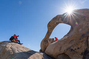 Mobius ArchThe Lone Pine Film History Museum is a great place to learn about the film history of the area. The 5.7-mile unpaved Movie Flat Road through the Hills goes past the filming locations for such greats as “How the West was Won,” “Rawhide,” and “Gunga Din.” A “Movie Road Touring Brochure,” is available online or at the museum.
The rocks in the Alabama Hills are very different from the boulders found in Bishop. They are much more rounded as the result of chemical weathering. When these hills were still covered with soil, percolating water rounded the granite blocks and sculpted the interesting arches and potato-shaped boulders that we would see along our hike today.
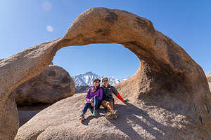 Mobius ArchOur hike began near a rock formation named Shark Fin, a 60-foot monolith shaped exactly like the fin of a shark. Like most of the boulders in the Alabama Hills, there is a climbing route up the fin, and I am proud to say that I actually climbed it a few years back.
From there we set out for a fantastic journey amongst the bulbous rocks of the Alabama Hills. Eventually, we came to the iconic Mobius Arch, through which you can see Mt. Whitney. Photographers love to take this photo, so, of course, we had to as well. Although this photo can be cliche, each photo can be different, based on weather conditions, time of day, and who’s posing in it.
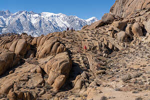 Alabama Hills HikeThe hike was more tiring than we all had expected - 6 ½ miles with about a 1,000 foot of elevation gain, with the occasional rock scrambling when we wandered off route.
What a wonderful day, an awesome hike with fabulous views and great company along the way. We all (except Andrew) fell asleep on the hour-long drive back to Bishop.
Back home, we spent the rest of the day just enjoying each other’s company and sitting down to another one of Celeste’s delicious dinners.
Day 5 - Super Bowl Party
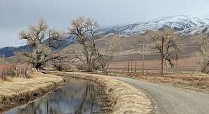 Stroll along the Bishop CanalSince the Super Bowl was this afternoon, we didn’t wander too far, but just took a nice long walk along the Bishop Canal.
I love this walk, threading our way through the cows with the snow capped Sierra mountains to the West and the White Mountains to the East. Andrew and Celeste are so lucky to have this so close to their home.
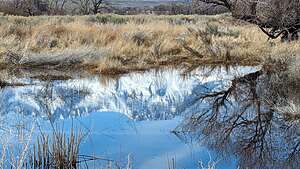 Stroll along the Bishop CanalAround 3:00, Andrew and Celeste’s friends started arriving, bearing lots of food to munch on through the game. Meanwhile, Celeste had a Crock Pot full of beef chili ready for half time.
Andrew and Celeste have met some really great people since their move to Bishop, and it was so much fun spending time with them. Being so far away from us, it’s nice to know that they have such a good group of caring friends.
The game, as you all know, was an exciting one. However, being from the Bay Area, we were all disappointed at the 49er’s loss.
Day 6 - More 4WD exploring of areas around Bishop
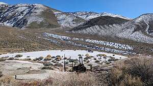 The Bishop"Beach"This was our last day with Andrew and Celeste in Bishop before we would set out for four days into Death Valley, one of Herb and my favorite places.
We still had a few hours to spare while the kids were working, so we decided to go to the “Beach,” a large bright patch of white in the foothills of the White Mountains northeast of Bishop in an area known as Gunter Canyon.
It definitely was an oddity. What was a beach doing out in the hills below the Whites? And why were their old abandoned rusty cars and machinery.
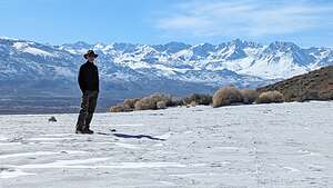 Herb at the "Beach"We had been here a few times before, but never really took the time to research the history behind this unique landscape.
Well, as it turns out, the white stuff spread across the ground is not sand at all, but rather fine-grain pumice tailings, remnants from the old Hidecker Pumice Mine that used to operate here.
It seems like you can’t go too far offroad in the Eastern Sierra (especially in Death Valley) without running across an old mining area. I think there are so many minerals to mine in this area because of all the volcanic activity that occurred in its distant past.
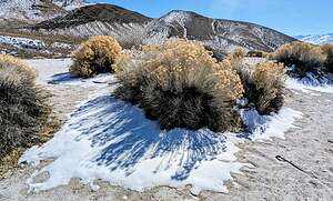 Some snow and sandOf course, now I had to know what pumice is, how it got here, and what commercial uses it has that would make someone go through the trouble of mining here.
Pumice is a type of extrusive volcanic rock, produced when lava with a very high content of water and gasses is discharged from a volcano. As the gas bubbles escape, the lava becomes frothy. When this lava cools and hardens, the result is a very light rock material filled with tiny bubbles of gas.
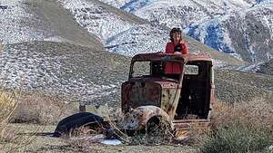 Car shoppingLong ago, people found that this very porous, froth-like volcanic rock is very abrasive and very useful as a cleaning, polishing, and scouring compound.
In fact, Martha Stewart even wrote an article about the “Seven Surprising Uses for a Pumice Stone,” some of which include: making your toilet bowl sparkle, cutting through greasy deposits on stove grates, removing pet hair from furniture, and on and on.
In fact, now I remember that Herb has this giant orange bottle of hand cleaner in the garage that is extremely effective. Guess what? It’s made from pumice.
All that, and being able to create the illusion of being on a white sandy beach in the middle of a canyon.
Day 7 - Drive to Death Valley
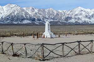 Manzanar MemorialThe drive along 395 from Bishop to Lone Pine is always a treat, especially when the surrounding mountain tops are covered with snow.
Although we had been to the Manzanar National Historic Site in Lone Pine before, I asked Herb if we could take a quick drive through to the poignant obelisk memorial that stands at the far edge of the camp, before the dramatic backdrop of the Sierra.
Unlike most of the Historic Sites we have had the privilege of visiting, this is not one that we as Americans can be proud of. This particular facility was one of ten relocation centers set up by the U.S. Government during World War II to forcibly intern Japanese American citizens. During the three years it was in operation, more than 10,000 people were sent to this center alone to be housed and held against their will for the duration of the war.
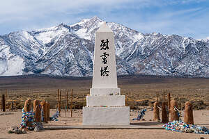 Manzanar MemorialThree large characters on the front of the memorial translate to “Soul Consoling Tower.” Colorful ribbons and scarves and other assorted offerings, like coins and even sake, adorn the posts around the obelisk.
Every last Saturday in April, hundreds of former internees, their families and friends, and a growing number of young people take a pilgrimage to this site to remember, honor, and reflect on the experiences of the people that were unjustly interned in this camp.
I highly recommend that anyone visiting Manzanar stop at this cemetery for a moment of reflection.
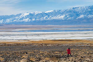 Owens Lake with waterAfter leaving Manzanar we continued south on 395 and then turned left on Highway 136 which would link us up with Highway 190, the major road into Death Valley.
As we were driving along 136, we couldn't help but stop to see the long dried up Owens Lake replete with water from the continuous atmospheric rivers hitting California.
Owens Lake has basically been a dry lake bed since the 1920s when the streams feeding it were diverted to quench the growing city of LA’s thirst for water.
The problem with dry lake beds is that when the wind blows the dust on their surface into the air, it creates a dangerous air pollution and health problem.
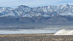 Owens Lake with waterTo make amends, LA has spent billions of dollars building infrastructure to keep the dust down on the lake. Ironically, the water that is filling the lake (which would naturally keep the dust down) is threatening to damage that expensive equipment that has been installed to keep the dust down.
The erratic swings in the California weather from too dry to too wet make managing these areas very difficult.
However, for today we were just happy to have had a chance to see how beautiful this lake once was before it was sacrificed for the growth of LA.
Now, onto Death Valley
North Shore - The Cliffs at Princeville
Sunday, January 14, 2024 - 2:00pm by Lolo42 miles and 1.25 hours from our last stop - 4 night stay
Travelogue
Day 7 - Check out of the Sheraton and drive to the north shore north to stay at the Cliffs at Princeville
 The Cliffs at PrincevilleIt had been a lovely stay at the Sheraton, but we had pretty much seen and done everything we had wanted, so we were excited to head to the northern shore of Kauai where we had more fun things planned.
Against Herb’s wishes, we made a stop at Costco as we passed through Lihue to stock up on more breakfast and lunch items. This time rather than having to confine ourselves to a mini fridge, we had a full kitchen.
I had reserved a one-bedroom suite with an ocean view on Bookiong.com at the Cliffs at Princeville, a timeshare community perched on the edge of a cliff overlooking the Pacific, however, when we got there, there was a bit of confusion, and they sent us instead to a first-floor suite with a view of a hedge.
 The Cliffs at PrincevilleThis just wouldn’t do, so we marched back to the Reception Area and informed them that there had been some kind of a mistake, as our reservation specifically said ocean view. After some apologetic mumbling and fiddling on the computers, they switched us to a second story suite in a building near the cliff with an ocean view. Herb was very proud of my feistiness in dealing with the reception clerk.
The suite was beautiful - full kitchen, dining area, living room, and bedroom, with a balcony off the living room with an ocean view and another balcony off the bedroom with a garden (and parking lot) view. We were very happy with our situation.
Once we were settled in, we took a bottle of wine and walked out to the cliff’s edge where there were about a dozen adirondack chairs to sit in and watch the sun set.
Beside the lovely view, there were two interesting birds wandering around: roosters and nene geese.
 Feral RoosterFirst the rooster, which was outsmarting me in my attempt to photograph it. These birds are everywhere on the island, acting like they own the place - wandering through restaurants, crossing the streets (without looking both ways), and any expanse of grass they can find.
According to local lore, the reason there are so many roosters wandering around freely on the island is that two hurricanes (Iwa in 1982 and Iniki in 1992) destroyed domestic chicken coops, thereby setting them free. These domesticated birds then mated with the wild red junglefowl, resulting in the feral chickens that are everywhere today.
They are actually quite beautiful, especially when the sun shines on their colorful feathers.
 The endangered Nene GooseThe other bird that was joining us for sunset cocktail hours was the Nene, an endangered goose that looks similar to the Canadian Goose except for its coloring and its diagonal black and white stripes. These stripes are caused by diagonal rows of white feathers with black skin showing through.
When Captain Cook arrived in the Hawaiian islands in1778, the nene was quite common. But hunting and predators like mongooses, pigs, dogs, and cats reduced the population to just 30 birds by 1952. Today, after much effort, they have been brought back from the brink of extinction and re-introduced into the wild. Today, there are 2,500 nenes in the wild, but it is still the 6th-most endangered waterfowl species in the world.
Then it was back to our lovely suite for a dinner of salad and sandwiches ala Costco.
Before going to bed, we decided to walk over to the lovely pool, right across the way from our building and take a soak in the hot tub. We asked the other couple that was already in the hot tub and they replied Santa Rosa, California, which just so happens to be where we are from. Small world.
Day 8 - Hanalei Bread Company, stroll on Hanalei Beach, and muddy hike from Ke’e Beach to Hanakapi’ai Beach
 Hanalei BeachOne of the major things we wanted to do on the north shore was to hike a section of the Kalalau Trail in Hāʻena State Park, the most famous backpacking trail in all of Hawaii. This trail is the only way visitors can visit the Na Pali Coast via land, because there is no road.
To do the whole trail requires a backpacking permit as it will take several days to complete the very strenuous 20-miles (out-and-back) along miles of switchbacks, precarious narrow trails, precarious drop-offs, and usually muddy conditions.
 Stroll along Hanalei BayThe only part of the Kalalau Trail open for day visitors is the first 2 miles from Ke’e Beach, where we parked, to Hanakapi’ai Beach. From Hanakapi’ai Beach there is an additional 1.8 mile side trail upstream to Hanakapi’ai Falls, one of the more spectacular falls on the north shore.
Because it has become so popular, you now need reservations to enter Hāʻena State Park and to access the Kalalau Trail. Anyone that wants to enter the park must make online reservations to either drive in and park or ride a shuttle.
 The muddy Kalalau trailThe parking spots, which we very much preferred, are extremely difficult to get and you must reserve one of three time slots: 6:30 am – 12:30 pm, 12:30 pm – 5:30 pm, or 4:30 pm – sunset.
Before leaving for Hawaii, I was only to get a 4:30 pm slot, which wouldn’t allow much time for hiking. When we were in Hawaii, I kept looking at the website, and was eventually able to grab a cancellation for the 12:30 pm slot on the same day, which was great, because it would allow us to do the hike to Hanakapi’ai Beach.
We still had all morning, so we drove to the Hanalei, stopping first at the Hanalei Bread Company to pick up some sandwiches for our hike. It was an extremely popular place, so we had to wait quite a while on line. Then we drove over to take a stroll on lovely Hanalei Beach, which we had seen from above during our helicopter ride.
 Ke'e Beach from the Kalalau trailIt was a very pretty beach, great for families because of the calmer waters of the bay.
Herb became fascinated with photographing two coconuts bobbing in the surf, which I found quite amusing. We named one of his little coconut friends Wilson.
Further down the beach, we came to a large "ALOHA" structure made with tree branches that had washed ashore.
 View of Napali CoastIt was almost time for our 12:30 parking reservation in Hāʻena State Park, so we drove the narrow road to the park, crossing several bridges, that often get flooded and impassable, to the end of the road. This is as far as you can drive on the north shore.
As I mentioned in my description of our drives through Waimea Canyon, we had gone as far north as we could go from the south shore when we drove all the way to the end and parked at the Pu’u O Kila Lookout. Only about 7 miles separates the ends of the two roads.
 Stream crossing near Hanakapi’ai BeachThe plan a while back was to connect these two road ends allowing for a complete circumnavigation of the island by car, but the ground in between was just too swampy. So the road around Kauai was like a clock with one hour blocked off (the one before midnight), and we had driven every possible bit of it - some of it multiple times.
When we got to Hāʻena, we realized we would only have time to do the 4-mile, out-and-back hike to Hanakapi’ai Beach. Going all the way to the Hanakapi’aiFalls and back would be about 6 hours in the muddy conditions, bringing us back after dark. Not a very good idea considering how rocky and slippery the trails were with many hazardous stream crossings along the way.
After parking the car, we walked on a boardwalk over taro fields, which were growing in pond water. Taro is a very important Hawaiian crop and a staple in the native Hawaiian diet. It is believed that the plant was brought to Hawaii by ancient Polynesians.
_0.thumbnail.jpg) Finally! Hanakapi’ai BeachThe Kalalau Trailhead was located right near beautiful Ke’e Beach. Rather than stop to enjoy the beach now, we wanted to get the hike done first, because we didn’t know how long it would take.
Finally! Hanakapi’ai BeachThe Kalalau Trailhead was located right near beautiful Ke’e Beach. Rather than stop to enjoy the beach now, we wanted to get the hike done first, because we didn’t know how long it would take.
For some reason I thought a beach (Ke’e) to beach (Hanakapi’ai) hike would be flat, but it was far from it.
The trail, which was very rocky and muddy, immediately began to climb and kept on climbing for the entire first mile.
 Hanakapi’ai BeachAbout a half mile from the start of the trail, we came to a pretty view below of Ke’e Beach.
Then at about a mile into the hike, near the top of the ridge in an opening in the brush, we got our first view of the Napali Coast. As I mentioned earlier, this trail is the only place where you can see the Napali Coast by land.
 Back to Ke'e BeachFrom there the trail descended down towards Hanakapi’ai Beach just as steeply as it had risen. Downhill is always tougher than uphill, especially when you have to worry about slipping on muddy rocks.
We could see glimpses of the beach as we descended so we knew we were closer. Back down at sea level, we came to a rapidly moving river (stream?) that we had to cross. Rather than try to delicately balance on a series of rocks to get across, I gave up and just got my boots (and my butt) wet. It wasn’t the most dignified crossing, but I didn’t care.
 Back on Ke'e BeachIn the winter, Hanakapi’ai Beach is not much of a beach, as the powerful waves and high tides of winter wash away the sandy shore line, leaving just a narrow stretch of sand with lots of boulders, draped by emerald green moss - very pretty. Definitely not a place to lounge and swim at this time of year.
From the beach we headed back from whence we came - across the fast-moving stream, up the muddy, rocky trail to the summit, and slipping and sliding back down again to Ke’e Beach.
Originally I thought we would take some time to relax and maybe even swim on Ke’e Beach, but we were muddy and tired, so after a short time we headed back to the Cliffs at Princeville, where we soaked in the hot tub.
Day 9 - Larsen’s Beach and enjoying the Cliffs at Princeville Pool
 Trail to Larsen's BeachToday the forecast was for rain in the afternoon, so we figured we would get out early while it was still sunny and explore some potential beaches to enjoy tomorrow.
The beach we were particularly interested in seeing was Larsen’s Beach, a secluded and isolated beach on the northeastern shore that just happens to border what the locals call “Zuckerland,” Mark Zuckerberg’s 1,400-acre compound. He calls it Ko'olau Ranch.
His massive construction project includes two mansions (totally over 57,000 square feet), guest houses, a gym and sauna, multiple swimming pools and hot tubs, a tennis court, 11 treehouses with rope bridges and, of course, an underground bunker (in case of societal collapse). And so much more.
 Larsen's BeachIt’s a very controversial and highly secretive project. No one is quite sure exactly what is going on behind the walls.
The good news is, although Zuckerberg can own all the land above the beach, he can’t own the beach itself.
To get to it we took a dirt road marked “Beach Access,” just west of Moloaa Road. In less than a mile, we came to a small parking lot.
 Larsen's BeachFrom there, there were several choices leading to the beach. The one straight ahead was steeper and rougher, so we took the middle one towards the left, which was quite easy and gentle. We weren’t sure if we were actually on Zuckerberg’s property (and he was allowing beach access), or whether we were just skirting it.
The beach was lovely - totally void of people, with lovely shade trees to sit under while watching the very large waves breaking over the reef.
We walked along the beach until we came to an impassable outcrop of lava rocks that essentially divided Larsen’s beach in half. I think there is a rough path that goes over the lava rocks to the other sides, but we were perfectly content to stay where we were.
 Larsen's BeachThe forecasted rain never came that day, so we spent an enjoyable few house on this lovely beach, me happily reading my book under a shade tree and Herb photographing the giant waves.
The winter Hawaiian surf season, which runs from approximately November through March, is where you can expect to see the largest waves, particularly along the north-facing shores where the waves can get up to 30 feet and even 70 feet during the largest swells. I think these waves were about 30 feet high.
.thumbnail.jpg) Giant waves at Larsen's BeachWe watched a young Hawaiian boy tossing a net over and over again into the sea and then retrieving it to see if he had trapped any fish. He was practicing an ancient Hawaiian fishing style.
Giant waves at Larsen's BeachWe watched a young Hawaiian boy tossing a net over and over again into the sea and then retrieving it to see if he had trapped any fish. He was practicing an ancient Hawaiian fishing style.
It involves a lot of patience. Most of the time is spent just quietly staring at the water until you see a school of fish. Then the net is thrown out, forming a circle that drops down to the water, and finally it is pulled in and hopefully emptied of its catch. Unfortunately, the boy caught nothing, at least as long as we were watching.
.thumbnail.jpg) Traditional Hawaiian net fishingLater that day, an older man holding a net stood silently by the lava rocks and then just stared at the water for almost an hour, never throwing his net once as knew there were no fish in reach. Later he wandered along the beach and stopped again. I took my eyes off of him for a while, but when I did look up, I saw him emptying his catch of about 5 small fish from his net onto the beach.
Traditional Hawaiian net fishingLater that day, an older man holding a net stood silently by the lava rocks and then just stared at the water for almost an hour, never throwing his net once as knew there were no fish in reach. Later he wandered along the beach and stopped again. I took my eyes off of him for a while, but when I did look up, I saw him emptying his catch of about 5 small fish from his net onto the beach.
Curious as to what he caught, I strolled down the beach to see. He told me that the fish he caught were “manini” and that they were good to eat.
.thumbnail.jpg) Manini caught in a netI asked if I could take a picture, and he said of the fish, but not him. I’m not sure if Hawaiians were just tired of tourists taking photos of them doing everyday Hawaiian things or whether his catch was legal or not. I later saw that the minimum allowable size to keep a manini is 5 inches and this one might be a little shy of that.
Manini caught in a netI asked if I could take a picture, and he said of the fish, but not him. I’m not sure if Hawaiians were just tired of tourists taking photos of them doing everyday Hawaiian things or whether his catch was legal or not. I later saw that the minimum allowable size to keep a manini is 5 inches and this one might be a little shy of that.
.thumbnail.jpg) Cliffs at Princeville poolWhen I researched this fish a little more, I found out that it is also called the convict tang, I guess because its stripes make it look like it is wearing a cute little prison outfit.
Cliffs at Princeville poolWhen I researched this fish a little more, I found out that it is also called the convict tang, I guess because its stripes make it look like it is wearing a cute little prison outfit.
I was wondering why this fish looked sort of familiar, but then remembered that Herb’s dad had a saltwater fish tank for years with lots of tropical fish, including tangs just like this one.
Still blue skies and no sign of rain, so we managed to get a full beach day out of today. I was so glad, because now rather than making tomorrow (our last day on Kauai) our beach day, we could spend it visiting two places I really wanted to see that were closed today: the Kalalau Lighthouse and the Na ‘Aina Kai Botanical Gardens and Sculpture Park, both of which were closed today but open tomorrow.
Then it was back to the Cliffs and Princeville for some pool and hot tub time! It was a very lovely pool with warm water and even a small waterfall to refresh yourself.
Day 10 - Fitness Center and Pool, Na ‘Aina Kai Botanical Gardens and Sculpture Park, Kilauea Lighthouse and Wildlife Refuge, and Shave Ice
 Na ‘Aina Kai GardensBig day for our last day of vacation: a 1:00 tour at the Na ‘Aina Kai Botanical Gardens and Sculpture Park followed by a 3:00 reservation to enter the Kilauea Lighthouse and Wildlife Refuge.
That gave us the entire morning to relax at our resort. We started off with a visit to the fitness center where I did 40 minutes on a stationary bike followed by 20 minutes of lifting. Visiting fitness centers while on vacation is kind of a new thing for us, but we both just finished reading “Outlive: The Science and Art of Longevity,” so we were doing our best to live to be healthy centenarians.
Then it was on to the pool to read and relax for a bit before setting out on our busy day.
 "Valentine"Our first activity of the day was a visit to the Na ‘Aina Kai Botanical Gardens and Sculpture Park, which combines art and nature in a lovely setting. I confess to not knowing much about plants, but I do love art within nature.
The gardens were started by Joyce and Ed Doty, a couple that moved to Kauai in 1982 from Santa Rosa, California, our home town. Joyce was actually the ex-wife of Charles Schulz of Peanuts comics fame.
Over the next decades they expanded what was a simple landscape project in the front yard into 240 acres of diverse gardens, complete with one of the largest collections of bronze sculpture in the United States.
 Bismark nobilis palmIn 1999 the Dotys created Na ‘Āina Kai Botanical Gardens, a private foundation, to which they donated the entire gardens. The foundation maintains the gardens and offers a variety of guided tours.
We would have preferred to do a self-guided walk so we could spend time photographing, but they are only offered on Thursdays, which didn’t work for us.
Instead, we signed up for the “The Stroll” tour, where a guide led us through various parts of the garden, explaining the history of the gardens and the plant life along the way.
 "Hearts on a Swing"Our guide was a naturalist that lived in Alaska during the summer and Kauai in winter. In between, she traveled the world, mostly to tropical places like Tahiti. She was very knowledgeable and interesting.
She took us through the Formal Gardens and Poinciana Maze, past a Lagoon with a lovely cascading waterfall and tropical island with fountain, a Japanese teahouse, and a Desert and Palm Garden.
My favorite part of exploring the Gardens was being surprised by a bronze sculpture around every turn in the trail.
T One of the 200 bronze statueshere are 200 life-size, bronze sculptures in the gardens, each done by a Coloradan artist name George Lundeen. I wish I could have seen them all.
Joyce never bought a piece until she knew exactly where she wanted to place it in the garden, where it would be integrated into the horticultural setting without competing for attention with other sculptural pieces.
.thumbnail.jpg) Bark of a Rainbow Eucalyptus TreeI found myself losing the tour group because I was admiring and photographing the sculptures rather than learning about the plants.
Bark of a Rainbow Eucalyptus TreeI found myself losing the tour group because I was admiring and photographing the sculptures rather than learning about the plants.
My absolute favorite was a sculpture of an elderly couple sitting on a bench, leaning lovingly towards each other.
The piece, which is very appropriately called “Valentine,” was an anniversary gift from Joyce to Ed. It was their first sculpture in what would become a very extensive collection, many of which from the same artist, George Lundeen of Colorado.
 "Hearts on a Swing"As I mentioned above, Joyce never purchased a sculpture until she knew exactly where she was going to place it in the garden. She chose wisely, placing Valentine beneath the big banyan tree in the Main Garden.
I found myself far behind the group, wistfully looking at it, thinking, if we were lucky, that that would be Herb and me someday.
The next sculpture we encountered was of a beautiful young lady sitting casually on a swing, called "Hearts on a Swing." She was lovely.
There were so many more. The subjects reminded me of Norman Rockwell paintings in their quaintness, idealism, and sentimentality.
 “Flight of the Tropic Birds"The only sculpture we saw that wasn’t by George Lundeen was a beautiful fountain sculpture in the middle of the lagoon called “Flight of the Tropic Birds,” done by artist Panco Vining. Rather than bronze, it was a brilliant white flock of birds.
Besides the lovely banyan tree under which “Valentine” was placed, we did see many different varieties of palm trees, one of which was the Bismark nobilis palm. A native of Madagascar, this rather unusual palm tree, which grows 30 to 60 feet high has silver green leaves.
 "Follow the Leader"However, my absolutely favorite tree was the rainbow eucalyptus, whose bark was so brightly colored that I couldn’t believe it was natural. But it was!
This time I did pay attention to our guide as she explained why the bark of this tree looks the way it does. As the tree sheds its bark, it reveals a neon green inner layer. Over time, as this layer is exposed to air, it ages into different colors—bright reds, oranges, blues, pinks and purples. The different colors appear as different layers fall off, while other exposed areas begin aging.
The last sculpture we encountered was another favorite of mine. It was called "Follow the Leader" for obvious reasons. It consisted of five adorable children (and one old lady trying to join them) balancing their way across a log.
 Kilauea LighthouseThe Na ‘Aina Kai Botanical Gardens and Sculpture Park had been a very worthwhile educational and aesthetically- pleasing stop.
From the Gardens we continued on to the nearby Kilauea Lighthouse and Wildlife Refuge where we had a 3:00 entry reservation.
The Kilauea Lighthouse stands atop a 180-foot-high bluff above the ocean at the very northernmost point of the Hawaiian Islands.
.thumbnail.jpg) Here come the wavesIn the early 1900s, the U.S. government studied alternatives for placing a lighthouse on Kauaʻi, as it is the first landfall for ships coming from the west. After much study, Kīlauea Point was selected, in part due to its 180-foot elevation, making it less expensive since the tower structure did not have to be taller to be effective. Construction started on July 8, 1912.
Here come the wavesIn the early 1900s, the U.S. government studied alternatives for placing a lighthouse on Kauaʻi, as it is the first landfall for ships coming from the west. After much study, Kīlauea Point was selected, in part due to its 180-foot elevation, making it less expensive since the tower structure did not have to be taller to be effective. Construction started on July 8, 1912.
Already important to marine navigation, the lighthouse also aided aviation since its beam could be seen from 90 miles away from an airplane.
Just after the Japanese attack on Pearl Harbor, the light station went dark until the end of the war.
 Crashing waves off Kilauea LighthouseIn 1976, the massive beam of Kīlauea Point Lighthouse was replaced by an unmanned automated beacon. Large ships and planes no longer relied on the light for navigation.
Today visitors such as us come to view and photograph this beautiful lighthouse.
A wildlife refuge was established on the bluff in 1985 to preserve seabird nesting colonies. It is a wonderful place to see seabirds rarely seen from land, such as the red-footed booby, the great frigate bird, the Laysan albatross, and the endangered nēnē.
 Jojo's Shave IceAlthough we unfortunately did not see much bird activity, we did have a lot of fun watching the giant waves crash on the promontory across the way.
Since it was our last night, and we had run out of Costco food, we decided to drive into Hanalei for a bite to eat. Plus, the last thing we had on our list to accomplish was having a Shave Ice, and there was a Jojo’s Shave Ice in town.
Our original intent was to have a poke bowl at Hanalei Poke, but despite their website saying they were open, they weren’t, so we had a Hanalei Pizza instead. We figured that we should try something Hawaiian, so we had a BBQ pizza with pork, pineapple, and a drizzle of BBQ sauce. Not exactly my favorite, but we thought it needed to be done.
Then it was on to Jojo’s Shave Ice where we managed to gain back all the calories we worked off in our multiple visits to the fitness centers in our hotels. It was decadent. A mound of ice with pina colada and other colada flavored syrup over Macadamia Nut ice cream. It was tasty, but the portion was ridiculously large.
Okay, well we knocked the pineapples on a pizza and shave ice off our list, so I guess it was time to go home.
South Shore - Sheraton Kauai Resort
Monday, January 8, 2024 - 9:45am by Lolo14 miles and 0.5 hours from our last stop - 6 night stay
Travelogue
Day 1 - Arrival on Kauai, stocking up at Costco, and checking into the Sheraton Kauai Resort in Koloa
 Our arrival at the Sheraton KauaiA trip to Hawaii definitely made more sense now that we had moved to the West Coast. The flight from San Francisco is about 5 hours and you even gain 2 along the way, so we landed around 12:30 pm with plenty of the day left to settle in.
After picking up our rental car, we stopped at a Costco on our way to our hotel. We only had a mini-fridge in our room, so we had to be really disciplined as to what we purchased. However, we did go a bit too crazy on the non-perishables. I thought Herb was kidding when he placed one of those barrels of pretzels in the cart. Unfortunately not. We also stopped in a Safeway to get some more reasonably sized items.
Fully-stocked, we headed to the Sheraton Kauai Resort located on the beach in Koloa, Hawaii. It was even better than expected. We knew we had an ocean view, but not “the” ocean view - 4th floor balcony with a balcony overlooking the sunset gathering spot for the resort - adirondack chairs on a grassy knoll beneath a line of beautiful palm trees.
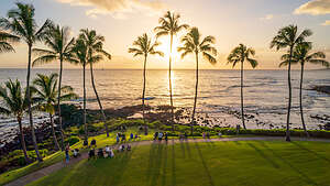 Sunset from our balconyWe were exhausted, so we took a brief nap before heading out on an exploratory walk around the resort. It was perfect - great fitness center, beautiful pool, its own private beach, and two restaurants - one casual and one more fancy. Plus we were in easy walking distance to several highly-rated restaurants in the other resorts nearby.
We got back to the room in time to watch the sunset from our balcony. It definitely seemed like the place to be, as crowds gathered (as they would do every evening) on blankets and the Adirondack chairs below us.
Much too tired to go out for dinner, we had cheese and crackers, walnuts, a wonderful salad, and a turkey sandwich - all ala Costco. Oh, and of course I made Herb eat some pretzels
I slept like a baby that night, lulled to sleep by the pounding of the surf outside our window.
Day 2 - Hike the Maha'ulepu Heritage Trail, drive up to Waimea Canyon after helicopter ride canceled, and dinner at Holoholo Grill
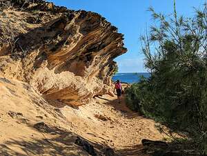 Maha'ulepu Heritage TrailToday was supposed to be our doors off helicopter ride over the Waimea Canyon and the Na Pali Coast with Mauna Loa helicopter tours. It was quite windy with forecasted gusts over 30 mph, so I was a bit nervous. That wasn’t until 3:00 this afternoon though, so I decided to put it out of my mind for now and enjoy the morning (which hopefully wouldn’t be my last - just kidding). Herb said he wasn’t nervous, but I did see him checking the “Windy” app on his phone quite often.
So, as planned we drove the short distance to Shipwreck Beach to hike along the Maha'ulepu Heritage Trail.
The trail departs from Shipwreck Beach, a beautiful stretch of sand surrounded by large rocky cliffs. We would definitely have to spend some time just relaxing on this beach some time this week.
 Maha'ulepu Heritage TrailFrom the trailhead, we climbed up along sand dunes and then along the rocky coastline with several opportunities to step out onto the cliffs overlooking Shipwreck Beach and other beaches hidden between the surrounding coast cliffs.
As we continued on, the ground became a bit redder, with lots of volcanic rocks strewn about. From there, we followed a grassy trail at the edge of the Poipu Bay Golf Course towards beautiful red cliffs.
We had to get back soon for our helicopter ride, so at a mile and a half out, we turned around and retraced our steps back towards Shipwreck Beach.
 Maha'ulepu Heritage TrailAfter a quick lunch in our room, we kept looking at the weather forecast to see if we should reschedule our helicopter ride. We had paid an extra $50 in insurance to allow us to do that in case we chickened out.
It was questionable, but we decided to go there and see what the pilot thought. We had only gotten about 10 minutes from our hotel when we received a phone call from Mauna Loa Helicopter Tours telling us that it was too windy and no more helicopters were going out that day. Whew! I’m glad they made the decision for us.
We looked at a long range weather forecast, which we knew wasn’t that accurate because of the volatility of the weather patterns here, and rescheduled for Saturday (4 days from now).
 Waimea Canyon - Waipo'o FallsNow what? With nothing else planned for the day, we decided to take a drive to Waimea Canyon. If we couldn’t see it by air, we would attack it by car.
As I mentioned in the Trip Over, Waimea Canyon is pretty much what motivated us to come to Kauai. The colorful layers along the sides of the cliffs of this spectacular 10-mile canyon have earned it the nickname “the Grand Canyon of the Pacific.”
 Waimea Canyon Waipo'o FallsIt is extremely wild and remote and only visible from the air or from lookouts along the 20-mile Waimea Canyon road that winds and twists its way up from sea level to over 4,000 feet at roads end.
As we started the drive up Waimea Canyon Road, the weather almost immediately shifted from sunny skies to atmospheric clouds drifting through the canyon. Well, at least it wasn’t raining.
We drove into the parking lot of the Waimea Canyon Overlook, which is supposed to have the most dramatic views. Unfortunately, it was completely socked in with clouds, and since we didn’t want to spend the $20 fee to park there to look at a wall of clouds, we continued up the road.
We had only driven a short distance when we saw a few cars pulled over to the side of the road, so we decided to join them and see what was up.
Oh, no wonder. There was some light on beautiful Waipo’o Falls creating a very atmospheric effect on it and the surrounding colorful cliffs.
 Waimea CanyonWe had to act quickly though because the light was very fickle and if you hesitated, you could miss it. We just had to be patient and wait, because the light was constantly changing.
After capturing a few images, we continued up Waimea Canyon Road pulling over, if possible, whenever we saw some light.
We wound up driving all the way to the end to the Pihea Trailhead, but by then the lookout had nothing to look at except clouds, so we decided to head back.
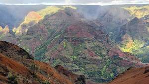 Waimea CanyonThe drive had not been a total wash out though as I think we did capture some fairly dramatic photos. Blue skies can be boring.
That evening we walked about a quarter mile over to the next resort to the Holoholo Grill for dinner. We both had what became our go-to meal in Kauai - a Hawaiian Poke Bowl with raw ahi tuna, white onion, sesame oil, avocado, cucumber, edamame, ocean salad, crispy onion, sweet soy drizzle, wasabi aioli drizzle and furikake sushi rice.
It was delicious and very healthy too.
Day 3 - Relaxing on Shipwreck Beach and the Sheraton Aulii Luau
 Shipwreck BeachToday we needed to be back at our hotel by 4:30 to get ready for our Luau, so we decided to spend the day where one should when on Kauai - at a beautiful sandy beach.
We returned to Shipwreck Beach, where we had started our hike on the Maha'ulepu Heritage Trail yesterday. It was a lovely beach with water calm enough to swim in and there were shade trees if needed to get out of the sun.
There was a large group of college age kids on the beach who spent a good part of the day climbing up the cliff at the west end of the beach, called Makawehi Point, and jumping off it, over and over again. It was fun to watch and try to capture them in midair.
 Jumpers at Shipwreck BeachAfter a few hours, we went back to our room for a light lunch, as we would be stuffing ourselves with an all-you-can-eat buffet later that night at the Aulii Luau, held on the grounds of the Sheraton.
We had never been to a luau before, so I started researching luaus on Kauai. To my delight, the one I selected was actually located on the grounds of the Sheraton Kauai Resort where we were staying, making it much safer to take advantage of the open bar with unlimited Mai Tais.
 Aulii LuauThe Sheraton Aulii Luau is the only oceanfront Luau on Kauai, which I thought made it extra special. We booked the Aloha (standard seating) package which was $190 a person. I think the Premier seating was an extra $25 each.
It worked out great for us though, as our assigned “Standard” seating was right behind a Premier table, and we had equally good views of the stage where the dancing would be done.
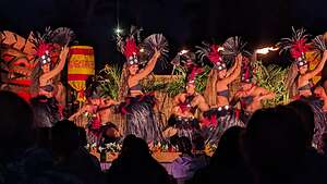 Aulii LuauAfter a wonderful buffet dinner, the hula dancing began. It was phenomenal, far exceeding my wildest expectations.
The dancers belonged to a group called Urahutia Productions, started by a Kauain woman named Mi Nei, who spent many years in Tahiti studying Tahitian Dance. When she returned home to Kauai in 1998, she created Urahutia Productions and began offering Tahitian dance classes, which she has continued to do for the last 25 years.
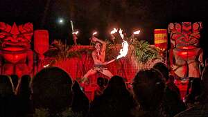 Aulii LuauIn 2011, the Sheraton Kauai Resort partnered with Urahutia Productions to put on shows that entertained, as well as educated guests in the history, lifestyles, and culture of the Polynesian people.
Many of the extremely talented dancers we saw that night were multi-generational members of Mi Nei’s ‘ohana’ (family).
You could feel their energy, pride, and “aloha” (love and fellowship) as they put on quite a show for us. I was totally mesmerized.
My only regret is that Herb and I did not take advantage of the Hula Lessons offered each morning at our hotel.
Day 4 - Fitness Center Workout, Lunch at Kalaheo Cafe, Hanapepe Swinging Bridge, and another attempt at photographing Waimea Canyon
 Too Old to ExerciseHerb and I were both reading a book called “Outlive: The Science and Art of Longevity,” so we decided to spend some time in the Sheraton Resort’s Fitness Center to add on a few quality years. When we are home, we are very active, exercising probably about 6 out of 7 days of the week. However, we usually slouch off when on vacation, but this time we were motivated.
The Fitness Center was quite nice - great equipment and a view of the ocean. I have always done a lot of cardio, but I just within the last year have added lifting weights to my regimen, as building muscle mass is very important at our age.
We did have a good laugh when we looked at the Aerobic Exercise Guide chart on the wall, which showed target heart rate zones by age category. What immediately came to our notice was that there was no age category over 65!!
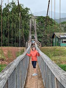 Hanapepe Swinging BridgeApparently, we were now considered too old to exercise - despite the fact that I had just completed 40 minutes of cardio in the 35 - 40 age category range. I didn’t know whether to be proud or concerned.
After our workout, we decided to make another attempt at photographing the fickle Waimea Canyon.
On the way, we stopped at the Kalaheo Cafe, where I continued my new-found plan to live to 100 by ordering a delicious veggie sandwich, piled high with Guacamole, carrots, zucchini, squash, onion, mushroom, olives, lettuce, tomato, cucumber and clover sprouts. Herb had his standard go to - a club sandwich.
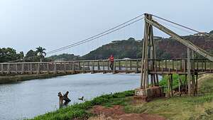 Hanapepe Swinging BridgeHawaii is known for its coffee, and in the town of Kalaheo there are over 4,000 acres of coffee farms. I had one of the best coffees of my life - Kahlua and Cream. My less adventurous husband had a regular drip coffee. I made him take a sip of mine and I could tell he was jealous.
Happily fed and caffeinated, we continued on, stopping first in the little town of Hanapepe to see and walk across its famous swinging bridge.
For over a 100 years there has been a suspension bridge spanning this part of the Hanapepe River, used by taro farmers and locals to cross the river. In 1992 Hurricane Iniki damaged the bridge and it was replaced with the one that is currently there. Built with reinforced cables and wooden planks, it is considered very safe.
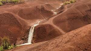 Red Dirt FallsGood, because it really swayed a lot when we walked across it, especially because of the high winds we were experiencing today.
From there we continued on to Waimea Canyon Road. Right on queue, it began to rain and quite heavily too. The day was a bit of a bust. After stopping at several lookouts where we could barely see our hand in front of us, we decided to give up and head back to the resort.
On the way back along the Waimea Canyon Road, I asked Herb to let me out of the car to take a photo of Red Dirt Waterfall, which ran right alongside the road. It was pouring out, so I had to make it quick as water droplets were rapidly covering my lens.
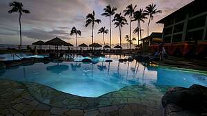 Sheraton Kauai poolThe waterfall, which is relatively small, is carved into the canyon surrounded by bright red soil and lush vegetation.
Carved into the island’s iconic Waimea Canyon, this relatively small waterfall is surrounded by gorgeous red soil and the canyon’s lush vegetation.
This red soil here, and in much of Waimea Canyon, is a natural byproduct of the dark, iron-rich basalt rock that surrounds the canyon. These rocks have oxidized over time, giving the soil various shades of red.
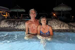 Enjoying the Sheraton hot tubIt is thought that the red soil is what gave Waimea Canyon its name, as the word “waimea” means “reddish water” in Hawaiian.
Well, only one Waimea Canyon photo today. We still had another day to try as well as our helicopter ride over the canyon in a few days.
Of course, when we got back to our hotel, the sun was shining and it was a beautiful day. Who knows? It might have been like this all day and only the Canyon was covered with clouds and rain.
Since we had a big lunch out at the Kalaheo Cafe, we decided to have dinner (Costco salad and sandwiches) on our balcony and watch another beautiful sunset.
Afterwards, we headed down to the pool area to enjoy a soak in the hot tub.
Day 5 - Drive back to Waimea Canyon with thoughts of hiking, late lunch at the Kalaheo Cafe, hang out at hotel pool, work out in fitness center
 Thwarted by cloudsHoping that three was the charm, we drove once again up the Waimea Canyon road with the hopes of getting some good light and being able to do at least one of three pretty long hikes we had researched.
- Awa’awapuhi Trail - a very strenuous 5.8-mile, out-and-back trail with over 1,800 feet of elevation gain, with a spectacular, but fairly dangerous ending
- Waipo’o Falls Trail - a strenuous 2.6-mile, out-and-back trail to the beautiful waterfalls we had photographed the other day.
- Pihea Vista Trail - a moderate 2.3-mile, out-and-back trail with good vistas along the way. This trail started at the very end of Waimea Canyon Road
 Rainbow Waimea CanyonNormally, we would have left in the afternoon when the light on the canyon is much better, but since we wanted to get in a multi-hour hike first, we left in the morning, so we could get a hike in and then photograph from the lookouts later in the afternoon on the way back.
As we drove up the Canyon Road, we did get some good lighting, especially of the Waipo’o Falls, so we figured we would stop to photograph it now. Lesson we have learned: grab the light when you have it.
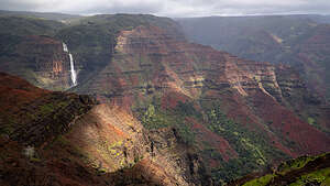 Light hits Waipo'o FallsWe stopped at the trailhead for the Awa’awapuhi Trail, but even the parking lot was deep in mud. The thought of slogging for over 4 hours along a muddy trail to get to a spectacular ridge ending that was probably scary enough when dry, convinced us to continue on and to the shorter Pihea Vista Trail, which started at the very end of the Waimea Canyon Road at the Pu’u O Kila Lookout.
Interesting story. They originally planned many years back to continue the road to Hā'ena State Park on the northern shore, about 7 miles further, as the crow flies. However, the ground was so swampy that construction trucks sunk in the muck and are supposedly still there. That didn’t bode well for any expectations of a dry trail.
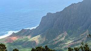 Where Waimea Canyon meets the seaWhen we got to Pu’u O Kila Lookout, it started to rain. We decided to wait for 20 minutes for it to stop, but it didn’t.
We knew from people we had met at the Luau the other night, that the hike to Waipo’o Falls falls had been too muddy to get close to the falls.
That was three strikes against our hiking hopes, so we decided to cut our losses short and go back to the Resort where there was probably plenty of sun.
 Another sunset from our balconySure enough, when we got back to the town of Waimea, the sun was shining brightly. We were half tempted to drive back up the Canyon road, but figured it could very likely just change to clouds and rain again.
We hadn’t eaten the peanut butter sandwiches I had packed for our hike, so we stopped again at the Kalaheo Cafe for another delightful lunch and great coffee.
Then it was back to our hotel, where the sun was shining, as it very likely had been all day. We hadn’t really spent much time yet at the lovely pool, so we got in our bathing suits, grabbed some towels, and spent a few relaxing hours poolside.
Afterwards, feeling guilty for not doing something physical today, I went to the fitness center to do 45 minutes of cardio on a stationary bike.
We finished the day with another beautiful sunset from our balcony.
Day 6 - Fitness Center, Sheraton Resort Pool, poolside lunch at Lava’s on Poipu Beach, Helicopter Ride, and dinner at Holoholo Grill
 Poolside lunchToday was the big day, assuming that the weather cooperated - our doors off helicopter ride over the Waimea Canyon and along the Nāpali Coast. It was originally scheduled for a few days ago, but the high winds kept the helicopters grounded. Hopefully, today would be calm and clear.
If the pilots make the decision that it is unsafe to go up, they issue a full refund. We bought extra cancellation insurance though, just in case our opinion differed from the pilot’s. It might be safe to fly, but if the conditions were cloudy or rainy and still too windy (in our opinion), we wanted to be able to get our money back if we decided we didn’t want to go.
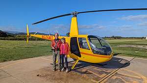 Our ride for todayFortunately, today looked perfect - clear skies and calm winds.
Our reservation wasn’t until 3:00 pm, so we had plenty of time to just relax around the resort, which was really quite lovely.
We started off with an hour of lifting and cardio in the fitness center. It was a really nice fitness center with lots of good equipment and big windows looking out at the ocean.
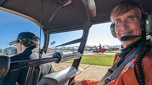 Happy HerbAfter that it was pool time. The pool was quite popular so it was always a bit challenging to get two lounge chairs together, but we managed to get the last two.
We spent a relaxing few hours reading and people watching. We ordered lunch from the poolside Lava’s on Poipu Beach restaurant and had it delivered to our lounge chairs.
This was definitely very different from our normal style of travel, but the contrast made it extra fun.
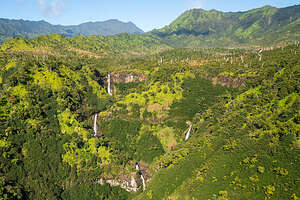 Lush valleysNo call from the helicopter tour company, so it looked like we were on for flying today. Herb had booked our tour with Mauna Loa Helicopter Tours because they were highly rated and offered private tours (just the 2 of us and the pilot) with the option of having the doors off to allow for unobstructed photography.
We drove to the Mauna Loa office near the airport to check in - sign forms, watch a safety video, etc., and then over to the heliport at Lihue Airport to meet our pilot Julien.
After greeting us, Julien gave us a headset, so we could speak back and forth during the flight, a strap to make sure our cell phones did not fly out the door opening, and the promise of an “Aloha” (barf) bag if we needed one. We had already taken 2 Bonines for motion sickness, and the winds were pretty calm, so hopefully those “Aloha bags” would not see the light of day.
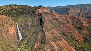 Waipo'o Falls from the airI tried to hold back from asking Julien if he had ever flown one of these before, but we did eventually get around to asking him how many flying hours he had - 1,000, so I relaxed a bit.
Most importantly, we were instructed to keep all appendages inside the helicopter. Later, during the flight, I briefly learned how essential an instruction this was when my hand went slightly outside the door opening to take a photo, and the 100 mph wind force almost ripped my phone right out of my hand if it hadn’t been for the strap. That was the last time I got even close to that door opening.
 Bank turn Napali CoastWe took off from the Lihue Heliport and started heading west towards Waimea Canyon, which had thwarted us with rain and clouds on three separate days that we had driven up Waimea Canyon Road. What a difference today, when the sun was shining, the skies were blue, and the water in the falls was raging. And, most importantly of all, no clouds to obstruct our view.
This island is so lush and green with dozens of waterfalls cascading over cliffs on their way to the sea.
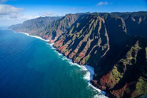 Napali CoastWe cruised right up close to beautiful Waipo’o Falls, which we had photographed from the Waimea Canyon Road, but nothing like this!
We then headed north towards the Nāpali Coast, one of the most recognizable and beautiful coastlines in the world. These views of the colorful, rugged cliffs and narrow valleys ending abruptly at the sea are the reason we came to Kauai in the first place.
They are extremely remote and inaccessible, except by sea, air, or a very long backpacking trip. During the winter the seas are too rough for a comfortable boat ride, so helicopters were the best option.
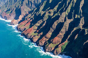 Colorful Napali cliffsI thought I would be afraid during this ride and counting down the minutes until it was over, but instead I was absolutely at peace, mesmerized by the beauty on display below us.
We cruised along the coastline for a while, occasionally dipping into and out of several valleys.
Many times I felt like we were headed right towards a canyon wall, before Julien either turned or went up over it. There were times I felt like I could reach out and touch the top of a ridge. Helicopters are a lot more maneuverable than I would have ever imagined.
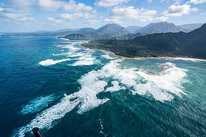 Rough winter seasI have a tendency to have crooked horizons in my photos, but now I had the perfect excuse. Everytime Julien made a banked turn, the horizon went close to a 45 degree angle. I kind of like the effect.
As we headed east along the northern shore, we passed over beautiful, crescent-shaped Hanalei Bay, which we would visit in a few days.
I didn’t make the connection until Herb informed me that this idyllic Bay was the inspiration for the mythical “Honah Lee” in the 1960’s song “Puff the Magic Dragon.” That was one of my favorite songs as a kid, and now I couldn't stop humming it.
 Hanalei BayThen Julien turned inland - oh no, our trip was almost over. The hour was going far too fast.
On the way back to the heliport, we passed over inland forests, hills, and agricultural land. There were even some cows down there.
Before I knew it, Julien had expertly landed us back on our helipad.
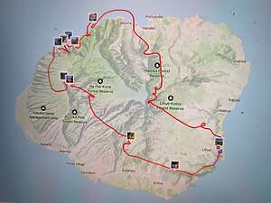 Our helicopter routeAll I can say is Wow! What a way to spend our last day on Kauai's southern shore.
Back at the Sheraton, we watched one last sunset from our balcony before walking to the nearby Holoholo Grill, where we had had a delicious dinner a few nights ago. We even ordered the same exact meal as before - the Hawaiian Poke Bowl.
Before leaving for the north shore the next morning, we tried had a late breakfast at the Keoki’s Paradise, another lovely restaurant in walking distance to our hotel. I took advantage of the all-day breakfast and had a veggie omelet, while Herb I think made the better choice with a poke bowl that had both ahi and pulled pork.
Fallon
Tuesday, September 19, 2023 - 9:30am by Lolo505 miles and 8.5 hours from our last stop - 1 night stay
Travelogue
.thumbnail.jpg) Sand Mountain Recreation AreaAfter leaving our amazing sunrise experience in Bryce, it was time to head home. Our goal today would be to get at least half of the 14 hour drive behind us, so we could be back home tomorrow night.
Sand Mountain Recreation AreaAfter leaving our amazing sunrise experience in Bryce, it was time to head home. Our goal today would be to get at least half of the 14 hour drive behind us, so we could be back home tomorrow night.
Our route would take us back pretty much the way we came here - across the entire width of Nevada on Highway 50, appropriately dubbed the “Loneliest Road in America.”
On our drive through in the beginning of the trip we had spotted a sign for the Sand Mountain Recreation Area and vowed to stop there on our way back.
.thumbnail.jpg) Sand Mountain Recreation AreaIt was very cool - a 2-mile long, 600-foot-high sand dune that is an OHV area, meaning it allows dune buggies to drive all over it. Fortunately, there were no dune buggies there today and we could have it for ourselves.
Sand Mountain Recreation AreaIt was very cool - a 2-mile long, 600-foot-high sand dune that is an OHV area, meaning it allows dune buggies to drive all over it. Fortunately, there were no dune buggies there today and we could have it for ourselves.
I think Herb was a bit trip fatigued, because he just wanted to move on to find a place to stay for the night. I, however, wanted to climb it, so before he could stop me, I ran off and did - if even for just a little bit.
.thumbnail.jpg) Depot Casino RestaurantThis dune is one of a rare group of “singing sand dunes.” There are only about 40 of them in the entire world, and we have been to two of them - Kelso Dunes in the Mojave Preserve and Eureka Dunes in Death Valley.
Depot Casino RestaurantThis dune is one of a rare group of “singing sand dunes.” There are only about 40 of them in the entire world, and we have been to two of them - Kelso Dunes in the Mojave Preserve and Eureka Dunes in Death Valley.
Basically, when you run down the steep part of a dune, the sand avalanches in rivulets and begins to “sing.” The singing is caused by the friction of the sand grains sliding against each other. It sounds a bit like the bass note of a pipe organ or the distant drone of an airplane.
I didn’t get up high enough to make it sing.
.thumbnail.jpg) Oh My!We stopped for the night in Fallon, a relatively large town for Nevada with 7,000 residents and plenty of shopping malls and food chains. Fallon is home to the U.S. Navy-Fighter Weapons School and is where the film Top Gun: Maverick was filmed.
Oh My!We stopped for the night in Fallon, a relatively large town for Nevada with 7,000 residents and plenty of shopping malls and food chains. Fallon is home to the U.S. Navy-Fighter Weapons School and is where the film Top Gun: Maverick was filmed.
After checking into a Quality Inn on the main drag, we decided to look for a place to have dinner in walking distance, as we had been in the car long enough already today.
Herb chose the Depot Casino Restaurant right nearby. It served breakfast all day, as people in casinos don't usually know what time of day it is.
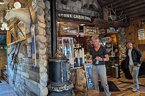 Stone Cabin Coffee ShopSo Herb ordered the scrambled eggs with hash browns and sausage, which came with I side of pancakes (???) and I ordered an omelette with potatoes O’Brian, which came with a side of biscuits and gravy. It was obscene. Even the waitress had to laugh when she (in multiple trips) delivered our ridiculously large entrees.
I will never let Herb select a restaurant again.
The next morning we stopped at the highly recommended Stone Cabin Coffee Shop and drove the remaining 6 hours home.
Awesome trip, but it was definitely good to be back home, where I plan to stay putt for a while..
Bryce Canyon National Park
Monday, September 18, 2023 - 12:30pm by Lolo22 miles and 0.3 hours from our last stop - 1 night stay
Travelogue
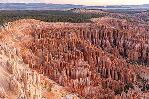 Bryce AmphitheaterEveryone should see Bryce Canyon in their lifetime. We were fortunate enough to have been here two times prior to this visit, but its magic never fades.
There are lots of beautiful places in the west, but there is something special about Bryce--something unique and somewhat unreal. It's a lot smaller and less intimidating than places like the Grand Canyon and much easier to explore.
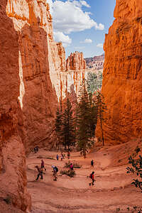 Hiking down into the AmphitheaterYou can stand at the edge of the plateau rim and gaze down into the maze of hoodoos below or descend the trails from the rim and wander around among them.
It is majestic yet intimate.
Ironically, Bryce Canyon is not really a canyon at all, but rather a series of amphitheaters cut into the Pink Cliffs of the Paunsaugunt Plateau by millions of years of erosion from flowing streams.
It’s a geological fairyland, and the centerpiece of the park is the 6-mile square Bryce Amphitheater with its intricate maze of whimsically-shaped pinnacles of rock called hoodoos.
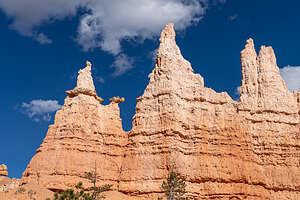 Queen Victoria on her throneThese rock spires (hoodoos) are the result of erosion in rock layers that vary in hardness. When water flowed through the cracks in these rocks, the softer rock wore away leaving behind the harder, erosion-resistant caps. The ongoing cycle of freezing and thawing continues to dissolve the softer rock, constantly changing the shape of the hoodoos. This continuous erosion is also causing the plateau cliffs to recede at the rate of about one foot every 60 years.
 Along the Queen's Garden TrailAnd the best part is the hoodoos put on a show twice a day - at sunrise and sunset, changing colors from warm yellows and oranges to more dramatic pinks and reds. During the golden hour they appear translucent, seeming to light up from within.
That was why we were here.
 Along the Queen's Garden TrailWhen we made the last minute decision to add Bryce to our itinerary, there was no lodging or camping available in the park, so we booked a room at the nearby Ruby’s Inn, just 3 miles from the park visitor center. Fortunately, it had a very liberal cancellation policy - up to 4:00 on the day of your arrival.
So, when we entered the park and realized that Sunset Campground was first-come-first-serve, we immediately drove there and claimed a site. Then we made a quick call to Ruby’s Inn to Cancel. So, instead of $200 for the night, we were paying $10 (Good old Senior Lifetime National Park Pass) for something we like so much better. Now we had easy access to the hoodoos both for sunset and sunrise.
 Along the Queen's Garden TrailIt was already around 1:00 when we arrived in Bryce, so we decided to have lunch at the Bryce Canyon Lodge. I love the National Park lodges, and although this one was not as majestic as the Ahwahnee in Yosemite or Old Faithful in Yellowstone, it was still cozy and warm and its rustic design fit well with its surroundings.
After lunch we returned to the campground for a while to take a well-needed nap. We had already done two hikes this morning - Angel’s Palace in Kodachrome and the Pink Ledges in Red Canyon State Park - so we wanted to rest up for our late afternoon Sunset Point to Sunrise Point hike into the Bryce Amphitheater.
 Along the Queen's Garden TrailAround 3:30 we drove over to the Sunset Point parking lot, and it was a total zoo. There were even parking attendants to control the situation. What a difference from the last couple of times we were here 20 years ago. We mentioned that to the parking attendant and he said that ever since Utah’s “The Mighty 5” ad about Utah’s awesome national parks, attendance has increased exponentially, almost to the point where they wanted to dial it back a bit.
Selfishly, I wanted these places to remain undiscovered. Unfortunately, with social media and people posting Instagram of Facebook photos of themselves in incredible scenery, there are no secrets anymore.
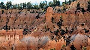 Along the Queen's Garden TrailMany people don’t even hike down into the canyon, but just stay up top and enjoy the amphitheater from one of the benches along the Rim Trail.
We, however, joined the stream hiking down the steep switchbacks of the Navajo Trail down through the narrow walls of the canyon into the amphitheater.
Unfortunately, the Wall Street side of the Navajo Loop trail was closed because of a rockfall. Too bad, because I remember it being a real highlight.
.thumbnail.jpg) Sunrise hitting the tips of the hoodoosOnce we connected to the Queen’s Garden Trail, the crowds began to think out a bit. When we got to the garden, we paid homage to Queen Victoria, sitting high above us on her throne.
Sunrise hitting the tips of the hoodoosOnce we connected to the Queen’s Garden Trail, the crowds began to think out a bit. When we got to the garden, we paid homage to Queen Victoria, sitting high above us on her throne.
As we continued along the Queen’s Garden Trail, the light was starting to get better and better, transitioning from to more dramatic pinks and reds. They looked translucent, as if lit up from within.
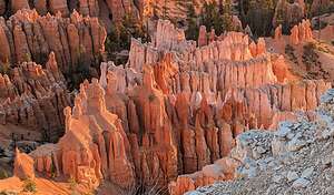 Sunrise from Inspiration PointFrom there we followed the Queen’s Garden trail up to Sunrise Point. Since our car was parked at Sunset Point, we walked the half mile back along the Rim Trail to the car.
When looking back down at the Amphitheater from the top, I couldn’t help but think of Ebenezer Bryce, a Mormon pioneer who built a cabin here in the 1870s and grazed cattle and sheep in the canyon. After losing one too many of his cows in the labyrinth of rock formations, it is claimed that he said: “this is a hell of a place to lose a cow.” For that alone, he deserves having this incredible park named after him.
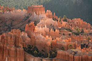 Sunrise from Inspiration PointBefore calling it a day, we decided to check out Inspiration Point. We could have just walked along the Rim Trail for 0.7 miles, but then we would miss sunset, so we drove instead.
We started first at Lower Inspiration Point, where there were less than a dozen people waiting for sunset. Already we liked it better than Sunrise and Sunset Points with its easy accessibility and therefore larger crowds.
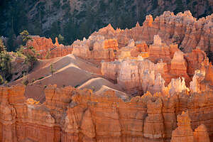 Sunrise from Inspiration PointFrom there we hiked up to Upper Inspiration Point where there were even fewer people and better views. To one side was the veritable forest of hoodoos and on the other what looked like castle complexes.
This is definitely where we wanted to be for sunrise.
It was dark now and we really didn’t feel like cooking back at the campground, so we went back to the Bryce Canyon lodge and had a light dinner of quesadillas and wine.
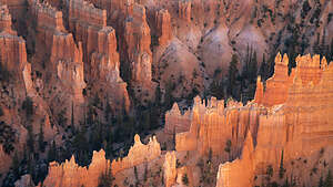 Sunrise from Inspiration PointThen it was early to bed, so we could be very early to rise in order to get to Inspiration Point to watch the sunrise.
When we got there in the morning, we were the fourth car in a large parking lot. By the time we got our camera gear out, a dozen more cars had pulled in and more were coming.
We quickly hiked up to Upper Inspiration Point which we had scouted out last night, and found only 2 other people there. We knew more were coming, so Herb set his tripod up to claim his ground.
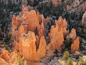 Sunrise from Inspiration PointTo the left of us was a forest of hundreds of hoodoos. To the right, you could really let your imagination run wild. There were fortresses and castles, complete with surrounding walls, towers and turrets, like the drip castles kids make on the beach.
Right on schedule, the sun rose and began lighting up the tips of the hoodoos.
As soon as the sun finished rising, most of the people left, but this was when it was just getting good. The morning golden hour only starts an hour after sunrise, when the deep reds and whites of the rock formations light up in pastel pinks, yellows and oranges, as if they were lit from the inside.
It was mesmerizing. And to think this goes on every morning.
This was the end of the trip for us, the last planned stop on our 11-day trip to Utah. I couldn’t have asked for a better ending.
Red Canyon State Park
Monday, September 18, 2023 - 10:45am by Lolo32 miles and 0.75 hours from our last stop
Travelogue
 Red Canyon State ParkSince our check in time at Ruby's Inn wasn’t until 4:00, we had some time to kill. So, rather than go directly to Bryce Canyon, we passed the turnoff and drove another 11 miles west on Highway 12 to visit Red Canyon State Park, Bryce’s lesser known neighbor, which has some spectacular orange-red sandstone pinnacles, spires and hoodoos of its own.
For most people it’s just a quick stop along the side of the road to take a few photos, which is too bad, because it has a personality of its own with red sandstone spires and formations an even intenser red than you’ll find at Bryce.
 Red Canyon State ParkWe didn’t have that much time, so we chose to hike the one-mile long Pink Ledges Trail, which starts from the far side of the Visitor Center parking lot.
It has some moderately steep sections as it climbs through a ponderosa pine forest past red sandstone hoodoos, alcoves, and other formations along the cliff.
.
By far my favorite was what looked like an adorable snowman, but rather than the white kind made of snow we are all familiar with, this one was bright red and made of sandstone, Sitting atop of rock surrounded by ponderosa pines. I almost missed him. He was adorable.
There are several other trails in the park and a state campground as well.
Kodachrome Basin State Park
Sunday, September 17, 2023 - 1:30pm by Lolo48 miles and 1 hour from our last stop - 1 night stay
Travelogue
 Big Stoney in all its majestyKodachrome Basin is another one of Utah’s incredible state parks. As with Goblin Valley, and the Boulder Mountain Lodge, I was very lucky to have gotten a last-minute reservation, allowing us to set a framework for our travels through Utah.
Although best known for its beautiful red rock, Utah’s parks have much more, and each park has its own unique geological features.
Kodachrome’s unique feature is its 67 multicolored rock spires, known as sand pipes, which appear nowhere else in the world.
 Heading out on the Panaorama TrailGeologists believe that these sand pipes are solidified sediment that filled ancient geysers and springs and were left standing after the softer sandstone surrounding it eroded away. They vary in size from 6 feet to nearly 170 feet high and their colors vary from soft whites and yellows to more dramatic pinks and reds.
The most prominent and by far the most interesting sand pipe is the very large, anatomically correct, phallus-shaped one that overlooks the campground. And as if that wasn't amusing enough, its name is "Big Stoney."
 Indian CaveThere are six hiking trails in the park, most of them less than 1 mile in length, except for the Panorama Trail, a 3-mile loop through what is probably the best and most varied scenery in the park.
Back in 2003 when we were here with our then 11 and 13-year-old sons, we mountain biked this trail. It’s the only trail in the park where mountain bikes are allowed. Well, today, we would revisit it, this time on foot and without kids. Wow! Twenty years. I still can’t believe that.
The scenery was amazing right from the start. We weren’t more than 100 yards from the trailhead before he came to a beautiful red-orange Entrada Sandstone rock formation with a large white chimney-like sand pipe rising from it.
 Handprints on Indian CaveGeologists think that this was once a geothermal area with hot springs and geysers. After they stopped flowing, they filled with sand. These are the white spires (sand pipes) we were looking at today. They are composed of coarse sand, which is far more resistant to erosion than the overlying orange Entrada Sandstone, so that is why so many of them remain. It was amazing to think that this is the only place in the world where they can be found.
Already the hike was worthwhile and we had only gone 0.1 miles. At 0.3 miles we came to a fork and took a right, going the recommended counter-clockwise direction around the loop.
 Ballerina SlipperAt 0.7 miles we came to Indian Cave, a small rock overhang just a short distance off the path. It was thought to have been inhabited by Native Americans.
The interesting feature of this cave was a row of handprints adorning the outside wall of the cave. These were very different from the pictograph 100 Hands we had seen earlier in the day. These were deep grooves (handprints) carved into the wall, which makes them a petroglyph rather than a pictograph. Some are very deep while others are just shallow indentations.
 Teepee rocks in the Secret PassageThere was no signage explaining the handprints, so they might not have been made by Native Americans. In either case, they were very interesting.
The next feature of note along the trail was the Ballerina Slipper, a tall, graceful sand pipe, resembling a ballerina en pointe (fancy word for on her toes).
Next came the Hat Shop, a collection of hoodoos, one of which looked like it was wearing a baseball cap - a bit of a stretch.
 Morning visit to Big StoneyAt around 1.5 miles we came to the “Secret Passage,” a 0.3-mile spur loop over a small slickrock divide between the high cliffs. I’m so glad we took this little spur trail, because one of the highlights of the entire hike was a collection of teepee-like rocks, so smooth and perfectly cone-shaped that they seemed man-made.
We skipped the additional side trails to Cool Cave and Panorama Point, which would have added another 3 miles to our hike.
 Sunrise start on the Angel's Palace TrailIt was already around 5:00, and we were anxious to get back to the campground and settle in. It had been a very full day already, with the hike to the 100 Hands Pictograph, the drive down Hole-in-the Rock road to the Devil’s Garden, and now this.
So, all in all, a 3.75-mile hike with lots of great and varied scenery along the way.
The campground was very nice, 27 sites set in a natural amphitheater right by “Big Stoney.” Like Goblin Valley State Park, the bathrooms had wonderful showers, nicer than the one I have at home.
 Entrada Sandstone along the Angel's Palace TrailI slept very well that night, listening to the patter of rain on the roof of the 4Runner. By morning the rain was gone and we had clear blue skies.
Before leaving the campground for another hike in the park, we took a stroll around the campground. I tried to climb up and get as close to Big Stoney as I could. He’s even bigger up close.
 Along the Angel's Palace TrailThis morning, before leaving the park, we decided to hike the Angel’s Palace Trail, probably the second most popular hike in the park, after the Panorama Trail, which we did yesterday. The two trailheads are right across the road from each other.
The beginning of the hike was along a mostly flat sandy path. After about a quarter of a mile, we entered a small canyon lined with beautiful orange Entrada sandstone and began to climb for about 150 feet up the left-side wall of the canyon, eventually switchbacking over to the right.
 Promontory out to an awesome viewThe trail flattens out as the top of a ridge and becomes somewhat hard to follow, so we just wandered wherever it looked interesting. We knew we would get lost because we had enough technology (Gaia, Strava, Google Maps) to land on the moon.
We eventually came to a short spur trail that led out to a long promontory overlooking the entire basin below. The trail out along the promontory was at least a sidewalk's width, so it shouldn’t be a problem unless you have a real fear of heights.
From the end of the promontory there was a great view of the entire basin below - Entrada badlands to the north, a cluster of small buttes and sand pipes to the south, and an extensive outcrop of red sandstone to the west.
 Views from the Angel's Palace TrailPlus the rising sun was now illuminating the tops of the jagged formations to the west.
A lot of bang for our buck on a 1.66 mile hike with just a 260-foot elevation gain. What a great way to start the day!!
Kodachrome was originally supposed to be our last stop before heading home, 14 hours away. That was until we realized Bryce Canyon National Park was only a half hour away and along our route home. How can anyone pass up such an easy visit to Bryce.
So we checked the Lodge and the Campground in Bryce, but they were totally booked. So, we did the next best thing - book a room at Ruby’s Inn, the closest lodging to the park just a 3-mile drive to the Visitor Center. This would allow us to get into the park for both sunset and sunrise.
So what if we got home a day later. That's the good part (one of many) of being retired.
Grand Staircase-Escalante Area
Friday, September 15, 2023 - 3:30pm by Lolo120 miles and 3 hours from our last stop - 2 night stay
Travelogue
Notom Bullfrog Road and the Burr Trail
 Along the Notom Bullfrog RoadAfter Cathedral Valley, we left the San Rafael Swell area and headed south along the Notom Bullfrog Road towards the Grand Staircase-Escalante National Monument area, another one of Utah’s many gems.
The Notom Bullfrog Road runs south from just west of Caineville through the lovely Strike Valley along the eastern boundary of Capitol Reef National Park, between the Henry Mountains and the Waterpocket Fold. It goes all the way to the Bullfrog Marina on Lake Powell, but we only went as far as the turnoff for the Burr Trail switchbacks.
The scenery along the way was so unique and beautiful that we stopped several times along the way. The ranches set against the base of the Waterpocket Fold provided a lovely juxtaposition of man-made and natural beauty.
 Burr Trail switchbacksAt 34 miles, we turned right towards Strike Valley and began our climb up the Burr Trail switchbacks, which although dirt, are doable in a 2WD car. However, they did climb 1,000 feet in a mile, so they were still pretty exciting. We stopped several times to gaze down at the tiny vehicles winding their way up the twists and turns of the switchbacks.
A short distance after the completion of the switchbacks, we came to the 3-mile spur road to the Strike Valley Overlook and the Upper Muley Twist trailhead. We did this hike in 2021 and it was absolutely incredible - probably one of the best hikes we have ever done. I highly recommend it. It is quite strenuous though - 10.7 miles with a 1,050 foot elevation gain, but the views along the way are worth every step of the way.
 Atop the Burr Trail SwitchbacksBut we would pass on that today, as we had lots of stuff planned in the beautiful Grand Staircase-Escalante National Monument area.
It was getting late in the afternoon though, so before venturing onto the Burr Trail, we decided to camp in the same spot we camped in 2021. This would allow us to enjoy the very scenic Burr Trail in morning light.
Since dispersed camping is not allowed in Capitol Reef National Park (or any national park), we drove a few miles past the Strike Valley Overlook turnoff until we hit asphalt, which told us we were now outside the boundaries of the Park, and camping was allowed. It wasn’t long before we found a nice spot in a pinyon forest.
 Along the Burr TrailIt was getting late in the afternoon though, so before venturing onto the Burr Trail, we decided to camp in the same spot we camped in 2021. This would allow us to enjoy the very scenic Burr Trail in morning light.
Since dispersed camping is not allowed in Capitol Reef National Park (or any national park), we drove a few miles past the Strike Valley Overlook turnoff until we hit asphalt, which told us we were now outside the boundaries of the Park and on BLM land where camping is allowed.
 Along the Burr TrailThen we made a right turn into a lovely pinyon forest. The last time we were here, we could drive pretty far into the forest, but so many trees were down that we could get too far. However, we did find a nice spot to spend the night.
Herb cooked up his go-to camping meal - Bratwurst and powdered Idahoan potatoes. We counted the guacamole we had with our blue chips as our vegetable.
 Along the Burr TrailThe next morning, we left the pinyon forest to start our drive along the Burr Trail. We had already done the most exciting part of it when we came up the Burr Trail Switchbacks yesterday, but there was still much great scenery to be had on the remaining 30 miles to the town of Boulder.
The Burr Trail used to be an old Mormon track used to bring livestock from the high-altitudes of Boulder to the warmer grazing areas of the Waterpocket Fold. The country is still wild and remote, but in the 1980s, the old trail was paved right up to the boundary of Capitol Reef. Today it is strictly used for recreational purposes, and there is nary a sign of a Mormon or a cattle herd to be seen.
 Along the Burr TrailThe nicest section of the drive is the last 10 miles or so through Long Canyon, which passes through sheer red sandstone cliffs covered with desert varnish.
The Burr Trail ends at the intersection of Highway 12, one of the most scenic roads in America, especially the section between the towns of Boulder, where we were no, and Escalante, where we were headed.
At the intersection is the lovely Boulder Mountain Lodge where we would be staying tonight. I was so excited. We stayed here in 2021 and it was awesome. But first, a short drive down Scenic Byway 12 and a hike to the Lower Calf Creek Falls.
Lower Calf Creek Falls Hike
 Heading out on the Lower Calf Creek Falls TrailHowever, we were too early to check in, so we drove 12 miles south on Highway 12 to the Lower Calf Creek Falls Trailhead, a hike I have wanted to do since we first came to Utah almost 20 years ago.
This is a very popular hike, so we were very lucky to get the last parking spot by the trailhead. In fact, it is considered by many to be the most rewarding short hike in Utah, which, if you’ve spent any time in Utah, is very high praise indeed.
We took one of the leaflets at the trailhead that had descriptions of various numbered stops along the way. We were most interested seeing the Rock Art at Stop #8.
 I want my trekking poles!The trail begins at the Lower Calf Creek Falls Campground and crosses a sandy stretch, before going up a side drainage, before dropping down some sandstone ledges to a few feet of the creek.
We were so distracted by the beautiful red Navajo Sandstone canyon we were in, that we forgot to look up high above on the canyon ledges where there were several granaries built by the ancient Fremont Culture that inhabited Utah from AD 700 to AD 1300 (#5 if we had been paying attention to our pamphlet).
.thumbnail.jpg) Lower Calf Creek FallsSometimes the trail got pretty rocky and I wished I had my trekking poles.
Lower Calf Creek FallsSometimes the trail got pretty rocky and I wished I had my trekking poles.
When we got to signpost #9, we realized we missed Stop #8 - the Pictographs, so we vowed to not miss them on the way back.
As we got nearer to the falls, the canyon narrowed and there was some welcome shade. The desert varnish on the canyon walls became even more noticeable - a nice contrast with the green of the tall grasses and the cottonwood trees.
 Lower Calf Creek FallsAnother thing that happened as we got closer to the falls were several people telling us that we were in for a real treat up ahead, which I assumed referred to the waterfall.
After crossing a small meadow, we arrived at the plunge pool where the 126-foot-high falls poured down the streaked, moss-covered wall. This was probably one of the prettiest falls I have ever seen, and we’ve seen a lot.
There were about a dozen or so people there hanging out on the nice sandy beach, politely taking their turns posing in front of the falls.
We must have stayed there enjoying the falls for over an hour before returning the way we came.
 Fremont PictographDetermined to not miss the Pictographs again, we kept our eye out for Signpost #8. They were hard to find at first, but there they were, across the canyon at the base of a smooth cliff face streaked with desert varnish - three large, human-like figures painted with red pigment, wearing headdresses and holding hands.
Their trapezoidal shape and elaborate headdresses are typical of Fromont-style rock art. They were probably created by the Fremont people, who lived in this area from about 700 – 1300 AD.
The entire hike was about 6-miles round-trip, with about a 530-foot elevation gain. It was worth every sandy, rocky step of the way.
Boulder Mountain Lodge and the Hell’s Backbone Grill
 Boulder Mountain LodgeWe were very excited about returning to the Boulder Mountain Lodge, which we had discovered two years ago on a road trip to Utah.
It is set in the middle of Utah’s red rock canyon country at the intersection of two of the most beautiful roads in Utah - the Burr Trail and Scenic Byway 12 - making it a perfect base camp for exploring the Grand Staircase-Escalante area.
Boulder Mountain Lodge is an unexpected oasis of tranquility and comfort, overlooking an 11-acre bird sanctuary. This nationally recognized luxury lodge provides everything for a fabulous getaway - spacious rooms, intimate ambiance, unparalleled views, fine dining, and an impressive array of services and amenities.
 Our balcony at Boulder Mountain LodgeAfter so many nights of camping, it was like an oasis of comfort and tranquility. But first, I was very much looking forward to a shower.
We were very lucky to have been able to reserve a room, because the Lodge is extremely popular and often books up years in advance. When I was still waffling back and forth about going on this trip with Herb so soon after our return from Vancouver Island, I went onto the Boulder Mountain Lodge website and checked availability for every day that we could possibly be here. There was only one night, and it was surprisingly for a Saturday, so I immediately booked it and the decision was finalized - I would accompany Herb on this spur of the moment Utah trip.
 Dinner Time!We had Room #12 on the second floor of the main building with a balcony looking out over an 11-acre bird sanctuary. The very first act, after a shower of course, was sitting in the adirondack chairs on the balcony with a glass of wine.
I also made dinner reservations for 7:15 at the award winning Hell’s Backbone Grill, located on the premises - a culinary experience not to be missed.
 Lolo and her Hellfire MargaritaI was worried when I read that they had hired a new chef in March, because we really were impressed by the food the last time we were here. But no need to worry, as an award-winning chef named Tamara Stanger was taking over the kitchen, but still working with Jen Castle, and Blake Spalding, the two women that originally founded the restaurant over two decades ago.
Sanger plans to continue following their Buddhist principles of commitment to sustainability, environmental ethics, and community responsibility. Much of their produce is grown on their six acre farm and their meat comes from local ranchers.
It was very hard to believe that we were in Utah, in the town of Boulder (population of 226), one of the most remote towns in America.
I had the Steelhead trout with rice and organic vegetables and a fancy Hellfire Margarita. Herb had a very large pork chop with mashed potatoes and organic vegetables plus a Highway 12 Old Fashion.
Needless to say, the food was delicious, the service impeccable, and the ambience lovely.
Tonight was certainly a contrast to our nights camping out in some very remote and beautiful places. However, Life is full of contrasts, and it is those contrasts that make things special. The totally different experiences of those nights in the wild and our cushy night tonight of fine dining enhanced our experience of each of them.
100 Hands Pictograph Panel
.thumbnail.jpg) 100 Hands Pictograph is up there somewhereTonight we had camping reservations at Kodachrome Basin Campground - another lucky grab before heading out on this trip, so we had the whole day to explore while driving south on beautiful Scenic Byway 12.
100 Hands Pictograph is up there somewhereTonight we had camping reservations at Kodachrome Basin Campground - another lucky grab before heading out on this trip, so we had the whole day to explore while driving south on beautiful Scenic Byway 12.
Our first stop was to see the 100 Hands Pictographs, located just above the Escalante River Trailhead, right along Highway 12.
From the parking area, we crossed the road and picked up the well-used social trail on the other side, which parallels the north property line of a private property. The pictographs are known to be a bit difficult to find, but that’s half the fun.
We could see the 100 Hands pictograph on the flat face of the large rock formation above us. Now we just had to get there. It did involve some scrambling over rock ledges to get to the base of the cliff.
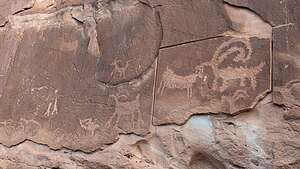 Bighorn Sheep panelThe first panel we came to was the Bighorn Sheep Panel. We were shocked to see that some vandals actually tried to saw the panels off the wall. No wonder some people frown upon disclosing the location of ancient pictographs and petroglyphs. There are too many idiots out there to do harm to these irreplaceable gems.
Actually, I think the Bighorn Sheep panel is a petroglyph, not a pictograph. The difference between a petroglyph and a pictograph is that a petroglyph is an image carved, incised or scratched into stone, while pictograph is a painting on stone, using natural pigments.
 100 Hands PictographFrom there, we continued left along the cliff base constantly looking up for the 100 Hands Panel. It wasn’t too far before we found it, 30 feet above us on the cliff face. It was very cool. I wonder how the Fremont artists got up there to do this.
Unlike the Bighorn Sheep panel, this was a pictograph, because those hands were not carved but painted on using natural pigments, like the ones we saw on our hike to Lower Calf Creek falls yesterday.
After leaving, I realized I forgot to count them. I guess I could zoom in on the photo and count, but I’ll let it remain a mystery.
Devil's Garden along the Hole-in-the-Rock Road
 Herb at Kiva KoffeehouseOnce we clambered back down to our car, we drove less than a mile down the road to the Kiva Koffeehouse, a favorite stop of ours in the past.
This is not just your ordinary coffee shop, but a work of art. This beautiful building was built in 1998 by Brasdshaw Bowman and his family. His vision was to create a beautiful building that blended harmoniously into the landscape of Southern Utah using natural building materials. Well, he succeeded and now people flock to this place, not just for the wonderful coffee and pastries, but to enjoy the incredible setting.
 Devil's GardenWe sat there having our coffee overlooking the red and white striated sandstone rock formations that we had grown so accustomed to over the past week. Then we grabbed some sandwiches to go and headed back down Highway 12 for 9 miles, before turning right onto the Hole-in-the-Rock Road, a 106-mile (out-and-back) rough dirt road that starts near the town of Escalante and goes all the way to Lake Powell. Except for the last 7 miles, which gets very rough, it can usually be driven by high-clearance 2WD vehicles.
 Devil's GardenIt's an historical trail that retraces the route taken in 1879 by a party of 230 Mormons, 83 wagons, and 1,000 cattle, who were sent out to build a settlement on the San Juan River.
53-miles into what was already a rough journey, they came to the top of a cliff, with a narrow and steep crevice leading at a 25 to 45 degree angle down to what is now the Escalante Arm of Lake Powell 2,000 feet below. It wasn’t a lake then, but part of the Colorado River.
.thumbnail.jpg) Devil's GardenThat crevice became known as the Hole-in-the-Rock, and we have seen it from the water when boating in Lake Powell. Staring up at that steep crevice, I had a hard time imagining how they had accomplished this amazing feat. Trust me, you wouldn’t want to come down that, especially with wagons and cattle.
Devil's GardenThat crevice became known as the Hole-in-the-Rock, and we have seen it from the water when boating in Lake Powell. Staring up at that steep crevice, I had a hard time imagining how they had accomplished this amazing feat. Trust me, you wouldn’t want to come down that, especially with wagons and cattle.
The pioneers spent the entire winter working on the crack, slowly enlarging the opening with only pick axes, shovels, and small supplies of blasting powder.
Finally, on January 26, 1880, the expedition slowly made its way down the precarious “road” where a ferry had been built to get them across to the eastern side of the Colorado River where there was a route for them to continue on.
 Devil's GardenUnbelievable. Never again will I complain about road conditions of any kind.
This is a road we very much wanted to do in its entirety someday (not the river crossing part), but for today we would have to satisfy ourselves with just the first 12 miles to get to the Devil’s Garden.
I felt kind of wimpy in our comfortable 4Runner, with the air conditioning going and sandwiches from Kiva Koffeehouse in our frig, driving just the first 12.5 miles of the road.
.thumbnail.jpg) Devil's GardenThe Devil’s Garden was pretty awesome, a wonderland of Navajo Sandstone hoodoos, domes, narrow passages and small arches, all in beige and brown, just ready to turn red in the golden hour. Instead we had to make due with the harsh late morning light, but it still was a delight to visit.
Devil's GardenThe Devil’s Garden was pretty awesome, a wonderland of Navajo Sandstone hoodoos, domes, narrow passages and small arches, all in beige and brown, just ready to turn red in the golden hour. Instead we had to make due with the harsh late morning light, but it still was a delight to visit.
There are no marked trails, so we just wandered around as we pleased, sometimes passing the same hoodoo several times. My favorite was the ones that looked like ice cream cones, or maybe I just thought that because it was so hot.
Definitely a worthwhile stop, and there are so many other beautiful places to see further along on the Hole-in-the-Rock Road. Maybe next time.
