- Home
- About
- Map
- Trips
- Bringing Boat West
- Migration West
- Solo Motorcycle Ride
- Final Family XC Trip
- Colorado Rockies
- Graduates' XC Trip
- Yosemite & Nevada
- Colorado & Utah
- Best of Utah
- Southern Loop
- Pacific Northwest
- Northern Loop
- Los Angeles to NYC
- East Coast Trips
- Martha's Vineyard
- 1 Week in Quebec
- Southeast Coast
- NH Backpacking
- Martha's Vineyard
- Canadian Maritimes
- Ocracoke Island
- Edisto Island
- First Landing '02
- Hunting Island '02
- Stowe in Winter
- Hunting Island '01
- Lake Placid
- Chesapeake
- Provincetown
- Hunting Island '00
- Acadia in Winter
- Boston Suburbs
- Niagara Falls
- First Landing '99
- Cape Hatteras
- West Coast Trips
- Burning Man
- Utah Off-Roading
- Maui
- Mojave 4WD Course
- Colorado River Rafting
- Bishop & Death Valley
- Kauai
- Yosemite Fall
- Utah Off-Road
- Lost Coast
- Yosemite Valley
- Arizona and New Mexico
- Pescadero & Capitola
- Bishop & Death Valley
- San Diego, Anza Borrego, Joshua Tree
- Carmel
- Death Valley in Fall
- Yosemite in the Fall
- Pacific Northwest
- Utah Off-Roading
- Southern CA Deserts
- Yosemite & Covid
- Lake Powell Covid
- Eastern Sierra & Covid
- Bishop & Death Valley
- Central & SE Oregon
- Mojave Road
- Eastern Sierra
- Trinity Alps
- Tuolumne Meadows
- Lake Powell Boating
- Eastern Sierra
- Yosemite Winter
- Hawaii
- 4WD Eastern Sierra
- 4WD Death Valley +
- Southern CA Deserts
- Christmas in Tahoe
- Yosemite & Pinnacles
- Totality
- Yosemite & Sierra
- Yosemite Christmas
- Yosemite, San Diego
- Yosemite & North CA
- Seattle to Sierra
- Southwest Deserts
- Yosemite & Sierra
- Pacific Northwest
- Yosemite & South CA
- Pacific Northwest
- Northern California
- Southern Alaska
- Vancouver Island
- International Trips
- Index
- Tips
- Books
- Photos/Videos
- Search
- Contact
Day 8 and 9 - 119 Mile Rapid (119) to Thunder River Camp (Mile 134)
Tuesday, June 4, 2024 - 9:45am by Lolo15 miles and 4 hours from our last stop - 2 night stay
Travelogue
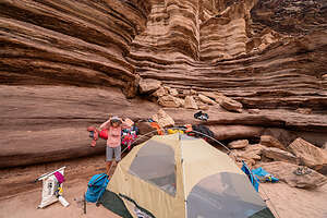 Camp LifeSeven days down, seven to go. We had reached the halfway point of our trip, and had already seen and done so much that it felt like we had been away for a month - but in a good way. But there was still lots of fun and excitement awaiting us over the next 7 days.
Today I would experience both my trip highlight and trip lowlight, all in the span of one hour. As Charles Dickens once said, “It was the best of times, it was the worst of times.” I’ll explain more later.
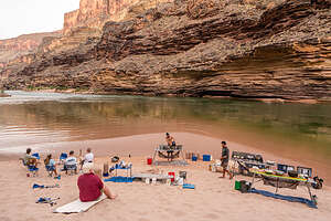 Breakfast cookingThe day started like any other on the river: rising to the 5:00 call for “COFFEE,” the guides cooking us breakfast in the kitchen down by the river, taking down our camp and loading everything onto the boats, and getting ready for another day on the river.
Then, we set off down the river for just only a mile or two before stopping at the entrance to Blacktail Canyon, which for me, as well as most of the others in our group, would be a true trip highlight.
.thumbnail.jpg) Let's hit the riverAfter beaching the rafts, we made our way up a short path and soon entered the cool, deeply shadowed world of Blacktail Canyon, a magnificent narrow slot canyon, less than a mile long, composed mostly of overhanging Tapeats Sandstone.
Let's hit the riverAfter beaching the rafts, we made our way up a short path and soon entered the cool, deeply shadowed world of Blacktail Canyon, a magnificent narrow slot canyon, less than a mile long, composed mostly of overhanging Tapeats Sandstone.
It felt like we were entering a cathedral. We found ourselves lowering our voices to a whisper. There was a sense of reverence and spirituality about the place.
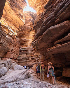 Entering Blacktail CanyonUnlike the smooth sandstone of other slot canyons we had been in, this one had angular blocky walls of stone, rising up steeply on both sides of a narrow, twisting and turning trail.
The walls were so close together that the sky was only visible through a very narrow gap at the top, revealing a fantasy land of stone and shifting shadows. The walls of the canyon were lit up in golden, turquoise and purple hues.
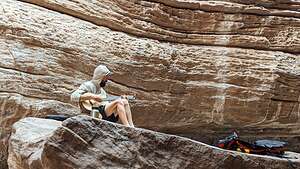 Ivan, our musical guidAlthough the canyon went on for almost a mile, dead-ending at a deep pool of dark green, algae-filled water, most of us stopped less than halfway through, because we found Ivan, one of our guides, sitting on a large rock with his guitar.
As Ivan started to play, we all sat down on the nearest rock, because no one wanted to leave. This was much more interesting than an algae-filled pool.
The acoustics in the canyon were beautiful and the music was mesmerizing.
.thumbnail.jpg) Cosmo joins inEventually Ivan shared his guitar with Cosmo, the most amazing 13-year-old I have ever met, who played a beautiful rendition of House of the Rising Sun.
Cosmo joins inEventually Ivan shared his guitar with Cosmo, the most amazing 13-year-old I have ever met, who played a beautiful rendition of House of the Rising Sun.
We leaned back, listening,and gazing up at the sky through the narrow canyon walls.
It was truly a magical moment which none of us would forget. Back on the river, the guides told us that even they had never had such a moving and spiritual experience in that canyon before. Thank you Ivan and Cosmo (plus others: Tim, Gib, Van, and Paolo).
.thumbnail.jpg) We were mesmerizedBesides its sense of reverence and great acoustics, there was one other thing about Blacktail Canyon that was special, but in a geological way.
We were mesmerizedBesides its sense of reverence and great acoustics, there was one other thing about Blacktail Canyon that was special, but in a geological way.
The Grand Canyon is a geologist’s paradise, because its distinct layers of rock, ranging from 200 million to almost 2 billion years old, allow geologists to study the earth’s history. The oldest rocks are on the bottom and the youngest rocks are on the top
.thumbnail.jpg) Looking upOccasionally, however, there are gaps in the geological record that occur when rocks or sediment are eroded away, and time goes by before new deposition occurs and forms new rock layers on top of the eroded surface. This missing piece of the geological record is called a “uniformity,” or sometimes “The Great Unconformity” (TGU).
Looking upOccasionally, however, there are gaps in the geological record that occur when rocks or sediment are eroded away, and time goes by before new deposition occurs and forms new rock layers on top of the eroded surface. This missing piece of the geological record is called a “uniformity,” or sometimes “The Great Unconformity” (TGU).
Well, it turns out that one of the best places to see and touch a TGU is in Blacktail Canyon, where 500 million year old Tapeats Sandstone (lighter colored rock) sits directly atop 1.75 billion year old Metamorphic Gneiss, leaving a 1.2 billion year gap in the geologic record. You can actually span all that missing time with your thumb and forefinger.
.thumbnail.jpg) Walls of Blacktail CanyonUnfortunately, I only found out about this after doing research when I got home.
Walls of Blacktail CanyonUnfortunately, I only found out about this after doing research when I got home.
Ok, that was the “good times.” Now onto the not so “good times.” After leaving the peace and tranquility of Blacktail Canyon, our day was about to drastically change.
Before we settled into camp tonight, we had two fairly big rapids to run, but nothing that required drawing them in the sand this morning or stopping to scout them out.
.thumbnail.jpg) Our little concert hallThe first one was Bedrock. This is a description of it from Western River Expeditions:
Our little concert hallThe first one was Bedrock. This is a description of it from Western River Expeditions:
An enormous chunk of hardened metamorphic and igneous rock splits the current in two. The best run is on the right side, which requires adept and precise handling to bring a craft around the rock and into calm water. The left side is an unforgiving place, as the river pinballs through a narrow rock studded channel.
Before entering the rapid, Kayla, whose boat we were in today, explained how she was going to take the line to the right side of the rock as suggested.
Unfortunately, that’s not what happened, resulting in what was the most terrifying moment of the trip - both for us in the boat, and our comrades behind watching.
.thumbnail.jpg) Back down the river we goRather than getting to the right of Bedrock (large boulder in the river) as we should, we were drawn too far to the left and slammed right into it, getting pinned and almost flipping the boat stern over bow. Herb and I were in the bow of the boat, which was tilted bow-side down at more than a 45 degree angle. Water was rushing in up to our knees.
Back down the river we goRather than getting to the right of Bedrock (large boulder in the river) as we should, we were drawn too far to the left and slammed right into it, getting pinned and almost flipping the boat stern over bow. Herb and I were in the bow of the boat, which was tilted bow-side down at more than a 45 degree angle. Water was rushing in up to our knees.
Kayla kept her cool and yelled for us to climb up to the back side of the boat that was sticking up in the air (the “high side”). I amazingly remained calm (for the moment anyway), and Herb and I were able to climb up over her seat and she grabbed my hand from the stern and pulled me into the stern.
.thumbnail.jpg) Aerial view of Bedrock RapidNow all five of us were crowded into the stern, which caused the weight to shift enough to set us free from the rock. Kayla jumped back into the rower’s seat and we went flying out of control to the left (wrong) side of the rock, hitting a few more rocks along the way before finally ending up in the pool at the end, where everyone greeted us with cheers.
Aerial view of Bedrock RapidNow all five of us were crowded into the stern, which caused the weight to shift enough to set us free from the rock. Kayla jumped back into the rower’s seat and we went flying out of control to the left (wrong) side of the rock, hitting a few more rocks along the way before finally ending up in the pool at the end, where everyone greeted us with cheers.
Kayla had to do all that with just one oar, because one of the oarlocks was twisted out of position.
She had done a great job getting us out of a very precarious situation which could have had a much worse result.
.thumbnail.jpg) Stone Creek WaterfallThe calm I had managed during the height of the crisis was now gone, and I was shaking and could hardly speak. Herb’s first words: “You can plan the next vacation.”
Stone Creek WaterfallThe calm I had managed during the height of the crisis was now gone, and I was shaking and could hardly speak. Herb’s first words: “You can plan the next vacation.”
The amazing thing was that Herb’s camera, which was strapped onto one of the bags in the bow, had held on. Even more amazing, when he went to pick it up afterwards, the strap broke in his hands. Somehow it had stayed on long enough to get through the chaotic and violent slamming in the rapid, but decided it didn’t need to anymore. Thank God or we would have lost all the photos we had taken so far.
For some reason, Herb didn’t have his GoPro running through this rapid, so I had to go on the internet to find an aerial view of Bedrock Rapid. Wow!
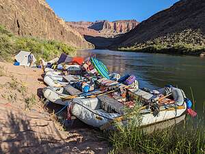 Safelyl settled into campI was a bit shaken, but we had to get right back on the horse again, because Deubendorff Rapid (9), an even bigger rapid, was just around the bend.
At this point I was pretty numb. Kayla ran it perfectly and we were home free (at least for today).
Immediately after running Bedrock and Deubendorff rapids, we pulled onto a beach and walked the short distance to picturesque Stone Creek Waterfall. It was lovely and I finally had stopped shaking.
.thumbnail.jpg) River cocktail hourThat afternoon when we landed at Thunder River Camp (Mile 135), our guides announced that we would be staying there for two nights, rather than our usual one.
River cocktail hourThat afternoon when we landed at Thunder River Camp (Mile 135), our guides announced that we would be staying there for two nights, rather than our usual one.
WOO HOO! We practically danced with joy at the thought of not having to take down camp tomorrow morning and set up camp again somewhere down the river again tomorrow night.
.thumbnail.jpg) Thunder River HikeFinally, a day of leisure - hahaha. Who was I kidding. The guides had an 8-hour hike planned for tomorrow.
Thunder River HikeFinally, a day of leisure - hahaha. Who was I kidding. The guides had an 8-hour hike planned for tomorrow.
Well, we would worry about that tomorrow. Tonight all I wanted to do was join my friends in the river for cocktail hour. A warm beer never tasted better.
The next morning we awoke as always at 5:00 am to the sound of one of our river guides announcing “COFFEE.” But today was going to be different, because for the first time the entire trip we would be staying in the same campsite for two nights.
.thumbnail.jpg) Thunder River HikeSo no rushing around taking down the tent, packing our bags, forming a fireline, and loading up the boats.
Thunder River HikeSo no rushing around taking down the tent, packing our bags, forming a fireline, and loading up the boats.
This morning we had a more leisurely breakfast, but not too leisurely, because today we were hiking from the campsite to Thunder River Falls, a strenuous 8-mile (out-and-back) hike with 2,500 feet elevation gain, which would take us an estimated 8 hours.
.thumbnail.jpg) Crossing Tapeats CreekSome in our group were concerned about being able to go the whole distance, especially in 108 degree weather, which was a valid concern.
Crossing Tapeats CreekSome in our group were concerned about being able to go the whole distance, especially in 108 degree weather, which was a valid concern.
However, not everyone had to go the whole distance, because there would be several shaded areas along the way for people to just hang out and stay cool while the rest of us went on.
Plus, there would be places along Tapeats Creek to jump in and cool off.
.thumbnail.jpg) Cooling off in TapeatsSo off we went.
Cooling off in TapeatsSo off we went.
Although the hike was called the Thunder River hike, the first three miles of it were actually along Tapeats Creek, which cascades through a lovely open valley.
We had to cross Tapeats Creek twice on the way up to Thunder River. The current was really strong, so we all linked arms while carefully maneuvering ourselves over slippery rocks to the other side of the creek.
.thumbnail.jpg) Getting closeOne of our guides stood guard a little bit downstream to catch us if we slipped.
Getting closeOne of our guides stood guard a little bit downstream to catch us if we slipped.
We also took several breaks along the way to cool ourselves off in the creek. There was one particular section that was like a water slide that everyone found particularly fun and refreshing.
.thumbnail.jpg) Thunder River Falls3 miles into the hike, we came to the confluence where the Thunder River flowed into Tapeats Creek.
Thunder River Falls3 miles into the hike, we came to the confluence where the Thunder River flowed into Tapeats Creek.
At this point the trail made a sharp left, as we moved away from Tapeats Creek and started tracing the Thunder River.
The trail really began to climb more steeply now as we hiked the remaining mile to the Falls.
We knew we were getting close when we saw about a dozen small waterfalls cascading out of the limestone canyon walls. It looked like the walls had sprung a leak.
A little bit further and we arrived at the main event - Thunder Creek Falls, a stunning waterfall erupting from the side of a steep canyon wall.
.thumbnail.jpg) Thunder River FallsFrom there, it flows ½-mile downstream into Tapeats Creek, making it one of the shortest rivers in the world. During that ½-mile it drops approximately 1,200 feet over a series of waterfalls, also making it the steepest river in the country. It’s very rare for a river to be a tributary of a creek.
Thunder River FallsFrom there, it flows ½-mile downstream into Tapeats Creek, making it one of the shortest rivers in the world. During that ½-mile it drops approximately 1,200 feet over a series of waterfalls, also making it the steepest river in the country. It’s very rare for a river to be a tributary of a creek.
The mist it threw off was so refreshing.
We had already gone through 2 liters of water each on the way up, so we were very relieved that the guides had brought a water filter so we could refill our water bottles from the falls - the first ice cold water we had had in over a week. Water never tasted so good.
.thumbnail.jpg) The long way downAfter a while, we tore ourselves away and began the long, steep trek down, repeating the two stream crossings we did on the way up.
The long way downAfter a while, we tore ourselves away and began the long, steep trek down, repeating the two stream crossings we did on the way up.
Funny story on one of the stream crossings. I mentioned how we all linked arms and gingerly navigated our way across, stepping sideways along slippery rocks. I happened to be linking arms with Mitchell, one of the assistant guides, when I mentioned that I had found a particularly good foothold. He very nonchalantly replied, “That’s my foot.” We both started laughing hysterically.
We eventually caught up with the part of our group (about 5) that stayed behind on the shady ledges. They looked a lot less tired than we did, but I wouldn’t have missed this hike for the world.
Day 7 - Hermit Rapid (Mile 96) to 119 Mile Rapid (Mile 119)
Monday, June 3, 2024 - 2:15pm by Lolo23 miles and 5 hours from our last stop - 1 night stay
Travelogue
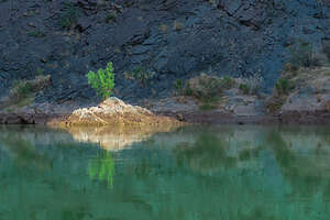 Morning light hits the riverI was definitely a bit nervous today, because we would be running Crystal (a rapid rated 10 on the Grand Canyon scale), which, along with Lava Falls, also a 10, are iconic Grand Canyon rapids that are considered some of the most difficult to run in the Canyon.
When Herb first announced we were going to do this trip, I spent far too many hours watching YouTube videos of rafts running Crystal and Lava Falls, with mixed results.
Well, at least we were going to get it over with almost right away, so then I could relax the rest of the day, although Waltenberg Rapid (an 8) still had to be dealt with before we got to camp.
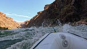 Crystal RapidI had arranged for Herb and me to ride on Robin (our trip leader's) boat, an incredibly skilled and knowledgeable oarswoman who has been down this river more than 30 times. She knows this river and all its features so well that I am convinced she could just close her eyes and run all 226 miles of it in her mind.
We started the day with a warmup rapid before Crystal - Boucher (a Grand Canyon 4). Easy peasy.
Next up was Crystal. Crystal has quite a history behind it, much of which is described in the book The Emerald Mile, which I highly recommend to anyone interested in the geology, cultural history, the damming of the river, and the history of rafting through the canyon. It’s a very interesting and exciting read.
 Smiling through CrystalCrystal is not just a rapid, but a legend.
Before 1966, what is now Crystal Rapid was a minor riffle. Then in December of that year, a once-in-a-century flash flood tore through the canyon, spilling large boulders and debris into the river at the mouth of Crystal Creek, constricting the river to less than a quarter of its original width, thereby creating a monstrous rapid with one of the largest holes in the river.
Below the holes, a large rocky island splits the channel into two distinct sections. Crystal can be run to the left or the right of the island, but both sides have their unique challenges.
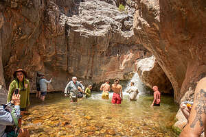 Sinumo Creek FallsThen in 1983, because of a particularly large snow melt, the reservoir (Lake Powell) behind the dam was overfilling, placing the integrity of the dam itself in jeopardy. Dam Operators had to rush to let out as much volume as they could before water began spilling over the top of the dam.
The result was that rather than flowing at the usual 10,000 - 20,000 cubic feet per second, Crystal was running with a flow of 70,000 cubic feet per second, birthing a three-story high hydraulic wave that ran across the river.
Unfortunately several river trips were already in progress, and they had no idea what was going to hit them. By the time the park service closed the rapid to commercial passengers, four large motorized rafts and several smaller boats had capsized and several people had drowned.
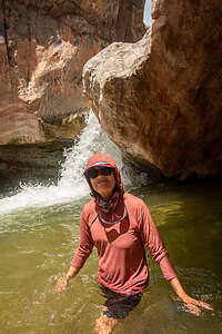 Shinumo Creek FallsSince the flood, Crystal has continued to change, as over the decades the river has moved rocks around and broadened its width, making it less intense than at its peak in 1983. However, it’s still a significant rapid and one of the greatest challenges for river runners in the Grand Canyon.
Robin was not as fearful of Crystal as she was with other rapids such as Hance, Hermit, and Lava Falls. She didn’t feel it necessary for us to stop and scout it out, as she was confident that she knew how to run it.
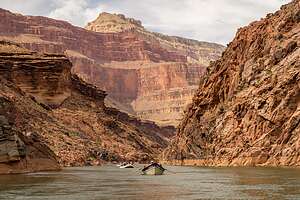 Heading to campBeing the trip leader, we were the first raft to go through, and she executed it so well that at the end, I even asked, “Was that it?” I felt a definite sense of relief knowing that that rapid was now behind us. Herb even has a photo of me smiling through the rapid.
We still had a few more rapids to go though, but nothing as significant as Crystal. At Mile 100 we entered The Gems - a series of six rapids in 5 ½ miles named after gems: Agate (3), Sapphire (7), Turquoise (6), Emerald (5), Ruby (6), and Serpentine (7).
They were actually quite fun.
At Mile 109.5 we stopped at Shinumo Creek where we took a walk literally through the creek to a lovely little waterfall with a pool below it - a perfect place to cool off in today’s 108 degree temps.
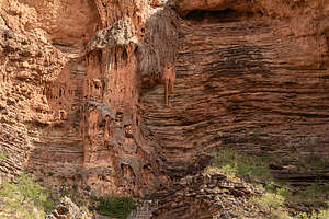 Interesting geologyThen it was back in the boats to head for camp with one more daily major rapid along the way - Waltenberg (a Grand Canyon 8)
After that we pulled over onto a beach around Mile 119, where we did our usual get off the boat as quickly as we could to run and select a good campsite. We had a new strategy.
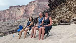 The ladies of the riverThere were 11 of us that had formed a very strong friendship and desire to be together, so, whichever one of us 11 got off the boats first, would run madly around, finding a good place to camp, and then scatter various belongings over a wide area to create a sort of compound with several campsites.
Once ownership of a section of sand was established, we went back down to unload the boats, before setting up our individual camps.
Then it was time for some mingling, laughing, and drinking warm beverages with our friends.
It had been another pretty exciting day, but then they all have been so far.
Day 6 - Zoroaster Rapid (Mile 85) to just after Hermit Rapid (MIle 96)
Sunday, June 2, 2024 - 8:45pm by Lolo11 miles and 5 hours from our last stop - 1 night stay
Travelogue
.thumbnail.jpg) The Upper Canyon groupToday was to be the “exchange,” where those in our group (9 out of 20 of us) that had signed up only for the 6-Day Upper Canyon trip would be leaving us.
The Upper Canyon groupToday was to be the “exchange,” where those in our group (9 out of 20 of us) that had signed up only for the 6-Day Upper Canyon trip would be leaving us.
We were very sad, because we had come to love the ultimate frisbee guys and George, a very funny and interesting character from Vancouver.
Before they left us, we gathered for a group photo, which I will cherish.
.thumbnail.jpg) Jose awarding me the "Badass" FrisbeeAfterwards, Jose announced that they wanted to leave one of their frisbees behind for us to remember them by. After a little speech about what an unforgettable time they had had with the rest of us, he said they wanted to award the frisbee to the “badass” of the trip, which turned out to be me - hahaha. I think it was more like I reminded them of their mothers.
Jose awarding me the "Badass" FrisbeeAfterwards, Jose announced that they wanted to leave one of their frisbees behind for us to remember them by. After a little speech about what an unforgettable time they had had with the rest of us, he said they wanted to award the frisbee to the “badass” of the trip, which turned out to be me - hahaha. I think it was more like I reminded them of their mothers.
I was very touched and that frisbee now holds a proud place in my bookcase.
They and their gear were loaded up on two of our oar boats, which would take them downriver where they would be dropped off at the bottom of the Bright Angel Trail. We sadly waved goodbye to a big chunk of our “canyon family.”
.thumbnail.jpg) Phantom RanchFrom there they would hike the grueling 8 miles (with 4,460-feet elevation gain) in 100 degree weather up to the South Rim. Herb pointed out that this was reason enough for us doing the 14-day Full Canyon trip. He had a good point.
Phantom RanchFrom there they would hike the grueling 8 miles (with 4,460-feet elevation gain) in 100 degree weather up to the South Rim. Herb pointed out that this was reason enough for us doing the 14-day Full Canyon trip. He had a good point.
While they were hiking up the Bright Angel Trail, another group of 9 people, who had signed up for the 8-Day Lower Canyon trip, would be hiking down to replace them - although we were very doubtful that any group could possibly replace the Frisbee boys in our hearts.
.thumbnail.jpg) Cold lemonade - first cold drink in a weekWhile we were waiting for the new arrivals, we had time to take a quick hike over to Phantom Ranch, an historic oasis nestled at the bottom of the Grand Canyon. It’s the only lodging below the canyon rim and can only be reached by mule, on foot, or by rafting the Colorado River. Teddy Roosevelt once stayed here.
Cold lemonade - first cold drink in a weekWhile we were waiting for the new arrivals, we had time to take a quick hike over to Phantom Ranch, an historic oasis nestled at the bottom of the Grand Canyon. It’s the only lodging below the canyon rim and can only be reached by mule, on foot, or by rafting the Colorado River. Teddy Roosevelt once stayed here.
Like many national park structures, this one was built of wood and native stone to blend in with the natural beauty of its surroundings.
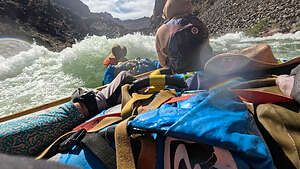 Hermit RapidIt was our first exposure to civilization in a week. Herb and I bought ice-cold lemonades, the first non-warm beverages we had since we left Flagstaff. They were amazingly good and refreshing.
Then we went back to the boats to await our new friends.
The “exchange” didn’t go quite as smoothly as hoped because some of the people hiking down to join us had hired mules to bring their duffle bags down to the river. Unfortunately, mule service is not quite the same as Amazon prime, so we lost a few hours while the guides tried to find where the mules left them.
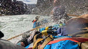 Hermit RapidOnce the “9” had joined us, we set off on the river for what would be a pretty wild ride. In just a 5-mile stretch, we would hit back to back huge rapids: Horn Creek (a Grand Canyon 9), Granite (a 9+) and Hermit (another 9).
It must have felt a bit like a fraternity hazing for the new people. One poor guy banged his face on a river bag during one of the rapids and cut his forehead with his glasses - and this was just the first hour of his adventure.
This trip was not for the faint of heart.
.thumbnail.jpg) Our campsite (with view) after HermitWe camped that night at a campsite with a nice view, just after Hermit Rapid at Mile 96. The new group had to be exhausted after getting up super early to hike down Bright Angel Trail, and then getting pounded by three very significant rapids.
Our campsite (with view) after HermitWe camped that night at a campsite with a nice view, just after Hermit Rapid at Mile 96. The new group had to be exhausted after getting up super early to hike down Bright Angel Trail, and then getting pounded by three very significant rapids.
I was a bit nervous tonight because I knew that Crystal Rapid was just 3 miles downriver. This was one of the rapids (along with Lava Falls) that I had been obsessing over ever since Herb booked this trip over a year ago.
I made sure to ask Robin tonight if Herb and I could go in her boat, as I definitely did not want to run Crystal in either the paddle boat or the dory.
Day 5 - Carbon Canyon (Mile 64) to just shy of Zoroaster Rapid (Mile 85)
Saturday, June 1, 2024 - 12:15pm by Lolo21 miles and 5 hours from our last stop - 1 night stay
Travelogue
.thumbnail.jpg) Setting off down the riverAs of yesterday, we had left the sedimentary limestone sandstone of Marble Canyon behind and entered the Upper Granite Gorge of the Grand Canyon, an area of igneous and metamorphic rocks that had been twisted and thrust upwards during mountain building events over millions of years.
Setting off down the riverAs of yesterday, we had left the sedimentary limestone sandstone of Marble Canyon behind and entered the Upper Granite Gorge of the Grand Canyon, an area of igneous and metamorphic rocks that had been twisted and thrust upwards during mountain building events over millions of years.
Along this section of the river, you can see exposed 1.7 billion year old Zoroaster Granite and Vishnu Schist.
Because the rock in the gorge does not easily erode, the river becomes swifter and the rapids grow larger, so today was going to be a very big rapids day - Hance (a 10), Sockdolager (an 8) and Grapevine (another 8), all within 5 miles, so sort of boom, boom, boom.
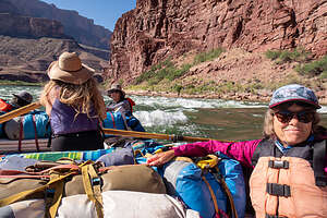 Big rapids day todayIt’s hard to capture the feeling of what it’s like going through a major rapid with a photo, so today Herb used his GoPro for the first time on the trip so that we could record what it actually felt like while running it.
The best way I can describe it is that it’s like sitting in a rocking chair while having a friend use all their might to knock you off of it, while another friend is simultaneously throwing buckets of water in your face.
.thumbnail.jpg) Scouting Hance RapidBefore any really major rapid, the guides scout it out by hiking up to a point from which they can look down on it to see if it’s what they expect (the features in the rapid change a lot based on water levels) and to plan their “line” to run it.
Scouting Hance RapidBefore any really major rapid, the guides scout it out by hiking up to a point from which they can look down on it to see if it’s what they expect (the features in the rapid change a lot based on water levels) and to plan their “line” to run it.
Hance was the most concerning one of the day, so we pulled the rafts over on a small beach before it and hiked along a path to an overlook. I’m sure the guides didn’t need our input, but it was nice of them to invite us along, so that we could learn their plan and know what to expect.
.thumbnail.jpg) Hance RapidThis particular rapid has lots of large rocks constricting the channel, forming powerful hydraulics (or “holes” as they are known. This causes the water on the surface to be pulled back towards the obstacle, creating a recirculating vortex-like zone, which can flip a boat or flip one of us out of the boat in what they refer to as an "unintentional swim."
Hance RapidThis particular rapid has lots of large rocks constricting the channel, forming powerful hydraulics (or “holes” as they are known. This causes the water on the surface to be pulled back towards the obstacle, creating a recirculating vortex-like zone, which can flip a boat or flip one of us out of the boat in what they refer to as an "unintentional swim."
I have to admit that my heart was pumping pretty fast as we got back in the rafts. We were in Robin (our trip leader’s) boat today, so I felt we were in good hands. She has run this river more than 40 times, and I am convinced she could run it with her eyes closed - she has every rapid and its features etched in her mind.
.thumbnail.jpg) Running Hance RapidSince Robin is the trip leader, we were the first to go. She definitely didn’t sugar coat what running this rapid was going to be like. As we approached the start of it, she said “Ok, this is going to be violent,” which is a term I didn’t want to hear, and “get ready for a big hit!”
Running Hance RapidSince Robin is the trip leader, we were the first to go. She definitely didn’t sugar coat what running this rapid was going to be like. As we approached the start of it, she said “Ok, this is going to be violent,” which is a term I didn’t want to hear, and “get ready for a big hit!”
The kicker though (no pun intended) was when she said there is a potential “donkey kick,” which meant that people sitting in the back of the raft (which happened to be me and Herb) could potentially be catapulted up and over the raft. She laughingly said, “if it happens, try not to land on me.”
.thumbnail.jpg) Between the rapidsShe then instructed us how to avoid that. We should stay down low behind the bags, spread our legs apart, and hold onto straps fairly far apart.
Between the rapidsShe then instructed us how to avoid that. We should stay down low behind the bags, spread our legs apart, and hold onto straps fairly far apart.
I probably assumed the “donkey kick” position much earlier than necessary, but better to err on the side of caution I always say.
Running Hance was actually very exciting (and perhaps a little terrifying), but Robin executed it perfectly.
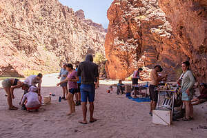 Lunch stop at Clear CreekBeing in the lead boat allowed us to watch all the other rafts in our group come through - one at a time leaving lots of space in between. There was lots of whooping and hollering as our fellow boats safely made their way through Hance.
One down, two to go.
We had a brief breather before running Sockdolager Rapid (a Grand Canyon 8). The key to running this one was to start in the center and hit everything straight, because there are large holes and waves that flank the sides of the rapid, both on river right and left.
.thumbnail.jpg) My shin colliding with some metamorphic schistThis rapid was actually named by John Wesley Powell’s crew on their second expedition down the river. Sockdolager is an old boxing term meaning a heavy, decisive blow that can knock someone down. Glad I didn’t know that before we ran it.
My shin colliding with some metamorphic schistThis rapid was actually named by John Wesley Powell’s crew on their second expedition down the river. Sockdolager is an old boxing term meaning a heavy, decisive blow that can knock someone down. Glad I didn’t know that before we ran it.
However, once again, Robin safely brought us through, running her line exactly as planned.
Last up for the day was Grapevine Rapid (another Grand Canyon 8), a bit less powerful than Sockdolager, but much rockier. The plan for this one was to enter it center-right, just to the left of the rocks on the right and avoiding the hole at the top, and then work our way back towards center, avoiding another hole at the bottom of the rapid at center-right.
‘
.thumbnail.jpg) My river guide docNot to be redundant, but another perfect run by Robin
My river guide docNot to be redundant, but another perfect run by Robin
Okay, I was pretty ready to get to camp and get a river cocktail hour going, but we had one more stop to make before getting to camp - a hike up to Clear Creek Waterfall.
As I mentioned above, the geology had been changing as we drifted downriver, and we were now in the Upper Granite Gorge, an area of metamorphic schist and igneous granite, much harder and sharper than the limestone of Marble Canyon.
No kidding! I hadn’t gotten more than 100 feet into the hike to Clear Creek Waterfall before I had an encounter with a metamorphic schist and it won, cutting my shin down to the bone.
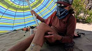 My Boo Boo during a sandstormI hardly felt it happen and was actually quite surprised when I looked down at my leg, which looked pretty bloody with skin flaps exposing stuff, that probably shouldn't be visible, underneath.
Leonard, one of our trusty river guides, was in charge of first aid, so he stayed behind with Herb and me and cleaned my wound, put some antibiotic cream on it, and bandaged it. It was really hot out, so he set up a beach umbrella for me so I could have some shade.
.thumbnail.jpg) My river spouseUnfortunately, the wind picked up as it often does in the afternoon, practically blowing the umbrella down the river. I really needed the shade, so I held onto it for dear life, with sand blowing in my face, for the hour or so it took the gang to get back from their hike to Clear Creek Falls.
My river spouseUnfortunately, the wind picked up as it often does in the afternoon, practically blowing the umbrella down the river. I really needed the shade, so I held onto it for dear life, with sand blowing in my face, for the hour or so it took the gang to get back from their hike to Clear Creek Falls.
Ok, between Hance, Sockdolager, Grapevine rapids, and metamorphic schist, I think I had enough fun for today.
I was pretty ready for camp. I was dreaming of a nice river cocktail hour, and then I remembered Leonard told me not to get my wound wet. When we beached the boat, Van, a wonderful 17-year-old with us, offered to carry me ashore like a baby. Very sweet. I only wish I had a photo of that.
Afterwards, I did manage to have a nice warm beer at the edge of the river.
Day 4 - Nankoweap Canyon (Mile 53) to Carbon Canyon (Mile 65)
Friday, May 31, 2024 - 3:45pm by Lolo12 miles and 3 hours from our last stop - 1 night stay
Travelogue
.thumbnail.jpg) Arriving at the ConfluenceToday I finally mustered the courage to ask Leonard if today would be a good day (meaning mild rapids) for Herb and I to join his paddle boat crew. He assured me it was. Okay, at least we would get a little exercise in while going down the river.
Arriving at the ConfluenceToday I finally mustered the courage to ask Leonard if today would be a good day (meaning mild rapids) for Herb and I to join his paddle boat crew. He assured me it was. Okay, at least we would get a little exercise in while going down the river.
The paddle boat consisted of 6 volunteer paddlers from our group and Leonard, our guide, who sat in the back sort of steering us and yelling out commands as to what we should to: “Right 2 forward,” meant the paddlers on the right side of the boat should take two strokes to move the boat forward. “Left 3 back,” meant the paddlers on the left side of the boat should take three strokes to move us in a backwards direction.
.thumbnail.jpg) Transition from emerald green to cobalt blueThe important thing was for all paddlers is to stay in sync. The two paddlers in the front (on the left and right side) set the pace and we all tried to stay in sync with the person in front of us. This meant I was pretty much looking at the paddle in front of me rather than the terrific view going by.
Transition from emerald green to cobalt blueThe important thing was for all paddlers is to stay in sync. The two paddlers in the front (on the left and right side) set the pace and we all tried to stay in sync with the person in front of us. This meant I was pretty much looking at the paddle in front of me rather than the terrific view going by.
I was shanghaied onto this slave ship under somewhat false pretenses as I did have to paddle through Kwagunt Rapid, which was a Grand Canyon 6. However, we did it in style, and I have to admit it was very fun and I was quite pleased with myself.
.thumbnail.jpg) Lovely Little Colorado River6 miles further down the river, at Mile 61.5, we came to the confluence with the Little Colorado River, the highlight of any raft trip down this river.
Lovely Little Colorado River6 miles further down the river, at Mile 61.5, we came to the confluence with the Little Colorado River, the highlight of any raft trip down this river.
Although the Navajo own the land along The Little Colorado River, the confluence of the Colorado and Little Colorado rivers holds deep spiritual meaning for many of the Native American tribes that live in the Grand Canyon region.
_1.thumbnail.jpg) The viewing standsFor the Hopi, life began near the confluence when their ancestors emerged from the underworld at the Sipapu, a landmark on the Little Colorado River.
The viewing standsFor the Hopi, life began near the confluence when their ancestors emerged from the underworld at the Sipapu, a landmark on the Little Colorado River.
The Hopi people also believe that their spirits live amongst the clouds above the Grand Canyon.You can easily see how a place so beautiful can take on spiritual qualities.
When not muddied with runoff, the waters of the Little Colorado River are a brilliant turquoise blue.
.thumbnail.jpg) LCR Conga LineWe were in luck today, as there had been no recent runoffs from rain to muddy it up, which would have made the water as brown as chocolate milk.
LCR Conga LineWe were in luck today, as there had been no recent runoffs from rain to muddy it up, which would have made the water as brown as chocolate milk.
At the confluence of the main Colorado River and the Little Colorado River, we could actually see the transition from an emerald green in the main river to bright cobalt blue in the Little Colorado. The temperature change is drastic as well as we moved from a chilly 50 degrees in the main Colorado River to the mid-70s in the Little Colorado.
.thumbnail.jpg) So much fun!!The electric blue color of the river was amazing. It is a result of the magnesium and calcium in the water, combining with the carbon dioxide in the air, creating calcium carbonate. This combination of minerals reflect the sunlight, creating, arguably, the most beautiful water in the world. The only other time we had seen water this color was at the Blue Lagoon in Iceland.
So much fun!!The electric blue color of the river was amazing. It is a result of the magnesium and calcium in the water, combining with the carbon dioxide in the air, creating calcium carbonate. This combination of minerals reflect the sunlight, creating, arguably, the most beautiful water in the world. The only other time we had seen water this color was at the Blue Lagoon in Iceland.
The calcium carbonate also creates a material called tufa, which forms a thin, spongy, white material coating the river bed.
.thumbnail.jpg) Short cut back to the raftsA harder, chalky limestone material called travertine settles out of the water and coats the rocks and boulders in a white hue, adding to the river’s color palette.
Short cut back to the raftsA harder, chalky limestone material called travertine settles out of the water and coats the rocks and boulders in a white hue, adding to the river’s color palette.
From the confluence, we walked about a quarter mile up along the bank of the Little Colorado to a natural water slide where we would spend a good part of the day acting like kids at a waterpark.
.thumbnail.jpg) Why walk when you can floatThere were even layers of limestone ledges alongside the river, which served as a great viewing platform to watch the action and get ready for another run down the slides.
Why walk when you can floatThere were even layers of limestone ledges alongside the river, which served as a great viewing platform to watch the action and get ready for another run down the slides.
We spent hours sliding down the soft, tufa-covered rocks through the warm cobalt blue rapids. Sometimes we slid down individually. Other times we formed conga lines and drifted down as a group.
.thumbnail.jpg) I hope I don't go through the ConfluenceWhen it was time to walk back along the ledges alongside the LCR, some of us walked and others (including me) took the shortcut of just floating on our backs to the confluence.
I hope I don't go through the ConfluenceWhen it was time to walk back along the ledges alongside the LCR, some of us walked and others (including me) took the shortcut of just floating on our backs to the confluence.
What a treat after the freezing cold water of the main Colorado River.
Herb took the boring way back by foot. I guess he wanted to keep his camera equipment dry.
.thumbnail.jpg) Herb took the boring way backOnce we got back to our boats and started heading further downriver, we left Marble Canyon behind us and entered the Grand Canyon for the first time on this trip.
Herb took the boring way backOnce we got back to our boats and started heading further downriver, we left Marble Canyon behind us and entered the Grand Canyon for the first time on this trip.
John Wesley Powell first made the distinction between the two canyons after his expeditions down the river in 1869 and 1871. After this point, the main canyon quickly becomes much deeper and foreboding as it begins to bend west.
As the river starts to cut deeper into the Kaibab Plateau, the gradient (drop) becomes steep as the river flows over harder rock, such as granite and schist.
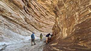 Slot canyon at Carbon CreekIt was a relatively short river day today (only 11.5 miles), since we had spent so much time joyfully playing in the Colorado River.
We stopped to camp at a lovely spot called Carbon Canyon. After setting up camp, we took a short hike (2.7 miles with a 614-foot elevation gain) up the canyon from the camping area up to a slot canyon with sculpted sandstone walls. There was a bit of rock scrambling to do as well.
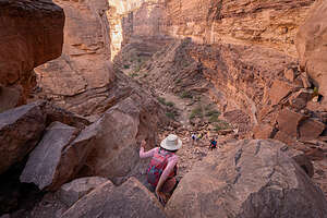 Rock scrambling in Carbon CanyonBack at camp, we were treated to a delicious steak dinner. I really have no idea where the guides were able to hide all this food.
Oh, and that evening I got my first red fire ant bite, which definitely wasn’t pleasant. Several of us had gotten them already and described the numbness that moves up your leg. Great. I didn’t get that though. Maybe it was because Daniel, one of our river guides, gave me his secret antidote - a nicotine patch - not to chew but to place directly on the sting. I think it really helped because I didn’t experience the numbness others were describing.
What a day it had been!!
Day 3 - Buck Farm Canyon (Mile 41) to Nankoweap Canyon and Granaries (Mile 53)
Thursday, May 30, 2024 - 9:15pm by Lolo12 miles and 3 hours from our last stop - 1 night stay
Travelogue
.thumbnail.jpg) Some fun on the riverToday was going to be a pretty mellow day - no big rapids, just swimming in the river, watching the scenery go by, playing ultimate frisbee, and hiking up to an ancestral Puebloan architectural site..
Some fun on the riverToday was going to be a pretty mellow day - no big rapids, just swimming in the river, watching the scenery go by, playing ultimate frisbee, and hiking up to an ancestral Puebloan architectural site..
Since we were encouraged to switch boats throughout the trip so that we could try each type of boat, as well as each guide, we shopped around for a boat to spend the day on.
Our fleet consisted of six boats in total: three oar boats, which were each rowed by a river guide and held 4 passengers, another oar raft which held much of the supplies needed for 14 days on the river, a paddle boat in which 6 of us could paddle each day, and a classic Colorado River dory, which could hold three passengers.
 Frisbee between the boatsI was probably the biggest chicken on the trip in terms of fear of the boat flipping or being flung from a boat into a rapid, so I had avoided the paddle boat and dory up to now. I would try to eventually work my way up to having the courage to do so.
So until then, I would stick with an oar boat. Today we would ride with Robin, our trip leader, who was extremely experienced, having gone down the river over 40 times and could read the water in her sleep.
We were all in a pretty playful mood today, so during our short 12 miles on the river today, we jumped and did flips off the raft, we swam through mild rapids, and we even tossed a frisbee (amazingly successfully) between the boats.
.thumbnail.jpg) Ultimate Frisbee on the RiverBy three days into the trip, the 20 of us were definitely coalescing into one big family, something I didn’t really expect when we first met in that orientation room back in Flagstaff, what seemed like a week, rather than just 3 days ago
Ultimate Frisbee on the RiverBy three days into the trip, the 20 of us were definitely coalescing into one big family, something I didn’t really expect when we first met in that orientation room back in Flagstaff, what seemed like a week, rather than just 3 days ago
The only rapid of any note today was President Harding Rapid at Mile 43.5 (a Grand Canyon 4). When we asked Robin if President Harding had run this rapid, she laughed and told us that it was actually named by the U.S. Geological Survey expedition in 1923, when they learned the news by radio that President Warren G. Harding had died.
.thumbnail.jpg) Views along the hike up to the GranariesIf I knew today was going to be such an easy rapid day, I should have taken the opportunity to go in the paddle boat or dory. Oh well. I’m sure there will be more easy days (well, there weren't),
Views along the hike up to the GranariesIf I knew today was going to be such an easy rapid day, I should have taken the opportunity to go in the paddle boat or dory. Oh well. I’m sure there will be more easy days (well, there weren't),
We got to the Nankoweap Canyon Camp (Mile 53) by 2:00 in the afternoon, probably the earliest we would ever arrive at a campsite.
.thumbnail.jpg) Nankoweap GranariesWhen pulling onto the beach, the guides pointed out a fairly big beach a short walking distance from the beach we were camping on that might serve as a good place to play ultimate frisbee. The group of six ultimate frisbee players were very excited.
Nankoweap GranariesWhen pulling onto the beach, the guides pointed out a fairly big beach a short walking distance from the beach we were camping on that might serve as a good place to play ultimate frisbee. The group of six ultimate frisbee players were very excited.
A bunch of us walked over to the nearby beach, and the guys began drawing boundary lines in the sand. Rules were explained and teams were then selected.
.thumbnail.jpg) Nankoweap GranariesI was so tempted to join the game, but I was literally twice the age of anyone playing, so I volunteered to photograph the event instead. I didn't want to show them up - haha.
Nankoweap GranariesI was so tempted to join the game, but I was literally twice the age of anyone playing, so I volunteered to photograph the event instead. I didn't want to show them up - haha.
It was really fun to watch, even if I wasn’t exactly sure what the heck was going on. During one exciting play, Kayla, one of our river guides and first time player of ultimate frisbee, caught a beautiful pass behind her back and ran for a touchdown, or whatever it’s called in this game.
.thumbnail.jpg) What goes up must come downWhen it cooled off a bit, one of the guides came over to tell us it was time to come back to camp and get ready for our hike up to the Nankoweap Granaries. We felt a little bit like kids being told recess was over.
What goes up must come downWhen it cooled off a bit, one of the guides came over to tell us it was time to come back to camp and get ready for our hike up to the Nankoweap Granaries. We felt a little bit like kids being told recess was over.
The hike was to be short and sweet - 1.5 miles with a 617-foot elevation gain.
The trail began right from our camp and led us up a steep slope to an absolutely incredible view of the bends in the river below.
.thumbnail.jpg) The Golden HourPulling ourselves away from the view, we continued up the trail to a series of ledges set against a limestone wall. Under an overhang there were what looked like a row of four square windows cut into the cliff wall.
The Golden HourPulling ourselves away from the view, we continued up the trail to a series of ledges set against a limestone wall. Under an overhang there were what looked like a row of four square windows cut into the cliff wall.
These were the granaries, cut into this wall by Native Americans from the Ancestral Puebloan culture almost a thousand years ago. If we thought this hike was tough, just think of Ancestral Puelbloans hauling their grain, including pumpkin seeds and corn, from the river delta below to these “storage units.” The granary helped keep the food dry during floods and protected it against rodents and other hungry creatures.
.thumbnail.jpg) Dinner back at campWe sat on the ledges for a while, contemplating the fact that a thousand years ago, people lived in this canyon that we were rafting through, and envisioning what their lives must have been like.
Dinner back at campWe sat on the ledges for a while, contemplating the fact that a thousand years ago, people lived in this canyon that we were rafting through, and envisioning what their lives must have been like.
On the way down, the golden hour was approaching, so the view of the river bends were even more stunning than on our way up.
Back at camp, we were spoiled again with another delicious dinner cooked by our trusty river guides.
Day 2 - Hot Na Na (Milel 17) to Buck Farm Canyon (Mile 41)
Wednesday, May 29, 2024 - 2:45pm by Lolo24 miles and 5 hours from our last stop - 1 night stay
Travelogue
 Morning CoffeeToday was the first day waking up on the river and all that it entailed. It was a process that we would repeat every morning for the next 12 days.
- 5:00 - Call for Coffee
- 5:15 - Race for the Groover (our primitive restroom)
- 5:30 - Call for Breakfast
- 6:00 - Eat breakfast and mingle
- 6:30 - Guides would call us together to inform us our the plan for the day (sometimes that included drawing a rapid we would face that day in the sand)
- 7:00 - Take down tent and pack everything into our river bags
- 7:30 - Join the fire line, passing all the bags down the line to be loaded on the boats
- 8:00 - Hit the river for a day of rapids, hikes, etc.
.thumbnail.jpg) Drawing the plan for House Rock RapidIt was also our first day with some serious rapids, so before leaving camp, Robin gathered us all together, as she would on any day that would include a challenging rapid, to draw the features of the rapid in the sand and explain to us their plan for running it. Not that we able to offer any advice, but rather I think it was a way for her to assure us that they knew what they were doing.
Drawing the plan for House Rock RapidIt was also our first day with some serious rapids, so before leaving camp, Robin gathered us all together, as she would on any day that would include a challenging rapid, to draw the features of the rapid in the sand and explain to us their plan for running it. Not that we able to offer any advice, but rather I think it was a way for her to assure us that they knew what they were doing.
Up until this point in my life, I pretty much thought all rapids were the same and that some just had bigger waves than others.
.thumbnail.jpg) Through the rapidsApparently that’s not the case. Rapids are sections of a river where the river bed has a relatively steep gradient, causing an increase in water velocity and turbulence. Flow velocity, gradient, constriction, and obstacles are four factors that are needed for a rapid to be created.
Through the rapidsApparently that’s not the case. Rapids are sections of a river where the river bed has a relatively steep gradient, causing an increase in water velocity and turbulence. Flow velocity, gradient, constriction, and obstacles are four factors that are needed for a rapid to be created.
These factors determine how difficult the rapid is to navigate through. The Grand Canyon has their own system of rating the difficulty of rapids, from 1 to 10, with 10 being the most challenging.
.thumbnail.jpg) Arriving at Redwall CanyonAnother thing we learned is that there are a whole bunch of different types of “features” in a rapid, caused by the rocks that lay on the bottom. Some examples of these features are “holes” and “eddies.” Those were features we wanted to avoid.
Arriving at Redwall CanyonAnother thing we learned is that there are a whole bunch of different types of “features” in a rapid, caused by the rocks that lay on the bottom. Some examples of these features are “holes” and “eddies.” Those were features we wanted to avoid.
An experienced guide knows how to read the river - what to avoid and what line to take through it.
.thumbnail.jpg) It was a huge amphitheaterOur first test today would be House Rock, a 9 rapid on the Grand Canyon 1 to 10 scale. It would give us a sense of what was to come the rest of the trip. This particular rapid curves against the left canyon wall and crescendos into a large “hole” on the left at the bottom, necessitating a right turn.
It was a huge amphitheaterOur first test today would be House Rock, a 9 rapid on the Grand Canyon 1 to 10 scale. It would give us a sense of what was to come the rest of the trip. This particular rapid curves against the left canyon wall and crescendos into a large “hole” on the left at the bottom, necessitating a right turn.
Also known as an hydraulic, holes can form in rapids when water flows over an obstacle, such as a rock or ledge, into deeper water. This causes the water on the surface to be pulled back towards the obstacle, creating a recirculating vortex-like zone. The current at and below the surface of the hole will be recirculating upstream, which can be dangerous for boaters and watercraft who may become stuck in the water or worse yet, flip, or cause one of us to take what they call an "unintentional swim."
_0.thumbnail.jpg) Tiny Herb in Redwall CavernFortunately, Kayla our river guide, executed it perfectly, which is great because “holes” can be pretty scary and dangerous.
Tiny Herb in Redwall CavernFortunately, Kayla our river guide, executed it perfectly, which is great because “holes” can be pretty scary and dangerous.
That was not the end of our running rapids today. As we continued downriver, the river cut deeper into the canyon’s geologic strata, and redwall Limestone began to appear along both shorelines. This limestone represents an ancient deep-sea bed from 350 million years ago.
Due to the hardness of this limestone and its resistance to erosion, the rapids are larger and more frequent in this section, appropriately called the “Roaring Twenties,” a 10 mile stretch of river from Mile 20 to 30 with a fairly good-sized rapid every mile or so.
.thumbnail.jpg) The Guides setting up lunchThe biggest rapid we ran in the “Roaring Twenties” was Georgie (rated an 8 on the Grand Canyon scale), one of only two rapids named after a woman.
The Guides setting up lunchThe biggest rapid we ran in the “Roaring Twenties” was Georgie (rated an 8 on the Grand Canyon scale), one of only two rapids named after a woman.
Georgie was quite the adventurous woman. Besides being one of the first people to swim the rapids of the river, wearing only a bathing suit, life jacket, and tennis shoes, she also made history when in 1952 she became the first woman to row a boat through the Grand Canyon.
After that first ride, she realized this was what she wanted to do with her life, so she began configuring war surplus rubber pontoons into inflatable crafts to take paying passengers down the river. She eventually became the most famous commercial river runner of all time.
.thumbnail.jpg) A little Frisbee playSoon after the “Roaring Twenties,” at Mile 33, we stopped at one of the most beautiful and interesting places along the river - Redwall Canyon, a huge amphitheater carved by high river flows into the canyon’s limestone walls.
A little Frisbee playSoon after the “Roaring Twenties,” at Mile 33, we stopped at one of the most beautiful and interesting places along the river - Redwall Canyon, a huge amphitheater carved by high river flows into the canyon’s limestone walls.
It looked impressive from the river, but to really appreciate its grandiosity and enormity you have to walk into its expanse.
.thumbnail.jpg) Such deep sandWhen John Wesley Powell camped here in 1869, he estimated that the cavern could hold more than 50,000 people, a bit of a hyperbole, but let’s just say that it is pretty impressive.
Such deep sandWhen John Wesley Powell camped here in 1869, he estimated that the cavern could hold more than 50,000 people, a bit of a hyperbole, but let’s just say that it is pretty impressive.
Upon beaching the rafts, the river guides began setting up the kitchen to make us lunch, while the rest of us ran into the cavern like a bunch of little kids let out at recess.
Not sure if I mentioned yet that eight of our fellow passengers were members of an ultimate frisbee team, so of course the frisbee had to come out to play.
.thumbnail.jpg) Buck Farm CanyonThe sand was very deep within the cavern as a result of floods in the pre Glen Canyon Dam times, when the cavern would often become completely filled with silty river water. After the water receded, the sand stayed behind, building up with each flood. Since the dam was built, the cavern doesn’t get flooded anymore.
Buck Farm CanyonThe sand was very deep within the cavern as a result of floods in the pre Glen Canyon Dam times, when the cavern would often become completely filled with silty river water. After the water receded, the sand stayed behind, building up with each flood. Since the dam was built, the cavern doesn’t get flooded anymore.
What a great place this would be to camp, but unfortunately (or perhaps fortunately), because of its popularity, camping is not allowed.
From Redwall Canyon, we continued down the river, passing the proposed (but fortunately failed) Marble Canyon Dam Site at Mile 40.
.thumbnail.jpg) Buck Farm CanyonThe country was pretty much going dam crazy in the 1950s, proposing dozens of dam sights on the rivers in the West. Fortunately, opposition from environmental groups such as the Sierra Club, as well as concerned citizens, got the Bureau of Reclamation to agree to halt dam construction at this site and others in the canyon.
Buck Farm CanyonThe country was pretty much going dam crazy in the 1950s, proposing dozens of dam sights on the rivers in the West. Fortunately, opposition from environmental groups such as the Sierra Club, as well as concerned citizens, got the Bureau of Reclamation to agree to halt dam construction at this site and others in the canyon.
Had a dam been built here, we would have been paddling so far on an artificial lake, starting all the way back at Lee’s Ferry.
A mile after that we stopped to camp at Buck Farm Canyon (Mile 41).
From camp, we hiked into Buck Farm Canyon. There was a bit of scrambling over rocks in the beginning for the first quarter mile. From there, we had the choice of either wading through the creek or walking above the creek on an exposed set of ledges. It was a rewarding 2-mile, out-and-back hike.
Then it was back to camp for warm beers, dinner, mingling and laughing, and then to bed.
Little America Hotel (Flagstaff)
Monday, May 27, 2024 - 2:00pm by Lolo800 miles and 12.5 hours from our last stop - 1 night stay
Travelogue
.thumbnail.jpg) All packed up and ready to goOur white water rafting adventure with AzRA (Arizona Raft Adventures) began at the Little America Hotel in Flagstaff, where we would gather with our group of fellow adventurers for a mandatory orientation meeting before departing for Lee’s Ferry the next day.
All packed up and ready to goOur white water rafting adventure with AzRA (Arizona Raft Adventures) began at the Little America Hotel in Flagstaff, where we would gather with our group of fellow adventurers for a mandatory orientation meeting before departing for Lee’s Ferry the next day.
As we took a seat in the meeting room, I was somewhat surprised to see that half of the participants were easily half our age. For some reason I had expected an older demographic, as had been our experience on other group tours.
However, the trip was billed as quite physically demanding, so I guess that scared away some of our more mature peers from signing on. The recommended 8-week training program leading up to the trip could be quite intimidating for many people even much younger than us. Fortunately, Herb and I have kept in pretty good shape, so we figured we could hold our own.
As I glanced around the room at the others in the group, I thought OK, they look nice enough, so hopefully we would get along just fine for the next 14 days. Little did I know at the time that we would become like family before it all was over.
Once the meeting was over, we went back to our room and started packing our river bags: white one (boat bag) for stuff we wanted with us during the day, and the blue one (camp bag) for stuff we wanted when we arrived at camp each night.
As usual, I had packed way too much, thinking that I would require a new outfit each night when we got to camp. The reality would be that I would live in the same clothes for days at a time.
Once we finished stuffing our bags, it was right to bed for an early morning bus ride to Lee’s Ferry where we would start our river adventure..
Day 1 - Lee's Ferry (Mile 1) to Hot Na Na Wash (Mile 17)
Tuesday, May 28, 2024 - 2:00pm by Lolo17 miles and 5 hours from our last stop - 1 night stay
Travelogue
.thumbnail.jpg) And our journey beginsWe arose bright and early, as we would every morning for the next 14 days, to meet everyone by the bus which would take us to Lee’s Ferry and the start of our adventure.
And our journey beginsWe arose bright and early, as we would every morning for the next 14 days, to meet everyone by the bus which would take us to Lee’s Ferry and the start of our adventure.
Once our white and blue river bags were loaded on the bus, we found some seats near the front and tried to get a little more sleep during the 3-hour drive
When we got to Lee’s Ferry, our guides and their boats were there to greet us. Robyn, our trip leader, gave us some instruction on what to expect and how to best avoid unintentional swimming or the boat flipping during the rapids. We learned about gripping onto the straps (to not fall out), highsiding (leaning in towards the wave to prevent the boat from flipping), and how to breath in the trough of a wave if the above two prevention measures didn’t work.
.thumbnail.jpg) Herb gets a chance at the oarsOur fleet consisted of six boats in total: three oar boats, which were each rowed by a river guide and held 4 passengers, another oar raft which held much of the supplies needed for the next 14 days on the river, a paddle boat in which 6 of us could paddle each day, and a classic Colorado River dory, which could hold three passengers.
Herb gets a chance at the oarsOur fleet consisted of six boats in total: three oar boats, which were each rowed by a river guide and held 4 passengers, another oar raft which held much of the supplies needed for the next 14 days on the river, a paddle boat in which 6 of us could paddle each day, and a classic Colorado River dory, which could hold three passengers.
I had already decided that an oar boat was my safest option, and least likely to expel me or flip. As I was contemplating my options, an oarswomen named Kayla came up to me to see if I needed help. Was I that obviously helpless already? - probably. I asked her if Herb and I could join her on her boat and she gladly accepted. We soon came to learn that despite her diminutive size, she was a very talented oarswoman and strong as an ox.
 Wes in the DoryOnce everyone had figured out what boat they would be going on, we formed a fire line (the first of many on this trip), where we passed the blue (camp) river bags from person to person until it reached a boat to be loaded and strapped down on. Then we got our PDFs on and brought our white (boat) river bags onto the boat we were riding on and attached them to something on the inside of the boat (a strap or a ring) with a carabiner.
Then off we went on the start of our 14-day, 226-mile journey. Once we entered that canyon, I knew there would be no turning back, so I admit to feeling a little bit nervous.
.thumbnail.jpg) The paddle boatUntil now, I didn’t realize that we wouldn’t be in the Grand Canyon until Mile 62. Instead, we would be spending our first 3 days rafting through beautiful Marble Canyon.
The paddle boatUntil now, I didn’t realize that we wouldn’t be in the Grand Canyon until Mile 62. Instead, we would be spending our first 3 days rafting through beautiful Marble Canyon.
The rating system for rapid difficulty in the Grand Canyon is on a 1 to 10 scale, unlike most other sections of the country where the difficulty ratings range from I to VI.
To make it more confusing, each rapid in the Grand Canyon has four ratings based on the water level: very low, low, medium, and high. Some rapids are more difficult in low water because of exposed rocks, but others become more fierce with higher and faster river flows.
.thumbnail.jpg) The Oar BoatsFor most of our trip through the Grand Canyon, we were rafting through low water (3,000 - 9,000 cubic feet per second).
The Oar BoatsFor most of our trip through the Grand Canyon, we were rafting through low water (3,000 - 9,000 cubic feet per second).
Today would be a relatively moderate day in terms of rapids. The big ones that I had been fearing the whole year leading up to this trip would come later.
After passing under the Historic Navajo Bridge that we had stopped to walk across on our bus ride to Lee’s ferry, at Mile 8, we ran Badger Creek, our first significant rapid - rated 7 on the Grand Canyon scale.
.thumbnail.jpg) Arriving at CampIt is described as having a large pour-over in the center right. Pour-overs are narrow holes that form when water falls over a rock and can be identified by a small bump in the water's surface. It often looks like a small, glassy waterfall.
Arriving at CampIt is described as having a large pour-over in the center right. Pour-overs are narrow holes that form when water falls over a rock and can be identified by a small bump in the water's surface. It often looks like a small, glassy waterfall.
Okay, not too bad and a good size rapid to get our feet wet, literally and figuratively.
Then at Mile 11.5, we smoothly navigated through Soap Creek Rapid, rated a 5 on the Grand Canyon scale.
_0.thumbnail.jpg) Camp Life
Camp Life
Soap Creek Rapid is described as having a long wave train of medium and large waves. In August of 2015, a flash flood changed the rapid, constricting the entry and making the waves much steeper and more powerful.
It’s always interesting to read about how the various rapids got their names. Let’s take Badger and Soap Creek for example, because their naming stories actually go together.
.thumbnail.jpg) Our humble homeBack in the 1880s, Jacob Hamblin, a Mormon missionary and accomplished outdoorsmen was traveling down the river when he saw and shot a badger in the side canyon right near a rapid. Hence the name Badger Creek.
Our humble homeBack in the 1880s, Jacob Hamblin, a Mormon missionary and accomplished outdoorsmen was traveling down the river when he saw and shot a badger in the side canyon right near a rapid. Hence the name Badger Creek.
He then gathered up the dead badger and continued downstream to the next large side canyon, where he proceeded to boil the Badger. During the process soap formed as the badger’s fat mixed with the alkalinity of the creek water. Hence the name Soap Creek.
.thumbnail.jpg) The KitchenSince this was only a partial day, we stopped for the night at a Camp called Hot Na Na Wash at Mile 17.
The KitchenSince this was only a partial day, we stopped for the night at a Camp called Hot Na Na Wash at Mile 17.
Then we would begin the ritual which would repeat every afternoon when we reached camp - race everyone else to find a good campsite, form a fire line to unload the bags from the boat, bring our bags (3 each + a tent bag) to previously selected campsite, set up our tent and unload some of our stuff, go back to the boats, and get a well-needed beer from our burlap beverage bag.
.thumbnail.jpg) The "Groover"Meanwhile the guides would be unloading and setting up the kitchen as well as two groover sites (our restrooms).
The "Groover"Meanwhile the guides would be unloading and setting up the kitchen as well as two groover sites (our restrooms).
Eventually, the call would come for “DINNER,” and we would gather near the boats for what was always a delicious dinner. The supplies and food ingredients that came off those boats for 14 days was amazing.
After some mingling and music played by a fortunate collection of good musicians that were on the trip (both guides and passengers), it was early to bed, as we would get the call for "COFFEE" at 5 am.
Yosemite Valley
Thursday, October 13, 2022 - 2:45pm by Lolo256 miles and 5.5 hours from our last stop - 8 night stay
Travelogue
Day 1 - Arrival and stroll to Mirror Lake
_0.thumbnail.jpg) Trail to Mirror LakeWhenever we arrive in Yosemite, which is usually in the late afternoon after 5 ½ hours of driving, I feel compelled to practically jump out of the motorhome to immerse myself in its meadows and trees before our engine has even had time to cool down.
Trail to Mirror LakeWhenever we arrive in Yosemite, which is usually in the late afternoon after 5 ½ hours of driving, I feel compelled to practically jump out of the motorhome to immerse myself in its meadows and trees before our engine has even had time to cool down.
We have been here so many times that It feels like coming home.
Herb, on the other hand, has a different approach to celebrating our arrival, which involves sipping a gin and tonic while gazing out the large back windows of the motorhome at the granite cliffs. After all, he did drive the entire 5.5 hours here.
There wasn’t much daylight left, so I just took a quick walk from the campground and walked one mile on the Mirror Lake trail before turning back. I didn’t make it to the lake (which had no water in it anyway), but I did get to say hello to Half Dome, which as all aglow in the golden hour.
Day 2 - Valley Loop Bike Ride
.thumbnail.jpg) Valley Loop Bike RideEarly the next morning we drove the motorhome over to the Church Bowl picnic area because it was one of the few spots in the Valley that gets early morning sun.
Valley Loop Bike RideEarly the next morning we drove the motorhome over to the Church Bowl picnic area because it was one of the few spots in the Valley that gets early morning sun.
We weren’t the only ones with this idea, so we pretty much had to get there by 8:30 to nail a parking space. Most of the other occupants of the spot were twenty- or thirty-something climbers in white vans (like both of our sons) prepping for a big wall climb the following day. In fact, one out of five vehicles in the Valley were white Promaster vans.
.thumbnail.jpg) Herb and El CapI was excited at the prospect of seeing their two vans in the campsite across from us tomorrow morning. I hope they both would fit.
Herb and El CapI was excited at the prospect of seeing their two vans in the campsite across from us tomorrow morning. I hope they both would fit.
From there, we set out on our bikes for a ride along the Valley Loop trail. We stopped first in Yosemite Village to visit the Ansel Adams Gallery and to walk through the old Yosemite Cemetery, where many of the men and women important to the early history of Yosemite are buried, like Galen Clark, its first caretaker and George Anderson, the first person to ascent to the summit of Half Dome.
Every Halloweeen, the Yosemite Conservancy offers a spooky tour through the cemetery at night to visit the graves of these people and meet their ghosts.
.thumbnail.jpg) El Cap ReflectionsWhen it was time to hop back on our bikes, we discovered that I had a flat tire. Thank God that Herb is handy, so we were soon back on the bike bath again.
El Cap ReflectionsWhen it was time to hop back on our bikes, we discovered that I had a flat tire. Thank God that Herb is handy, so we were soon back on the bike bath again.
From there we continued on the north side of the Valley Loop trail to the El Cap Crossover road which brought us over to Southside Drive.
We stopped at Cathedral Beach, one of our favorites, where there are wonderful reflections of towering El Cap in the Merced River.
Then we continued back along the South Side Drive adding the Happy Isle Loop road on so that I could get our mileage up to a more respectable 15-mile bike ride.
Bikes are definitely my favorite way to get around the Valley.
Day 3 - Boys and wives arrive, bouldering, and Church Bowl sunset
 The boys have arrived!I woke up the next morning and immediately peeked out the window to see if the kids had safely arrived. Sure enough, there were two white Promaster Vans across from us, squeezed so tightly into the campsite that the back bumpers of each were practically touching each other.
Eventually they wandered off to have bagels and coffee with us. Funny, how they just assume mom is going to have food to feed them.
The boys and their wives are very avid and accomplished rock climbers, so when they do get a chance to visit the Valley, that is pretty much what they do.
 The Thriller Boulder in Camp 4So the plan was to do some bouldering in the morning, followed by bouldering in the afternoon.
We spent the morning in Camp 4, the famous rock climbers’ campground located near the base of Yosemite Falls. Some of the world’s most renowned climbers have used it as their base when climbing in Yosemite.
So important was this site to the climbing community, that when its removal was threatened in the late 1990s, a campaign was started to save it.
 Diesel Power Boulder in Camp 4It worked, and today it is listed on the National Register of Historic Places for "its significant association with the growth and development of rock climbing in the Yosemite Valley during the 'golden years' of pioneer mountaineering.”
So here we were, on hallowed climbing ground. Even if you don’t climb, it’s fun to just walk through this camp and watch the bouldering that goes on here.
Herb and I also like to climb, but only sport climbing, not bouldering. So today we would just spectate.
Bouldering is quite different from trad and sport climbing, which is done with ropes and gear on a rock wall. Instead, it is done on freestanding boulders, where the routes are generally short.
 Ahwahnee BouldersTo help cushion the inevitable fall, crash pads are placed on the ground and other climbers (and, in our case, sometimes even climbers’ mothers) spot the person bouldering by standing below with arms outstretched, ready to protect the climber’s head from hitting any rocks off the pad.
Also, bouldering has its own difficulty grading system. Rather than the 5.0 – 5.14 grades used for trad and sport climbing, boulder routes are graded from V0 to V14.
Boulder routes are referred to as boulder problems, because figuring them out and completing them is very much like solving a problem – finding just the right moves and holds and putting the sequence together.
 Half Dome in Golden HourMany climbers will work on a difficult boulder problem for weeks or even years. It is often quite elegant and beautiful to watch, and a cause for celebration when achieved.
The boys had scouted out ahead of time a few boulder problems that they wanted to work on.
The first was a V9 called Thriller and the second was a V10 called Diesel Power. They both looked ridiculously hard.
In the afternoon, we moved our operation to Church Bowl, where the kids played around on a few of the Ahwahnee boulders before getting down to the business of cocktail hour and watching the sun set over Half Dome.
Day 4 - Hike to Glacier Point from Valley
 Along Four Mile TrailEvery year all I ask for Christmas is that I can get a photo of the six of us together to send out on our family Christmas cards, and every year it’s the same griping and complaining about stopping whatever we are doing to pose.
It’s a rare event that I can get all six of us together in a spot worthy of a Christmas card, so I wasn’t above guilting them into it.
What I had in mind was a big family hike up Four Mile Trail from the Valley Floor to Glacier Point. It’s a big effort - over 11 miles with a 3,500 elevation gain.
One problem - Celeste, who would normally not have found this hard at all, had an ankle issue and wasn’t sure whether she would be able to go the whole distance.
 Along Four Mile TrailAfter much debate, we decided to give it a try and just turn around if necessary.
There’s not much parking along Southside Drive for the Four Mile Trail, so we decided to park in Visitor Parking near the Yosemite Lodge on Northside Drive and hike across the meadow and over Swinging Bridge to get to the Four Mile Trailhead. This would add a half mile each way to an already very long hike.
Plus, the kids were leaving this afternoon after we got back from the hike, so they would be better positioned to make a quick exit without the normal Sunday traffic backlog, if they were positioned on Northside Road.
We set off on the inaccurately named Four Mile Trail (it’s actually 4.8 miles) and after a brief flat area wandering through some boulders, we began to climb. In fact, from that point on, all we did was climb, as we had a lot of vertical feet to gain.
.thumbnail.jpg) Christmas Card - Take OneThe scenery started slowly, since we had to get above the Valley trees first, but once we did, all the icons of the Valley came into view - Yosemite Falls, Cathedral Rocks, El Cap, Half Dome, Clouds Rest, North Dome, and more. It was like a tour of Yosemite’s greatest hits.
Christmas Card - Take OneThe scenery started slowly, since we had to get above the Valley trees first, but once we did, all the icons of the Valley came into view - Yosemite Falls, Cathedral Rocks, El Cap, Half Dome, Clouds Rest, North Dome, and more. It was like a tour of Yosemite’s greatest hits.
We stopped to take a family photo here, just in case Celeste’s ankle would prevent us from making it all the way. But she was a real trooper and said we should continue on.
It wasn’t a bad photo, and probably would have been good enough for a Christmas card, but we forged on.
The tremendous views were a great distraction from the fact that we were climbing and climbing along a continuous series of switchbacks.
 Maybe not this oneAt one point, Celeste and Andrew fell behind a bit and I saw them in deep discussion. Uh uh. Maybe Celeste’s ankle was bothering her too much to go on, but then they started moving again up towards us.
As we came around to the northeast side of the valley wall, Half Dome came into view. The switchbacks were now done and the trail became less steep. One more mile to go.
Once we came off the Four Mile Trail, we continued left down a paved trail to what is one of the best views in Yosemite, where we found the usual crowd of people, most of which took the easy way up by shuttle bus.
.thumbnail.jpg) Gaidus Family Christmas CardHerb set up his tripod and we assumed our positions, with Half Dome as a backdrop.
Gaidus Family Christmas CardHerb set up his tripod and we assumed our positions, with Half Dome as a backdrop.
I thanked them all for humoring me, especially Celeste, but it turned out to be a really good photo - probably our best Christmas card to date.
The way down is always harder than up, especially on the knees.
Although we were retracing our steps on the way down, the views were completely different in this direction - Half Dome, Yosemite Falls, those miles of switchbacks, and finally to my favorite view of all looking out over El Capitan and the western Yosemite Valley during Golden Hour.
Back at the cars, we hugged and said our goodbyes. They had added so much fun and laughter to our trip. I missed them before they even got out of the park.
Day 5 - Sentinel Beach, Valley Loop Bike Ride, Sunset in Meadow
 Herb on the quiet Sentinel BeachAfter our busy weekend with the kids, today was more of a chill day, hanging out on a beach, taking a bike ride, enjoying sunset from a meadow - you know, old folks stuff.
Today we wanted to cover the western portion of the Valley Loop trail, so we parked along the Northside Drive where a bend in the Merced River came close to the road.
 Valley ViewFrom there we walked down to Sentinel Beach, or more correctly the little beach on the other side of the Merced from Sentinel Beach. Not many people come here as opposed to the larger beach on the other side of the river, so it was much more quiet and peaceful. We spent most of the morning reading and taking photos.
Later that afternoon, we took our bikes off the back of the Subaru and headed along the Valley Floor trail towards Valley View. This section of the Valley Loop Trail is a bit dicier so there were times we chose to ride out on the road rather than deal with rocks and fallen trees.
 Valley ViewOur next stop along the loop road was the very popular Valley View near the end of the Northside Drive, where El Capitan, on the left, and Cathedral Rocks, on the right, frame a magnificent valley view.
.thumbnail.jpg) Two Golden Half DomesIt’s an iconic shot, so the challenge is to make your photograph different than the one everyone else takes. Normally, there is a tour bus with dozens of people vying for the same shot. Today we were fortunate enough to have it to ourselves.
Two Golden Half DomesIt’s an iconic shot, so the challenge is to make your photograph different than the one everyone else takes. Normally, there is a tour bus with dozens of people vying for the same shot. Today we were fortunate enough to have it to ourselves.
From Valley View, we took the left back around onto Southside Drive and rode for a few miles before turning left onto the El Cap Crossover road to get back to Northside Drive along which our Subaru was parked.
It was a very nice ride and just under 9 miles. As I said many times, bikes are the best way to get around the Valley.
We spent that evening wandering around Cook’s Meadow, between Sentinel Bridge and Swinging Bridge, during the golden hour. Sometimes, but now always, Sentinel Rock and Half Dome take on a golden hue. Tonight we were lucky. We were even able to get two Half Domes thanks to the Merced River.
Later that evening we went over to Ahwahnee Grand Lounge with our kindles and a bottle of wine.
Day 6 - North Dome Hike
.thumbnail.JPG)
There are four classic hikes above Yosemite Valley that provide expansive views of the Valley and the surrounding cliffs: Four Mile Trail to Glacier Point, which we had done earlier this week; the Half Dome Cable route, which we have done twice; the precarious Cloud Rest hike, which I had been afraid to do for years but lived through it, and today’s planned hike to North Dome, which we had done with the boys about 8 years ago. It was well overdue for a return visit.
 Half Dome and Clouds Rest in distanceThe drive to the trailhead at Porcupine Creek was about 43 miles from our campground. This is usually a very popular hike, but today the parking lot was empty, so it was a good chance that we would have this hike to ourselves.
Unlike the other hikes we had done this week, the trail started down rather than up, which it continued to do for about a mile through a lovely, quiet pine forest. There was no one else around, so it was very, very peaceful.

The last time we hiked this back in 2014, on the way back from North Dome, Herb and Andrew actually took the Tenaya Canyon hike back down to the Valley while Tommy and I went back to the trailhead and drove the car back.
This time we continued straight towards North Dome.
 Down to the North Dome SummitAt 2.5 miles we came to another junction for the side trip to Indian Rock. We had done that last time, so we decided to skip that this time and continue on.
As the trail made its way up the ridge, we came to a big flat granite area that I at first thought was North Dome, but realized we hadn’t gone far enough yet. I knew that because whenever we hike I clutch a GPS that tells me how far we’ve gone, what our elevation is, etc. I use it for reinforcement that I am actually making progress. This false North Dome was just a treeless portion of Indian Ridge.
.thumbnail.jpg) Our granite reclinerNow that we were out of the trees, the views were getting really good, and as we continued on, they just kept getting better and better. Eventually, we saw the real North Dome, a huge smooth granite plateau jutting out before us.
Our granite reclinerNow that we were out of the trees, the views were getting really good, and as we continued on, they just kept getting better and better. Eventually, we saw the real North Dome, a huge smooth granite plateau jutting out before us.
At 4.5 miles, we took the left spur for the hike down (that’s right, down) to the summit of North Dome. This is probably the first summit that I have ever descended to, but that’s because Tioga Road is so high.
As we made our way down to the summit, it seemed like the whole world lay before us – Clouds Rest and Tenaya Canyon to the northeast, Yosemite Valley below, and our old favorite Half Dome just across the canyon.

We spent most of our time on the summit trying to take a picture of the two of us sitting on a rock that looked a bit like a lady’s shoe, heel and all, with the wider version of Half Dome as a dramatic backdrop. We looked like Etruscans reclining on a couch.
Finally, we pried ourselves off our stone couch and began our ascent off the summit of the Dome, back across the other false granite dome, through the peaceful forest, and then back up to the car.
10.3 fabulously scenic miles, with a 1,924-foot elevation gain (mostly on the way back).
We got back to the Valley just in time to see a glorious sunset.
Day 7 - Mariposal Grove
.thumbnail.jpg) The Grizzly GiantFor a very different perspective of Yosemite, we left the giant granite cliffs of the Valley behind today and drove 30 twisty miles south to Wawona and the Mariposa Grove to see the giant Sequoias.
The Grizzly GiantFor a very different perspective of Yosemite, we left the giant granite cliffs of the Valley behind today and drove 30 twisty miles south to Wawona and the Mariposa Grove to see the giant Sequoias.
It seems like everything about this Park is super-sized.
There are actually three sequoia groves in Yosemite, but by far the largest and most impressive is the Mariposa Grove where there are about 500 giant sequoias, many of which are more than 3,000 years old. They are considered to be the largest living things on earth – almost 300 feet tall, 50 feet in circumference, and about 2 million pounds.
It is one of the most highly-visited attractions in all of Yosemite.
 The California Tunnel TreeIn 2015, the Grove underwent a massive 3-year restoration project, removing parking lots and roads, in an attempt to improve the habitat for the sequoias. They also eliminated the open-air trams that used to take visitors on a tour through the Upper Grove. Now you have to hike to it.
The last time we were here, we were able to drive in and park near the groves, but now visitors have to park at the Mariposa Grove Welcome Center and take the free shuttle bus to the Lower Grove. It runs approximately every 15 minutes.
However, we didn’t want to wait and get on a crowded shuttle bus, so we walked from the Welcome Center to the Lower Grove, adding about 0.6 miles (each way) onto our hike for the day.
There was a large crowd disembarking from a shuttle bus when we got there, and they were all headed the same direction - to the right to see the Grizzly Giant, by far the most spectacular tree in the Grove, and only 0.7 miles from the trailhead.
 Mariposa Grove CabinWe hurried onto the trail so we could get there before the crowd.
Rising 209 feet in the air with a circumference of 96.5-foot, and weighing in at roughly 2 million pounds, it is the 2nd largest tree in Mariposa Grove and the 26th largest tree in the world. it is quite impressive.
It’s also the oldest tree in Mariposa Grove, with the best estimate of its age being 2,995 years old (plus or minus 250 years).
It was scary to think that just 3 months ago, the Washburn Fire threatened Grizzly Giant and other trees in Mariposa Grove, but firefighters saved the day by installing a ground-based sprinkler system in the grove to increase the humidity near the trees.
 These trees are hugeAfter paying homage to the Grizzly Giant, we came to the California Tunnel Tree, which was cut in 1895 to allow horse-drawn stagecoaches to pass through.
Fun fact: There were once two trees in this grove that were tunneled to allow coaches through, but unfortunately the other one is now called the Fallen Wawona Tunnel Tree, because it fell during a winter storm in 1969, when it was just 2,100 years old. We would see that later on our hike.
So now, this one is now called the Surviving Tunnel Tree because it is not only standing, but still alive.
 Wawona PointMost visitors turn left here to continue on the relatively easy 2-mile Grizzly Giant Loop through the Lower Grove, since the trail to the Upper Grove is fairly strenuous and steep.
As we continued on the Perimeter Trail to the Upper Grove, it became quieter and less touristy, and yes, much steeper. The trail narrowed and there were no more wooden railings separating us from the trees. It felt like we were experiencing this grove like the pioneers and early adventurous tourists were.
At about two miles into our hike, we took the left branch of the guardian loop, which soon brought us to a beautiful log cabin with benches on the front porch.
 The Fallen MonarchGalen Clark built this cabin in 1858, a year after his discovery of the grove. Clark later on went on to become the first “Guardian” of Yosemite after the Yosemite Grant was signed by President Lincoln in 1864. It was Clark that persuaded Congress to protect the Mariposa Grove of Giant Sequoias as well as Yosemite Valley for future generations.
The cabin later served as the Mariposa Grove Museum up until the 2015 restoration project to remove all development in the grove. The cabin was boarded up and contents were moved to the bus stop near the parking area for the South Park entrance.
 Closeup of the Fallen MonarchToo bad, because I really would have liked to peek inside there.
Galen chose his location well. There was a pretty little meadow in front of the cabin surrounded by an amphitheater of immense sequoia trees.
The benches on the front porch were the perfect place for our picnic lunch - so quiet and serene.
We continued hiking up the Guardian Loop before taking the one-mile (RT) side trip to Wawona Point, where there was a sweeping view of the pine-covered Wawona Valley and meadow.
 The Clothespin TreeThis Valley was once a solid green carpet of pine trees, but now there were large brown patches of dead trees caused by a bark beetle infestation brought on by years of drought that killed about a third of the trees.
Those dead pine trees helped fuel the Washburn Fire of 2022 that came dangerously close to destroying the grove.
From Wawona Point we continued back to complete the Guardians Loop. This peaceful dirt trail used to be part of the paved loop road that the open-air tram took tourists on. I think it is much better this way with the only sounds being birds rather than a tour guide with a megaphone.
We soon came to the Fallen Wawona Tunnel Tree (also called the Fallen Monarch, which, as I mentioned earlier, fell during a winter storm in 1969. I was totally dwarfed by its root system, which on its side was as tall as a three-story building. The wood was beautiful.
 Back in the Valley in time for sunsetThis was once the most photographed tree in the grove. It was tunneled in 1881 in order to bring tourists to the grove. For over 75 years, thousands of visitors on foot, horse-drawn stage, and eventually automobiles passed through the tree’s core. Weakened by the tunnel, in 1969 it fell under the weight of a heavy winter snow load.
Eventually we worked our way back to the main Mariposa Grove Trail passing some more interesting named Sequoias along the way, like the Clothespin Tree with its distinctive split base and the Faithful Couple,two Giant Sequoia trees growing so close that they merged over the years to form a single massive trunk.
Then it was back onto the Grizzly Giant Loop trail (the part we didn’t do yet) where we joined the crowds.
I am so glad we made the extra effort to explore the Upper Grove where we could experience this beautiful place more like the way Galen Clark did and were still make it back to the Valley in time to toast the sunset.
Day 8 - Cook’s Meadow and the Ahwahnee Patio
After two big days of hiking to North Dome and then the Mariposa Grove, we were ready for a slower-paced chill day in the Valley. Plus it was our last day.
In the morning, as we do most mornings while camping in the Valley, we moved the motorhome out of the campground, which because of the high surrounding cliffs, doesn’t see sun until almost 10:00, and moved it to Southside Drive, near the Yosemite Chapel.
We would use that as a base camp for strolls and other explorations for the day.
In the morning, we strolled through Cook’s Meadow between Sentinel and Swinging Bridge, where there were lovely reflections in the river of the surrounding granite cliffs.
Then we spent the afternoon in our beach chairs, just relaxing and enjoying the river flow by.
After putting the motorhome back in its campsite, we drove the Subaru over to the Church Bowl Picnic Area, where I loaded up my backpack with a bottle of wine and some cheese and crackers, and we strolled over to the Ahwahnee Hotel.
We were fortunate to find an empty table on the outdoor patio along the lawn in the back of the Hotel.
That evening we brought some wine and cheese over to the Ahwahnee and sat at one of the outside tables on the patio. The tall pine trees blocked our view of Half Dome, so when it came time for sunset, we walked back to the Ahwahnee Meadow where there is an unobstructed view,
Half Dome did not disappoint.
