- Home
- About
- Map
- Trips
- Bringing Boat West
- Migration West
- Solo Motorcycle Ride
- Final Family XC Trip
- Colorado Rockies
- Graduates' XC Trip
- Yosemite & Nevada
- Colorado & Utah
- Best of Utah
- Southern Loop
- Pacific Northwest
- Northern Loop
- Los Angeles to NYC
- East Coast Trips
- Martha's Vineyard
- 1 Week in Quebec
- Southeast Coast
- NH Backpacking
- Martha's Vineyard
- Canadian Maritimes
- Ocracoke Island
- Edisto Island
- First Landing '02
- Hunting Island '02
- Stowe in Winter
- Hunting Island '01
- Lake Placid
- Chesapeake
- Provincetown
- Hunting Island '00
- Acadia in Winter
- Boston Suburbs
- Niagara Falls
- First Landing '99
- Cape Hatteras
- West Coast Trips
- Burning Man
- Utah Off-Roading
- Maui
- Mojave 4WD Course
- Colorado River Rafting
- Bishop & Death Valley
- Kauai
- Yosemite Fall
- Utah Off-Road
- Lost Coast
- Yosemite Valley
- Arizona and New Mexico
- Pescadero & Capitola
- Bishop & Death Valley
- San Diego, Anza Borrego, Joshua Tree
- Carmel
- Death Valley in Fall
- Yosemite in the Fall
- Pacific Northwest
- Utah Off-Roading
- Southern CA Deserts
- Yosemite & Covid
- Lake Powell Covid
- Eastern Sierra & Covid
- Bishop & Death Valley
- Central & SE Oregon
- Mojave Road
- Eastern Sierra
- Trinity Alps
- Tuolumne Meadows
- Lake Powell Boating
- Eastern Sierra
- Yosemite Winter
- Hawaii
- 4WD Eastern Sierra
- 4WD Death Valley +
- Southern CA Deserts
- Christmas in Tahoe
- Yosemite & Pinnacles
- Totality
- Yosemite & Sierra
- Yosemite Christmas
- Yosemite, San Diego
- Yosemite & North CA
- Seattle to Sierra
- Southwest Deserts
- Yosemite & Sierra
- Pacific Northwest
- Yosemite & South CA
- Pacific Northwest
- Northern California
- Southern Alaska
- Vancouver Island
- International Trips
- Index
- Tips
- Books
- Photos/Videos
- Search
- Contact
Española Island
Saturday, March 25, 2023 - 3:00pm by Lolo0 miles and 0 hours from our last stop - 1 night stay
Travelogue
 Landing on Punta Suarez,After cruising through the night, we woke up anchored off the island of Española, the southernmost and oldest island in the Galapagos.
This island is famous for being the breeding site for waved albatross, an amazing bird with a 2.5 meter wingspan, known for their less than graceful landing, where many of them just fall over when they hit the ground.
 Christmas iguanaUnfortunately, we were a month too early for their arrival. No reason for complaint though, because March is one of the best months to visit the Galapagos as so many other animals are mating then.
We started our day with a 6:00 a.m. dry landing on Punta Suarez, on the western tip of Española, where we were greeted by sea lions, also starting their day.
 Christmas Iguana and his little buddyFrom there, we took a trail inland across to the other side of the point.
It wasn’t too long before we met the Española marine iguana, who during breeding season (which luckily for us was now) turns a bright red and green, earning it the nickname Christmas Iguana.
All the many marine iguanas we had met to date on the other islands were black, but on this remote island, the marine iguanas have evolved in their own distinct way. It is thought that their coloring might be the result of eating algae endemic to Española.
 Lava LizardThey look like contestants in an Ugly Christmas Sweater contest, except theirs is quite unique and beautiful.
They obviously liked climbing rocks and sunning themselves.
Continuing inland along the trail, we came to a series of tall rock formations where a colony of Nazca boobies was nesting. The Nazca Boobies are the largest of the Galapagos boobies, so they nest on high rocks to give themselves a bit of takeoff assistance from the wind.
 Nazca Booby feeding her hatchlingNazca boobies just recently graduated to being their own species. They were previously thought to be a subspecies of the naked booby, but they were differentiated from the masked booby due to its larger size, breeding range, and bill color.
They are beautiful white birds with black feathers on their tales. The males have yellow or orange beaks, while the females beaks are a paler pink. Somewhat unusual for the animal kingdom, the female is larger than the male. Unlike the more flamboyant blue-footed and red-footed boobies, Nazca feet are gray.
 Nazca Booby nesting areaThe white, fuzzy little hatchlings were adorable, but I later found out that these little fuzzballs had a dark side and practiced what is known as obligate siblicide.
Unlike the other boobies, Nazca boobies often lay two eggs, a couple of days apart. One of the hatchlings then proceeds to kick the other one out of the nest to avoid competing for food. It gets worse. The mom does nothing about the situation - no scolding or “time out” for the bully sibling. She doesn’t even acknowledge the unwanted chick and it quickly dies from either starvation, temperature change, or predation. Her excuse: she only has the energy and resources to raise one chick.
 Serious Nazca boobyThis process might seem cruel, but I guess it is an evolutionary adaptation that helps the survival of the Nazca booby species by only allowing the fitter ones to grow up and procreate.
Another interesting fact about the Nazca boobies, which I’m kind of glad we didn’t see, is that they are prey to the vampire finches, who peck away at the Nazcas and feed on their blood. The boobies hardly even take notice.
Wow! It’s not all sunshine and roses in the Galapagos, but that’s what evolution is all about - adaptive behaviors and traits to survive.
 Blue-footed booby nesting in the trailLater along the trail (and I mean literally along the trail), we saw blue-footed boobies incubating their eggs. They could care less about our presence.
So, just when I thought we had seen it all, we got to meet two new creatures: the Christmas marine iguana and the Nazca Booby.
 Snorkeling with sea lionsThen it was back to the boat to get into our wetsuits and get back in the pangas for our late morning snorkel, which I think was near Turtle Rock. We saw lots of sea lions zipping about, Mexican hogfish, Giant hawkfish, King angelfish, and more.
Back on the Tip Top IV, we had lunch and were given some free time. Herb and I immediately headed to the upper deck to claim two lounge chairs, where we spent a delightful, relaxing hour reading and snoozing before the ship bell rang calling us back into action.
 Cuddling sea lionsWe all piled onto the pangas and cruised over to a beautiful crescent Beach on Gardner Bay with a sea lion colony.
Once on the beach we were able to wander among the Sea Lion colony, while they rolled in the sand, played in the surf, lined up to take a nap in what looked like a long line of sausages, and other cute things.
 Black-tipped sharks feeding frenzyWe did have to remember to give the males a wide berth though because they can be a little defensive if you get too near them or their territory.
Another good day, but there was one more bit of excitement still to come. After our evening briefing and dinner, we are all usually so exhausted that we retire to our cabins and pass out.
Just as we finished our dinners, a crew member called us to come quickly outside onto the deck. He said something about sharks.
 Flying fishHe wasn’t kidding. Dozens of black-tipped sharks were churning up the water in a feeding frenzy. One of the crew members held up a flying fish that had landed in the boat when trying to escape from the sharks.
And to think we snorkeled with these guys - although those were much smaller.
We all stayed up way past our bedtimes watching the frenzy. For all we knew, it went on all night.
Recap of wildlife we saw today: sea lions, Christmas marine iguanas, Nazca boobies, blue-footed boobies, sea lions zipping about underwater, Mexican hogfish, Giant hawkfish, King angelfish, and more.
Santa Cruz Island
Friday, March 24, 2023 - 9:30am by Lolo0 miles and 0 hours from our last stop - 1 night stay
Travelogue
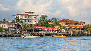 Cruising into Puerto Ayora on Santa CruzBright and early (as usual) we got on the pangas and cruised over to Puerto Ayora, an actual city with people in it, on Santa Cruz Island.
Santa Cruz Island is the center of Galapagos tourism. About half the island’s 18,000 residents live in or around the town of Puerto Ayora.
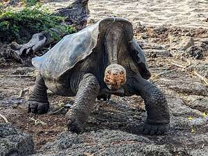 Giant Saddleback TortoiseI must say, it was a bit of a shock to see man-made structures, cars, and so many people again.
For the last 7 days, we had been as isolated from civilization as Charles Darwin and the crew of the Beagle had been in the 1830s - no interference from the outside world, no man-made anything - just us and the delightful wildlife in a quiet, pristine world.
I’m not sure I was ready for this.
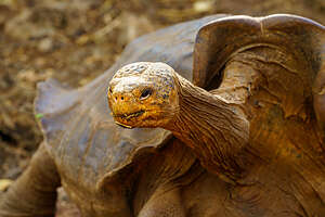 Giant Saddleback TortoiseWe spent the morning visiting the Charles Darwin Research Station, established in 1959 with the mission of the preservation and conservation of the plants and animals of the Galapagos Islands.
At the Visitor Center we saw “saddleback” tortoises, which are very different from the “domed” tortoises we saw a few days back on Isabela Island, or the ones we would see later today at the Rancho Primicias Giant Tortoise Reserve.
The domed tortoises have more rounded carapaces (shells), while the saddleback carapaces are flatter with an upward curve to the front, which allows them to stretch up to reach higher growing plants.
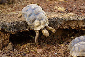 Hatchling being raised at the centerSaddlebacks tend to live on arid islands and feed mostly on cactus - that’s why they need those long necks, while the domed-shell tortoises live on more vegetated islands and feed primarily on grass.
The Charles Darwin Research Station became quite famous in 1971 when it became the home to “Lonesome George,” the last remaining Pinta Island giant saddleback tortoise. Scientists and researchers rushed to find him a mate, but George simply was uninterested and no offspring were ever produced.
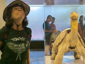 Lolo and Lonesome GeorgeSadly, in 2012 Lonesome George was found dead in his corral at the Tortoise Breeding and Rearing Center, marking the extinction of the Pinta species of tortoise.
Because of his fame, George was frozen and shipped to the American Museum of Natural History in New York City to be preserved by taxidermists. Not sure when, but he has been returned to the Charles Darwin Research Center, where he has been placed in a specially designed building with a cooling system to preserve him.
As we solemnly stood before his taxidermied remains, I honored him by stretching my neck as far as I could. After all, imitation is the highest form of flattery,
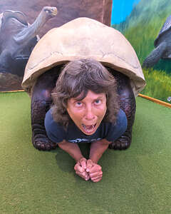 Lolo empathizing with a tortoiseOk, so if Pinta Island saddlebacks are extinct, what were we seeing wandering around the Breeding Center? Was this some kind of Jurassic Park? Well, maybe close. Based on much googling, I think scientists were able to find tortoises on other islands with DNA showing that they were hybrid Pinta tortoises. Maybe these guys are the offspring? - but don’t take my word on that.
The Research Center also supports a program of collecting tortoise eggs from various islands where they have been threatened to extinction. The eggs are then incubated and hatchlings are raised for several years until they are ready to be reintroduced to their native Islands.
They all had numbers on their back, which I assumed identified which islands they came from so they could be re-introduced to the right place.
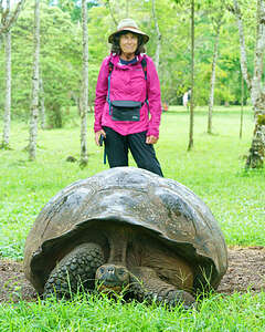 Rancho Primicias Giant Tortoise ReserveMy favorite was #15, a feisty little fella with big dreams who wasn’t going to let a little ledge get between him and his buddy. I could almost hear him thinking, “I think I can, I think I can.”
Unfortunately, his dreams clashed with reality and the result was a face plant.
Our final activity at the Research Center was me, trying to empathize with the tortoise, by crawling inside a tortoise shell. Getting in was a lot easier than getting out.
Next we all piled in a van and drove us to the Rancho Primicias Giant Tortoise Reserve, located up in the Santa Cruz highlands, where we would be able to enjoy giant tortoises in their natural habitat.
While wandering the grounds, Tui started running towards some rather loud and weird moaning and groaning sounds in the distance. You can never go wrong following Tui, so several of us started running behind her. Unfortunately, Herb was nowhere to be found.
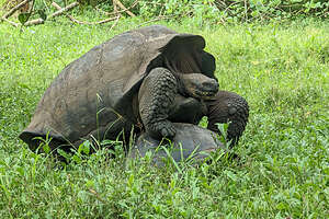 Mating Giant Domed TortoisesMarch is a great time to visit the Galapagos as it is the mating season, so there is lots of interesting action going on.
Sure enough, there was a male giant tortoise climbing on a much smaller tortoise, which was the female. We couldn’t even see her head. I think she might have had it tucked in. After more moaning and groaning, he rolled off her and walked away. What a romantic. I’m sorry Herb missed it.
After lunch at the Preserve, we returned to Puerto Ayora and were set loose to explore on our own.
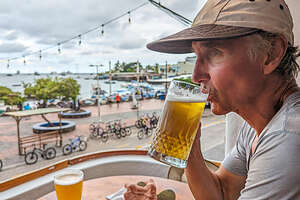 Herb enjoying the Santa Cruz BreweryWe’re not big shoppers, but we do like to come home with something to remember our trip by. We knew exactly what we wanted - a little blue-footed booty, hand-carved out of cedar wood, which we bought at a wood-carver’s studio called Hera’s Art Gallery.
Civilization isn’t all bad. We spent the remainder of our free time in Puerto Ayora enjoying a beer (or two) and the Santa Cruz Brewery, sitting on the balcony watching the activity in the harbor. It started to rain really hard (our second and final rain of the trip), but fortunately, we were covered and cozy.
Okay, now let’s get back to our critter-only, pristine little world on the Tip Top IV.
Recap of wildlife we saw today: Humans, Galapagos Giant Saddleback tortoises, and Galapagos Giant Domed Tortoises
Floreana Island
Thursday, March 23, 2023 - 6:30pm by Lolo0 miles and 0 hours from our last stop - 1 night stay
Travelogue
 Flamingos on a salt lagoonSometime during the night, we said goodbye to Isabela Island, cruised around its southern tip, and headed southeast to Floreana Island, one of the most southern islands in the Galapagos.
It was the roughest passage we had had so far, but still more of a rocking-us-to-sleep type motion than anything causing sea sickness. March is one of the calmer times, which is one of the many reasons we chose to visit this time of the year.
 Morning sun lights up the flamingosWe began our day with an early morning wet landing on Punta Cormorant, a beautiful olivine green beach on the north side of Floreana Island. The green is from olivine crystals, which are volcanically-derived silicates of magnesium and iron.
From there we hiked for about a half mile to a lovely saltwater lagoon where flamingos and other wading birds hang out. The particular species of flamingo in the Galapagos is the American flamingo, and it can usually be found in these salty lagoons during the nesting period, which lasts from March to July.
This lagoon is a great habitat for flamingos for several reasons.
 Flamingo running across the surfaceFirstly, it is hypersalinic, meaning that it is even saltier than the ocean. This is because the lagoon is quite shallow, so as the water evaporates, the salt becomes very concentrated. Since pink shrimp love this very salty water, so do flamingos because that’s what they love to eat.
It is that diet of pink shrimp, which have a carotenoid pigment, that gives flamingos their characteristic bright pink color. The more carotenoid they ingest, the pinker they get.
 Getting ready to danceSecondly, in order to mate, flamingo colonies need shallow water to perform their synchronized courtship dances, which they actually were doing this morning.
It’s an amazing thing to watch. Although they have 136 different dance moves in their repertoire, they usually use just a few. Things usually get started when the tallest male in the group stands up very straight and starts swinging his head back and forth, trying to get the rest of the group to join in. This is called head flagging. Sometimes it works and sometimes it doesn’t. However, when it does, it is incredible - dozens of flamingos stepping along together as if in a parade, heads turning side to side, bobbing up and down - all sizing up their fellow dancers to evaluate their moves.
 Synchronized courtship danceFun fact: a group of flamingos is called a “flamboyance.” I can’t think of a more appropriate name.
Unfortunately, for me at least, the flamingos were all the way on the other side of the lagoon. This is where those long telephoto lenses that everyone else in the group had came in handy. I, however, did surprisingly well with my trusty Google Pixel 7 Pro.
But until I saw Herb’s photos, I didn’t even notice that they had black-tipped wings.
 Sea Turtle nestsWe continued along the trail to the sea on the other side of Punta Cormorant to a very pretty, soft sand beach.
About a 100 yards back from the water there was a large nesting area, where dozens of female sea turtles had used their back flippers to dig nests in the sand where they laid and buried up to 100 eggs, which incubate in the warm sand for about 60 days.
 Sea Turtle crawling to the seaOnce she has buried them, she slowly drags herself back to the sea.
This was exactly what we were witnessing. For the next 15 to 20 minutes, we watched in awe as she crawled up and over the mounds of sand created by their nests and then slowly but surely made her way across the open expanse of beach. We felt like cheering when she finally reached the sea.
Eventually, when her eggs hatch, the little guys would have to make the same journey, but under much more dangerous circumstances, as predators, such as cormorants, gulls, hawks, and even crabs wait anxiously for them to hatch and consume most of them before they ever reach the sea.
 Finally she's thereWow! Not exactly what I would consider good parenting, but then again I am not a sea turtle.
On our way back to the panga, we passed by the salt lagoon again just as it began to pour - our first rain since we had been in the Galapagos. They were literally dancing in the rain, head flagging, bopping up and down, and twisting their bodies around.
Of course, this made the flamingos even more photogenic, so we couldn’t possibly leave. Instead, we stayed a good half hour getting soaked and hoping our cameras stayed dry under our attempts at waterproofing.
 Back to the Salt LagoonIt was worth it. The photos were absolutely stunning.
After lunch and a brief siesta, we went back out in the pangas for a wet landing at Post Office Bay, the closest thing to civilization we had seen in over a week.
It’s one of the most historically famous island locations in the archipelago. Its origin dates back to 1793, when whalers began the practice of leaving mail in a barrel for homeward-bound ships to collect and deliver.
When they got home, the crew members collecting the mail would then hand deliver the letters to the intended recipients - both as an act of kindness and in the hope that the favor would be returned when they “mailed” something from the Galapagos.
 Dancing in the rainToday, the tradition is carried on by tourists, such as us. I had purchased some postcards to send home to our sons and neighbors, which I placed in the barrel, in the hopes that some future traveler from the great state of California would collect it and hand deliver. I did not have high hopes, but what the heck.
 Floreana's historic "Post Office"In return, we were told to select some to hand deliver when we got back home. Everyone kept handing me anything with a California address on it, but I stopped with 6 of them. There was no way I was hand delivering one to San Diego, so I was going to take the more modern approach of putting it in an envelope with a stamp and mailing it.
On the way back to the ship, we cruised over to an area called the Mirador de la Baronesa (Baroness’s Lookout), a rocky shoreline, where there is a sea lion colony and penguins like to hang out. I’ll get to that later, but first, a little history of the Baroness.
 Sea Lions playing with a lava heronThe Baroness was a real person that lived on this island in the 1930s and was a central figure in much mystery and intrigue, and even murder. Today what happened on Floreana Island is referred to as “The Galapagos Affair.”
Without going into too much detail, Floreana Island was first settled by a German physician named Dr. Ritter and his lover, Dora. They were soon followed by the Wittmers, who gave birth to the first baby on the island. Dr. Ritter, who wanted his privacy, was not happy about their arrival, but they learned to get along.
Fun Fact: The Tip Top IV is owned by the Wittmer family, descendents of the original inhabitants on Floreana
 Mirador de la BaronesaHowever, a few years later, a woman, who claimed to be an Austrian Baroness arrived with her two lovers, Robert and Rudolf, who were actually her sex slaves. She wanted to build a grand hotel and transform the island into an adult-themed bacchanalia. Calling herself the “Pirate Queen of the Galapagos,” she would strut around the island scantily clad, with a revolver strapped to her leg, and a whip in her hand.
She would also sit on the rocky shoreline, which we were now at, watching for passing ships. Often these ships would deliver supplies for the Ritters or Wittmers that never found their way to them after the Baroness first got her hands on them.
 Time to head homeObviously, the Baroness was not very popular on the island.
Things got worse and worse between the island residents and strange things began to happen. In 1934, the Baroness and one of her lovers just disappeared, leaving behind all their possessions. According to Margaret Wittmer, they left on a strange yacht, but no one else saw this boat and they were never seen or heard from again.
A short time later the Baroness’ other lover left the island on a fishing boat heading for Guayaquil but never arrived. His corpse was found on the deserted island of Marchena.
A few months after, Dr. Ritter died of a mysterious poisoning. According to the Wittmers, he said before dying that his lover had poisoned him.
 End of another incredible dayTo this day the disappearance of the Baroness and her lover and the circumstances surrounding the deaths of her other lover and of Dr. Ritter remain a mystery.
My point for digressing with this story, besides the fact that it is quite a story, is that this lovely spot where we were watching the sea lions and penguins play was where the Baroness used to sit for enjoying the panoramic views and watching for visiting delivery ships.
Now it’s just a playground for playful sea lions and seabirds.
The sun was setting. Time for the panga to take us home.
Recap of wildlife we saw today: flamingos, Galapagos Giant Tortoises, sea lions, lava herons, blue-footed boobies
Galapagos - Isabela Island (Day 3)
Wednesday, March 22, 2023 - 7:15am by Lolo0 miles and 0 hours from our last stop - 1 night stay
Travelogue
 Our first Galapagos Giant TortoiseThis was our third and final day anchoring off of Isabella Island. It’s the largest of all the islands in the Galapagos so there was lots to explore.
We started our day, like most others, with a panga ride to a shore landing to hike and meet the critters that inhabit that area. Every day we thought we couldn’t possibly see something new, yet everyday we did.
 Galapagos Giant TortoiseOne of the first things we saw after our wet landing was the skull of a whale.
Continuing inland on a trail, we had our first encounter with a Galapagos giant tortoise, who was blocking our path.
After a photo shoot, where this tortoise got as much attention as a movie star on an Oscars red carpet walk, we tiptoed around him. He really could have cared less about us.
 Land Iguana digging his burrowThese creatures are the world’s largest tortoises, weighing up to 500 pounds and growing to 5 feet in length. They males are significantly bigger than the females. They can live to be 100 years or more.
Of all the wildlife, it is the giant tortoise that most symbolizes the Galapagos Islands. In fact, Galapagos means “tortoise” and it is his face that appears on the official insignia of the islands.
Much more gravitas than calling the archipelago “Booby” or “Sally Lightfoot.”
 Land Iguana being a bit defensiveThere are 12 different subspecies of giant tortoises in the Galapagos. Their total population is approximately 15,000. Basically, their carapaces (shells) come in two shapes: dome-shelled, like the ones we met today, or saddle-backed, which we would meet later on Santa Cruz Island.
Although they might look scary, they, like iguanas, are herbivores. They are known for their ability to fast for long periods of time, which was almost their downfall, as buccaneers and whalers would carry them off to their ships and keep them in the ship’s hold without food or water, until they became fresh food for them.
 Snorkeling with the sea turtlesNext we came across a land iguana digging away at the ground, kicking sand and dirt up behind him. We had seen plenty of land iguanas already on the trip, but never this type of behavior. We learned that they are burrowing animals, and the shallow tunnels they dig out provide shelter, shade, and a nesting place for their hatchlings. The quality of his burrow is also a draw for the ladies, so he works very hard at making a nice home
My favorite photo of a land iguana though was one where he was opening his mouth wide enough for us to see his tongue and tonsils (if he had tonsils).
 Cow-Nosed RaysI later researched why he might be doing this, and found that it is generally a sign of aggression or defensiveness, which made sense, because he might not have appreciated us getting too close to his burrow.
The article further went on to say that “it’s best to give your iguana plenty of space and allow it to settle down.” Firstly, this was not “my” iguana, and secondly I had no intention of invading his personal space at this time.
So, we had seen a new creature today, the Galapagos Giant Tortoise, and two new land iguana behaviors: digging a burrow, and showing us his tonsils.
 Spotted Eagle RaysDuring the snorkeling session later this morning, which I skipped because I still wasn’t feeling great, Herb saw and photographed lots of Sea Turtles.
I looked up the difference between turtle and tortoise and found the following: Tortoises spend most of their time on land, while turtles are adapted for life spent in water. As a result, tortoises have more rounded and domed shells, while turtles have thinner, more water-dynamic ones.
 Pelican with her two babiesLater that afternoon, we went for a panga ride to Punta Moreno and entered a grove of mangroves, where blue herons and penguins are often seen.
But first, we spent our time trying to get closer to the schools of rays we saw in the water.
Tui and Monica were very excited when we came near a school of Cow-Nosed Rays swimming along the surface, where we could get a look at them. They are also called golden rays because of their mustard color, and their noses do actually look like those of a cow.
We also saw a school of beautiful Spotted Eagle Rays, named for their spots When two of them flapped their wing-like fins above the surface, we were able to better see their white spots against their black coloring.
 Penguin with flippers outThe birdlife in the mangroves was wonderful as well. We saw a pelican mom with two baby chicks in her nest. I took a video of them also, with them loudly squawking away, and mom somewhat indifferently ignoring them.
There were beautiful blue herons nesting in the mangroves. Their necks are so long and thin that I can't imagine how a fish fits down there.
As we left the mangroves, we came around a rocky islet where penguins and flightless cormorants hung out.
 Flightless cormorant drying his wingsI love the penguin cooling himself off by holding his flippers out, but the dejected one heading right out of the photo stole my heart
It looked like the flightless cormorants were getting ready to settle down for the night as well, but first a little wing drying. Their wings don’t produce enough oil to waterproof them, so that’s why you often see them holding the short stunted wings out to dry.
They looked beautiful silhouetted against the sunset.
I hate to keep repeating myself, but what another incredible day.
Recap of wildlife we saw today: Galapagos giant tortoises, land iguanas, sea turtles, cow-nosed rays, spotted eagle rays flightless cormorants, penguins, pelicans, and blue herons
Gelapagos - Isabela Island (Day 2)
Tuesday, March 21, 2023 - 9:00am by Lolo0 miles and 0 hours from our last stop - 1 night stay
Travelogue
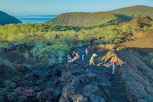 Hike up to Darwin LakeDuring the night, the captain navigated south along the western shore of Isabel Island and anchored near Tagus Cove, a natural harbor with steep cliffs.
Everything we had seen so far in the Galapagos was so pristine and untouched by man, so it was a surprise to find these cliffs covered in graffiti, painted or carved into the rock. Some were current, but many dating back to the 1830s were done by the crews of whaling ships. Does older graffiti make it history rather than vandalism?
After a dry landing, we set out on a 2-kilometer, somewhat strenuous hike through a steep gully to a wooden staircase and then along a gravel track to deep-blue Darwin Lake, an eroded crater 12 meters deep. The water has a very high salt content from seawater seeping in through the porous lava rocks beneath the surface, so there is no life in the lake.
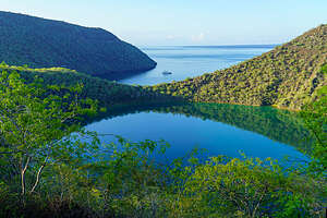 Darwin Lake and Tagus CoveFrom there we continued up to the lower lava slopes of Volcan Darwin, where there was a spectacular view of much of the island and Tagus Cove, where the Tip Top IV was patiently waiting for us.
We went back to the boat to get ready to go out and snorkel. As much as I hated missing anything, I decided to take a pass today as I wasn’t feeling that well - really tired and stomach cramps.
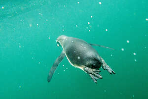 Snorkeling with the penguinsAs Herb left, I told him I was going to just lay down for 10 minutes and then go up on deck to relax and read a book - you know, like real vacationers.
Well, that didn’t exactly go as planned. I laid down for my 10-minute nap, which I awoke from when someone knocked on the door. It was Herb, back from snorkeling. I had passed out for an hour and a half. I definitely must have needed it.
Apparently I missed the snorkel of a lifetime - diving flightless cormorants, sea turtles, penguins zipping by, colorful starfish, and on and on. Even Tui and Monica, who have snorkeled here dozens of times, were raving about what a day it had been.
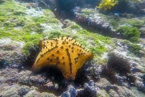 Chocolate chip starfishThe starfish were amazing - some of them more pentagon-like than star-like. My favorite was the chocolate chip starfish, no explanation needed.
The “chips” were actually conical black spines, arranged in lines radiating outward on the upper side of its body. They are meant to give the animal a threatening appearance so predators will leave them alone. Over time the protrusions erode and become more blunt, making them look more like the chips on a cookie than spines.
There were lots of other starfish in an amazing range of colors - reds, oranges, even white with red dots (or “chips”).
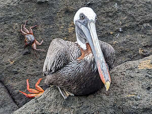 Serious looking pelicanThe action in the water was crazy, with flightless cormorants diving and penguins zipping by so fast that they were gone before you knew it. But then another one would zip by.
I was so sorry that I missed it, but fortunately Herb got some good underwater photos, so I could feel like I didn’t totally miss it.
After lunch, we had a choice of a panga ride or kayaking in Tagus Cove. Herb and I, and one other couple, chose to kayak. Everyone else went in the pangas.
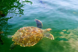 Galapagos Sea TurtleThe problem with kayaking, and the reason we only did it one day, is that the stronger kayaker (Herb) is in the back, and I was in the front - they were double kayakers. This meant that Herb couldn’t really photograph all the wildlife we were seeing along the cliffs, because he was keeping the kayak in control.
We saw pelicans, herons, blue-footed boobies, and penguins all hanging out and doing their thing on the rocky ledges of the cliffs. Penguins always look like they are having a lot of fun.
My absolute favorite capture was a short video clip of three penguins. I kiddingly urged them to “do” something because this was video. The middle wiseguy, right on queue, leaned over and shot poop out of his butt. I still look at this video and laugh. I could have gone home at this point and declared the trip a success.
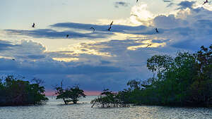 Sunset in the mangrovesLater that afternoon, we took a panga ride to Elizabeth Bay, a mangrove inlet with lots of green sea turtles and stingrays. There are no landing sites here, so we stayed in the pangas, exploring a beautiful secluded cove, lined with large red mangrove trees.
After an hour or so of chasing sea turtles and rays, we cruised out to a few rocky islets called the Marielas, home to the largest colony of Galapagos Penguins.
The rocks were covered with a menagerie of penguins, flightless cormorants, and Sally Lightfoot crabs.
Another great day in Paradise!
Recap of wildlife we saw today: flightless cormorants, penguins, blue-footed boobies, pelicans, sea turtles, and a variety of starfish
Galapagos - Isabela and Fernandina Islands
Monday, March 20, 2023 - 8:30pm by Lolo miles and 1 hour from our last stop - 1 night stay
Travelogue
 Pre-dawn panga cruise with the seabirdsAt 80 miles long, Isabella is the largest island in the Galapagos by far, covering more than half the landmass of the entire archipelago. It is also one of the youngest islands, dominated by six intermittently active, shield volcanoes.
In fact, it was originally six separate islands, each with its own active volcano. Eventually the lava flows from the six (Cerro Azul, Sierra Negra, Alcedo, Darwin, Wolf, and Ecuador) joined together forming one large island, shaped like a seahorse.
 Rounding Punta Vicente RocaWe started our day exploring Punta Vicente Roca, at the tip of the seahorse's nose. It’s a marine-only visitor site (no landings permitted), so we enjoyed the sights and the wildlife from the comfort of our panga - just us and the seabirds getting an early start on their day.
The scenery around the Point was stunning - spectacular cliffs formed out of tuff (volcanic ash) from the remains of two ancient volcanoes. A brown pelican stood at the edge of the cliff indifferently watching us pass by.
In the distance we could see the entrance to a sea cave, eroded from the tuff wall by the constant pounding of the sea, which we would explore later in the morning.
 Marine Iguanas warming up on the cliffsWe cruised along the cliff walls, mesmerized by the early morning activity of a very interesting and diverse group of wildlife, all getting ready to start their day.
Marine iguanas clung to the vertical walls as if they had suction cups on their feet, some of them seeming to be holding hands (or more correctly, claws) in a type of circular dance, except none of them moved. They just stayed still, warming their cold-blooded bodies by absorbing the rays of the sun. It reminded me of Henri Matisse’s painting “The Dance.”
 Flightless cormorant drying his wingsWe met a flightless cormorant for the first time, with bright, blue eyes and stunted wings. As their name implies, these birds are truly unable to fly. They are a great example of evolution and how a species adapts to its environment. Having few predators or competitors for food close to shore, they really didn’t need wings that much, so their wings gradually atrophied and their bodies evolved to be more streamlined for swimming. They are excellent divers that can speed through the water after fish. Trust me, I have been snorkeling when several of them whizzed by.
Since their wings don’t produce very much oil, they have lost some of their waterproofing, so after a dive, they hold them out to dry.
 Our first penguin!We watched a flightless cormorant pluck a large piece of seaweed from the surf, and valiantly proceed to hop his way up a rocky cliff to complete his morning chore of building a nest. Since they can’t fly, they hop up to the nest, using their stunted wings for balance.
Then there was a Galapagos penguin doing what he does best, peering out at the sea looking cute.
You might wonder what a penguin is doing at the equator. So did the first ones that arrived here when they rode the Humboldt Current from the Chilean Patagonia. After the glaciers melted, they were stranded here. They seem to do just fine though. They are really, really fast underwater. Between them and the cormorants whizzing by, snorkeling here can be quite exciting.
 Entrance to the sea caveTheir challenge is keeping cool, which they do by spending a lot of time in and near the water. When they are on land you sometimes see them holding their flippers out cooling their armpits (or maybe more correctly, flipper pits).
Then, of course, there were our old friends, the blue-footed boobies and Sally Lightfoot crabs, which never fail to delight.
The Sally Lightfoots scampered across the steep cliff walls as if they were on level ground. Being a family of rock climbers, we were amused to see one of them headed right towards a large vertical crack in the wall, as if he was going to climb it.
 Inside the sea caveEventually, we made our way to the entrance of the sea cave, which looked barely high enough to fit us. The cave was surreal, with purple and yellow walls flickering like flames in the early morning light.
Meanwhile, below us, a large school of fish swam in the beautiful aquamarine green water, which seemed as if it was lit from below.
What a fabulous morning, but it wasn’t over yet, as we still had our daily snorkeling event, and today was supposed to be a really good one, because the upwelling of cold water currents in this part of the Galapagos gives rise to an abundance of marine life.
 Snorkeling with a Giant Sea TurtleDue to the jellyfish stinging incident the other day (not me, but most of the rest of the group), I had devised a new snorkeling outfit to leave no exposed skin - Lululemon tights under my short wetsuit, a long-sleeve rashguard, and a tiny cap to keep my hair out of my eyes.
Today was definitely a very exciting snorkeling day. We saw giant sea tortoises feeding on the algae at the bottom. When rising to the surface, they often came right at me, causing me to flee or spread my legs apart so they could scoot through.
 Snorkeling with marine iguanasThere were dozens of marine iguanas who enter the water during the hottest part of the day to feed on the red and green algae on the rocks. They just scooted around, paying no attention to us, and occasionally even bumping into us. I think I was very brave.
Penguins are extremely fast in the water, darting by so quickly that it was hard for Herb to capture a photo of anything other than their butts. He did manage to get one though.
Herb was in the water when he popped his head up and saw these two marine iguanas cuddling on the shore.
 Marine Iguana pile-upIt was so exhilarating and the hour flew by, almost as quick as the penguins.
After lunch and a siesta, we went back out on the pangas for a dry landing on nearby Fernandina Island, the youngest and most volcanically active island in the archipelago. Its volcano, La Cumbre, has erupted several times in recent years, the most recent being in 2017.
There is only one visitor site on Fernandina, Punta Espinosa, so that is where we headed for a dry landing on a dock, which is only good at high tide - spoiler alert, it was low tide when we were finished exploring the island.
 Best buddiesFernandina has the largest colony of marine iguanas in the entire Galapagos, so we weren’t too surprised when we were barely off the dock before we stumbled (almost literally, as they are so well disguised against the black rock) upon a group of them.
Then about 100 yards further, we came upon a group of larger ones doing acrobatics, climbing all over each other, often in groups of three. They do this to keep warm. I wasn’t sure how they decided who gets to be on the top, middle, and bottom. I’m not even sure what’s best.
We came across our first lava lizard sitting contentedly on a marine iguana back. I bet he felt safe up there from predators.
 Scary marine iguanaAt 6 to 8 inches long, lava lizards are not as impressive as their larger relatives, the iguanas, but they are cute and interesting in their own way. They have to be much more alert and quick than the iguanas to avoid being gobbled up by birds or snakes. However, they developed some very effective traits to avoid being eaten, such as changing color to camouflage themselves and leaving a breakaway tail behind in the predator’s mouth, when they haven’t been quick enough. Don’t worry, they do grow a new one back.
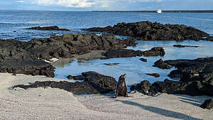 Bull sea lion guarding his territoryThe males are often seen doing what looks like push-ups, which is a show of strength to impress the ladies. The males in the Galapagos seem to always have the ladies in mind, or at least this time of year.
After wading through the sea of marine iguanas, we eventually got to the tip of the point, where there were dozens of Sally Lightfoot crabs covering the rocky volcanic coastline.
 Adorable sea lion pupThere was also a large colony of sea lions, and much loud barking and splashing about in the water.
We had already spent time with the cute variety of playful young sea lions, but today we would meet the more aggressive adult bulls, which can grow up to 600 pounds. The males are distinguished by a larger girth, thicker neck, and a noticeable bump on their forehead. They use their large size to defend their territories, which included about 70 feet of shoreline and the shallow waters beyond.
All the females within this territory (up to 30) belong to the bull's harem as mating partners, as well as any juveniles within the harem. The bull is constantly at work defending his territory, swimming back and forth from one end to the other.
 Lava cactusSince the bulls way outnumber the harems, there is constant conflict between the resident bull and the harem-less ones challenging him. Sometimes it is just a bit of show of aggression, but other times it can result in a fierce, bloody battle.
This goes on for weeks, with the resident bull going without food and sleep for long periods of time in his efforts to defend his territory, until he is eventually vanquished by a new champion, and the cycle repeats itself.
This behavior actually makes sense from an evolutionary standpoint. The resident bull's behavior is likely an evolved mechanism to best defend and ensure the survival of the colony, as someone, either he or the new champion, is always on guard.
 Whale BonesThey don't necessarily give photographers a free pass, and there were several times where one of us got a little too close, forcing a rapid retreat as the bull barked and moved a bit too quickly towards us.
On our walk back, we continued on a second trail which wound its way through a lava field. While the lava flow has obliterated much of the vegetation, several pioneering plants, including clumps of lava cactus, have begun to take hold.
A little further along, we came across a skeleton of a whale’s backbone, looking like a lineup of tombstones in the evening light.
 Less than elegant entry onto pangaAs we passed a group of marine iguanas, we caught one doing its characteristic spit. While it might look like it is an insult directed towards you, it is actually him expelling the excess salt from its system through a special gland connected to the nostrils. It’s also what sometimes gives them a white-crusted forehead.
It was way past high tide when we returned to the panga pickup area, so the dock was no longer an option.
 Homeward boundInstead the panga drivers had to back the boat up against slippery rocks, where aging photographers thrust themselves like beached whales onto the boat. At one point, Tui even jumped overboard in her clothes to try to hold the boat close enough to the rocks for us to get in. She is really a superwoman!
It was worth every undignified moment.
Recap of creatures we saw today: brown pelicans, blue-footed boobies, marine iguanas, lava lizards, Sally Lightfoot crabs, flightless cormorants, penguins, sea tortoises (underwater), sea lions
Galapagos - Santiago Island
Sunday, March 19, 2023 - 8:15am by Lolo0 miles and 0 hours from our last stop - 1 night stay
Travelogue
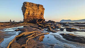 Puerto Egas beachWe slept through another overnight cruise south to the island of Santiago, a somewhat barren island with mostly volcanic landscape.
Originally named James Island, Santiago was the second of the Galapagos Islands visited by Charles Darwin in 1835. The island had already long been a source of freshwater, wood, and tortoises for buccaneers and whalers for two centuries.The easy-to-catch Giant Tortoises that lived here became a useful source of protein for the sailors. Between 1784 and 1860, whalers took more than 100,000 tortoises from the Galapagos islands, which they kept alive on their ships until ready to eat them
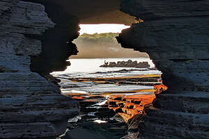 Puerto Egas beachToday, it’s only visitors are tourists, like us.
After breakfast, we hopped aboard the pangas for a wet landing on Puerto Egas where there was a lovely sand lava beach. As with every other morning, we were the first tour group ashore, and as a result we had the place to ourselves, except, of course, for the marine iguanas happily breakfasting on the exposed algae bed.
We were allowed to run free in either direction - although Galapagos rules required that tourists always remain in sight of their naturalist guide.
 Sally LightfootI, and most of our group, headed right towards a beautiful, volcanic rock formation just beginning to catch the morning light. Herb, who prefers to photograph in smaller groups, headed to the left, where he happily had the sally lightfoot crabs and marine iguanas all to himself.
The tide was still low enough to go around the backside of the rock formation to an arch, through which there was a lovely view of Sally Lightfoot crabs scurrying along the tidal pools and a brown pelican posing in the distance.
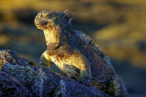 Marine Iguana greeting the sunMeanwhile, Herb was off by himself at the other end of the beach photographing the beautiful bright red, yellow and blue Sally Lightfoods crabs scampering along the lava rocks just above the surf.
They are named for their nimble, “light-footed” motion, up and down and even upside down while scurrying across the rocks. It is rumored that the “Sally” part of their name comes from a Caribbean dancer that displayed a similar exceptional agility when she danced.
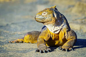 Re-introduced juvenile land iguanaThey would often scoot away when approached, but if you are patient enough and just sit quietly, they will come back out of their hiding place and approach you.
Unlike the flamboyantly colored parents, the juveniles are black, camouflaging them from predators, such as shorebirds, until they develop the speed and agility used by their parents to scoot out of danger.
If someone had told me before this trip that one of our favorite creatures to photograph would be a crab, I would have thought they were crazy, but then we met the Sally Lightfoot crab, and it was love at first sight.
 Rocky volcanic shorelineHerb also found a marine iguana soaking up the first morning rays of the sun. They are cold-blooded and need to absorb the heat from the sun to warm up. They are found much of the day, angling their body to directly face the sun, as if worshiping the sun god.
Herb often does the same.
Herb would have happily stayed there for hours, if Monica hadn’t yelled to him that it was time to move on.
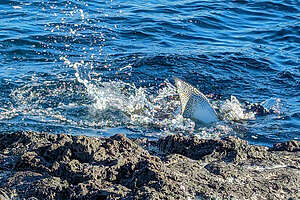 Beautifully patterned stingrayWe left the beach and followed a trail inland through a break in the low ledge adjacent to the sea. Off to the left were the remains of a salt mine from the 1930s, owned by a man named Jorge Egas, hence the name Puerto Egas.
Today, all that remains are some half-ruined buildings and an old soccer field, which has been designated by the National Park Service as one of the only few areas outside of the cities where ship crews are allowed to freely disembark and play for a few hours, to blow off steam from dealing with all those crazy tourists.
 Prehistoric-looking marine iguanaWe met a cute little land iguana along the way.
Land iguanas had been extinct on Santiago Island since the early 20th century, when feral cats and goats were introduced to the island, killing off many juveniles.
However, after these invasive species were eradicated, in 2019, land iguanas were reintroduced to the island. They were moved from North Seymour island (where we first saw them) where there were over 5,000 of them, too many for the available food on the island. A win-win situation for the two islands.
Three years later, a new generation of newborn and juvenile iguanas are thriving, and today we got to meet one.
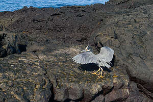 Yellow-crowned night heronThe trail eventually led out onto a rocky volcanic formation along the shoreline with a deep pool informally known as “Darwin’s Toilet, because it fills and empties rapidly with seawater rushing in from underground tunnels.
We saw a poor sea lion down in the pool that had a fishing line wrapped around his head with the hook still caught in his mouth. There was nothing anyone could do to help him. The rules are very strict in the Galapagos about interfering with the animals in any way. Plus sea lions have very large teeth and have been known to bite and even hospitalize good Samaritans that try to come to their aid.
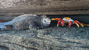 Feisty Sally Lightfoot poking a Marine IguanaFrom the rocks we spotted a stingray with a beautiful pattern on its fins and a large marine iguana swimming in the sea.
The diet of marine iguanas is primarily green and red algae. While females and smaller marine iguanas feed intertidally on exposed rocks, the larger males forage on the bottom of the sea. They are the only lizards in the world that are capable of doing this. The bigger males are great divers that can slow their metabolism down to stay submerged for up to an hour.
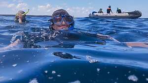 Snorkeling time!Their blunt snouts make it easier to nibble the thin layer of red and green algae found on the rocks.
Over the next few days, and even snorkeling with them, they started to grow on me. Maybe they were kind of cute in their own way.
We also met a yellow-crowned night heron, very much awake, unlike the one we saw yesterday on Genovesa.
 Hieroglyphic HawkfishNext, we came upon some more Sally Lightfood crabs tucked into the cracks of the rocky ledges that lined our path. They seemed perfectly at home with the marine iguanas that joined them. In fact, one feisty Sally Lightfoot seemed to taunt a marine iguana by poking him in the side of his head. The bright red, yellows, and blues of the crab next to the deep black of the marine iguana made for a stunning contrast.
I love watching and photographing the way the species interact with each other so casually - vulture ground finches riding on the back of marine iguanas, colorful reef fish nibbling at the algae on sea turtles, and these Sally Lighfood crabs teasing the marine iguanas.
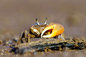 Fiddler CrabWhat an incredible morning it had been, and it was only 9:00 a.m.
We returned to the boat, got on our wetsuits, and headed back out on the pangas for our daily snorkeling.
One of the strangest fish we saw just lying there hiding amongst some rocks was a hieroglyphic hawkfish, dressed in complete camo garb of stripes and bands, which actually do look a little like hieroglyphics. He just hangs out disguised in the rocks, waiting for dinner to come by. There were also schools of colorful fish, including the pin-striped group, which I was unable to identify.
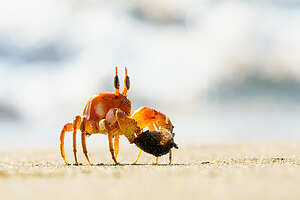 Ghost CrabAfter an hour of snorkeling, we went back to the boat for lunch and a siesta. Free time at last! Herb napped, and I finally got a chance to just sit in an upper deck lounge chair and read a book. However, I must confess I did close my eyes for a bit.
Fed and rejuvenated, we headed back out on the pangas for a landing on Playa Espumilla, a golden sandy beach where every year female sea turtles come in early March to nest.
We saw several of their nests, which were deep, wide holes dug into the sand up near the mangroves, but unfortunately they were empty.
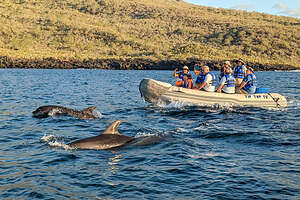 Dolphins joining us on our panga rideHowever, one lucky person in our group did see a tiny baby one crawl across the beach and successfully make it to the sea. Someday he would return to this very same beach to nest.
Beyond the beach there was a trail that led through a grove of mangroves to a saline lagoon. Alongside the lagoon we found several collections of sea turtle bones. We also found two new interesting crabs: the fiddler and the ghost.
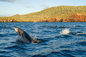 Our dolphin escortsLike the fiddler crabs we have seen in South Carolina, the male has a giant claw which he carries around like a cello - so I nicknamed him Yo-Yo Ma. During courtship, he waves it around to attract females - the fiddler crab that is, not Yo-Yo Ma. They’re kind of hard to photograph, because as soon as they feel the vibration of approaching footsteps, they quickly disappear into their sand burrows.
The other crab was a Ghost Crab, which Herb was very lucky to photograph, because, as their name implies, they are very elusive and nocturnal. Usually, you only see their tiny eyes at the end of movable stalks peering out from their burrows. Herb got him strutting right out in the open. He looked like a tiny lunar module.
 Volcanic cliffs along Buccaneer CoveI can’t believe I am starting to love crabs so much. They are actually quite beautiful when you get up close.
Back out on the beach we met a pair of oystercatchers patrolling the beach for food. Since their food is usually found along the shoreline, they walk rather than fly, and are almost found in pairs.
They are lovely birds with a distinctive black and white plumage, pink legs, and long, bright reddish-orange beaks.
 Volcanic Tower with Opuntia cactusTheir diet consists of bivalves, mollusks, worms, and crustaceans which they dig out using their perfectly adapted strong and powerful beaks. Once in their grasp, they pry open their catch with their beak and quickly slice the strong adductor muscles to get at the meat inside.
Our last activity of the day was a panga ride along the steep cliffs near Buccaneer Cove, with dolphins accompanying us much of the way.
Buccaneer Cove was a haven for pirates and whalers in the 17th and 18th century. When Darwin first visited here in the Beagle in 1835, he found a party of Spaniards drying fish and salt tortoise meat. The island had already been a source of freshwater, wood, and tortoises for buccaneers and whalers for well over a century.
 Post-sunset return to shipThe volcanic cliffs were beautiful, with layers of eroded tuff volcanic rocks forming amazing shapes. They were a stunning red in the late afternoon light.
Many of the cliffs were topped with tall Opuntia cactus. I am always awed with how persistent plants can be to find a home on what was once bare volcanic rock.
By the time we headed back to our boat, the sun was already setting. That’s why we chose this photo tour - first group onshore in the morning, and last to leave at night.
Recap of wildlife we saw today: marine iguanas, Sally Lightfoot crabs, land iguanas, yellow-crested night heron, sea lions, stingrays, hieroglyphic hawkfish (while snorkeling), oystercatchers, fiddler crabs, ghost crabs, and Galapagos mockingbirds.
Galapagos - Genovesa Island
Saturday, March 18, 2023 - 9:00am by Lolo0 miles and hours from our last stop - 1 night stay
Travelogue
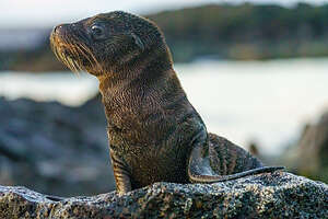 Galapagos Fur SealWhile we slept to the gentle rocking of the boat, our trusty captain made the 8-hour passage north from North Seymour Island to Genovesa (Tower) Island, the northernmost and most remote of the islands we would visit. In fact, sometime during the night, we went over the bump (equator) back into the northern hemisphere.
Genovesa is known for its abundant birdlife, notably the world’s largest colony of red-footed boobies, with more than 100,000 pairs coming to nest each year.
Oddly, there are no land reptiles on this island, just a few small marine iguanas. This is attributed to the direction of the ocean currents, which wouldn’t have carried terrestrial animals here.
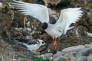 Swallow-tailed gull and her youngWe woke up (at 4:45 of course) safely anchored in Darwin Bay, inside a volcanic caldera surrounded by cliffs.
After breakfast, we promptly got into the panga at 5:50 to be dropped off on a small beach where colonies of great frigatebirds and red-footed boobies nest. This was our first wet landing, which meant we had to wear the appropriate footwear (Tevas in my case) because we would not be brought all the way to shore, but close enough to easily get ashore.
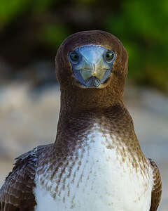 Juvenile booby of sorts?Today we were greeted by one old friend, the adorable fur seal we met yesterday on North Seymour Island, and one new, the lovely swallow-tailed gull.
I spoke yesterday about the fur seal and how they somewhat inadvertently found their way to the Galapagos Islands during the Ice Age and couldn’t leave when the glaciers melted. However, like all good Galapagos residents, they adapted and learned to cope in a climate not conducive to having a double furry coat of insulation.
The swallow-tail gull is a beautiful bird with a pearly gray and black head, pinkish legs, and a pale-tipped bill with a white spot at the base. When in flight they have a distinctive three-tone wind pattern of gray, white, and black.
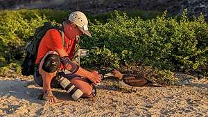 Herb and a very curious Brown NoddyThe ones we saw also had a distinctive red ring around their eyes, which means they are ready to breed. If the ring is black, they are not in the mood. Since they only come to the Galapagos when they are breeding, all of them on Genovesa had the red ring.
When swallow-tailed gulls are not breeding, they are totally pelagic, flying and hunting over the open ocean, never once setting their webbed feet on dry land. Although they spend most of their life flying and hunting over the open ocean, when it’s time to breed they come to the Galapagos Islands, particularly the rocky shores and cliffs of Genovesa (Tower), Hood, and Wolf islands.
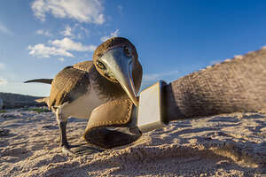 Brown Noddy peering in Herb's lensAnother interesting fact about the swallow-tailed gulls is that they are the only fully nocturnal seabird in the world, using their highly developed night vision to prey on squid and small fish which rise to the surface at night to feed on plankton.
Since the Galapagos is a great place to study how animals have evolved over time to cope with their environment, it’s important to point out that their night hunting is a form of adaptive behavior, evolving from the greater abundance of squid and other fish on the surface at night and the necessity of bringing food back safely before the diurnal frigatebird can steal it from them.
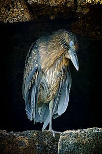 Yellow-crowned night heronFrom the beach, we set off on a 1.5 km trail which would take us inland to the mangroves where the red-footed boobies nest.
We didn’t get too far before we met a very social and curious Brown Noddy (or at least I think that’s what he was), who was even more interested in us than we were in him. As Herb knelt down to his eye level, the Noddy actually stuck his beak right into Herb’s lens, which did make for a very interesting perspective. He then started playing with Herb’s camera strap, trying to pull it away from him. He also nibbled on Monica’s toes for a while.
He was so much fun to play with that we found it hard to pull ourselves away. Unlike the non-photo tour groups which tended to just march non-stop along a trail, we would literally spend 2 hours just observing and photographing the wildlife, spreading ourselves out like beads on a necklace with Monica up front and Tui in the rear.
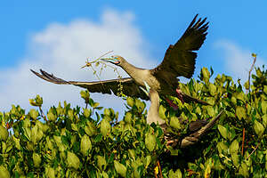 Male red-footed booby bringing twigs to nestIt was slow-going getting to the mangroves, because we kept seeing so many interesting creatures along the way, such as the nocturnal yellow-crowned night heron, snoozing on a rocky ledge. We were curious about the membrane across his eye, but later learned that many water birds have an extra eyelid, called the nictitating membrane, which provides protection to the eye.
Finally, in the mangroves, we got our first sighting of red-footed boobies, with their bright red feet and colorful light blue and pink beak. The ones found in the Galapagos are predominantly brown with a white, belly, rump, and tail. Out of the three booby species in the Galapagos, the red-footed boobies are the smallest.
 Red-footed boobyUnlike the blue-footed boobies who mate and nest right out in the open, often right in the middle of a trail, the red-footed boobies (males) collect twigs and build nests in trees and shrubs. They have longer toes than other boobies which allows them to grasp branches.
They are much more difficult to photograph than the blue-footed boobies because there always seems to be a branch in the way, often hiding their faces and red-feet.
However, we were fortunate enough to photograph a male bringing some twigs back to the nest.
 Frigatebird stealing food from a booby mid-airRed-footed boobies are strong flyers and feed on flying fish and schooling squid far out to sea, often traveling 90 miles out when foraging. They are well adapted for diving, with long bills and aerodynamic bodies.
Many visitors to the Galapagos never get to see this interesting sea bird, because they are only found in the northern, more remote part of the Galapagos archipelago, particularly Genovesa and Punta Pitt on San Cristobal Island where fewer people visit.
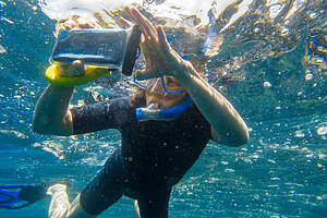 Snorkel Time!On the way back to the panga, we saw two lava gulls nesting on a rocky cliff ledge. They are the second species of gulls on Genovesa, much darker than the swallow-tailed gulls in order to blend better into the lava rocks they nest on.
However, the most dramatic action we encountered was a frigatebird doing its pirate-thing. As I mentioned in the North Seymour writeup, frigatebirds can’t get wet, because their preen gland doesn’t produce enough oil to waterproof their wings. So, they have to be pirates, surviving by stealing food from other diving birds (usually blue-footed boobies), by grabbing their tail feathers and shaking them violently until they give up their catch.
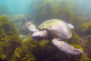 Galapagos Sea TurtleWhat an exciting day! Wait a minute, it was only 9:00 am, and we were just getting started. Next up, snorkeling in Darwin Bay.
This was to be the first of many snorkeling adventures this trip (one each day and sometimes even two). Herb and I had purchased new 2mm shorty wetsuits for the trip, which turned out to be the perfect thickness for the warm waters of March.
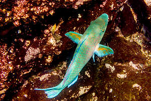 Rainbow ParrotfishIn order not to lose any clients, the following safety measures were used. The two pangas from our boat would stay out either ends of us, and the panga drivers would constantly count heads, making sure we were all accounted for. Meanwhile, Monica and Tui would be in the water keeping an eye on us as well. Monica even had a lifesaving ring with rope around it to hold onto in case any of us needed a break or had to adjust a facemask. While I didn’t hang onto it, I did pretty much follow Monica around in case I had to.
I had bought a waterproof cover for my phone so that I could take pictures, but it didn’t work very well, so I left Herb in charge of underwater photos. In retrospect, I wish we had a GoPro, like many of the other people on the trip, as videos would have been nice to have.
 Red-billed tropicbird in flightThat day we saw dolphins, sea turtles, sting rays, and very colorful reef fish. The hour passed by before we knew it.
Then it was back to the mothership where we had a delicious lunch and time for a far too brief nap before heading out on the panga again to climb Prince Philip’s Steps.
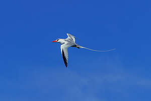
Along the way Herb was able to capture a red-billed tropicbird in flight from, which are rarely seen from land, as they nest in the crevices of the rocky cliffs. Adults have a stout red bill and long white tail streamers. They are absolutely beautiful.
The Prince Philip Steps were named in honor of a royal visit to the islands by Queen Elizabeth II’s husband Philip. The steep-railed stairway leads to a dramatic trail along the lava plains atop the cliffs.
 Prince Philip’s stepsAs if we hadn’t already seen such an amazing collection of wildlife today, there was more.
We saw a fuzzy baby chick emerging from its nest (not sure if it was a red-footed or masked booby chick). It looked like it had just been born.
Although we had seen Magnificent frigatebirds on North Seymour, here we came across a tender moment where the male and female are actually cuddling. It’s difficult to see, but the female is resting her head on her mate’s inflated, red throat pouch.
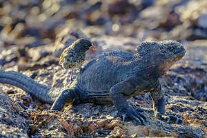 Marine Iguana giving a Vampire Finch a piggy back rideWe also got to see our first marine iguana with a vampire ground finch on his back. I won’t go into depth now describing the marine iguana’s appearance, behaviors, etc., because we would be seeing much larger populations of them when we visited Fernandina, Floreana, and Espanola; however, the vampire finch was a rare find.
Everyone knows about Darwin’s discovery of how finches adapted and evolved differently on each of the Galapagos islands based on the available food source. Well, that’s how the finches on Genovesa became vampires. As seeds and insects are sometimes scarce on the northern islands, these finches evolved to have extremely sharp beaks, which they use to peck at the feathers and skin of Nazca and blue-footed boobies until blood is drawn, which they then drink.
 Galapagos short-eared owlTheir beaks might be sharp, but not sharp enough to penetrate the skin of a marine iguana, so I think he was just going for a joy ride.
The last bird of an already eventful day was a short-eared owl, a medium-sized brownish bird, only found on Genovesa Island. He was asleep on his perch, although they, unlike other owls, do sometimes hunt during the day. We especially took note of his hairy legs.
What a day! Now it was back to the boat, a briefing as to tomorrow’s activity, dinner, and bed.
Recap of creatures we saw today: fur seals, swallow-tailed gulls, lava gulls, brown noddies (I think), juvenile blue-footed booby (?), red-footed boobies, yellow-crowned night heron, frigatebirds, sea turtles (underwater), red-billed tropicbird in flight, vampire ground finch, marine iguana, and a Galapagos short-eared owl
Galapagos - North Seymour Island
Friday, March 17, 2023 - 2:30pm by Lolo miles and hours from our last stop - 1 night stay
Travelogue
 Map of our 11-day cruiseAs I mentioned in the Overview, this was not our first attempt at a “once-in-a-lifetime” trip to the Galapagos Islands. Almost 3 years ago, to the date, on March 12, 2020, we were packed and ready to leave for the airport where we would begin our journey to the Galapagos Islands on a Gate 1 tour.
Just as we were about to head out the door, something made me check the Gate 1 website, only to discover that the tour, which was to begin in 2 days (we were going early) was canceled. We were so close to actually getting to Ecuador where we would find no tour guide to greet us.
 Tip Top IVWe all know what happened over the next 2 years - basically travel stopped while the world waited for the pandemic to end.
As things began to open up again, we thought about reimplementing our trip. However, since that time, we had talked to various people and researched other tours and came to the conclusion that the Gate 1 tour (which included only 3 nights on the Galapagos Islands) was not going to be enough.
After much research, Herb came to the conclusion that a longer photography-focused tour made the most sense for us. That’s when he discovered Tui de Roy, the legendary Galapagos photographer that was brought to the Galapagos by her Belgian parents when she was 2 years old. Her father gave her her first camera when she was in her early teens, and she hasn’t stopped photographing the islands since. Over 5 decades and tens of thousands of photos later, she has been awarded a place as one of the top 20 wildlife photographers in the world.
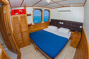 Our cabin on the Tip Top IVWhen Herb found that Tui was the photography guide on a Galapagos Travels 11-day Galapagos Islands tour, we knew we found the tour for us. The opportunity to spend 11 days exploring and photographing this amazing place with the best of the best was very exciting.
Our home for the 11 days was the Tip Top IV, a 125-foot yacht which held 15 passengers, 7 crew members, one Naturalist Guide (Monica), and Tui de Roy (Photography Guide). During those 11 days, we would visit 10 different islands, each with its own sometimes overlapping, but often unique, flora and fauna
Day 1 - Arrival and North Seymour Island
This was the big day - our flight to the Galapagos Islands!!!
 Our first dry landingThere was lots of extra hurdles to go through at the Quito airport to meet the restrictions and security inspections required by the Galapagos National Park, mostly to ensure that we were not bringing anything to the islands that we shouldn’t, specifically, agricultural or plant materials or any unprocessed food products, so as not to affect the unique and pristine ecosystems.
Upon arrival at Baltra airport, we were greeted by Monica, our Naturalist Guide, who we would learn to love over the next 11 days.
Before we knew it, we were transferred by bus to the yacht, which almost immediately lifted anchor and headed to North Seymour Island, officially marking the start of our 11-day Galapagos cruise.
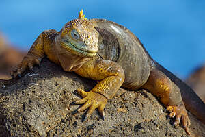 Our first land iguanaWe were shown to our lovely cabin on the upper deck, and barely started unpacking before the bell down below rang, summoning us to come down prepared for our first shore landing. The boat had already moved and anchored off of North Seymour Island white we were trying to unpack.. Wow! These people meant business.
This one was to be a dry landing, meaning the panga would back us right up onto the shore allowing us to get ashore without getting our feet, as opposed to a wet landing where we would have to step into the surf. Both were fine, and we quickly learned to trust the panga drivers and use the “Galapagos handshake” (grasping forearms rather than hands) to get safely on and off the boat.
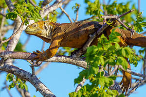 Have to remember to look upAs we got off the panga, I remember wondering if we would see any interesting wildlife. Well, that concern was quickly laid to rest as we were greeted by a Galapagos-style welcoming committee: land iguanas, frigatebirds, and adorable blue-footed boobies. Not only would we see them, but they would approach us like old friends.
The first resident of North Seymour that we met was the land iguana, who I came to love as a photo subject, especially because it couldn’t fly away and would happily sit still for me.
In the early 1930s, there were no land iguanas on North Seymour island, but an amateur naturalist named Allan Hancock moved some over from neighboring Baltra Island. They flourished, mostly because the plants on the island had not yet evolved natural defenses against them (evolution at work again). Today there are 2,500 of them on the island.
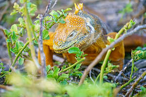 Can't get enough of these land iguanasBy the 1950s, land iguanas had gone extinct on Baltra from U.S. soldiers stationed there during WWII hunting them. The favor was returned and North Seymour iguanas were re-introduced to Baltra.
Although land iguanas look like scary prehistoric creatures, they are very trusting and docile (when not mating). Plus, they are vegetarians, so they were not interested in me as a lunch entree. Rather they feed on prickly pear cactus, spines and all, which provide them with both food and water.
They are actually quite beautiful (in their own way), about 4 or 5-feet long, with yellow and white bumpy skin and a spiny dorsal crest along their neck and back. They look like they are wearing long-sleeve sweaters that stop at the wrist. Where the sweater ends the very sharp claws on their toes (or hands?) begin.
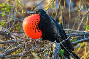 Magnificent FrigatebirdThe other thing I loved about them was that they always seem to have this smirky grin on their face, as if they are more amused about me than I was about them.
They are best to photograph at eye level, so I was very glad we brought along knee pads so that we could get down to their level - $20 volleyball pads on Amazon.
Land iguanas are easy to find during the day, because they are cold-blooded and need to absorb heat from the sun by basking on the volcanic rock. At night they crawl into burrows that they have dug to conserve the body heat they have accumulated during the day.
.thumbnail.jpg) Blue-footed boobies beginning their courtship ritualWe actually found one fairly large land iguana up in the upper branches of a tree. I didn’t realize they did that but they certainly have the claws to be good climbers. I have heard about Florida iguanas falling out of trees when the temperature drops because they are cold-blooded and become cold-stunned and lose their grip. Not sure if that happens in the Galapagos, but it would be interesting to photograph, or better yet, video.
Blue-footed boobies beginning their courtship ritualWe actually found one fairly large land iguana up in the upper branches of a tree. I didn’t realize they did that but they certainly have the claws to be good climbers. I have heard about Florida iguanas falling out of trees when the temperature drops because they are cold-blooded and become cold-stunned and lose their grip. Not sure if that happens in the Galapagos, but it would be interesting to photograph, or better yet, video.
As we continued along the trail, it curved away from the shore and into the interior of the island, we met our first Gelapagos bird, the Magnificent Frigatebird. “Magnificent” is actually part of its name. There is also a Great Frigatebird, which we would also soon see. The Great frigatebird has a green sheen on the scapular feathers and a white collar on the neck while the Magnificent is much bigger and has a purple sheen on its scapular feathers.
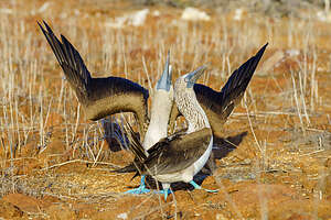 Continuing with the courtship ritualNorth Seymour Island is home to the largest colony of Magnificent Frigatebirds in the entire Galapagos.
We were fortunate to be here in March during their breeding season, when they perform their famous courtship ritual, during which the males inflate their red chest globes in order to attract the females. It’s crazy! It looks like a huge red balloon is attached to their chest. The females are attracted to those males that have the the brightest and most long-lasting throat pouch.
Frigatebirds mate just once a year and lay only one egg that takes 50 days to hatch. The chicks then spend a whole year with the parents, a particularly long period of time for a seabird.
.thumbnail.jpg) Making his not too subtle moveWhile other Galapagos birds dive for their lunch, Frigatebirds can’t get wet, because their preen gland doesn’t produce enough oil to waterproof their wings. So, they have to be pirates, surviving by stealing food from other diving birds, especially the blue-footed boobies whom they harass in mid-air until they drop their food, sometimes because they are so stressed that they vomit. The frigatebird then swoops down and plucks the dropped food out of the air.
Making his not too subtle moveWhile other Galapagos birds dive for their lunch, Frigatebirds can’t get wet, because their preen gland doesn’t produce enough oil to waterproof their wings. So, they have to be pirates, surviving by stealing food from other diving birds, especially the blue-footed boobies whom they harass in mid-air until they drop their food, sometimes because they are so stressed that they vomit. The frigatebird then swoops down and plucks the dropped food out of the air.
Their wings are massive and they have a deeply forked tail, allowing for speed and graceful aerial acrobatics, an adaptation that allows them to be very successful pirates. Plus, not having enough oil to secret on their wings has also provided them with the advantage of being lighter and more maneuverable, another useful trait for an air pirate.
Evolution is so neat!
 Bingo!While the word Galapagos means Tortoise, the most famous and popular of the creatures to see on the Galapagos Islands are the adorable Blue-Footed Boobies, given their name “bobos” (clowns) by Spanish sailors because of their unusually colored feet and their silly behavior. Their distinctly bright blue color of their feet comes from carotenoid pigments obtained from their fresh fish diet.
Continuing along the inland trail, we came upon a major blue-footed booby nesting area.
The blue-footed boobies were very fun to watch, especially during their mating season when they perform their famous courtship dance. During my pre-trip research I had been disappointed to learn that this takes from June to August, but they must not have gotten the memo because here they were in full swing on North Seymour Island in March.
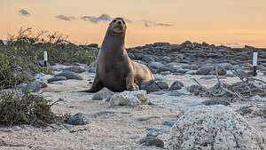 Galapagos Sea LionTheir elaborate courtship ritual begins with the male presenting the female with a small stick or stone. He then tips his beak up to the sky with wings behind his back, while he marches around the female lifting his feet (which he is obviously very proud of) in a high-stepping strut, pointed at a 45 degree angle. The bluer the feet, the more attractive he is to the female. The female’s feet are even bluer than his.
We were fortunate to actually be able to take photos and videos pretty close up of them doing this. I was in charge of video, but just when things were getting hot, I fumbled with my phone and missed taking the video of the actual copulation. I can be excused, however, because it literally only took 10 seconds. I think Herb did get some photos though.
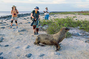 Making friends with a friendly fur sealI did manage to capture some drama afterwards though, when another blue-footed boobie flew in and a fight broke out. Not sure if the extra boobie was a male or a female, but they definitely felt put out by something.
The female will lay two to three eggs, and both parents will take turns using their large feet to incubate them while the other watches for predators, such as the Galapagos Hawk. The egg takes about 45 days to hatch and then they are fed regurgitated fish by both parents. They stay with their parents about 2 months before setting out on their own.
We would see blue-footed boobies incubating their eggs later on this trip when we got to Española Island.
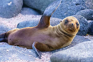 Fur Seals bidding us farewellWe met some Galapagos Sea Lions and Fur Seals on the beach back where the panga would pick us up.
Although land iguanas, frigatebirds, and blue-footed boobies were animals the likes of which we had never seen before, sea lions were something we were very familiar with in California, except these were a bit smaller. In fact, the ones on the Galapagos were originally considered a subspecies of the California ones, but have now attained full species recognition.
Galapagos Sea Lions are extremely friendly and playful and we would spend much time snorkeling with them later on the trip. The bulls, however, can be quite aggressive, constantly defending his shoreline territory and harem of females. We would have a few close encounters with them later in the trip.
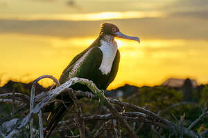 Giant FrigatebirdGalapagos Fur Seals, with their double coat of insulation, seems a bit out of place on the equator. They kind of found their way here north along the Humboldt Current during the Ice Age and became isolated here after the waters warmed and the glaciers melted, eventually becoming an endemic species.
They have some challenges. Firstly, to cope with the heat when they are on land they need to seek out shady shelter in the grottos along rocky shores. Secondly, sharks find them quite tasty, so they fish at night to avoid them and to take advantage of the greater number of fish near the surface at night.
A particularly friendly one waved goodbye to us as we got back on our panga.
Wow! We had seen land iguanas, magnificent frigatebirds inflating a red balloon on their chest, great frigatebirds, blue-footed boobies mating, Galapagos sea lions, and Galapagos fur seals. The trip could be over now and I would be satisfied.
Then it was back on board our ship, a delicious dinner, and our nightly briefing as to what to expect tomorrow. We were exhausted and still not fully unpacked.
Recap of creatures we saw today: land iguanas, magnificent frigatebirds inflating a red balloon on their chest, great frigatebirds, blue-footed boobies mating, Galapagos sea lions, and Galapagos fur seals.
Andean Cloud Forest
Wednesday, March 15, 2023 - 2:30pm by Lolo0 miles and 0 hours from our last stop - 1 night stay
Travelogue
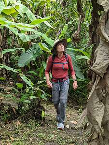 Lolo of the Cloud ForestBesides the 11-day cruise in the Galapagos, Galapagos Travels offers several excursions from Quito, such as trips to the Amazon, Volcanoes, the Bellavista Cloud Forest, etc.
We chose to take the 2-day excursion to the Bellavista Cloud Forest, located near the top of the famed Tandayapa Valley, within the Andean cloud forest region, a type of mid-altitude tropical rainforest that extends from 3,000 to 8,000 feet elevation. The Bellavista Reserve stands at 7,300 feet.
Cloud forests are like rain forests in that they both receive high levels of precipitation. However, the cloud forests get much of their precipitation directly from the clouds that filter through the trees.
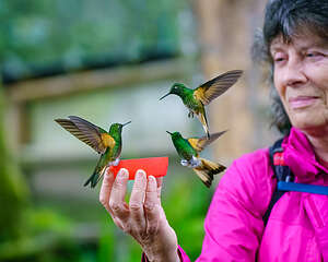 The hummingbird whispererThese consistent clouds are the result of transpiration of humid air from the billions of trees in the lowland Amazon moving up the mountain slopes of the Andes, condensing and falling as rain or remaining in the form of low clouds and mist. The atmospherics are truly magical.
Although cloud forests account for only 1% of global woodland, they have an incredible amount of biodiversity. The Ecuadorian cloud forests are considered the single richest hotspot on the planet, containing 17% of the world’s plant species, including thousands of species of orchids and nearly 20% of its bird diversity.
In order to take full advantage of our day (and especially early morning when the wildlife is more active), our guide picked us up at the hotel at 6:00 a.m. and we drove with three other of our tour group colleagues (Tom, Steve, and Bircan) on the winding roads to Bellavista Lodge (90 minutes west of Quito) where we would be spending the night. The final 12 kilometers of the drive was along a very bumpy dirt road.
 Giant EarthwormOur driver stopped and let us out when we came upon a giant 4-foot earthworm crossing the road, making me wonder if the earthworms were this big, what was the rest of the fauna going to be like.
We continued on to the Bellavista Cloud Forest Lodge, our home for the night, where we were greeted by Alfredo, our naturalist guide. After quickly dropping off our luggage in our cabin, which was lovely with a separate sitting room with big windows looking out over the forest, we met for breakfast in the Lodge restaurant - our second breakfast of the day.
 Tree FernNo time was wasted, and once breakfast was complete, we met by the hummingbird feeders and then set out with Alfredo to walk the trails of the Bellavista Reserve.
Armed with just my Google Pixel 7 Pro cellphone as my camera, I admit to having a bit of lens envy as I looked at the rest of the group’s camera equipment. Closeups of faraway or flying birds were definitely not going to be my forte on this stroll, so I decided to focus (no pun intended) on hummingbirds and the interesting flora. I would leave the toucans to Herb.
Cloud forests are the perfect habitat for epiphytes (sometimes known as air plants), which are plants that grow on other plants. The trees in the forest are festooned with bromeliads, orchids, mosses, and more.
There were also very interesting little insects and even a tiny frog that was smaller than half an ¼ inch. Not having the long telephoto lenses that my colleagues had, I tried to get up a little too close and personal to him, which caused him to disappear into thin air. Fortunately, Herb got to him before I did.
 Itsy bitsy frogSince I was having trouble photographing distant birds with my cell phone, I decided to deal with the flora because it stood still. One of my favorites was the Tree Ferns, where their curly fiddleheads (named for obvious reasons). The fiddleheads of a young fern are harvested for a vegetable. Everything in the Andean cloud forest seems to have a use.
At one point during our hike, Alfredo stopped us along the trail to allow Steve to make an announcement as to another choice in our itinerary. He asked if we would all be willing to pay an extra $39 pp (which later turned out to be $55 pp) to take an early excursion the next morning to see the “Cock of the Rock.” Never too old for low-form humor, his announcement was greeted with immature giggling from the rest of us. It got worse when Steve described the bird as being larger than 6 inches with a funny-looking head, which brought us to our knees. Knowing him better later, I realized he knew exactly how to get a reaction from the crowd. I love British humor.
 Oh my!We all agreed that we absolutely must see the “Cock.”
When we got back near the lodge, we were greeted in the parking lot by a big hairy tarantula. I had never seen one up close and personal before, so it was a little bit exciting. I just hoped he wouldn't find his way to our room.
After our walk, we spent some time at the hummingbird feeders where there are 15 different species zipping and buzzing around, often landing on us. Their tiny little feet gripping my finger felt really weird and I had to stop myself from shaking it off.
Alfredo tried to set up a more natural setting than a feeder for them to land on by pouring sugar water over a stalk with flowers, but they weren’t buying it. Instead they landed on his shoulder and watched his efforts.
 Plate-billed mountain toucanThere was also a beautiful toucan nearby enjoying a piece of a banana, pieces of which are left around the lodge to attract birds. Based on its coloring I think it was a plate-billed mountain toucan, which is only found in the Andean cloud forest in northwestern Ecuador.
It was starting to rain a bit, as it does almost every day after 2 p.m., so we returned to our lovely cabin and had a very cozy siesta on the daybed in our sitting room before having to join the rest of the group for dinner at the Lodge.
After dinner, we were supposed to take a night walk to see a bird that returns to sit on its egg at night, but it was raining pretty hard. No one wanted to be the first to say they didn’t want to go, but once one of us did, everyone else quickly followed suit. Besides, we had a very early morning ahead of us to drive to a place to see the “Cock of the Rock.”
 Cock of the Rock blindThe next morning,we left before sunrise (and breakfast) to drive the 50 minutes to the Reserva la Victoriana, a private reserve where there is a lek (communal gathering spot for male “Cock of the Rock” birds). There are only a few leks scattered throughout the Andean Cloud Forest.
As the sun rose, we marched through a very different topography than at Bellavista - much more expansive views and different vegetation. In a little less than a half mile we arrived at a blind and immediately began hearing the screeching sound of the male Cock of the Rock, coming from the ravine below us. Their call has sometimes been compared to the sound a screaming robot might make.
 Cock of the RockAs with most birds, male is much more attractive with a brilliant red-orange plumage, black and white wings, purple on his back, and a large fan-like crest that almost completely obscures his bill. Known as tunki in Quechua, he is the national bird of Peru. In comparison, the more drab female is darker and browner.
Males gather at communal gathering spots called leks, which are usually down in a ravine near a stream. It is at these leks that they compete for breeding females with each male displaying his colorful plumage, bobbing and hopping, and making a variety of bizarre squeaking and grunting sounds.
 Hummingbird at the Alambi PreserveAfter mating, the female makes a nest under a rocky overhang, incubates the eggs, and rears the young by herself. Hence, the “Rock” part of this bird’s name.
The birds were too far away and too fast for me to capture a good image with my cell phone, but I did enjoy passing the hour watching their antics (both the birds and the photographers). Thankfully, after probably hundreds of attempts, Herb was able to capture some great images.
After breakfast, we continued on to the Alambi Preserve, a family project for the conservation of the cloud forest in the famous Tandayapa Valley. It was a very different experience than our early morning trek to get to the Cock of the Rock lek to hear and watch them do their mating display.
 Hummingbird at the Alambi PreserveMuch less wild, the Alambi Preserve had beautifully gardens with beautiful endemic varieties and a hummingbird garden, where one could sit in a chair and watch 30 different species of hummingbirds visit the 8 hummingbird feeders.
They were fascinating to watch and I discovered the joy of slow motion video and the interesting effect of slowing down their frantic wing beating from 70 flaps per second to more like 5 times. That entertained me for almost an hour.
 Booted Rackettail hummingbirdHerb got some beautiful photos of hummingbirds in flight. My absolute favorite was of the one with the strange tail feathers that looked like little flippers or boots. I later was able to identify it as a Booted Rackettail, because of what looked like little boots at the end of his tail.
I eventually pulled myself away from the hummingbirds, and wandered through a lovely garden with many varieties of beautiful endemic plants. Everyone was still behind at the hummingbird feeders, so I had the garden to myself.
 Canna Yellow King HumbertI am no botanist, but you didn’t have to be one to appreciate these beautiful and unique plants. I had no idea what I was seeing at the time, but since coming home I have used Google Lens to identify them.
Canna “Yellow King Humbert” - rich deep yellow flowers, copiously splashed with fiery orange. The brilliant blossoms contrast nicely with a lush foliage of large, lamp shaped, apple green leaves. The contrast between its bright yellows and oranges was accentuated by the lovely tall red blades growing behind it.
Right nearby was a Heliconia Psittacorum - Erect, evergreen perennial with dense tufts of bright green leaves with pointy tips. The clusters of flowers are quite distinctive and range in colorful use of red, orange, yellow and green. The flowers produce and abundance of nectar and the color.
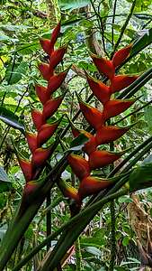 Heliconia CaribaeaEven the vines were works of art. Sanchezia Speciosa - an evergreen shrub that grows in the shady understory of tropical forests. The large variegated leaves have defined yellow veins and grow in an alternating pattern on the stems.
Next, near the hydrangea, I came across what looked like a bowl of rich, dark green leaves filled with hundreds of light green peas, which I later learned were hydrangea buds.
My all time favorite, however, was the Heliconia Caribaea, a large evergreen perennial with huge, oblong, leathery, dark green leaves and spectacular red flowers (6 to 8 inch long), which are actually modified leaves in the shape of lobster claws. I had never seen anything like them.
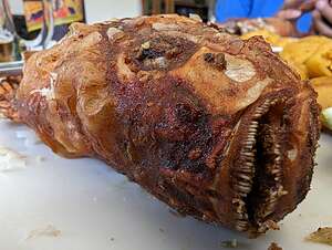 Tilapia as the locals like itWe ended our Cloud Forest excursion with a nice lunch at the Alambi Preserve restaurant. The waitress was a bit difficult to understand, so when Tom, one of our Galapagos Travel colleagues, who is admittedly not a very adventurous eater, asked if the tilapia was breaded, she answered “bones.” Tom was silent for a brief moment, obviously confused as to her reply, but eventually said “okay.”
One of the biggest laughs I had the entire trip, was watching Tom’s face when this was placed before him. I can still crack up just remembering the expression on his face.
Then it was back to the Mercure Alameda Hotel. Tomorrow was the big day - our flight from Quito to the Galapagos. Since there are a lot of additional security checks and procedures to go through when going to the Galapagos, it was going to be another early to bed night with a very early morning departure. All we had time for was dinner at the hotel’s Spicy Bistro restaurant, which was very good.
