- Home
- About
- Map
- Trips
- Bringing Boat West
- Migration West
- Solo Motorcycle Ride
- Final Family XC Trip
- Colorado Rockies
- Graduates' XC Trip
- Yosemite & Nevada
- Colorado & Utah
- Best of Utah
- Southern Loop
- Pacific Northwest
- Northern Loop
- Los Angeles to NYC
- East Coast Trips
- 1 Week in Quebec
- Southeast Coast
- NH Backpacking
- Martha's Vineyard
- Canadian Maritimes
- Ocracoke Island
- Edisto Island
- First Landing '02
- Hunting Island '02
- Stowe in Winter
- Hunting Island '01
- Lake Placid
- Chesapeake
- Provincetown
- Hunting Island '00
- Acadia in Winter
- Boston Suburbs
- Niagara Falls
- First Landing '99
- Cape Hatteras
- West Coast Trips
- Utah Off-Roading
- Maui
- Mojave 4WD Course
- Colorado River Rafting
- Bishop & Death Valley
- Kauai
- Yosemite Fall
- Utah Off-Road
- Lost Coast
- Yosemite Valley
- Arizona and New Mexico
- Pescadero & Capitola
- Bishop & Death Valley
- San Diego, Anza Borrego, Joshua Tree
- Carmel
- Death Valley in Fall
- Yosemite in the Fall
- Pacific Northwest
- Utah Off-Roading
- Southern CA Deserts
- Yosemite & Covid
- Lake Powell Covid
- Eastern Sierra & Covid
- Bishop & Death Valley
- Central & SE Oregon
- Mojave Road
- Eastern Sierra
- Trinity Alps
- Tuolumne Meadows
- Lake Powell Boating
- Eastern Sierra
- Yosemite Winter
- Hawaii
- 4WD Eastern Sierra
- 4WD Death Valley +
- Southern CA Deserts
- Christmas in Tahoe
- Yosemite & Pinnacles
- Totality
- Yosemite & Sierra
- Yosemite Christmas
- Yosemite, San Diego
- Yosemite & North CA
- Seattle to Sierra
- Southwest Deserts
- Yosemite & Sierra
- Pacific Northwest
- Yosemite & South CA
- Pacific Northwest
- Northern California
- Southern Alaska
- Vancouver Island
- International Trips
- Index
- Tips
- Books
- Photos/Videos
- Search
- Contact
High Road to Taos / Sanctuario de Chimayo
Monday, August 5, 2002 - 4:00am by Lolo65 miles and 2 hours from our last stop
Travelogue
We left Santa Fe and drove north on the "High Road to Taos," the most scenic route between the two cities. Our intention was to explore and spend the night in Taos--I say intention because we somehow managed to totally miss Taos, but that comes later. The drive was beautiful, winding through small, isolated mountain towns that seemed little changed since they were first settled by the Spanish centuries ago.
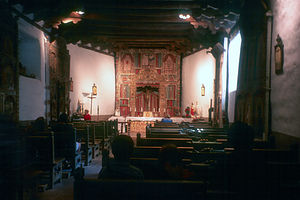 Sanctuario de ChimayoOur first stop was at the Santuario de Chimayo, a small Spanish church that has become known as the "Lourdes of America" because of its legendary healing powers. The story of the church is an interesting one. Back in the early 1800s, a friar approached a light he saw bursting from a hillside and found a crucifix in a hole. He removed the crucifix and brought it to Santa Cruz, but it kept disappearing and reappearing back in its original hole. Thinking that this was a sign of some sort, the crucifix was left in its original hole and a small chapel was built around it. That's when the miraculous healing began. So many people came to the chapel to be cured that in 1816 the small chapel was replaced with a larger adobe mission, which is the current Santuario de Chimayo.
Thinking a little miraculous healing would do us some good, we made a beeline for the small room off the sacristy which contained the hole where the crucifix was originally discovered. Supposedly, the dirt in here is the good stuff that has the power to heal, and no matter how much is removed, it miraculously replenishes itself.
We weren't sure just where to start. We had had a pretty rough start to our summer. Our trip this year almost didn't happen because of Herb's 4-week-long undiagnosable fever. During that time, he was poked and prodded by dozens of doctors unable to discover the source of his problem. One week it was thought to by lymphoma, the next prostate cancer. Then the fever just went away, and so did we. We just loaded up the RV, a month later than planned, and headed west. So now here we were in a Spanish mission in one of the most remote villages in New Mexico, poised in front of a pit of healing dirt--me a breast cancer survivor and Herb with some unknown ailment. Always the analytical ones, we were somewhat skeptical yet willing to give it a go. "How do we do this?" we wondered. What if we aren't actually sick now? Would it still work prophylactically? Do we have to rub the dirt on the site of the ailment? If so, who's going to put dirt on Herb's prostrate? And so on and so on. Finally, I discreetly reached down for some dirt and rubbed it on my chest. Herb still just stood there unsure of what to do. Not wanting to monopolize the healing dirt, I quickly picked up some more dirt and rubbed it on Herb's navel--close enough.
Back on the road to Taos, we continued our scenic drive through forests and small, remote hillside villages. It was really very pretty. As we neared the village of Pilar, we began looking for the road that would lead us up to the Taos Box Canyon West Rim trailhead, a mountain biking trail that sounded really great--7 miles along the very brink of the canyon's rim. Since the directions in the guidebook were pretty confusing, we stopped in a Bureau of Land Management Office where we spoke to a rather unfriendly Native American ranger. He gave us directions, which included mostly dirt roads, but assured us that it was RV friendly.
Naively, we believed him and turned off the High Road to Taos and onto the road he described. At first, the road was quite nice. It was paved and ran along the Rio Grande River past several nice places to camp. Then at the bridge, we turned north onto 567 as the ranger told us, rather than east towards Taos. That's when things got ugly. It had to be absolutely the worst road we have ever been on--dirt, practically straight up, and with turns so tight that Herb would yell, "Lean to the right! or Lean to the Left!" and we would scamper madly across the RV to help keep it from tipping. I admit to having some very uncharitable thoughts about the ranger around this time. To make matters worse, there was no going back--there was no place to turn around and backing down was completely out of the question. Having no choice, we continued the twisting climb out of the canyon. Finally, we reached the rim and the road leveled off. Now what? There was nothing up here--no people, no trees, no signs. After some futile attempts at finding the trailhead (and not really feeling comfortable about leaving the RV here unattended), we decided to forget about the mountain biking. "Let's just go to Taos," I said. Easier said than done. There was no way we were going to go back down the horrible road we just came up, and to get back across the Taos Box Canyon would take us over 50 miles out of our way.
Anyhow, that's how we missed Taos...
Description
The High Road to Taos is the most scenic route between Santa Fe and Taos. Starting from the village of Espanola it travels east on Route 76 to the village of Chimayo before heading north on Route 518. During its 54 miles, it winds through the Sangre de Cristo Mountains through small, isolated mountain towns that seem little changed since they were first settled by the Spanish centuries ago.
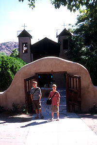 Boys at the SanctuarioOne of the most remote mountain villages along the drive is the village of Chimayo, where families still maintain the traditions of crafting hand-woven textiles, as their ancestors have been doing for 7 generations. Just one mile south of the town is the Santuario de Chimayo, an old Spanish chapel that is considered by many to be the "Lourdes of America" because of its legendary healing powers.
The history of the church is an interesting one. Around 1810, a Chimayo friar was performing penance when he noticed a light bursting from a nearby hillside. He followed the light, dug a hole and found a crucifix . He removed the crucifix and brought it to Santa Cruz, but it kept disappearing and reappearing back in its original hole. Thinking that this was a sign, the crucifix was left in its original hole and a small chapel was built around it. That's when the miraculous healing began. So many people came to the chapel to be cured that in 1816 the small chapel was replaced with a larger adobe mission, which is the current Santuario de Chimayo. Today more than 300,000 people a year visit the Santuario to dip their fingers in the healing dirt of the hole where the crucifix was originally found.
The drive continues north on 518 through more forests and remote villages. At the end of the High Road is Ranchos de Taos, where Georgia O'Keefe painted the 18th century mission church, San Francisco de Asis. From here Route 68 continues on into the village of Taos.
Santa Fe
Saturday, August 3, 2002 - 3:00pm by Lolo75 miles and 2 hours from our last stop - 2 night stay
Travelogue
I was really looking forward to visiting Santa Fe. We had spent the last week and a half touring places of natural beauty—which I truly love probably more than anything else—but now I was ready for the excitement and vibrancy that you can only find in a city. I think it’s the contrast that makes things interesting. Herb, however, would be perfectly happy if he never stepped foot in a city again—the natural wonders are enough for him. Anyway, since I’m the one that plans the trips, here we were.
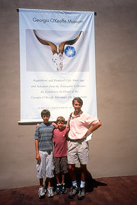 Herb and Boys at the Georgia O’Keefe MuseumOur first inclination was to find a campground as close to the city as possible. With this goal in mind, we headed to Babbitt’s RV Resort, which advertised that they were located right in town. They weren’t kidding—it was right on Business I25 with traffic roaring by. This just wouldn’t do, so we headed about 5 miles out of town to a more secluded, wooded campground called Rancheros de Santa Fe, which had a very pretty pool surrounded by an adobe wall (very southwestern), a rec hall where there were movies shown every night, and a nice hiking trail through the woods around the campground—definitely a much better selection. That night we watched a movie about Santa Fe, which helped us narrow down what we wanted to do the next day.
The next morning we set off early, eager to explore the old town of Santa Fe. Our first exposure to the town was driving along Canyon Road, an old Indian trail which is now a chic avenue lined with art galleries, upscale shops, and fine southwestern cuisine restaurants. Apparently, Santa Fe, with its natural and architectural beauty, has become an artist’s mecca and hundreds of them have come here to live and work.
We were quite pleasantly surprised that we were able to park our RV so easily in a lot right on the edge of the old part of town, in walking distance to everything. Cameras in hand, we set out on a walking tour of old Santa Fe where I was having a great time just wandering along the narrow streets, admiring the architecture. Everything was adobe—public buildings, churches, and even private homes.
Our first stop was the San Miguel Mission, the oldest church in North America--built in 1626. Of course it’s made of—you guessed it—adobe. The church was partially destroyed during the Pueblo Revolt and rebuilt again in 1710. This time, the Spaniards made it stronger, with thick walls and high windows. It’s a beautiful example of the Spanish mission churches of that time.
Our next stop was the Loretto Chapel, the Spanish church famous for its “Miraculous Spiral Staircase.” This staircase rises from the floor of the church to the choir loft in 360 degree spirals, with no visible means of support. According to legend, it was constructed by a carpenter who mysteriously appeared, built the staircase, and then disappeared without leaving his name or receiving pay. The staircase was quite beautiful and very amazing, but I was miffed by the pretty stiff admission price they charged to see it—I thought churches were supposed to be open to everyone.
Next we headed over to the heart of the old city, the Plaza, where we strolled through the aisles of vendors selling their wares—jewelry, clothing, arts and crafts, etc. We purchased some souvenirs to help us remember our visit to Santa Fe. Tommy bought a Native American dream catcher, which, according to legend, traps bad dreams and only allows good dreams to get through. He still has it hanging over his bed and I’ve never heard him complain of a bad dream since. Andrew purchased a decorated bunch of dried red chile peppers, called a ristra, which he still has hanging in his room to this day—minus a few chile peppers which have been eaten by some of this more daring friends. I chose a statue of Kokopelli, the hump-backed flute player that is sacred to the Native Americans of the Southwest. This cute little figure represents mischief and fertility, which, if you ask me, is a pretty dangerous combination. I think it made Herb pretty nervous.
Continuing through the Plaza, we were fortunate to find an unoccupied bench, where we sat for awhile and listened to a nearby band playing New Age music. I had never seen anyone play a pan flute before, so I was pretty mesmerized with its fascinating sound. Totally smitten with the whole Santa Fe experience, I’m sure I was grinning from ear to ear—much to Herb’s amusement.
Anxious to continue our Santa Fe experience with some genuine southwestern cuisine, we asked a local storekeeper for a recommendation for lunch. To our surprise, we were told that most restaurants were closed on Sundays. I would have thought that Sunday would have been a very big day for restaurants in the city—there certainly were enough tourists around. Finally, we were told about Cafe Pasqual’s, which was said to have excellent food, but very long waiting times for a table. They were right—the wait was over an hour. Fortunately, however, we were able to put our name on a list, leave to wander around some more, and come back at a designated time. When we returned, we were seated almost immediately in the noisy yet festive dining room, whose walls were covered with beautiful hand-painted Mexican tiles and murals. Everyone in the place seemed to be having a good time. The menu had some very interesting choices. I was glad the kids were willing to be a little more adventurous than their usual selection of chicken fingers and cheeseburgers—the fact that we were starving probably helped. We each ordered something different so that we could sample each other’s choices. All the dishes, however, had a common theme—chile peppers and more chile peppers. There was a choice as to how hot you wanted them, but none of us had the guts, or esophagus, to go for the hot ones. Everything was absolutely delicious. It definitely pays to take advantage of local knowledge when it comes to restaurant selection.
The last thing on our agenda was to visit one of the many museums in the city, but the problem was which one to choose. Being the multicultural city that it is, Santa Fe has dozens of museums representing the art and history of its three major cultures—Spanish, Mexican, and Native American.
We decided to visit the new Georgia O’Keefe Museum, because we were familiar with her work and very much admired her style. The museum, which was practically brand new, contains the largest collection of her paintings and sculptures in the world. Although we had seen many examples of her desert landscapes in books, it was a wonderful experience to actually see these works in person. Besides the familiar picture of the cow’s skull drying in the desert, we saw dozens of other less familiar, but no less beautiful, desert landscapes. It was definitely a worthwhile stop.
On the way back to the campground, we stopped to pick up some groceries. The only reason I mention this is that I was amazed at something I had never seen in a grocery store before—giant burlap bags full of peppers, the size of something you would see in the garden department at Home Depot. These people were really into their peppers.
That night we just hung around and enjoyed the campground, which really was quite lovely. After running on the trail that surrounded the campground, we went for a dip in the pool. Later, after dinner we roasted s’mores over a campfire. The kids even went to a movie in the rec hall. It was probably one of the nicest campgrounds we’ve stayed in.
It’s hard to really get to know a city in a day, but I think we really did get a good sampling. We had walked through most of the old town, toured a few old Spanish churches, shopped along the Plaza, sat in the park listening to New Age music, eaten some great southwestern food, and seen Georgia O’Keefe’s paintings of the New Mexican desert. It was definitely a place to come back to and explore deeper.
Description
The high desert city of Santa Fe (elevation 7,000 feet) is located about 50 miles northeast of Albuquerque, where the desert meets the ponderosa pine and aspen forests of northern New Mexico. Although the quickest way to reach Santa Fe is along I25, by far the most scenic route is the 48-mile Turquoise Trail, which winds through the foothills of the Sandia Mountains.
Santa Fe has the distinction of being the oldest capital city in the United States. The Palace of the Governors, the oldest building in Santa Fe, was built in 1609 and was the home to the provincial governors of New Spain for 200 years. It later housed three other seats of government--Mexican, Confederate, and American. Today, this beautiful adobe building houses a museum devoted to New Mexico history. In the portal outside the building, Native American vendors sell still their wares, much as their ancestors did in centuries past.
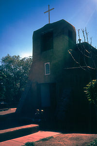 Old Church?The plaza, which runs along the south side of the Palace, has served as Santa Fe's village green for centuries. In fact, a stone marker in the southeastern corner of the plaza marks the official end of the 700-mile Santa Fe Trail, over which hundreds of pioneers and traders traveled in the early 1800s. Today it is still the vibrant heart of the city with outdoor performers and vendors selling everything from fine Southwestern art to kitsch.
Besides being the capital of New Mexico, Santa Fe is also its cultural center with hundreds of museums, art galleries, and live events. It is a very multicultural city, having been home to Spanish, Mexican, and Native American people for centuries. This mixing of cultures brings an interesting diversity to its history and art. Most of the art galleries are located on the plaza or along Canyon Road. In addition to the culture, people come to Santa Fee to enjoy its fine southwestern cuisine, lovely adobe architecture, and narrow cobblestone streets.
Here are just a few of the many things to see and do in Santa Fe:
- Palace of the Governors - oldest building in Santa Fe which today contains a museum of New Mexico history
- Santa Fe Plaza - vendors and outdoor performers along the oldest village green in the country
- San Miguel Mission - the oldest church structure in North America (built in the 1626)
- Loretto Chapel - contains the "Miraculous Staircase" which has 360 degree spirals and yet no visible means of support
- Canyon Road - narrow road (once an Indian trail) lined with art galleries and upscale shops and restaurants
- Georgia O'Keefe Museum - the 13,000 square-foot museum which houses a permanent collection of O'Keeffe's art
- Much, more
Tinkertown Museum / The Turquoise Trail
Saturday, August 3, 2002 - 11:00am by Lolo40 miles and 1 hour from our last stop
Travelogue
On our way to Santa Fe, we decided it was time to get off the Interstate onto the more scenic Turquoise Trail. This 48-mile road winds through pinyon pines and junipers through old mining towns, now populated with craft shops and New Age artists.
 As seen on TVAlong the drive we came across the very unique and entertaining Tinkertown Museum. Just one look at the outside of the museum told us just how different this place was going to be. There were wacky wood-carved characters sitting on the porch, and the walls of the building were made from thousands of glass bottles embedded in the concrete. Once inside, things got even more interesting. We were now wandering through a miniature wild-west town, populated with more than 1,200 hand-carved figures, many of which were animated. At the push of a button, many of the figures would come to life and start singing, playing instruments, or just going about their business. There was even an entire Circus carved in miniature. The amazing part was that all these wooden carvings had been done by one man--Ross Ward. What had started as a hobby in his teens became a life-long passion. Besides the miniature towns, there was much more to entertain us (for the mere price of a quarter), such as Esmeralda, the Fortune Teller, and Otto, the one-man band.
After leaving Tinkertown, we continued north on the Turquoise Trail. We would have loved to have taken the Sandia Crest National Scenic Byway, the 14-mile side road that climbs over 4,000 feet to the summit of the 10,678 foot high Sandia Crest, but unfortunately RVs and trailers were strongly discouraged. Instead, we continued on to Santa Fe.
Description
The Tinkertown Museum is located in Sandia Crest, New Mexico, on Rte. 14 (the Turquoise Trail). It's a private museum (admission fee), which contains a miniature western town and circus made of wood-carvings. The owner, Ross Ward, spent over 35 years carving and collecting over 1,200 figures to populate his miniature town. Parts of the town are even animated at the push of a button. There are other highlights here as well, such as a "bottle wall" made of 12,000 bottles pressed into cement
The Turquoise Trail is a 48 mile scenic drive, connecting Alburguerque and Santa Fe. Along the Trail there is a turnoff for the Sandia Crest National Scenic Byway, a 14-mile side road that climbs over 4,000 feet to the summit of the 10,678 foot high Sandia Crest. Unfortunately RVs and trailers are strongly discouraged.
Petroglyph National Monument
Saturday, August 3, 2002 - 7:00am by Lolo160 miles and 3 hours from our last stop
Travelogue
There's a lot to see and do along the section of I40 that goes through Arizona and New Mexico without straying too far from the highway, making it easy to break up a long driving day with some fun stops. Petroglyph National Monument, right outside of Albuquerque, was one of these.
 Herb and Boys on Petroglyph HikeAt the Visitor Center, we learned that the park contained more than 25,000 Native American and Hispanic petroglyphs, making it one of the largest petroglyph concentrations in all of North America. The ranger told us that the best way to see them up close was to hike one of the 3 paved trails in the Boca Negra Canyon section of the park just down the road from the Visitor Center.
We chose to hike the Mesa Point Trail, which started at the base of the mesa and climbed through a series of switchbacks to the summit. Along the way we saw enough petroglyphs for a lifetime. Most of the ones we saw were carved between 1300 and 1600 by the ancestors of today's Pueblo Indians. By chipping away at the desert varnish on the surface of these volcanic rocks, they created beautiful images in the lighter colored rock underneath. We saw images of birds, serpents, reptiles, spirals, and our unanimous favorite--Kokopelli, the hump-backed flute player. From the top of the mesa, there were tremendous views of the nearby Sandia Mountains and the outskirts of the city of Albuquerque. The whole hike took us about a half hour.
Description
Petroglyph National Monument, located right outside Albuquerque, contains one of the largest petroglyph concentrations in North America. Along the 17-mile West Mesa, there are more than 25,000 Native American and Hispanic petroglyphs etched into the dark boulders along the volcanic cliffs.
Long ago, people discovered that when they used a stone chisel and hammerstone to chip away at the thin desert varnish on these rocks, they exposed a lighter-color rock underneath. This provided the perfect surface for their rock art--or petroglyphs. The earliest rock images were made by nomadic people 2,000 to 3,000 years ago. However, the majority of the petroglyphs found here were carved from about 1300 through the late 1600s by the ancestors of today's Pueblo Indians and are referred to as the Rio Grande style of rock art. Images in the Rio Grande style include birds, serpents, reptiles, insects, spirals, and geometric designs. The best known image is that of Kokopelli, the hump-backed flute player.
The best place to observe these petroglyphs up close is the Boca Negra Canyon section of the park. From here, there are three paved trails of varying difficulty (from 5 to 30 minutes round trip) that provide plenty of opportunities for viewing petroglyphs--Cliff Base, Macaw, and Mesa Point. The Mesa Point Trail starts at the base of the mesa and climbs through a series of switchbacks to the summit of the mesa. Along the way there are numerous petroglyphs that you can observe up close as well as outstanding views of the Sandia Mountains.
Elephant Butte Lake State Park
Friday, August 2, 2002 - 8:30am by Lolo144 miles and 3.75 hours from our last stop - 1 night stay
Travelogue
We arrived at Elephant Butte Lake State Park early in the afternoon of a very hot day, ready for some refreshing water activities. At the park gate, we were informed that we had a choice of an established campground with electric and water hookups or that we could just drive on the beach and park anywhere. We all agreed that the beach sounded good.
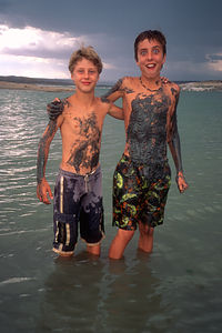 Muddy Butte BoysWe then began a stressful 2-hour search for a camping spot on the beach. Because of a multi-year drought, the water levels in the lake were way down leaving much larger but muddier beaches. After making several inquiries as to the best place to drive our RV on the beach, we were warned that it was all too common to have to be towed out after getting stuck in the sand. The kids kept pushing for a beach spot and we tried several times to drive onto the beach, but the sand soon turned too soft. We finally gave up and went to one of the established campgrounds overlooking the lake.
Although the views were good, we were really too far from the lake for easy access to swimming, especially since the lake levels were so low. We decided to ride the mountain bikes down to the beach for a swim. At first things went well, but then Andrew and I took a shortcut and sunk our tires about 8 inches into the mud. The mud was like quicksand and actually pulled our sneakers off so that we almost lost them. After quite a struggle, we finally managed to get our bikes and shoes to dry ground, but we were completely covered in mud.
Herb tried to package it as a spa mud treatment, but not buying it, I jumped in the lake to wipe it off as quickly as I could. The boys, on the other hand, felt that mud was a good thing and proceeded to smear even more of the stuff all over each other. To each his own.
Description
Elephant Butte Lake was created in 1916 by damming the Rio Grande River. This 43-mile long lake is the largest body of water in New Mexico and has more than 200 miles of shoreline. Its name comes from an elephant-shaped island in the southern end of the lake that was formed from the eroded core of a volcano.
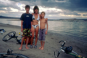 Lolo and Boys post mud bike ride This state park is very popular for fishing, boating, swimming, skiing, etc. There are designated camp sites as well as beach camping for those willing to chance the sand.
White Sands National Monument
Thursday, August 1, 2002 - 12:00pm by Lolo235 miles and 5 hours from our last stop - 1 night stay
Travelogue
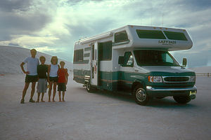 Family & Lazy DazeAfter prematurely aborting our hike in Guadalupe Mountains National Park because of the bugs and oppressive heat, we headed to our next destination, the fantastic white gypsum sand dunes of White Sands National Monument in Alamogordo, New Mexico. I must say that our drive there was fairly uninspiring—flat and dusty with oil derricks as far as the eye could see. This was definitely not one of the more scenic parts of the West.
As we approached White Sands along Highway 70, we noticed the signs warning that the highway could be closed for up to 2 hours when the White Sands Missile Range was performing missile testing. This was the site of the famous “Manhattan Project,” where the first atomic bomb was tested back in 1945. The Missile Range, which completely surrounds the National Monument, is still an active testing site for space technology and experimental weaponry. Fortunately, no testing was being done today so we were able to drive right on through.
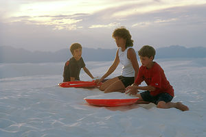 Lolo and boys on dunesSince the day was still oppressively hot and the sun was too high for good photography, we decided to drive right by the National Monument for now and come back later in the day when things had hopefully cooled down—as they usually do in the desert. About 20 miles north, in the town of Alamogordo, we found a great KOA campground where we took advantage of the pool for a good part of the afternoon. Feeling much refreshed, we were now ready to hit the dunes. After a brief stop at the campground store to rent some saucers (just like the kind you use in snow), we headed back down Highway 70 to the National Monument.
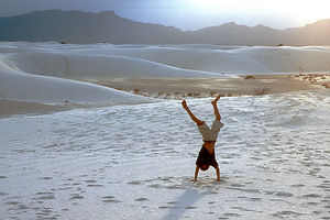 Andrew's dune handstandThe best way, and really the only way, to see the park is to drive the 8-mile scenic loop into the heart of the dunes. The road starts off paved, but soon turns to compacted white gypsum, yet still easy to drive on. We were definitely wise to wait for the low lighting. The landscape, or more correctly, moonscape, was eerie—miles and miles of brilliant white sand dunes surrounded in the distance by the peaks of the San Andreas Mountains. To make our experience seem even more otherworldly, there was not another soul in sight.
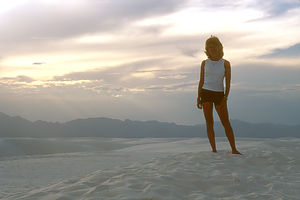 Lolo of the DuneAlthough I’m not usually a geology buff, I was curious as to how these gypsum dunes came to be. This is the condensed version of what I learned in the Visitor Center. The gypsum came from the rocks in the San Andreas Mountains which surround this basin. Rain and melting snow dissolved the gypsum in the rock and washed it down into Lake Lucero. When the water in the lake evaporated, the gypsum was left behind. Then the wind took over, blowing the crystallized gypsum over the desert covering everything in its path and creating the dunes. The wind is still doing its work, constantly changing the dunes and moving them up to 20 feet per year.
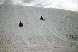 Boy's on saucers, zooming towards a Wal-MartNow that I understood the dunes better, it was time to experience them first hand. There were numerous places along the scenic loop to pull over and park. After spending far too much time in search of the perfect dune, we finally made our selection. The kids and I grabbed our saucers, and climbed to the top of a beautiful, brilliant white dune that must have been more than 50 feet high. Herb stayed at the base of the dune to set up his camcorder on a tripod, always ready to capture our family’s “Kodak” moments.
Once Herb signaled us for family fun to begin, we jumped on our saucers expecting to soar down the hill. However, to our dismay our saucers barely made it to the bottom. Undaunted, we tried again. We found that if we followed our tracks from the previous run, our speed gradually increased. Still not satisfied with our speed, we did something I’m embarrassed to admit. We sprayed Pam on the bottom of our saucers hoping to have the same effect that Clark Griswold had in Christmas Vacation when he almost flew through a Wal-Mart on his sled. Herb told me I was probably disrupting the delicate balance of the desert ecology by introducing vegetable oil to the environment. He made me feel quite guilty until I realized he was kidding. The spray definitely did help. We now were having some pretty good runs.
As the sun got lower, Herb and I sat on top of the dune with a glass of wine and watched an incredible sunset. Then, after much desanding—and believe me, it was everywhere—we drove out along the gypsum road in the twilight. What a truly spectacular place—unlike any other we’ve ever been to.
Description
White Sands National Monument, just west of Alamogordo in southern New Mexico, contains one of the most unique wonders of the Southwest—275 acres of glistening white gypsum sand dunes, the largest white gypsum dune field in the world.
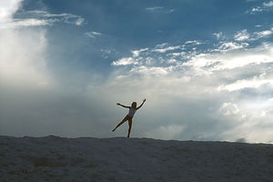 Lolo frolicking on dunesThese brilliant white dunes were formed over millions of years as melting snow and rain dissolved the gypsum in the rocks of the San Andres Mountains and carried it down into Lake Lucero. When the water in the lake evaporated, the gypsum was left behind. Gradually the strong southwesterly winds in the area blew the crystallized gypsum over the desert covering everything in its path and creating the dunes. These dunes are still constantly changing and advancing up to 20 feet per year.
The best way to see the dunes is to drive the 8-mile scenic Dune Drive into the heart of the dunes. The road is paved at first but then becomes compacted gypsum. Blowing sand usually covers the surface. There are numerous pullouts along the way to park your car and get out and climb the dunes.
The White Sands Missile Range, which completely surrounds the park, was the site of the "Manhattan Project" where the first atomic bomb was tested in 1945. It is still an important testing site for space technology and experimental weaponry. The National Monument and U.S. 70 are sometimes closed for up to 2 hours when testing is being done on the Missile Range.
Guadalupe Mountains National Park
Thursday, August 1, 2002 - 5:30am by Lolo35 miles and 0.75 hours from our last stop
Travelogue
Our drive from Carlsbad Caverns dipped back down into Texas and passed through the southeastern corner of Guadalupe Mountain National Park. Unable to just drive by a National Park Visitor Center without stopping, we pulled in to get some information about the park and to see if there was an interesting drive or hike to do for a few hours. We quickly learned that this is not a drive through park and that most of the good stuff was only reached by hiking long distances. In fact, the premier hike in the park is the strenuous 4.2 mile (one way) hike to the summit of Guadalupe Peak, the highest mountain in Texas. There was no way we were going to do that hike today--it was oppressively hot, it would take a good 8 hours, and we just weren't prepared.
 Family rejecting Lolo's hikeThe ranger suggested we hike the Devil's Hall Trail, which began at the Visitor Center and followed a streambed through Pine Springs Canyon to a natural rock staircase. It was fairly flat and about 4 miles roundtrip. Sounded like what we were looking for. Well, we didn't get too far. Less than a mile into the hike, Tommy kept swatting his neck and complaining about the bugs. The rest of us weren't being bothered by them, but they were swarming around Tommy. Poor Tom. Ever since he was little, he has been like a magnet for bugs. We tried to encourage him to go on, but he wasn't buying it--I don't blame him. We quickly hiked back to the RV, debugged him, and headed back into New Mexico on our way to White Sands National Monument.
Description
 Kid's climbing Rock!Guadalupe Mountain National Park in west Texas contains the southernmost and highest part of the Guadalupe Mountain range, which appears like a giant wall rising out of the desert. The Guadalupe Mountains are actually a 400-mile-long limestone reef that was formed about 250 million years ago when a tropical ocean covered most of this area. The reef was buried in sediment until forces uplifted the Guadalupes and exposed the limestone reef below. Geologists from all around the world come here to see one of the best examples on Earth of an ancient marine fossil reef.
Guadalupe Mountain National Park is not a highly visited park both because of its remote location as well as the fact that it is really a hiking park, with most of its treasures inaccessible by car. There are over 80 miles of hiking trails, the premier one being the hike to the summit of 8,749-foot high Guadalupe Peak, the highest mountain in Texas.
The park has three sections. The Pine Springs section, in the southeast, has a Visitor Center and campground and is the starting point for many hikes, including the one to Guadalupe Peak. The McKittrick Canyon section of the park, in the northeast,
is a 5-mile long canyon with streams and forests of maples and oaks, with brilliant colors in the fall. Dog Canyon in the north is wilder and more isolated with trails leading into the high country.
Carlsbad Caverns
Wednesday, July 31, 2002 - 5:45am by Lolo270 miles and 5.5 hours from our last stop - 1 night stay
Travelogue
 Water Slide We were on a roll now and truly felt that we were on vacation and ready for new experiences. Our next stop after a 5 hour drive was Carlsbad Caverns. As we usually like to do when we get to a new place, we checked into a campground so we didn't have to worry later about where we were going to spend the night. We chose White's City RV Park because it was the closest one to Carlsbad Caverns. Although the campground itself wasn't very scenic, it did have its advantages--a pool and a small water park.
Although our first choice of activities is usually enjoying natural beauty and wonders, the kids (and me) every once in a while need an amusement park fix. Herb was appalled at our decision to spend a few hours at the water park instead of getting to the caves, but he was overruled. The afternoon was hot, and the water slides were refreshing and exhilarating. All potential crankiness and whining was washed away and the family mood was much improved and ready for the next adventure.
 Dad and Kids in CaveWe headed over to the National Park to check out our options for exploring the caves. Unanimously, we decided on the self-guided tour of the Big Room, the largest and most famous of the caves, with a ceiling 25 stories high and a floor the size of 14 football fields. I think the kids briefly considered taking the elevator down into the Big Room, but then wisely came to their senses. Instead we followed the original explorer's route through the Natural Entrance of the cave, a steep 1-mile descent which winds 750 feet down into the Big Room--a much better choice.
As we descended the sharp switchbacks towards the Natural Entrance, we could feel the rush of cold air coming from the cave. We mistakenly thought the black birds swirling around the cave's entrance were bats, but then realized that the bats were still sleeping and these were just birds. Besides the rush of cold air, we immediately got a waft of the pungent smell of bat guano. It was eerie to think that somewhere above our heads, thousands of bats were sleeping and most likely manufacturing more guano.
Finally, after about an hour, we entered the Big Room, which was absolutely breathtaking. We spent the next hour wandering through the enormous chamber admiring the spectacular formations. As spectacular as the Big Room is, Andrew said he preferred Mammoth Cave because it was more natural and undeveloped. The Big Room had restrooms, an elevator, and even a cafeteria. You didn't get that same feeling of exploration as you did at Mammoth Cave. I, however, really felt that the formations at Carlsbad Cavern were more spectacular.
 Female BatsAfter dinner in the RV, we headed back to the Bat Amphitheater to wait for the evening flight of bats from the cave's Natural Entrance. Crowds gradually filled the large stone amphitheater built around the Natural Entrance while a ranger gave a short talk on bats. He told us what time they had appeared the previous evening so we waited anxiously as that time approached. Almost to the minute, a few bats appeared and began circling the entrance to the cave. Gradually, more and more streamed out of the cave and did their circling routine before heading towards the river to feast on insects. The whole mass exodus of a quarter million Mexican free-tail bats took about 20 minutes. It was absolutely mesmerizing to watch.
Description
Carlsbad Caverns National Park, in southern New Mexico, has one of the largest and most spectacular cave systems in the world. The park contains some 80 known caves that wind through the limestone of the Guadalupe Mountains.
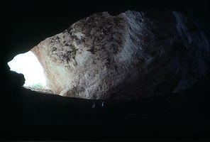 Cave entranceNative Americans had known about the caves for hundreds of years, but it wasn't discovered by white settlers until the 1880s. They discovered the caves because of the millions of bats that flew out of them each evening at sunset.
Jim White, a local cowboy and guano miner, began exploring the main cave in the early 1900s. As word spread, he began taking tourists through the caves. Carlsbad Caverns became a national monument in 1923 and a national park in 1930.
If you only have time to do one thing at Carlsbad Caverns, take the Natural Entrance into the cave, and hike the 750-foot descent into the Big Room. This is the largest and most famous of the caves, with a ceiling 25 stories high and a floor the size of 14 football fields. It is also the most accessible of the caves in that for those not physically able to hike from the Natural Entrance, there is an elevator that will take you directly into the Big Room from the visitor center. The fee for the self-guided Big Room tour was $6 for adults and $3 for children. Allow about 1 1/2 hours for the tour. The tour of the Big Room is a self-guided tour.
There are also several choices of ranger-guided tours through the various cave systems. There is a fee for each of these, and advanced reservations are recommended.
In addition to the cave tours, there is a ranger program offered each evening around 7:30 pm at the Bat Flight Amphitheater at the Natural Entrance. Every sunset from early spring through October, a quarter of a million Mexican free-tailed bats fly out of the Natural Entrance of the cave to begin their nightly hunt for insects.
Lake Colorado City State Park
Tuesday, July 30, 2002 - 12:00pm by Lolo550 miles and 10 hours from our last stop - 1 night stay
Travelogue
It was a long day of driving to get here, but for the first time this trip we got that exciting feeling of being somewhere very different from home. This was desert country with beautiful flowering cactus and little lizards scampering about.
 Lolo before Cactus ButtIt was early evening when we arrived, but still hot enough for an evening swim. We followed a path through the cactus down to the lake. Along the way, we encountered large groups of what looked to be fire ants, which we carefully avoided. It was a little hard getting into and out of the lake from the rocks at the edge, but the kids were much amused by my graceful entry.
After dinner, we strolled down to the fishing pavilion with the boys' rods. The lake is supposed to be especially good for catfish and large mouth bass, but we didn't have much luck. Tom even tried his expert fisherman form with a hint of butt-crack showing. Still no luck.
That evening and the next morning, we took some photos in the low light. We usually like to document our trips by taking a picture of the RV in a setting that we have enjoyed. We got a good one here. One word of caution. Do not squat down to take a picture when you are near cactus. I spent the next 3 hours picking tiny cactus barbs out of my shorts.
Description
 Brotherly love in Lake ColoradoLake Colorado City, one of Texas's 120 state parks, is a 500-acre park located on the southwestern corner of a 1600-acre reservoir. This reservoir, which provides water to power the largest power plant in western Texas, is also a great recreation spot for fishing, boating, and swimming. The park has three campgrounds.
Monroe's Shiloh Campground
Monday, July 29, 2002 - 8:30am by Lolo80 miles and 1.5 hours from our last stop - 1 night stay
Travelogue
After crossing the Mississippi River, we continued west on I20 to Monroe, Louisiana, where we chose to spend the night at the Shiloh Campground. Upon checking in, we were handed a flier warning us of Encephalitis and West Nile Virus from mosquitoes. This was a great start. Immediately, Tommy declared that he wasn't going to step out of the RV.
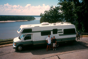 RV poised to cross the mighty Mississippi RiverWe managed to coax the kids out of the RV and we swam in a pretty nice campground pool, complete with slide. We also spent some time relaxing in the adjacent hot tub. Afterwards, the kids did do a little fishing in the lake, but unfortunately the only thing biting was the mosquitoes. So we called it an early evening and retired to the RV to watch a movie. We briefly left the safety of the RV again to do our ceremony of the placing of Louisiana on our U.S. map.
We were anxious to leave the mosquitoes and humidity of Louisiana behind the next day and head to the drier climate of Texas. I'm afraid we really didn't do Louisiana justice.
Description
The Monroe's Shiloh Campground was just a stopover on our way across Louisiana on I-20. The campground has a pool, hot tub, and small lake for fishing.
