- Home
- About
- Map
- Trips
- Bringing Boat West
- Migration West
- Solo Motorcycle Ride
- Final Family XC Trip
- Colorado Rockies
- Graduates' XC Trip
- Yosemite & Nevada
- Colorado & Utah
- Best of Utah
- Southern Loop
- Pacific Northwest
- Northern Loop
- Los Angeles to NYC
- East Coast Trips
- 1 Week in Quebec
- Southeast Coast
- NH Backpacking
- Martha's Vineyard
- Canadian Maritimes
- Ocracoke Island
- Edisto Island
- First Landing '02
- Hunting Island '02
- Stowe in Winter
- Hunting Island '01
- Lake Placid
- Chesapeake
- Provincetown
- Hunting Island '00
- Acadia in Winter
- Boston Suburbs
- Niagara Falls
- First Landing '99
- Cape Hatteras
- West Coast Trips
- Utah Off-Roading
- Maui
- Mojave 4WD Course
- Colorado River Rafting
- Bishop & Death Valley
- Kauai
- Yosemite Fall
- Utah Off-Road
- Lost Coast
- Yosemite Valley
- Arizona and New Mexico
- Pescadero & Capitola
- Bishop & Death Valley
- San Diego, Anza Borrego, Joshua Tree
- Carmel
- Death Valley in Fall
- Yosemite in the Fall
- Pacific Northwest
- Utah Off-Roading
- Southern CA Deserts
- Yosemite & Covid
- Lake Powell Covid
- Eastern Sierra & Covid
- Bishop & Death Valley
- Central & SE Oregon
- Mojave Road
- Eastern Sierra
- Trinity Alps
- Tuolumne Meadows
- Lake Powell Boating
- Eastern Sierra
- Yosemite Winter
- Hawaii
- 4WD Eastern Sierra
- 4WD Death Valley +
- Southern CA Deserts
- Christmas in Tahoe
- Yosemite & Pinnacles
- Totality
- Yosemite & Sierra
- Yosemite Christmas
- Yosemite, San Diego
- Yosemite & North CA
- Seattle to Sierra
- Southwest Deserts
- Yosemite & Sierra
- Pacific Northwest
- Yosemite & South CA
- Pacific Northwest
- Northern California
- Southern Alaska
- Vancouver Island
- International Trips
- Index
- Tips
- Books
- Photos/Videos
- Search
- Contact
Kanab - Kanab RV Corral
Friday, July 18, 2003 - 8:30am by Lolo66 miles and 1.5 hours from our last stop - 1 night stay
Travelogue
If you've ever watched old westerns in the movies or on TV, you've probably seen Kanab. The rugged scenery surrounding Kanab has been used so often as a Hollywood set for westerns that it is the image that probably most of America has of the "Wild West."
They're really into the cowboy thing here--even our campground in town was called an RV "corral." Although we were corralled in pretty close to our fellow RVers, it really was a very nice campground with one of the nicest campground pools I've ever experienced. We spent the afternoon lounging around the pool, planning our next day assault on Lake Powell.
Description
Kanab's location on U.S. 89 in Southern Utah makes it a popular stopover for people traveling to the Grand Canyon, Bryce, Zion, and Lake Powell, which are all within an hour and a half drive.
The beautiful scenery surrounding the small town of Kanab has made it the site of more than 150 western movies and TV series, such as Gunsmoke, The Lone Ranger, and F Troop. However, since most of the sets are located on private land, they are somewhat difficult to visit.
Cedar Breaks National Monument
Friday, July 18, 2003 - 4:00am by Lolo60 miles and 1.5 hours from our last stop
Travelogue
I think we would have appreciated Cedar Breaks much more if we hadn't just come from Bryce Canyon. Like Bryce, Cedar Breaks has a spectacular amphitheater filled with colorful hoodoos and interesting rock formations. However, unlike Bryce, there are no hiking trails that take you down and let you walk amongst the hoodoos. That's the part of Bryce that we loved so much.
Instead, visiting Cedar Breaks was more like a spectator sport. We drove the scenic 5-mile drive through the park stopping at the various overlooks along the way. The first one we stopped at was Chessman Ridge Overlook, where the rock formations below theoretically look like giant chess pieces. It was beautiful, but no matter how hard I tried, I just couldn't see it. I guess I don't have a very good imagination.
Our next stop was the Visitor Center near Point Supreme where there was a truly spectacular view of the amphitheater. Unfortunately, all the boys could work up was, "That's nice, but I like Bryce better." I think they're getting a little too jaded. If we had come here before Bryce, I'm sure it would have been a totally different experience. To the boys' relief, an approaching thunderstorm prevented us from hiking the 4-mile Spectra Point Trail along the rim.
What did interest Herb and the kids more than the amphitheater was a motor home identical to ours, right down to New Jersey license plates, parked in the lot near ours. This might not seem like a big deal, but Lazy Daze motor homes are somewhat rare, especially in the East Coast, and their owners tend to be a bit fanatical about them. Anxious to meet our New Jersey Lazy Daze brethren, we stalked the parking lot watching for their return. Upon their arrival, we greeted each other enthusiastically and spent the next half hour exchanging Lazy Daze stories--all of which were good. What really floored me was that they were traveling with 5 kids in a motor home that I found to be quite intimate with 2. I give them a lot of credit. They looked like they were having a really good time.
Description
Cedar Breaks National Monument, which is located in the southwestern corner of Utah, is very similar to Bryce with its fantastically-shaped, brightly-colored rock spires rising out of a giant amphitheater. However, the elevation here is 2,000 feet higher than Bryce, peaking at 10,662 feet at the highest point on the rim.
The 3-mile across, 2,500 foot deep amphitheater was carved out of the Markagunt Plateau by millions of years of uplift and erosion. Like Bryce, the amphitheater is filled with an intricate maze of hoodoos ablaze in colors from warm yellows and oranges to more dramatic pinks and reds.
There is a five-mile scenic drive through the park that has four spectacular overlooks, each with a different perspective of the amphitheater, From the Visitor Center you can take a short walk out to Point Supreme or the longer 2-mile Ramparts Trail along the plateau rim to Spectra Point. Both provide incredible views into the amphitheater.
Bryce Canyon National Park
Thursday, July 17, 2003 - 3:00am by Lolo23 miles and 0.75 hours from our last stop - 1 night stay
Travelogue
Bryce Canyon is up there on my list of top ten favorite places to visit--definitely a place to come back to again and again. Although this was our 3rd time here and the kids' 2nd, we were probably even more excited about stopping here than the 1st time because we knew of the magic in store for us.
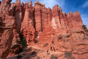 Lolo and the boys hiking out of the canyonThere are lots of beautiful places in the west, but there is something special about Bryce--something unique and somewhat unreal. It's also a lot less intimidating than places like the Grand Canyon and much easier to explore. You can just sit on one of the benches on the edge of the rim and gaze down into the hoodoos in the amphitheater below, or if you're more adventurous, you can hike down into the canyon from one of the trails from the rim and wander around among them. We spent lots of time doing both.
This trip, we were lucky enough to get a campsite in the park at Sunset Campground, in walking distance to the rim.
We chose to do the same hike that we had done on our last visit (it really is the best hike down into the canyon), but this time in the recommended reverse direction. Believe it or not, going in the opposite direction makes it seem like a completely different hike. We started this time from Sunset Point and followed the steep switchbacks of the Navajo Trail down through the narrow walls of the canyon into the amphitheater. From there we connected to the Queen's Garden Trail which brought us to some of the park's most interesting hoodoos, including one that actually does look like Queen Victoria sitting on her throne. From there we followed the trail up to Sunrise Point and then walked along the Rim Trail back to the RV.
 Sleepy family at sunrise on the rimAfter dinner that evening, we walked back to the rim and watched as the colors changed from the warm yellows and oranges of daylight to the more dramatic pinks and reds that come with the setting sun.
On the drive out the next morning, we just had to stop for one more peek from the rim and a few more pictures. The early morning light was just as good as last night's sunset.
What a great place! I'm sure we'll be back again.
Description
Bryce Canyon National Park, which is located in southern Utah, is a geological fairyland, an intricate maze of wondrous shapes and formations. The oddly shaped pinnacles of rock, called hoodoos, display a mysterious blend of colors--warm yellows and oranges, and more dramatic pinks and reds--that provide a continuous show of changing colors with the rising and setting sun.
 Bryce amphitheaterLike Zion National Park, Bryce is part of the Grand Staircase, which is a series of plateaus formed by the uplifting and tilting of the Colorado Plateau millions of years ago. Bryce occupies part of one of these plateaus of the Grand Staircase called the Paunsaugunt Plateau. Bryce Canyon is not really a canyon at all, but rather a series of amphitheaters cut into the Pink Cliffs of the Paunsaugunt Plateau by millions of years of erosion from flowing streams. The centerpiece of the park is the 6-mile square Bryce Amphitheater with its intricate maze of whimsically-shaped hoodoos.
The rock spires (hoodoos) are the result of erosion in rock layers that vary in hardness. When water flowed through the cracks in these rocks, the softer rock wore away leaving behind the harder, erosion-resistant caps. The ongoing cycle of freezing and thawing continues to dissolve the softer rock, constantly changing the shape of the hoodoos. This continuous erosion is also causing the plateau cliffs to recede at the rate of about one foot every 60 years.
 Colorful hoodoos in the amphitheaterBryce is much smaller and less intimidating than Zion and the Grand Canyon and much easier to explore. You can stand at the edge of the plateau rim and gaze down into the maze of hoodoos below or descend the trails from the rim and wander around among them. There are several good hiking trails. The Rim Trail runs 5.5 miles along the edge of the canyon, rather than taking you down into it, providing splendid views from above. Another great choice for a hike is the Queen's Garden Trail down into the canyon itself. Or if hiking isn't your thing, you can take the 17-mile scenic drive through the park, stopping at the numerous viewpoints along the way. You can either take your own vehicle or the free shuttle bus.
There are 2 campgrounds in the park. Both of them work on a first-come first-serve basis.
Kodachrome Basin State Park
Wednesday, July 16, 2003 - 9:00am by Lolo208 miles and 6 hours from our last stop - 1 night stay
Travelogue
 Lolo being playful with Big StoneyIt's hard for me to think of Kodachrome State Park without getting this stupid grin on my face. The park is very beautiful and has over 60 beautiful, multicolored rock pillars called sand pipes that are found nowhere else in the world. The most prominent and by far the most interesting sandpipe is the very large, anatomically correct, phallus-shaped one that overlooks the campground. And as if that wasn't amusing enough, its name is "Big Stoney." It functioned like a magnet. No matter how hard I tried, my beach chair would always wind up being oriented right towards it. I think Herb was starting to get a bit insecure.
Seriously though, the park is a real gem and much less crowded than nearby Bryce. The campground is located in one of the most spectacular settings I've ever camped in--a beautiful natural amphitheater with views on all sides. There are only 27 sites, but we had no trouble getting one. I think it was because there were no hookups and most people don't like to primitive camp.
 Lolo hiking the Eagle's View TrailAfter Herb pried me away from my beach chair, we headed out on our mountain bikes to explore some of the other less graphic sandpipes. Fortunately, the Panorama Trail, which we wanted to go on, allowed mountain bikes. It was the only trail in the park that did, but at least they had one. National Parks don't allow mountain biking at all on any of their trails. The trail took us through a pretty valley with some very colorful and interesting sandpipes, such as the Ballerina Slipper spire and a series of wide-brimmed pedestals called the Hat Shop. Very nice and what was even better--we didn't see another soul the entire time.
On the way back, we stopped at the camp store for some ice cream and had to search out back for someone to wait on us. Finally, we found a nice old lady that ran the place by herself. At first, we felt bad that she might be lonely out here, but after talking to her we realized that she was quite content with her remote surroundings. The town of Cannonville was only 6 miles away so that gave her a chance to be around people whenever she chose to. She told us about a Root Beer and Fiddler Festival they were having in town that weekend and said that she hoped we would be able to stay around for it. I really wish we could have. I think it would have been fun.
 Nice Campsite in Kodachrome BasinThe next morning while the kids slept in, Herb and I hiked the Eagle's View Trail, a trail that I had read about and very much wanted to do. The guidebook described the trail as strenuous, narrow, and exposed. They weren't kidding. As we climbed higher up the 1,000-foot, steep cliff face, the trail eventually narrowed to less than a foot wide, with a very steep drop-off. Herb kept pointing out the spectacular view in an attempt to take my mind off of the possibility of my imminent death. "Look you can see the campground and the RV," Herb said pointing at what looked like a matchbox car. Not even "Big Stoney," which from this height wasn't all that big, could cheer me up at this point. I realized that the trail really was quite visible from the campground. In fact, if the kids had woken up and looked out the window, they could have seen their mother crawling on all fours along the face of the cliff in front of the RV. Not a very pretty sight. Fortunately, they didn't.
Description

Geologists believe that these sand pipes are actually solidified sediment that filled ancient geysers and springs and was left standing after the softer sandstone surrounding it eroded away. They vary in size from 6 feet to nearly 170 feet high and their colors vary from soft whites and yellows to more dramatic pinks and reds. The most interesting rock spire of all is "Big Stoney," a phallus-shaped sand pipe overlooking the campground. After doing an article about this park in 1949, the National Geographic Society named it Kodachrome Basin because it's a photographer's paradise.
Kodachrome Basin has several short trails that lead to the most scenic view points. The Panorama Trail loops 3 miles through a valley with colorful sand pipes and interesting rock formations such as the Ballerina Slipper spire and the wide-brimmed pedestals in the Hat Shop. This is the only trail on which mountain biking is allowed. The ¾ mile Eagle's View Trail takes you 1,000 feet up steep cliffs overlooking the campground for tremendous views from the overlook. It is quite strenuous, narrow, and exposed.
The park has a 27-site campground located in a natural amphitheater right by "Big Stoney." Except for busy summer weekends, there are usually sites available.
Huntington State Park
Tuesday, July 15, 2003 - 10:30am by Lolo178 miles and 3.75 hours from our last stop - 1 night stay
Travelogue
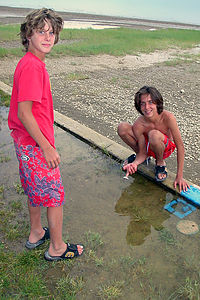
After the previous day of very successful fishing at Flaming Gorge and the thrill of eating their own catch, the boys had become a lot more interested in fishing. In fact, they were quick cocky about their ability. "Don't bother cooking me any dinner," Tommy informed me. "I'll be catching and cooking my own." Sounded good to me.
I went off for a run around the lake while Herb and the boys went to try their luck. After a while, Herb came back, empty handed. Andrew and Tommy stayed on, however, determined to repeat their experience from the day before. Finally, they returned grinning and displaying Tommy's catch--a 3-inch small mouth bass. Undaunted, Tom proceeded to fillet it (it was now down to 2 inches), season it, wrap it in tin foil, and throw it on the grill. I admired his determination.
We watched in amusement as Tom sat down to his feast, which had now shrunk to about 1 ½ inches. After chewing for far too long, he looked up and said the words I thought were coming, "What's for dinner?"
We barbecued a non-fish dinner that night and took a dip in the lake before settling down to a cozy night in the RV.
Description
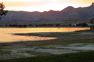
Flaming Gorge National Recreation Area Dam
Monday, July 14, 2003 - 4:00am by Lolo55 miles and 1.5 hours from our last stop - 1 night stay
Travelogue
If I had to pick one activity that we as a family enjoy more than any other, it would have to be river rafting. Combine that with some world-class trout fishing, and I think we were headed for a near perfect day.
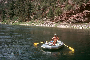 Herb and his trusty rubber boatOur first order of business was figuring out the logistics of getting back to our RV after we finished rafting. Rather than hitchhiking back, as we have done in the past, we stopped at the Dutch John Store and arranged for an outfitter to drive our RV from the put-in point right below the dam to the take-out at Little Hole, seven miles down the river. We were just expecting to arrange for someone to pick us up at Little Hole and drive us back upriver, but this was the way they did it here. I wasn't sure if Herb was going to go for the idea of turning over our RV to total strangers, but they seemed quite professional and they did it all the time. So we left them an extra set of our keys and headed down to the put-in point just east of the dam.
Although it was a Monday, the launch was still a very busy place. We had purposely planned to do this on a weekday, because we had heard that it gets very crowded on the weekends. The 7-mile stretch of river between the Flaming Gorge Dam and Little Hole is probably one of the most popular river trips in all of Utah. Besides the wonderful fishing, there were ten Class II rapids along the way to make the trip exciting.
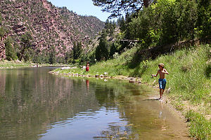
The river was moving along quite swiftly--so swiftly, in fact, that our trip would be done in under 3 hours if we just let the raft go. That just wouldn't do, so we took as many opportunities as we could to pull over and fish. Our first stop was a large rock in the middle of the river probably less than 500 yards from the put-in. We each claimed a portion of the rock and started casting, fully expecting trout to practically jump onto our lures. Just as Herb was commenting on the poor quality of one of my less than perfect casts, in which my lure barely reached the water 15 feet in front of me, I felt a tug on my line. Herb ate his words as I pulled in our first trout of the day, a 20-inch keeper.

The scenery along the way was beautiful and since I had already caught my dinner, I was ready to just sit back and enjoy the ride and watch the rest of the family obsess over catching a trout. Finally, a few fish were pulled in, but unfortunately they were in that off-limit 13 to 20 inch range. The kids were getting pretty frustrated. They would catch a trout, hold it up to the measurement lines they had drawn in the sand--pulling a little hard on either end of the fish to stretch it as much as possible--and then throw them back in disgust. None of them was going to leave this river until they each had a fish for dinner.
It was getting a little late on the river, but finally everyone did catch a keeper (after some aggressive stretching). As we approached Little Hole, Herb was relieved to see our motor home sitting safely in the parking lot--much better than having to hitchhike back to retrieve it.
We drove back to Dutch John and got a campsite at Mustang Ridge, one of the Flaming Gorge campgrounds. Although the campground overlooked the lake, there were actually only a few sites that had a decent view. However, since it was already getting dark and all we wanted to do was fillet and cook our fish, it didn't matter much to us.
I astutely excused myself from the fish cleaning process and went inside the motor home to prepare some rice and veggies. When I went out to check their progress, I found each of the kids cleaning and filleting their own fish, hands covered with blood and fish guts. I wasn't surprised at Andrew. Ever since he was little, he had never been squeamish about dealing with fish, but Tommy was another story. Up until today, he wouldn't even remove a fish from his hook. Now he was really getting into it.
Finally the fish were cleaned and they had some very nice looking fillets. They each seasoned theirs to their own tastes, wrapped them in tin foil and put them on the grill. By the time we ate dinner that night it was close to 10:00--much too late, but nobody cared.
Moments like this don't happen every day..
Description
Flaming Gorge Reservoir is a 91-mile long lake that was created by damming the Green River. It is surrounded by spectacular scenery--fiery red canyons and mountain ranges. Although the majority of the lake is in Wyoming, most of the campgrounds and facilities are in the Utah section of the lake. The reservoir is popular for boating, swimming, and fishing.
Below the dam, the Green River is a great place to raft. The 7-mile section of the river from the dam to Little Hole is extremely popular and has some of the best trout fishing in the West. Along this stretch there are ten Class II rapids, which makes it fun but also easy enough to navigate without a guide.
The put in is located at the end of a 1.4 mile road off of 191, 1/3 mile east of the dam. The parking area is small and is for unloading boats and passengers only. Vehicles must be parked .7 miles back up the road.
Raft rentals and shuttle services are also available at Flaming Gorge Recreation/Dutch John Service at the turnoff for Dutch John on 191.
Flaming Gorge National Recreation Area - Fire Hole Canyon
Saturday, July 12, 2003 - 10:30am by Lolo475 miles and 8.25 hours from our last stop - 2 night stay
Travelogue
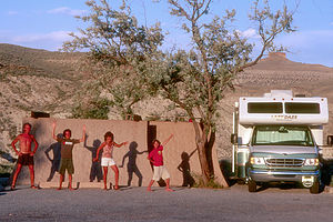 Foolish Egyptian Family ShadowsFlaming Gorge is one of those undiscovered treasures that I hesitate to rave about because selfishly I prefer that they remain just that--undiscovered. However, since I highly doubt that my reflections are going to rock the travel industry, I'll take my chances.
In my opinion, Flaming Gorge has some of the most spectacular scenery in the West--sheer red cliffs dropping 1,300 feet down into the waters of the reservoir, fiery red canyons, intriguing chimney rock formations, etc., etc, Now here's the best part--there's practically nobody here, especially in the northern Wyoming section.
We had briefly gotten a glimpse of the southern section of Flaming Gorge two years ago on one of our cross country trips and promised ourselves that we would come back some day and spend more time here.
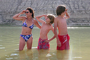
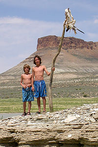
There wasn't much daylight left, so we quickly hopped on our bikes and followed a winding dirt road down to the river. There wasn't another soul in sight. The evening was hot and the water was warm, so we jumped in for a quick dip before biking back up to the campground.
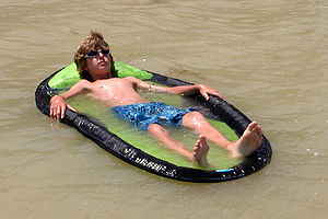
That whole day, we saw only one other boat, but still we were far from being alone. There were cows grazing along the river, hundreds of tiny black birds flitting in and out of holes in the cliff walls, and prong-horned antelope running through the tall grass along the sandy shore. And who says there is no entertainment for kids. Do you have any idea how well cow pies skip on water? Or how fun it is to come upon the intact skeleton of an antelope and the remains of a very large pelican? Or to float on your back and watch clouds float over the rim of the canyon?
That night the boys were quite resourceful in their attempts to make a campfire. Having no firewood, they did what any self-respecting pioneer boy would do--burn cow pies. That's right, cow pies have been used as a source of fuel for more than a century. I made sure that I sat upwind from the fire. We stayed up later than usual that night to watch the full moon rise over our chimney rock. It really doesn't get much better.
Description
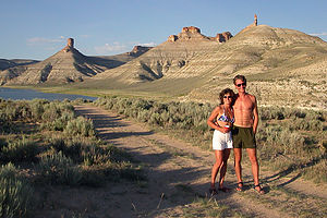
Firehole canyon is located in a very remote, not highly visited section of the NRA. Facilities include a boat ramp, picnic area, and a 40-site campground. The campground overlooks the lake and many unique and colorful chimney-shaped rock formations, which gave Firehole Canyon its name. Each camp site also has a 3-sided stone structure around the picnic table to provide some shade from the intense summer heat.
Lake McConaughy State Park
Friday, July 11, 2003 - 8:00am by Lolo421 miles and 7 hours from our last stop - 1 night stay
Travelogue
This was not our first time to Lake McConaughy, nor I am sure will it be our last. We had first discovered Lake McConaughy on our 2001 trip and had found it to be a great first highlight on a cross country trip to the West. It's right along Route 80 near the northeast corner of Colorado, so it isn't even out of the way.
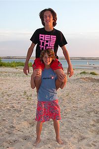
When we arrived, we were surprised to see how low the lake was compared to the last time we were there. Apparently, they were going on their fourth year of drought and Wyoming was being stingy with how much water it was letting out through its dams to flow into Nebraska.
The last time we were here we had primitive camped right on the beach and really loved it. However, with the lake down so low, making the beaches much wider, we were having such a hard time finding sand hard enough to make us feel comfortable about driving on that we decided to try one of the developed campgrounds on the asphalt.
Before committing to staying there, we decided we would try to see how difficult it was to get to the lake from our campsite. As we started walking through the tall grass from our RV, a pickup truck pulled over and said, "You're not from around here, are you?" What was that supposed to mean? Were we that obviously out-of-state tourists. The gentleman in the car then proceeded to tell us that in Nebraska you never walk through tall grass--it's full of rattlers. Oh, great! A campsite without lake access just wasn't gonna cut it, so we got back in the RV to search once again for a primitive site on the beach.
We finally did find a nice spot under some cottonwood trees right off the asphalt. Although it was about a 200 yard walk to the lake, at least we wouldn't be cheating death every time we wanted to swim. Since it was already late afternoon, we immediately headed to the water where we spent the next few hours enjoying the warm waters of the lake. It really is a great place.
That night we barbecued under the cottonwood trees and afterwards had a family game of Frisbee golf. The kids had recently learned this game from their uncle, who claims to have invented it, but I'm not so sure. You basically play it like mini golf, except you use a Frisbee to hit different objects that represent the holes. It's really quite fun and can pretty much be played anywhere.
As always, Lake McConaughy was a great stop and one that I'm sure we'll be back to on our next trip out west along I80. I just hope that the lake is still here. What a shame it would be to lose a place like this.
Description
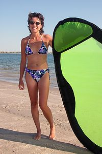
To Nebraskans, the main attraction of Lake McConaughy is water activities--swimming, boating, windsurfing, skiing, and world-class fishing. Trophy size catfish, walleye, stripers, bass, and trout have been caught in "Big Mac."
The park has 200 tent and RV sites. However, most people choose to primitive camp right on the beach at the water's edge. Camping is on a first-come first-serve basis.
Flying J - Toledo
Wednesday, July 9, 2003 - 2:00pm by Lolo549 miles and 11 hours from our last stop - 1 night stay
Travelogue
There's nothing like the feeling you get when you pull out of your driveway and head out on a road trip. All the hard work has been done: the trip has been planned, the RV is stocked with groceries, and everything is packed (hopefully). There is only fun and adventure ahead for the next few weeks. You're packed into tight accommodations with the people you love the most, who now are forced to spend quality time with you whether they like it or not. Excitement and anticipation is high as you head out, unsure of what the next few weeks will bring.
Since most of our trips are to the west, we always start out with some long driving days. Rather than pull into a commercial campground, we usually look for an all night Wal-Mart or a Flying J Travel Plaza. Both allow you to park overnight. I prefer the Flying J's because you feel much more secure in an area designated for overnight RV parking than you do in a Wal-Mart parking lot. Since all we need to do is sleep, these places are perfect. Once you pull the shade in the RV down, you can imagine that you're anywhere. On this particular trip, we were heading west on Route 80, so we drove 9 hours and stopped at a Flying J outside of Toledo, Ohio.
The kids always have to go into the Flying J store to see what kind of candy and junk they can buy. There is always an odd assortment of stuff on sale outside the store. This time there were electric scooters on sale for $199. I had to break it to the kids that dad wouldn't be very happy trying to fit 2 electric scooters in the RV. While I was using the phones to call home, Tom decided to try his luck on one of those machines that you use a crane to pickup some stupid toy that you don't want anyway. I interrupted my phone conversation to tell him not to bother since you never win anything good in those machines anyway. A few minutes later, he walked by me grinning and holding a really cute 2-foot high gorilla that he named Flying Joe. So much for teaching him a lesson about gambling.
I think some of my happiest moments on an RV trip are these first nights in a truck stop. The whole trip is ahead of us, spirits are high, and we haven't gotten on each other's nerves yet.
Description
Flying J's are Travel Plazas that cater to truckers and RV's. Their numerous services include gas, a dump stations, propane, fast food restaurant, limited groceries, and even showers and a barber shop. However, the best feature of all is the RV section that allows overnight parking.
They are conveniently located on most of the interstates (except for the East Coast)
Home
Saturday, August 17, 2002 - 9:00am by Lolo460 miles and 7.5 hours from our last stop - 1 night stay
Travelogue
Well we made it home safely--just a little over 3 weeks on the road. We had seen some pretty wonderful places and had some memorable times.
Our first totally "wing it" trip with no itinerary set in stone had been a definite success--an approach I'm sure we'll take again next year, wherever our travels lead us.
Description
Our home in Upper Saddle River, a suburb of New York City.
