- Home
- About
- Map
- Trips
- Bringing Boat West
- Migration West
- Solo Motorcycle Ride
- Final Family XC Trip
- Colorado Rockies
- Graduates' XC Trip
- Yosemite & Nevada
- Colorado & Utah
- Best of Utah
- Southern Loop
- Pacific Northwest
- Northern Loop
- Los Angeles to NYC
- East Coast Trips
- Martha's Vineyard
- 1 Week in Quebec
- Southeast Coast
- NH Backpacking
- Martha's Vineyard
- Canadian Maritimes
- Ocracoke Island
- Edisto Island
- First Landing '02
- Hunting Island '02
- Stowe in Winter
- Hunting Island '01
- Lake Placid
- Chesapeake
- Provincetown
- Hunting Island '00
- Acadia in Winter
- Boston Suburbs
- Niagara Falls
- First Landing '99
- Cape Hatteras
- West Coast Trips
- Burning Man
- Utah Off-Roading
- Maui
- Mojave 4WD Course
- Colorado River Rafting
- Bishop & Death Valley
- Kauai
- Yosemite Fall
- Utah Off-Road
- Lost Coast
- Yosemite Valley
- Arizona and New Mexico
- Pescadero & Capitola
- Bishop & Death Valley
- San Diego, Anza Borrego, Joshua Tree
- Carmel
- Death Valley in Fall
- Yosemite in the Fall
- Pacific Northwest
- Utah Off-Roading
- Southern CA Deserts
- Yosemite & Covid
- Lake Powell Covid
- Eastern Sierra & Covid
- Bishop & Death Valley
- Central & SE Oregon
- Mojave Road
- Eastern Sierra
- Trinity Alps
- Tuolumne Meadows
- Lake Powell Boating
- Eastern Sierra
- Yosemite Winter
- Hawaii
- 4WD Eastern Sierra
- 4WD Death Valley +
- Southern CA Deserts
- Christmas in Tahoe
- Yosemite & Pinnacles
- Totality
- Yosemite & Sierra
- Yosemite Christmas
- Yosemite, San Diego
- Yosemite & North CA
- Seattle to Sierra
- Southwest Deserts
- Yosemite & Sierra
- Pacific Northwest
- Yosemite & South CA
- Pacific Northwest
- Northern California
- Southern Alaska
- Vancouver Island
- International Trips
- Index
- Tips
- Books
- Photos/Videos
- Search
- Contact
Bodie State Historic Park
Saturday, September 16, 2017 - 2:45pm by Lolo32 miles and 1.5 hours from our last stop
Travelogue
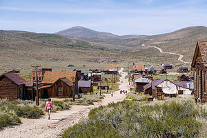 Bodie Ghost TownWe had been to Bodie State Historical Park once before, but this time we would approach it the way the old prospectors did - over a mountain on a rough backcountry road past abandoned mines, and even a genuine cattle drive, but I’ll get to that later.
Rather than taking 395 south to the the paved 270 into Bodie, we headed north and turned onto Masonic Road. From here, we spent the next 32 miles driving up and down the rolling Bodie Hills, past old ghost towns and abandoned mines, with sweeping views of the Sierra and the Sweetwater Mountains all along the way. It was breathtaking.
Like ski runs,4WD roads are graded in terms of difficulty - Green for Easy, Blue for Intermediate, and Black for “no thank you.” This was a Green and the 4Runner handled it like a champ.
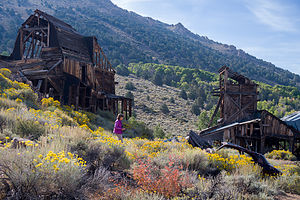 Abandoned mine along the road to BodieWe stopped several times along the way to wander amongst the old mining sites, many of which still had quite a few structures and equipment to poke around. It was really fascinating to imagine what a bustling place this must have been during the heyday of the Gold Rush. For now, we pretty much had the road entirely to ourselves, well almost.
Probably about 5 miles or so outside of Bodie, we saw a huge cloud of dust and dirt ahead. Not sure what to expect, we pulled as far as we could to the side of the road. As the noisy cloud approached, we started to hear the lowing of cows. Apparently, we had gotten ourselves into a traffic jam with a genuine cattle herd being prodded along by a genuine cowboy. I am not sure who was more confused - us or the cattle. They practically came up to our windshield to observe what I guess they thought were the oddities along this road. They certainly did outnumber us.
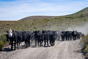 Traffic jam on the road to BodieOnce they had passed, we cleaned our windshield of dust and continued on our way. Before long, the many surviving structures of the old town of Bodie lay before us. What an awesome way to arrive.
For anyone traveling on 395, I highly recommend a side trip to Bodie State Historical Park. I believe it is the best preserved ghost town in all of California, if not the entire West.
The town rose to prominence when mining along the western slope of the Sierras declined, and prospectors moved to the eastern side to search for gold. Sure enough, in 1859, W.S. Bodey and his buddy E. S. “Black” Taylor stumbled upon gold in the hills north of Mono Lake, amounting to millions of dollars in gold and silver. Unfortunately, Bodey froze to death in a blizzard while returning with supplies and never got to enjoy his new-found wealth. The town, with a slight spelling change, is named for him.
Things slowed down for a bit in the 1860s, but then in the mid-1870s a rich strike was made by the Standard Mining Company in the Bodie Hills. Word spread, sparking a rush of people to Bodie. By 1879 the town had a population of about 10,000 people and more than 2,000 buildings, primarily general stores, dance halls, and saloons to keep the miners supplied and entertained. Bodie soon developed a reputation for wildness and lawlessness.
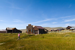 Lolo loose in BodieHowever, by 1881, the mines were depleted and miners and business people left Bodie to follow the next strike. By 1886, the town’s population had fallen to 1,500 people. In the 1890s, the use of electricity as a source of cheap power made mining here profitable again and temporarily boosted it. However, a fire in 1932 destroyed 90% of the town.
Bodie faded into a ghost town in the 1940s. Fortunately, in 1962, the town was designated a National Historic Site and a State Historic Park and its buildings are preserved in a state of “arrested decay.” The interiors of the buildings are maintained as they were left, still furnished and stocked with goods.
It’s a very poignant experience wandering the deserted streets, peeking in windows, and imagining the lives of those that once lived, played, worked, and died here not all that long ago.
Description
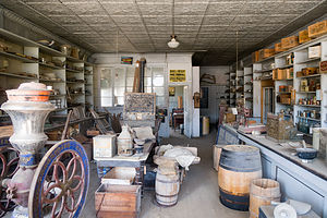 Bodie General StoreBodie State Historic Park is a genuine California gold-mining ghost town. The town rose to prominence when mining along the western slope of the Sierras declined, and prospectors moved to the eastern side to search for gold. A huge strike in Virginia City, the Comstock Lode, brought a wild rush to the high desert country along the eastern Sierras.
In 1859, W.S. Bodey and E. S. “Black” Taylor stumbled upon gold in the hills north of Mono Lake, amounting to millions of dollars in gold and silver. Unfortunately, Bodey froze to death in a blizzard while returning with supplies and never got to enjoy his new-found wealth. The town, with a slight spelling change, is named for him.
Things slowed down for a bit in the 1860s, but then in the mid-1870s a rich strike was made by the Standard Mining Company in the Bodie Hills. Word spread, sparking a rush of people to Bodie. By 1879 the town had a population of about 10,000 people and more than 2,000 buildings, primarily general stores, dance halls, and saloons to keep the miners supplied and entertained. Bodie soon developed a reputation for wildness and lawlessness.
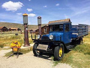
However, by 1881, the mines were depleted and miners and business people left Bodie to follow the next strike. By 1886, the town’s population had fallen to 1,500 people. In the 1890s, the use of electricity as a source of cheap power made mining here profitable again and temporarily boosted it. However, a fire in 1932 destroyed 90% of the town.
Bodie faded into a ghost town in the 1940s. Fortunately, in 1962, the town was designated a National Historic Site and a State Historic Park. Today visitors can walk the streets of this deserted town, which has been preserved in a state of “arrested decay.” The interiors of the buildings are maintained as they were left, still furnished and stocked with goods.
To get there, take U.S. Hwy. 395 to State Hwy. 270 and drive 10 miles east until the paved road ends, then continue for 3 miles of an unpaved dirt road.
Bridgeport
Friday, September 15, 2017 - 2:00pm by Lolo260 miles and 5.5 hours from our last stop - 1 night stay
Travelogue
 Herb's favorite poolHerb sensed that I wasn’t totally keen on camping in the 4Runner, so we decided that we would alternate between motels and camping.
Since the first day was mostly a driving one to get across to the other side of the Sierras, we decided to find a motel in Bridgeport, as that would set us up as a great place to start an exploration south.
I did some internet searching and was surprised to find how expensive motels were in the Bridgeport to Lee Vining area. All I wanted was a clean bed to sleep in that gave me more than a 4-inch clearance above my face. Oh, and a toilet and shower would be nice too.
I started making phone calls to inquire about availability and pricing for a Friday night. My most intriguing call was to the Bodie Hotel, right on Main Street in Bridgeport. The woman that answered the phone must have been at least 100 - probably a prospector’s wife during Bodie’s heyday. I just couldn’t seem to get an answer from her as to whether she had a room available. I think her concern was that it was opening day for deer hunting and she was hesitant to give away a room for only one night of a weekend. The conversation went on for a good 20 minutes while she hemmed and hawed about whether this was a good business decision for her. I remained silent on the other end, waiting for her to work things out in her mind.

To my dismay, when we arrived around 3:00 on Friday afternoon, a hotel clerk greeted us rather than the owner. To our further dismay, he was unable to locate the key for the infamous Room #9 and said that the owner, who was not on the premises, probably had it. We agreed to come back in two hours - we wanted to go to Travertine Hot Spring anyway - by which time he was pretty confident he could get us into our room.
 Lolo of TravertineThere are many natural hot springs in the Eastern Sierras, but I think Travertine is one of the prettiest. The main three pools are fed from water trickling over the ridge of a colorful rock formation that rises above them. The beautiful tan, cream and rust colors of the rock are the result of a form of limestone, called “travertine” that is deposited by the mineral-laden hot springs. The water flows from one pool to the next decreasing in temperature as it goes along. The first pool is about 105 degrees, while the last, which is the largest and shallowest, is only about 90 degrees.
However, these three pools are the most popular and often quite crowded. Herb’s favorite is a more primitive pool, just a short walk beyond the main pools, set in a rather geothermically active field. This one you are pretty much guaranteed to have to yourself. In fact, Herb had it totally to himself, because I was too cold to take off my down jacket. Instead, I just enjoyed the wonderful views of the Sierra looming over the town of Bridgeport below.
 Queen of TravertineFeeling we had given the hotel clerk sufficient time to track down the key to our room, we returned and were let into the intriguing Room #9. It did not disappoint. I couldn’t remember the last time I had seen red shag carpeting. As promised, a huge moral depicting the main street of the Gold Rush town of Bodie covered the entire wall, drawing us in to a different place and time. It was quaint, but I had serious doubts as to the fame of its artist.
The room also had some beautiful antique collectibles and furnishings. It was all a bit odd -a little bit of a 19th-century brothel vibe -, but I can see why the proprietress considered this room special. For all we knew it could have been hers as a little girl. It was definitely more interesting than staying in a chain motel.
The next morning, we dutifully headed next door to the Sportsmen’s Bar and Grill to have breakfast. It definitely lived up to the “Sportsmen” name - we were the only ones in the place not dressed in camo. The service was good and the breakfast was hearty and tasty.
Description
Bridgeport is a town located along the scenic Eastern Sierra Byway, about 25 miles north of Lee Vining and the road to eastern entrance to Yosemite National Park. The well-known trout streams and lakes in the area attract thousands of tourists each year. It is also notable for its Travertine Hot Springs as well as its proximity to Bodie State Historical Park.
Travertine Hot Springs (Bridgeport)
 Geothermal field at Travertine Hot SpringsThere are many natural hot springs in the Sierras, but the Travertine Hot Springs are one of the prettiest and the easiest to get to. They are located just south of the town of Bridgeport along Route 395. To reach the springs, turn onto Jack Sawyer Road, then left again onto a marked, but somewhat rutted, dirt road.
There are several pools at Travertine. Right next to the parking area is a developed pool, which is the hottest of the pools in the area. There were even rugs placed around it to cushion the hard surface.
A short way down the trail are the lower three pools, which are fed from water trickling over the ridge of a colorful rock formation that rises above them. The beautiful tan, cream and rust colors of the rock are the result of a form of limestone, called “travertine” that is deposited by the mineral-laden hot springs. The water flows from one pool to the next decreasing in temperature as it goes along. The first pool is about 105 degrees, while the last, which is the largest and shallowest, is only about 90 degrees.
A little past the main pools there are a few more primitive pools that are much more private. The whole area around the springs is very active geothermally, and new springs are continuously erupting.
There are wonderful views of the Sierras while you bathe in one of its pools, sitting along a rocky ledge or in the mud that lines their bottoms. The mud is slightly sulfuric and soothing to the skin.
The area is designated “clothing optional,” but most people wear bathing suits.
Home
Wednesday, August 23, 2017 - 3:15pm by Lolo353 miles and 7 hours from our last stop - 1 night stay
Klamath Falls KOA
Tuesday, August 22, 2017 - 3:15pm by Lolo184 miles and 4 hours from our last stop - 1 night stay
Travelogue
Before leaving Solartown in the morning, we took one last walk around the campground, once alfalfa field. It was amazing how everyone had been so well behaved and respectful. There wasn't any litter in sight.
Seeing that traffic was moving along on Highway 26, we headed out around 10 am with the intention of making a good dent in our 11 hour drive home. A full hookup was high on our list. We ran into a bit more traffic than we had hoped, just south of Bend, so we cut our first day relatively short and stopped at a KOA in Klamath Falls.
The remainder of the day was spent cleaning up the motorhome.
Description
Campground in Klamath Falls with pull through sites with full hookups.
Solartown
Thursday, August 17, 2017 - 12:15pm by Lolo183 miles and 4 hours from our last stop - 5 night stay
Travelogue
Day 1 - Arrival at Solartown
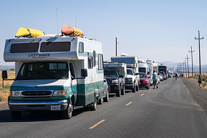 Lining up for SolartownToday was the beginning of our 5-day celebration of the total solar eclipse in Madras, Oregon. Our plans for this event had begun back in January, when Paul and Herb decided that this possibly once-in-a-lifetime event was something definitely worth pursuing.
So, we made Solartown campsite reservations and bought a ticket to the Solarfest festival. We were way ahead of the game. As months passed and word got out as to just how monumental an event this was going to be, accommodations disappeared and prices for those remaining rose to astronomical (no pun intended) heights. By April our $150 5-night campsite had risen to $300, and airbnb rooms were going for as much as $700 a night. We felt quite smug about our foresight.
We were quite excited. Besides the eclipse itself, the whole event was predicted to be quite a scene - 100,000 people descending on the little town of Madras, population 5,000. The town had been prepping for this for over a year, and had partnered with NASA to make it a truly educational and informative event.
Because of its clear skies and breathtaking mountain views, Madras was the place to be along the Totality Line that crossed the U.S. from South Carolina to Oregon. From our campsite, we could see Mt. Hood to the north and Mt. Jefferson to the west.
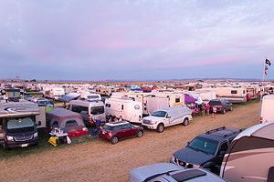
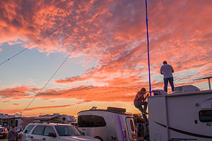 Our Lawrence Livermore Camping BuddiesOur home for the 5-day event was Solartown, a farmer’s field setup to accommodate 30,000 people. I guess the enterprising farmer realized there was more money to be made from eclipse mania than alfalfa. So, the alfalfa was replaced with grass and Roundup was used to mark roads and campsite boundaries.
Our arrival at Solartown did not go as smoothly as it could have. Gates didn’t open until noon on Thursday, but campers began arriving at 9:00, causing a mile-long line to extend all the way back to Highway 26. We sat for 5 hours before finally getting in. Fortunately, Hilda and Paul were about an hour ahead of us in line and were able to secure us a campsite right next to theirs.
On the other side of Hilda and Paul’s site was a pair of ex-Lawrence Livermore research scientists, equipped with a huge ham radio antenna, telescopes, cameras with big lenses, computers, etc. - our very own NASA center. They had obviously been prepping for this for some time. My prepping had consisted of ensuring that we would have enough beer and wine to last us the 5 days without having to leave Solartown.
Their ham radio antenna, which was strung with blue lights, would serve as a beacon for us to find our way home whenever we left our campsite.
Day 2 - Smith Rock State Park and the Deschutes Brewery in Bend
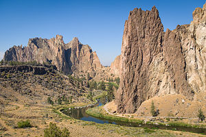 Smith Rock State ParkNone of us just wanted to hang around the campground for 5 days waiting for the eclipse, so we decided that this would be the best day (in terms of traffic) to venture out and explore some of the really cool areas nearby.
Herb and I had been to this area several times before, so we decided to show Hilda and Paul two of our favorite places - Smith Rock State Park and Bend. This would allow for some physical activity followed by refreshing beer at the Deschutes Brewery - my idea of a perfect day.
We drove the 26 miles down to Smith Rock without encountering any traffic at all. I think our rationale that most people had either arrived in Madras yesterday on opening day, or were waiting until closer to the eclipse to arrive, was correct.
Smith Rock is an absolutely stunning place, known both as a premier rock climbing destination (our reason for being here in the past) as well as a wonderful place to hike.
The rock formations in the park are spectacular – multi-colored, jagged ridges of basalt, formed from volcanic activity millions of years ago, when lava flows entered this canyon and cooled. Winding between these basalt peaks is the lovely Crooked River, which twists and turns its way for miles through the park.
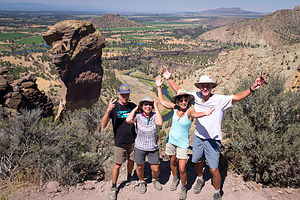 Happy Hikers atop Misery RidgeAfter parking the car, we took the trail down to the river, crossed a bridge, and then followed the River Trail along the banks of the Crooked River. It was very nostalgic for Herb and I, passing so many areas where we had climbed with the boys.
The trail along the river was flat, but eventually we took a turn onto the appropriately named Misery Ridge Trail, where we climbed a series of switchbacks back up to the top. We found a shady spot to have lunch from which there were great views of the river and climbers on the Monkey Face, a rock formation that indeed does look like the face of a monkey.
Afterwards, we continued back down to and across the Crooked River before climbing right back up again to the parking lot.
After 4.5 miles and 1,000-foot elevation gain in hot weather, we felt we owed ourselves a trip to the Deschutes Brewery, in the very fun town of Bend. We must have really wanted that free beer, because it was another 27 miles south on Highway 97. I just couldn’t be so close to Bend without stopping by.
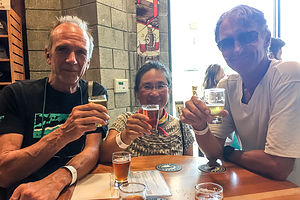 Free Beers at the Deschutes BreweryHerb and I had been to the Deschutes Pub House before, but never to the actual brewery where they make their beer. Rather than do the tour, we went straight to the tasting room, where we were given a wristband that would allow us four tastings each (for free). What a great concept! Deschutes makes some really good beers. My personal favorite is Freshly Squeezed - an IPA with a bit of a citrus taste. Good thing I didn’t live in Bend, or I probably would have found myself here every afternoon.
Since the drive back was close to an hour and I was the designated driver, I was very responsible and only took a few sips.
When we got back to camp, our neighbors, the Lawrence Livermore researchers, were busy playing with their equipment, practicing for the big day. This was really a huge deal for a lot of people.
Oh, and Hilda and I walked over to try the mobile showers that had been brought in. We couldn’t understand why they weren’t more crowded. There were only about 40 showers in the whole place for 30,000 people, but yet there was no line. They were great!
Day 3 - Solarfest and the arrival of more friends
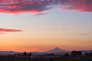 Mt. Jefferson from SolartownAs part of our pre-eclipse planning, we had also purchased tickets for the Solarfest festival, which had NASA talks and exhibits, food carts, eclipse merchandise vendors, and bands.
In retrospect, we probably should have waited to go later in the day, because by 1:00 in the afternoon, we were pretty much done with the festival. We had listened to a NASA talk, explored the merchandise booths , had two beers in the beer garden, and eaten lunch. The bands didn’t start until 3:00, but it was hot and we didn’t see how we were going to last until then. We had just peaked too early.
So, we headed back to Solartown, which was in itself quite interesting to wander around. It was amazing how quiet, clean, and harmonious the camp was, considering how many people were packed in. It was kind of a Woodstock for science nerds.
Later that evening, our friends, Anita and Roberts, from Portland (previously New Jersey) arrived to join the festivities.
Day 4 - Exploring Solartown on Foot
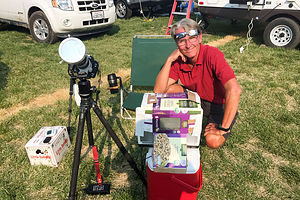 Herb getting readyIt was Sunday, Eclipse Eve, and campers were pouring into Solartown. There was no way we were going to take the car anywhere just to wait in traffic for hours to get back in.
However, there is only so much you can do in an ex-alfalfa field. We would have to figure out some way of entertaining ourselves. We each chose a different path.
Herb stayed at the campsite and played with his new Lawrence Livermore friends, who loaded software onto his laptop that would control his camera’s exposure and timing of pictures during the eclipse. Paul and Hilda went off on their bikes to explore the backroads. Anita, Roberts, and I decided to take a walk across the highway to the Madras airfield, over which people had been dropping out of the sky (with parachutes) for the last few days.
There had to be at least 400 private planes parked alongside the runway, many of which with tents set up beside them. The runway itself was fair game to just wander around on, which was quite surprising to me. There was no control tower - just one guy with a reflective vest directing incoming planes.
 WW II Plane at Erickson Aircraft CollectionWe waited on a line to enter the Erickson Aircraft Collection, a small museum with a dozen or so American, German, and Japanese planes from the World War II era - many of which are still in flying condition. It was really quite interesting and well worth the $9 admission.
That evening we all attended a talk given by people at a nearby campsite, which had had informative fliers about the eclipse tacked onto their trailer all week. The woman who gave the talk introduced herself as a real estate agent that just happened to be very interested in eclipses. She was actually very good and quite interesting, explaining to us in layman’s terms what to expect on Monday and how to get the most out of our 2+ minutes of “totality.”
I was finally starting to realize just how significant being in the path of totality was - it was not just better than 99%, it was totally different. It was pretty much binary - either you were in totality or you weren’t. Only in totality do you get to experience the full corona, the diamond that briefly appears along the corona’s ring, and Bailey’s beads, where the rough topography of the moon allows beads of sunlight to shine through in some places and not in others.
We also got some hints as to how to use colanders to create interesting patterns of little crescents as the sun builds to totality.
I definitely felt more prepared for tomorrow and excited about the unique and awesome experience that we were going to be a part of.
Day 5 - Totality!
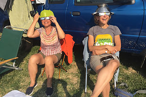 Hilda and Anita getting readyI don’t know how to describe it, but there was definitely something different about the mood in the campground this morning - a sense of solemnity and anticipation that we were about to be witnesses to something big.
People were scurrying around cleaning up breakfast dishes, setting up telescopes and tripods, positioning themselves on the roofs of campers and cars. Some were even packing up, so they could leave as soon as it was over and get a jump on the traffic. Despite all the preparations, everything was quiet and calm.
In our campsite, Paul positioned himself on the roof of the motorhome with his tripod and camera to get a good vantage point to capture the whole scene. Herb was set up behind his tripod with a large lens to take photos of the sun going through its various phases. The rest of us were in beach chairs, equipped with colanders and eclipse glasses ready to put on.
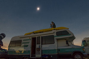 Paul capturing the sceneIt was eerily quiet as we all awaited the show to begin. I found myself whispering as to not disturb the mood. For a brief moment in time, 30,000 people were seemingly united in focus and purpose.
At 9:06, exactly on time (isn’t science amazing?), the eclipsed kicked off with what is called first contact, when the moon starts to pass across the sun, biting a little chunk out of it, kind of like pac man.
For the next hour or so, the moon continued on its journey across the sun, eventually forming a crescent. Just before totality, lots of stuff began to happen - the diamond briefly appeared along the corona’s ring, and we started seeing an effect called “Baily’s beads,” where the light from the sun passes through the nooks and crannies on the bumpy moon’s surface. All the while, the temperature was dropping and the skies darkening as if it was nighttime.
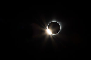 The Diamond Ring!At exactly 10:19, the moon totally blocked the sun, and we all briefly took our eclipse glasses off to view the sun’s corona surrounding the moon. It was amazing and humbling. This phase lasted for a little over 2 minutes, before the moon passed through the sun, starting the whole process over in reverse for another hour.
There are no words that give justice to what we had just experienced. Thankfully, Herb took some stunning photos that did just that.
Before the last phases of the eclipse were even over, several campers and cars quietly started moving towards the exit, hoping to beat the crowds. We could already see traffic backing up on the exit roads and Highway 26. We were perfectly happy to stay where we were and just reflect on and absorb what had just occurred.
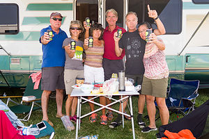 Post-Totality CelebrationWe really didn’t know what to do with ourselves for the rest of the day. It was a hard act to follow. Everything seemed sort of inconsequential in comparison - but in a good uplifting way. The immensity of the event had put everything in perspective.
Anita and Roberts left for Portland later that afternoon, and Hilda and Paul headed home to Sebastopol in the middle of the night.
Herb and I stayed on, in no particular hurry to go anywhere. The next morning we walked around Solartown, surprised to see how little litter there was. Attendees had definitely been on good behavior. Maybe we need more of these awe-inspiring events, or some equivalent kick in our collective butts.
Crater Lake National Park
Tuesday, August 15, 2017 - 8:30am by Lolo291 miles and 6 hours from our last stop - 2 night stay
Travelogue
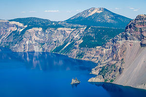 Crater Lake's Phantom ShipAs we approached Crater Lake, the smoke from the nearby wildfires was getting worse and worse. Hopefully, we would have some views on our hike tomorrow.
When we got to Mazama, we found that all the first-come-first-serve sites were taken and the campground was totally full. Thank goodness we had a reservation. Checking in was rather a unique process. Rather than telling you what our site number, we were told to just look for an unoccupied site with a yellow slash on the post - they promised us there was one left.
It felt a bit like an Easter Egg hunt as we drove through each of the five campground loops to find it. Sure enough, it was at the end of the very last loop we checked. I was getting worried for awhile there.
Later that evening I took a walk to scout out a better site to move to in the morning - one closer to the rim of Annie Creek Canyon. I checked the departure dates on all the sites with a yellow bar and found a good one that would free up in the morning.
Early the next morning we moved into our much more spacious campsite right alongside the Annie Creek Trail.
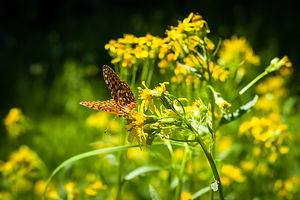 Along the Annie's Creek TrailI am always a bit more antsy then Herb, so while he read his book, I set out on the trail along the rim to the right to hike the 1.7-mile loop trail down into and back up out of the canyon. Unfortunately, I only got about ½ a mile, and had just started descending into the canyon, before encountering a trail closed sign. On my way back to the campsite, I ran into a few people carrying spades and shovels and asked them about the trail. They said that a bridge across the creek was out, but I could get down to the canyon by doing the loop in the opposite direction.
So back I went along the rim of the canyon past our campsite, waving to Herb, until I found the turnoff for the other half of the trail that descended about 200 feet down into the canyon. I followed a series of steep switchbacks that led down to lovely Annie’s Creek. From there, the trail followed the creek, crossing a couple of bridges that fortunately were intact. The wildflowers alongside the trail were beautiful. Eventually, after about a mile I did come to the washed out bridge and had to turn around and retrace my steps back up to the rim.
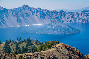 Wizard Island from Garfield PeakThe Annie’s Creek hike was just a surprise bonus, because our real plan for the day was to hike from the Crater Lake Lodge in Rim Village to Garfield Peak, a 3.8-mile, relatively strenuous, out-and-back hike to tremendous views of Crater Lake and the surrounding mountains.
After leaving the Crater Lake Lodge parking lot, we hiked up the steep trail for about a half mile, where we got our first views down of the lake. From there we continued eastward along a ridge, continuing to climb upwards for close to another mile and a half before arriving at the 8,060-foot summit where the views of the lake and the Phantom Ship were even better.
While enjoying the views at the top, my phone rang, which was surprising, considering Crater Lake National Park supposedly has no cell coverage whatsoever. I guess they let important news through, because it was Andrew calling to tell us that he got a really good job offer. I’m so glad we were able to get his call and share in the excitement.
The way back was downhill all the way.
Description
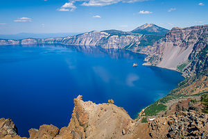 View from summit of Garfield PeakCrater Lake is the only national park that is located within a dormant volcano. More than 7,500 years ago, Mount Mazama erupted, spewing out so much pumice and ash that the summit collapsed, creating a giant caldera, measuring 4,000 feet deep and 6 miles across. A series of smaller eruptions afterwards formed several cinder cones on the caldera floor, the largest of which is 2,700-foot high Wizard Island.
Over the next 700 years or so, rain and snowmelt filled the caldera creating what is now the deepest lake in the United States. It is 1,943 feet deep at its deepest point.
Wizard Island is the only cinder cone tall enough to be exposed, rising 755 feet above the current lake level. The top of the Wizard Island cone is capped by a crater about 100 feet deep and 500 feet wide. In fact, this is the only crater in Crater Lake National Park. The lake itself should more accurately be named Caldera Lake.
It is Crater Lake’s extreme depth and purity that gives it its clarity and magnificent deep blue color. As sunlight penetrates the lake, the water molecules absorb the longer red waves in the spectrum and reflect the shorter violet and blue waves, giving its intense deep blue hue.
Crater Lake has no streams flowing into or out of it. It is refilled entirely from rain and snowmelt and is lost through evaporation and subsurface seepage. As a result, the lake had no fish in it until rainbow trout and kokanee salmon were introduced by humans from 1888 to 1941.
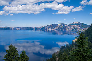 Views from Garfield Peak TrailIf you only have a day to visit the park, the best way to see it is to drive the 33-mile Rim Drive, which encircles the entire lake, stopping at its many overlooks. Because of heavy snowfalls, the Drive is generally open from July to October, and partially open in May, June, and November.
A good place to start the drive is at the Rim Village Visitor Center at the southern end of the lake, where you can stroll out to the Sinnott Memorial Overlook for a spectacular view of the lake and Wizard Island.
The best way to do the Rim Drive is clockwise, so that you can most easily pull into the scenic viewpoints on the lake side of the road. There are 25 of them, so it is very easy to spend a half-day enjoying the drive. My favorites are the overlook at mile 4, which offers an excellent view of Wizard Island, rising 755 above the lake’s surface, and the Phantom Rock Overlook at mile 23.2.
If you have more time, a boat trip out on the lake is definitely worthwhile. Tours are offered from late July to mid-September and in 2013. There are two types of cruises offered. The Standard Tour leaves 6 times a day and costs $35 for an adult. It does not stop at Wizard Island. The Wizard Island Tour only leaves twice a day (9:30 and 12:30) and costs $45 for an adult. This tour drops people off and allows them to hike and explore the island for 3 hours before the boat returns to bring you back. Each tour has a park ranger aboard to discuss the geology and natural history of Crater Lake. Tickets sell out quickly, so be sure to buy them in advance at the kiosk in the Crater Lake Lodge. I definitely recommend the Wizard Lake Tour.
To get to the boat, park at the Cleetwood Cove Trailhead on the north side of the lake, and hike the steep 1 mile trail down to the lakeshore. This trail provides the only access to the lake. Before committing to the trek down, make sure you feel comfortable with the strenuous climb back up.
Once you reach the lakeshore, you are sure to see dozens of people jumping from a high rock into the chilly waters of the lake.
Once on Wizard Island, there are two hiking options. The most popular is the relatively steep 0.9 mile trek (each way) up the steep Wizard Island Summit Trail. Besides the wonderful views of the lake along the way, once on top of the cinder cone, you can descend into 100-feet deep crater.
The other option is to hike along the rough volcanic rock along the shore to Fumarole Bay – about 0.7 miles each way. There is an excellent view from here of Watchman Peak, straight across the lake. The shallow, clear water in the bay is good for swimming (chilly) and fishing for rainbow trout and kokanee salmon. Unlicensed fishing is allowed in the park without any limitation of size, species, or number. In fact, the park encourages fishing to try to rid the lake of these non-indigenous fish.
In addition to the Cleetwood Cove and Wizard Island trails, there are several other hiking options in the park. These include:
- 3.5 mile (round trip) steep hike to Garfield Peak, with tremendous views after ½ mile of hiking. The trail starts from the parking lot of Crater Lake Lodge
- 1.7 mile (round trip) Annie Creek Canyon Trail, which begins behind the amphitheater at the Mazama Campground and loops down to the bottom of a deep, stream-cut canyon and back.
- 3.9 mile (round trip) hike to the summit of Mt. Scott, the highest point in the park, with panoramic views of the lake and Klamatch Basin.
- 0.7 mile (round trip) Pinnacles hike through dramatic tall pinnacles and spires. The trailhead is located on the Pinnacles Spur Road, 7 miles southeast of the Phantom Ship Overlook in the southeast corner of the park.
The park has two campgrounds:
- The Lost Creek campground is tent only and is open from mid-July to late September. This campground is located on the Pinnacles Spur Road in the southeast corner of the park.
- The Mazama Campground has 213 tent and RV sites (and some hookups) and is open from late June to mid October. This campground is located in Mazama Village, about 3 miles south of the Steel Visitor Center
Bordertown RV Resort
Monday, August 14, 2017 - 2:00pm by Lolo175 miles and 4 hours from our last stop - 1 night stay
Travelogue
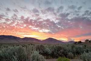 View from our Bordertown RV siteWe had 3 nights before we had to be in Solartown - the last two of which we would be spending at Mazama Campground at Crater Lake. That left us a day in between to break up the 10 hour drive to Crater Lake.
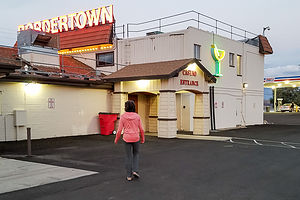
A quick google search showed the Bordertown Casino and RV Resort, just north of Reno, near the California border. We were very much ready for electricity and a long shower, so a commercial campground with full hookups sounded very appealing. Also, appealing was the fact that there was a restaurant right nearby, so I wouldn’t have to cook in the RV for the seventh night in a row. I even had a $2 coupon.
The campground was nice enough - large pull through sites so we didn’t have to detach the Subaru and pretty views of the surrounding mountains. Our picnic table was missing the benches to sit on, but you can’t have everything.
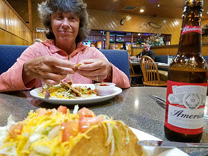 $1 Tacos in BordertownHerb was quite amused by how excited I was about my night on the town - I am a very low maintenance date. We strolled over to the casino / restaurant where we were hit with a wall of cigarette smoke when we opened the door. Poor Herb. We had left the fires in Yosemite behind and now this. Although there was no smoking in the restaurant, no one had told the smoke not to drift in.
We looked at the menu board and saw that it was $1 taco night. Oh boy! We asked our less than enthusiastic-about-her-job waitress how the tacos were, to which she respond with a shrug of her shoulders and a mumbled, “Eh. It depends on the chef.”
At this point, I was not going to let a mediocre review from the staff stop my bargain taco, so I ordered three and Herb ordered 5, along with a Budweiser. I have to give her credit as a restaurant reviewer. She was pretty dead on with her “Eh”.
When we received the bill for $11, we were too embarrassed to use our coupon. Herb figured if he had ordered a draft beer rather than a bottle, we could have brought our total, with coupon, down to $7 - but anything under $10 I don’t count as a date.
Yosemite - Tuolumne Meadows
Tuesday, August 8, 2017 - 9:45am by Lolo236 miles and 5.5 hours from our last stop - 6 night stay
Travelogue
Day 1 - Arrival in Tuolumne Meadows
 Lembert DomeWe have been to Yosemite so many times that I really don’t have much new information to add for our readers. However, it does provide a place for Herb and me to store our photos and remember where the heck we have been.
As with all camping trips to Yosemite, this one was conceived five months ahead of time, and successfully implemented at 7:00 am (PST) on March 15, when the reservation window for July 15 through August 14 opened. As I have mentioned in previous Yosemite postings, this is a stressful process that must be carefully planned and executed - multiple computers and quick fingers on the keyboard are a must, as all campsites are grabbed up within 5 minutes.
The boys love climbing in Yosemite, and Herb and I love the fact that they still like hanging out with us, so we were delighted that we now had a meetup planned for August - even if their busy schedules only allowed it to be for a weekend.
 Tuolumne MeadowsThe concept of “family” has grown over the years, as girlfriends have been added, and even the parents of girlfriends. Fortunately for Herb and me, not only did the boys choose great girlfriends, but the potential in-laws are pretty cool as well. Tommy’s girlfriend Erin’s parents would be spending the weekend with us in Tuolumne and Andrew’s girlfriend Celeste’s parents would be our partners at the eclipse. We have known Celeste’s parents for years, but this was to be the first time we would meet Erin’s parents, so we had to be on good behavior.
We got to the Tuolumne Campground late afternoon on Tuesday and were extremely pleased to find that we were assigned a handicapped spot, which was very level and large enough to accommodate all our guests. Now, we wouldn’t have to get up early in the morning to wait on line for a first-come-first-serve site for Erin’s parents. Thank God, because the line actually begins forming at 6 am for a 9 o’clock office opening - and it is pretty darn cold at 6 am in Tuolumne.
One little glitch in our planning was that there was no longer any cell coverage whatsoever at Tuolumne Meadows, making our meet up plans with Erin’s parents and the boys a bit more challenging. In years past, there had been just enough coverage in certain spots to receive and/or send an occasional text, but for some reason not totally explained to me by the ranger, even this tiny bit of connection was no longer working. He did, however, say that he thought I could get a little bit of coverage at Olmsted Point, 10 miles back along the Tioga Pass Road. We would visit this spot several times before the weekend to give and receive updates. My need to be connected with the outside world drives Herb crazy.
Day 2 - Hiking to Polly Dome Lakes, Beaching on Tenaya Lake, and Meandering through Tuolumne Meadows
 Polly Dome LakeSmoke, smoke, and more smoke! This was not a good wildfire season for northern California and Oregon. The fire that was literally hanging over us this time was near Bridalveil Creek, far away in the southern end of the park, but not far enough to avoid its impact. Thankfully, however, it was under control, so it was more of an annoyance than a danger.
So much for our hope of finally doing the 14-mile (RT) hike to Clouds Rest. The views would be non-existent, and the air quality was so bad that an asthmatic, such as Herb, would have difficulty breathing on such a strenuous hike.
We decided on something more modest, the 6-mile (RT) hike along Murphy Creek to Polly Dome Lakes. The nice thing about this hike is that the trailhead is located right across the street from the picnic area on Tenaya Lake, so we could just enjoy the beach afterwards without having to worry about getting a parking space again.
We had done the beginning of this hike the previous year when we climbed here with the boys, but this time rather than veering left to the rock face, we continued along the creek until we reached a small pond. From here, we left the main trail and made our way right, sort of bushwacking at times, to get to the largest of the Polly Dome lakes.
While not nearly as spectacular as Clouds Rest would have been, or so many of the other hikes we have done in Yosemite, it was peaceful and serene place to have a picnic lunch.
After the hike we grabbed our beach chairs out of the car and went in search of the perfect beaching spot on Tenaya Lake. It’s hard to go wrong here as the lake, with its glacial blue waters and surrounding granite domes, is one of the most beautiful in the Sierras.
We concluded our evening with a stroll from our campsite out to lovely Tuolumne Meadow. We would do a further exploratory when our guests arrived for the weekend, but for now, we just found a quiet spot along the bend of the river to sit and have a glass of wine.
Day 3 - Kayaking to Paoha Island on Mono Lake
 Chillin' on the MoonHerb loves desolation and the feeling of being miles and miles from civilization and the nearest human being - with the exception of me, of course. Since I was going to be exposing Herb to lots of socialization this trip, I fully recognized that a day of complete solitude would do wonders for his disposition and group harmony.
So, off we went to an old favorite that was sure to deliver - Paoha Island in the middle of Mono Lake, about 3 ½ miles from the Navy Beach kayak launch. Its difficulty to reach and its barren, moon-like landscape pretty much guaranteed that we would not encounter another soul.
The drive from the Tuolumne Campground to Mono Lake is a highly scenic, 45-minute drive, a.worthy activity in itself. When we got to the launch parking lot, we were surprised to find no other cars, even though it was an extremely calm morning - perfect for kayaking.
 Old Resort on Paoha IslandIt's funny how deceptive distances are on the water. The island was just a little over 3.5 miles from Navy Beach, but I could swear that it kept moving further and further away the more I paddled. Thankfully, the lake was calm, at least for now. We would have to keep an eye out for changing conditions because the winds usually pick up in the afternoon making kayaking extremely difficult.
After about an hour and a half, I paddled up onto the beach beside Herb’s kayak and stepped out onto the crunchy, white, moon-like surface. We were standing on volcanic material that had once been lake bottom until a volcanic eruption pushed it 290 feet to the surface about 350 years ago. This place truly is otherworldly.
In the distance we were surprised to see a man-made structure - a dome-like, metallic building practically hidden in the brush. I figured it was some kind of research facility, but later found out that this was once the site of a small resort that catered to people with tuberculosis, who came for a cure in the hot springs on the island. In hindsight, I wish we had battled our way through the brush to peak inside.
 Herb meets calcium carbonateWe spent an hour or two exploring, reading, and just enjoying the solitude. It was quite hot and eerily still, until a light breeze began to pick up, cooling things off a bit. I was very much enjoying the effects of this breeze until I realized what that breeze meant - the afternoon winds that kayakers are warned about was coming.
I started running around throwing my stuff in the kayak, urging Herb to hurry up and do the same. Already our nice smooth. glassy lake was taking on a rougher appearance - no white caps yet, but I feared they wouldn’t be far behind. Herb didn’t seem nearly as concerned as I was - sure, he was stronger and had a faster kayak.
I spent the next 3 hours paddling non-stop against 15 mph winds and 2-foot waves, yelling not very nice things at Herb most of the way. I don’t think he heard much of it, but I’m sure he got the gist of my mood.
Mono Lake is extremely salty, so as the waves washed over us and the water evaporated, leaving the salt behind, we became totally covered in a white chalky substance. We looked like mimes. I couldn’t even see through my sunglasses. I was not happy.
After what felt like 2 days, we finally reached Navy Beach, where there was now a fairly good-sized crowd, swimming and playing on the beach. Everyone sort of just stared at us while we pulled our kayaks on shore.
It wasn’t until I got a closer look at Herb, all covered in white, like a mime, that I realized how ridiculous we must look. I still had some venting planned, but at the sight of him, all the anger just flowed out of me and I started to laugh.
We could have grown our own tufas from all the calcium carbonate that came off of us in the shower.
Day 4 - Tenaya Lake and Tuolumne Meadows
 Hanging out at Tenaya LakeIt was Friday and today we would get company - Erin’s parents in the early afternoon and the kids late that night.
After a trip to Olmsted Point to get cell coverage last night, we had arranged with Erin’s parents to meet them at the Tenaya Lake beach, across from the Murphy Creek trailhead sometime in the early afternoon. We would be the ones with the two kayaks covered in calcium carbonate.
Right on time, a couple that I recognized from FB photos, strolled down the beach and introduced themselves as Erin’s parents. Within 10 minutes we felt like old friends.
I lent Richard my kayak and he and Herb enjoyed a paddle around the perimeter of the lake, which really is stunning. The crystal clear water also served as a well-needed rinse from yesterday’s adventure. The kayaks were red and yellow again!
 Tuolumne MeadowsThat evening after helping Richard and Beth set up camp, we headed out to show them the Meadow. We started on the trail by the Visitor Center, and in about a 1/2 mile crossed a footbridge over the river, where we were treated to lovely views of Cathedral Peak, Unicorn Peak, the Cockscomb, and Echo Peaks to the south and Lembert Dome to the north.
A short distance past the bridge, we turned left towards the Parsons Memorial Lodge, a rustic structure built entirely from local logs and granite by the Sierra Club in 1915. It was named for Edward Taylor Parsons, who was the club’s director for 10 years and heavily involved, along with John Muir, in the unsuccessful fight to save Hetch Hetchy. The Club used it as a meeting house and library.
Today the Lodge is used to hold the Tuolumne Meadows Summer Series of lectures by renowned photographers, writers, musicians, storytellers, and environmentalists. It’s nice to know that it is still being used to inspire visitors to appreciate these wonderful surroundings and to instill a need for stewardship to protect them.
 McCauley Cabin in Tuolumne MeadowsJust above the Lodge stands the old wooden McCauley Cabin, built by John McCauley in 1912. Today it is used to house park personnel. An interesting tie-in between this cabin and the Parsons Lodge is that the founder of the Parsons Lodge Summer Series, Margaret Eissler, lived in the McCauley Cabin for several summers when her parents were caretakers. There is even a picture of her as a little girl standing in front of the cabin with her family.
We retraced our steps back to the junction for Parsons Lodge and Soda Springs, and continued a short distance to another historic structure - the Soda Springs Cabin, a small log cabin built by John Baptiste Lembert in 1889 over a bubbling, naturally carbonated spring. A surprising fact is that geologists have no idea how or why the springs formed.
 Lolo enjoying the water from Soda SpringsBeside the cabin, there was a man with several large water bottles, one of which he was sipping from. Without too much prompting, he began telling us of the wonders of the carbonated water that came from this spring - “No better water on Earth,” as he described it. He reminded me a bit of an 1800s traveling salesman hawking bottles of elixir. He urged us to try some.
Richard dove right in, filling one of the cups we had brought along for drinking wine. Beth followed suit. They loved it. “Quite minerally,” they said.
I was a bit skeptical at first - and the sign warning of possible animal contamination didn’t help -- but, not wanting to feel like a weenie in front of our new friends, I took a tentative sip as well. “Quite minerally,” was certainly an understatement.
 Herb and Richard stalking troutI was about ready for some wine to wash down the minerals, so we set up a blanket near the stream where Herb and Richard could try their luck at fly fishing. Herb had had the foresight to bring along his fly rod and a box of flies. After examining the choices, they selected a tiny Adams as their weapon of choice. Richard, who had considerably more experience fishing in small streams, stressed the importance of sneaking up on trout, as they are very skittish and have a very acute sense of sight. Beth and I sat happily amused, sipping our wine while watching our men crawl through the underbrush towards their prey. It was a noble effort, but alas at the end of the battle it was Trout 1, Herb and Richard 0.
The only thing I love more than pristine, natural beauty is having some history thrown in. Add a good cocktailing venue along a river to that and you have the makings of a perfect evening.
Day 5 - Rock Climbing at Murphy’s Creek
 Andrew and Tommy climbing at Murphy's CreekAndrew, Celeste, Tommy, and Erin had arrived late last night, ready and raring to use their short time in Yosemite doing what they enjoyed most - climbing. Herb and I enjoy climbing as well, so we decided to join them, while Beth and Richard went off for a hike to Cathedral Lakes.
We chose the Murphy Creek climbing area, both for its numerous interesting routes, as well as for its convenient access. Parking in Tuolumne on a summer weekend can be an event in itself, so situating ourselves in the Tenaya Lake lot across from the trailhead would allow us to both climb and enjoy the lake afterwards.
Accessing the climbing area took us along the trail that Herb and I had followed a few days back on our way to Polly Dome Lakes. However, this time after about a mile and a half, we left the trail, which at this point was rock slab, and headed left toward the obvious rock wall. It required a bit of bushwacking and rock scrambling along the way.
Once there, the boys used the Tuolumne climbing guide, which has photos and detailed descriptions of each route, to get to the base of the climbs they wanted to start with. There was a wide selection of crack climbs ranging from 5.7 to 5.11, so there would be something for everyone to have fun on - even me.
 Tommy climbing at Murphy's CreekI love the conviviality of hanging out with the kids while they climb. Also, they are so nurturing encouraging to me - real role reversal here. They convinced me that I could do a 5.7 called Frogger, which I did, and later a 5.9 called X Wing, which I struggled through falling a few times, but eventually completed. The rest of them (including Herb) did those as well as a 5.8 called Pac Man, a 5.11a called Penguin, Cafe and a few others I can’t remember.
The other thing that the boys had encouraged me to do was to get my lead belay certification so that Herb and I could be somewhat self-contained. I actually did belay him on a lead climb, which freed them up to be simultaneously working on their own climbs.
Afterwards, we met Beth and Richard back at the beach on Tenaya Lake. I could see that Andrew and Celeste were itching to do more climbing, so I volunteered to drive them up the road about 5 miles and drop them off at Olmsted Canyon to do a climb that they had on their list. So many climbs, so little time seems to be their driving force.
As promised, we picked them up an hour later on our way (actually this was in the wrong direction) to get back to the campground.
That evening, we all combined food and had a wonderful feast.
Day 6 - Rock Climbing at Olmsted Canyon and Farewell
 Celeste on Ivory Tower CenterIt was Sunday, and everyone had to leave by mid-afternoon (except lucky Herb and I), so we split into two groups. Tommy, Erin, and her parents went for a hike in Tuolumne Meadows, which would allow Richard to fill up the empty water bottles he had been collecting with mineral water from the Soda Spring.
Andrew, Celeste, Herb, and I went to Olmsted Canyon, where we had dropped Andrew and Celeste off the previous night. Celeste had fallen on the last move of a 5.10a climb called Ivory Tower Center, and wanted to go back and have another go at it.
On her first attempt, she once again made it to the final move before coming off. Undaunted, after a brief rest, she went back for another attempt and got it. Andrew breathed a sigh of relief as he now knew there would be peace and harmony in the world.
There was nothing on this wall within my range of ability, but Herb did take a shot at the Ivory Tower as well, and Andrew lead a 5.11a climb called Tideline.
It was getting around that time for the working folk to get back to San Francisco, so we hiked back out and met Tommy and Erin at Tenaya Lake. Her parents had already started their long trip back to southern California. After a round of hugs, the kids hit the road as well.
It seemed so quiet again to just be the two of us. We took another walk out to the meadow that evening. It is such a peaceful and serene place - with the exception of 4 people, with cameras at the ready, stalking a poor mama bear and her three cubs that were sauntering across the meadow minding their own business.
Another Yosemite adventure had come to a close. Tomorrow we would head north towards Crater Lake and then onto Solartown and the eclipse!
Description
 Tuolumne MeadowsIn my past Yosemite National Park trip stop descriptions, I have focused on Yosemite Valley. However, this time our foray into Yosemite included a few days in beautiful Tuolumne Meadows along the Tioga Pass Road in the northern part of the park.
Tuolumne Meadows is very different from Yosemite Valley. At an altitude of 8,600 feet, it is high country and therefore, considerably cooler and wetter. As its name implies, Tuolumne is a beautiful sub-alpine meadow along the Tuolumne River, surrounded by rugged snow-covered mountain peaks and glacially-carved granite domes. The rock is porphyritic granite, which has a tendency for exfoliation, resulting in the distinctive dome shapes that are found here.
Hiking and rock climbing are extremely popular in this section of the park and tend to be much less crowded than the Valley. In contrast to the big walls in the Valley, the rock climbing routes on the major domes in the Meadow are shorter.
There are very few services in Tuolumne and the Tioga Pass Road is usually only open from Memorial Day through late October / early November, depending on the snowfall. During the summer (mid-June to mid-September), camping is available at Tuolumne Meadows Campground. It is extremely popular, so reservations are strongly recommended. However, there are also many sites saved as first-come-first-served. There is also a small grocery store, grill, post office, and gas station.
McRent, Arcadia Hotel München Airport, and Flight Home
Thursday, June 22, 2017 - 9:45pm by Lolo10 miles and 0.25 hours from our last stop - 1 night stay
Travelogue
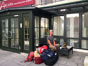 Ready to go homeWe said goodbye to our "home away from home" for the last 4 weeks and called a taxi to take us from McRent to the Arcadia airport hotel, where our trip had begun - what seemed like a year ago.
To complete the symmetry of our journey, we dined at Il Casale, the same Italian restaurant as Day 1 on the trip.
The next morning it was off to the airport and the long flight home. It had been quite a journey!
Description
The Arcadia is a 3-star hotel located in Oberding, Germany close to the Munich Airport, which offers a shuttle (charge) to and from the airport.
Wieskirche, Andechs Monastery, and Ampersee
Wednesday, June 21, 2017 - 9:45pm by Lolo80 miles and 2.5 hours from our last stop - 1 night stay
Travelogue
 Cows grazing near the WieskircheThis was it. The final day in the camper van. I can’t believe it was almost over. It felt like we had been traveling for a year rather than just 4 weeks -- and I mean that in a good way.
Our goal for today was modest - just situate ourselves near enough to McRent to be able to clean and return the camper by 10:00 am the next morning.
That didn’t mean, however, that we couldn’t make a few interesting a fun stops along the way, the first of which was the Pilgrimage Church of Wies, about 18 miles northeast of Fussen, in a lovely alpine meadow on the slopes of the Ammergau Alps.
This lovely somewhat isolated and pastoral setting seemed like an odd place for such a large church, and it would have been if it had not had been for the “miracle” that attracted, and still attracts, thousands of pilgrims each year.
 Pilgrimage Church of WiesBack in 1738, when this was just a small abbey, a peasant woman named Maria Lory claimed to have seen tears in the eyes of the dilapidated wooden statue of Christ at the whipping post. Word got out and soon thousands of worshippers were making the pilgrimage here to see this miracle.
Unable to accommodate the throngs, the Steingaden Abbey commissioned the brothers J. B. and Dominikus Zimmerman to design a larger and more worthy church to house the miraculous figure of the Scourged Christ.
The result was a masterpiece of Rococo art and one of the most extravagant and flamboyant rococo buildings in the world. The Wieskirche was added to the UNESCO World Heritage List in 1983.
We were fortunate enough to have timed our visit while a mass was going on.
 Andechs Monastery Pilgrimage ChurchOur next attempt to avoid admitting our vacation was over was a stop at the Andechs Monastery, atop the Heiliger Berg (Holy Mountain) above the eastern shores of the Ammersee. We
Like the Wieskirche, this too was a pilgrimage church, but dating back much further all the way to the 10th century. Its claim to fame and main attraction for pilgrims is a piece of Jesus’ crown of thorns, which is still on display in this lovely rococo and baroque-style church.
However, most of the pilgrims today come for the miraculous beer that the Benedictine monks have been brewing here since 1455.
We would have liked to have tried some beer and Bavarian food in the “Klostergasthof” (monastery restaurant ), but there was literally an army on line in front of us. Seriously, a German army band had just completed a concert in the church and were now ready to be rewarded with some wurst and Andechser Doppelbock.
No more excuses or diversions. It was time to settle in somewhere and start putting the camper back into pristine condition for its return.
We found Camping Ampersee, a pretty little campground on a small lake, just 10 miles from McRent. In between the cleaning, we did manage to squeeze in some time to swim in the lake and dine at their beer garden.
Description
Pilgrimage Church of Wies
The Pilgrimage Church of Wies is located in a lovely alpine meadow on the slopes of the Ammergau Alps, in the village of Steingaden, about 18 miles northeast of Fussen. It is one of the most extravagant and flamboyant rococo buildings in the world.
The history of this church began in 1738, when a peasant woman named Maria Lory claimed to have seen tears in the eyes of a dilapidated wooden statue of Christ at the whipping post, which prompted thousands to make a pilgrimage to see this miracle.
Unable to accommodate the throngs, in 1740 the Steingaden Abbey commissioned the brothers J. B. and Dominikus Zimmerman to design a larger and more worthy church to house the miraculous figure of the Scourged Christ.
The result was a masterpiece of Rococo art, created to unleash the divine in visible form. The Wieskirche was added to the UNESCO World Heritage List in 1983.
Admission to the church is free, but donations are appreciated. Guided 30-minute tours for groups can be reserved with advance notice.
Andechs Monastery
The Andechs Monastery is located on top of the Heiliger Berg (Holy Mountain) above the eastern shores of the Ammersee.
Dating back to the 10th century, It is the oldest pilgrimage church in Bavaria. For centuries, the faithful have made the trek across Bavaria to this beautiful rococo and baroque style church to see a piece of Jesus' crown of thorns, which is still on display.
The Monastery is not only famous for its pilgrimage, but also for its beer, which the Benedictine monks have been brewing in this location since 1455. The Andechs brewery produces seven different varieties of beer, with their most popular one being the dark, strong Andechser Doppelbock. There are guided tours to the brewery.
Besides several beer gardens, there is also traditional Bavarian food served in the monastery restaurant “Klostergasthof.”

