- Home
- About
- Map
- Trips
- Bringing Boat West
- Migration West
- Solo Motorcycle Ride
- Final Family XC Trip
- Colorado Rockies
- Graduates' XC Trip
- Yosemite & Nevada
- Colorado & Utah
- Best of Utah
- Southern Loop
- Pacific Northwest
- Northern Loop
- Los Angeles to NYC
- East Coast Trips
- Martha's Vineyard
- 1 Week in Quebec
- Southeast Coast
- NH Backpacking
- Martha's Vineyard
- Canadian Maritimes
- Ocracoke Island
- Edisto Island
- First Landing '02
- Hunting Island '02
- Stowe in Winter
- Hunting Island '01
- Lake Placid
- Chesapeake
- Provincetown
- Hunting Island '00
- Acadia in Winter
- Boston Suburbs
- Niagara Falls
- First Landing '99
- Cape Hatteras
- West Coast Trips
- Burning Man
- Utah Off-Roading
- Maui
- Mojave 4WD Course
- Colorado River Rafting
- Bishop & Death Valley
- Kauai
- Yosemite Fall
- Utah Off-Road
- Lost Coast
- Yosemite Valley
- Arizona and New Mexico
- Pescadero & Capitola
- Bishop & Death Valley
- San Diego, Anza Borrego, Joshua Tree
- Carmel
- Death Valley in Fall
- Yosemite in the Fall
- Pacific Northwest
- Utah Off-Roading
- Southern CA Deserts
- Yosemite & Covid
- Lake Powell Covid
- Eastern Sierra & Covid
- Bishop & Death Valley
- Central & SE Oregon
- Mojave Road
- Eastern Sierra
- Trinity Alps
- Tuolumne Meadows
- Lake Powell Boating
- Eastern Sierra
- Yosemite Winter
- Hawaii
- 4WD Eastern Sierra
- 4WD Death Valley +
- Southern CA Deserts
- Christmas in Tahoe
- Yosemite & Pinnacles
- Totality
- Yosemite & Sierra
- Yosemite Christmas
- Yosemite, San Diego
- Yosemite & North CA
- Seattle to Sierra
- Southwest Deserts
- Yosemite & Sierra
- Pacific Northwest
- Yosemite & South CA
- Pacific Northwest
- Northern California
- Southern Alaska
- Vancouver Island
- International Trips
- Index
- Tips
- Books
- Photos/Videos
- Search
- Contact
Fussen
Monday, June 19, 2017 - 6:45pm by Lolo180 miles and 3.5 hours from our last stop - 2 night stay
Travelogue
Day 1 - Beaching and bathing in the Forggensee
 Camping BrunnenWe were back in the Motherland! After an amazing 4 weeks of traveling through Bavaria, Austria, Northern Italy, and Switzerland, we were back to the land of beer gardens and fantasy castles. It felt like we had come home.
What better place to end it than Fussen, a town in the foothills of the Bavarian Alps, with a beautiful lake, Old Town with beer gardens, and, of course, “Mad” King Ludwig II’s Schloss Neuschwanstein, a castle so magical that Disney used it as the model for Sleeping Beauty.
Although this castle gets most of the attention, Schloss Hohenschwangau, the castle that Ludwig actually grew up in, is also nearby.
As you can imagine, it’s a very popular tourist destination, so we were fortunate to get the last campsite in Camping Brunnen, on the shores of the Forggensee, about 3 miles north of the castles.
 Our campground beach on the ForgenseeWhen we asked about visiting Schloss Neuschwanstein tomorrow, the campground host said that there were no longer pre-day ticket reservations, and that if we wanted to tour the inside of the castle, we would have to get up early and wait in a very long line at the Ticket Center. Oh, great. We were actually more interested in photographing it from the outside, so we would just go there anyway and see how long the line was.
In the meantime, we spent the afternoon relaxing on the beach and swimming in the Forggensee, capped off by an evening stroll along its shoreline path.
Being a coast dweller, I always thought it would be hard to live far from the ocean, but there is definitely something to be said for the beauty of a warm freshwater lake surrounded by incredible scenery. I think this was our seventh.
Day 2 - Biking to the Castles, Lechfall, and Fussen Altstadt
 On the way to Schloss NeuschwansteinToday it was off to the castles! Not wanting to move the camper or deal with parking by the Ticket Center, we decided to rent bikes at the campground and ride there.
The ride was great - only 3.5 miles alongside lovely green pastures. Directions were easy. Just keep heading towards the magnificent castle on the hill.
As we entered the tiny village of Hohenschwangau, we left the peace and serenity of our bike ride behind and entered the land of long lines and tour buses. What a mob scene! The ticket line had to be at least an hour and a half long.
It was a little bit of a tough decision, but we both agreed that we would rather not wait.
 Crowds on the Marienbrucke to take the classic Neuschwanstein photoBesides, the best photographs of the castles are from the exterior anyway; in fact, photography is not even allowed inside. At our age, pictures are the only way we remember where we’ve been.
So, we locked up our bikes, and joined the crowd hiking up the steep mile-long hill to Neuschwanstein. It was a pretty long walk so I’m surprised so many were doing it instead of taking the shuttle or the fancier horse-drawn carriage.
Once at the castle, we continued on past for another 10 minutes to the Marienbrucke, which spans the spectacular Pollat Gorge over a waterfall just above the castle. This is the spot where the classic photos of the castle are taken. This vantage point is no secret, so we practically had to elbow our way to the railing to get a shot. I think the real photo to get here is of the people taking selfies of themselves with the castle in the background.
 Schloss Neuschwanstein from the MarienbruckeThis is turn around point for most visitors, but we continued across the bridge and a short distance along the gorge, just to get a breather from the crowds. Legend has it that Ludwig used to love to come to this bridge to enjoy the serenity. Boy, would he be surprised if he were here today.
We walked down a different trail to get to the other castle, Schloss Hohenschwangau, Ludwig’s boyhood home. Built by Ludwig’s father, King Maximilian II, this 19th-century, bright yellow, neo-Gothic palace has none of the theatrics of Ludwig’s “fantasy” castle. Still, Ludwig did manage to add a whimsical touch to his bedroom, by having stars, illuminated with hidden oil lamps, painted on the ceiling.
 Swan statue in Schloss Hohenschwangau GardenAs with Neuschwanstein, we did not have tickets to enter Hohenschwangau, but we did get to enjoy its gardens. Ludwig must have gotten a little bit of his theatrical flair from his dad, because Maximilian had Domenico Quaglio, a theater architect, design the gardens.
The garden had lots of fountains. The swan (“schwan” in German) was the emblem of the Bavarian royal family - hence, the word schwan in both castle names, and not so surprisingly a swan fountain in the garden.
There is also a beautiful Lion Fountain with four majestic lions supporting a central basin. It was inspired by the Palace of Lions in the Spanish Alhambra.
Also, in the courtyard is a lovely fountain with the Virgin Mary holding the baby Jesus in her lap.
There was also a relatively austere royal family chapel on the grounds, which we were allowed to go into without tickets. The building was a drinking hall before it was converted into a chapel. I wish I could have been a fly on the wall for that discussion.
 LechfallWe returned to the Ticket Center to retrieve our bikes and then continued through a park along the Schwansee towards Lechfall, located in a beautiful gorge along the River Lech. We walked out onto the footbridge that spans the falls for a beautiful view of the Lechfall cascading over five man-made tiers on one side and cascading into a rock-studded gorge on the other.
From the bridge, we climbed down a trail and strolled for a while along the river. Rumor has it that King Ludwig II also loved the beauty of these falls and visited here often. I don’t think he could have been that crazy, maybe just a bit too theatrical and romantic. There are worse qualities to have.
We continued on to Fussen’s Historische Altstadt (Historic Old Town) in search of beer and schnitzel. After yelping, we selected the Fussen Brauhaus, both for its good reviews, as well as the fact that it had an accordion player right nearby in the square to add to the ambience. It was great to be back in Germany!
After a very delicious meal and a refreshing beer, we rode the remaining 5 miles back to Camping Brunnen. All in all we had biked / walked 15.6 miles on our castle exploration.
Time to hit the beach back at the campground.
Description
Fussen is a town in the foothills of the Bavarian Alps, two hours south of Munich, that is home to “Mad” King Ludwig II’s fantasy castle - Schloss Neuschwanstein, as well as Schloss Hohenschwangau, his boyhood home.
Schloss Neuschwanstein is featured in “1,000 Places to See Before you Die” and is also the model for the Disney castle.
King Ludwig II designed the castle with the help of a stage designer, rather than an architect. He was obsessed with Germanic mythology and the operatic works of Richard Wagner, so he planned his palace to be a giant stage on which to recreate his fantasies.
Today Schloss Neuschwanstein if one of the most popular castles in Europe, hosting about 6,000 visitors per day in the summer. Entrance tickets (13 euro) can only be purchased at the Ticket Center in the village of Hohenschwangau below the castle.
Visitors have three options for getting from the Ticket Center to the castle.
- Walk - it takes about 30 to 40 minutes to walk up the steep 1 mile hill
- Horse-drawn carriage - For 6 euros, the carriage brings visitors to an area below the castle, from which it is a 5 to 10 minute walk uphill
- Shuttle - For 1,80 euros, the bus brings visitors to an area above the castle, from which it is a 10 minute to 15 minute walk downhill
For the best view of the castle, walk another 10 minutes to the Marienbrucke, which spans the spectacular Pollat Gorge over a waterfall just above the castle
Standing more subtly below Neuschwanstein is the Schloss Hohenschwangau, a 19th-century, bright yellow, neo-Gothic palace where Ludwig spent most of his childhood. It is much less showy than Ludwig’s “fantasy castle” and has a distinctly live-in feeling. After Ludwig’s father, King Maximilian II died, Ludwig had stars, illuminated with hidden oil lamps, painted on his bedroom ceiling - always the romanticist.
Admission to the Schloss Hohenschwangau is also 13 euro, or you can buy a combo ticket for the two castles for 24 euro.
Another attraction in Fussen is Lechfallwhere the River Lech cascades into a rock-studded gorge. A footbridge spans the fall, giving a dramatic close-up view. King Ludwig II loved the beauty of the falls, just as visitors still do today.
Lucerne
Saturday, June 17, 2017 - 4:00pm by Lolo55 miles and 1.5 hours from our last stop - 2 night stay
Travelogue
Day 1 - Lido Beach and the Altstadt
 Outdoor art along the waterfront promenadeSwitzerland is not just alpine meadows, verdant pastures, flower-filled window boxes, and cowbells, so we figured it was about time we visited one of its cities, to see how the other half lived.
We chose Lucerne (population 81,000), just a half hour drive from Gimmelwald (population 120), -- but seemingly a world away. It is known for its beautiful Altstadt (Old Town) with colorful houses, waterfront promenades, covered bridges, sunny squares, and medieval architecture.
We found camping at Camping International Lido, across the street from Lido Beach, and just a mile and a half walk along the waterfront promenade to the Old Town.
 KapellbruckeAfter settling into our campsite, we walked across the street to the grassy beach on Lake Lucerne. We could have paid 7 francs to go to the official Strandbad Lido, a lakefront park with a heated pool, playground, volleyball court, and beach, but we thought the free beach right next door suited our needs just fine.
It was a Saturday, so the beach was full of young Lucernians (if that is a word) recreating. Most of them were under 30, probably because those with children were enjoying the facilities at the Strandbad Lido. Even the statues along the promenade were young. We old folks spent a relaxing afternoon swimming and people watching.
Later that afternoon we walked the mile and a half along the lovely waterfront promenade to Lucerne’s Altstadt, the colorful Medieval Old Town that the city is famous for.
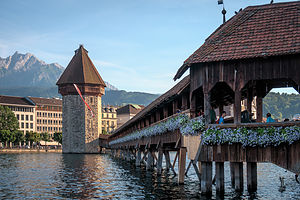
 Lucerne street performersWhen we got to town, we continued along the waterfront to the Kapellbrucke (Chapel Bridge), the iconic covered wooden bridge that runs diagonally across the Reuss River. It is Lucerne’s most photographed landmark. Originally built in 1333, it was completely rebuilt and restored in 1993 after a devastating fire. Although damaged a bit by the fire, there are still more than a hundred 17th century pictorial panels hanging from the roof rafters, depicting scenes from the town’s history.
Next to the Kapellbrucke is the octagonal Wasserturm, a 13th-century, 110-foot high water tower that was once part of the town’s fortifications.
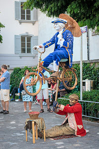
After crossing the bridge, we continued along the southern bank of the Reuss River to a plaza where street performers gathered. My favorite was a gold-covered peasant holding up a brightly-clad aristocrat on a bicycle. I don’t know how they did it! Of course, my engineer husband later explained it to me, giving away the illusion.
After passing the 17th century Jesuit Church, with its double onion-domed towers, we crossed back over the river along Lucerne’s second covered bridge - the Spreuerbrucke. Built in 1408, this bridge also has artwork in its rafters, but of a more macabre theme. Beneath the roof, for all sinners to see while passing beneath, are 45 triangular panels depicting the Dance of Death, known in German as a Totentanz.
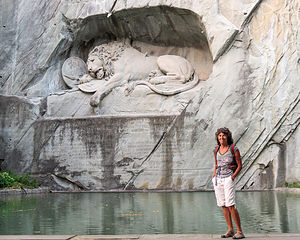 Lolo beating the hordes to the Lion MonumentWe couldn’t leave the Altstadt without visiting Lucerne’s famous Lion Monument, so we continued our self-guided tour up the hill to the Lowenplatz. As we approached the square, we passed a large tour group. We knew exactly where they were headed, so we picked up our pace to get there first. I am so glad we did, because for 3 minutes we had this beautiful, touching monument all to ourselves. As I was posing in front of it, I watched the army of tourists approach Herb from behind. “Just take the picture!” I urged through gritted teeth. He did, and not a moment too soon, as we were immediately engulfed by hordes of tourists.
Having nabbed the rare solo shot in front of the Lion, we sat on a bench and took time to admire this truly touching sculpture of a dying lion, carved into the limestone cliff. It was created in 1820, as a memorial to the Swiss soldiers who died protecting King Louis XVI during the French Revolution. Mark Twain once called it the “saddest and most moving piece of rock in the world.”
On the way back to the waterfront, we passed another one of Lucerne’s beautiful churches - the Hofkirche, an 8th-century Benedictine monastery built in the 1630’s. This twin-towered church is considered the most important Renaissance church in Switzerland.
The walk back along the waterfront promenade in the evening light was enchanting.
Day 2 - Mount Pilatus Golden Round Trip
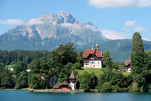 First leg of Golden Round Trip - cruise along Lake LucerneFrom everything we read, the single must-do tour in the Lucerne area is the Goldene Rundfahrt (Golden Round Trip) to the summit of Mount Pilatus, the iconic mountain that rises above Lake Lucerne. The trip, which costs 77 francs, is a multi-leg adventure with various means of transport, including a lake steamer, a cogwheel railway, a cable car, and a bus.
We started our journey, or “Golden Fart,” as Herb kept calling it, by walking to the nearby ferry dock by Lido Beach. From there, we boarded a beautiful lake steamer, which took us an a very scenic one-hour cruise across Lake Lucerne to the town of Alpnachstad.
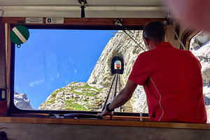 2nd leg of Golden Round Trip - cogwheel railwayUpon disembarking in Alpnachstad, we hopped aboard a cogwheel railway, famous for being the steepest in the world, with gradients up to 48%. This railway has been in action since 1889, which I have to admit made me a little nervous. For 40 minutes, we were transported through alpine meadows and forests, up steep rock faces, and through four tunnels to the summit of Mount Pilatus, 7,000 feet above sea level.
Now it was free time to spend as much time as we liked exploring the summit.
We stopped first to take a peek at the beautiful Hotel Pilatus-Kulm, built in 1890, a year after the cogwheel railway started scooting tourists up the mountain. The views from the rooms and Queen Victoria dining room must be amazing. We, however, satisfied ourselves with peanut butter and jelly sandwiches on the sun terrace.
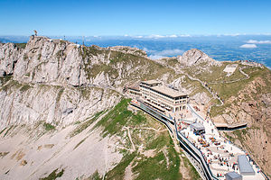 View of Pilatus-Kulm Hotel from EselThere are several hiking trails to various viewpoints. We started with the short walk up the Esel trail to the second highest point on Mount Pilatus - don’t worry, we would get to its highest later. From Esel, there was a wonderful view of the Hotel, Lake Lucerne, and the surrounding mountain peaks.
The whole while we were up there, we heard the haunting sound of a Swiss alphorn. We weren’t sure where it was coming from, but it certainly enhanced the experience.
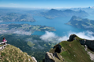 View from atop the Tomlishorn of Mt. PilatusNext, we took the longer and slightly rougher trail for about a mile past the Hotel to the Tomlishorn, the highest point and actual summit of Mount Pilatus. So many mountains in Switzerland end with “horn” because of their horn-like shape. Needless to say, the views from here were breathtaking as well.
Back at the Hotel terrace, we tested out their comfy lounge chairs a while before starting on the next leg of our journey.
Satisfied that we had conquered Mount Pilatus, we boarded a gondola, which swept us along on a scenic aerial ride back down to the town of Kriens.
From there we walked to the bus stop and embarked on the least glamorous leg of our journey - the #1 bus back to Lucerne.
Description
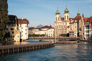 Twin onion-domed towers of the Jesuit ChurchLucerne is a small city in central Switzerland, known for its colorful Altstadt (Old Town) and preserved medieval architecture. The Altstadt, with its colorful houses, waterfront promenades, covered bridges, and sunny squares, lies on the east side of the River Reuss, an outlet to Lake Lucerne. Majestic Mt. Pilatus looms above the lake’s western shore.
Sights in the Altstadt include:
- Kapellbrucke (Chapel Bridge), Lucerne’s best-known landmark, is a covered wooden bridge that runs diagonally across the Reuss River. Originally built in 1333, it was completely rebuilt and restored in 1993 after a devastating fire. Although damaged a bit by the fire, there are still more than a hundred 17th century pictorial panels hanging from the roof rafters, depicting scenes from the town’s history. Next to the Kapellbrucke is the octagonal Wasserturm, a 13th-century, 110-foot high water tower. It was once part of the town’s fortifications.
- Spreuerbrucke is Lucerne’s second covered bridge. Built in 1408, this bridge also has artwork in its rafters, but of a more macabre theme. Beneath the roof, for all sinners to see while passing beneath, are 45 triangular panels depicting the Dance of Death, known in German as a Totentanz.
- The Jesuit Churchon the Reuss’s left bank was Switzerland’s first church in the Baroque style. Built between 1666 and 1677 it can be easily recognized by its two distinct onion-domed towers. In 1750, its interior was updated to the Rococo style
- The Lion Monumentis a 10-meter long sculpture of a huge dying lion, carved into the limestone cliff in the Lowenplatz, just north of the Altstadt. It was created in 1820, as a memorial to the Swiss soldiers who died protecting King Louis XVI during the French Revolution. Mark Twain once called it the “saddest and most moving piece of rock in the world.”
- The Museggmauer (Town Walls)run along the north side of the Altstadt. Built between 1350 and 1408, each of the nine towers was constructed in a different style. Four of the towers can still be climbed today for views of the city and the lake. The Zyt tower houses the city’s oldest clock, built in 1535. It asserts its dominance by chiming one minute before all the other clocks in the city
- The Hofkirche is an 8th-century Benedictine monastery. Built in the 1630’s, this twin-towered church is considered the most important Renaissance church in Switzerland. Recitals of the church’s famous organ are held in the summer.
- The Museum Sammlung Rosengartshowcases the Post-Impressionist collection of Angela Rosengart, an art collector and friend of Pablo Picasso. The collection features the works of more than twenty 19th and 20th century artists, such as Klee, Monet, Cezanne, Chagall, Braque, Matisse, Miro, and Kandinsky
- The Verkehrshaus der Schweiz (Swiss Transport Museum), just east of the city center, is devoted to Switzerland’s proud transport history - from automobiles, to ships, to railway locomotives, to aircraft, to rockets. An entire exhibit explains how construction of rail tunnels through the mountains
- The Strandbad Lidois a lakefront park with a heated pool, playground, volleyball court, and lakefront beach. Admission is 7 francs. Right next to the park, there is a lovely grassy beach that is free, where the locals like to lounge and swim.
Mount Pilatus Golden Round Trip
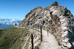 Approach to TamlishornWhen in Lucerne, one should really not miss the classic Goldene Rundfahrt (Golden Round Trip) to the summit of Mount Pilatus, the iconic mountain that rises above Lake Lucerne.
The trip begins with a scenic, hour-long trip on a lake steamer from Lucerne to Alpnachstad. From there you board the steepest cogwheel railway in the world, with gradients up to 48%, for a 40 minute ride through alpine meadows and forests, up the steep rock face, and through four tunnels to the summit of Mount Pilatus, 7,000 feet above sea level. Spend as long as you like on the summit, taking one of the short hikes to various viewpoints, dining at one of its restaurants, or just lounging in one of the deck chairs on the terrace. When you are ready to leave, the summit cable cars will bring you down to Kriens where bus #1 will bring you back to Lucerne.
The cost of the trip is 72 francs per person.
Stechelberg, Gimmelwald, and Murren
Thursday, June 15, 2017 - 9:00am by Lolo14 miles and 0.5 hours from our last stop - 2 night stay
Travelogue
Day 1 - Hike to Gimmewald and Murren and Lunch at the Hotel Bellevue
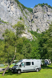 Camping Rutti in StechelbergToday’s drive was a short one - just 14 miles to the other side of the Eiger to Camping Rutti, at the end of the Lauterbrunnen Valley in the village of Stechelberg. Although we didn’t have the Eiger to gaze at, the views of the Lauterbrunnen Valley and surrounding mountains from our campsite were equally impressive, but in a less dramatic way.
The woman that ran the campground, I think totally by herself, was very methodical about where people camped, and she escorted each and every one of us to a spot that would not impede in any way on their neighbor.
Our true reason for being in Stechelberg though was to get to Gimmelwald, the tiny alpine village above the Lauterbrunnen Valley, with a higher population of cows than people. I had wanted to visit it ever since I saw it featured on a Rick Steves Switzerland video -- to me, it was the epitome of a Swiss pastoral village.
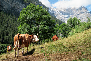 Gimmelwald cowsStechelberg was the closest we could get, because Gimmelwald is car-free and only reached via cable car or foot. The Schilthornbahn cable car was just a little over a half mile walk from Camping Rutti, but we thought it would be more fun and adventurous to walk the 2 miles to Gimmelwald.
So, we set out from the campground and spent the next hour and a half hiking up and up until after about a 2,000 foot elevation gain we finally started seeing cows and then the rooftops of chalets. I knew we were finally getting close.
We were further inspired by a welcoming pair of gnomes alongside the trail, who seemed very fitting residents for a place as magical as this one. I felt like I was in a fairy tale.
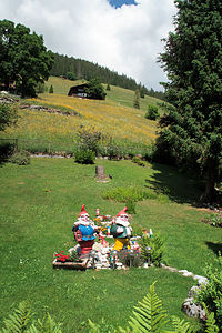 Gimmelwald GnomesThe village was everything I imagined - quaint houses, verdant pastures, cows, and, of course, that awesome mountain backdrop of the Eiger, Monch, and Jungfrau.
There’s not a whole lot to see and do in Gimmelwald - one street, no cars, no food store - just cows and cheese. The only store is “The Honesty Shop - Europe’s First Unattended Self-Service Village Shop.”
The main center of activity is the cable car station which picks up and drops people off on their way between Stechelberg and Murren.
From here, we planned to continue our hike up to Murren, where we wanted to hike along the Murren Via Ferrata back down to Gimmelwald.
Via Ferrata is Italian for “scary hike” - just kidding, actually it means “iron way.” In German, these routes are called Klettersteig (“climbing path”).
They can probably best be described as hiking routes that are precarious enough to require some kind of protection from falling. That protection usually involves steel cables that run along the route at shoulder height to the hiker. Hikers wear helmets and a climbing harness with carabiners attached to them. As they move along, they clip their carabiner onto the cable so they can’t fall.
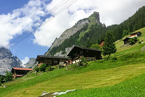 GimmelwaldBesides clinging to steep cliffsides, via ferrata routes also cross steep canyons and ravines on wooden walkways and suspension bridges. Basically, they allow inexperienced mountaineers to go on routes that would be too dangerous to undertake otherwise. They are found all throughout the Alps and are very popular with more adventurous tourists.
This particular one had three canyon crossings, one with over a 3,000-foot drop. I have to admit that my palms were sweating a little bit at the thought of it.
Before leaving Gimmelwald, we stopped in the Youth Hostel, which is the end of the Murren via Ferrata route, only to find out that all the harnesses and helmets had been rented out for the day. They suggested that when we got to Murren, we inquire at one of the sport shops to see if any had been returned early. What a disappointment.
We wanted to see Murren anyway, so we continued on our way for another 2 miles and up another 1,000 feet to the much more commercialized and bustling village of Murren, which was, however, also car free.
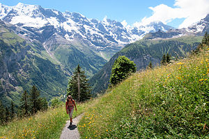 Along the way to MurrenWe wandered around town trying to find a sports shop to rent a Via Ferrata kit, but none of them were open - either because it was mid-day “siesta” time, or they just hadn’t opened yet for the season. It was the opening day for the via Ferrata, which was part of the reason for our timing here, but I guess many of the shops had not geared up yet.
Finally, we gave up and reconciled ourselves to having raclettes at the Hotel Bellevue instead - not a bad consolation prize. The hotel had a beautiful outdoor dining terrace with a fabulous view of the iconic Schilthorn, the Eiger’s rival for attention in the area. It was an amazing setting.
I had been dying to try raclettes, a traditional Swiss dish made with lots and lots of melted raclette cheese over potatoes, so I ordered those and Herb ordered the kalberwurst (veal wurst). Thankfully we shared, because as delicious as the raclettes were, they were very very heavy. Of course, there were two nice refreshing mugs of beer to wash it all down.
The meal definitely fortified us for the long 4-mile walk back down to Stechelberg.
Day 2 - Trummelbach Falls
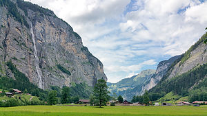 Lovely Lauterbrunnen ValleyOur legs were still tired from our hike to Murren yesterday, so we decided to stick to the Lauterbrunnen Valley floor today and visit one of its most popular sights - Trummelbach Falls, the most unique and powerful of the valley’s 72 waterfalls.
Unlike a typical waterfall that cascades out in the open for all to see, Trummelbach is a series of ten glacial waterfalls that flow inside the mountain. Trummelbach Falls single handedly drains the entire glacial melt of the Eiger, Monch, and Jungfrau, at a rate of 20,000 liters per second, carving and sculpting interesting rock formations along the way.
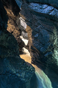 Trummelbach FallsAfter purchasing a ticket for 11 francs, we rode an elevator inside the mountain to a platform from which we walked through a dimly lit tunnel to the uppermost falls. Along the way, there were small cutouts where we could view the water tumbling through the narrow slot canyon.
From there we could have taken the elevator back down, but we chose to walk back down stopping at other viewing platforms along the way.
It was a very special and unique place, enough to warrant it becoming a UNESCO World Heritage Site.
Despite this being our “easy” hiking day, we had still walked 7.1 miles.
Later that evening I heard the sound of cowbells near the campground. I ran out to see what was going on and saw that a line of traffic had formed out on the road behind a farmer bringing his 5 cows home from pasture. Nobody beeped to hurry him along. It was just a typical evening commute in the Lauterbrunnen Valley.
Description
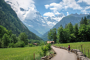 Lauterbrunnen ValleyStechelberg is a small village in the Lauterbrunnen Valley in the Schilthorn Region of Switzerland’s Bernese Oberland, about 11 miles southeast of Interlaken. Set at the base of the Schwarzmonch mountain, it is an excellent base camp for exploring the area. The Schilthornbahn cable car whisks visitors up to Gimmelwald, Murren, Birg, Schilthorn
Gimmelwald is a small alpine village (population 120) perched on the edge of a the mountain 1,500 feet above the Lauterbrunnen Valley, between the villages of Stechelberg and Murren. It is known for its picturesque beauty - chalets decorated with flowers, verdant pastures, grazing cows - all set amongst the backdrop of the Eiger, Monch, and Jungfrau. The village is totally car-free and only reached via cable car or foot. The Schilthornbahn cable car stops in Gimmelwald where it is possible to board another cable car to Murren and the Schilthorn.
Perched 2,000 feet above the Lauterbrunnen Valley, Murren (population 450) is also car free. However, unlike Gimmelwald, it is much more developed and ready to accommodate large numbers of tourists - there are about 2,000 hotel beds. The village has many fine restaurants and shops, as well as impressive views of the Eiger, Monch, Jungfrau, and Schilthorn.
Grindelwald
Tuesday, June 13, 2017 - 9:30am by Lolo80 miles and 3 hours from our last stop - 2 night stay
Travelogue
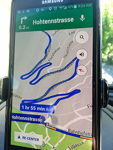 The twisty roads to GrindelwaldLet’s just say that the drive from Tasch to Grindelwald was an interesting one. We weren’t even an hour into our drive before the twisties began. We refer to them on Google Maps as intestines.
The twisties eventually straightened out and we breathed a collective sigh of relief.
One thing our sons criticize Herb and I about is our reliance on Google Maps, rather than doing it the old fashioned way with real maps and having a general idea of where we are going. Perhaps, they are right, as the following episode will illustrate.
As we were entering the town of Goppenstein, Google Maps told us to “turn left.” Herb did as he was told, and we found ourselves in a parking lot.
Somewhat confused, Herb asked me to get out of the car to help him back out so we could regroup and figure out what was going on. As I was guiding him back, he stuck his head out the window and said, “Google Maps is saying to get on the train!”
What? What train?
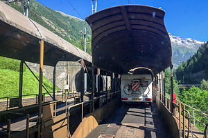 "Take the Train!"Soon we noticed other cars and even another camper drive past us through the parking lot to a ticket kiosk. That’s when we realized that this was a station for a auto-train, and that we really were supposed to “take the train.”
Rather than drive over the Bernese Alps, we were going to go right through them. We paid our 27 francs and drove onto a flat car. We spent the next 15 minutes in the dark, rather stinky Lötschberg Tunnel before popping out on the other side of the Alps in the town of Kandersteg, Switzerland. It was the best 27 francs we ever spent. I’m sure the cost of gas and antacids pills for the driver over the pass would have been more than 27 francs.
Next time we will look at Google’s proposed directions on a real map, so that we have no more surprises.
The remaining hour or so of the drive to Grindelwald was thankfully uneventful.
Day 1 - Cable Car to Mannlichen and the hike down to Kleine Scheidegg and Grindelwald
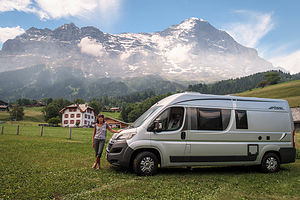 Camping EigennordwandWe were very excited to be in Grindelwald. This village had been on the top of my list of places to see from the very beginning of my trip planning. It was what I visualized when I thought “Alps.”
It was even more beautiful than I had imagined - lovely alpine chalets, verdant pastures, cowbells ringing. and best of all, the north face of the Eiger looming over our campsite. I had picked Camping Eigernordwand because of its close proximity to the Mannlichen cable car station, but had no idea that it would have the views it did. It never hit me that “Eigernordwand” meant Eiger North Wall.
We selected a site at the northern end of a grassy field, so we would have an unobstructed view of the “big fella.” We have had some very scenic campsites over the last 20 years, but this one hit the top of the list.
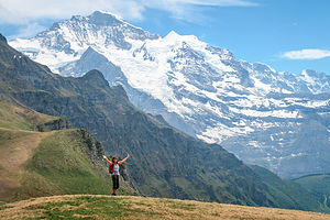 "The hills are alive" atop MannlichenOur preference probably would have been to just chill at the campground for the rest of the afternoon, but the forecast for tomorrow looked questionable, and we really had our heart set on a hike.
So, we walked to the Mannlichen cable car station, bought our tickets for 30 francs each, and spent the next ½ hour soaring through the sky, enjoying the mountain views along the way.
When we got off the cable car we walked to the top of the ridge and were treated to the most incredibly breathtaking view of mountains I have ever seen. This was turning out to be a stop full of superlatives. I wanted to burst into song.
From Mannlichen, we followed a well-traveled trail for 3 miles down to Kleine Scheidegg, with the majestic Eiger, Monch, and Jungfrau mountains laid out before us the entire way.
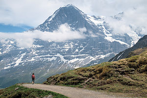 Hiking down to Kleine ScheideggAlthough the hike was one of the most scenic I have ever done, I have to admit that I was a bit disappointed with the commercialism of Kleine Scheidegg. As we approached, the scene was dominated by a large red and white tee pee with “Coca Cola” written across it, and lots and lots of tourists, who I had a feeling didn’t get here by foot, as we did.
From Kleine Scheidegg there are several options. You can take a cable car back down to Grindelwald, hike down to it, or take a 2 hour cable car up to the Jungfraujoch, a saddle between the Monch and Jungfrau with even more incredible views of the mountains, as well as the Aletsch Glacier, a UNESCO World Heritage Site. A round trip ticket to the Jungfraujoch costs about 77 francs per person, unless you have one of the many Swiss or Bernese Oberland discount cards.
It was already pretty late in the day, and we have a preference for non-touristy activities, so we chose to walk the 6 miles back down to Grindelwald. It was a lovely walk through meadows and verdant pastures, accompanied by the melody of cowbells. The cow to people ratio was easily 50 to 1 - just the way we like it.
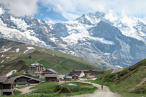 Kleine ScheideggWe were quite tired when we got back to the campground, as it had been an 8.8-mile hike with a 4,200 foot elevation loss. Elevation loss always sounds good on paper, but I find hiking down much harder on the knees and feet.
We set up our little rental table and chair outside the camper, drank a well-earned beer or two, and just gazed at our imposing neighbor, the Eiger.
After the sun went down, we noticed two bright lights on its face. At first we thought it was the headlamps of climbers camping on its face, but we later learned that it was the lights from the tunnel that was drilled through the Eiger for the Jungfraujoch train to pass through. I don’t think there is a mountain big enough to stop these Swiss from drilling through it.
Day 2 - Exploring the village of Grindelwald and Bouldering in the Sportzentrum Climbing Gym
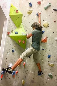 Lolo climbing at the Grindelwald SportzentrumWe had been smart to get our hike in yesterday, because, as we feared, the weather today was cloudy with possible rain showers in the afternoon. Since we hadn’t seen the main part of Grindelwald yet, we decided to make the mile and a half walk into town.
Our first stop in town was the Sportzentrum, a state-of-the art sports center for sports, recreation, and wellness, open to the public. It was pretty amazing. There was a swimming pool, Finnish sauna, steam room, weight room, indoor rope park, internet cafe lounge, ice rink, and boulder area, which is what we came for.
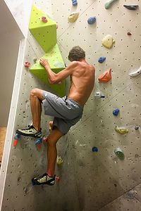 Herb climbing at the Grindelwald SportzentrumIt cost us 21 francs each for a bouldering pass and climbing shoes. When we got to the bouldering room, which was the smallest I have ever seen, we looked at the ratings chart on the wall, which showed the color of climbs from easiest to most difficult - Yellow for kids, Orange the next easiest, then green being medium, and so on.
I joked that I would warm up on the Kids’ routes. Well, I should have known that kids that grow up in the shadow of the Eiger are tough, because these routes were far from easy for me. It was quite discouraging. Herb, did much better, of course, but even he agreed that the climbs were quite challenging.
After that we picked up groceries in the COOP and wandered back to the campground, which basically had the best view in town.
One funny, but rather embarrassing story about our food shopping in a foreign land. Herb loves to eat pastry first thing in the morning before I wake up, a habit he has had for as many years as I can remember. The COOP had no donuts or apple turnovers, so I picked up what looked like cinnamon buns.
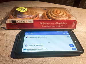 Snails in Hazelnuts??When we got back to the camper, Herb happened to read the side of the package, which said, “Schnecken aux nussfullung.” Just for fun, he looked it up on Google Translate and found that it meant, “snails in hazelnuts.”
Snails in pastry? That seemed crazy, but it wouldn’t be the first time this trip that we were surprised by different European foods and customs.
Herb was crestfallen. He has lots of food allergies, including shellfish, so he didn’t think eating snails would be a very good idea. Then it hit us. The buns were shaped like snails!
So, he ate one.
Description
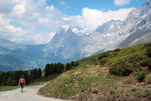 Hiking back to GrindelwaldGrindelwald is an alpine village perched in the mountains of the Jungfrau Region of Switzerland's Bernese Oberland, about 12 miles southeast of Interlaken.
This lovely village of alpine chalets and verdant pastures, set at the base of the Eiger’s north face, is one of the most popular destinations in the Alps, and it is easy to see why.
In winter it offers excellent skiing, and in the summer it serves as a great base camp for hiking. Some of the best hiking trails in the Bernese Oberlands originate here. Hikers can either start in the village or take one of the cable cars up to the high country to begin their trek.
Mannlichen Cable Car
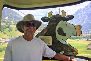 Herb on the Mannlichen Cable CarFrom the Grindelwald Grund at Grundstrasse 54, a cable car whisks hikers up to Mannlichen, where there is a fantastic panoramic view of the Eiger, Monch, Jungfrau, and more. This cable car is featured in National Geographic’s Journeys of a Lifetime.
If you have time for only one hike from Mannlichen, make it the Panoramaweg to Kleine Scheidegg. Along this 90-minute, mostly downhill walk, there is nothing but pure Alps before you. From Kleine Scheidegg you can take a train back to Grindelwald or hike 3 hours.
Another popular option from Kleine Scheidegg is to take another cable car up to the Jungfraujoch. This train, which actually goes through the Eiger to the Jungfraujoch, which is a saddle between the Monch and Jungfrau mountains. For 2 hours, The railway climbs 9 km to the Eiger Glacier Station where the views of the surrounding peaks and the Aletsch Glacier are incredible.
First Gondola
Another option for hiking in the Grindelwald area is to take the Gondola in the village up to First, where a trail leads to the Bachalpsee, a pretty alpine lake at the foot of the Faulhorn. The hike is 3.6-miles (RT) and takes about 2 to 2 ½ hours.
Also at First, is the new Cliff Walk by Tissot, a narrow metal walkway built into the side of a cliff, with a 130-foot suspension bridge and 150-foot-high viewing platform from which there are incredible views of the surrounding mountains, valleys, and pastures.
Zermatt and the Matterhorn
Sunday, June 11, 2017 - 4:00pm by Lolo86 miles and 2 hours from our last stop - 2 night stay
Travelogue
Day 1 - Arriving in Tasch and Hiking to Matterhorn Views
 Simplon PassI’m not sure why the Matterhorn hadn’t made it to our original itinerary, but after speaking to fellow travelers along the way, we added it. That is the beauty of not being locked into a fixed itinerary.
Our drive between Lake Maggiore and Zermatt was very scenic, but reinforced for us why Europeans have smaller motorhomes than the U.S. The roads leading from Italy to Switzerland were so incredibly narrow, steep, and twisty that our trusty Lazy Daze, or at least its driver, would not have been happy navigating them.
When we came to the border, we had to stop to buy a vignette to drive on Switzerland’s highways. All the countries in Europe, except for Germany, which is free, have some form of charging people for driving on its roads. In Austria it had been a 10-day vignette for 8.90 euros, but in Italy it had been a pay-as-you-go toll system, which added up to something like 80 euros for us. In Switzerland you have to buy an annual vignette for 40 euro, which seems like a waste when you are only going to be in the country for a week, but still cheaper than driving the Italian roads.
 First peak of the MatterhornWe also had to exchange some euros for Swiss francs because we now were leaving the European Union. It was exciting to be in Switzerland!
Our drive took us over beautiful Simplon Pass, where we stopped to admire the incredible view. We were back in the Alps, and after the heat spell we had been experiencing the past few weeks, I felt like making a snow angel.
We continued on to the town of Tasch, Switzerland, literally, the end of the road to the Matterhorn. Since Zermatt is a car-free town, visitors have to park their cars in Tasch, 5 km away, and take the train in.
Fortunately for us, there was Camping Alphubel located right near the Tasch train station, which we would use as our base camp for exploring the area over the next two days.
 Matterhorn from the AHV-WegThe campground was nice and the woman working the reception desk was really helpful in giving us information as to how to get a good view of the Matterhorn in Zermatt. Apparently it wasn’t that easy.
Herb and I really like to keep physically active, but with our busy itinerary, we hadn’t had much time for running, our primary form of exercise. To make up for it, we were pretty much hiking and walking everywhere. Who needs trains and buses when you have feet?
So, rather than take the train to Zermatt, we chose to walk the 3.5-mile Bahnweg path instead. It started right by the campground, and followed the train tracks most of the way, leading us through forests, meadows, and pastures. There were no big views along this trail. Instead, the main attraction was watching the fancy red Swiss trains zip by. Unfortunately, we don’t have trains this fast and beautiful in the States.
Finally, we passed the Zermatt heliport and descended into town near the train station (bahnhof).
Zermatt is a very popular and glitzy ski resort town, and it felt very much like ski resorts in the States, such as Aspen or Vail - right down to the expensive food. I looked at a menu and saw that burgers and pizzas cost over 20 francs - no more 6 euro pizzas like we had found in Germany and Italy. Switzerland is very, very expensive.
We followed our campground host’s very specific directions and headed across town along the Untere Mattenstrasse towards the Vispa River. We crossed the river and arrived at our destination, the Sunnegga-Rothorn station, the starting point for several scenic train trips up into the surrounding glaciers and mountains, such as the one to Gornergrat.
 Zermatt at the foot of the MatterhornNow here comes the tricky, secret part we learned from our campground friend. She told us to walk through the station, but to make a left just before the turnstiles for the trains. There, as promised, we found an elevator (funicular), which we took for free up to the starting point of the AHV-Weg trail that would lead us to fabulous views of the Matterhorn.
She was right!! There it was - the iconic, pyramid-shaped mountain. What an amazingly unique rock formation!
We had a long trek home ahead of us, so to increase morale we stopped at a COOP supermarket near the train station and bought 2 beers to enjoy along the trail.
All in all, we hiked 12 miles with about a 2,000-foot elevation change. Not a bad day’s work.
Day 2 - Explore Tasch
 Herb relaxing on tiny SchaliseeWe briefly considered moving on to Grindelwald, because we had already done our hike to see the Matterhorn, but decided to hang out another day and explore the village of Tasch.
Once again, we consulted Trip Advisor for a suggestion of things to do in Tasch. I have to admit that the list was pretty short, but long enough for our purposes today.
One of the Top Things to Do in Tasch is waterskiing in the Schalisee, a tiny little lake located about a 20 minute walk from our campground in the opposite direction from Zermatt. We were intrigued, but skeptical. However, it was another hot day, so the prospect of dipping into a refreshing mountain lake sounded inviting.
 The Hohenweg above TaschSo, we put on our bathing suits, packed towels and a lunch, and walked to the Schalisee. It was quite pretty, surrounded by larch trees and grassy meadows, with a grassy beach on its shore.
As for the water skiing, now we understood. These Swiss are so ingenious. The lake itself is only a little more than 100 meters long, but instead of using a boat to pull a skier, which would be impossible, they have built an electrically-powered waterskiing lift that pulls skiiers from the shoreline. There is even a jumping ramp in the middle of the lake. I would have loved to have seen this in action, but unfortunately it wasn’t opening for another week.
After a refreshing dip, we continued our exploration. We crossed the main road which goes to Zermatt, and hiked up a steep hill to the Hohenweg (High Path), which led us along the hills above the village of Tasch for about 2 miles before descending into the town.
 Cemetary Roemisch-katholische Kirche CemeteryUnlike Zermatt, this is not a glitzy resort town, but a real down-to-earth village where everyday, hardworking people live - in fact, the workers that make Zermatt the successful resort it is. It was quite charming and quiet.
The next (and last 2) things to do in Tasch according to Trip Advisor were both churches. The first one was the Roemisch-katholische Kirche (Roman Catholic Church). The interior was much simpler than the Catholic Churches we had visited so far in Munich and Venice, as you would expect in the parish of a small village.
The most interesting thing about this church is the beautiful cemetery in front of it. Rather than tombstones, each grave has a wooden-carved cross, topped by two more pieces of wood, forming a triangle - kind of like the roof of a chalet. They were beautiful. Each marker had the deceased’s name and dates and was surrounded by personalized items - photographs, flowers, candles, memorabilia, etc. There was no status-seeking here - all the markers were of the same wood and height. What a lovely, peaceful setting to come visit one’s loved ones.
 Fuxstein ChapelThe second church on the Things to Do list was very different from the first, and a bit hard to find, because it is so well camouflaged - a rather unique characteristic for a church. The Fuxstein Chapel is not a free standing building, but rather a room hollowed out of a large boulder that sits on the valley floor, surrounded by meadows and pastures.
The interior is quite small - just a few wooden pews set before a small golden altar. Rather than the usual cross representing the crucifixion, the bottom of the altar contained a glass, coffin-like box containing a replica of the body of Christ.
I couldn’t believe this chapel was only about a 100 yards from our campsite, and we never even knew it was here!
Tomorrow we would move on to Grindelwald and begin our exploration of the Bernese Oberland.
Description
 ZermattZermatt, Switzerland’s glitziest resort since the mid-19th century, is a popular mountaineering and skiing village that lies below the iconic, pyramid-shaped Matterhorn. It is surrounded by mountains and has fabulous views.
In summer, ski lifts transport hikers into the mountains to many excellent hiking trails. There is a cog railway from Zermatt to Gornergrat that is the highest in Europe and brings passengers to even greater views of the Matterhorn.
The main street through town is the Bahnhofstrasse where visitors will find upscale (and expensive, especially compared to Germany and Italy) restaurants, boutique shops, and hotels.
The town is essentially traffic free, so visitors must park 5 km away in the village of Tasch and take the train into town.
Lake Maggiore and the Borromean Islands
Friday, June 9, 2017 - 10:45am by Lolo180 miles and 3 hours from our last stop - 2 night stay
Travelogue
Day 1 - Swim/Beach on Lake Maggiore and Explore Feriolo
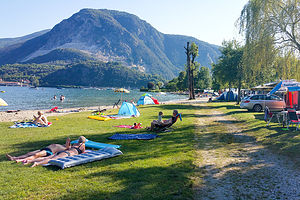 Campground beach on Lake MaggioreAfter Cinque Terre, we almost headed to another U.S. tour favorite - Lake Como, but after learning that it's a place where the rich and famous like to hang out, we thought that we, and our humble little camper, would feel more at home on Lake Maggiore, another beautiful lake in the Italian Lakes District.
My trip planning is usually very heavily activity based, meaning that I pick stops based on things to do - like hikes, or bike rides. I hadn’t really researched Lake Maggiore at all, but we do like beautiful lakes, so we looked on Yelp for highly rated lakeside campgrounds. At the least, we could swim and enjoy the scenery.
We came up with Camping Conca d’Oro on the western shore of the lake near the little village of Feriolo. It had nice grassy sites and a sandy beach right on the lake.
While Herb was checking in, I walked over to the information desk to find out about things to do in the area. The brochure that grabbed my eye was the boat tour to the Borromean Islands, complete with palaces and gardens. Wanting to find out more about this, I asked if anyone spoke English. One poor girl got volunteered, but her English wasn’t much better than my Italian. I think I eventually conveyed my desire to take this tour tomorrow and asked how I could get to the Baveno boat ferry, which was about 3 miles away. She nodded a lot and eventually handed me a bus schedule.
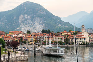 Village of FerioloMeanwhile, Herb was able to get the last available campsite in the section near the lake. It was a nice grassy site less than 50 yards from the beach.
The European heat wave still hadn’t let up, so after settling in, we immediately headed to the beach. Unlike the pebbly campground beach on the Gardasee, this one was sandy with trees to provide some shade. The water was refreshing and delightful.
After a few hours of reading and swimming, we decided to take a walk into the nearby village of Feriolo, about a mile away. It had a picturesque waterfront with several dining patios alongside the lake and rows of brightly colored houses (this is Italy after all).
We continued our stroll along the waterfront around the bend to the marina, where we had a great view back at the village with the mountains of Val Grande National Park as a backdrop. So far, I hadn’t met an Italian village I didn’t like.
Day 2 - Boat to Borromean Islands
 Cruising Borromean BayToday we would explore the Borromean Islands of Lake Maggiore, which Trip Advisor rated as the top Thing to Do in the area.
The islands get their name from the Borromeo family, a noble family from Milan that has owned these islands since the 17th century. The Borromeos were art lovers and botanists and hired the best architects and gardeners of their time to build their grand residences and elaborate gardens.
Three of these islands - Isola Madre, Isola Bella, and Isolo dei Pescatori -- are open to the public and reached via a hop-on-hop-off ferry. The closest ferry dock for us was in the town of Baveno, which according to the girl I spoke to at the campground tour desk yesterday could be reached by bus.
So, bus schedule in hand, we set off on the mile walk to the village of Feriolo to catch the 9:28 bus to Baveno. We were the only ones at the bus stop, so we rechecked the schedule to make sure we had the right time and place. We did. Perhaps it was so quiet because it was a Saturday. 9:28 soon came and went, then 9:38 - still no bus.
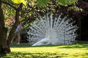 Isola Madre White PeacocksI looked at the schedule again and noticed the word “Feriale” at the top of the column for 9:28 (and most of the other times that morning). Not knowing Italian, I keyed it into my phone translator. The result was not good - “Weekday.” There would be no bus today.
Not wanting to give up on our plans to visit the islands, we walked the 3 miles to Baveno.
Down at the docks, there were a few different options for boat tours, some more official than others. One was just about to pull out as we got there, so we quickly hopped on and paid the 13 euro (each) fare.
We were dropped off first at Isola Madre, the largest of the Borromean Islands, where we followed the crowd to the ticket booth to purchase tickets to visit the palace and the gardens. We decided to buy a combo ticket for 21 euro each, which would also cover the admission to the palaces and gardens on Isola Bella.
 Isola Madre Puppet TheaterBefore touring the villa, we wandered through the beautiful English-style botanical gardens that this island is famous for -- the lifework of Count Vitaliano IX Borromea, a passionate botanist who spent his life collecting rare trees and exotic plants from around the world. However, what was stealing the show were two totally white peacocks strutting freely around the grounds as if they owned the place.
After the gardens, we toured the 16th century villa, which was the residence of one branch of the Borromeo family - residences by other members of the family were scattered throughout the Borromean Bay. The home was warm and charming, a lot less ostentatious than many of the palaces we had seen on our trip so far. However, this one did have something the others hadn’t - a puppet theater and marionette collection for entertaining their guests.
Behind the villa there is a small piazza with a modest family chapel and a colorful waterlily pond.
Time for the next island, so we walked back to the dock and didn’t have to wait long for our trusty captain to show up and deliver us to our next stop - Isola Bella.
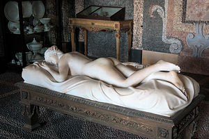 Isola Bella Grotto - Reclining VenusIt didn’t take us long to figure out that Isola Bella was where the more flamboyant branch of the Borromeos had once lived. The island is dominated by a huge, sumptuous, four-storey Baroque palace with 30 richly furnished rooms to tour - nothing like the relatively simple, yet charming, abode of the Madre Borromeos. Some of the more memorable rooms in the palace included the Hall of Honor, the Tapestry Hall, the Neoclassical ballroom, and the room where Napoleon once slept.
However, by far the most intriguing part of the palace is in the basement where there are six underground natural grottos, decorated with dark and light-colored shells and pebbles depicting various nautical themes. I lost Herb for awhile in front of the “Reclining Venus” statue, which had caused quite a stir back in the day, when one of the Borromeo’s guests found its sensuality shocking. I’m glad the Borromeos stood their ground and kept it, because it really was quite lovely.
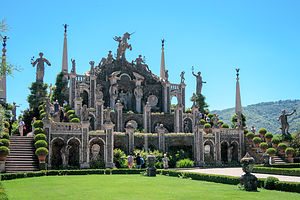 Isola Bella Garden AmphitheaterJust as the residence on Isola Bella was much more ostentatious than that on Isola Madre, the gardens were equally over the top in comparison. The gardens were laid out on ten terraces ornamented with exotic plants, spectacular flowers, topiary, ponds, fountains, obelisks, reliefs, and statues. At the end, there is an amphitheater, on three levels, decorated with statues representing the triumphs of the Borromeo family, dominated by a huge statue of a Unicorn, the heraldic emblem of the Borromeos, flanked by statues representing Nature and Art. From the 120-foot high upper terrace, there is a breathtaking view of the lake and surrounding mountains. It was pretty spectacular.
Oh, and of course they too had their own white peacocks strutting around, a little bit more pompously, I thought, than those on Isola Madre.
The third, and last, island on the tour that day was Isola dei Pescatori, a very different experience from the previous two. This island has no lavish palaces or gardens, and there wasn’t even a fancy peacock in sight. Rather, as its names suggests, it is a quaint fishing village, with narrow Medieval lanes, hardworking inhabitants, and simple two-storey fishermen’s homes, complete with long balconies for drying fish. In contrast to Isola Madre and Isola Bella, this was an island of everyday hardworking people, and had been so for centuries.
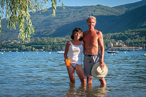 Lovely Lake MaggioreThat was the end of our island tour, which had been truly fascinating and lots of fun - a very worthwhile activity, which I highly recommend.
Once back to the dock in Baveno, we probably could have found a bus that ran on weekends back to Feriolo, but we decided to just walk the 3 miles instead.
It had been quite a full day and we were exhausted, so we spent what was left of it enjoying the campground beach on the lake.
Description
 Feriolo on Lake MaggioreLake Maggiore, meaning “greatest lake,” is one of several beautiful lakes in the Italian Lake District, which stretches across Northern Italy. It is Italy’s longest lake, stretching for 43 miles, 8 of which extend into Switzerland.
The jewels of Lake Maggiore are the Borromean Islands, which lie in a bay surrounded by mountains on the western side of the lake, between Stresa and Verbania. The three major islands can be reach via a hop-on-hop-off ferry service from Stresa, Verbania, or Baveno.
The islands get their name from the Borromeo family, a noble family from Milan that has owned these islands since the 17th century. The Borromeos were art lovers and botanists and hired the best architects and gardeners of their time to build their grand residences and elaborate gardens.
Ticket prices to visit the palaces on the island can be found here: http://www.isoleborromee.it/eng/info.html
Isola Madre
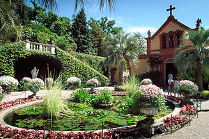 Isola Madre Chapel SquareIsola Madre is the largest of the Borromean islands. Once a medieval defense, it is now dominated by an English-style botanical garden with rare trees, exotic flowers, azaleas, rhododendrons, camellias, and ancient wisteria. Count Vitaliano IX Borromea was a passionate botanist who spent his life collecting valuable plants from around the world. Like on Isola Bella, white peacocks wander the grounds as if they own the place.
The villa on the island was built in the late 16th century and served as a residence for members of the Borromeo family. Visitors can tour the home, including the Dolls’ Room, the Room of the Seasons, and the Puppet Theaters.
Behind the villa there is a small piazza with a modest family chapel built in 1858 and a colorful waterlily pond.
Isola Bella (“Beautiful Island”)
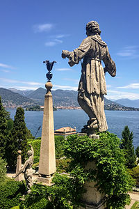 Isola Bella GardemsIsola Bella is dominated by its sumptuous four-storey Baroque palace, along with a luxuriant Italian-style garden. Visitors can tour 30 of the richly furnished rooms of the palace, including the Hall of Honor, Tapestry Hall, music room, Neoclassical ballroom, room where Napoleon slept, etc. However, the most intriguing part of the palace is the six underground natural grottos, decorated with dark and light-colored shells and pebbles reflecting nautical themes.
Equally impressive are the formal gardens, laid out on ten terraces ornamented with exotic plants, spectacular flowers, topiary, ponds, fountains, obelisks, reliefs, and statues. There are also two white peacocks that freely wander the grounds. At the end, there is an amphitheater, on three levels, decorated with statues representing the triumphs of the Borromeo family. The upper terrace, which is 120-feet high, has a breathtaking view of the lake and its surrounding mountains.
Isola dei Pescatori (Fishermen’s Island)
Isola dei Pescatori is the only one of the three islands that is inhabited, and as its name suggests, most of those inhabitants are fishermen, generations of whom have been living there for centuries. Unlike the lavish palaces and gardens of the first two islands, this is a quaint fishing village with narrow Medieval lanes and simple two-storey fishermen’s homes, with long balconies for drying fish. The island’s many fine fish restaurants, where you can eat freshly caught fish, make it a popular destination.
Cinque Terre
Wednesday, June 7, 2017 - 10:15am by Lolo170 miles and 3 hours from our last stop - 2 night stay
Travelogue
Day 1 - Arriving at and exploring Levanto
 The colors of Levanto BeachCinque Terre is a very popular destination on U.S. tours of Italy, and several of my friends have posted Facebook photos of its picturesque, centuries-old villages tucked along the edges of its rugged, mountainous Italian Riviera coastline. Surprisingly, Europeans not so much so. Many whom I shared my list of stops with had never even heard of it. Strange, because it is a truly amazing place.
There are five of these villages (Monterosso, Vernazza, Corniglia, Manarola, and Riomaggiore), so hence the name “Cinque Terre, which means “Five Lands” in Italian. I’m sure everyone has seen beautiful photos of these villages taken from the Sentiero Azzurro trail (blue trail) that runs above them along the cliffs. This trail and those photos were the reason we were here.
The towns along the trail are quite remote and isolated and can only be reached via train, boat, or foot. Our plan was to camp in the town of Levanto, so that we could take the train to Monterosso, where the Sentiero Azzurro trail began.
Our original intent was to camp at Camping Acqua Dolce, a small campground in the heart of Levanto, in walking distance to a sandy beach on the Mediterranean and the train station. Sounded perfect -- apparently everyone else thought so too, because by the time we got there it was totally full.
 Surfers on Levanto BeachThe campground host gave us a list of four campgrounds a short distance outside of town, which we tried calling to see if they had room for us. Three didn’t answer (possibly Siesta time), but the one that did said they were full as well. We were in a little bit of a panic, as we had really driven quite far out of our way along some pretty winding roads to get here.
We decided to try Camping San Michele, because it was the furthest from town, which we figured would give us the best chance of having availability. As we pulled in, a woman (the proprietress) was just getting in her car to go pick up her son at school. She told us there was room, and suggested we take a walk around to pick a site while she was gone.
 Levanto Beach on the Mediterranean SeaWhat a difference from the hustle and bustle we had encountered down at the other campground in town. This one was so peaceful and tranquil, set in an olive grove atop a hill overlooking the countryside. We picked the site that had the best view and waited for the campground owner to return. It seemed like she ran the entire place herself.
My main concern was how we would get to the train station in Levanto tomorrow, without moving the camper. The proprietress told us there was a dirt trail that started right outside the campground that would lead us to the road to the train station, about a mile away.
We decided to take the trail that afternoon and check out the town of Levanto. Our first stop was the train station, where we got a copy of the schedule and bought a two-day Cinque Terre Train Card for 29 euro each. This would give us unlimited train travel for 48 hours, starting with our first usage, and a pass to hike the Sentiero Azzurro trail.
 More of lovely Levanto BeachAfterwards, we strolled down to Levanto’s long sandy beach on the Mediterranean and watched the surfers ride the waves. I so wished we had brought along our bathing suits, but since we didn’t, I did the next best thing - waded up to my knees in the warm water - my first dip in the Mediterranean Sea.
We continued along the lovely waterfront admiring the colorful houses and beach umbrellas. It’s amazing what a difference a bucket of paint can make. The Italians certainly know how to use a colorful palette to make things festive.
We stopped for dinner at a little restaurant called Caffe Roma on the Piazza Staglieno and sat on the outdoor patio watching people recreating and socializing in the park across the way. It was such a happy scene of locals enjoying everyday life.
We made the long walk back to our campground and set up our little rental table and chairs outside the camper to watch the sun set over the olive groves. Now this was the real Italy.
Day 2 - Hiking the Sentiero Azzurro Trail from Monterosso to Vernazza
 Looking back at MonterossoWe were quite excited about hiking the beautiful Sentiero Azzurro trail today, so we got an early start, trekked down the path to the Levanto train station, and caught the 9:05 train to Monterosso, the first stop. From the Monterosso train station we walked up the hill to the Cinque Terre Visitor Center to get maps and information about trail conditions.
The Sentiero Azzurro (Blue Trail - marked # 2 on the maps) goes along the rugged mountainside, passing through each of the coastal towns - Monterosso (which we were in now), Vernazza, Corniglia, Manarola, and Riomaggiore. It is supposed to be quite steep and challenging.
We would have loved to hike the whole stretch, but unfortunately the part from Corniglia on has been closed since 2011, due to a devastating flood that damaged the trails.
As an alternative, I asked the Ranger about returning from Corniglia via the inland Sentiero Rosso trail, which runs high above the Cinque Terre towns and is also supposed to be beautiful. She looked at me like I was a crazy tourist and said that not many people do that. I had no idea at this time just how hilly and rough all these trails were. We decided that we would make that decision when we got to Corniglia. If we didn’t want to do it, we could just take the train back to Levanto.
 From Monterosso to Vernazza on the Sentiero AzzurroThe hike from Monterosso to Vernazza is the most challenging section of the trail. The trails, are steep, narrow, and rocky, and there are lots of steps. It was a rough 4 miles - felt much longer - and pretty much took us the estimated hour and a half.
Almost everyone we passed on the trail was speaking English, confirming my earlier statement that Cinque Terre is very popular with Americans.
As we approached Vernazza from the trail above, the views of the town were incredible - colorful old houses stacked haphazardly on top of each other, narrow crooked streets, and a small, sandy beach along the harbor. I think this is the vantage point from which the photos I have seen of Cinque Terre are taken. It looked very inviting.
 Looking back at Vernazza on our way to CornigliaWe hiked the steep trail down into the town and sat on the beach for awhile. Afterwards we wandered through the narrow alleys of this very picturesque town before climbing back up to the Sentiero Azzurro and continuing on towards Corniglia.
This section of the hike was the wildest and greenest section along the coast. The previous section to Vernazza was supposed to be the most challenging, but this was not exactly a piece of cake either.
Corniglia was different from the other CInque Terre towns in that it was not at sea level. Rather, it sat atop a 300-foot high rocky promontory surrounded by vineyards. No ferries or cruise ships could reach it, so it was quieter and more tranquil than the other villages, but just as quaint.
We took advantage of the quiet, to have a nice lunch overlooking the water. I think there was a refreshing beer involved as well.
 Approaching Corniglia on the Sentiero AzzurroThis was the end of the line in terms of hiking the Sentiero Azzurro trail since the next two sections were closed. We had already hiked 10 miles, counting the walk from the campground to the Levanto train station, and most of them had been quite challenging. Now I understood why the Ranger thought I was a crazy lady suggesting that we might want to hike back from Corniglia on the inland Sentiero Rosso trail.
The only hiking we were going to do now was to the Corniglia train station. Even this wasn’t easy, as the station is located down on the waterfront, and required walking down 365 steps. At least, we were going down and not up.
By the time we got back to the campground, we were exhausted. The thought of hiking these steep trails again tomorrow was not particularly appealing, especially since we had already seen the highlights.
Despite hating the thought of not using the second day on our Cinque Terre Cards, we decided that tomorrow morning we would move on to our next stop - Lake Maggiore in the Italian Lakes Region.
Description
 Approaching Vernazza on the Sentiero AzzurroCinque Terre, which means “Five Lands”, is a series of five centuries-old seaside villages tucked away along an 11-mile stretch of rugged, mountainous Italian Riviera coastline.
The easiest way to reach and travel between the villages is via a train from the town of Levanto, just north of Cinque Terre. I highly recommend purchasing a Cinque Terre Train Card, which covers unlimited train travel as well as access to all hiking paths. A one-day card costs 16 euro and a two-day card costs 29 euro: http://www.cinqueterre.eu.com/en/cinque-terre-card.
However, by far the best way to visit the villages is via the Sentiero Azzurro (Blue Trail - marked #2 on the maps), which follows the edge of the hills between the villages. It involves steep climbing up rough stone stairs and walking on loose rocky surfaces, so sensible footwear is recommended. It requires a hiking pass (which can be part of the Cinque Terre Train Card). For an overview of the trail, see: https://www.walksofitaly.com/blog/cinque-terre/hiking-trails
NOTE:
In October of 2011, the Cinque Terre region was hit hard by a devastating flood which has resulted in the closing of the section of the trail connecting Riomaggiore (on the southern end) to Manarola to Corniglia. However, the section from Manarola (northern end) to Vernazza (1.5 hours) to Corniglia (1.5 hours) is open. For current conditions, check with the Cinque Terre National Park office (parconazionale5terre.it).
The following is a brief description of the five villages (from north to south - the direction we took):
- Monterosso if the furthest north of the 5 villages and the only one with a sandy beach. A tunnel connects the “Old” town to the “New.” The Old Town is similar to the other villages, though larger and not quite as steep. While pretty, it is not quite as stunning as the other 4 villages and has a more beach resort feel to it. Monterosso is known for its lemon trees and anchovies served right off the boat.
- The hike from Monterosso to Vernazza is probably the most challenging section of the trail. The trails, are steep, narrow, and rocky, and there are lots of steps. Before descending to the town, make sure to take in a beautiful view of it from above. Its colorful old houses haphazardly stacked on top of each other, narrow crooked streets, numerous restaurants and cafes, eye-popping sea views, and small beach along the harbor make it a wonderful respite along the way.
- The hike from Vernazza to Corniglia is the wildest and greenest section of the coast. Like the previous section, it is quite steep and challenging. Sitting atop a 300-foot high rocky promontory surrounded by vineyards, is the only one of the five villages not near sea level - and therefore, not accessible by water. 365 steps lead down to its waterfront train station far below.Corniglia has a much quieter and more tranquil feel to it than the other villages, but is just as quaint.
- The hike from Corniglia to Manarola(45 minutes) is currently closed due to damage from a devastating 2011 flood. However, the town can still be reached via train, boat, or car. Manarola has a bustling main street and waterfront promenade, a nice swimming area off a cement pier, and lots of caves and coastline to explore.
- The hike from Manarola to Riomaggiore(20 minutes) is currently closed due to the above-mentioned flood. However, like Manarola, the town can still be reached via train, boat, or car. Riomaggiore is the southernmost of the five villages and its largest. It has a lovely harbor and pebbly beach, a botanical garden, and an ancient stone castello built in 800 to protect the citizens in case of an attack from the sea. There are numerous restaurants, cafes, and bars along the Via Colombo, Riomaggiore’s main street.
 Exploring the back alleys of Corniglia
Besides the Sentiero Azzurro (Blue Trail), there is another more challenging inland trail called the Sentiero Rosso (Red Trail), which runs high above the Cinque Terre villages for 22 miles from Levanto to Porto Venere. It’s mainly flat, with plenty of restaurants and bars along the way. It is far less populated than the Sentiero Azzurro.
Peschiera del Garda on the Gardasee
Monday, June 5, 2017 - 12:45pm by Lolo122 miles and 2.5 hours from our last stop - 2 night stay
Travelogue
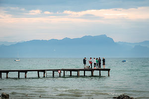 The GardaseeBefore yesterday we had never heard of the Gardasee. I hadn’t come across it during my pre-trip research, so it never made it my proposed itinerary. Instead, we learned about it last night in our Venice campground, while doing dishes at the campground sinks -- which by the way, is a great way to not only get your dishes clean, but to socialize and learn from your fellow campers. We got to talking to the gentleman scrubbing away next to us about where we might be heading next. He was from Germany, like practically everyone else in the campground, and suggested that we might like the Gardasee, Italy’s largest lake, which was only a little more than 2 hours away along our intended route.
Not being locked into a set itinerary, which is a wonderful luxury, we did some research on our own as to campgrounds on the lake, and found Bella Italia, on the southern shore of the lake in the town of Peschiera del Garda. It had great Yelp reviews.
Day 1 - Drive to Bella Italia and walk to and explore Peschiera del Garda
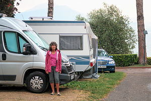 Camping Bella ItaliaWhen we got to the campground, we were lucky enough to get an electric site just a short distance from the campground’s stone-covered beach. A friendly neighbor from Britain said that he and his wife were staying here for 3 weeks and used it as a base camp for taking various day trips throughout northern Italy. I’m glad we talked to him, because he told us about the picturesque village of Peschiera del Garda, which was just a mile-long stroll away, along the pedestrian walkway that ran alongside the lake. We would definitely have to check that out this evening.
Before going for a swim, we took a walk around the campground to check out the facilities. Like our Venice campground, there were five amazing pools, several great restaurants, numerous shops, and a full supermarket. Plus, a beach on the Gardasee. Now that the bar had been so dramatically raised as to what we expected in a campground, how were we going to go back to camping in the States?.
By the time we got back to our campsite, threatening clouds were moving across the lake, so instead of going to the beach for a swim, we hunkered down in the camper until it passed.
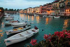 River Mincio in Peschiera del GardaAfterwards, the skies cleared and we set off, as our neighbor suggested, to the little town of Peschiera del Garda. What a lovely walk it was -- lake on one side, restaurants, cafes, beautiful homes on the other.
After about a mile, we came to the village itself and crossed a bridge over the River Mincio, which flows into the lake. My phone rang, so while I was busy talking to one of our sons, Herb spent his time taking photographs of the houses and boats along the river in the evening light. I tend to get oblivious to my surroundings when talking on the phone, so when he showed me the photos afterwards, I was stunned with how beautiful it was, and a little sorry that I hadn’t paid more attention.
The bridge had brought us onto an island with old fortress walls dating back to the 16th century. These walls once enclosed a fortress that played a prominent role in the Italian campaigns of the French Revolutionary War, the Napoleonic War, and the War for northern Italy’s Independence from Austria.
 Remains of a 1st century Roman settlement unearthed in 1974Crossing back over the bridge we wandered along the waterfront and then back into the pedestrian alleys where there were lots and lots of clothing and shoe shops - this is Italy after all and fashion plays a very important role. We had already noticed how Italian women love to dress up, much more than we had noticed in Germany. Most of the shops were quite chic and expensive, but I did find one outside rack of dresses where the prices were very reasonable - under 20 euro. It was closing now, but Herb promised we could come back tomorrow night.
We also stumbled upon a fenced off archeological dig, which we learned was the remains of a Roman settlement from the 1st century B.C. Peschiera del Garda, known as Acrilica in Roman times, was once a thriving trade community, and this site is where the important Roman road Verona-Brescia-Milano crossed the Mincio River. These ruins were discovered in 1974 by construction workers while excavating the area. Today the area is fenced off and protected for public viewing.
I love Italy. Where else can you go clothes shopping and Roman ruin viewing on the same block?
Day 2 - First run in Europe, Campground beach, and dinner and shopping in Peschiera del Garda
 Rainy Run to along pedestrian way to Peschiera del GardaWe awoke to very cloudy skies and a bit cooler temperatures - the perfect conditions for a run. I love to run, but between the sightseeing and the hiking, there just hadn’t been the time or opportunity to even squeeze in a short one.
We set off on the pedestrian walkway back towards Peschiera, but kept on going through the town and up along the lake for another mile and a half before it started to rain. We turned around and headed back towards the campground. It wasn’t raining too hard, so we continued past the campground for another mile to the town of San Benedetto di Lugana. It felt so incredibly refreshing to run in the rain, especially after spending the last two weeks in a European heat wave,
We still hadn’t swam in the Gardasee, so after getting back from our run, we got on our bathing suits, hobbled across the stone-covered campground beach and jumped in the water. Now our visit to the Gardasee was official.
 Peschiera del GardaLater that afternoon, we headed back into the town of Peschiera so that I could try on the dresses I saw last night. The store was somewhere in one of the back alleys off the waterfront, but fortunately Herb, who has a much better sense of direction than me was able to find it. I actually picked a different dress to try on than the one I had my eye on last night, and it was actually cheaper - only 14 euro! I couldn’t decide on sage or blue, so I got both.
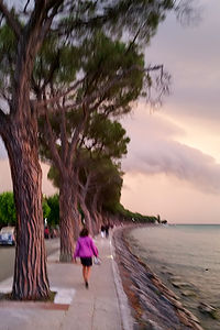 Running to beat the stormAfterwards we had dinner at a restaurant on the Mincio River called Al Canal. Herb pointed out that this restaurant was in the photo he had taken the night before when I was too busy on the phone to notice. It was quite lovely.
Just as we were finishing our dinner, the wind picked up and the skies grew dark and ominous. We could hear thunder rumbling quite nearby. The waiters began scurrying around, closing umbrellas and removing tablecloths. Guess it was time to go.
As we headed back along the pedestrian walkway, the skies opened and it began to pour. The thunder and lightning was right upon us now. I had been suffering through the heat for the last few weeks, so this weather was really invigorating for me - so much so, that I clutched my bag of dresses and began to run, and pretty fast, if I must say so myself. Herb kept calling for me to slow down. I had on this really nice pair of Keen sandals from REI that have Vibram soles, so I could do this much better than the Italian ladies in their chic high heels. I made sure to point this out to Herb later, as I had caught him several times admiring those heeled shoes. I never realized he liked ladies’ shoes that much.
We were totally drenched by the time we got back to the camper, but it had been so much fun!
Description
The Gardasee, located in northern Italy, is Italy’s largest lake and a very popular holiday destination for Europeans. It is 32 miles long and 10 miles wide.
he picturesque town of Peschiera del Garda is situated on the lake’s southern shore at the mouth of the River Mincio. Its strategic location at the river’s mouth made it an important trading town for centuries. There is much history to discover here.
The town dates back to 1400 B.C., but had a flourishing Bronze Age community even before that. Its ancient Roman name was Acrilica, and in 1974 the remains of a Roman settlement were discovered here. This settlement was probably built around the 1st century B.C. in the place where the important Roman road Verona-Brescia-Milano crossed the Mincio River near the lake shores. These remains can be viewed today in a protected archeological area in the village.
Jumping forward several centuries, the town is surrounded by enormous fortress walls, in the shape of a five-pointed star, dating back to the 16th century. Originally built by the Scalgieri’s of Verona, over the years they have been added to by Venetians, Austrians, and Italians. The fortress played a prominent role in the late 18th century during the Italian campaigns of the French Revolutionary War, in the early 19th centuries Napoleonic War, and in the First Italian War of Independence during the 1840s when it was finally taken from Austrian occupiers.
Near the fortress, is the 16th century Sanctuary of Madonna del Frassino, visited each year by thousands of pilgrims.
Today this picturesque old town on the lovely Gardasee is a very popular resort, with lots of wonderful cafes, restaurants, and shops to enjoy when not out having fun on the lake.
Venice
Wednesday, May 31, 2017 - 6:15pm by Lolo275 miles and 5.5 hours from our last stop - 5 night stay
Travelogue
 Camping Marina di Venezia beach on the Adriatic SeaComing from a country that takes multiple days to cross, it was pretty amazing to us how compact Europe is. Within five hours of leaving the snow-covered Bavarian Alps in Berchtesgaden, we were in Venice -- or at least in a campground on Punto Sabbioni just across the lagoon.
This was the campground that Herb had been dreaming of ever since he saw the giant aerial photograph of it in the McRent lounge. It’s called Camping Marina di Venezia and it’s the largest campground in Europe.
The facilities are beyond anything I have ever seen in the U.S. There is an Aquamarine Park with 5 pools, including an Olympic size lap pool, a wave pool, 3 large water slides, a play area with a giant tipping bucket that periodically dumps gallons of waters on heads below, and several jacuzzis. There are 3 restaurants, 2 bars; a supermarket, a hair salon (where you can even get your armpits done), all kinds of shops, a doctor’s office, a stage for performances, and on and on. Oh, and did I mention a sandy mile-long beach on the Adriatic Sea?
 Not your everyday campground restaurantIt was like a closed ecosystem, a city unto itself. You could live there for years and never have to leave.
I was a bit fearful that Herb was thinking just that. Hopefully, the lure of Venice would be too much for him to resist.
We negotiated a plan that would incorporate some down time into our somewhat frantic schedule. We agreed to spend five nights in this incredible campground in order to allow us four full days here. On the first full day (tomorrow) we would just hang out at the campground, enjoying the pools and swimming in the Adriatic Sea from the campground beach. On days 2 and 3 we would play tourists and visit Venice and the outer islands (Murano, Torcello, and Burano). Then on day 4 we would relax at the campground once again, culminating with a fireworks display on the beach that night. It seemed like they scheduled it just for us.
Day 1 - Camping Marina di Venezia lap pool, first “shushy time”, and beach on the Adriatic Sea
 Camping Marina di Venezia Aquamarina ParkWe learned two surprising things today. First, Germans really really like to camp. Although we were in Italy, 90% of the people camping here were Germans. After that probably about 5% were from the Netherlands. Except for the employees, there wasn’t an Italian in sight.
Second, Spain does not have a monopoly on siestas. Germany, Italy, and Switzerland seem to love their mid-day nappy time too. Maybe we didn’t notice it at our previous stops, because we were out during the day, but between noon and 2:00 each day (and even as long as between 11:00 am and 3:00 pm in other places we would visit), everything comes to a stop - supermarkets, campground offices, and shops close; German people disappear into their campers or loungers to nap; and a hush falls over the campground, as everyone is encouraged to enjoy some quiet downtime.
I was too hyper for this, but Herb thought it was great. He called it “Shushy Time.”
 Herb enjoying Camping Marina di Venezia Aquamarina ParkWe spent pre-shushy time at the Aquamarina Park. This place truly is incredible. Herb loves to swim for exercise, and when we are home, he goes at least 3 or 4 days a week to our community pool to swim laps. He was in heaven at the thought of being able to do that here. I figured I would join in as well, although I am not the best of swimmers in that I hate putting my face underwater without holding my nose. At home, I use goggles and a snorkel, but here I was on my own.
I felt pretty at home here though, because I think European woman often swim with their heads above water as well. Herb’s mom, who was from Germany, used to do this, but I always thought it was to keep her perfectly coiffed hair in tact. For whatever reason, there were plenty of women doing this here as well.
 Lolo frolicking in the Adriatic SeaWe set off in the pool with the intention of swimming a mile, which is 32 lengths of an Olympic pool. About half way through our workout, Herb’s lane turned into an aqua aerobics class, and he soon found himself surrounded by dozens of elderly bobbing German women, bouncing up and down while moving their arms in sync to the loud dance music coming from the large speakers that had been placed at the end of the pool. He looked confused. I found it hilarious.
So, we cut our workout short and headed back to the campsite to enjoy our first “shushy time.” I have to admit, it is kind of nice to just chill for awhile in the afternoon.
Afterwards, we walked the short distance to the beach to spend the remainder of the afternoon sunning on the sandy beach and periodically dipping in and out of the luxuriously warm water. It was quite lovely.
Day 2 - Venice
 St. Mark's Square from or Vaporetto ride along the Grand CanalDescribing Venice in words is beyond my skills as a writer. Besides, I don’t think there is anyone that doesn’t have a pretty vivid image in their mind of the uniqueness and beauty of this incredible old city.
Since Venice is an island without roads, getting to and around it requires some form of water transport. There are basically three types: gondola (romantic, pricey, and great for selfies), water taxi (less romantic, less pricey, but convenient), and vaporetto (most economical).
For our needs, the vaporetto made the most sense. It is Venice’s public transit system and works like city buses with established schedules and fares. Single ride tickets are 7.50 euros, which can really add up, one-day Travel Passes are 20 euros, and the two-day Travel Pass is 30.
We decided on the two-day Travel Pass, which would allow us to take unlimited rides over a 48-hour period. It would pay for itself in just 4 rides. Plus, we wanted the freedom to feel we could just hop on and off the ferry as we pleased.
 St. Mark's SquareThe Punto Sabbioni vaporetto dock was a 2-mile walk from the campground. There is a bus that runs between the campground and the dock, but rather than wait for it, we decided to just walk. At the dock we purchased our Travel Passes, and the 48 hour clock started ticking as soon as we validated them to board the boat.
It was a 30-minute boat ride, including one stop on the island of Lido, to the San Marco dock. From there it was just a brief walk to the famous Piazza San Marco (St. Mark’s Square), Venice’s religious and political center for centuries.
I’m glad we got an early start this morning, because the Piazza was still fairly quiet, allowing us to have it almost to ourselves to enjoy with the pigeons, before the inevitable stream of tourists began pouring in.
The Square is quite large - almost two football fields long -- and lined by a colonnaded arcade, which houses dozens of shops, restaurants, and cafes, many of which were getting ready for the day, setting up tables and chairs in the Piazza in anticipation of the crowds to come.
Four major historical buildings surround the Square: St. Mark’s Basilica, the Doge’s Palace, the Campanile bell tower, and the Correr Museum.
 Lolo of the Doge's PalaceWe decided to visit the Doge’s Palace first. Before leaving the campground this morning, we had purchased a museum combo pass that gave us admission to the Doge’s Palace as well as a few others we planned to visit, such as the Correr Museum and the Glass Museum on Murano island. Depending on what you want to visit, there are lots of different museum passes to choose from: http://www.venice-museum.com/venice-museum-pass
The Doge’s Palace, which was built in the 14th century, was once the official residence of Venice’s doges (dukes) and the seat of the Republic’s government. Unlike other European palaces of the time, it was less a fortress than an in-your-face display of wealth and power, which can be even more effective at keeping your enemies at bay.
Rather than being heavy and impenetrable, it is light and open, full of windows and pointed arcades, with lavish moldings and decorative quatrefoils. The upper story, which rests on a double arcade of slender marble columns, is ornamented with lacy patterns of pink Verona marble. It is a masterpiece of Venetian Gothic architecture that should be on every traveler’s bucket list.
 Courtyard of the Doge's PalaceThe interior of the Palace was even more incredible. We entered the Palace through the Foscari Arch, which was decorated with alternate bands of white stone and red marble, and found ourselves in a large central courtyard, ornamented with columns, niches, and turrets. On the far end of the courtyard, is the Scala dei Giganti, or Staircase of the Giants, which leads up to the State Apartments on the upper floor. The top of the stairs is flanked by two colossal statues of Mars and Neptune to represent Venice’s power by land and by sea.
We, however, began our self-guided tour by ascending another grand staircase called the Scala d’Oro, or Stairs of Gold, to the Doge’s apartment on the first floor (which is actually the second floor in Europe, with the ground floor being the first). The apartment has no furnishings, because they were partly stolen by Napolean’s army, but there are some masterpieces painted on the ceilings, which gave us an idea of its past opulence.
The staircase continued up to the incredibly lavish government offices on the second floor. Rather than just wandering aimlessly from room to room, signs directed us sequentially from one room to the next. This way I didn’t have to worry about missing one, which I usually obsess over when left to my own devices.
 Sala del Maggiore Consiglio in the Doge's PalaceThe most breathtaking and over-the-top room was the Sala del Maggiore Consiglio, or Hall of the Grand Council. The room was huge, 175 feet by 80 feet, and the place where up to 2,000 members of the aristocracy met to discuss the business of the Republic. In this room, all the Republic’s power and glory were on display and meant to impress, not only for its immense size, but also for the inestimable value of its wall and ceiling decorations.
The paintings on the walls in the Hall were originally done by artists such as Bellini and Titian. However, a fire in 1577 destroyed their work, and Tintoretto and Veronese were commissioned to paint this room as well as the other rooms damaged by the fire.
Tintoretto chose to go big and paint a massive 72 by 23-foot painting of Jesus Christ and Mary in heaven surrounded by 500 saints on the wall over the Doge’s throne. Called “Paradise”, it is the largest oil painting in the world. Being in that room was a very poignant and humbling and experience.
 Prisoner's Eye View from the Bridge of SighsBesides being the Doge’s residence and the seat of the Republic’s government, the Doge Palace also housed a prison, linked to the Palace by the infamous Bridge of Sighs. Built in 1614, the bridge and the New Prisons were meant to be an upgrade from the bleak, inhospitable original prison on the ground floor of the Palace.
Unlike the other bridges in Venice, the Bridge of Sighs is totally enclosed and covered on all sides, to prevent any possibility of escape, with a few small windows with stone bars. As we walked across the bridge, I, as thousands of tourists before me, tried to imagine myself as a prisoner, looking out at their beloved city of Venice for possibly the last time. I let out a sigh, and continued on into the prisons. If the New Prison was meant to be an improvement in conditions, I would hate to see what the old one was like.
From opulence, wealth, and power to despair and hopelessness, our incredible tour of the Doge’s Palace had taken us on a fascinating journey through the extreme ends of Venetian society, the most fortunate and the least, with no stops in the middle.
Although Herb and I are history buffs -- just ask me a question about the American Revolution -- we are admittedly weak, despite our attempts at preparation, in Italian history. The Museo Correr, on the opposite side of St. Mark’s Square from the Basilica, was the perfect place to correct that.
 Correr MuseumThe Museo Correr originated in 1830, when Teodoro Correr, a passionate collector of everything Venice, bequeathed to the city his entire collection of art, documents, and objects charting the history of Venice from the Medieval 13th century up until his death.
Wandering its rooms is like taking a journey through Italian history, art, and culture. The museum is laid out in several sections. The Napoleonic Wing, which was originally a 19th century palace, houses a remarkable collection of works by the great late 18th, early 19th century, sculptor Antonio Canova.
The next set of rooms, the Procuratie Nuove designed by Vincenzo Scamozzi in the 16th century, contains collections documenting Venetian history - from military battles, politics, to daily life.
Beyond these rooms is the Art Collection from the earliest days of Venetian painting to the 16th century, with works by artists such as Bellini, Messina, and Carpaccio.
 Correr Museum - closeup of Farsi calligraphy on “The Home of My Eyes” exhibitThere are also special exhibits with contemporary prints, photographs, and paintings. One which we found particularly interesting was “The Home of My Eyes” by Shirin Neshat. The work consisted of 55 close-up, photographic portraits of diverse people from Azerbaijan, each staged in similar clothing and posed against a dark background. Across their faces is Farsi calligraphy, so small that we only noticed it when we stood up close. The writing is text composed by Neshat from both the sitters’ responses to the notion of homeland and from poems by a 12th century Iranian poet, who lived in what is present-day Azerbaijan.
From the windows on the upper floor of the museum, we had a tremendous view of the entire Piazza San Marco. I think this has to be the best view of the Square you can get, because from its location on the west end of the Piazza, you get to see all the good stuff on the east end - St. Mark’s Basilica, The Campanile, and the Doge’s Palace, all in one visual sweep.
From here, we could see that the line to enter the Basilica was already huge. Rather than join it, we stopped in a tour ticket office near the museum, and purchased "skip the line" tickets for 2 euro each. If your willing to wait on line, admission is free.
A little background first about this amazing church whose ornate domes, intricate arches and spires, lavish marble work, and gold mosaics dominate the east end of the square. I had seen enough of Venice already to understand that they liked to show off their wealth and power, so it was no surprise that St. Mark’s Basilica was the largest and most lavishly decorated church of its time.
This was not the first church to be built on this site. The original 9th-century basilica was built to house the remains of St. Mark, the patron saint of Venice. It burnt down in 932, and the construction of the present-day church began in 1063, just nine years after the schism between the Western (Catholic) and Eastern (Orthodox) churches.
 St. Mark's BasilicaIts architectural style very much reflects its ties to the Byzantine Empire, which had ruled Venice for many centuries. Unlike the rectangular structure of Western basilicas, it has a Greek-cross plan, with each cross having its own dome - plus one more in the center, making five in total.
Before entering the church, we had to check our backpacks at the nearby Ateneo San Basso church, just 30 yards to the left of the basilica. Checking was free for up to one hour. Only afterwards did I learn that checking a bag automatically gives you "skip the line" privileges. Oh well.
Catholic churches do not like bare shoulders, so I had to purchase a plastic, orange shapeless sheet to cover them for 1 euro. I didn’t realized that bare knees was an issue as well. Fortunately, my dress was long enough to cover mine, but some poor woman had to buy two sheets and wrap herself up like a mummy. Finally, sans backpack, but with mini-tarp, we were ready to enter the church.
The interior of the church is as spectacular as its exterior, but unfortunately photography is not allowed. Its spacious interior, covered with over 40,000 square feet of gold mosaics, was another example of Venice flexing its muscles and letting the world know that this was a wealthy and powerful city. To ensure that continued, in 1075 the Doge passed a law requiring that all returning ships bring something precious back to decorate the basilica.
 Tympanum over St. Mark's Basilica entranceWe were herded a little bit like cattle along one aisle up towards the altar and then across and back down the other side. Although we were restricted from straying from the aisle, the views of the mosaics, columns, altar, etc. were pretty amazing. Along the way, there were several roped-off sections that required an extra fee to visit, such as the Pala d’Oro (Altarpiece of Gold), beneath which St. Mark is interred.
After we got outside again, I noticed people looking down on the Square from a balcony that ran the length of the church above the door and arches. How did they get up there, and why hadn’t we? I only learned afterwards that there is a staircase, just inside the front doors of the church, that leads up to this balcony, known as the Galleria. It costs extra, of course, but who cares. It looked phenomenal. I was so mad that I almost- but not quite - wanted to get in line again.
We retrieved our backpacks within our allotted hour and set off to explore the back alleyways of Venice, hoping to leave some of the crowds that now filled the Square behind. We had no idea where we were going, but it was an island after all, so we couldn’t get too lost, at least for long. It was so much fun zigging and zagging through the pedestrian alleyways. I especially enjoyed strolling through the quieter, less touristy sections where Venetians actually live.
 Gondola on the Grand CanalOur route wasn’t totally random though, as I had an objective in mind - to end our ramble at the far end of the Grand Canal by Piazzale Roma and then cruise the Grand Canal via vaporetto all the way back to San Marco, under its bridges and past its palaces.
Equally attention getting to the sights alongside the canal was the controlled chaos of the boat traffic in the canal - gondolas, water taxis, vaporettos, kayaks, rowing skulls - all zigging and zagging within inches of each other. I kept expecting a collision at any moment, but these people were professionals and dealt with it day after day.
From San Marco, we took the vaporetto back to Punta Sabbioni and walked the two miles back to the campground.
What a magical day it had been!
Day 3 - Venetian outer islands (Murano, Torcello, and Burano)
 The colors of BuranoToday we would continue our tour of Venice and visit three of its outer islands - Murano, Torcello, and Burano.
As we did yesterday morning, we walked the two miles to the Punto Sabbioni vaporetto dock, but this time we took the #12 line to the outer islands rather than the one to San Marco.
As we approached the first island, Burano, we got a glimpse of the famous brightly-colored fishermen’s houses we had read about. They were so picturesque that we were tempted to get off, but we stuck to our original plan of going to the island furthest out first, Murano, and then working our way back.
We stayed on through the Torcello stop as well, and got off at Murano. It had taken us about 50 minutes from Punta Sabbioni.
 MuranoMurano is famous for its glassware shops and factories, having been the center of a thriving glasswork industry since 1291, when all the glass artisans in Venice were forced to move to the island because of the risk of fires in crowded Venice. Wow, so Venice was even crowded back then.
When we got off the vaporetto, we headed in the direction of the Murano Glass Museum to learn about the history of glassmaking and see samples of works created over the centuries. Murano is made up of seven islands (Venice was only two), so we found ourselves constantly crossing bridges over canals -- I think sometimes even more than once. As we had learned during our meandering through the pedestrian alleys of Venice, it is not always that easy here to get from point A to B, even with a GPS.
Everywhere we looked there were shops selling glasswork - beads, jewelry, vases, bowls, figurines, you name it. There were also several factories open to the public where you could step in and watch glass blowers performing their craft.
 Lolo and her glass headdressFinally, we saw a large, brilliant blue glass starburst sculpture in the middle of a square in front of an old clock tower. Herb took my picture in front of it, posed in such a way that it looked like I was wearing a giant headdress.
The museum itself is located in an old Gothic style palace in the Palazzo Giustinian, which was once the residence of the bishops of nearby Torcello island. It opened as a museum in 1861.
Wandering through its rooms, we were treated to a century-by-century tour of Venetian glassmaking, with displays showing how the art and manufacture of glass has developed and changed over time. There were lovely samples of works from Egyptian times through the present day.
We had to pick up the pace a bit, as we wanted to explore all three islands, so we headed back to the vaporetto dock. As we approached, we noticed a huge line of people and wondered what was going on. To our dismay, we learned that this was the line for the vaporetto, and from the size of it, we realized we weren’t getting off this island anytime soon.
After close to an hour and a half, we finally boarded a vaporetto back towards Torcello and Burano. We were so disgusted at the thought of spending over an hour to get off each of the next two islands that we decided to bag it and just go back to Punta Sabbioni. I tried not to be too overly disappointed, but I kept picturing those colorful fishermen’s houses on Burano in the evening light.
 Torcello CanalWhen the vaporetto stopped at Torcello, there were only a few people on the dock to board. Hmm...Maybe this wouldn’t be so bad. We quickly hopped off the boat.
The island was small and most importantly, not crowded. As we walked along the canal leading from the boat dock, we stopped at an outdoor restaurant to have a beer. We were practically glowing from the realization that our day had been brought back from the depths of despair - well, perhaps that is a bit overly dramatic. Let’s just say we were very happy to be here.
It was hard to believe that this island was once the most populated of all the islands in the Venetian lagoon. Settled in 453 (the earliest settlement on the Venetian islands), it even had a cathedral long before Saint Mark’s was even a glimmer in an architect’s mind.
During its heyday, some estimates say that as many as 20,000 people lived here. However, malaria, the arrival of the plague, and the gradual silting up of Torcello’s canals pretty much destroyed their flourishing economy, forcing its inhabitants to flee to the city of Venice.
 7th century Cathedral of Santa Maria AssuntaToday, Torcello is mostly farmland and has barely 100 residents. However, visitors still flock to the island to see the beautiful old 7th century Cathedral of Santa Maria Assunta and the 12th century Church of Santa Fosca, located next to each other in a grassy square.
We only went into the Cathedral of Santa Maria Assunta. If I remember correctly, the entrance fee for the church (plus audio guide) and the campanile was about 9 euro. Unfortunately, photography is not allowed.
Although the church dates back to the 7th century, most of what you see today was rebuilt in the 11th and 12th century in the Byzantine style. The exterior brick facade of the Cathedral is quite plain, and the interior is quite austere as well, especially when compared to St. Mark’s. However, what it does share with St. Mark’s are its golden, Byzantine-style mosaics.
The two most famous mosaics in the Cathedral are the “Madonna and Child” in the apse and the “Last Judgment” on the west wall. I highly recommend the audio guide, which gives a very detailed description of the mosaics. We would have missed so much without it.
 View of Burano from Santa Maria Assunta CampanileI know enough about Christian art during this time period to expect that a depiction of the Last Judgment would be either the first or the last image parishioners would see when attending mass -- a not so subtle reminder that they should behave.
The "Last Judgment" mosaic was huge and occupied the entire counter facade of the church. We probably spent a good half hour pouring over its many details, thanks to our audio guide - the weighing and judgment of the souls, the separation of the blessed from the damned, lots of writhing and suffering on the damned side, etc. I can see how these images left a lasting impression on people as they departed the church.
Afterwards, we climbed the bell tower behind the church for a spectacular view of Torcello, the Venetian lagoon, and the islands.
With more time, we would have visited the 12th century Church of Santa Fosca as well, but we were pretty anxious to get to Burano. Fortunately, there was no Murano-sized line at the dock.
 Burano Lace ShopBurano is to lace, what Murano is to glass, so like Murano, it has countless shops selling everything from tablecloths to doilies to baby booties and wedding gowns; and a museum focused on the history of lacemaking on the island.
The women of Burano have been stitching lace since the 16th century. Back then the work was extremely exacting. Each woman would specialize in a single stitch (there are seven in total), so completing a piece was a group project passed from one woman to the next. It is extremely time consuming and expensive to make handmade lace, so most of what is being sold in the shops today is made by machine.
However, you can still see samples of handmade lace and even watch how it’s done in some of the shops as well as in the Scuola del Merlotto (Lace Museum) on Burano’s main piazza.
 Don't mess with that Burano girlUnfortunately, by the time we got to Burano, the museum was closed. Herb tried to pretend he was disappointed, but I knew he would much rather be photographing the beautiful colors of Burano than learning how a doily is made.
So we spent the next few hours wandering along its canals and through its quaint pedestrian alleys. It was like Venice without the crowds, and felt a lot less touristy and more real. It was, after all, still an active fishing village.
We watched fishing boats coming in at the end of the day with their catch, women hanging their laundry out their windows for all to see, old men sitting on the stoops of their homes watching tourists stroll by, children laughing and playing in the alleys and boats along the canal -- it was pretty enchanting.
 Dinner at Ristorante Pizzeria Principe on BuranoTo us, the brightly colored houses were the real draw of this island. Each house in a row is painted a distinct color. The colors are not random nor even decided by the owner, but rather they follow a specific system that originated back when the island was first developed. The government controls what colors are allowed for each lot. Two houses next to each other are never allowed to be painted the same color. This helps designate where one family’s quarters ends and a neighbor’s begins, as well as makes them visible from the sea.
We had a nice dinner of pizza and wine at the Ristorante Pizzeria Principe, right alongside a canal, with the Church of San Martino’s leaning campanile in the background.
Let’s just say that on a scale of 1 to 10, today had been an 11.
Day 4 - More campground fun and fireworks over the Adriatic
 Camping Marina di Venezia Olympic PoolThe last two days had been a whirlwind of activity, so as I had promised Herb, today would be a down day, where we wouldn’t leave the campground - not exactly a hardship as everything anyone could possibly need was there.
We spent the morning swimming laps in the Olympic pool, this time timing it not to swim amongst the aqua aerobics. After 32 lengths (1600m), we were ready for Herb’s favorite new European tradition -- siesta (“shushy”) time.
Then it was a lovely afternoon swimming in the Adriatic Sea from the campground beach, followed by pizza at one of the campground restaurants.
What a place!
 Fireworks at Camping Marina di VeneziaThat evening, the campground put on a fireworks display on the beach that had to be one of the best shows I have ever seen. Italians certainly do know how to do fireworks!
I thought they would be shot off from a barge over the water, like we were used to in the States, but instead they were set off right from the beach. They felt so close that I found myself putting up my hands to protect myself from them falling on me. They didn’t of course - these people were professionals.
It was an appropriately spectacular end to what had been a magical time in Venice.
Description
 Lolo and the Bridge of SighsWhile I will not attempt to do an in-depth description of all Venice has to offer -- there are numerous guidebooks to do just that -- the following is a list of interesting sites that we enjoyed:
Piazza San Marco (St. Mark’s Square)
This beautiful Square is the heart and soul of Venice. Nearly two football fields long, it is lined by a colonnaded arcade, which houses dozens of shops, restaurants, and cafes. Four major historical buildings surround the Square:
- St. Mark’s Basilica - Venice’s signature church, built in the 11th century to replace the original chapel which was destroyed by fire in 932. Its architecture - exterior domes, arches, and spangled spires; gold mosaics covering both the exterior and interior space, and lavish colored marble - illustrates Venice’s strong connection with Byzantium. Admission to the church is free, but you can pay a small fee to jump the long lines.
- Campanile - bell tower in front of St. Mark’s Basilica. An elevator takes visitors 325 feet to the top for the best views of Venice.
- Doge’s Palace - built in the 14th century, this building served as the official residence of the doges (dukes) and the seat of the Republic’s government for four centuries. A masterpiece of Venetian Gothic architecture, it was built to show off the power and wealth of the Republic. The palace walls are covered with masterpieces by Tintoretto and Veronese. A one-way tour takes visitors through the doges’ apartments on the first floor, up a grand staircase to the incredibly lavish government offices on the 2nd, and finishes with the Bridge of Sighs and the prison.
- Correr Museum - small museum on the west side of the Piazza that has a large collection of art, documents, and objects charting the history and culture of Venice from the Medieval 13th century through the 19th.
Outer Islands
 Strolling the alleys of BuranoIn total there are over a hundred of islands in the Venetian Lagoon. The most popular ones to visit, besides the main one of course, are Murano, Burano, and Torcello:
- Murano
Island about a mile north of Venice that is famous for its glassware shops and factories. The island has been the center of a thriving glasswork industry since 1291, when the risk of fires in crowded Venice forced glass artisans to move to Murano. The main attraction on the island is, of course, glass, with countless shops selling Murano glass beads and souvenirs, factories to watch master glass makers performing their craft, and the Murano Glass Museum in the Palazzo Guistinian to learn about the history of glass making. - Torcello
First settled in 452, Torcello was the earliest center of civilization in the Venetian lagoon and had its own cathedral long before Saint Mark’s was built. Once the most populated of all the islands, with estimates as high as 20,000 people, today it is a quiet place with only about 10 permanent residents. Visitors do come, however, to visit the beautiful 7th century Cathedral of Santa Maria Assunta and the 12th century Church of Santa Fosca. - Burano
Island known for its fine, handmade lace and picturesque, pastel-colored fishermen’s houses. The main attraction on this island are related to lace: numerous shops to purchase handmade lace items and the Museum and School of Lace Making to learn about its history. Visitors should also spend an hour or two wandering along its canals and through its pedestrian alleys, photographing the brightly colored houses, especially in evening light.
For information on ticket options for visiting museums in Venice and on the outer islands, see: http://www.venice-museum.com/venice-museum-pass
Berchtesgaden National Park
Monday, May 29, 2017 - 2:00pm by Lolo25 miles and 0.5 hours from our last stop - 2 night stay
Travelogue
Day 1 - Konigsee Ferry to Salat and St. Bartholomew
 Ferry on KonigseeWe had spent the past few days exploring cities and castles, which had been wonderful, but we were about ready to explore some natural beauty. Berchtesgaden National Park was very high on our list of places we wanted to see, so we left Salzburg a day early to get there before the bad weather that was forecasted moved in. This would be our first opportunity to hike in the Alps, and we were quite excited about it.
Although there are no campgrounds in the national park itself, a small, family-run campground called Campingplatz Grafenlehen is right nearby. From there, it’s just a ¾-mile walk on a lovely path alongside a river to the northern end of Konigsee Lake and boat docks from which the lake ferry departs. Perfect!
Fortunately, the campground had room for us and by noon, we were nicely tucked into a site with very pretty views of the mountains. Like the other campgrounds we had been to so far, this one had a beer garden and restaurant on site - a wonderful amenity that you almost never find in campgrounds in the States.
 St. BartholomewSince the forecast was a little questionable for tomorrow, we wanted to make the most of today, so we packed lunch and set off immediately on the path to the Konigsee.
The lake is stunning. No wonder Bavarian and Austrian royalty spent centuries recreating here. It was also one of Adolf Hitler and Eva Braun’s favorite vacation spots. They used to go boating on its waters and sunbathe on its shores - not a very pleasant image.
The lake is about 5 miles long, crystal clear, and narrow, like a fjord. It is surrounded on all sides by steep, vertical walls, so there is no path around the lake. The only way to get anwhere is by ferry.
The ferry makes only two scheduled stops: St. Bartholomew and Salat. It also stops on request at a backpacker’s dock on the eastern side of the lake. We purchased two round-trip tickets (17.80 euro each) that would allow us to get off at both stops. The whole round-trip takes about 2 hours.
 Salat to Obersee to Rothbachfalls HikeThe ferry was a beautiful wooden boat that was electrically powered and extremely quiet. About 20 minutes into our trip, the captain shut off the engine and a crewman reached under the seat next to us and extracted a musical instrument case. He then rather dramatically pulled out a trumpet and began to play a duet with the echo that reverberated off the surrounding rock walls. Actually, it was more of a quintet the way the sound kept bouncing around.
About half way up the lake, the boat stopped to let people off at St. Bartholomew, where there is a beautiful, baroque, onion-domed chapel that was built in the late 1600s. We decided to stay on the boat for now and go to Salat on the southernmost end of the lake first. Then we could stop here on the way back.
 Friendly German cows lounging near the RothbachfallFrom the boat dock in Salat it was only a quarter mile walk to the Obersee, a pristine alpine lake, much smaller than the Konigsee. At the far end of the Obersee, there is a solitary alpine hut called the Fischunkelalm, which serves refreshments to hikers. From the Fischunkelalm, two paths lead up through an alpine meadow towards Rothbachfall, the highest waterfall in Germany, which we could now see in the distance.
It was fun hiking up through the meadow, weaving in and out of a dozen or so very mellow cows. They were so docile you could practically pet them. To my delight, cows in the Alps really do wear huge cowbells, the sound of which I found very quaint, but must drive the cows themselves crazy after awhile. I guess someone must live up here, because someone had to milk them.
We continued along a bit further, but didn’t go all the way to the base of the falls, as the view from a bit further away was good enough. Plus, we wanted to get back to the ferry to have enough time to spend at St. Bartholomew, from which the last ferry of the day departed at 6:00 pm.
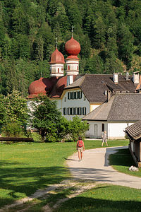 St. Bartholomew ChapelThe entire hike from the Salat boat dock to and from our vantage point of Rothbachfall was only about 2 miles, but what a satisfying two miles it was - pristine alpine lake and meadow, a cowbell symphony by a troupe of friendly cows, beautiful waterfall, and mountain views. Our first hike in the Alps!! They say you never forget your first, and I think in this case, it will be true.
We got to St. Bartholomew with about an hour to spare. This small onion-domed pilgrimage church, with Watzmann mountain looming behind it, is one of the most visited and photographed places in Berchtesgaden. It is easy to see why.
Originally built in the 12th century in the Gothic style, it was remodeled in the 16th century into its current baroque appearance. It has two onion domes, one octagonal and one round, on a red domed roof. After Berchtesgaden joined Bavaria in 1810, the church became a hunting lodge for the Bavarian Kings.
There is a restaurant and beer garden outside the church. During the summer, they serve fresh fish right from the lake. No other fishing is allowed on the lake.
This was one of the few places along the lake that you could stroll along the shoreline, so we did just that before returning to the ferry back home.
What a wonderful day it had been. Even if it did rain all day tomorrow, I think Berchtesgaden would live on as one of our favorite stops.
Day 2 - Hike to summit of Mt. Jenner
 Glimpses of the Konigsee at the start of our Jenner hikeWe awoke to a very pleasant surprise - no rain. In fact, the sun was shining. Herb suggested that we take the Jennerbahn (cable car) to the top of Mt. Jenner and then hike the 6 miles back down. The views from the summit down to the Konigsee were supposed to be spectacular. It sounded like a great plan.
According to Google Maps the Visitor Center to buy Jennerbahn tickets was near where we bought the ferry tickets yesterday, so we set off once again along the river path into Konigsee village. I remember thinking to myself that it was funny that we hadn’t noticed the cable cars passing overhead on our boat tour yesterday, which should have been a forewarning of what was to come.
The girl at the Visitor Center didn’t speak English very well, but I soon got the gist - the Jennerbahn was under construction and wouldn’t reopen until 2018. So that’s why we didn’t see any cable cars. After exchanging some concerned looks, Herb and I decided that we would hike instead, at least up part of it. We asked the girl for a trail map.
While reviewing the map with her, I noticed that there were several huts along the way, which from my brief exposure to the German culture, I suspected meant beer garden. I asked her about them, but did not really understand her answer. I was only able to decipher the word “Schnapps.” In retrospect, I think I can now approximate a translation of what she was trying to say - “all the beer gardens are closed as well, so I hope you’ve brought along your own schnapps.”
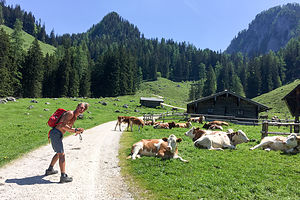 Herb playing with the cows on Konigsbach AlmArmed with a map and good attitudes, we walked passed the valley cable car(less) station and up the steep Jennerbahnstrasse through a lovely residential area with picture perfect Bavarian-style houses.
After turning onto the Richard-Voss-Strasse, we came upon our first trail marker, a series of yellow arrow-shaped signs atop a pole, indicating destinations and times (rather than distances) to get to them - a much more meaningful measure in steep terrain. Unbeknownst to us at the time, this system of marking trails was used at every trail junction throughout Germany, Austria, Switzerland, and Italy. Herb said he read somewhere that in Switzerland they have the local senior citizens walk the trails and establish the times. If so, I am impressed, because they were pretty dead on with our hiking times -- but then again, we are not too far from being senior citizens ourselves.
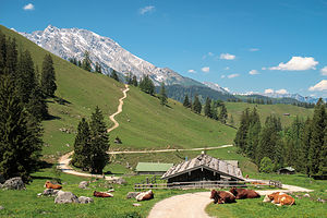 Konigsbach Alm on hike up to Jenner summitWe made a right onto the Hochbahnweg towards Konigsbach Alm (alpine meadow), two hours away, thinking that might be a good destination for the day. The trail led us up a forested slope with occasional views of the Konigsee, somewhat obscured by the trees. Hopefully, they would get better when we got more out in the open in the meadow.
Pretty much on time (2 hours), we arrived at the Konigsbach Alm, where there was a restaurant/beer garden that was quite obviously closed. I guess without the Jennerbahn running, there weren’t enough customers to make it worth opening. We sat on a rock and ate our peanut butter sandwiches and water. I wish I had brought schnapps.
Herb had been hoping that Konigsbach Alm would be a lovely meadow to just spend time relaxing in and taking in the view, but although very pretty, it really wasn’t very conducive to that. It was more of a pasture for cows to hang out in.
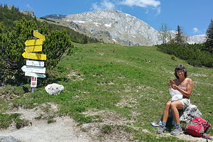 Coping with Peanut Butter when the Beer Gardens are closedNow what? The trail marker showed that it was another two hours to Jenner summit. We didn’t want to just turn around and do an out and back, so we decided to forge on.
This part of the hike was much more open, with long vistas as far as the eye could see. It seemed like it went on forever. Finally, after 6 miles and a 4,800-foot elevation gain, over a 3 hour period, we arrived at the upper station of the Jennerbahn.
It was eerily deserted. I am sure this place is bustling in winter time and in summers as well when the cable car can transport people to the top. For now, it was all ours, and we had earned it.
From the lodge, which was also under reconstruction, we hiked another 10 minutes up to the viewpoint on Mt. Jenner’s summit (1874 meters), where a large cross stood atop a rocky pile, marking its highest point. Of course, we had to scramble up to it. We didn’t come this far to not get to the official summit.
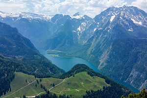 View from Jenner summitThe views were worth every step of the way. The crystal blue waters of the Konigsee lay below us, surrounded by over a 100 German and Austrian snow-covered mountain peaks. It was utterly breathtaking. We could just make out the tiny ferries scooting silently across the water below us.
Rather than hike down the same way we came up, we followed the trail signs to the Jennerbahn Mittelstation. While the hike was nice at first, the trail eventually brought us onto a ski resort road that was undergoing construction. It was horrible - no pristine forests or mountain vistas; just noisy trucks kicking up clouds of dirt, and ruts to twist your ankle in. If we had come up this way first, we never would have continued on to the summit.
Ominous storm clouds were starting to build - perhaps that anticipated bad weather was finally on its way. Despite being quite tired, we picked up the pace to try to beat out the storm.
Hiking down always sounds better on paper, but I often find it harder on my legs and feet. We limped back into the campground, just as the skies opened up and the rain began to fall.
All in all we had hiked 13 ½ miles that day, with almost a mile of elevation gain. Most of it had been truly spectacular.
Description
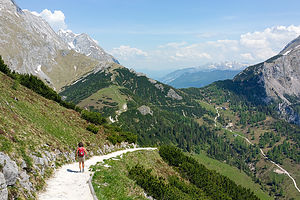 Start of the descent from Jenner summitBerchtesgaden National Park, in southeastern Germany near the Austrian border, is one of the oldest protected areas in the Alps. The park, which was established in 1978, encompasses 218 square kilometers of lakes, mountains, forests of dwarf pines, and alpine meadows.
The gem of the park is the beautiful Konigssee, a 5-mile long, crystal clear, fjordlike lake,
surrounded on all sides by steep, vertical walls, including the Watzmann, Germany’s second highest mountain.
An electrically driven boat ferry is the only way to access points around the lake. The ferry makes only two scheduled stops:
- St. Bartholomew, where there is a beautiful baroque, onion domed chapel, as well as a restaurant and beer garden
- Salat, on the southern shore where there are hikes to the Obersee and Rothbachfalls, the highest waterfall in Germany.
The Jennerbahn (cable car) scoots visitors to the summit of Mt. Jenner for fantastic views of the Konigsee, surrounded by over a 100 German and Austrian snow-covered mountain peaks, including Mount Watzmann.
Note:
When we were there in June 2017, the Jennerbahn was closed with plans to reopen in 2018. We hiked to the top instead
