- Home
- About
- Map
- Trips
- Bringing Boat West
- Migration West
- Solo Motorcycle Ride
- Final Family XC Trip
- Colorado Rockies
- Graduates' XC Trip
- Yosemite & Nevada
- Colorado & Utah
- Best of Utah
- Southern Loop
- Pacific Northwest
- Northern Loop
- Los Angeles to NYC
- East Coast Trips
- Martha's Vineyard
- 1 Week in Quebec
- Southeast Coast
- NH Backpacking
- Martha's Vineyard
- Canadian Maritimes
- Ocracoke Island
- Edisto Island
- First Landing '02
- Hunting Island '02
- Stowe in Winter
- Hunting Island '01
- Lake Placid
- Chesapeake
- Provincetown
- Hunting Island '00
- Acadia in Winter
- Boston Suburbs
- Niagara Falls
- First Landing '99
- Cape Hatteras
- West Coast Trips
- Burning Man
- Utah Off-Roading
- Maui
- Mojave 4WD Course
- Colorado River Rafting
- Bishop & Death Valley
- Kauai
- Yosemite Fall
- Utah Off-Road
- Lost Coast
- Yosemite Valley
- Arizona and New Mexico
- Pescadero & Capitola
- Bishop & Death Valley
- San Diego, Anza Borrego, Joshua Tree
- Carmel
- Death Valley in Fall
- Yosemite in the Fall
- Pacific Northwest
- Utah Off-Roading
- Southern CA Deserts
- Yosemite & Covid
- Lake Powell Covid
- Eastern Sierra & Covid
- Bishop & Death Valley
- Central & SE Oregon
- Mojave Road
- Eastern Sierra
- Trinity Alps
- Tuolumne Meadows
- Lake Powell Boating
- Eastern Sierra
- Yosemite Winter
- Hawaii
- 4WD Eastern Sierra
- 4WD Death Valley +
- Southern CA Deserts
- Christmas in Tahoe
- Yosemite & Pinnacles
- Totality
- Yosemite & Sierra
- Yosemite Christmas
- Yosemite, San Diego
- Yosemite & North CA
- Seattle to Sierra
- Southwest Deserts
- Yosemite & Sierra
- Pacific Northwest
- Yosemite & South CA
- Pacific Northwest
- Northern California
- Southern Alaska
- Vancouver Island
- International Trips
- Index
- Tips
- Books
- Photos/Videos
- Search
- Contact
Stechelberg, Gimmelwald, and Murren, Switzerland
Thursday, June 15, 2017 - 9:00am by Lolo
14 miles and 0.5 hours from our last stop - 2 night stay
Travelogue
Day 1 - Hike to Gimmewald and Murren and Lunch at the Hotel Bellevue
 Camping Rutti in StechelbergToday’s drive was a short one - just 14 miles to the other side of the Eiger to Camping Rutti, at the end of the Lauterbrunnen Valley in the village of Stechelberg. Although we didn’t have the Eiger to gaze at, the views of the Lauterbrunnen Valley and surrounding mountains from our campsite were equally impressive, but in a less dramatic way.
The woman that ran the campground, I think totally by herself, was very methodical about where people camped, and she escorted each and every one of us to a spot that would not impede in any way on their neighbor.
Our true reason for being in Stechelberg though was to get to Gimmelwald, the tiny alpine village above the Lauterbrunnen Valley, with a higher population of cows than people. I had wanted to visit it ever since I saw it featured on a Rick Steves Switzerland video -- to me, it was the epitome of a Swiss pastoral village.
 Gimmelwald cowsStechelberg was the closest we could get, because Gimmelwald is car-free and only reached via cable car or foot. The Schilthornbahn cable car was just a little over a half mile walk from Camping Rutti, but we thought it would be more fun and adventurous to walk the 2 miles to Gimmelwald.
So, we set out from the campground and spent the next hour and a half hiking up and up until after about a 2,000 foot elevation gain we finally started seeing cows and then the rooftops of chalets. I knew we were finally getting close.
We were further inspired by a welcoming pair of gnomes alongside the trail, who seemed very fitting residents for a place as magical as this one. I felt like I was in a fairy tale.
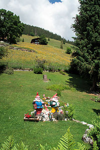 Gimmelwald GnomesThe village was everything I imagined - quaint houses, verdant pastures, cows, and, of course, that awesome mountain backdrop of the Eiger, Monch, and Jungfrau.
There’s not a whole lot to see and do in Gimmelwald - one street, no cars, no food store - just cows and cheese. The only store is “The Honesty Shop - Europe’s First Unattended Self-Service Village Shop.”
The main center of activity is the cable car station which picks up and drops people off on their way between Stechelberg and Murren.
From here, we planned to continue our hike up to Murren, where we wanted to hike along the Murren Via Ferrata back down to Gimmelwald.
Via Ferrata is Italian for “scary hike” - just kidding, actually it means “iron way.” In German, these routes are called Klettersteig (“climbing path”).
They can probably best be described as hiking routes that are precarious enough to require some kind of protection from falling. That protection usually involves steel cables that run along the route at shoulder height to the hiker. Hikers wear helmets and a climbing harness with carabiners attached to them. As they move along, they clip their carabiner onto the cable so they can’t fall.
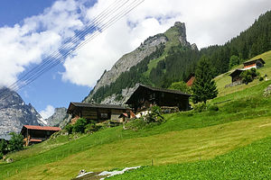 GimmelwaldBesides clinging to steep cliffsides, via ferrata routes also cross steep canyons and ravines on wooden walkways and suspension bridges. Basically, they allow inexperienced mountaineers to go on routes that would be too dangerous to undertake otherwise. They are found all throughout the Alps and are very popular with more adventurous tourists.
This particular one had three canyon crossings, one with over a 3,000-foot drop. I have to admit that my palms were sweating a little bit at the thought of it.
Before leaving Gimmelwald, we stopped in the Youth Hostel, which is the end of the Murren via Ferrata route, only to find out that all the harnesses and helmets had been rented out for the day. They suggested that when we got to Murren, we inquire at one of the sport shops to see if any had been returned early. What a disappointment.
We wanted to see Murren anyway, so we continued on our way for another 2 miles and up another 1,000 feet to the much more commercialized and bustling village of Murren, which was, however, also car free.
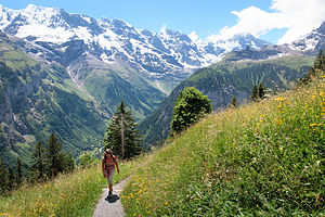 Along the way to MurrenWe wandered around town trying to find a sports shop to rent a Via Ferrata kit, but none of them were open - either because it was mid-day “siesta” time, or they just hadn’t opened yet for the season. It was the opening day for the via Ferrata, which was part of the reason for our timing here, but I guess many of the shops had not geared up yet.
Finally, we gave up and reconciled ourselves to having raclettes at the Hotel Bellevue instead - not a bad consolation prize. The hotel had a beautiful outdoor dining terrace with a fabulous view of the iconic Schilthorn, the Eiger’s rival for attention in the area. It was an amazing setting.
I had been dying to try raclettes, a traditional Swiss dish made with lots and lots of melted raclette cheese over potatoes, so I ordered those and Herb ordered the kalberwurst (veal wurst). Thankfully we shared, because as delicious as the raclettes were, they were very very heavy. Of course, there were two nice refreshing mugs of beer to wash it all down.
The meal definitely fortified us for the long 4-mile walk back down to Stechelberg.
Day 2 - Trummelbach Falls
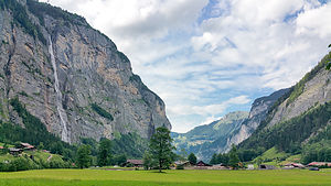 Lovely Lauterbrunnen ValleyOur legs were still tired from our hike to Murren yesterday, so we decided to stick to the Lauterbrunnen Valley floor today and visit one of its most popular sights - Trummelbach Falls, the most unique and powerful of the valley’s 72 waterfalls.
Unlike a typical waterfall that cascades out in the open for all to see, Trummelbach is a series of ten glacial waterfalls that flow inside the mountain. Trummelbach Falls single handedly drains the entire glacial melt of the Eiger, Monch, and Jungfrau, at a rate of 20,000 liters per second, carving and sculpting interesting rock formations along the way.
 Trummelbach FallsAfter purchasing a ticket for 11 francs, we rode an elevator inside the mountain to a platform from which we walked through a dimly lit tunnel to the uppermost falls. Along the way, there were small cutouts where we could view the water tumbling through the narrow slot canyon.
From there we could have taken the elevator back down, but we chose to walk back down stopping at other viewing platforms along the way.
It was a very special and unique place, enough to warrant it becoming a UNESCO World Heritage Site.
Despite this being our “easy” hiking day, we had still walked 7.1 miles.
Later that evening I heard the sound of cowbells near the campground. I ran out to see what was going on and saw that a line of traffic had formed out on the road behind a farmer bringing his 5 cows home from pasture. Nobody beeped to hurry him along. It was just a typical evening commute in the Lauterbrunnen Valley.
Description
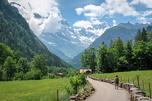 Lauterbrunnen ValleyStechelberg is a small village in the Lauterbrunnen Valley in the Schilthorn Region of Switzerland’s Bernese Oberland, about 11 miles southeast of Interlaken. Set at the base of the Schwarzmonch mountain, it is an excellent base camp for exploring the area. The Schilthornbahn cable car whisks visitors up to Gimmelwald, Murren, Birg, Schilthorn
Gimmelwald is a small alpine village (population 120) perched on the edge of a the mountain 1,500 feet above the Lauterbrunnen Valley, between the villages of Stechelberg and Murren. It is known for its picturesque beauty - chalets decorated with flowers, verdant pastures, grazing cows - all set amongst the backdrop of the Eiger, Monch, and Jungfrau. The village is totally car-free and only reached via cable car or foot. The Schilthornbahn cable car stops in Gimmelwald where it is possible to board another cable car to Murren and the Schilthorn.
Perched 2,000 feet above the Lauterbrunnen Valley, Murren (population 450) is also car free. However, unlike Gimmelwald, it is much more developed and ready to accommodate large numbers of tourists - there are about 2,000 hotel beds. The village has many fine restaurants and shops, as well as impressive views of the Eiger, Monch, Jungfrau, and Schilthorn.
- ‹ previous
- 13 of 17
- next ›
Stechelberg, Gimmelwald, and Murren location map in "high definition"
Javascript is required to view this map.
