- Home
- About
- Map
- Trips
- Bringing Boat West
- Migration West
- Solo Motorcycle Ride
- Final Family XC Trip
- Colorado Rockies
- Graduates' XC Trip
- Yosemite & Nevada
- Colorado & Utah
- Best of Utah
- Southern Loop
- Pacific Northwest
- Northern Loop
- Los Angeles to NYC
- East Coast Trips
- 1 Week in Quebec
- Southeast Coast
- NH Backpacking
- Martha's Vineyard
- Canadian Maritimes
- Ocracoke Island
- Edisto Island
- First Landing '02
- Hunting Island '02
- Stowe in Winter
- Hunting Island '01
- Lake Placid
- Chesapeake
- Provincetown
- Hunting Island '00
- Acadia in Winter
- Boston Suburbs
- Niagara Falls
- First Landing '99
- Cape Hatteras
- West Coast Trips
- Utah Off-Roading
- Maui
- Mojave 4WD Course
- Colorado River Rafting
- Bishop & Death Valley
- Kauai
- Yosemite Fall
- Utah Off-Road
- Lost Coast
- Yosemite Valley
- Arizona and New Mexico
- Pescadero & Capitola
- Bishop & Death Valley
- San Diego, Anza Borrego, Joshua Tree
- Carmel
- Death Valley in Fall
- Yosemite in the Fall
- Pacific Northwest
- Utah Off-Roading
- Southern CA Deserts
- Yosemite & Covid
- Lake Powell Covid
- Eastern Sierra & Covid
- Bishop & Death Valley
- Central & SE Oregon
- Mojave Road
- Eastern Sierra
- Trinity Alps
- Tuolumne Meadows
- Lake Powell Boating
- Eastern Sierra
- Yosemite Winter
- Hawaii
- 4WD Eastern Sierra
- 4WD Death Valley +
- Southern CA Deserts
- Christmas in Tahoe
- Yosemite & Pinnacles
- Totality
- Yosemite & Sierra
- Yosemite Christmas
- Yosemite, San Diego
- Yosemite & North CA
- Seattle to Sierra
- Southwest Deserts
- Yosemite & Sierra
- Pacific Northwest
- Yosemite & South CA
- Pacific Northwest
- Northern California
- Southern Alaska
- Vancouver Island
- International Trips
- Index
- Tips
- Books
- Photos/Videos
- Search
- Contact
Bridgeport
Tuesday, May 29, 2018 - 9:00am by Lolo27 miles and 0.5 hours from our last stop - 1 night stay
Travelogue
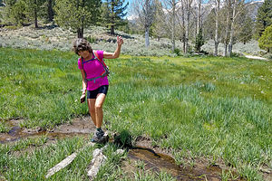 Lolo on the Buckeye Creek TrailContinuing our journey up 395, we decided to grab a campsite at Bridgeport Reservoir Marina and Campground on the Bridgeport Reservoir, a pretty lake with nice views of the Sierra - or as they say, “Killer fishin, killer views.”
Next time, we’ll bring fishing gear, but for now, hiking was the activity of the day - as it had been for every day on this trip so far. The Buckeye Creek Trail sounded interesting, so we drove out to the Buckeye Campground where the trail began.
Unfortunately, there wasn’t much “creek” along the Buckeye Creek Trail. I definitely had had visions of meandering alongside a lovely creek for the duration of our hike. Instead after 2.5 miles and still no creek, we bushwhacked down to it to have lunch.
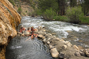 Lolo soaking in Buckeye Hot SpringAfter our hike we decided to take a soak in the Buckeye Hot Springs, so we drove over to the parking area for the springs, just a short distance away at the top of a hill near the Buckeye Campground.
These pools are very different than Keough and Travertine in that they are directly next to a creek, separated from its chilly waters only by man-made rock piles. The source of the spring is on top of the grassy hillside that we were parked atop. The water emerges from the spring at about 140 degrees and flows down, cooling along the way, until it cascades over a cave into the largest pool, forming a nice little waterfall. Additional rock piles separate the hot water area into three separate pools, varying in temperature from 95 to 110 degrees.
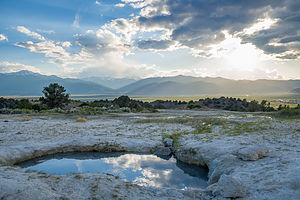 Primitive pool at Travertine Hot SpringHerb and I grabbed our towels and scrambled down the short, steep trail to the pools. We weren’t the only ones with this idea, but there was still plenty of room for us in the middle one with the waterfall. It was nice sitting in the warm pool, listening to the babbling creek flow by.
That was until Herb’s watch starting beeping with a weather alert. We didn’t believe it at first, but within minutes the winds picked up and the sky darkened. We quickly dried ourselves off and scurried back up the steep hill to avoid being caught in a storm. Herb was quite impressed with his watch - it must measure a drop in barometric pressure.
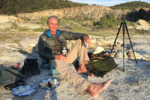 Herb at TravertineLater that evening when the weather cleared, we drove over to Travertine, Herb’s favorite hot spring. They really are quite beautiful - fed from water trickling over the edge of a colorful, “travertine”-stained rock formation that rises above them. Rock piles separate the water into three separate pools, with water flowing from one pool to the next, decreasing in temperature as it goes along. The rightmost pool, which has stone sides to sit on, is about 105 degrees; the middle pool also has stone sides and is about 100 degrees; and the leftmost pool has a mushy mud bottom and is about 90 degrees. As usual, these pools were full of people - after all, it was a Friday night after work.
However, these are not the only pools to soak in. The whole area around the springs is very active geothermally, so new springs are continuously erupting forming new pools. Fortunately, Herb’s favorite pool-for-two, with the great mountain views, was still there, but unfortunately, it wasn’t very warm. That’s the challenge with natural hot springs - their status is always changing.
Oh well, the view was still good.
Description
Buckeye Hot Springs, near Bridgeport, CA, are considered by some to be the most beautiful pools in the eastern Sierra. The pools are quite unique in that they sit directly next to chilly Buckeye Creek. The two main sources emerge from the side of a steep grassy hillside at about 140 degrees and flow downward, cooling along the way before cascading over a cave in a mini-waterfall formation into the largest pool. The hot water is captured by man-made rock piles alongside the creek, creating three pools of varying temperature in the 95 to 110 degree range. Since the creek water cycles through the pools, they are cleaner than those at Travertine. The trail down to the creek from the parking lot is quite steep. As with most hot spring pools in the Sierra, this one is clothing optional.
Travertine Hot Springs
There are many natural hot springs in the Sierra, but the Travertine Hot Springs are one of the prettiest and the easiest to get to. They are located just south of the town of Bridgeport along Route 395. To reach the springs, turn onto Jack Sawyer Road, then left again onto a marked, but somewhat rutted, dirt road.
There are several pools at Travertine. Right next to the parking area is a developed pool, which is the hottest of the pools in the area. There were even rugs placed around it to cushion the hard surface.
A short way down the trail are the lower three pools, which are fed from water trickling over the ridge of a colorful rock formation that rises above them. The beautiful tan, cream and rust colors of the rock are the result of a form of limestone, called “travertine” that is deposited by the mineral-laden hot springs. The water flows from one pool to the next decreasing in temperature as it goes along. The first pool is about 105 degrees, while the last, which is the largest and shallowest, is only about 90 degrees.
A little past the main pools there are a few more primitive pools that are much more private. The whole area around the springs is very active geothermally, and new springs are continuously erupting.
There are wonderful views of the Sierra while you bathe in one of its pools, sitting along a rocky ledge or in the mud that lines their bottoms. The mud is slightly sulfuric and soothing to the skin.
The area is designated “clothing optional,” but most people wear bathing suits.
Mono Lake
Monday, May 28, 2018 - 9:00am by Lolo60 miles and 1.25 hours from our last stop - 1 night stay
Travelogue
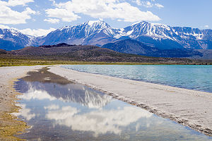 Stroll on Mono Lake south shoreThe kids left in the morning to head back to the city. Since snow in the Sierra was no longer a threat, they took the Tioga Pass Road through Yosemite, the shortest, and also the most scenic, route back to the Bay Area.
Not having jobs to get back to, Herb and I had the luxury of not having to drive home on Memorial Day. Instead we could take our time cruising north on 395 before heading west towards home - retirement is so great!
Herb loves Mono Lake, and never seems to get enough of its otherworldly landscape of “tufa castles” that rim the lake. So, we got a campsite at nearby Mono Vista RV Park, a campground we have stayed at on numerous occasions while exploring up and down Highway 395.
Besides being the oldest lake in North America, Mono Lake is extremely unique, because of the massive amounts of salt and minerals that flow into it from Sierra streams and have no way out except through evaporation—similar to the Great Salt lake in Utah. However, Mono Lake has something the Great Salt Lake doesn’t – “tufa castles,” which built up over thousands of years from the calcium-carbonate deposits accumulating in the lake. Normally they would just be hidden beneath the water, but as lake levels dropped, these extraordinary-looking knobs, spires, and minarets became exposed, some of them rising as high as 30 feet above the surface—and they do look like castles.
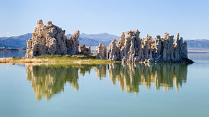 Reflecting on tufasThe largest concentration of them can be found along the southern shore of the lake at the South Tufa State Reserve, just ½ mile west of Navy Beach.
We’ve pretty much seen the main tufa areas, both by kayak and by hiking, but Herb still wanted to find the “sand tufas” which he had seen in the movie about Mono Lake played at the Visitor Center. We asked a ranger where we could find them, and he told us to drive towards Navy Beach, hanging a right on a dirt road to a small parking lot. From there we should just walk east along the lakeshore.
We did as told and soon found ourselves in a small parking lot with just one other car. From there we walked along the beach. There were always more tufas in the distance, so we kept forging on, hoping these would be the elusive sand ones. But alas, they were just your everyday tufas, still spectacular, but nothing different from what we had seen on our past visits.
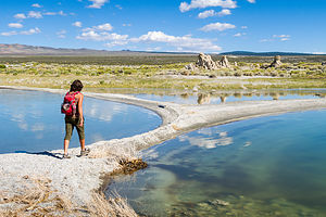 Lots of circlesAt the 2 ½ mile point, we decided to turn around and head back. Rather than walk on the harder sand further from the lake, we decided to walk along a sand spit between the lake and a small stream of water. Herb had me go ahead because he likes to use me in his photos to give some sense of scale.
Or, was that the real reason? Before long my feet began to sink a little, but stupidly I plowed on, only to sink even further. Soon I found myself sunk up to my knees in quicksand. As I started to sink, I put out my left hand to stop myself, but it sunk into the sand as well. Unfortunately, that hand was clutching my cell phone which was now wet and covered with sand.
Herb jumped to my rescue, and by that I mean he started taking pictures of me struggling to extricate myself. Big help! I eventually got myself to firmer ground and tried getting the sand off my phone. Herb made me immediately turn it off to hopefully save it from getting its inner workings water damaged. Since the phone was my only camera, that was the end of my picture taking for the day.
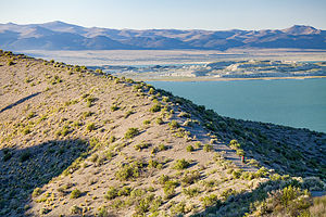 Panum Crater RidgeSurprisingly I wasn’t muddy at all. It wasn’t really mud at all, but just really soft, wet sand. We made it back to the car without any further calamities.
While driving back to the campground, we decided stop and do a hike which we had done on a previous visit - the trail up to and along the rim of Panum Crater, a perfect example of a rhyolitic plug-dome volcano. Panum Crater is pretty small by volcanic standards – 220 feet high and 2,000 feet across. It last erupted in 1325 AD.
The entire hike around the rim is about 2 miles, and the views along the way of Mono Lake and the snow-covered Sierra are really beautiful.
Description
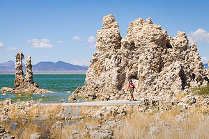 Lolo of the tufasMono Lake is located just off Highway 395 near the town of Lee Vining, California, 13 miles east of Yosemite National Park. Mono Lake is extremely unique. First of all, at over 1 million years of age, it is one of the oldest continuously existing lakes in the continent. Secondly, it is about 2 ½ times as salty as the sea and about 80 times as alkaline. This is because Sierra streams flow into Mono Lake bringing trace amounts of salts and minerals, but the lake has no outlet other than evaporation. As a result, the concentration levels of salts and minerals keeps growing each year. Thirdly, and the main reason Mono Lake is so popular, are the hundreds of spectacular “tufa towers” that rise from the lake. These intriguing calcium-carbonate sculptures were formed beneath the water when carbonates in the water combined with calcium from freshwater springs feeding into the lake. As lake levels dropped, these extraordinary-looking knobs, spires, and minarets became exposed. Most of the towers visible in the lake are from 200 to 900 years old and rise as high as 30 feet above the water.
A good place to start your visit is at the Mono Basin Scenic Area Visitor Center, located just off Highway 395, north of Lee Vining, where you will find exhibits about both the natural and human history of the Mono Basin.
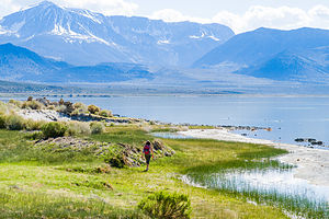 Lovely Mono LakeOne of the best places to view the tufas is at the Mono Lake Tufa State Reserve along the southern shoreline of the lake. The trailhead for the south tufa castles and Navy Beach is at the edge of the parking lot. During the summer, rangers lead walking tours 3 times a day (10am, 1pm, and 6pm), but if your not lucky enough to catch one of these, there are plenty of informative signboards along the trail. A short walk along the mile-long trail brings you to the strange and fanciful tufa castles at Navy Beach. A swim in the buoyant waters of Mono Lake is a memorable experience, as long as you are willing to step through the millions of harmless alkali flies that line the water’s edge. It’s fun to watch what at first looks like black sand part before you.
Surrounded by volcanic hills, Mono Lake is also a geologist's paradise. The two major islands in the lake are actually volcanic domes. The large black island, which the Kuzedika Indians named Negit, meaning “blue-winged goose,” erupted about 1700 years ago. The white island, which the Native Americans named Paoha, meaning “spirits of the mist,” erupted 250 years ago.
Bird watching and photography are other popular activities at Mono Lake.
Bishop
Thursday, May 24, 2018 - 8:30pm by Lolo155 miles and 3 hours from our last stop - 4 night stay
Travelogue
Day 1 - Arrival
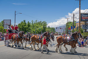 Mule Day ParadeIf it wasn’t for the kids wanting to take advantage of the long Memorial Day Weekend to go to a rock climbing destination, Herb and I would never have chosen that weekend to spend in Bishop.
Memorial Day Weekend in Bishop means Mule Days, and with that means crowds of mule enthusiasts - yes, there are thousands of mule enthusiasts. I guess the best way to describe Mule Days is that it is part mule show, part test of skills, and part Wild West Show. Over its 47 year history, it has grown from attracting a crowd of 200 to becoming an international world class event bringing in more than 30,000 fans. Over the course of a week, more than 700 mules compete in 181 events including calf roping, steer roping, barrel racing, flat racing, carriage driving, team chariot racing, and even dressage.
Needless to say, getting a campsite anywhere near Bishop during this time is quite a challenge. Fortunately however, I had faced this identical problem 3 years ago and discovered that Brown’s Millpond Campground has an overflow area where they could put us. There was no water or electric, but it would just have to do.
The drive from Red Rock Canyon to Bishop was a lovely 3-hour drive up Highway 395, my favorite highway. Also known as the Eastern Sierra Scenic Byway, Highway 395 runs the entire length of the Sierra Nevada Range, from south of Lone Pine to Carson City. The scenery along the way is breathtaking – snow-covered mountains, incredible lakes teeming with fish, ancient bristlecone forests, natural hot springs, and so much more.
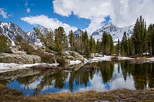 Pond on the way to Ruby LakeWe arrived at Brown’s Millpond Campground late in the afternoon and found that we had been upgraded from overflow into an actual campsite - still no water or electricity, just a higher price.
The wind was really picking up, but I decided to go out for a run anyway, just 2 miles out and 2 miles back. The way out was fine, and I felt like I was somewhat effortlessly cruising along. When I turned around to head back, I found out why it had seemed so easy up to this point. The wind, which had been at my back the whole first half of my run, was now in my face and practically stopping me dead in my tracks. It was a little scary. Having no choice, I forged on, head down, body bent into the wind, dodging tumbleweed.
When I finally made it back to the motorhome, hair so windblown I looked like a crazy woman, I found a contented Herb lounging in the back of the motorhome, listening to music and drinking a beer. Trying to keep a straight face, he asked “How was your run?” I just shook my very dishevelled head.
Day 2 - Hike to Ruby Lake and Tommy and Erin Arrive
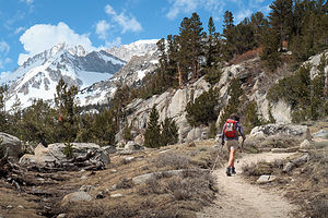 Hike to Ruby LakeIt was Friday, and the kids wouldn’t be arriving until late tonight after work, so we had a full day to entertain ourselves.
We decided to hike to Ruby Lake, a beautiful alpine lake set in a hanging cirque. To get to the trailhead we drove north on Highway 395 for 18 miles to Tom’s Place, where we made a left onto Rock Creek Road. From there it was 10.5 miles to the end, at the Mosquito Flats parking area and trailhead for the Ruby Lake hike.
Although only 4.5 miles round trip, the trailhead is at 10,200 feet and the lake is another 1,000 feet higher. The distance and elevation gain was not a big deal, but the high elevation would make it more challenging, especially since we had had no time to acclimate.
After parking the car we headed out into the Little Lakes Valley, with lovely views of the snow-covered Sierras all around us. In fact, we would soon be encountering some of that snow up close and personal.
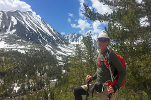 Sierra HerbAfter about ½ mile, we came to a junction and took the trail to the right heading up to Mono Pass. Before long we were crossing small patches of snow. I was glad I listened to Herb and brought along my trekking poles because the snow kept getting deeper and deeper.
Two miles in, we began looking for the spur trail to Ruby Lake. We managed to find it, but it was impassable because of the snow, which we were now postholing through up to our knees. While we were standing around, a bit confused as to how and if we should proceed, two young hikers came along and said they were going to go up and scramble along the rocky ridge to the lake.
We followed behind, a bit slower, and soon came to a view from above of Ruby Lake. Rather than the emerald waters we had been promised in the hiking book, the lake was completely frozen. However, ringed by a granite cirque, it was still quite impressive.
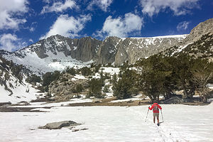 A little more snow than anticipatedWe decided that it made no sense to posthole our way down to it, so we enjoyed a picnic lunch from above, and then made our way back from whence we came.
It would have been nice to have gotten all the way down to the lake, but you just never know what the conditions are going to be in the Sierra, no matter what time of year.
Tommy and Erin arrived about 10:00 that night, after a quick stop to boulder in the Buttermilks, but Andrew and Celeste got a much later start and spent the night in South Lake Tahoe. They would join us in the morning.
Rather than 6 of us trying to squeeze into the Lazy Daze, Tommy and Erin now had their own camper van, so they had left the nest. Andrew and Celeste are getting a camper van as well, but for now, they would stay with us, probably for the last time. Saying it that way makes me feel a little sad - the end of an era. But more room for all of us!! Yeay!
Day 3 - Mule Day Parade, Andrew and Celeste’s Arrival, and Bouldering in the Buttermilks
>
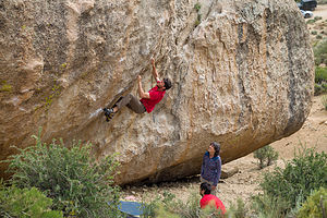 Tommy bouldering in the ButtermilksUsually our time with the boys and their girlfriends on these mini-vacations is spent rock climbing, but this time we were dealing with several injuries. Herb had a bruised or possible fractured rib and Celeste had a very bad high ankle sprain and was wearing a boot. That left Erin and Tommy (one complete pair) and Andrew and Mommy (not exactly Andrew’s ideal set up).
While waiting for Andrew and Celeste’s arrival, we took a ride over to Cardinal Pinnacle to check out a multi-pitch trad climb that Tommy and Erin planned to do the following morning. It was one of Bishop’s must do classic climbs. They didn’t want to be away from all of us the whole day tomorrow, so they wanted to make sure they knew how to find the approach to it and the actual start of the climb itself, so they wouldn’t waste time in the morning.
The scramble up the rocks to the base of the climb was a bit too much for Herb’s sore rib, so we went up about halfway and then sat and waited for Tommy and Erin’s return. They came back beaming and excited about climbing it the following day.
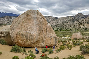 Tiny Andrew atop High Plains DrifterWe still had time before Andrew and Celeste arrived, so we stopped in town to see the end of the Mule Day Parade. We had never seen it before and it was quite a scene - people in cowboy hats and attire as far as the eye could see, lots of American flags, mules pulling carts, prancing Clydesdale horses, cute little cowgirls on ponies, giant pooper scooper trucks to clean the streets, etc. It was a hoot!
Now that we were all feeling in the holiday spirit, we decided to welcome Andrew and Celeste at the campground with a traditional Memorial Day BBQ - complete with hamburgers, hot dogs, corn on the cob, and all the fixin’s.
However, since this was a climbing trip after all, immediately upon completion, we headed over to the Buttermilks, a world-famous bouldering destination just 20 minutes from our campground, the last part of which is along a 3 ½ mile bumpy, washboard road. It’s an amazing landscape - hundreds of huge boulders (or more technically, glacial erratics) strewn along a vast hillside with the snow-capped Sierra in the background.
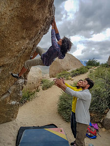 Lolo on her projectEven if you’re not bouldering (as half of our party due to injuries was not), it’s a great place to just hang out, enjoy the scenery, and watch people puzzle out the “problem” of getting to the top of a boulder - and then, even more interestingly, puzzle out how to get back down again.
I’m not a particularly big fan of bouldering, because I don’t like to fall - even three feet. Plus, I get a bit nervous watching the boys and their girlfriends boulder, because unlike “trad” or “sport” climbing, there are no ropes. Rather, crash pads are placed on the ground to soften the climber’s fall. In addition to the pads, other climbers stand at the bottom with arms extended upward to catch or slow the climber down if he falls. The reasoning behind the lack of ropes is that bouldering routes are much shorter than “trad” or “sport” routes. Well, generally that is true, but the Buttermilks are known for their especially tall boulders, some as high as 45 feet.
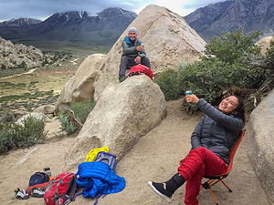 The injured crew spectatingAndrew and Tommy gave me a boulder “problem” to work on. The word “problem” is used in bouldering because climbers often spend weeks and even months, working out all the moves to complete a particular bouldering route. I think they were pretty proud of me when I completed my boulder problem the first try - I think they gave me a pretty easy one. Even so, I had to drop down about 5 feet from the top, so they very gallantly grabbed my hips and lowered me down like I was in an elevator. What service!
Andrew and Tommy spent some time working on a boulder called High Plains Drifter, a . At 35 feet, it was a little too high for my comfort. They reassured us that the tough part of the climb was at the bottom and it got increasingly easier as it got higher. Still, it did make us quite nervous watching them do it. The photos afterwards made it look even worse.
Andrew, Tommy, and Erin played around on a few more boulders while Herb and Celeste (the injured) and I (still basking in the glory of my completed “project”) spectated. We didn’t mind - the celebratory beers were cold and the sun was just starting to dip behind the snow-capped Sierras. The lighting was incredible!
Afterwards, we drove back into town and had dinner at the Mountain Rambler brewery, a popular hangout for climbers at the end of a day on the rocks.
Day 4 - Lots of climbing - Cathedral Pinnacle (Tommy and Erin), Alabama Hills, and Buttermilks again
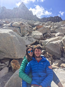 Tommy and Erin excited about their next day climb up Cardinal PinnacleIt was a little challenging figuring what to do when 33% of the group is injured, but I think we had a pretty good plan.
As per plan, Tommy and Erin headed out early to climb Cardinal Pinnacle, the classic 3-pitch climb they had scouted out yesterday. Afterwards, they would meet up with us.
The rest of us got in the car and drove down to the Alabama Hills in Lone Pine, where the scenery is beautiful and the approach to the climbs are easy, even for someone in a boot. Although the drive was long (about an hour), the trip along the 395 corridor is always a treat, especially when the Sierra Mountains are topped with snow.
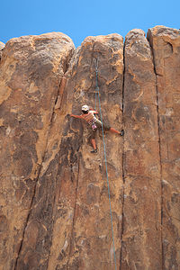 Lolo hits the Alabama HillsEven if you’ve never been to the Alabama Hills, if you’ve ever watched an old Western, you’ve probably seen its beautiful scenery. Because of its dramatic landscape and proximity to Hollywood (3 hours), this area has been the setting for dozens of Hollywood westerns, TV shows, and commercials, right up to the present.
However, finding old movie sets was not what we were here for. Today Andrew and I were climbing buddies (poor Andrew!) and there were hundreds of oddly-shaped boulders and towers just asking to be climbed. And they were so easy to get to.
Several dirt side roads branch off Movie Flat Road and lead right up to the base of many of them. Too often when we climb with the boys, we have to hike and rock scramble for miles to get to the start of a climb. Here I could practically start from the hood of our car.
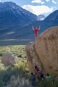 Andrew victoriousI have to give Andrew a lot of credit allowing me to be his climbing partner for the day. He was so patient, finding climbs within my grade and encouraging me to keep trying. Talk about role reversal.
Poor Celeste was itching to get on the rock. Probably somewhat foolishly, she removed her boot and did one - it was an easy one for her, but still probably not a good idea with a badly sprained ankle.
Towards mid-afternoon, as so often happens, dark clouds began moving in over the mountains,. We immediately thought of Tommy and Erin and hoped that they were not experiencing a storm during their climb. Neither they nor we had cell coverage so we were just going to have to wait to find out.
Rather than have them drive all the way down to the Alabama Hills to meet up with us, only to be greeted by rain, we decided to head north up 395 and try to contact them on the way.
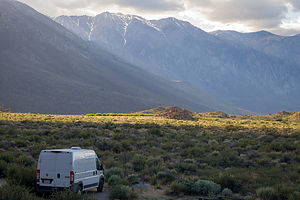 Tommy's new camper vanI confess to being a little worried about them, so I was so glad when they picked up the phone. They were in a coffee shop in Bishop. They had finished the climb just as the rain was starting - in fact, they were the only party that made it to the top that day, as everyone else had to retreat back down to miss the storm. We decided to meet up at the coffee shop.
When we saw them, they were absolutely beaming. They said that the climb, which is a Bishop Classic, had been awesome.
There was still a few more hours of daylight, so rather than go back to the campground to relax like normal people, we went back to the Buttermilks to climb some more.
Good decision! What a fun evening - rocks to climb on, beautiful scenery, great company, much laughter, tasty celebratory beers, lovely sunset over the Sierras! We even got everybody to stand still long enough to memorialize the moment - perhaps the Gaidus 2018 Christmas card!
Boy I’m going to miss these guys when they leave tomorrow.
Description
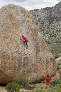 Andrew on High Plains DrifterBishop is my favorite town in the Eastern Sierra. It is located along Highway 395 between the towns of Mammoth Lakes and Big Pine. It lies at the northern end of the Owens Valley with the Sierra Nevada mountains to the east and the White Mountains to the west.
One of the town’s claims to fame is that it is the "Mule Capital of the World," holding a week-long festival each May called Bishop Mule Days. Part mule show, part test of skills, and part Wild West Show, this annual event has been attracting crowds for over its 47 year history, growing from a crowd of 200 in its early days to becoming an international world class event with more than 30,000 fans. Over the course of a week, more than 700 mules compete in 181 events including calf roping, steer roping, barrel racing, flat racing, carriage driving, team chariot racing, and even dressage.
The reason we go to Bishop is for the excellent rock climbing. The three major climbing areas in Bishop include:
The Owens River Gorge is a steep 10 mile long canyon just north of Bishop that is a very popular destination for rock climbing. With 416 sport-climbing and 52 trad routes it is California’s most concentrated sport climbing area. The climbing is on volcanic tuff and features edges, pockets and cracks. Although there is a full range of difficulty level, the best climbs are in the 5.10 to 5.11 range. The most popular walls are located in the Central Gorge – Warm Up Wall, the Pub, the Social Platform, and the Great Wall of China, which feature tons of 5.8 to 5.11 sport routes. Summers get a bit too hot to climb in the gorge.
Buttermilk Country, one of California’s premier bouldering destinations, is located southwest of Bishop along the western edge of the Owens Valley. These massive glacial erratic boulders sit in the foothills of the Sierra Nevada under an impressive backdrop of high peaks just a mere four miles to the west. There are 243 bouldering routes, many of which top out at over 20 feet.
The Volcanic Tablelands, another popular bouldering destination, lie just north of Bishop in an area where the floor of the Owens Valley rises abruptly, forming a 300 foot-high volcanic plateau. Along the southern tip of the plateau there are numerous canyons and washes containing thousands of boulders. The Happy Boulder area with 418 routes and the Sad Boulder area with 187 routes are the most popular. Because of its 4,500 foot elevation, the Volcanic Tablelands are climbable year round.
Red Rock Canyon State Park
Wednesday, May 23, 2018 - 8:30pm by Lolo407 miles and 7.5 hours from our last stop - 1 night stay
Travelogue
 Camping in Red Rock CanyonAlthough 2 ½ hours longer, we decided to take the southern route to Bishop to avoid encountering snow along the mountain passes. I5 south to Bakersfield is a bit monotonous to say the least, but a lot less stressful than the alternatives.
Rather than go the whole way, we decided to stop for the evening at Red Rock Canyon State Park, a desert park we have not been too, known for its reddish desert cliffs, buttes, and spectacular rock formations.
The campground is first-come-first-served, and we were far ahead of the Memorial Day crowd - if there ever is one at this remote park - so we had no trouble getting a nice campsite, set against a backdrop of colorful cliffs. The sites are quite large with a lot of space between them, making for a very pleasant experience.
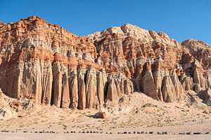 The Red Cliffs of Red Rock CanyonBefore dinner, we took a stroll around the campground loop, enjoying the colorful rock formations along the way.
The next morning, before continuing on to Bishop, we decided to do a few hikes in the park. We drove the short distance down Highway 14 to the Red Cliffs Natural Preserve, a hikers-only section of the state park.
From the parking lot we set off on the Red Cliffs trail, which was really more of an old jeep road than a trail, with great views of the 300-foot high columnar red cliffs the park is known for and the El Paso Mountains in the distance - oh, and some Joshua Trees along the way. There was a lot of scenery packed into our 2.5 mile out and back hike.
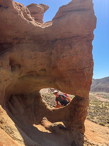 Herb peeking through window along Hagan Canyon TrailSince we had our Subaru Forester, which we now always tow behind the Lazy Daze, we thought it would be fun to do a bit of off-roading in the park. We headed out from the Red Cliffs parking lot on a dirt road through Iron Canyon, but were unable to get too far before being stopped by a gate. Much of the Scenic Cliffs area is closed each year from February 1 to July 1 to protect nesting birds of prey.
So we got back on Highway 14, drove north a bit, and took another dirt road with the hopes of getting to an overlook, marked on the map we had gotten at the Visitor Center. However, trails weren’t marked very well, so after driving for what seemed like far too long, we realized we had overshot our goal. Eventually we found our way back to Highway 14 and headed back to the campground to squeeze in one more hike before the noon-time checkout.
 Along the Hagan Canyon TrailWe parked at the Hagan Canyon trailhead right outside the entrance to the campground. It was even shorter than the Red Cliffs hike - only 1 mile - but it too packed a lot of awesome scenery into that distance.
Many cowboy westerns were filmed amongst these beautiful sandstone cliffs and interesting rock formations, such as “Zorro Rides Again", "Law and Order" starring Ronald Reagan, "The Ten Commandments", "Jurassic Park", and "Beneath the Planet of the Apes".
Noon was quickly approaching - time to move our motorhome out of the camping site and move on towards Bishop.
Description
 Hagan Canyon TrailRed Rock Canyon is a California state park located 120 miles north of Los Angeles, via I5 and Highway 14, where the southernmost tip of the Sierra Nevada converges with the El Paso mountain range.
The park features reddish desert cliffs and spectacular rock formations with dramatic shapes and vivid colors. Miles of hiking trails meandering through the dramatic landscape of the park. There is also a vast network of dirt primitive roads for 4WDing.
There is a first-come, first-served campground in the park with 50 primitive sites. The sites are spacious and tucked up against the base of the dramatic desert cliffs.
Suvarnabhumi Airport Hotel
Wednesday, March 28, 2018 - 10:00pm by Lolo miles and hours from our last stop - 1 night stay
Travelogue
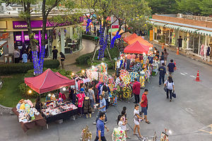 Suvarnabhumi Night MarketToday we began the first leg of our long journey home. We flew from Phuket back to Bangkok and took a taxi to the Golden Jade, a hotel in Suvarnabhumi, close to the airport, and I guess you could call it a “suburb” of Bangkok.
The hotel wasn’t great, and the neighborhood around it wasn’t very appealing either, so we had no great expectations for our last day in Thailand. However, we did have to eat, so we looked on Tripadvisor and found that there were several choices just a little over a half mile west on Lat Kabrang Road.
While we couldn’t find the restaurant we were originally searching for (I think it had closed), we did find a very pleasant outdoor night market with upscale stores and restaurants, as well as numerous food vendors selling very affordable and delicious looking food.
 Last item on Lolo's bucket listBy this point, I had an extreme craving for two things: non-Thai food (not that it isn’t wonderful, but I did miss home) and wine (no more Chang beer please). That made our choice for dinner quite obvious - Scoozi Pizza, a pretty fancy looking (white tablecloths Italian restaurant that served wine. I was pretty excited. It was relatively empty, because we were really between meals, as it was only 4:00 pm, but the pizza was quite good and the wine (which could probably have been any form of grape by this time) was exquisite.
While eating, we happened to glance out the window at the wine store next door, to which we were close enough to see the prices of bottles on their shelves. I looked for something familiar and spotted a bottle of Kendall Jackson chardonnay with a price tag of 2500 bahts, which is the equivalent to about $80. Now, I am far from a wine snob, despite living in Sonoma Valley, but our house wine is Kendall Jackson chardonnay, and I buy it at Safeway (after discount) for $8.99. No wonder we hadn’t been drinking wine in Thailand. It is exorbitantly expensive!
 Herb enjoyinga beer at the Suvarnabhumi Night MarketAfter our early dinner, we strolled around the market and observed it getting more and more crowded as the dinner hour approached - not with tourists, but with people from local neighborhoods, stopping by to eat or pick up dinner to bring home. This was the closest I had gotten to feeling a similarity to home - a suburban community going, coming home from work, and going out for some socialization and a bite to eat. I could picture this being somewhere in a U.S. city.
Making that feeling of home even stronger, the music being played was classic rock from the 80s. Herb and I sat out an outdoor bar, had a drink, and people watched. I left briefly to try something that was still left on my Thailand bucket list - drinking straight from a coconut. I was so excited, but soon found out that warm coconut milk is overrated - at least for me. I should have chosen one of the cold coconut smoothies.
It was a much better airport hotel experience than we had anticipated. Every experience in Thailand up to this point had felt so unique and exotic, but there was a certain familiarity in this market that gave us a jump start on our transition back home.
Patong Beach, Phuket Island
Sunday, March 25, 2018 - 1:15pm by Lolo0 miles and 0 hours from our last stop - 3 night stay
Travelogue
 Lolo really enjoying Patong BeachWe were now on the do-it-yourself part of our Thailand trip - no more Udom and his Gate1 flag guiding us through space, no more air conditioned bus delivering us everywhere we needed to go, no more giant buffet meals and luxurious hotels. It was kind of scary but liberating at the same time.
Being on a group tour had far exceeded our expectations, and if we had to do a guided tour, Thailand was definitely the place to do so -- we could never have seen and learned so much doing a trip like this on our own. Still, we are very used to planning our own trips and being on our own, so we were quite excited about spending three additional days in Thailand, just the two of us.
The Gate1 tour was centered around cities, temples, and culture, which was great. However, we wanted to end it with some natural beauty, relaxation, and fun. After some research, we chose to add three days onto our trip and spend them on the beautiful island of Phuket.
After spending a good half day finding flights, a hotel, transportation from the airport, and things to do, we had a new-found appreciation for all the planning that Gate1 had done for us on our 11-day tour. It probably would have taken us 11 days of planning to have pulled that off on our own.
Day 1 - Travel to Phuket
 Patong BeachAfter checking out of Le Meridien Chiang Mai, Udom accompanied us on the bus to the Chiang Mai airport to make sure we had no glitches boarding our flight back to Bangkok. Rather than fly back to Bangkok with us, he was continuing on with the part of our group that had signed up for additional days in Vietnam, Laos, and Cambodia. As much as we loved our Gate1 tour in Thailand, we were glad that we hadn’t signed up for more. 11 days was just about right.
Rather than staying in Bangkok for the night, as the rest of the group was, and then coming back to the Bangkok airport the next morning, we had arranged to fly directly to Phuket that same afternoon.
It was a long day, but we arrived at the Charm Resort Phuket, our home for 3 nights, in time to take a sunset walk along the beach, which was only a block away.
After so many days rushing around crowded, smoggy cities, it was nice to just relax and take in some fresher air and ocean breezes.
Day 2 - Relaxing on Patong Beach, sipping cocktails in the hotel pool, and checking out the action on Bangla Road
 Infinity pool at the Charm Resort in PhuketWow! A day totally to ourselves where we could lie guiltlessly in a lounge chair without a single planned activity in sight.
Armed with kindles and towels, we walked the short distance to Patong Beach, where for about the equivalent of $20, we rented lounge chairs and umbrellas for the day. It was extremely hot, but the water was refreshingly delightful.
 Bangla RoadLater that afternoon, we switched venues to the hotel’s rooftop pool, where we sipped tropical drinks while watching the sun set over the Andaman Sea. It was really quite lovely - very different from our usual travels in a motorhome.
That evening, after dinner and at a restaurant called No. 9, Herb suggested we take a walk along Bangla Road, which is Patong’s infamous nightlife district. Despite its notoriety, I had never heard of it, so it was quite an eye-opening experience. At least it was more pedestrian-friendly than anything we had encountered in Thailand so far, as the road is closed to vehicle traffic at night.
It was quite a scene - neon lights, loud music, go go bars, pole dancers, street performers, and vendors touting ping pong shows (which I don’t want to go into). It certainly was an interesting place to people watch.
Day 3 - Tour of James Bond Island and cave kayaking tour
Phuket has a large Muslim population compared to the rest of Thailand, which is predominantly Buddhist. Our hotel was located near a mosque, so every morning before sunrise, we were awoken to the beautiful and haunting sounds of the morning call to prayer. No need for an alarm clock, as long as this was the time we wanted to get up.
 Our James Bond Island TourFortunately, today we did want to get up early because we were expecting to be picked up at our hotel for our big excursion to James Bond Island and kayaking through sea caves. At least, we hoped we were going to be picked up. Things had gotten a little confusing yesterday when we called to confirm our reservation, which we had made through Viator.com a few weeks back.
First of all, they were supposed to call us to confirm, but they didn’t. When we called them, they kind of gave us the impression that they had no intention of calling us to tell us that the boat we were supposed to go on didn’t have enough people signed up to go out. They then tried to change us to another day, which wouldn’t work for us, before finally saying that they would switch our reservation to another outfitter. It didn’t exactly give us a warm and fuzzy.
 Enjoying being kayaked around beautiful Phang Nga BayHowever, at 7:30 sharp, a van did pick us up at our hotel and bring us to the Kong Khien Pier on the other side of the island, where we would start our adventure. The scene at the pier was utter chaos, with hundreds of people being lined up and somewhat randomly loaded onto about half a dozen boats. We sincerely hoped we were on the right tour.
It was, and soon we were cruising out to beautiful Phang Nga Bay, which is home to over 100 islands, each more beautiful than the next. Our goal later in the day would be the James Bond Island (Khao Ping Kan), a major tourist attraction ever since it was featured in the 1974 Bond movie, “The Man with the Golden Gun.” Fortunately, the island is now under the protection of Ao Phang Nga National Park, or it would be completely overrun.
But first, we had some sea caves to explore. I had thought when we signed up for this trip, that we would be doing the paddling, but instead we were loaded up in pairs onto inflatable kayaks with someone to paddle for us. I guess exercising while in Thailand just wasn’t meant to be.
 Sea cavesIt was still fun though weaving in and out of the stalactite and stalagmite formations and limestone caves. Fortunately, the tide was low enough for us to squeeze through without too much contorting. I can imagine that you can get in a bit of trouble on your own if you get caught on the wrong side of the caves when the tide comes in.
Our paddler was lots of fun and always smiling. He even took a corny picture of us through a leaf he pulled out of his pocket that had a heart frame cut out of it.
After kayaking, we were treated to a delicious buffet lunch on the boat, which was actually freshly cooked on board. Once lunch was complete, we pulled up anchor and headed towards the main event - James Bond Island.
Since the island is under national park protection, no big boats are allowed to go too close to the island. Instead, we were transferred to one of the many long-tail boats anchored nearby that were authorized to deliver tourists to the island.
 James Bond IslandIf I thought this morning’s loading of the cruise boats was chaotic, this was insane. Boarding and unboarding the long tails required climbing up on and balancing oneself along the gunnels of the boat, with barely anything to hold on to. There were small children, grandmas, Muslim women in full-length black garments and veils, and people of all shapes and sizes tightroping their way to the front of the boat. It was amazing no one fell in the water.
Herb and I are not big on tourist traps, and that is exactly what this was. It was beautiful enough - a really cool rock formation that rises out of the water, slim at the bottom and big on top, but we had seen many other small islands on the cruise over, just as interesting. However, what those were missing was the aura of James Bond. Needless to say the island was full of souvenir shops and hordes of people.
 Long-tail boats to get on James Bond IslandOnto the next event with safety precautions thrown to the wind - anchoring and swimming off Koh Hong Island. Jellyfish, some of which can be quite nasty, are often found in these waters, but our faithful crew peeked over the gunnels and said they didn’t see anyway. Oh, ok. Then it must be fine.
While most of us just jumped in and hung around near the back of the boat, Herb and a young couple from Germany decided to swim to shore, about ½ mile away. I think Herb swam a lot longer than that because the was doing backstroke and veering off too far to the right. Rather than do the hypotenuse of a triangle, he was doing its two sides.
 Herb meets ladyboys aboard James Bond boatOn his way back, unbeknownst to us at the time, Herb was stung by a jellyfish, which left a series of red lines across his arm. I was quite concerned and asked the crew what he should do. “Don’t worry,” they said. “If it was the bad kind he would be crying in pain by now.” Well, that was comforting. With my persistence for them to do something, they rubbed some some stuff on his arm that looked entirely too much like soy sauce. Herb was a real trooper though. I would have been much more dramatic.
As we were returning to port, the crew had one last surprise for us - ladyboys - not exactly the attractive, flamboyant kind we had seen in the Chiang Mai night bazaar, but rather two crew members with flowery dresses and balloons for breasts. They put on quite a show though, shaking it up for the men on board. It was hysterical.
I’d have to say, it was really a fun day and well worth the cost, which I believe was about $90 each.
Chiang Mai
Thursday, March 22, 2018 - 12:30pm by Lolo120 miles and 3 hours from our last stop - 3 night stay
Travelogue
Day 1 - Arrival and Night Bazaar
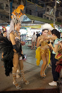 Ladyboys in the Chiang Mai night bazaar After our visit with the Karen Long Neck people, we continued on to Chiang Mai where we would be spending the next three nights at another luxurious hotel - Le Meridien Chiang Mai. I could really get used to this.
We were totally on our own for the rest of the day, a welcome respite from the sensory overload of so many new experiences and a way to recharge ourselves for more. Some time in the hotel fitness center running on a treadmill and a dip in the pool did just that.
Herb followed this with his traditional late afternoon two-pack of Chang beer from a nearby 7-Eleven. I neglected to mention the ubiquitousness of 7-Elevens in Thailand. There are over 8,000 of them. You literally can’t walk a tenth of a mile in a Thailand city without passing one.
We were on our own for dinner that night, so we consulted the Gate1 packet we had been given for a restaurant recommendation in Chiang Mai and then looked how they were rated on Trip Advisor. Everyone seemed to love Lemongrass.
The recommendation was spot on. The food was delicious and reasonably priced. The only negative was that neither the wine or the IPA on the menu (both of which I was craving at this point) were unavailable, and I was getting pretty sick of Chang beer.
After dinner, we decided to walk through the nearby night bazaar, a very popular concept in Thailand’s cities. Every evening around 6:00, hundreds of vendors set up their stalls along the sidewalks near the intersection of Chang Khlan Road and Loi Khro Road. For the next five hours, hordes of locals and tourists flood the market searching for bargains on everything from hand-tailored Thai silk to designer purses to jewelry to CDs and DVDs to tacky souvenirs. Herb bought a really cute pair of silk boxer shorts with elephants all over them. I tried to keep a straight face when he was haggling over their price.
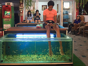 Fish spa anyone?The night bazaar was quite a scene, not your typical night at the mall in New Jersey.
First difference - ladyboys. As we wandered through the bazaar we noticed a couple of very beautiful flamboyantly dressed ladies - complete with low cut gowns, feathers, super high heels, the works. At first we thought they were prostitutes, but then realized they were ladyboys, or katoeys (meaning third gender) as they are called in Thailand. Ladyboys are well integrated into Thailand society and widely accepted amongst the people. They were gorgeous. We took a picture of one as she approached us, but she stopped us from taking any more without paying for the privilege first.
The second difference from NJ malls - fish spas. That’s right. People actually pay 300 Baht (about $10) to place their feet in a giant fish tank so that toothless garra rufa fish can nibble the dead skin tissue off their feet. Yuck! Udom actually warned us against doing this because one of his previous clients wound up in the hospital with an infection from an unhygienic tank.
From long neck women to ladyboys - another interesting day had come to a close. Tomorrow, elephants!!
Day 2 - Elephant Kingdom and more free time
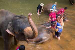 Lolo bathing the elephantsAnother day, another ethical challenge as a tourist, and rationalizing that the elephants truly are better off because of tourism.
As commercial logging is slowing being outlawed in Southeast Asia, many elephants are being forced into early retirement. Without the income from logging, their owners can’t afford to keep or support them, so they have to go somewhere else or they will die. There just isn’t enough acreage in the wild to support the Thailand elephant population.
There are really only two options for them: an elephant sanctuary or an elephant camp. The difference is that a sanctuary is a true “retirement community” for the elephants, while in a camp, elephants are still well cared for, but they continue to be trained to entertain tourists.
Today, we would be visiting the Elephant Kingdom, where we would get to bathe, feed, and ride an elephant - in other words, an elephant camp. Udom assured us that these elephants were treated very well here and would die without places like this to feed and care for them. It reminded me a bit of the dilemma the long neck people were in. What about creatures that weren’t exotic or entertaining enough to earn a living through tourism. I guess their fate was much worse.
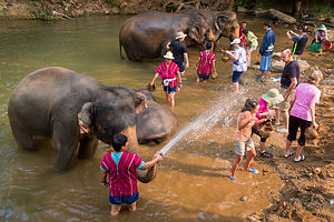 Washer or washee?Gate1 is such a big force in Thailand, that the Elephant Kingdom has a separate area devoted just to Gate1 tours, with 3 mahouts (trainers) and 4 elephants (one of them a rambunctious toddler).
Our first interaction with the elephants was giving them a bath in the river. It was kind of like a car wash, but one where the cars squirted back. It was a bit scary at first, as they are very large animals, but their trainers were in the water with us, making sure no mishaps or tourist stomping occurred, which would be very bad for business.
As with all the Thai people we have met so far, the mahouts were always smiling, possibly because they were getting a chance to use the elephants’ trunks to squirt water on squealing tourists.
Now, that we had cleaned them, it was time to make them lunch. At this point, I was starting to feel a lot less guilty about the elephants’ life in the camp.
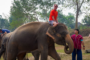 Herb atop his pachydermThe mahouts gave us tamarind, salt, and cooked rice and, which we mixed, pounded, and rolled into balls. When the balls were complete, we set off to feed them. You had to be quick, because once the elephant got sight of that ball, if you didn’t offer it up, he was coming for it anyway. That certainly didn’t take long.
It was now time to ride them - the moment I had been anticipating with excitement as well as a healthy dose of fear - these animals were huge!
We got a quick lesson as to how to mount them. Hold onto their ear with one hand, step up on the leg which they have bent for you, grab their skin with the other hand (trying not to pull their hair - yes, they have little hairs covering their skin), and pull yourself up - easier said than done. Then, you’re supposed to place your hands on the knobby bumps on their skull.
I waited and let others try first, including Herb. He did a really good job, forfeiting just a little bit of dignity along the way, before finally majestically (haha) mounting his pachyderm. I tried not to laugh, because I had no idea how my process would go. My attempt wasn’t too bad, but I did receive a little boost from behind by one of the helpers.
The ride was a bit rockier and more precarious than I expected, and I felt quite insecure holding onto nothing but its bumpy knobs as it rocked and swayed along. I kept trying to avoid the temptation of grabbing on to its hair, as I didn’t want to make him angry. We tried to look dignified and in control as our photos were taken.
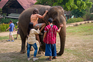 Lolo mounting her pachydermDismounting was a bit easier than getting on. All we really had to do was clutch an ear and slide down its side.
I do have to admit that we had a lot of laughs watching each others attempts at mounting and dismounting these really large animals. Everyone was such a good sport. I especially give credit to Henri, who was 81 years old. He gave up on the first attempt, but went back for a second and with a little extra help, made it. It was really quite inspirational.
After everyone had gotten a chance to ride, the mahouts brought the elephants forward so that we could pose with them. As we each took a turn standing between two of the larger ones, they poked us with their trunks and even gave wet kisses on our cheeks. It was pretty disgusting. I couldn't wait to wash my face.
The last event of the day, and the one that I found the tackiest, was the mahouts lining up the elephants so that we could offer them tips (dollar bills or bahts) as they reached out and grabbed them with their trunks. They just wouldn’t stop and I felt bad for one woman on our tour that kept being harassed by one until she practically handed over her entire pocketbook.
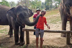 Herb getting a smoochAs we were leaving, there was a table with the photographs of each of us riding our elephant, set in a frame made from elephant dung - I am serious. Elephant dung is used to make paper products in Thailand. Kind of ironic that toilet paper is also made from dung. Of course, we just had to purchase it. I think it cost something like the equivalent of $10.
Herb and I are not big shoppers, so we skipped the afternoon excursion to Sankampang Street to see demonstrations on how silk, lacquer, silver, wood and bronze handicrafts are made. It was 95 degrees and humid, so instead we got a 2-pack of Chang beer at the 7-Eleven and hung out at the pool.
That evening we were on our own again for dinner, and not feeling terribly creative or adventurous, we went back to Lemongrass, had the same dinner as the night before, and then walked through the night bazaar. I think with all the new and changing stimuli, we needed some sense of routine.
Day 3 - Wat Suan Dok, Wat Phrathat Doi Suthep, visit to a local jade factory, authentic Thai dinner in a local Chiang Mai family’s home
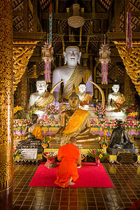 Wat Suan DokThis was it: the Gate1 finale - our last day of the tour. It was hard to believe it was almost over. It was even harder to believe how much we had seen and experienced in 11 days. It felt like we had been away from home for a month.
Our first stop of the day was the Wat Suan Dok, a 14th century temple of great significance, because it houses a very sacred Buddha relic - a bone believed to be from the shoulder of the Buddha. This sacred relic is enshrined in a large golden chedi (pagoda), surrounded by numerous white chedis that contain the ashes of several generations of the Chiang Mai royal family.
As legend has it, a monk named Sumana Thera from Sukhothai found the shoulder bone and brought it to King Kuene who ruled the Lanna Kingdom in the north (what is today Chiang Mai). When the monk arrived, the bone magically split in two. The smaller piece was enshrined in the Wat Suan Dok, but the king had the larger piece put on the back of a white elephant which was set free to wander wherever it wanted. The elephant chose to take the high road and wandered to the top of Doi Suthep mountain, where it was said to have trumpeted three times and then died.
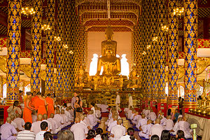 Ordination of young monks at Wat Suan DokTaking that a divine sign, the King had a Wat built on top of the mountain to house the relic, on the very spot where the elephant had collapsed. Later today we would be following in the footsteps of that elephant to visit the famous Wat Phra That Doi Suthep.
Before leaving the Wat Suan Dok thought, we did have the opportunity to watch an ordination ceremony for young monks in the ordination hall. Just like a graduation ceremony in the states, the hall was filled with proud parents and grandparents celebrating this important milestone in a young Thai boy’s life.
Then it was on to our very last temple on our Gate1 tour, the The Wat Phra That Doi Suthep, one of northern Thailand’s most sacred temples and a beautiful example of northern Thai architecture.
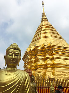 Wat Phrathat Doi SuthepFortunately, unlike the poor elephant that had to trudge up Doi Suthep with the Buddha’s shoulder bone strapped to his back, we got to ride up the steep hill in an air conditioned bus.
When reading about this temple beforehand, I was excited to see that there was a long 306-step staircase to reach the temple complex. Finally, some physical activity I thought - something greatly lacking on a guided tour. However, to my dismay, Udom herded us onto an elevator instead, which scooted us effortlessly to the temple complex on top.
From the outer terrace which was dotted with shrines and monuments, including one of the white elephant that carried the Buddha relic, we passed a lizard-like guardian dragon and entered an inner terrace and followed a walkway that circumnavigated a 79-foot tall golden chedi, within which was the Buddha’s shoulder bone.
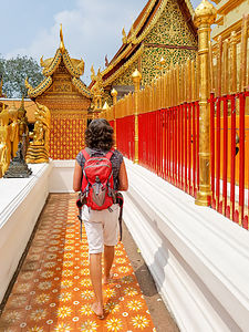 Inner Terrace of Wat Phrathat Doi SuthepIt was quite crowded with people stopping to leave lotus blossoms and other offerings at various shrines along the way. Each of the shrines had a Buddha statue with a particular pose and hand gesture. Each pose represents a day of the week, and you are supposed to pay respect to the statue representing the day you were born - something I learned on our brief visit into Myanmar, except that I later found out I making offerings to the Saturday Buddha when I should have been giving my lotus blossoms to the Thursday Buddha.
Based on what we had learned about the Buddha, I’m not sure how much he really cared about my offerings. Herb and I couldn’t help questioning whether this is what he really wanted from his followers. He clearly stated that he did not want to be worshiped and that one should shun the accumulation of material things as a way of seeking happiness. Yet here we were surrounded with glittery gold statues and buildings and people leaving offerings and bowing down before his image, as if he were a god. We would have to ask Udom how the Thai people reconcile this seeming paradox.
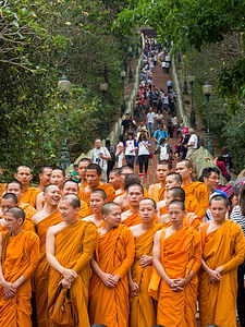 Monks about to earn Buddhist merits by climbing stairs to templeWe had some extra time, so I suggested to Herb that we go down the 306-step staircase, so that we could walk back up it like we should have in the first place. Ascending these steps is a way of gaining Buddhist merit. Herb thought it was kind of silly, but he knew better than to try to dissuade me on this.
The balustrade of the staircase was a beautiful tiled mosaic water serpent (“naga”) that ran along its entire length. Besides representing a bridge between the earth and the sky, a naga is a sacred being believed to bring good luck.
So down we went, passing many monks on their way up, earning their merit points. Once at the bottom, we turned around and started back up again. I don’t think you get merit for just descending.
Along the way, there were little girls dressed in traditional Thai costumes. I stopped to take a photo of one really adorable one, who immediately held out her hand and said “money,” an English word that the children of Thailand have seemed to master.
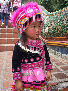 Another favorite little Thai girlOnce we had completed the folly of going down stairs, just so we could go up them, and then down them again, we met up with the rest of our tour group who had more sensibly taken the elevator down. They might have thought we were crazy, but we had earned Buddhist merit points and naga good luck.
Once that Udom had us all gathered together again, we walked a short distance down the road to Orchid Jade, a jade factory where he had arranged for us to have a tour. From the moment we were offered fancy cookies and coffee, I knew this was not going to be a tacky gift shop. The jewelry and figurines were absolutely beautiful. My particular favorites were the carved elephants, but even the tiny ones were over $100. I looked at this stop as more of a museum visit than a shopping trip.
That evening, for our closing event, we gathered together at a local Chiang Mai family’s home to have an authentic Thai dinner. Herb and I wondered how they were going to accommodate such a large group, but when the bus pulled up in front of their beautiful teak home, we knew it would not be a problem.
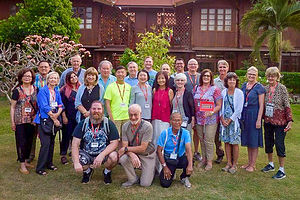 Our fellow travelers at our final dinner togetherOur hosts were lovely. They spoke English perfectly. The son, who was now in his late 20s had gone to high school in Los Angeles, so he very much knew all the idioms and expressions that a typical American teenager would. Many children of wealthy Thai families go to high school in the United States. They were quite affluent and well connected it seemed, as there were photos of them with the royal family.
The food was delicious and the tour of their home afterwards was quite interesting. They even gave us some home-made curry paste to take home.
It was a lovely way to conclude our time together.
Chiang Rai
Tuesday, March 20, 2018 - 9:45am by Lolo250 miles and 6 hours from our last stop - 2 night stay
Travelogue
Day 1 - Wat Rong Khun (The White Temple)
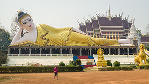 Roadside Reclining BuddhaToday would be an even longer driving day than yesterday, over 6 hours, and with more mountainous twists and turns.
Udom was constantly making sure that we were happy and comfortable along the way. Part of that task involved finding suitable restrooms, which apparently got more and more challenging as we ventured into the rural northern part of the country. Rather than Western style toilets with toilet paper, most of Thailand uses a toilet hose, or as it is affectionately referred to, a “bum gun.” I won’t get into the sordid details, as I’m sure “bum gun” creates a vivid enough visual image. I followed Udom’s sage advice and tucked some tissues in my pocket.
About two hours north of Sukhothai, we made our first Buddha stop of the day. I am convinced that you could devote a lifetime to visiting each Buddha in Thailand and never finish the task. After all, there are over 33,000 Buddhist temples in Thailand.The only thing equally ubiquitous are portraits of the king.
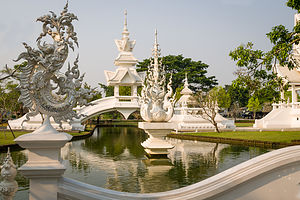 White Temple of Chiang RaiThis particular Buddha was a huge reclining Buddha, in the same pose as the famous golden one we had seen in Bangkok’s Wat Pho.
Udom explained that each Buddha pose and accompanying hand gestures has a significance related to an important event in his life. A reclining Buddha depicts the last moments of his final life on earth, before entering Nirvana. In this pose, the Buddha is always depicted lying on the right hand side on top of a resting table. As with many depictions of the Buddha, this one’s features were quite delicate and feminine.
Back on the bus, Udom announced that we would be stopping for lunch in a few hours at a restaurant on the shores of Kwan Phayao, Thailand’s largest freshwater lake. As I’ve mentioned before, Udom just oozes with love and pride for his country, so he was quite excited to show off a bit of Thailand’s natural beauty at this popular resort.
 Lolo crossing the bridge of the "cycle of rebirth";After being in cities for the previous week, we too were anxious for some non man-made attractions. Unfortunately, March is the time of the year when farmers burn their rice fields to prepare for the next planting, so the air was so thick with smoke and haze that the lake and surrounding mountains were hardly visible. Plus, it wasn’t all that great for breathing either.
Lunch was good though, and afterwards we took a brief stroll along the waterfront. Unlike the lakes we are used to in the states, there was little to no activity out on the water - just a few men fishing along its shores.
Only one more hour on the bus, and we were finally at our main destination for the day - Wat Rong Khun, better known as the “White Temple,” which out of the dozen or so Wats we would visit on our tour, was in my opinion, the most spectacular.
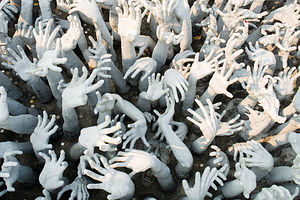 The beseeching hands of the suffering at the White TempleIt was unlike any temple we had seen so far. Everything was a brilliant white, and the pieces of glass embedded in the plaster made the buildings shimmer and sparkle even more in the sunlight. Besides creating a stunningly beautiful effect, the choice of colors and materials had a symbolic meaning as well. White signifies the purity of the Buddha, and glass symbolizes wisdom and self-reflection.
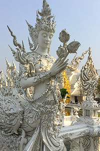 "Kinaree"; on the bridge of the "cycle of rebirth";As far as Buddhist wats go, this temple is a baby compared to those we had previously visited in Bangkok, Ayutthaya, and Sukhothai, and quite contemporary and unconventional in style.
The original Wat Rong Khun that was on these grounds was in a bad state by the 1990s, and despite efforts to restore it, the project was canceled due to lack of funds. That’s when a famous Thai visual artist from Chiang Rai, named Chalermchai Kositpipat, stepped in and offered to completely rebuild the temple with his own money. He wanted it to be a center of learning and meditation for the people of Chiang Rai - a very generous gesture on his part.
Today, Wat Rhon Khun is very much a work in progress and is not expected to be completed until the end of the century. Eventually there will be nine buildings, including a meditation hall, an ubosot (ordination hall), a hall to enshrine Buddhist relics, living quarters for monks, and an art gallery.
A major setback occurred in 2014, when a 6.3-magnitude earthquake hit Chiang Rai, badly damaging the White Temple. At first, Kositpipat declared that the damage was so great that the temple would have to be demolished. However, on further inspection, it was determined that the cracked pillars, damaged murals, and broken spires could be repaired, so he forged on. The process took about two years and the damaged buildings have reopened.
Besides being beautiful to look at, every detail of the temple carries meaning and is meant to encourage visitors to reflect on the Buddhist teachings and show the way to escape from worldly temptations, desires, and greed and to focus on the mind instead.
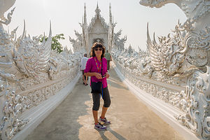
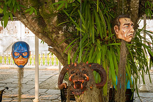 Creepy heads hanging from trees at the White TempleWe started our tour of the temple (and our journey to Nirvana) by crossing the bridge of the “cycle of rebirth,” towards the ubosot, the main building of the temple complex. It was a little unnerving to pass over a pool of upturned, beseeching hands representing the suffering souls destined to hell by their greed and desire. As we proceeded across the bridge, we were symbolically leaving worldly temptations behind and heading towards a state free of desire and suffering.
While crossing the bridge, we ran into two old “kinnaree” (half woman, half bird) friends, like the ones we had seen at the Grand Palace in Bangkok, except these were brilliant white rather than gold and much more ornate and flamboyant. Their role is to watch over the well-being of humans in times of trouble or danger, which I guess we were in until we made it to the other side of the bridge.
We still had a few more demons to pass by before reaching the safety of the ubisot. After crossing the bridge we arrived at the “Gate of Heaven,” guarded by two huge, scary creatures, that represented Death and Rahu, who decides man’s fate. They were wielding some very threatening weapons.
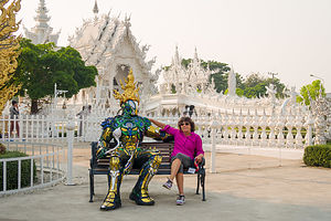 Lolo making friends at the White TempleFinally we stood before the ubisot, which like the other structures in the temple complex was a brilliant white with fragments of reflective glass set into the plaster, sparkling in the afternoon light. Although much more ornate than most Thai temples, it did have the traditional three-tiered roof with lots of serpents and blade-like projections sticking out of it - except this one was a lot more glitzy and gaudy.
Upon entering the temple, we immediately saw why it was so controversial. Rather than covering the walls with scenes from the life of the Buddha, as most temples in Thailand do, Kositpipat chose to use contemporary characters and events from the popular culture of the West to depict good and evil.
The murals of the White Temple are covered with modern cultural icons, such as Batman, Elvis, Superman, Neo from the Matrix, Harry Potter, Angry Bird, and even Hello Kitty. The message was somewhat confusing to me - is Angry Bird evil or just having a bad day? What about Hello Kitty? There are images of 9/11, nuclear warfare, terrorist attacks, and oil pumps all driving home the fact that human beings are evil and destructive.
My biggest regret is that we were not allowed to take photographs inside the temple, because you could literally study the murals for hours and still discover something new.
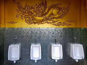 Fancy urinals at the White TempleOn the back wall there is a golden mural of the Buddha and a few images of the Buddha in front of it. It is this juxtaposition of traditional Buddhist imagery and pop culture that has drawn criticism from the Thai government.
On the temple grounds there was more to perplex our minds - severed heads hanging from trees, a larger-than-life silver and gold robotic type figure that I sat down next to on a bench, and more.
Amongst all the white buildings, there was one golden one that stood out. To our surprise, this ornately decorated building was a restroom. The symbolism of the color is that gold represents the body and is for lay people, while white represents the mind and the enlightened. My unenlightened Herb took a photo in the men’s room of the elaborate golden carvings above four urinals. It was beautiful.
The White Temple had been a truly amazing stop, so exquisite and thought provoking!!
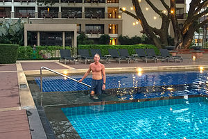 Pool at Le Meridien Chiang RaiRight on time, the Gate1 bus picked us up at the exit and took us to our hotel, Le Meridien Chiang Rai Resort, where we would be spending two nights. It probably is the nicest hotel I have ever stayed in. It was nice to be in a rural setting for a change, where we didn’t have to experience the sounds and smells of a city - just crickets and the smells of food from the outside BBQ.
The pool was absolutely lovely. It was Happy Hour so I ordered a glass of Chardonnay from the poolside bar - finally, a glass of wine. For awhile there I thought Thailand only had Chang and Singha beer. We live in Sonoma Valley now, so I was starting to have withdrawal.
At dinner, I ordered a second glass, forgetting it was no longer Happy Hour. When I did the math afterwards, I realized that my 500 baht glass of wine was $18 - oops! It was surprising, because everything up to that point had been so inexpensive. In Bangkok $18 got both Herb and I dinner and a Chang beer. Still, the wine was worth it.
Day 2 - Myanmar, lunch at a farm in Thailand, longtail boat to Laos
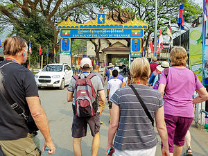 Border crossing into MyanmarOur Gate1 itinerary had been pretty aggressive already, but today we were going to take it up a notch and throw in a quick dip into Myanmar and Laos. I should have read the itinerary a little closer - I had no idea we would be leaving Thailand.
We departed early for the town of Mae Sai, at the northern-most tip of Thailand, right across the river from Tachileik, Myanmar.
Going into Myanmar was an optional add-on to our tour, but only four in our group decided stay behind in Mae Sai. The rest of us handed over our passports and $40 to Udom, who made the necessary arrangements for us to cross the border. He also gave us strict instructions as to what to do and not do during our brief visit.
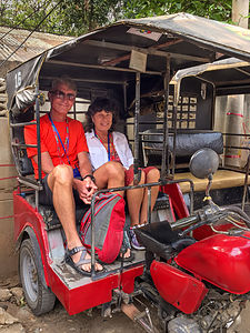 Myanmar tuk tuk rideI have to admit that I was a bit nervous as we passed through an entrance gate with the sign “The Republic of the Union of Myanmar” and walked across the bridge over the River Sai past some very stern looking Myanmar Immigration officials into the village of Tachileik. We were immediately struck by the difference in development between Mai Sai and Tachileik. We felt like we were in another world - a “third world.”
As with all Gate1 activities, this one was meticulously orchestrated. A lineup of 10 red and black tuk tuks, which apparently were expecting us, scooted us through the narrow chaotics streets up to a Buddhist nunnery, where we would be treated to a performance of the nuns chanting their morning prayers.
We were escorted to a hall where we Westerners struggled to settle ourselves comfortably on a hard wooden floor, always making sure that our feet did not point towards the nuns and the statue of the Buddha behind them.
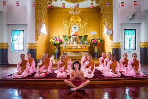 Lolo looking devout at a Buddhlist nunneryAbout 15 or so nuns sat facing us on a raised platform. Like Buddhist monks, their heads were shaven, but they wore pink robes rather than the traditional orange we had seen on the monks in Thailand. I am sure they were as fascinated by us as we were with them.
Once everyone was in place, they proceeded to chant their morning prayers. It was quite mesmerizing. I couldn’t help wondering what these girls lives were like. Based on the conditions of the village we had passed through on our tuk tuk ride here, I felt that maybe that had made a good choice.
After they were done chanting, we each had a chance, if we wanted, to sit cross-legged in front of them in the prayer pose to have our photos taken. Fully knowing it was a very touristy thing to do, we did it anyway.
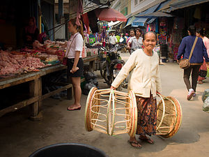 My favorite Myanmar grandmaBack outside the nunnery, our tuk tuk train was faithfully waiting for us to deliver us to our next destination - the street markets, where the people of the village would come each morning to get their food for the day.
It was crowded and we once again found ourselves dodging motorbikes weaving their way through the market, carrying entire families and the contents of their households on them.
We bypassed the meats, fruits, and vegetables and stopped at a stall selling betel quids - meant to be chewed like we Westerners chew gum, except that they are a stimulant and can give you a bit of a buzz. They use it the way we use tobacco or caffeine to get a bit of a pick me up, except this is much more potent.
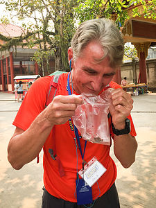 Herb enjoying his betel juiceWe watched as a merchant laid out a betel leaf, coated it with slaked lime, sprinkled some tobacco and areca nuts on top and then rolled the leaf. They are extremely popular in Southeast Asia and the reason you see many people with teeth stained red from the juice.
Udom said he was buying, but there were only a few takers in our group, Herb and a reluctant me included. As we strolled the market, we began chewing. I thought it was pretty disgusting and after just a minute or two spit it out into a tissue I fortunately had in my pack. There are no public garbage bins in Tachileik - we were on our own. Herb, however, forged on and did admit to getting a bit of a buzz before finally spitting it out.
Back on our tuk tuks we head up a steep hill to the Scwe Dagon Pagoda, a golden stupa used for meditation and rituals as well as a reliquary for the remains of Buddhist monks.
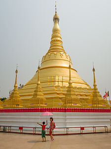 Scwe Dagon Pagoda (Myanmar)Before entering, however, we were exposed to another Burmese tradition, having our faces painted with Thanakha, a yellowish-white cosmetic paste made from ground bark. All the women and girls, and even some men and boys, were wearing it, both for its aesthetics as well as protection from the sun.
I sat still while a woman applied a circular patch on each of my cheeks as well as a stripe down my nose. She even suckered me into buying a bottle to bring home.
As we entered the Pagoda grounds, the woman I bought the Thanakha from pointed me out to a little boy, probably about 6 or 7 years old, who was apparently assigned to escort me through the Pagoda. He was adorable and as little as he was, he struggled somewhat successfully to keep me shaded from the sun by holding an umbrella over my head.
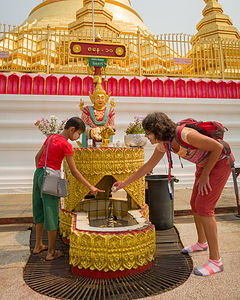 Lolo's little friend helping her through her Buddhist ritualsNot knowing what to do with him, I began, to his dismay, wandering somewhat aimlessly around the pagoda. This was obviously disturbing him, but we had no way of communicating, as he knew no English and my Burmese was even worse.
Finally, sensing our (or more correctly, my) confusion, his mother intervened and asked me what day of the week I was born on. Not knowing the answer, and appearing even more foolish than the two of them probably already thought I was, she consulted a book and told me “Saturday.” I later found out that I was actually born on a Thursday - oh well..
Apparently, it is very important for Burmese Buddhists to know on which day of the week they are born, because this determines at which of the 8 stations (for some reason Wednesday has two) I should perform my spiritual ritual.
Happy now that we had some structure to our wandering, my little friend brought me to the Saturday shrine, where I followed his lead pouring water, laying flowers, etc. Then, for the grand finale, he brought me over to a gong which I got to ring. I think he was anxious to get rid of me.
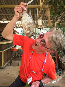 Herb's farm fresh lunchOur last stop in Myanmar was at their equivalent of a shopping mall, a crowded street lined with vendors selling all sorts of counterfeit goods. We managed to resist the temptation of buying anything, but some of our fellow Gate1 companions did not. I think the most ironic purchase by one of the women on our tour was a Hello Kitty suitcase to hold all the other stuff she was buying along the way.
Walking back across the bridge into Thailand, we felt a collective sense of relief to be back in Thailand, whose modernization and progress we now appreciated even more.
It felt like we had already gotten in a full day of touring, but it was only a little past noon when we crossed back into Thailand. We gathered our Gate1 companions who had remained in Mae Sai during our jaunt into Myanmar and headed off to our next event of the day, which was lunch at a farm, with all locally grown and raised food.
The road into the farm was not meant for giant tour buses, so we were loaded onto three farm trucks and brought to our hosts’ home. Lunch was great. Herb had the tilapia, which was served head and all, and I had the chicken wings, which looked much more like the actual wing than anything I have ever had in the states. It was delicious.
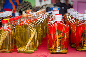 Laos cocktail hour - complete with tiger penisAfter lunch, we drove to the Golden Triangle where the Mekong River forms the border between Thailand, Laos, and Myanmar. From there we boarded a longtail boat which took us on a short tour up and down the river before dropping us off on the small island of Don Sao in Laos. It’s the only part of Laos that can be visited without a visa.
Basically, it’s a tourist trap with a large market filled with local handicrafts, opium paraphernalia, faux designer bags, and the ubiquitous elephant pants -- which I did buy more of as gifts for my sons and their girlfriends. I unsuccessfully tried to haggle down the usual 100 baht (about $3) price since I was buying four, but even my walking away didn’t work. I later learned that they have a no haggling rule on the island, so I was glad to learn that it wasn’t just my poor haggling skills.
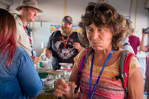 Lolo's first taste of whiskey soaked tiger penis - she likes it!However, our best experience on the island, besides standing next to the sign showing that we we were in Laos, was having a shot of tiger penis whiskey - that’s right, whiskey from a bottle with a tiger penis sitting in it. Herb was intrigued at its possible side effects. There were also some with pickled cobras and scorpions to choose from. I’m not a big hard liquor fan, especially when soaked with strange body parts, but it seemed like the appropriate thing to do.
This day just wouldn’t quit. After getting back to the Thailand side of the Mekong River on our longtail boat, Udom gave us free time to explore Golden Triangle Park where there was a very interesting Hall of Opium Museum, a big part of this area’s economy for literally thousands of years.
Exhausted and overwhelmed, we returned to our beautiful accommodations at Le Meridien Chiang Rai Resort, where we logged some well-earned relaxation time at its beautiful pool.
Day 3 - Karen Long Neck Tribe of Mae Salong
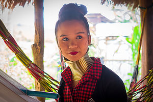 Karen Long Neck womanBefore continuing on to Chiang Mai, we had one more stop to make in the Chiang Rai Province this morning - Mae Salong, a village inhabited by the Karen Long Neck tribe. This too was an optional add-on to our tour, but this time the entire group had signed on.
So, just who are these exotic people? They were originally from the hills on the Myanmar side of the Thai border, but fled to Thailand in the late 1980s because of civil war and political unrest. While life is much better for the Karen that fled to Thailand, they are still considered refugees and do not have options for gaining Thai citizenship. As a result, they are confined to small villages in the north and kept separate from most of modern Thailand. On a positive note, this has allowed them to keep their culture and traditions alive.
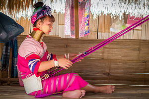 Long Neck woman weavingChoosing to visit this village did not come with a totally clean conscience. While some say tourism gives the Long Neck people an opportunity to make a living while still retaining their culture, others consider it exploitation and a type of human zoo where tourists come to gawk and take photos. I think it is a bit of both. In any case, we were here and the best we could do was show our respect and admiration for their traditions, and even more importantly, buy something that was actually made in the village.
The reason over 40,000 people a year visit these hill tribe villages is to see the exotic women (and little girls) whose necks appear so long that their heads seem to be magically disembodied, hovering above a coil of golden rings. Like magic tricks, this too is an illusion. Contrary to popular belief, the coils don’t lengthen the neck itself, but rather they push the shoulders and rib cages down, just making their necks seem long.
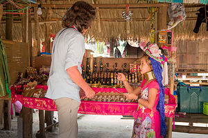 Lolo trying to haggle this little girl out of a few bahtsThe Karen long neck women begin wearing rings when they are about four or five years old. Every year afterwards until their 21st birthday, a ring is added, eventually reaching as much as 25 pounds. The origin of this tradition is a mystery even to the tribe itself. An ancient legend claims that the rings protected villagers from tiger attacks. Another theory is that the rings were purely aesthetic - worn as an accessory to make women more beautiful.
Whatever the reason, the tradition has made them a real tourist attraction and, as a result, has given them a means to feed and support their families. Exploitation? Perhaps, but their lives seemed peaceful and comfortable compared to what conditions could have been like for them back in Myanmar.
As we walked through their village, I tried hard not to gawk, but to view them as people just like us, trying to do the best they can with the opportunities presented to them. At each stall, there was a colorfully dressed woman or girl with shiny rings around their neck, busily knitting and weaving and selling their handicrafts. It seemed a bit staged, as if it was showtime, and they were performing for us.
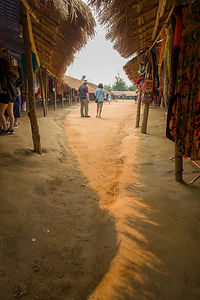 Long Neck VillageUdom had warned us that if we really wanted to help them, we should buy crafts made in the village rather than things produced in China, which you could pretty much find anywhere in Thailand.
At one stall, there was an adorable little girl, probably about 8 years old, with about 4 inches of rings around her neck and lovely circles of Thanaka painted on her face, standing in front of a table of handicrafts. As I slowly walked by, I heard her implore me to “Buy someting.” I started admiring the rather crude wood carvings of little longneck people on the table behind her. I tried asking her which one she liked best, which she eventually understood, and thrust one towards me while saying “40 baht” (about $1.25).
I looked around for Herb and his wallet, but he was nowhere to be found. I searched my pockets, but came up with only 20 baht (63 cents). I tried to just give the money to her without taking the figurine, but that was not the way it worked. She wanted to sell me something, not take charity. Finally, she said, “20 baht” and we made the exchange. Oh, great. My first successful haggle was cheating this little girl out of 63 cents.
Between the little boy that led me through my spiritual rituals at the Scwe Dagon Pagoda in Tachileik yesterday and this little girl today, I had fallen in love with the beautiful, soft spoken children of Myanmar - so unspoiled and mature in their ability and willingness to participate in the life of their village.
Sukhothai
Monday, March 19, 2018 - 9:45am by Lolo225 miles and 5 hours from our last stop - 1 night stay
Travelogue
 Golden monkWe would have lots of time on the bus today, as the drive from Ayutthaya north to Sukhothai is 225 miles. No worries about being bored though. There was no downtime with Udom. For the entire drive he stood at the front of the bus with his microphone and spoke to us about what we had seen and what we would see at the next stop, as well answering any questions we had about pretty much anything - ranging from his personal relationship to Buddhism, his feelings about the monarchy and the current and previous king, how the Thai people are adjusting to the transition into a developed and modernized nation, and whatever else we could think of. He was extremely open and honest with his answers. This is the kind of insight into the culture of Thailand that we could never have gotten if we had done this trip on our own.
 Mama macaque monkey and her young We weren’t even on the road a half hour, before we took a brief stop just a short distance off the highway to see a giant golden monk, larger than a 4-story building, sitting in the meditative lotus position on the other side of the pond from an outdoor market. Udom joked that he pulled in here, because if he didn’t one of us would be sure to say, “Why aren’t we seeing that?” You couldn’t exactly sneak past it.
Udom was extremely accommodating in meeting any of our requests or needs. His motto was, “You’re the boss. I work for you.” So, when someone in our group merely mentioned their interest in monkeys, he added a spontaneous stop along the way at Khao No-Khao Kaeo, a Wat at the foot of a limestone mountain where monkeys like to hang out.
When getting our travel shots at Kaiser before the trip, the travel nurse warned us to stay away from the monkeys in Thailand, as they are very aggressive and carry diseases. Now here we were intentionally seeking them out. Udom was not about to lose one of his charges, so he gave us strict instructions to not go near them and to allow he or one of the workers do any feeding.
 Gate1 approaches Sukhothai Historical ParkIt was hard to believe that something so adorable could be so dangerous. These were macaque monkeys, and they were about two feet tall and weighed less than 15 pounds. Many of them had suckling babies hanging onto their bellies while others were carrying babies on their backs. What a spontaneous and fun stop!
Then it was on to the main event of the day, the Sukhothai Historical Park, which like Ayutthaya is a UNESCO World Heritage Site.
Again, I think some general background information about the significance of this site to Thailand’s history would be helpful. Let’s just say that Sukhothai is the “Once upon a time…” part of Thailand’s history.
Before its rise, Siam was made up of small fiefdoms, subject to the ancient Khmer Empire’s rule. In 1238, two Thai rulers, Pho Khun Pha Muang and Pho Khun Bang Lang Hao, were able to consolidate power and succeed the Khmer as the rulers of the newfound kingdom of Siam. Sukhothai, which means “Dawn of Happiness,” became its first capital.
 Sukhothai Historical Park - Wat MahathatDespite it short lifespan (1238 to 1438), the Sukhothai Kingdom marked a golden period for religion, art, and architecture in Thailand. King Ramkhamhaeng the Great, the second ruling monarch of the newly established kingdom, established Theravada Buddhism as the state religion and he is also credited with the creation of the Thai alphabet.
From about 1378 onwards, Sukhothai slowly entered a period of decline. By 1438 it was fully annexed by the Ayutthaya Kingdom, whose ruins we had visited yesterday. Gate1 was taking us on a trip back in time.
 Sukhothai Historical Park - Wat MahathatOur visit to the Sukhothai Historical Park began in Wat Mahathat, which confused me a bit, because that was also the name of the Wat we visited in Ayutthaya. However, the architectural styles between the two capitals differed a bit.
In addition to building Khmer-style, corn-shaped prangs, as in Ayutthaya, Sukhothai temple craftsmen also developed their own style, known as the “Sukhothai style,” the most notable feature being one central lotus-bud chedi, surrounded by smaller bell-shaped chedis. If you recall from our first Wat visit in Bangkok, a chedi (or stupa) is a structure used to house relics, such as the remains of Buddhist monks or nuns.
Another notable feature of the “Sukhothai style” are its graceful depictions of the Buddha, several of which had feminine characteristics.
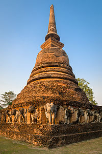 Wat Chang Lom behind hotelThe Buddhas in this complex seemed particularly peaceful and serene. I’m not sure what materials they were made from, but their current white with black coloring made them stand out in contrast to the darker reddish browns of the structures.
The most famous and photographed image in Sukhothai is that of a giant Buddha, seated in the lotus position behind rows of half-collapsed columns. Although no longer serving a functional purpose, these columns have assumed an aesthetic role. I liked the way the verticality of the columns mimicked the sharp pointy top on the Buddha’s head.
Right on schedule, Udom herded us back onto the bus, which brought us to our home for the night, the Legendha Sukhothai.
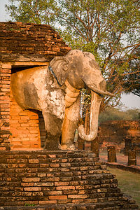 Wat Chang Lom behind hotelThis was my favorite hotel so far. While definitely less luxurious than the ones in Bangkok and Ayutthaya, where it felt like you could be anywhere, the ambience of this one was much more authentic Thai. We really felt like we were sleeping in Thailand for the first time - even if the toilet leaked a bit and the bed was hard. Our towels were even folded into the shape of an elephant. I almost didn’t want to shower and ruin them.
When checking in, Udom happened to mention that there was another temple ruin, a short walk behind our hotel. He wasn’t kidding! What a treasure in our own backyard, and one we had totally to ourselves to enjoy during the magical sunset hour.
The small temple complex was called Wat Chang Lom, the “Elephant Circled Monastery,” and it consisted of a main bell-shaped chedi (to hold relics), in the Sukhothai style, with 36 elephants sculpted into its base. It was amazing that a majority of those elephants, including their delicate trunks, were still intact. It was our very favorite ruin of all! So peaceful to just wander through.
We concluded our busy day with a dip in the hotel pool. I had made it my personal goal to do so at every hotel we stayed at, an easy and pleasant task considering how hot and humid it was.
Ayutthaya
Sunday, March 18, 2018 - 9:45am by Lolo50 miles and 1.5 hours from our last stop - 1 night stay
Travelogue
 Bang Pa In - the Royal Summer ResidenceWe said our farewells to Bangkok and began our journey north to the historic city of Ayutthaya, the 14th-century capital of the kingdom of Siam, the remains of which are so culturally significant that it has been designated a UNESCO World Heritage Site.
However, we knew enough about the pace of a Gate1 tour by now to expect more than just one amazing highlight per day. Today, there would be three.
Our first stop was Bang Pa In, the summer palace of the kings of Thailand, about 40 miles north of Bangkok along the banks of the Chaopraya River.
Since this is a royal site, the dress code is even stricter than that for entering a temple. Both men and women have to wear long pants and shirts with sleeves - no knees or shoulders, please. No bare feet are allowed either, so if you’re wearing sandals, you must wear sox.Two in our group were pulled aside for inappropriate attire - one woman with lycra tights with mesh and the other with a long sleeve shirt with holes cut out on the shoulder. Fortunately, there was a booth near the entrance that sold or lent clothes to properly cover up. The woman with the tights bought a pair of “elephant pants” for 100 baht, about $3.50 in U.S. dollars. They were so cute that I went in to buy Herb and me a pair. He looked at them a little skeptically, but he eventually came around to calling them his favorite loungewear.
 Lolo playing with the elephants at Bang Pa InThe palace grounds are lovely. One of my favorite spots was a large lawn, with a small herd of topiary elephants - even a baby one. I even went up and pet one’s trunk.
The buildings are laid out alongside a lovely pond, lined with formal plantings. The original palace was built by King Prasat Thong in 1632 when Thonburi was still the capital of Thailand. The buildings fell into disuse for a long period, but were revived by Rama IV in the 19th century. Most of the buildings as they stand today were created by his successor, Rama V, who also expanded the area into the magnificent sprawling Versaillesque gardens in the late19th century.
The palace is very European in design. During the mid-1800s, there was a conscious effort on the part of King Rama IV to modernize and adopt western customs and styles in order to fend off attempts to colonize them. As a result, from that point forward, you often see a mix of western and Thailand architectural styles. To learn more about this period of Siam’s history, I would recommend watching the movie, The King of Siam.
 King Rama V's Lookout TowerI think one of the loveliest views in the palace complex is from the gardens looking out at the Thai-style pavilion in the middle of the pond. This is actually the only example of classical Thai architecture within the palace grounds, and has the rather daunting name, “The divine seat of personal freedom.”
King Rama V also built a colorful lookout tower for viewing the surrounding countryside. It is called Ho Withun Thasana (or sages lookout). We were allowed to climb the spiral stairs to the top, but only after respectfully removing our shoes. From the balcony that encircled the top, there were wonderful views of the palace grounds.
If I were King, I certainly would want to spend my summer vacations here. However, the palace is no longer used as a royal summer residence, but rather just for special state occasions.
Before continuing on to the historic city of Ayutthaya, the main event of the day, we checked into the Kantary Hotel where Udom granted us 2 hours of free time. The rooms were huge - actually they were suites complete with living room and kitchen. This building was obviously originally planned to be rented as condominiums, but for whatever reason, was now a really nice hotel.
Avoiding the temptation to use our free time napping, we headed to the hotel pool. I forget if I mentioned what the weather in Thailand is like even in March - humid and in the 90s, so an afternoon dip was extremely refreshing.
Before we knew it, we were back on the bus headed to the Ayutthaya Historic Park to see the ruins of Siam’s second capital.
 Khmer-style prangs in AyutthayaFirst, some general background. The historic city of Ayutthaya, founded in 1350, flourished from the 14th to the 18th century. Strategically located on an island surrounded by three rivers, Ayutthaya grew to be one of the world’s largest urban areas and a center of global diplomacy and commerce. The power and glory of this once flourishing city came to an end in 1767 when it was attacked by the Burmese army, burning it to the ground and forcing its inhabitants to flee. The city was never rebuilt and is now an extensive archaeological ruin.
The site we were visiting is called Wat Mahathat and it was one of the most important temples in the Ayutthaya Kingdom. In one short bus ride, we had left Thailand’s present push to modernity and been thrust into its past. It was unlike anything we had seen so far.
 Mat Mahathat in AyutthayaThe temple was constructed in 1374 by King Boromma Rachathirat I. The design of the Wat Mahathat followed the concepts of the ancient Khmer mountain temples of Angkor in Cambodia, which featured a large central tower, called a prang, standing on an elevated platform, surrounded by four subordinate corner prangs, forming a quincunx, kind of like the number 5 on a dice.
A tower can mean many things, so I guess I can best describe these rather unique ones as multi-tiered, with each layer receding in size as it went up. Constructed of laterite (a reddish clayey material) and brick, they were reddish in color and richly carved with arches and columns. Their purpose was to enshrine Buddha relics. The upper part of the central prang collapsed in the early 20th century, so only the base remains.
There are several larger than life-sized seated buddha statues throughout the temple. However, by far the coolest and most photographed representation of the Buddha is the head of a stone Buddha entwined in the roots of a tree. No one knows how it got there, but there are several theories. One is that the tree simply grew around the Buddha head during the time when the temple lay abandoned and overgrown. Another theory is that a thief moved the head away from the main temple to hide it, but never returned to retrieve it.
 Chai Watthanaram TempleWhile we were wandering the grounds, we met two lovely young ladies dressed in ceremonial Thai clothing. When they saw us admiring their costumes, they offered to pose for a photo with the temple ruins in the background. Of course, I volunteered Herb to pose with them, which makes two days in a row that I have him grinning like a loon between girls one third his age.
Udom wasn’t done with us yet, so we were loaded back on the bus and transported a short distance to the Chai Watthanaram Temple, set along the banks of the Chao Phraya River - the same river we had dined beside on our first night in Bangkok. He promised us that the lighting on this temple near sunset would be phenomenal.
There was some sort of festival or event going on so we almost weren’t able to park the bus. However, Udom is not easily daunted, and found a way to make it happen.
 Traditional Thai dress at Chai Watthanaram TempleThe temple complex looked a lot like the one we had just left, but bigger and better preserved, perhaps because it was three centuries younger than Wat Mahathat. It was built in 1630 by King Prasat Thong, the same ruler that build the original summer palace that we visited yesterday morning, Bang Pa In. Like Wat Mahathat, it was built in the Khmer style, with a larger central prang surrounded by smaller prangs on each of its corners. Built of the same materials (laterite and brick), it too was reddish in color, even more pronounced in the evening light.
It’s not a word I use often, but I would have to say that Chai Watthanaram in the evening light was magical, made all the more so by the friendly and beautiful Thai people, many of whom were dressed in colorful traditional Thai clothing.
Udom explained to us that the new king, Rama X, is encouraging his people to take pride in their heritage by dressing, on special occasions, in the country’s traditional attire. However, an even greater impetus comes from an unlikely source - a TV soap opera called “Love Destiny,” set during the 17th century reign of King Narai the Great (Rama III). Many of the scenes from the show take place in Ayutthaya, so many Thais, both men and women, come to this Wat dressed in traditional garb to take selfies against the backdrop of the ruins.
I think King Prasat Thong would have approved.
