- Home
- About
- Map
- Trips
- Bringing Boat West
- Migration West
- Solo Motorcycle Ride
- Final Family XC Trip
- Colorado Rockies
- Graduates' XC Trip
- Yosemite & Nevada
- Colorado & Utah
- Best of Utah
- Southern Loop
- Pacific Northwest
- Northern Loop
- Los Angeles to NYC
- East Coast Trips
- Martha's Vineyard
- 1 Week in Quebec
- Southeast Coast
- NH Backpacking
- Martha's Vineyard
- Canadian Maritimes
- Ocracoke Island
- Edisto Island
- First Landing '02
- Hunting Island '02
- Stowe in Winter
- Hunting Island '01
- Lake Placid
- Chesapeake
- Provincetown
- Hunting Island '00
- Acadia in Winter
- Boston Suburbs
- Niagara Falls
- First Landing '99
- Cape Hatteras
- West Coast Trips
- Burning Man
- Utah Off-Roading
- Maui
- Mojave 4WD Course
- Colorado River Rafting
- Bishop & Death Valley
- Kauai
- Yosemite Fall
- Utah Off-Road
- Lost Coast
- Yosemite Valley
- Arizona and New Mexico
- Pescadero & Capitola
- Bishop & Death Valley
- San Diego, Anza Borrego, Joshua Tree
- Carmel
- Death Valley in Fall
- Yosemite in the Fall
- Pacific Northwest
- Utah Off-Roading
- Southern CA Deserts
- Yosemite & Covid
- Lake Powell Covid
- Eastern Sierra & Covid
- Bishop & Death Valley
- Central & SE Oregon
- Mojave Road
- Eastern Sierra
- Trinity Alps
- Tuolumne Meadows
- Lake Powell Boating
- Eastern Sierra
- Yosemite Winter
- Hawaii
- 4WD Eastern Sierra
- 4WD Death Valley +
- Southern CA Deserts
- Christmas in Tahoe
- Yosemite & Pinnacles
- Totality
- Yosemite & Sierra
- Yosemite Christmas
- Yosemite, San Diego
- Yosemite & North CA
- Seattle to Sierra
- Southwest Deserts
- Yosemite & Sierra
- Pacific Northwest
- Yosemite & South CA
- Pacific Northwest
- Northern California
- Southern Alaska
- Vancouver Island
- International Trips
- Index
- Tips
- Books
- Photos/Videos
- Search
- Contact
Quito
Monday, March 13, 2023 - 2:30pm by Lolo0 miles and 0 hours from our last stop - 2 night stay
Travelogue
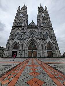 Basílica del Voto NacionalOur base camp in Quito was the lovely Mercure Alameda Hotel, located in walking distance to the historic Old Town.
Although we arrived around midnight, Quito is only two hours later than San Francisco, so it felt more like 10:00 p.m., and there really was no jet lag to deal with, making for an easy transition.
Since we only had one full-day to explore Quito, we immediately went to sleep and surprisingly (for me at least) woke up at 7:30 a.m. feeling quite refreshed and ready to get going. The hotel had a delicious free buffet, which would keep us satiated for quite a few hours.
We had watched numerous YouTube videos on top things to do in Quito, so we had carefully chosen how to best utilize our short time here. Also, the guide books warned of safety issues, such as making sure you only used an Uber or an authorized (legal) taxi, as there have been issues of “express kidnapping,” where the driver takes passengers at gunpoint to an ATM, withdraws their money, and then lets them go. That was not high on our list of things to do in Quito, although it would have provided an interesting story for Lolo’s Extreme. Other warnings were about sketchy neighborhoods to avoid.
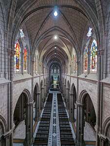 Basílica del Voto NacionalWe decided to limit ourselves to the Old Town historic district, a UNESCO World Heritage Site known for its narrow streets, Spanish colonial architecture, and historic attractions.
The Basilica del Voto Nacional was the top thing we wanted to see in Quito, both because of its beauty and significance, as well as for the opportunity to climb the steep rickety steps and ladders to the top of its towers for a stunning view of Quito below.
It is the largest neo-Gothic church in all of South America. Like every large cathedral we have ever visited, it was undergoing some construction, which in this case was a good thing, because according to local legend, the world will end if construction of the basilica is ever officially completed. I would hate to have that happen before we finally got to the Galapagos. We were thwarted once because of Covid, so the world ending on our second attempt would really be a bummer.
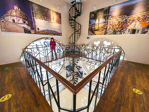 Climbing to the top of the Basilica TowerThe cathedral was designed in 1890 by the French architect Emilio Tarlier, who was inspired by the Notre Dame and Bourges cathedrals. It took over 30 years to build the basilica. The first mass and ringing of the bells took place in 1924. Pope John Paul II blessed the church in 1985, and it was consecrated and finally inaugurated in 1988.
It is an extremely impressive structure - 460 feet long and 115 feet wide, with its two frontal towers reaching a height of 377 feet. I particularly enjoyed the gargoyles protruding from the exterior: Ecuadorian iguanas, tortoises, armadillos, and Andean condors, chosen to represent the local endemic fauna rather than classic mythological or religious figures.
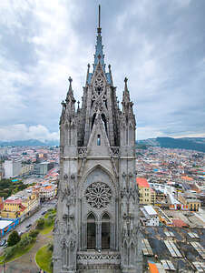 View of one Basilica Tower from the otherAfter admiring the exterior, we went around the back of the church and paid our $3 to begin our ascent to the top of the tower, which is 16 stories high. You can either take an elevator to the top or walk it. We chose to walk it. The YouTube video we had watched of a couple climbing it made it seem much scarier and strenuous than it actually was, although the fact that Quito is 9,000 feet above sea level did make our breathing a little harder.
We began ascending a few narrow, winding stairs which eventually brought us to a level from which we could look down onto the interior of the cathedral with its long central nave and stunning stained glass windows. Although we couldn’t see them from this vantage point, there are 24 small chapels surrounding the central nave, each dedicated to an Ecuadorian province.
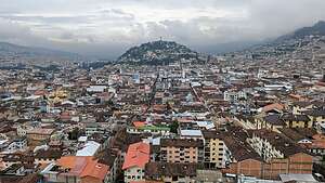 View from atop the Basilica TowerFrom there we continued climbing up above the ceiling of the Basilica where there is a wooden walkway above the church roof connecting to the other tower, but it was blocked off at the end because of construction - or fake construction so the world wouldn’t end.
Along the way, there were windows in the tower walls where we got views of the other tower as well as close ups of the interesting gargoyles.
On the 10th floor there was a cafe serving snacks and beer. Beer in a cathedral was a novel idea, which we passed up because it was only 10 a.m.
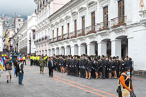 Carondelet Palace in the Plaza GrandeEventually we came to the floor where we stood behind the huge clocks on the four sides of the tower. It was an interesting perspective to see the clocks in reverse.
The final ladders to the top were actually outside the tower with metal rungs that we could look through down to the ground hundreds of feet below, which did freak out the YouTube couple, but I am always okay as long as I have a railing to hold onto.
Once at the top, we had a fabulous 360 degree view of Quito with El Panecillo looming in the background topped with a huge 45-meter high statue of the Virgin Mary with wings, which can be seen from practically anywhere you are in the city. El Panecillo translates to “The Little Bread Loaf,” and it’s easy to see why.
 Metropolitan Cathedral in the Plaza GrandeThe irony to me was that El Panecillo is one of the sketchiest places in the city despite the Virgin Mary’s presence. All the guidebooks warn you to take a taxi to visit the statue because it is not safe to walk there.
Once we were ready to come down, we had to go backwards down the metal rung ladder for a bit, which can be pretty unnerving for some.
We continued down from whence we came, sadly still too early for a cerveza in the cafe. Perhaps later, at a more respectable time, after we visited some other sights in the Old Town.
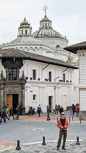 Exterior of Iglesia de la Compania de JesusFrom there, we headed to the heart of Quito’s Old Town, the Plaza Grande, also known as Independence Square, where palm trees and well-manicured gardens line the walkways through the park, with a large fountain in the center.
The plaza is surrounded by ornate colonial architecture, the most impressive of which is the Carondelet Palace, where Ecuador’s president lives and works. In front of the palace a group of Ecuadorian military (both male and female) were assembled for inspection. That plus the presence of at least two dozen police officers made this the safest place to be in Quito.
Near to the Palace is the Metropolitan Cathedral, a Catholic church also known as the Cathedral of Quito. Construction began in 1565, with various additions and renovations made until it was completed in 1806. Rather eclectic, it has a variety of architectural styles that blend very well together - Gothic style arches, a Baroque main altar, a Neoclassical choir area, and Moorish style ceilings.
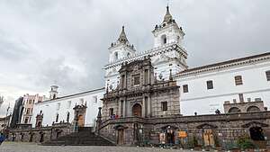 Plaza de San FranciscoThe murals inside blend European Christian iconography with a unique Andean interpretation. An imitation of the Last Supper has the disciples dining on guinea pig (an Ecuadorian favorite) and a nativity scene has llamas along with the usual farm animals.
A stone’s throw away from the Plaza Grande is another large cathedral, the Iglesia de la Compania de Jesus (Church of the Jesuits), the most ornate and beautiful of all. I know Ecuador is a very Catholic country, but there are four huge cathedrals in a little more than a square mile. I wonder how filled they are on Sundays.
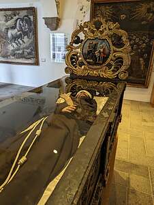 Religious art in Museo Fray Pedro GocialBuilt by Jesuits between 1605 and 1765, this church is the pinnacle of Latin American Baroque. The church is known for its gold plated interior built by artists from the Quito School, who skillfully carved and gilded every inch of the Church with 23-carat gold sheets. My biggest regret is that photography was not allowed, meaning I am going to basically forget that I have ever been here.
However, the exterior was not off limits, so we were able to photograph the lovely green and gold domes atop the church.
We continued a short distance (4 minute walk) to the Plaza de San Franisco, one of Quito’s most beautiful squares, surrounded by whitewashed walls and the twin bell towers of Ecuador’s oldest church and the Andes mountains in the background. It was our fourth and final church of the day.
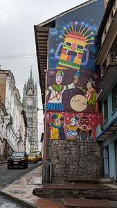 Street art in Old Town QuitoThe plaza is dominated by the Iglesia and Convento de San Francisco - the largest religious complex in South America. Established in 1536 by Franciscan monks, this magnificent architectural masterpiece features a museum (Museo Fray Pedro Gocial) in its convent with one of the most beautiful and complete collections of Quito Art from the 16th, 17th and 18th centuries.
As with the inclusion of local fauna on gargoyles of the Basilica del Voto Nacional, many design motifs from indigenous cultures were to be found within the complex, such as faces of sun gods and harvest symbols of flowers and fruit.
There were also plenty of morbid and ghoulish sculptural works, with plenty of skulls and other metaphors for death in order to inflict the proper level of fear of consequences for a sinful life.
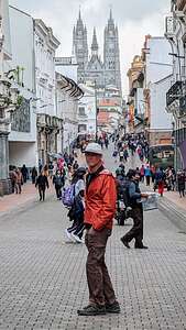 Herb on the streets of the Old TownOn a more pleasant note, we stumbled into a room with beer making equipment and a large table with benches on either side. So maybe the monks were not all gloom and doom. I liked to imagine them gathering around this table together just to chill and enjoy a good beer together.
Speaking of, it was getting near beer o’clock for us, so time to move on.
We left the Old Town and headed towards the Calle La Ronda, described in the books as a narrow cobblestone lane lined with postcard-perfect 17th century buildings, festive restaurants, bars, art galleries, and elegant shops. I pictured it being like Las Ramblas in Barcelona
I navigated to a random spot on Calle La Ronda and we started walking there. I’m not sure if we were on the wrong section of the street or whether we were just tired, but we started to feel a bit unsafe and uncomfortable. Unsavory characters were getting a little too close and the neighborhood definitely looked a bit sketchy. The angel atop El Panecillo was looming over us, which wasn’t a good thing, because that was the area we were warned to avoid.
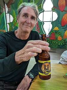 Herb enjoying his first beer in a basilicaI did read in the guidebooks that La Calle Ronda looks more “romantic” at night, but we weren’t anxious to find out.
We pointed ourselves back to the Basilica del Voto Nacional with the hope of having our first beer in a church. The guy at the entrance recognized us and let us back in for free. I don’t think he’d ever seen anyone that wanted to climb the tower twice in one day. Beer is a great motivator.
Unsure what floor the cafe was on, we forged on. I told Herb I was pretty sure it was on the 6th, but it turned out to be all the way up to the 10th (oops!).
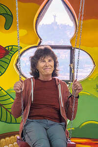 Lolo enjoying the swing in the Basilica cafeThe lunch menu consisted of only one item: a jamón, tomato, lettuce and cheese sandwich. I thought she said “jam”, tomato, and cheese, and thought “that’s weird,” but I figured I would go with the local cuisine. Besides, there was no other choice. Oh, and, of course, a round of the nice cold cervezas.
The atmosphere was simple but cute, and we were the only ones in there. There was even a swing with a view through a window behind it of the Virgin Mary atop El Panecillo. She really was everywhere, like those crazy eyes that follow you on some portraits.
By the time we climbed the 10 flights down, it was pouring rain out, so we called an Uber which brought us back to the Mercure Alameda for $2.50.
We were pretty beat and we had to get up at 5:00 the next morning to go on the tour to the Cloud Forest, so we just showered, took a quick nap, and went downstairs to eat dinner in the hotel restaurant, the Spicy Bistro, which turned out to be very good.
Athens
Tuesday, October 18, 2022 - 5:30pm by Lolo245 miles and 9.5 hours from our last stop - 1 night stay
Travelogue
.thumbnail.jpg) The National Archaeology Museum of AthensOur 9/12-hour ferry from Crete delivered us to Athens, well rested and in time for breakfast back at the Acropolis Select, the hotel we had stayed in when this adventure started.
The National Archaeology Museum of AthensOur 9/12-hour ferry from Crete delivered us to Athens, well rested and in time for breakfast back at the Acropolis Select, the hotel we had stayed in when this adventure started.
Tassos did not let any moss grow under our feet. Right after breakfast we boarded our bus, which took us to the National Archaeological Museum, which holds the world’s best collection of ancient Greek Art. Now that we had been in Greece for two weeks and seen so much, it would be a nice wrapup to our tour.
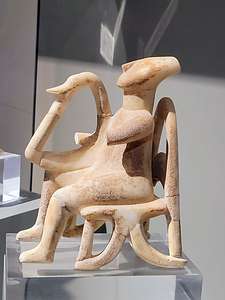 Cycladic Male-Seated Harp PlayerI love Art History and often spend my spare time reading Art History textbooks, so I was very excited to see some familiar favorites.
The museum traces the history of Greece’s various civilizations: the Minoans, the Mycenaeans, Archaic Greece, the Classical Age, Alexander the Great, and the Romans. That’s a lot of millennia to cover.
The exhibits are displayed chronologically so we started our journey in the early Bronze Age with a terracotta figurine called "The Thinker", estimated to have been made around 4000 BCE. While its purpose is unknown, it is thought to have been some sort of fertility figure. I thought he was adorable.
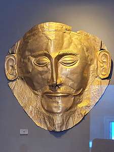 Death Mask of AgamemnonNext up was the Cycladic collection, featuring the famous marble figurines from the Aegean islands of Delos and Keros. These mysterious human representations, which resemble modern art, came from the 3rd millennium BCE old cemeteries throughout the Aegean islands, along with bronze tools and containers. This more intricate example is called the Male-Seated Harp Player. It was found on the island of Keros and dates from the Early Cycladic period (2800 - 2300 BCE). Amazing to think this finely detailed figure was sculpted around 5,000 years ago. Need I say, he was adorable too.
 Archaic period kousosMoving along chronologically, we next came to Room 4, which displays artifacts found in the ruins of the ancient mainland fortress-city of Mycenae, which flourished from 1600 - 1200 BCE. This was the civilization that theoretically battled Troy in Homer’s Iliad.
I immediately recognized what Henry Schliemann named the “Death Mask of Agamemnon.” The mask is made of beaten gold and it was once placed tied over the face of the deceased.
More accurate dating technology, however, showed that it was made several centuries before Agamemnon lived. Oh well.
Some of the earliest surviving examples of the post-Mycenaean, or Archaic Age (700 to 480 BCE), of ancient Greece are life-sized, and some even larger than life-sized, statues of clothed young women (kore/korai) and naked young men (kouros/kouroi).
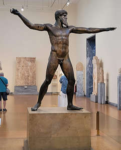 Artemision Bronze (Zeus or Poseidon?)You can see the Egyptian influence in their stiffness, triangular faces, and arms held at their side, except unlike the Egyptian statues, these Archaic Greece statues are actually freestanding and even have some empty space between their legs.
The statues of this period are rather expressionless with the characteristic Archaic smile, a small smile or smirk that was meant to suggest that the subject was alive and in good health. Very little personality comes through during this period.
Continuing on, we came to a room with the Artemision Bronze, discovered amid a 150 BCE shipwreck off Cape Artemision (north of Athens) in 1928. The weapon he once held was never found, so no one knows for sure whether it was Zeus (who would have had a thunderbolt) or Poseidon (who would have had a trident). Or, maybe he was just doing a yoga Warrior 2 pose. It was thought to have been created around 460 BCE.
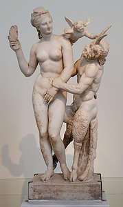 Aphrodite, Pan, and ErosI think the final sculpture I will discuss is one of my favorites: Aphrodite, Pan, and Eros - an example of Hellenistic Greek Art, which was less serious and more erotic than Classical Art. In this statue, dating to about 100 BCE, Aphrodite is playfully fending off Pan’s (half-man, half-goat) lecherous advances with her slipper. Between them, Eros (known as Cupid to the Romans) is obviously up to no good.
There was so much more in the museum to talk about, but these were just some of our favorites.
That evening we wrapped up our tour with a farewell dinner at the Cave of the Acropolis, in the Plaka, in the shadows of the sacred rock of the Acropolis.
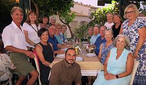
We kind of dreaded the next day - about 24 hours of travel before we would get home. Home is good too though. We were about ready.
Thank you Tassos and the people of Greece for sharing your beautiful land and rich culture with us.
αντίο και ευχαριστώ (Goodbye and thank you)
Crete
Wednesday, September 14, 2022 - 3:15pm by Lolo125 miles and 1.5 hours from our last stop - 3 night stay
Travelogue
Day 1 - Arrival on Crete
 Crete here we comeAfter two wonderful days exploring Santorini, we once again boarded a ferry, this time to Crete, our final island on the tour. We arrived pretty late, around 8:00 pm in the evening, so all there was time for was a quick dinner at the hotel and then bed.
Crete is much bigger than the other islands we had visited, so we would spend 3 days here exploring ancient Minoan ruins, visiting several villages throughout the island, swimming in the Aegean Sea at the famous Matala beach, making pottery, and just immersing ourselves in the culture of Crete (which is quite different from the rest of Greece).
Day 2 - Palace of Knossos, Pottery demonstration, and Heraklion Archaeological Museum
 Entrance to the Palace of KnossosBefore arriving, all I knew about Crete was from Art History books - the Palace of Knossos and the myth of the Minotaur, a creature that was half-man and half-bull, and wandered through the labyrinth beneath the palace, munching on youths sent down there as sacrifices.
Besides being a wonderful tourist destination today, Crete holds the distinction of being the birthplace of Europe’s first advanced civilisation, the Minoan culture, which flourished from 2800 to 1450 BC., and it is the buildings excavated at the Palace of Knossos that are the main source of information about Minoan architecture and culture.
Much of the palace was reconceived and reconstructed by Arthur Evans, who worked here between 1900 and 1932. His reconstruction though is a bit controversial, as archaeologists (including our guide) felt that he took a bit too much creative license in its restoration.
 Fresco roomStill, I think it was a lot more interesting to wander through a series of buildings and artifacts that provide a sense of what life was like for the Minoan people more so than if it had just been left in ruins.
The Palace was quite advanced for its day with courts, halls, workshops, storehooms (housing vast clay jars), and perhaps even residential quarters. There was even a system of clay pipes for drainage, an early sewage system similar to the one we saw in Akrotiri.
The entrance to the Palace of Knossos is a good example of Minoan architecture. Unlike the Doric columns of the Parthenon, Minoan columns were made of wood rather than marble, painted red, and tapered downward from the top, with a big bulbous capital on top. Wall paintings suggest that the capitals were painted black and the shaft red, so that is how Arthur Evans recreated them.
 Throne RoomWhen excavating the ruins of Knossos, archaeologist Arthur Evans placed a copy of a restored relief bull fresco on the wall behind the columns, possibly using a bit of creative license, as historical accuracy as to its real appearance was not available.
The grand rooms of the palace at Knossos were decorated with murals. Most of them were in such bad shape that they required extensive restoration, which may not have always been reliable. The frescoes are characterized by vibrant mineral colors (whites, reds, blues, yellows, and greens), applied to wet or dry plaster, with wide bands of geometric patterns serving as elaborate frames.
.thumbnail.jpg) Snake Goddess of KnossosWe entered one of the reconstructed buildings and found two frescoes which we were quite familiar with.
Snake Goddess of KnossosWe entered one of the reconstructed buildings and found two frescoes which we were quite familiar with.
The mural next to the window is the famous Toreador Fresco, which scholars believe represents a bull-leaping scene, a ritual game in which performers vaulted over a bull’s back. The fresco depicts a critical moment in the event. Two female figures (in white) are positioned at each end of the bull, while a male figure (in brown) throws himself into a somersault off of the bull’s back.
To the left of the Toreador Fresco is the “Ladies in Blue” fresco, named for its blue background. The three women are quite lavishly dressed and covered in jewels. They seemed quite modern-looking and fashionable for being painted over 3,500 years ago.
 Modern day Snake GoddessNext, we entered the Throne Room, a chamber built for ceremonial purposes during the 15th century BCE. The murals on the surrounding walls were stunning. Note the creatures guarding the throne. They are griffins, legendary creatures with the body, tail, and back legs of a lion and the head and wings of an eagle.
After visiting the actual site of the Palace of Knossos, we took a trip to the Heraklion Archaeological Museum, one of the best museums in the world for Minoan art. Here too we were greeted by some familiar favorites from our Art History books. Many of the artifacts here, including the murals, were moved here from the actual Palace site to better preserve them.
My all time favorite is the famous Snake Goddess, a female figure about 12 inches high, raising a snake in each hand. The snakes take up so much of the attention that you almost miss the cat sitting on her head. The revealing dress might seem shocking to modern viewers, but bare-breasted, buxom goddesses were worshiped in ancient civilizations. I believe they still are.
In many ancient religions, snakes are associated with earth deities and male fertility, and bared breasts suggest fecundity.
 A master potterWe later came across some graffiti in an alleyway obviously painted by a student of Minoan Art. I couldn’t resist seeing what it might feel like to be a snake goddess.
We did have one more activity today - a pottery demonstration by a master potter in a village of potters. He was pretty amazing. He slapped a lump of clay on his wheel, hit the gas pedal, and did magic. He made the vase rise, he made it widen, he gave it a spout, he made patterns in its side - and it took him less than 3 minutes. The end result was a beautiful amphora.
Next, he called for someone in the audience to try. No one budged as he was a pretty hard act to follow. Somehow I got suckered into doing it.
He plopped a blob of clay on the wheel for me and I pressed on the pedal. For a brief moment, I felt like Demi Moore in that scene in Ghost. Where was Herb when I needed him? That moment quickly passed.
.thumbnail.jpg) Not a master potterI had to keep remembering to wet my hands, because apparently that was important. I tried to do what he did and make my clay rise up high in some recognizable shape, but I think he gave me less clay than he had, because when I tried to raise it to the height he made his go, I ripped it right off the wheel.
Not a master potterI had to keep remembering to wet my hands, because apparently that was important. I tried to do what he did and make my clay rise up high in some recognizable shape, but I think he gave me less clay than he had, because when I tried to raise it to the height he made his go, I ripped it right off the wheel.
Without muttering a word, he took my blob, chucked it away, and put another one on my wheel. This time I tried to not go so high, but it soon began to wobble, somewhat out of my control. Not knowing how to get it back in control, I took my foot off the pedal and declared it a finished product. It didn’t look too bad, and I had accidentally created something resembling a spout.
At least I made the potter crack up.
I could definitely imagine how with some degree of skill, this could be very rewarding.
Day 3 - Gortyna ruins, old Venetian town of Vori, Phaistos ruins, and Matala Beach
.thumbnail.jpg) The Odeon at GortynaWe would be visiting two archaeological sites today, but Tassos warned us that they would be very different from Knossos in that they did not have the razzle dazzle of Arthur Evans’ creative reconstruction work. In contrast, they were left in their current excavation state.
The Odeon at GortynaWe would be visiting two archaeological sites today, but Tassos warned us that they would be very different from Knossos in that they did not have the razzle dazzle of Arthur Evans’ creative reconstruction work. In contrast, they were left in their current excavation state.
Our first stop was Gortyna, a place that has been inhabited since Neolithic times, but reached its pinnacle after it became the capital of Roman Crete around 67 BCE. At that time, there was believed to be as many as 100,000 residents.
Like every good Roman city, Gortyna had an Odeon, or theater. This one was originally built in the 1st century BCE. It was leveled in an earthquake and rebuilt by Trajan in the 2nd century CE.
 6th century BCE laws of Gortyna iThe covered, arched structure on the far side of the Odeon shelters Gortyna’s most important artifact: the 6th century BCE laws of Gortyna inscribed on massive stone tablets. These represent the oldest law code in the ancient Greek world, and cover many of the same issues we deal with today: property transfers, inheritance, marriage, divorce, and various criminal offenses. The 600 lines are written in a Dorian dialect.
 (1).thumbnail.JPG)
 6th-century CE Byzantine Basilica of Agios TitosThe fact that Zeus chose to seduce Europa on Crete gives weight to the claim that the civilization of the European continent began on the island of Crete. In the 19th century, a colossal statue of Europa sitting on the back of a bull was discovered in the Odeon in Gortyna. Today, that statue, along with the Elgin Marbles from the Parthenon, are in the British Museum. I think it’s about time for the Brits to give the Greeks their treasures back.
 Venetian influenced architecture in VoriReturning to the real world (or the ancient one at least) from the world of mythology, we arrived at the very impressive, 6th-century CE Byzantine Basilica of Agios Titos, the finest early-Christian church in Crete. According to tradition, Gortyna was the first city in Crete to accept Christianity, so it became the seat of the first bishop of Crete, which was St. Titus, a disciple of the Apostle Paul.
The conquest of Crete by the Arabs in 824 CE put an end to the history of ancient Gortyna. After the Byzantines recaptured the city from the Arabs in the 10th century, the church was rebuilt. All that survives today is the apse flanked by two side chapels.

Venice controlled Crete from 1204 - 1669, so there is much Venetian influence in the town’s architecture.
 Messara Plain near PhaistosToday the village is classified as a “traditional protected village” by the Greek Ministry of Culture because of its collection of historical buildings, churches, homes, and way of life.
We visited the wonderful little Vori Ethnological Museum, which had a great collection of artifacts relating to cultural and traditional life on Crete - food production, farming, war, music, rural life, etc.
When we got to the ancient ruins at Phaistos, we had to use our imagination a lot more than at the partially reconstructed Palace of Knossos and even at Gortyna where there were several remaining intact structures.
.thumbnail.jpg) Ruins at Phaistos palace complexThe site has been inhabited since the Final Neolithic period (c. 3600-3000 BCE), but its greatest period of influence was from the 20th to 15th century BCE, during which time it, along with Knossos, was one of the most important centers of the Minoan civilization.
Ruins at Phaistos palace complexThe site has been inhabited since the Final Neolithic period (c. 3600-3000 BCE), but its greatest period of influence was from the 20th to 15th century BCE, during which time it, along with Knossos, was one of the most important centers of the Minoan civilization.
The palace of Phaistos was once the second largest palace in Crete, with Knossos being the largest. It was built on the most spectacular setting of all the palaces, high on a hill, overlooking the entire fertile Messara Plain, with Mr. Ida, Crete’s tallest mountain (8,058 feet) in the distance.
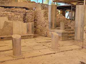 Queen's Apartment in the Phaistos PalaceWhile very few structures remain, we were able to see the building outlines and ground plan of the palace complex. The main courtyard, which still has its original pavement stones, looks out with unobstructed views over the Messara Plain.
There were four deep circular pits, lined with stone walls, in the palace complex. These are known as kouloura, and similar ones were found at Knossos and other Minoan palaces. There are multiple theories as to what they were used for, such as garbage pits, cisterns for storing water, or, the most popular theory, a granary to store excess harvest.

These rooms were lit by lightwells, a popular feature in Minoan architecture. They also had porticos and pier-and-door partitions which allowed sections of the room to be closed off. The floors and walls retain their original alabaster slabs and the walls are decorated with frescoes of plant motifs.
 Phaistos DiskSome Linear A tablets were also found around the site. Linear A was the primary script used in palace and religious writings of the Minoan civilization. It was succeeded by Linear B, which was used by the Mycenaeans to write an early form of Greek. No texts in Linear A have yet been deciphered
Amongst the many artifacts discovered at Phaistos was the mysterious Phaistos Disk, a disk of fired clay covered on both sides with a spiral of undeciphered symbols featuring 241 tokens, comprising 45 distinct signs. The symbols were made by pressing hieroglyphic “seals” into the clay, in a clockwise sequence spiraling toward the center of the disk. It has been dated to between 1850 and 1600 BCE. It is the only known sample of a hieroglyph-like writing system.
.thumbnail.JPG)
It is currently in the National Archaeological Museum in Athens, which we would get to see later when we returned to Athens.
We were about “scholared out,” so we were very much excited about our next stop - the famous Matala Beach on the southern coast of Crete, where we would have a seafood lunch at Petra and Volsalo, a great seafood restaurant right on the waterfront, followed by free time to explore the town or hang out at the beach.
.thumbnail.JPG)
Joni Mitchell lived in one during her time here. It was here that she wrote some of her most famous folk songs: “Beneath the Matala Moon” and “Carey” (a man with whom she had an affair while staying in Matala). Other celebrities that also came to Matala included Bob Dylan, Janis Joplin and Joan Baez.

Today Matala is a thriving modern tourist destination, with very few remnants of their hippie past.
So, I guess we were now just some of those modern tourists here to enjoy the beauty of Matala Beach.
After lunch, we changed into our bathing suits in the restaurant restrooms and hit the beach for a few hours. Technically, we were now swimming in the Libyan Sea (which is still part of the Aegean). I don’t care what they call it, it was lovely.
Day 4 - Rethymno, Chania, and our overnight ferry back to Athens
 Rethymno HarborIt was our last day in Crete. This morning, as we did whenever we were moving on from one island to the next, we brought our luggage down to the hotel lobby, where it would be taken, stored in the bus, loaded on the ferry, and then magically appear in our next hotel room. It made us kind of nervous, but so far Tassos was 4 for 4. Just one more to go for a perfect score.
.thumbnail.JPG)
Our first stop for the day was the northern coastal city of Rethymno, one of the most well-preserved Venetian old towns on the island of Crete. Venice wasn’t just a brief visitor to this island, but rather they controlled it from the 12th - 16th century - a much longer period of time than the United States has been a country.
 Street Art in Petichaki SquareThe architecture in the harbor and along the waterfront definitely reflected their Venetian past.
Another vestige of the Venetian occupation is Fortezza, an imposing medieval castle that stands on a hill looking down and once protecting the town.
In 1645, the Ottoman Empire took Crete from the Republic of Venice, and held onto it until 1897, so there is a lot of Turkish influence as well - often in the same building.
.thumbnail.jpg) Old Town RethymnoMany of the over 600 Venetian buildings have Turkish touches, such as latticework balconies (through which harem women used to keep tabs on street life without revealing themselves) and arched doorways with Turkish inscriptions.
Old Town RethymnoMany of the over 600 Venetian buildings have Turkish touches, such as latticework balconies (through which harem women used to keep tabs on street life without revealing themselves) and arched doorways with Turkish inscriptions.
Even the Neratze Mosque near Petichaki square was once a Venetian Church and then an Augustinian Monastery, before the Turks arrived in 1657, added a minaret and some balconies for praying, and transformed it into a mosque.
When Crete was later freed from the Ottomans, they turned it back into a Christian Church dedicated to Agios Nikolaos (the guardian saint of sailors), but the minaret remained and it never actually functioned as a church. Today, the Mosque houses the Municipal Odeon, run by the Rethymno Association for the Promotion of the Arts.
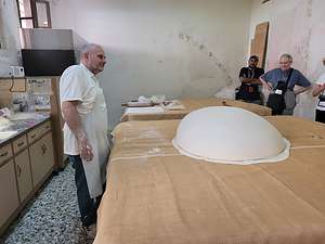 Baklava demonstrationWhile the waterfront with its numerous restaurants and cafes was definitely the main attraction, wandering through the narrow alleyways of the lovely Old Town was a close second.
We got to see a demonstration of how baclava is made. The baker took a lump of filo and spread it so thin that it covered an 8’ x 8’ table. He then put a cloth over that and repeated the process several times. Then, he took one of the layers and flipped it in the air. It fell onto the table as a perfectly round dome. Not sure the purpose of this, but it sure was cool.
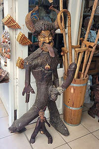 PriapusA Lot more stuff had to happen before this became baklava, but it was time for us to move on, but not before first buying a few samples.
Afterwards, Herb and I went off on our own to wander the alleyways. We’re not really shoppers, and there was absolutely no room in my carry-on bag to fit any new additions, so we just window shopped. There were some pretty interesting objects for sale.

Another common souvenir were objects covered with large, wideopen blue eyes. They were everywhere - on posters, t-shirts, scarves, mugs, whatever. It’s called το μάτι (to máti) in Greek, and it is actually an “evil eye” – an amulet that is supposed to protect you from a curse that is said to be cast by envious people.
.thumbnail.jpg) My healthy yogurt energy bowlI bet the nearby wooden Priapus could use some protection from envious people.
My healthy yogurt energy bowlI bet the nearby wooden Priapus could use some protection from envious people.
However, there was one type of souvenir that pretty much is only found on Crete, specifically in the western prefectures of Heraklion, Rethymno, and Chania. That item is the Cretan dagger or knife.
Crete has a long tradition of “vendetta” and the men tend to act more “macho” than the rest of Greece. Cretan vendettas are a form of unwritten tradition, in which men take the law into their own hands. It is pretty much a family affair and emanates from the duty Cretans feel to protect their family honor. It is considered to be a great form of justice, almost pious, and the hatred and revenge between families is passed down from generation to generation. Knives were the weapon of choice. It still goes on today.
The knives were beautifully handcrafted and many even had poetry inscribed in the handle. I tried to convince Herb to get one as a souvenir, but he's not the vendetta type.
We ended our visit to Rethymno with lunch at the Lux Cafe on the waterfront, where I had a healthy yogurt energy bowl while Herb enjoyed his idea of a healthy power meal which included French Fries and a large beer.
 Chania's Venetian HarborTime to get back on the bus and get to our final destination on Crete - Chania, the 2nd largest city on Crete and the port from which we would be leaving later tonight.
Chania, known for its 14th-century Venetian harbor, narrow streets and waterfront restaurants, is among the most picturesque towns in Crete. Due to the long occupation by the Venetians, its architecture has a vivid Medieval look.
However, like Rethymno, there is also a Turkish influence from when the Ottoman Empire booted the Venetians out and ruled for 250 more years.
 Chania LighthouseThis town certainly changed hands many times until it finally gained its independence from the Ottomans in 1898, formally becoming the Cretan State. Crete became part of Greece in December 1913.
The lighthouse of Chania, which is the symbol of the city, stands at the end of a long stone pier jutting into the Venetian harbor. It was originally built by the Venetians in the 16th century.
 Firka Fortress being attacked by a Tourist submarineDuring the Turkish occupation, the lighthouse fell into disrepair and was eventually rebuilt between 1824 and 1832 in the form of a minaret. The reconstruction was done by Egyptian troops who were supporting the weakening Ottoman Empire against the rebellious Cretans.
 Old Town ChaniaHowever, the base of the lighthouse is still the original Venetian base, although the Lion of St. Mark, Venice’s patron saint, which was carved there has long gone.
The Firka fortress dominates the other side of the harbor. It was built by the Venetians in 1629 to protect the harbor entrance from raiders. A chain could be connected from the fortress to the base of the lighthouse to close the harbor from invaders.
.thumbnail.jpg) Küçük Hasan Pasha MosqueI guess that didn’t work out too well, because the city fell into the hands of the Turks in 1645. The Turks used the fort as a barracks for their army and changed the name to “Firka,” which means a military division.
Küçük Hasan Pasha MosqueI guess that didn’t work out too well, because the city fell into the hands of the Turks in 1645. The Turks used the fort as a barracks for their army and changed the name to “Firka,” which means a military division.
We visited the Maritime Museum of Crete, next to the Firka Fortress, which houses an extensive collection of model ships, nautical instruments, paintings, historical photographs and war relics, and an impressive model of the fortified town and port when it was under Venetian rule. The material is classified chronologically, starting from the Bronze Age right up to the present.
.thumbnail.jpg) Sunset over Chania's Venetian HorborAfterwards, Herb and I wandered around the Old Town on our own, through its lovely Medieval looking alleyways.
Sunset over Chania's Venetian HorborAfterwards, Herb and I wandered around the Old Town on our own, through its lovely Medieval looking alleyways.
Eventually we wound up back on the waterfront near the Küçük Hasan Pasha Mosque. This was the first mosque built in Crete after it was declared an Ottoman province in 1646. After the Greco-Turkish population exchange in 1923, the mosque ceased to function and in 1939 its minarets were demolished. Today it is an exhibition hall.
While walking along the waterfront, we found one of the couples in our tour group sitting at a very well-placed table on the waterfront sipping wine. They invited us to join them and we readily accepted. Gradually, more and more of our group wandered by and soon there were eight of us enjoying the sun going down over the harbor.
 Our overnight ferry from Crete to AthensPretty nice way to end our time on Crete.
Now it was off to the Port of Chania, where we, and hopefully our luggage, which we had given up this morning, would board our 9-hour ferry back to Athens. We all had sleeper cabins, complete with bathrooms and showers, so hopefully it would be a very comfortable and uneventful passage.
Santorini
Monday, September 12, 2022 - 1:45pm by Lolo96 miles and 3.5 hours from our last stop - 2 night stay
Travelogue
Day 1 - Fira and Oia
.thumbnail.JPG)
As we approached, we saw what appeared to be snow or white icing atop the cliffs. However, the closer we got, the icing turned into the famous whitewashed, cubiform houses of Santorini.
A steep, zig-zaggy road led from the port up to the top. This or a cable car or a donkey are the only ways up to the village of Fira (also called Thera) - unless of course your group has its own private bus to transport you in comfort. Thank you Road Scholar.
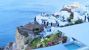 Oia's whitewashed cubiform houses carved into the cliffsBesides the crowds getting off the ferries, there were several cruise ships in the harbor that would be offloading thousands of tourists taking taxis or the cable car to the top.
As a result, the port was packed with masses of people, but fortunately, our bus was there to greet us. We got on board and joined the dozens of other vehicles winding their way up the switchbacks to the top.
We would be staying for two nights in Fira, the picturesque capital of the island perched on the top edge of the caldera, 850 feet above us, with breathtaking views of the Aegean Sea.
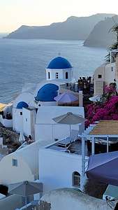 The beautiful white and blue-domed churches of OiaHowever, it was already 4:00 when we arrive on the island, so before checking into our hotel, our bus took us directly to the beautiful town of Oia, famous for its whitewashed houses and blue-domed churches carved into the rugged clifftops.
This was by far the most crowded village we had been to yet, and it didn’t help that a dramatic sunset was about to take place. It was shoulder to shoulder walking on the pedestrian way. The most popular spot to watch the sunset is by Oia Castle. The crowds there every evening are supposed to be insane, so we changed directions and started walking away from the sunset. I felt like a salmon swimming upstream, but we did seem to be leaving the crowd behind.
It sort of worked and soon we could actually breathe and take in the beautiful views of the whitewashed cubiform houses carved into the lava rock cliffs, overlooking the caldera below.
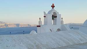 Bells, bells, bellsAnd then I found what I had been looking for - Oia’s famed whitewashed, cubiform churches topped with the famed blue-domes set into the cliffside.
So why were there so many white and blue buildings in Greece? For aesthetics? Because they matched the flag of Greece? Actually, the answer to that is quite different. It is more out of necessity than aesthetics.
First, why the white?
In 1938, the dictator of Greece, Ioannis Metaxas, ordered all citizens to whitewash their homes to try to stop the spread of a cholera outbreak. Now, this might sound silly, but the whitewash contained limestone, which is a powerful disinfectant.
The white of the houses had the additional benefit of making them cooler during the hot Greek summers.
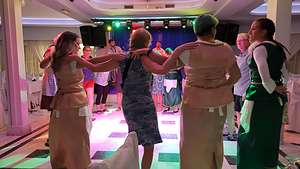 More Greek dancingOk, so what about the blue?
Because it was cheap and easy to make. Fishermen painted their windows and shutters with whatever was left over after painting their boats. The blue used for Greek island homes was made from a mixture of limestone and a cleaning product called “loulaki,” which was a kind of blue talcum powder most islanders had readily available at home. Therefore, blue paint was a practical choice.
When the military dictatorship took over Greece in 1967, they made white and blue mandatory, because they thought it would inspire patriotism.
These laws don’t exist anymore, but now many islanders make the personal choice to paint their homes blue and white, as it has become synonymous with Cycladic architecture.
That evening at dinner, we were treated to an evening of Greek dancers performing for us, and then encouraging us to join in the fun. Although hesitant at first, we all had a great time.
What a full day, and we hadn’t even checked into our hotel yet!
Day 2 - Akrotiri, relaxing by the pool, and wine tasting
.thumbnail.jpg) The donkeys of SantoriniThe next morning, our first in Santorini, we were awoken to the sound of tinkling bells. I ran out onto our balcony and quickly snapped a photo of a man leading a team of donkeys from the stone hut way off in the distance up into town. I found out later that these donkeys had a full-day of work ahead of them carrying tourists up and down the steep zig-zaggy paths from the port to the top of the caldera.
The donkeys of SantoriniThe next morning, our first in Santorini, we were awoken to the sound of tinkling bells. I ran out onto our balcony and quickly snapped a photo of a man leading a team of donkeys from the stone hut way off in the distance up into town. I found out later that these donkeys had a full-day of work ahead of them carrying tourists up and down the steep zig-zaggy paths from the port to the top of the caldera.
Today we had another very full day ahead of us: a field trip to Akrotiri and Wine Tasting. Fortunately, we did manage to squeeze a little down time relaxing at the pool somewhere in between all that. I'm not sure whose day would be more exhausing, ours or those donkeys we saw this morning?
.thumbnail.JPG)
This was the same volcano that blew away half of Santorini, changing it from a round island into a crescent-shaped one, with the harbor now being in the caldera.
.thumbnail.jpg) AkrotiriPrior to the volcanic eruption, the city of Akrotiri was very sophisticated. It had cobblestone streets, an extensive drainage system, and multi-story buildings with luxurious furniture and frescoes covering the walls. It had once been one of the most important Minoan urban centers and ports in the Aegean Sea.
AkrotiriPrior to the volcanic eruption, the city of Akrotiri was very sophisticated. It had cobblestone streets, an extensive drainage system, and multi-story buildings with luxurious furniture and frescoes covering the walls. It had once been one of the most important Minoan urban centers and ports in the Aegean Sea.
Preservation of the settlement is exceptional, making this one of the most significant archaeological sites in Greece.
.thumbnail.jpg) Chill time by the poolThe frescoes that once adorned the walls of the homes of Akrotiri before they were buried in volcanic ash were painstakingly removed and restored. They are now housed in the Prehistoric Museum of Thera, which we would visit tomorrow.
Chill time by the poolThe frescoes that once adorned the walls of the homes of Akrotiri before they were buried in volcanic ash were painstakingly removed and restored. They are now housed in the Prehistoric Museum of Thera, which we would visit tomorrow.
At one time, visitors were allowed to wander down and amongst the ruins, but now because of funding issues in hiring enough security personnel, we were confined to walkways above the ruins. The reason they have insufficient funding is that they lost their major sponsor, Yevgeny Kaspersky, one of the richest oligarchs in Russia, when he was sanctioned by the U.S. back in 2017.
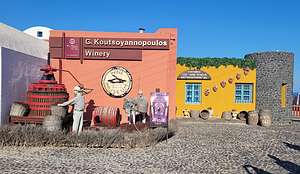 Koutsoyannopoulos Wine MuseumHowever, we still had a very interesting and educational experience being able to look down on the settlement from the walkways that surrounded the ancient settlement.
Back at the hotel, we were treated to a few hours of downtime, which we chose to spend at the hotel's lovely pool. We weren't the only ones, as we were soon joined by most of the rest of our tour group.
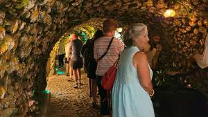 Wine cave in the Koutsoyannopoulos Wine MuseumLater that afternoon, we were back on the bus for one last activity that day - a visit the Koutsoyannopoulos Wine Museum. The winery has been a family business since 1870, when the Koutsogiannopoulos brothers wound up on Santorini island by mistake when they were blown off course by strong winds when trying to get to Syros. Apparently, they liked Santorini, because 150 years later the descendants are still making olive oil and wine here.
I have to confess to being a bit of a wine snob now that I live in Sonoma Valley. Their wines are very different from anything I have ever tasted. All I need to make me happy is a dry chardonnay with some texture.
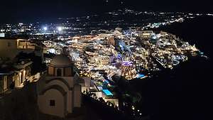 Fira at nightStill it was an awesome museum, nestled in a 300-meter long cave 8 meters below ground, with life size dioramas of the family's history in winemaking. It took them over 20 years to make this museum.
We got to sample four different kinds of wine in a room in the cave, but like I said, they just weren't what I like in a wine. That's not to say they weren't good. There were plenty of people in the winery bar that seemed to be enjoying them just fine.
Later on that evening, Herb and I decided to take a walk from our hotel to the pedestrian alleyways along the top of the cliffs above the caldera. It was nice and quiet, which was a pleasant surprise compared to the mobs we had experienced during the day. Looking out over the edge to the buildings built into the side of the cliffs with their lights ablaze was magical.
Day 3 - Prehistoric Museum of Thera and Paralia Perivolos (Black Sands Beach)
.thumbnail.jpg) The FishermanOur ferry to Crete didn't leave until 6:00 pm tonight, so we pretty much had another full day to enjoy Santorini.
The FishermanOur ferry to Crete didn't leave until 6:00 pm tonight, so we pretty much had another full day to enjoy Santorini.
First up was the Prehistoric Museum of Thera, a perfect follow-up to a visit to the ruins of Akrotiri yesterday. As I mentioned in my write-up about our visit the the Akrotiri Archeological site yesterday, the frescoes that once adorned the walls of the homes there before they were buried in volcanic ash were painstakingly removed and restored. The Prehistoric Museum of Therea is where they now reside for all to enjoy.
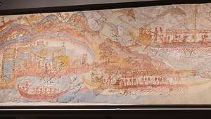 The FlotillaOne of my favorites is called "The Fisherman." I asked Herb to stand next to it so I could take his picture, because he too is a fisherman, but a security guard stopped us and said "no posing."
I later learned that Greeks think of their artifacts as sacred treasures and consider it disrespectful to pose with them. I think that is why when we were at the Acropolis, security guards started blowing their whistles and yelling to a girl who had a Greek flag wrapped around herself in front of the Parthenon to stop posing.
.thumbnail.jpg) Herb enjoying himself at Paralia Perivolos (Black Sands Beach)Another familiar frescro we saw in the museum was "The Flotilla," which depicted lots of boat activity in a harbor. The harbor must have been a different one than the one we pulled into the other day, because the volcanic eruption had not yet taken place, so there was no caldera yet. The Flotilla fresco showed that the residents of Akrotiri were very involved in commerce and trade with the rest of the Aegean world.
Herb enjoying himself at Paralia Perivolos (Black Sands Beach)Another familiar frescro we saw in the museum was "The Flotilla," which depicted lots of boat activity in a harbor. The harbor must have been a different one than the one we pulled into the other day, because the volcanic eruption had not yet taken place, so there was no caldera yet. The Flotilla fresco showed that the residents of Akrotiri were very involved in commerce and trade with the rest of the Aegean world.
.thumbnail.jpg) Lolo enjoying herself at Paralia Perivolos (Black Sands Beach)Tassos had a real treat for us today! - hint, he had told us to bring our bathing suits! Our bus brought us to the seaside village of Perivolos, in the southeastern corner of Santorini. We were then let loose with the instructions to return to the bus in 4 hours.
Lolo enjoying herself at Paralia Perivolos (Black Sands Beach)Tassos had a real treat for us today! - hint, he had told us to bring our bathing suits! Our bus brought us to the seaside village of Perivolos, in the southeastern corner of Santorini. We were then let loose with the instructions to return to the bus in 4 hours.
While some in our group chose to pass the time wandering through the town, six of us chose to spend it on Paralia Perivolos (Black Sands Beach) - great another chance to swim in the Aegean Sea and practice our synchronized swimming.
For 10 euro, we got two lounge chairs and a beach umbrella for the afternoon. Herb was quite happy with his situation, especially when he was delivered his very large Mythos beer.
I chose to spend my time swimming in the sea.
Then it was back on the bus to get to our 6:00 pm ferry to our final island - Crete.
Paros
Saturday, September 10, 2022 - 6:30pm by Lolo54 miles and 0.75 hours from our last stop - 2 night stay
Travelogue
Day 1 - Explore the town of Parikia
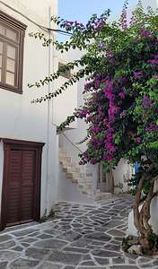 Alleyways of ParikiaAfter two nights on Mykonos, we boarded a 45-minute ferry to the island of Paros, a much more laid–back island than many of the others in the Cyclades. Tassos, our faithful guide, explained that it was “more authentic Greek,” as opposed to the international jet-setting feel of Mykonos, and that it was the place he would vacation to get away from the tourists.
During our 2-day visit, we would explore three very different villages: Parikia, our home base, considered one of the most attractive villages in the Cyclades; Lefkes, a mountain village; and Naoussa, a fishing village.
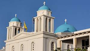 St. Nikolaos Holy Orthodox ChurchWe checked into our hotel, the Hotel Aegeon, which was charming and such a contrast to the over-the-top luxurious Mykonos Korali hotel. No private pool for us this time.
After a brief rest, we spent the afternoon and early evening with the group exploring the town. Parikia is the capital of Paros and considered to be one of the most beautiful villages in the Cyclades. I can certainly see why.
We spent a good part of the afternoon wandering through the lovely narrow stone alleyways of the town, admiring the colorful doors and beautifully colored flowers.
I knew we would be seeing blue-domed churches in Santorini, but I was delighted to discover our first, right along the waterfront. This lovely white church with three blue domes was called the St. Nikolaos Holy Orthodox Church. This is not the St. Nikolaos that brings presents on Christmas, but rather the guardian saint of sailors - very important to people living on a land totally surrounded by water. Sailors come to this church right on the harbor and leave tamatas or ex-votos (objects or paintings) in gratitude for a safe return from the sea.
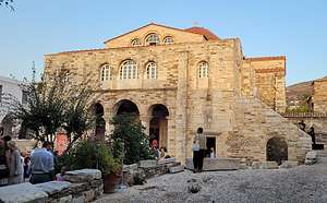 Church of Panagia EkatontapilianNext, Tassos brought us to a very different kind of church than we had seen so far - the Church of Panagia Ekatontapilian, an historic Byzantine pilgrimage church founded in the 4th century by Constantine the Great’s mother Helene.
As the story goes, during Helene’s journey to the Holy Land to search for the Holy Cross, a storm brought her to Paros, where she made a promise to the Virgin Mary that she would build a church on the island if her quest was successful. According to church lore, she did in fact find the Holy Cross, so her son Constantine built this magnificent church and dedicated it to the Assumption of the Virgin.
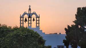 Church bellsThe name Ekatontapiliani means the Church with the Hundred Doors. According to tradition, the church has 99 doors and a secret door will open when the church of Hagia Sofia in Constantinople becomes Orthodox again.
Helene would probably be quite surprised, and hopefully happy, to see what was going on in her church tonight. There were dozens of finely dressed people - the women stunning in their beautiful brightly colored fabrics, and heels that made my toes hurt just looking at them - gathered in front of the church for two separate celebrations of life - the welcoming of a new child (Baptism), and the joining of a young couple in marriage, which are two of the seven sacraments in the Greek Orthodox Church.
 Tassos giving us a sunset lecture on the history of ParosOn our walk back to the hotel, we passed another one of Parikia's Orthodox Churches, this one much more modest than the last. It was that beautiful pure white that we had seen on Mykonos, and like many there, this one was topped with a number of bells.
The ringing of bells is one of the most essential elements of an Orthodox church. Church bells are rung to both summon the faithful to services, as well as to express the triumphal joy of the Christian Church.
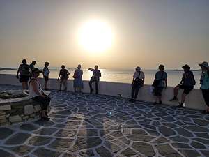
Of course, since we were a group of “road scholars,” Tassos gave us a lecture on the history of Paros. At least this time we got to watch the sunset over the Aegean while he was doing so. Herb, however, did lament the lack of a glass of wine to toast the end of another day.
Tomorrow would be another busy day, with three field trips: a visit to the lovely mountain village of Lefkes, a cooking demonstration in a family-owned hotel/restaurant, and a visit to the fishing village of Naoussa on the northern coast.
We were going to need a vacation after this vacation.
Day 2 - Lefkes, Cooking Demo, Naoussa, and my first swim in the Aegean
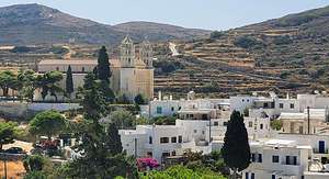 Lefkes with Agia Triada in backgroundThe next morning after breakfast at the hotel, we boarded our bus, which would take us around the island for the day. Road Scholar runs their tours very smoothly. On each island, we would have a bus, and the same bus driver, assigned to us for our entire time on that island.
Our first stop was to Lefkes, a lovely mountain village nestled in the inland part of the Island’s mountainous region, surrounded by olive groves and verdant hills.
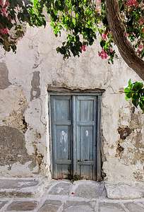 Alleyways of ParosThe town was built in the 17th century, as a protected enclave from the rampant piracy that plagued the Mediterranean during this time. At one point, it was even the capital of Paros. Its protected inland position also led it to become the farming epicenter of the island.
Now, it is a popular destination for those wanting to visit a more truly traditional Greek village, much quieter, peaceful, and real than many of the villages on the coast.
Once let loose, we did what we would come to love doing in every village we visited - stroll its lovely maze-like, stone alleyways, being surprised with something beautiful around every corner - colorful unique doorways, bright red bougainvillea flowers set against whitewashed buildings, and, of course, blue-domed churches.
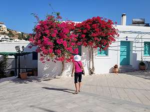 Lovely bougainvillea flowersThere was one particular whitewashed building fronted by two bright bougainvillea trees, that Tassos told us was very popular with Instagram "influencers," who dressed up to pose in between the bougainvillea trees.
Besides the many small Orthodox Churches throughout the village, Lefkes is home to the second largest church on the island - Parikia’s Panagia Ekatontapilian, which we had visited yesterday being the largest.
Like the Parikia Church, the Agia Triada (Holy Trinity) is a 19th-century Greek/Byzantine basilica-style church, with two imposing marble bell towers dominating the structure. This church has a huge cultural importance to the people of Lekfes, and even Paros. The church is visible from pretty much everywhere in town.
 Cooking with MariaIt was getting near lunchtime, but rather than take the easy way out and just dine out at one of the tavernas in town (anyone could do that), we got back in the bus and drove to the Anezina Restaurant, in the village of Drios in the southeastern part of Paros, where we would have a cooking demonstration and get to make our own lunch. And maybe even dance a little.
When we got to the Anezina Restaurant, we met Maria, our lively, funny cooking instructor for the day. She got us organized, and assigned us various vegetables, fruits, spices, meats, and cheeses to chop and dice for the next half hour.
I was put in charge of tomatoes, a very important part, along with olive oil and feta cheese, of Greek cuisine. I took my responsibilities seriously. Then, under the guidance of Maria, we somehow assembled and cooked our choppings into a delicious feast. It was very tasty and so so much fun.
Afterwards, to celebrate our successful feast, we did a traditional Greek folk dance, known as the kalamatianos, where we gathered in a circle, held hands, and kicked our feet (some of us somewhat randomly - not saying any names) as we went round and round, smiling and laughing the entire way. It was sort of like the Jewish hora.
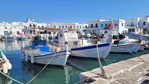 NaoussaWell fed and happy, we got back on the bus and were transported to the very northern end of the island to the fishing village of Naoussa. Tassos was certainly fulfilling his promise of showing us how varied the villages of Paros were.
It too had its lovely narrow alleyways and sugarcube buildings fronted by brightly colored flowers, but the main attraction was the waterfront along the harbor, with its fishing boats bringing in their catch of the day and its many restaurants serving it.
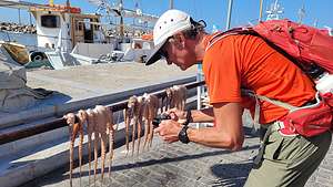 Fresh caught octopusThere was even some freshly caught octopus, dangling from what looked like a clothesline.
It’s no longer a quaint, quiet fishing village though, as it has definitely been discovered by tourists and has become one of the more popular destinations on Paros, with swanky international cuisine, chic cocktail bars, and expensive designer clothing boutiques.
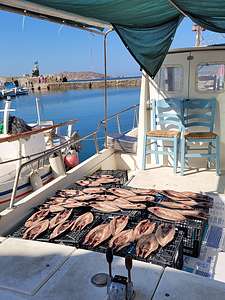 Catch of the dayWe watched the same thing happen to our favorite island, Martha Vineyard, in the states. There’s a lot more money selling art and clothing than tackle and bait.
Still, it was a lovely town to wander through.
It had been quite a busy day - two very different types of villages on two different sides of the island and a cooking demonstration in between.
Tonight was free time to spend on our own back in Parikia. I very much wanted to walk to one of the beaches along the waterfront and swim in the Aegean for the first time.
It was already getting near sunset, so rather than walk to one of the better known ones a mile or two away, we just went straight down from our hotel to the waterfront and settled ourselves on a beach overlooking a windmill set on a point, with the sun setting right behind it.
.thumbnail.jpg) First time in the Aegean SeaThe problem was, I didn’t really think we were going to swim, so I had my bathing suit in my backpack rather than on my body.
First time in the Aegean SeaThe problem was, I didn’t really think we were going to swim, so I had my bathing suit in my backpack rather than on my body.
Determined, however, I hid behind a tree and quickly, yet not too gracefully slipped into it. Herb declined to do the same and said he'd rather sip the beer he had packed in his backpack and spectate.
His loss. The water was quite shallow and the beach rocky, so I sort of had to crawl into water deep enough to technically “swim.” It was warm and delightful, and highly scenic.
The only problem now was having dinner in a wet bathing suit. Still worth it.
Mykonos and Delos
Thursday, September 8, 2022 - 10:45am by Lolo114 miles and 5.5 hours from our last stop - 2 night stay
Travelogue
Day 1 - Arrival on Mykonos, enjoy our private pool, and stroll through Old Town and Little Venice
 Our early morning ferry to MykonosAs part of our education, Tassos (our tour guide) felt it important that we learn the modern culture of the various islands in the Aegean, and how they have evolved differently. So, during our tour we would visit four islands - Mykonos, Paros, Santorini, and Crete and immerse ourselves in each of their histories and cultures. The Road Scholar tour was not a cruise, but rather we would be taking ferries from island to island.
The first island on our list was Mykonos - and what a place to start! For more than 50 years, the island of Mykonos has been one of the most popular destinations for the rich and famous - the most famous of which was Jacky Kennedy. We were very ready to immerse ourselves in this culture.
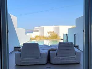 Our private poolMykonos was a 5 ½-hour ferry ride from Athens, so we received a wake up call at 5:00 am to catch the 7:00 am ferry from Athens to Mykonos, thereby allowing us to have almost a full day on the island.
Our bus was waiting for us at the port to deliver us up the steep narrow road to our home for the next 2 nights - the lovely Mykonos Korali Hotel. The logistics were perfect. Our luggage was taken from us at the Acropolis Select, stored on the ferry, and then magically waiting for us in our hotel room upon arrival.
When we arrived at the hotel, we were brought to our room by a staff member who felt the need to explain how things worked - like the well-stocked mini-fridge. Herb was really hoping for a nice view behind the closed curtains, but when she opened them, we saw this lovely private pool, just for us. We felt like we had chosen the right door on Lets Make a Deal. I knew where Herb would be spending the rest of the day.
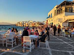 Old Town MykonosThis was definitely not our usual style of travel - usually I’m sleeping in the back of our 4Runner in some remote wilderness. But this was after all an educational tour, so I was willing to learn to immerse myself in the modern culture of Mykonos - and, of course, the pool.
After a two hour refreshing break, we joined our tour group to take our tour bus back down to Old Town Mykonos to wander along the waterfront. We took our tour bus because although the walk wasn’t very far, it was down a steep, narrow road with no shoulder - and did I mention that Greek drivers are a little crazy.
.thumbnail.jpg) Alleyways of Old Town MykonosThe Old Town (called Chora by locals) is a traditional Cycladic Village, with mazes of narrow streets, cubic whitewashed houses, colorful doorways, bougainvilleas, and small white churches. And of course, the famous 16th century windmills, which I will get to later.
Alleyways of Old Town MykonosThe Old Town (called Chora by locals) is a traditional Cycladic Village, with mazes of narrow streets, cubic whitewashed houses, colorful doorways, bougainvilleas, and small white churches. And of course, the famous 16th century windmills, which I will get to later.
We walked along the lovely waterfront, lined with boutiques and restaurants, before heading into and getting lost in the maze of stone alleyways. It was hard to get too lost though, because eventually we always popped out along the waterfront.
One particularly nice section of Old Town was Little Venice, officially known as Aléfkántra. Its brightly painted former fishermen’s houses with balconies jutting out over the sea provided a colorful backdrop to the bustling bars and restaurants that line the waterfront between it and the windmills.
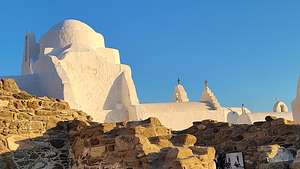 Church of Panagia ParaportianiThe town became more and more crowded as sunset approached, and I can understand why. It was hard to pick where to be for the best view of sunset.
We decided on the windmills, so we set off along the waterfront, stopping first to photograph the beautiful pure white Church of Panagia Paraportiani, one of the most photographed churches in the whole world.
The Church, which dates back to the 1400s, is considered a perfect example of Cycladic architecture. Its asymmetrical shape is due to the fact that it is not just one church, but rather a series of five tiny churches squeezed together - four below and one on top. At the center is the church of Agios Efstathios, surrounded by the churches of Agia Anastasia, Agios Anargyros, and Agios Sozon, and with the Church of the Virgin Mary standing out at the top with a dome.
.thumbnail.jpg) Iconic windmills of MykonosWe hurried to get to the iconic windmills of Mykonos, just in time for sunset. I have never seen windmills like this before. These five windmills, collectively known as “Kato Miloi,” were built by the Venetians in the 16th century to mill the grain produced on Mykonos, which was then distributed throughout the Aegean and even to Asia.
Iconic windmills of MykonosWe hurried to get to the iconic windmills of Mykonos, just in time for sunset. I have never seen windmills like this before. These five windmills, collectively known as “Kato Miloi,” were built by the Venetians in the 16th century to mill the grain produced on Mykonos, which was then distributed throughout the Aegean and even to Asia.
No longer milling grain, the windmills are now an extremely popular and highly photographed tourist destination. We had to jockey for a position to take a photograph.
It was time to find our group again to take our bus back up the short windy hill to our hotel. Herb and I couldn't resist a glass of wine out on or poolside lounge chairs before calling it a day - and a wonderful day it was at that.
Tomorrow we would take a day trip to the island of Delos.
Day 2 - Side Trip to Delos
.thumbnail.JPG)
Although Delos is only 5 kilometers long, it has served an extremely important role in Greek history.
Before our trip, I knew Delos as the birthplace of two very important Greek divinities: Artemis, the goddess of wild animals, the hunt, chastity, and childbirth; and her brother Apollo, the god of music, poetry, healing, and prophecy. As a result, it was an important religious and cultural center from the 3rd millennium BCE right up to the 5th century BC.
.thumbnail.jpg) Sanctuary of ApolloHowever, what I didn’t know is that it was also a thriving commercial center, with an estimated 750,000 tons of merchandise passing through the port each year during the first century BC. During that time, the population of this tiny island was 30,000. Today it is 14.
Sanctuary of ApolloHowever, what I didn’t know is that it was also a thriving commercial center, with an estimated 750,000 tons of merchandise passing through the port each year during the first century BC. During that time, the population of this tiny island was 30,000. Today it is 14.
We began our exploration of the island in the commercial section of the island where many rich merchants lived. There were streets, rich houses with mosaics, and even a theater district. The island was inhabited until the 7th century CE.
Separated from the commercial center was the Sanctuary of Apollo, the religious center of the island. We passed the Terrace of the Lions, a series of four lions carved in the 6th century BCE of marble from the nearby island of Naxos. Their purpose was to guard the sacred area. These lions are actually reproductions. The original ones are in the Archaeological Museum on the island.
.thumbnail.jpg) Terrace of the LionsFurther along, we came across some Amphoras near a stone wall. Amphoras were often used to contain funeral offering for the deceased, or in this case, probably an offering to Apollo
Terrace of the LionsFurther along, we came across some Amphoras near a stone wall. Amphoras were often used to contain funeral offering for the deceased, or in this case, probably an offering to Apollo
And, of course, there was the inevitable phallus (although this one was a bit broken), a common symbol of fertility in Ancient Greece. The rooster was also sacred to the ancient Greeks and symbolized vigilance.
.thumbnail.jpg) Phalluses were a common symbol of fertilityWe were running out of time before our ferry (the last one of the day) was scheduled to leave, so unfortunately we would not have time to hike up Mount Knythos, the small mountain, and the highest point on Delos, that was calling out to us. This mountain is the mythological birthplace of Apollo and Artemis.
Phalluses were a common symbol of fertilityWe were running out of time before our ferry (the last one of the day) was scheduled to leave, so unfortunately we would not have time to hike up Mount Knythos, the small mountain, and the highest point on Delos, that was calling out to us. This mountain is the mythological birthplace of Apollo and Artemis.
That was the tough part about being on a tour. Everything is pretty tightly scheduled so you don't have as much flexibility.
After we got back to our hotel on Mykonos, we had a bit of free time to relax and a tough choice to make - swim in our private pool or do laps in the larger hotel pool, which we had to share with other people. Good God. We were getting spoiled. Wanting to get some well-needed exercise, we chose the larger pool.
We didn't have too much time though because we were scheduled to meet at 7:00 on the hotel's outdoor reception area for a lecture on the challenges that modern Greece has faced in the last two centuries - we were Road Scholars after all.
This was where Herb almost mutinied for the first time. We love sunsets, and we love a nice glass of wine to watch the golden light before the sun dips below the horizon. The problem was that Tassos' lecture, which was held on a lovely outdoor patio, coincided with sunset. I could see Herb getting antsy as the sky began to take on a golden glow. Finally, unable to contain himself, he excused himself and went to retrieve two wines from our hotel room’s mini-fridge, so we could listen, while having a proper cocktail hour while watching the sunset. Maybe Herb wasn’t “scholar” material afterall.
Day 3 - Walk down to Old Town Mykonos and ferry to Paros
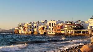 Little VeniceToday we would catch a morning ferry to the island of Paros. However, I realized that I had enough time to walk down to the Old Town to photograph it in the morning light before the crowds started filling up the streets.
I asked Herb if he wanted to join me, but he was already sitting with a cup of coffee in his bathrobe on the lounge chair by our private pool. In other words, he wasn’t going anywhere. I think I was going to have to carry him kicking and screaming off this island.
So, off I went alone down the narrow, winding, shoulderless road to Old Town. It was so lovely - no crowds, just local proprietors getting ready for the onslaught that would later occur.
I wandered through Little Venice, along the quiet stone alleyways, and back to the iconic old windmills. It was so peaceful and serene.
Mykonos had been a lovely stop. Now onto Paros.
Athens
Sunday, September 4, 2022 - 8:30am by Lolo6776 miles and 22 hours from our last stop - 4 night stay
Travelogue
Day 1 - Arrival
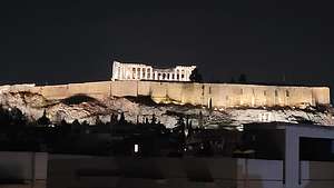 View of Acropolis from hotel rooftopWe left San Francisco on Saturday night at 9:00 and arrived at our Athens hotel around midnight on Sunday night. It felt like a whole day had just disappeared on us. That didn’t stop us, however, from taking the elevator up to the rooftop to catch our first glance of the Acropolis, lit up in the night.
Having accomplished that, we crawled into bed and managed to sleep for 8 hours, putting us somewhat in sync with Greek time.
Our 15-day Road Scholar tour didn’t start for another day and a half, so we would have some time to explore the city on our own. Our hotel, the Acropolis Select, was located right in the heart of things, so it was easy for us to walk everywhere.
Day 2 - Acropolis Loop, Mars Hill, Ancient Agora, and Anafiotika
.thumbnail.jpg) Odeon of of Herodes AtticusAfter a hearty breakfast at the hotel buffet, we set off on a walk to get the lay of the land with the goal of doing the Acropolis Loop, a pedestrian walkway which, as its name implies, loops around the Acropolis. We would not enter the Acropolis today, as we would be doing that with our Road Scholar group in a few days. The crowds were a bit overwhelming.
Odeon of of Herodes AtticusAfter a hearty breakfast at the hotel buffet, we set off on a walk to get the lay of the land with the goal of doing the Acropolis Loop, a pedestrian walkway which, as its name implies, loops around the Acropolis. We would not enter the Acropolis today, as we would be doing that with our Road Scholar group in a few days. The crowds were a bit overwhelming.
From our hotel it was just a short distance to Dionysiou Areopagitou, the pedestrian boulevard that traces the southern edge of the Acropolis grounds. There were already big lines to get into the Acropolis, but the cobblestone walkway was still relatively quiet, as it was still fairly early in the morning.
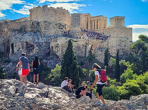 Lolo climbing the slippery marble of Mars HillWe passed the Odeon (theater) of Herodes Atticus, a large 5,000-seat amphitheater, built into the southwestern slope of the Acropolis. Built by the Romans in 161 AD, it is still used today for performances. However, it was renovated to its current condition in the 1950s. I so badly wanted to get tickets for a performance, but there just wasn’t time in our busy tour schedule.
We took a side trip from the Dionysiou Areopagitou to Mars Hill (Areopagus), the knobby, windswept hill near the western entrance to the Acropolis with great views of the Acropolis. Climbing to the top of this small hill was pretty precarious in that the stone stairs and the rocks on top are so slippery, polished smooth by the crowds of people that walk on them each day. They actually shined. Despite being rock climbers and comfortable with scrambling on rocks, I found myself slipping and even scooching along on my butt to keep from falling.
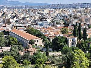 View of Ancient Agora from Mars HillWhen I got to a point where people couldn’t obstruct my view of the Acropolis, I plopped myself down and just took in the view.
Besides having a great view of the Acropolis, which looked like it was being overrun by an army of tourists, there was a more serene view of the Ancient Agora below to the north. We would visit that further along on our walk later.
Once safely down from Mars Hill, we continue along Dionysiou Areopagitou boulevard, eventually making a right onto the quiet Apostolou Pavlou, also a pedestrian walkway, which traces the western edge of the Acropolis grounds.
This part of the Acropolis Loop was much quieter, enough so to allow a turtle to navigate its way along without being crushed by Segways.
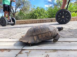 Slow traffic along the Acropolis LoopEventually we came to Thissio, a trendy neighborhood with tons of cafes and restaurants, many of which had Acropolis views.
We continued on turning east on Adrianou, which brought us to the entrance of the Ancient Agora. Since this was not part of our Roads Scholar tour, we decided to visit it on our own, with a little help from a Rick Steves audio tour which we had downloaded before leaving home.
While the Acropolis is the main show in current day Athens, it was the Agora (which means “gathering place") that was the real heart of ancient Athens. From 600 BCE to 300 AD. It was the place where ancient Greeks, and eventually the conquering Romans, came to shop, conduct business, pass laws, talk philosophy, and attend plays.
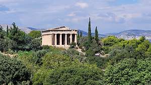 Temple of Hephaestus in the Ancient AgoraWe paid our 8 euros each and entered what are mostly the ruins of the Agora. Little survives from its height, except for the Temple of Hephaestus and a stoa that was reconstructed in 1952. Compared to the Acropolis, it was pleasantly quiet so we could wander around at our leisure while Rick Steves talked in our ears. We weren’t the only ones.
From the main gate, we strolled along the Panathenaic Way, the city’s main street, which led through the main square and up to the Acropolis. During Ancient Greek times, a Panathenaic Festival was held each summer, in which the birthday of Athena, the patron goddess of Athens, was celebrated.
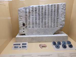 A kleroterion, ancient voting machine in the Agora MuseumThousands of people would parade along the Way, dancing and banging tambourines. The main “float” carried the peplos, a ceremonial robe woven as a gift for Athena, which was placed on a life-size old wooden statue of Athena Polias (“Guardian of the City”) in the Erechtheum.
We turned left to the reconstructed Stoa, a two-story high 400-foot long rectangular building with covered walkways, lined with 45 Doric columns on the outside and 22 Ionic columns in the interior (the 2x + 1 formular for columns that we would later see at the Parthenon. While once serving as a sort of shopping mall, the old stalls currently house the very interesting Agora Museum with artifacts laid out in chronological order.
One of the most interesting artifacts on display was an early voting machine called a kleroterion, a slab of stone incised with rows of slots and an attached tube. It was used to randomly select citizens to serve on the city council. In this way, each citizen would get a chance to serve (sort of like jury duty). Perhaps, the ancient Greeks had a better idea than our modern system.
.thumbnail.JPG)
After leaving the Agora, we continued walking along Adrianou east and then south, in search of Anafiotika, a tiny, hard-to-find neighborhood of winding, narrow alleyways with tiny homes clinging to the hillside surrounding the Acropolis.
It was built by people from the tiny Cycladic island of Anafi, who came to Athens looking for work after Greece gained its independence from the Ottomans in 1821. Some descendants of the original islanders still live here in what they call Anafiotika (“little Anafi”).
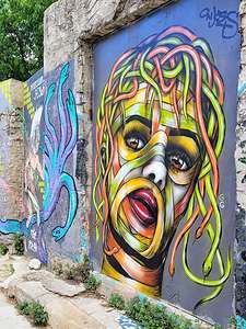 Street Art in AnafiotikaIt was so much fun randomly wandering and getting lost in its labyrinth of narrow alleyways with cute houses, lots of colorful flowers, innumerable cats, and interesting street art. Plus, the best part was that we had left the crowds around the Acropolis behind and pretty much had this place to ourselves.
Every once in a while we would come to the end of a lane and be confronted with an amazing view of the modern city of Athens laid out before us, with the cone-shaped Lycabettus Hill, the largest of the seven hills in Athens, looming over it.
We stopped for lunch at the Anafiotika Cafe where Herb had his first (of many) pastitsio, a Greek version of lasagna, with a white creamy sauce rather than marinara and a hint of cinnamon.
At this point, we were really jet lagged and exhausted, so we headed back to the Acropolis Select for a well-need nap.
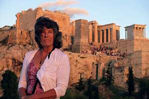
So off we marched again (mind you, this is still day 1) to the Dionysiou Areopagitou pedestrian boulevard and on to the side trip up Mars Hill. This time I had sandals on rather than sneakers, so the climb up was even more precarious than before.
It was worth every bit though, as we watched the sun do its magic and light the Acropolis in a golden glow.
This day wasn’t over yet. There was still dinner to deal with, so we walked back to the Anafiotika neighborhood again and had pizza and wine at the Anafiotika rooftop restaurant.
I think that was probably more than enough for our first full day in Athens.
Day 3 - Hike up Lycabettus Hill and Evening Meetup with Road Scholar group
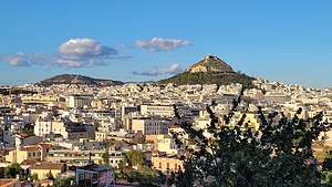 View of Lycabettus Hill from AnafiotikaTonight at 6:00 we would be meeting our Road Scholar guide and group for a welcome drink and introductions. That meant we had most of the day to ourselves to explore more of Athens.
We had explored much of the area around the Acropolis, except for actually going in, which we would do tomorrow, so I was struggling to think of something interesting to do. Then, during the middle of the night it came to me like a vision - that mountain with the little white church on top that seemed to be visible from everywhere was calling to me.
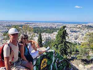 Making our way up Lycabettus HillAfter further research, I found out that it was Lycabettus Hill, the highest of the seven hills in Athens - almost twice as high as the Acropolis Hill. So we set off from our hotel, walked through the trendy neighborhood of Plaka, which we would explore more later, and continued through the modern downtown area until we got to the base of Lycabettus Hill.
We never did see the cable car to the top, but no matter, because we wanted to walk the winding switchbacks up to the summit anyway. Despite being the tallest of the city’s hills, it was still only a modest 909 feet high, a far cry from the elevation gains we were used to in the American West.
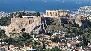 View of the Acropolis from top of Lycabettus HillAt the top is the tiny 19th century Agios Georios (the Chapel of St. George), which was unfortunately closed. However, the viewing platform surrounding it provided us with awesome 360 degree views of the whole of Athens, including the Acropolis, the Aegean Sea, and the mountains of the Peloponnese.
All in all the hike from the hotel to the summit and back was about 6 miles with 1,000 foot elevation gain.
Our Road Scholar tour hadn’t even begun yet, but we had already explored most of Athens’ neighborhoods.
.thumbnail.jpg) Relaxing at the hotel rooftop barTime for lunch, a shower and a nap, before meeting with our guide and fellow “scholars,” whom we would be spending the next two weeks with. I admit to being a little nervous. Herb and I are so used to just the two of us traveling together that we were a bit apprehensive as to how we would like the “group” thing.
Relaxing at the hotel rooftop barTime for lunch, a shower and a nap, before meeting with our guide and fellow “scholars,” whom we would be spending the next two weeks with. I admit to being a little nervous. Herb and I are so used to just the two of us traveling together that we were a bit apprehensive as to how we would like the “group” thing.
I felt a little like a new kid in school meeting my classmates for the first time. Would they be nice? Would we make friends? Although I didn’t think so at the time, we became a completely cohesive group (or functional as Tassos, our tour guide said) that within a few days we felt like we had known each other forever. So many bright, interesting people, and so many laughs.
Plus, we really lucked out with our guide, Tassos, an ex-archaeologist with a passionate love for the history, art, and culture of his country, who over the next two weeks would help us totally immerse ourselves in the lives (from Bronze Age to current day) of the people of Greece.
After introductions, we moved up to the hotel rooftop for a lovely dinner overlooking the Acropolis, which we would be visiting as a group the next day.
Day 4 - Acropolis Museum and the actual Acropolis
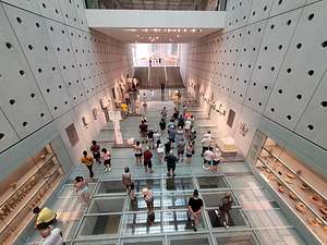 Acropolis MuseumThe next morning after our very ample hotel buffet breakfast, our group gathered in the hotel lobby to begin our short, ¼-mile trek to the Acropolis Museum. Tassos felt that a visit to the museum first, would amplify our experience of the actual Acropolis.
The Acropolis Museum is considered one of the finest museums in the world. Unlike other museums that display works of art from around the world, the Acropolis Museum houses artifacts from just one place - the Acropolis, which looms over it from atop the hill above. It is specifically designed to complete the experience of visiting the actual Acropolis.
Surprisingly, the museum iis an eye-catching, glassy postmodern building - sort of a modern temple to house a treasure of ancient artifacts from 3000 years ago. Actually, make that 6000 years ago, because the museum was built above a neighborhood from 4000 BCE, whose streets, houses, baths, and workshops were visible through the glass floors below your feet as you enter the main building.
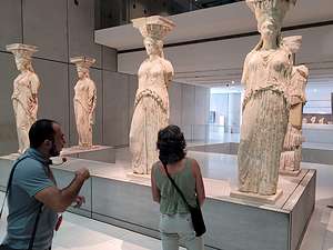 Acropolis Museum - 5 of the original CaryatidsAfter entering the museum, we ascended a ramp meant to represent the experience of ancient Greeks ascending the Sacred Rock of the Acropolis. More glass floors beneath us revealed artifacts and details of everyday life from the ancient neighborhood found while constructing the museum.
Moving on to the first floor, we came face to face with the Kore and Kouros of the Archaic period (7th century BC to the end of the Persian Wars in 479 BC).
Eventually we came to my favorites - the Caryatids that once held up the porch of the Erechtheion. Five out of six of the originals were here. There was an empty circle left for the Caryatid taken by Lord Elgin (along with nearly half the 150m marble frieze around the Parthenon) and sold to the British Museum in the early 19th century. The Greeks want their treasures back, but this controversy has been going on for two centuries and probably will go on for two more.
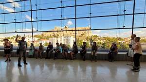 View of Acropolis from Acropolis MuseumThe six on the actual Acropolis are copies, removed to protect them from erosion. I never realized before that each of them is unique.
The escalators up to the third floor deposited us inside a virtual Parthenon, featuring the collection of Parthenon structures, laid out the way they were on the original Parthenon. Even the floor was 228 feet long and 101 feet wide, just like the real Pathenon, which we could see through the large glass windows surrounding the exhibits. Even the stainless-steel columns marked the location of each marble column on the real Parthenon.
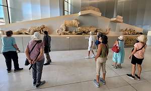 Remains of a pediment from the ParthenonThis floor, which is totally dedicated to the Parthenon’s metopes, frieze and pediments, is the highlight of the Acropolis Museum. We walked around the frieze, where there are some original models as well as replicas of those taken (by Lord Elgin) or destroyed. All the while, we could see the real thing through the huge glass windows that wrapped around the entire floor.
Now, it was time to see the real thing.
The Acropolis has been the heart and soul of Athens for millenia, and many temples have graced its hill. What we would see today was the rebuilding in 450 BCE, when the Athenians, fresh from their victory over the Persians, decided to rebuild the destroyed buildings on a grand scale.
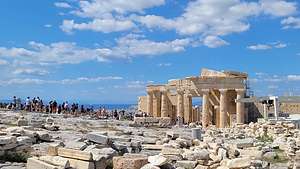 The Propylaea (entrance gate to the Acropolis)Pericles, Athens’ leader at the time, funneled Athens' newfound wealth from donations by allies in the Delian League into a massive rebuilding program, led by the visionary architect/sculptor Pheidias. The result is an incredible 4-building ensemble: the Propylaea (entrance gate), Parthenon, Erechtheion, and Temple of Athena Nike.
After entering the grounds, we (and crowds and crowds of others) proceeded up the steps of the Propylaea, the magnificent Classical Greek Doric building complex that served as the monumental ceremonial gateway to the Acropolis. It was designed by
Mnesicles, who brilliantly found a solution to the difficult problem of building a monumental structure on varying levels of terrain.
 (1).thumbnail.jpg) Long side of the ParthenonThe Propylaea is U-shaped, with a large central hallway (the six Doric columns), which looks a bit like a mini Parthenon, flanked by two side wings. The left wing, called the Pinakotheke (“painting gallery”) once contained artwork and housed visiting dignitaries.
Long side of the ParthenonThe Propylaea is U-shaped, with a large central hallway (the six Doric columns), which looks a bit like a mini Parthenon, flanked by two side wings. The left wing, called the Pinakotheke (“painting gallery”) once contained artwork and housed visiting dignitaries.
Unfortunately, there were so many people that we felt a bit like we were being herded like cattle.
As we continued toward the Parthenon, we heard a security guard start whistling and waving to stop a girl draped in a Greek flag posing before the temple. We learned later that posing before their sacred treasures is considered disrespectful in Greece. However, there were not enough security guards to stop the dozens of high-heeled, brightly dressed Instagram “influencers” from doing their thing.
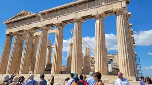 Back of the ParthenonThe star attraction of the Acropolis is the Parhenon, a marble temple dedicated to the Greek goddess Athena. It was built between 447 and 432 BC during the height of the ancient Greece empire. It is the largest Doric temple in ancient Greece - 228 feet long and 101 feet wide. At each of its two ends there are 8 fluted Doric columns and 17 on each of its sides.The Greeks were into harmony and numbers, so the ratio of columns in all Greek temples is 2x + 1.
The Parthenon has gone through many phases. First, as the Classical temple built by Pericles in the 5th century BCE. Then in the 5th century AD, it became a Christian church. During this period, the pagan sculptures and decoration were removed and the interior was decorated with colorful Christian frescoes.
.thumbnail.jpg) The ErechtheionThen in 1456, the Ottoman Turks took over and converted it into a mosque, even adding a minaret. An unfortunate incident occurred in 1687, during the Venetian siege of the Acropolis. The defending Turks were using the Parthenon to store gunpowder so when the Venetians hit it with a mortar shell, it caused an explosion that blew out the heart of the building, destroying the roof and parts of the walls and colonnade.
The ErechtheionThen in 1456, the Ottoman Turks took over and converted it into a mosque, even adding a minaret. An unfortunate incident occurred in 1687, during the Venetian siege of the Acropolis. The defending Turks were using the Parthenon to store gunpowder so when the Venetians hit it with a mortar shell, it caused an explosion that blew out the heart of the building, destroying the roof and parts of the walls and colonnade.
In 1801, Lord Elgin, the British ambassador to the Ottomans, got permission from the sultan to take sculptures from the Parthenon. He even sawed some of them off the building. Then he carted them off to London where they were placed in the British Museum, where they still remain - a bit of a sticking point with the Greeks.
.thumbnail.jpg) Porch of the CaryatidsThere are still a few original frieze, metope, and pediment carvings on the Parthenon, but most of them are either in the British Museum or the nearby Acropolis Museum where we had just seen them.
Porch of the CaryatidsThere are still a few original frieze, metope, and pediment carvings on the Parthenon, but most of them are either in the British Museum or the nearby Acropolis Museum where we had just seen them.
From our vantage point atop the Acropolis, we had a great view of Lycabettus Hill, the mountain we had climbed yesterday.
Near the Parthenon, stood the Erechtheion, a temple almost as prestigious as the Parthenon in its day. Its primary function was to house the ancient wooden cult status of Athena - the one that would receive a new woolen peplos each year at the end of the Panathenaic Festival.
The temple’s most famous feature, and my personal favorite, is the Porch of the Caryatids, where for over 2,500 years, these lovely ladies have been supporting the roof. If you look closely, each of them is unique. Their legs serve as columns, the pleated robes the fluting, the fruit baskets on top of their heads as capitals, and their hair as buttresses. As I mentioned earlier, these are reproductions. Lord Elgin ran away with one of them, and the other five are in the Acropolis Museum.
.thumbnail.JPG)
Despite its proximity to the more hidden and less well-known Anafiotika neighborhood, whose narrow alleyways we had explored the night before, the Plaka had a very different vibe, with high-end shops, sidewalk cafes, and family-run tavernas. This was modern, trendy Athens, while Anafiotika was still living in a bygone day.
When we got back to the hotel, we were pretty pooped, and tomorrow we would have to get up at 5:30 to catch a very early 5 ½ hour ferry to Mykonos, our first Greek Island. So, we stopped at a grocery store to buy some cheese and crackers and a bottle of wine to enjoy on our balcony.
Route 66 quirky stops, Barstow, and Home
Friday, May 6, 2022 - 4:00pm by Lolo540 miles and 9 hours from our last stop - 1 night stay
Travelogue
Route 66, Barstow, and Home
 Meteor CraterWe were exactly 1,000 miles from home, too long for a one-day drive. The first half of that was on I40 (the old Route 66) with Barstow at its end, so a perfect place to stop for the night.
To break up the monotony of driving, we figured we would stop at some Route 66 attractions that we hadn’t been to before.
The first one was Meteor Crater, the site of one of the best preserved meteorite impact craters on earth.
Around 50,000 years ago, a huge iron-nickel meteorite, approximately 150 feet wide and weighing several hundred thousand tons crashed into a rocky plain just east of what is now Flagstaff, Arizona.The result of this impact was the creation of a giant bowl-shaped cavity, measuring 550 feet deep and almost a mile across.
 Lolo making friends at Meteor CraterThe crater has been privately owned by the Barringer family since 1902, when Daniel Barringer, a mining engineer from Philadelphia, became interested in the site as a potential source for mining iron. It was he that set forth the correct theory that the crater had been formed by the impact of a large iron meteorite. He formed the Standard Iron Company and filed four mining claims with the Federal government, thus obtaining ownership of the two square miles containing the crater.
Although scientific research is still done here today, it has become a very successful tourist attraction, complete with movie theater, restaurant, and gift shop. Entry prices are $22 for adults, and $13 per child (free for the under fives).
We decided it was worth a stop. After watching an informative movie explaining the impact, with lots of loud noises and bright lights, we stepped out into the observation area for our first glimpse of what is a very impressive and massive bowl-shaped depression.
 Coming close to Roy's CafeWe walked outside to two other viewing areas to get a better view of the crater. The only hiking possible is along a short portion of the rim as part of a guided tour. We didn’t have much time, so we skipped that.
Our basic impression was that it was impressive, but not much more so than Ubehebe Crater in Death Valley, where we wereR allowed to walk around the entire rim and hike down to the bottom of it. Oh, and it’s free.
As we continued west along I40, Herb kept talking about wanting to see another Route 66 icon, Roy’s Cafe. To get there, we had to make a turn south off of I40 on the Kelbaker road, just south of the Mojave National Preserve, to get to a section of the original Route 66 in Amboy, California.
There wasn’t much left to the town of Amboy, except a Post Office and the remnants of Roy’s Cafe and Motel - just enough to show that like many other ghost towns along the old Route 66, this had once been a vibrant and popular place to stop.
From the late 1800s until the interstate highway system diverted traffic away from Route 66, the town of Amboy had served as both a railroad depot and a rest stop for travelers.
 The famous Roy's CafeOpened in 1938, Roy’s was the only stop to find gas, a hot meal, and a bed in the area. During Roy’s heyday in the late 1940s and 1950s, the town (population 150) had three service stations, two cafes, a motor court, and a post office.
Roy’s sign and cafe are both classic examples of “Googie” or (“do-wop”) architecture, a popular futuristic art movement in Southern California from the 1940s to 60s, inspired by industrial progress, car culture, and the space age. It’s characterized by geometric shapes, upswept roofs, vast glass surfaces, bold colors, neon, and the symbols of motion, such as arrows, boomerangs, and wings. It was most commonly used in designs for restaurants, gas stations, bowling alleys, etc.
The romance of a road trip along Route 66 is still alive, well attested to by the hordes of visitors that still come to this out-of-the-way, desolate place, where you can still get an ice cream and a postcard.
 Buddha at Roy'sUnfortunately Roy’s Motel was long gone as a place to lay your head for the night on Route 66, so we continued on to good old reliable Barstow to spend the night.
The next day, Herb did have one more Route 66 stop up his sleeve, so rather than head west from Barstow on HIghway 58 as usual, we made a half hour diversion down Highway 66 to Elmer’s Bottle Tree Ranch. I don’t know where he found these places.
 Bottle Tree RanchWe love quirky desert art, and this place certainly fits the bill. Aptly named, the Bottle Tree Ranch is literally a forest of large metal pipes with bottles of all different colors hanging from them, like branches from a tree. They are especially pretty when the light shines through them, lighting them up like odd-shaped Christmas lights.
Elmer also seems to have had a thing for old typewriters and cash registers, because there are several of them scattered throughout the forest.
When researching this place, I learned that unfortunately Elmer passed away in 2019, and the family just recently reopened it.
It was actually a very good start, but if we kept stopping at this pace we’d never get home.
.thumbnail.jpg) Bottle Tree RanchOn our way back to Highway 58, we passed (but didn’t stop) at one more desert oddity - a 55+ retirement community called Silver Lakes in the town of Helendale. Seriously, Lakes?? We were in the middle of a barren desert with most people living in old trailers or somewhat dilapidated homes, but this community had beautiful homes with terracotta roofs, nice cars in the driveways, and most surprisingly boats at their docks.
Bottle Tree RanchOn our way back to Highway 58, we passed (but didn’t stop) at one more desert oddity - a 55+ retirement community called Silver Lakes in the town of Helendale. Seriously, Lakes?? We were in the middle of a barren desert with most people living in old trailers or somewhat dilapidated homes, but this community had beautiful homes with terracotta roofs, nice cars in the driveways, and most surprisingly boats at their docks.
That’s right, docks!! The two man-made Silver Lakes were created in such a way to have side canals running like streets along the backside of houses, so they could keep boats - just like Florida! These boats didn’t have much water to play in, but still they were boats in the Mojave Desert. Of course, I had to go on Zillow and see what these houses sold for and they were in the 300 - 500K range and you got a lot of house for that.
Ok, back on the road with one last stop at Andersen’s Pea Soup Andersen’s on I5 in Santa Nella.
Great trip, but great to be home again as well.
Chaco Canyon
Thursday, May 5, 2022 - 8:15am by Lolo75 miles and 1.5 hours from our last stop - 1 night stay
Travelogue
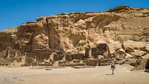 Chaco Canyon - Pueblo BonitoThis was turning out to be an educational journey about ancient and current day Native American cultures. Monument Valley, Canyon de Chelly, and Shiprock are all part of the current Navajo Nation although their past dates back to the Puebloan.
Chaco Canyon is a little different in that it is not part of a current day reservation and no one lives there today. In fact, there is even some question as to whether anyone ever lived there at all, or whether this was just a site for large spiritual gatherings. The lack of middens (prehistoric refuse heaps where archeologists sift through evidence of human occupancy) and burials (only 13 burials uncovered) does not seem to support the theory that a large community lived here.
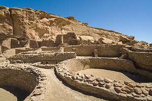 Chaco Canyon - Pueblo BonitoSo there is lots of mystery surrounding Chaco Canyon.
What is known is that beginning around the mid-800s, Chaco people began building here, creating multi-story stone buildings on a grand scale. For the next 300 or so years, they quarried sandstone blocks and hauled timber from great distances to build fifteen major complexes, which remained the largest buildings ever built in North America until the 1800s.
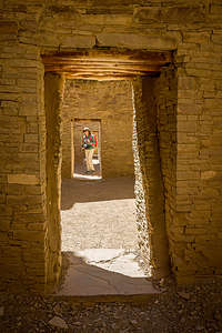 Inside Pueblo BonitoBetween 850 and 1130 CE, Chaco Canyon was a major hub for trade, administrative and ceremonial life, a meeting place where Ancestral Puebloan people living in distant communities came to at certain times of the year to gather together for what probably were religious ceremonies.
Then, around 1130 CE, the canyon was pretty much abandoned with the onset of a fifty-year drought.
Today Chaco Canyon is a World Heritage Site, as it remains one of the most impressive archaeological sites in the world. Tens of thousands of visitors come here every year, despite its remote location and need to drive miles and miles on bumpy dirt roads to reach it.
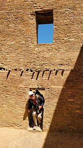 Doors pretty small in Pueblo BonitoChaco Canyon can pretty much be explored in a day. There is a nine-mile Canyon Loop drive with stops along the way to visit the various ruins: Una Vida, Hungo Pavi, Pueblo Bonito, Chetro Ketl, Pueblo del Arroyo, and Casa Rinconada.
There are also a few hikes, the most popular one being the 5.2-mile Pueblo Alto Loop, where there is a wonderful overlook of Pueblo Bonito (the most impressive of the Canyon’s ruins).
We were so well prepared for this stop. I am a bit of a nerd and I made Herb listen to an hour of lectures on the Chacoan Culture and watch a documentary called “The Mystery of Chaco Canyon” narrated by Robert Redford.
A lot of the “mystery” surrounding Chaco Canyon includes:
What is the real purpose of this huge complex since it didn’t seem to serve as a residence?
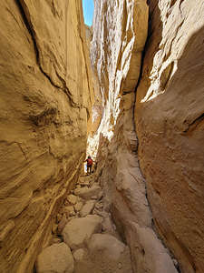 Climbing the slot to start the Palo Alto LoopWhy did they build wide roads extending out from it, like spokes on a wheel, that seemed to go nowhere?
What was the role that astronomical observations played in their culture? There was definitely a strong interest (and incredible knowledge) in lunar and solar cycles, and many buildings are oriented to align with the winter and summer solstices.
I don’t think we are going to solve those questions today, but I am glad we learned so much before coming here, because it definitely made our visit more interesting and thought provoking.
Our first stop along the drive was the parking area for Pueblo Bonito, and Chetro Ketl, considered to be the best and most interesting of the ruins.
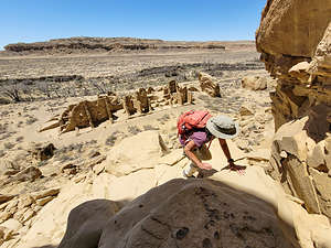 Starting up the Pueblo Alto trailWe headed first towards Pueblo Bonito, the oldest and largest, as well as best preserved, of the ruins. It is massive, covering over 3 acres and containing 800 rooms.
The entire complex, which is in the shape of a “D,” is divided into two sections by a precisely aligned wall which runs north to south through a central plaza. There is a giant kiva on either side of the wall, creating a symmetrical pattern. There are 30 other kivas in the complex, but the two Great Kivas were probably used for large religious ceremonies, more evidence that this site was used as a ritual center rather than a residence.
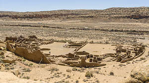 View of Pueblo Bonito from aboveIn places, the ruins were five storeys high with hundreds of rooms enclosed by elaborate brickwork and windows, with interior doorways connecting the rooms. We were delighted to find that we could wander on our own through some of its rooms.
The doorways were the most intriguing. When we stood in just the right place, they lined up to give the impression that you can see all the way through the building through multiple doors.
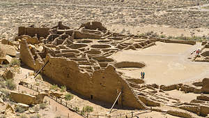 Closeup of Pueblo Bonito from aboveAfter exploring all the rooms that we were allowed to, we decided to do the Pueblo Alto hike, where we would be able to see the whole Pueblo Bonito complex below us in all its grandeur.
Here’s where I made a big mistake. I mistakenly thought that parking at the Pueblo Bonito parking lot would lead us to the trailhead for the hike whose highlight was the Pueblo Bonito Ruins. As a result, Herb and I kept scanning the cliffs behind Pueblo Bonito to see where we could climb up. I mean, we don’t mind a little rock scrambling, but this looked impenetrable.
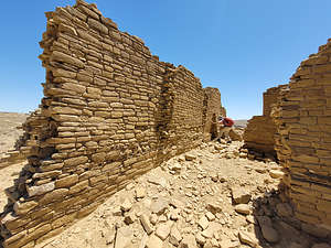 Peeking through the ruins at Pueblo NuevoFinally, we looked at Gaia and saw that the trailhead was actually from the Pueblo del Arroyo parking lot, so we just forged on to that, basically adding almost 2 miles (now and on our way back) to our 5.2-mile hike. That’s a pretty big % off in hike length.
Even then, the trailhead was hard to find until we realized it was a narrow crevasse up the cliff that required a bit of rock scrambling. It was fun! For the purposes of the description of this hike, I will state the mileage from the real start of the trail rather than ours.
From atop the plateau, we followed the trail along the riml, nicely marked by rock cairns, across slickrock along the edge of the mesa. At 0.6 miles we came across some perfectly round basins (about 10 inches across) carved into the slickrock. They were called "pecked basins." We guessed that they must have been used for grinding something.
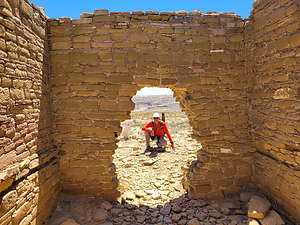 Pueblo NuevoAfter about 1 mile we came to the junction with the Pueblo Bonito Overlook trail. This short spur trail goes to the mesa rim right above Pueblo Bonito at 1.1 miles. The bird’s-eye view of this Great House is really amazing and offers a much greater appreciation of its massiveness and grandeur.
From there we had a choice, although many people just choose to turn around at this point making it a 2-mile RT. We, however, were going all the way.
We decided to do the loop clockwise, so we headed north (away from the rim) towards New Alto and Pueblo Alto for about a mile. We ascended a wide dirt trail, which pointed out a section of Chacoan steps along a slickrock ramp that was part of a Chacoan Road.
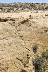 Chacoan StairwayWe came first to the two-story New Alto structure, which was built around 1100 CE. The ruin contained 58 rooms arranged around a kiva. The structures have been stabilized but not excavated.
Next we arrived at the Pueblo Alto complex, which is composed of six structures, only four of which are visible. Pueblo Alto is the largest of the ruins on the rim and the only one that has been excavated. Unlike the other multi-story Great Houses in Chaco, Pueblo Alto, which was built from 1020 - 1050, was only one story. Oddly, there is no kiva in the complex. Archaeologists have found evidence of four roads from the north that converge at Pueblo Alto as do roads from Chetro Ketl, Pubelo Bonito and Penasco Blanco.
Unlike Pueblo Bonito, which had undergone excavation and reconstruction, these were true unrestored ruins - an interesting contrast to the Pueblo Bonito and Chetro Keti - very eerie and remote.
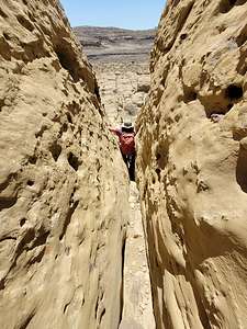 Squeezing my way through a slotFrom here, many people turn back, making for a 3.8-mile out-and-back hike. We, however, continued on, heading east. In about a mile we caught sight of the Chacoan Stairway, which I am embarrassed to admit was another uninformed miscalculation on my part. For the entire hike so far, I held onto the belief that we did not have to go totally back to the rock scramble down the crevasse by Pueblo del Arroyo.
And how did I think I was going to do that? On the Chacoan Stairway, of course, which according to Gaia was coming up soon. Herb did not hold this same belief, and enjoyed my reaction far too much when they came into view. They called these tiny nitches carved into what was practically a vertical wall a Stairway?? I couldn’t even get myself close enough to the edge to see the first one I was supposed to step on. Actually, I, nor anyone else born in this millennium was supposed to step on them.
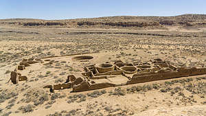 View of Chetro Ketl from aboveThey were artifacts from the Ancient Puebloans built roads coming from the Great Houses in exactly straight lines. They didn’t care what got in their way. If the topography went straight up, so did the stairs. Sometimes, as in this case, they were wise enough to carve handholds along the side of them.
Looks like we had some more miles to go.
The trail now turned right (south) and we proceeded back towards the rim descending the mesa. At one point we were a bit stymied as to which way we were to go, but then we found a marker indicating where the trail went down a narrow slot between two large boulders, bringing us to the next bench on the mesa.
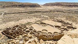 Another look at Pueblo Bonito from aboveFrom here we began heading west. Soon we came to a great viewpoint directly above Chetro Ketl, the second largest of the Great Houses of Chaco Canyon. From here we could see the internal rooms, a great kiva, and an elevated plaza with more kivas.
From there we just kept heading west. At one point, we looked straight down into the parking lot where our car was parked, but there wasn’t a Chacoan Stairway in sight, so we forged on, stopping once again at the Pueblo Bonito Overlook before finally scrambling down the narrow crevasse back to the trailhead.
.thumbnail.jpg) Back at Pueblo BonitoFinally, back at the car, Herb pointed out that we had managed to turn a 5.2-mile hike into a 9-mile one. Oops.
Back at Pueblo BonitoFinally, back at the car, Herb pointed out that we had managed to turn a 5.2-mile hike into a 9-mile one. Oops.
It was already 4:00. We were tired and didn’t know yet where we were staying for the night, so we completed the Canyon Loop Drive and then started heading southwest towards I40, along about 30 miles of bumpy dirt roads before finally hitting the pavement of Highway 371.
We figured Gallup would be a good place to stop for the night, so we found a Best Western in the center of town, right off historic Route 66.
We struck gold when we asked the hotel concierge for a recommendation for dinner. He pointed us right across the street to the El Rancho Hotel.
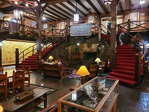 Historic El Rancho Hotel in GallupDuring its heyday, the El Rancho Hotel was one of the premier hotels in the entire Southwest, and in the 1930s and 40s it became the place for the Hollywood set to stay when filming in the area. Some of the movie stars that stayed there include: Jane Fonda, Humphrey Bogart, Katharine Hepburn, Lucille Ball, Gregory Peck, Betty Grable, Kirk Douglas, Robert Mitchum, John Wayne, Jimmy Stewart, Doris Day, and Rita Hayworth.
The lobby was beautiful - dark wood, colorful navajo rugs, a large fireplace, and practically a museum of movie memorabilia on the walls.
Dinner was good and since it was Cinco de Mayo, of course we just had to have a Margarita.
Nice way to cap off a great day and a great vacation. Tomorrow we would start heading home.
Bisti Badlands
Tuesday, May 3, 2022 - 7:30pm by Lolo130 miles and 3.5 hours from our last stop - 2 night stay
Travelogue
 Hiking into the North Bisti BadlandsAfter leaving Shiprock yesterday, we drove an hour and spent the night in the Brentwood Inn in the town of Farmington, New Mexico, which is the closest town to use as a base for exploring the Bisti Badlands..
From everything we had seen and read, the Bisti Badlands was an amazingly unique and otherworldly land of colorful expanses, undulating mounds, and unusual rock formations covering over 4,000 acres in the high desert of northwestern New Mexico.
Bisti Badlands was the driving force of this trip - the reason we took the route we did across northern Arizona and New Mexico. All because of some amazing photos in a Photographing New Mexico book and descriptions of its extreme remoteness and isolation - exactly the experience that my husband craves.
 North Bisti BadlandsHowever, with that remoteness comes several challenges to exploring it - unmarked dirt roads, no signs, no cell coverage, no services, etc. What often looked like short distances on the map turned out to be much longer because of the lack of roads connecting two places.
So we prepped by watching YouTube videos of people that had been there, downloading dirt roads, hiking trails, camping spots, and interesting rock formations on Gaia to follow when we were there, even if there was no cell coverage.
 Manta RayThen there was the biggest challenge of all, which couldn’t be solved with research or Gaia maps - the relentless spring desert winds!!, and once again the forecast was for gusts up to 50 mph, very unpleasant in a sandy environment.
We had marked down places where we could disperse camp, but had no idea if the wind would cooperate or make camping a miserable experience.
 North Bisti BadlandsThere were three hikes in particular we wanted to do, each of them separated by miles of unmarked dirt roads.
Since the winds tend to pick up in the afternoon, we got an early start hoping to get in at least one of those hikes while it was still calm. From Farmington, we drove down NM 371 through wide open prairie land at the eaastern edge of the Navajo Nation. There are two areas to explore off of 371 - North Bisti and South Bisti.
 Stone WingsWe decided to go to North Bisti first. Herb had marked the Bisti Badlands Parking North in Gaia, so I was able to follow our progress towards it. We traveled south on 371 for 33.5 miles and made a left onto County Road 7295, which we followed until it came to a T. From there we just followed our tracks on Gaia for another quarter mile or so until we came to a small parking area.
After squeezing through a narrow barb-wired entrance designed to keep cattle in, we started walking east on a fairly obvious path on the flats. We had the major rock formations we wanted to see in Gaia as well, so we used that as a guide to finding them.
 Conversing HoodoosMany of the formations are best seen in evening light, but you can’t be everywhere at sunset, but we did the best we could to capture them.
The names of many of the rock formations, such as Manta Ray, Conversing Hoodoos, and Stone Wings are so aptly descriptive that it was easy to know when we had found them, even without Gaia’s help.
 Badlands on the way to King of WingsStone Wings was the first named formation we came to, but the unnamed scenery was pretty awesome as well. You can see how these large wings perched on a bluff got their name, and they were very cool. Little did I know at the time though that we would see a much more impressive wing later today on the King of Wings hike.
Next came Conversing Hoodoos, two elegant hoodoos sitting side by side on bluff looking out over Hunter Wash and theoretically conversing about it.
 In Search of the King of WingsThe next one was my absolute favorite - the Manta Ray, although Gaia tried to tell us it was somewhere else and we wasted a lot of time looking for it. Fortunately, we took photos of what we thought was a really cool unnamed formation, which I afterwards confirmed actually was the Manta Ray. That sort of taught us a lesson to just look with our own eyes and find what was interesting to us rather than searching on our phones for named ones.
 King of WingsAfter three and a half miles we were back to the barbed wire fence where we squeezed back through to the parking lot. It was only 10:30 and the wind hadn’t picked up yet, so we decided to implement the second hike we wanted to do in the Bisti Badlands - King of Wings.
This one and the next one (Valley of Dreams) was located in the Ah-shi-sle-pah Wilderness Study Area, an even more remote section of the Bisti Wilderness.
.thumbnail.jpg) King of WingsThe directions to the Ah-shi-sle-pah Wilderness were all from the east on NM 550, but we were already fairly deep into the badlands, so we decided to navigate our way there via Gaia, which worked just fine. We went back out to NM 371, went south for about 10 miles and then turned left on dirt road 7650, which we followed for about 10 miles, before turning right onto an unsigned dirt road.
King of WingsThe directions to the Ah-shi-sle-pah Wilderness were all from the east on NM 550, but we were already fairly deep into the badlands, so we decided to navigate our way there via Gaia, which worked just fine. We went back out to NM 371, went south for about 10 miles and then turned left on dirt road 7650, which we followed for about 10 miles, before turning right onto an unsigned dirt road.
In about a mile, we came to a parking lot, but fortunately Herb had done his research and knew that there was another parking lot one and a half mile further on that could only be reached with a 4WD vehicle. This would save about a mile and a half of hiking.
 King of WingsAs in the first hike in North Bisti, we parked by a barbed wire fence and had to figure out how to get around - or in this case, more correctly, under it. There were no “No Trespassing” signs, so we found a section that had obviously been used to get under before, took off our backpacks, and played limbo.
From there we headed across a rather nondescript sandy, grassy desert plain for about a quarter of a mile before arriving at the edge of the plateau where beautiful olive-colored badlands dropped down into a lower plateau. They were beautiful and already worth the hike.
 Along the way to the King of WingsAs I mentioned before, there are no trails or signs as to where to go, so without the aid of Gaia, it would have been extremely difficult, if not impossible, to find the King of Wings. Even with it, it was tough.
We were unsure whether we should stay on top of the Badlands or go down and wander through the washes, so we did a bit of both - constantly watching Gaia to see if we were headed in the right direction.
 Hike into the Valley of DreamsUnlike our previous hike, where we navigated our way from one hoodoo to the next, the King of Wings was the only game in town. After about 1.7 miles of wandering, we arrived at the big fella, and he was certainly worth the effort.
Like most of the other hoodoos in the Bisti Badlands, the King of Wings was a large boulder balanced atop a clay pedestal. However, what distinguished it from the others is that the top boulder extends 10 feet beyond the pedestal creating what looks like a giant wing. It was pretty amazing.
 Seemed like there was gold everywhereOf course we had to take photos of us underneath the wing to give some sense of scale. Also, it was fun to wander around it, because it looked so different from each perspective.
Now that we had the tracks that we took to hike here, it was much easier to find our way back to the car.
Knock on wood, the wind still wasn’t too bad, so we decided to do the third hike we had wanted to do - the Valley of Dreams.
 More goldSo back we drove to 7650, made a left and continued for 2 miles before making another left onto 7870. We followed 7870 for about 3.5 miles and then made another left onto 7022, which we followed for about 2.5 miles to the parking area.
There were actually three cars in the parking lot, the first time we had seen anyone else all day. The wind was starting to pick up, but still not the kind that sandblasts you.
 And moreThis hike was definitely easier to navigate because we could see in the distance a group of rock formations that we just headed towards.
Rather than spread apart as in North Bisti, or standing alone as in King of Wings, the hoodoos in the Valley of Dreams were all centered around a low, yellow hill where there were dozens of them scattered about. I especially liked the tall white formations with the golden tops. Oh, and there was petrified wood just lying about amongst them.
 And even some petrified woodMany of the formations had names, but after searching for them and not finding them, or finding them and thinking the name was stupid, I gave up on that and just wandered. The one hoodoo I absolutely did want to find though was the Alien Throne, which did turn out to be aptly named.
The Alien Throne was absolutely surreal. Like other hoodoos it was formed by the erosive forces of wind and rain wearing away at the softer clay layers below a harder cap rock on top. The wind and rain must have been feeling pretty creative when they made this one.
It looked both powerful and fragile at the same time - sturdy base and cap rock that looked like it could last forever, and in between a lattice of softer white stone punctured with several windows through which you could see a bright blue sky. It was a throne worthy of the most eminent of alien leaders.
 The Alien ThroneFor now, it would have to be satisfied with me, trying my best to look like it was mine from which I was about to issue edicts to my loyal followers. Then Herb told me to get down before I hurt myself. Oh well.
On our way back to the car, we ran into a group of a dozen or so people armed with backpacks and tripods. This was the same photo tour group from Japan that we had met in the parking lot earlier. They had obviously waited for the golden hour before heading out, as that is definitely the best time to photograph these hoodoos, but unfortunately for them, they had also missed the window of calm before the sandstorm. There were going to be lots of sandy cameras later.
 The Alien Throne and his friendsOur next real destination was going to be Chaco Canyon, but since there was no place to stay near there, we headed back up to Farmington and booked another night at the Brentwood Inn.
Before checking in, we stopped for dinner at the Three Rivers Brewstillery, a fun place obviously frequented by locals. Herb had a boring hamburger but I went for the BLT sandwich, which was served with a fried egg on top of the bacon. I wondered why they offered a half size, but I soon found out when the waitress served my whole BLT. It was not only good for dinner but tomorrow’s lunch as well.
The beers were great and Herb and I toasted ourselves for our very fun and productive day, pulling off much more than we thought we could accomplish in a day - 11 miles of hiking over three separate very remote hikes through some of the most unique hoodoos we have ever seen - and we are hoodoo aficionados.
Tomorrow - Chaco Canyon!
