- Home
- About
- Map
- Trips
- Bringing Boat West
- Migration West
- Solo Motorcycle Ride
- Final Family XC Trip
- Colorado Rockies
- Graduates' XC Trip
- Yosemite & Nevada
- Colorado & Utah
- Best of Utah
- Southern Loop
- Pacific Northwest
- Northern Loop
- Los Angeles to NYC
- East Coast Trips
- 1 Week in Quebec
- Southeast Coast
- NH Backpacking
- Martha's Vineyard
- Canadian Maritimes
- Ocracoke Island
- Edisto Island
- First Landing '02
- Hunting Island '02
- Stowe in Winter
- Hunting Island '01
- Lake Placid
- Chesapeake
- Provincetown
- Hunting Island '00
- Acadia in Winter
- Boston Suburbs
- Niagara Falls
- First Landing '99
- Cape Hatteras
- West Coast Trips
- Maui
- Mojave 4WD Course
- Colorado River Rafting
- Bishop & Death Valley
- Kauai
- Yosemite Fall
- Utah Off-Road
- Lost Coast
- Yosemite Valley
- Arizona and New Mexico
- Pescadero & Capitola
- Bishop & Death Valley
- San Diego, Anza Borrego, Joshua Tree
- Carmel
- Death Valley in Fall
- Yosemite in the Fall
- Pacific Northwest
- Utah Off-Roading
- Southern CA Deserts
- Yosemite & Covid
- Lake Powell Covid
- Eastern Sierra & Covid
- Bishop & Death Valley
- Central & SE Oregon
- Mojave Road
- Eastern Sierra
- Trinity Alps
- Tuolumne Meadows
- Lake Powell Boating
- Eastern Sierra
- Yosemite Winter
- Hawaii
- 4WD Eastern Sierra
- 4WD Death Valley +
- Southern CA Deserts
- Christmas in Tahoe
- Yosemite & Pinnacles
- Totality
- Yosemite & Sierra
- Yosemite Christmas
- Yosemite, San Diego
- Yosemite & North CA
- Seattle to Sierra
- Southwest Deserts
- Yosemite & Sierra
- Pacific Northwest
- Yosemite & South CA
- Pacific Northwest
- Northern California
- Southern Alaska
- Vancouver Island
- International Trips
- Index
- Tips
- Books
- Photos/Videos
- Search
- Contact
Blue Springs Lake Campground
Sunday, July 15, 2007 - 10:00am by Lolo663 miles and 11 hours from our last stop - 1 night stay
Travelogue
Blue Springs Campground was the site of my longest campsite selection and check-in process.
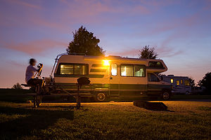 Tom photographing Lazy Daze at dusk - AJGWe were hot and tired and just wanted a nice place to park our RV and unwind after 11 hours of driving. As usual, Herb let me out to handle the normally straightforward process of obtaining a site. However, when the nice couple in the booth asked me what type of site I wanted, I couldn’t decide. I have this really hard time making decisions when I’m tired, so I kept waffling back and forth about whether I wanted to spend the extra $3 for water when I knew that all we really needed was electricity to run our air conditioner. Then I made the mistake of asking if the sites were level. The next thing I knew I was being scooted away in a golf cart by the campground host in order to get a first-hand look at the merits of each site. Herb and the boys were quite amused and even took the time to video my adventure.
Unfortunately, the process did not end there. The site that I had selected was reserved by someone that had not shown up the previous day. Apparently this was not a situation that the nice couple that ran the campground office had encountered before. Over the next 10 minutes, I really got to learn more than I needed to know about their feelings towards the mysteries and sometimes vengefulness of computers.
When I finally got back to the RV, Herb asked me whether I had purchased the site or just rented it. I couldn’t think of a witty response, so I didn’t give him the satisfaction of an answer. I just pointed to my new friend in the golf cart who was cheerfully waiting to lead us to our site, which I might add was quite nice.
Before settling down to relax, we thought it would be a good idea to get a run in after the long day of just sitting in the RV. The boys have to run pretty much every day for their summer XC training and Herb and I try to squeeze one in as often as we can. The boys set off ahead of us with the plan of meeting up at Blue Springs Lake for a refreshing dip. The run was extremely hilly and it was very hot out, so I was not having a very good time. My mood worsened significantly when we caught up to the boys who were staring at the lake through a chain-linked fence with a sign indicating that the beach was closed for the evening. That always gets me so angry. Why do all these parks insist on over-regulating and over-protecting people? Our forefathers got to swim without lifeguards, so why can’t we?
Sweaty, unrefreshed, and cranky, we ran back up the rolling hills to our campsite for a refreshing shower and a relaxing evening before the next day’s big push West.
Description
Blue Springs Campground is part of Jackson County's Fleming Park, which has two large lakes for swimming, fishing, and boating. The Blue Springs Campground is just a short distance from both a swimming beach and a boat launch on Blue Springs Lake. There are 61-sites.
Brother's house in Columbus
Saturday, July 14, 2007 - 11:00am by Lolo566 miles and 9.5 hours from our last stop - 1 night stay
Travelogue
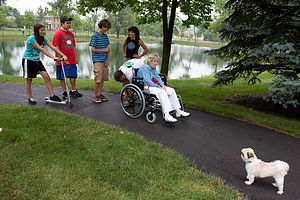 Taking Muffin for a stroll in the parkOnce again, as we do each summer, we pulled out of the driveway, filled with the anticipation and excitement that comes with the prospect of 3 glorious weeks out on the road with my 3 favorite people on Earth, my husband and our two teenage boys. Well, actually this year make that 4—my 87-year-old mother was coming—not the whole way, but as far as Ohio where she would be spending 3 weeks with my brother and his family.
Then we would pick her up again on our way back home. A perfect solution to getting a woman who won’t step foot on an airplane out to Ohio and giving me the chance to relax and enjoy my trip knowing she was in good hands.
 James managing Muffin's poopSo, our first stop was her apartment one mile away from our home, where we proceeded to load an incredible amount of luggage for one tiny woman. “You know they do have a washing machine out there,” I told her as I lugged a third garment bag filled with what the boys like to call her matching “jumpsuits”. “I just want to look nice,” she said sweetly. What could I say to that? Once we had completely filled the bed over the cab and half the back area with her stuff, we loaded her in and drove off. I glanced back and saw her very contentedly sitting on the back couch across from her two best friends. She looked so happy that I was a little afraid she might try to stow away all the way to Yosemite.
After a very long drive, we finally got to the Kroger Supermarket in New Albany, Ohio, where my brother had made arrangements for us to park overnight. He said his Community Association would not allow motorhomes to park in the street. I, however, think he has watched Chevy Chase’s Christmas Vacation too often and had visions of Cousin Eddie dumping his sewage tank in his driveway.
That evening we got my mother comfortably settled in and had a great time visiting and catching up with my brother and his family. However, rather than sleep in his house, we said our goodbyes later that night and headed back to the Kroger parking lot so that we could get a very early start in the morning.
Description
My brother's home in a suburb of Columbus, Ohio
Hope
Friday, July 28, 2006 - 10:00am by Lolo53 miles and 1.5 hours from our last stop - 1 night stay
Travelogue
Navigating our way around Alaska by RV had a certain simple elegance to it. You just drove and drove until the road ended and hit the sea. Then you turned around and did it all over again down a different road. Hope was another one of Alaska's many end of the road treasures.
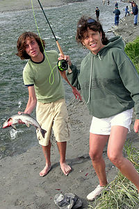 Andrew holding Lolo's first HumpyIt was our last night in Alaska. We had selected Hope as our final destination because it sounded like a really cute town (obviously I was doing the itinerary and not Herb - Herb rarely chooses places for their cuteness), and it would put us in good striking distance to Anchorage where we had to return our rental RV the next morning.
So, after leaving the Russian River, we turned off the Seward Highway and drove down the 17-mile Hope Highway to its end, in the quaint, historic village of Hope, on the southern shores of the Turnagain Arm. I was right. It was cute. However, Herb and Hans thought that the fact that fishermen were lining the banks of the Resurrection Creek that flowed through town was even cuter. We didn't even know there would be any fishing here. However, after our experience at the Russian River, we didn't necessarily associate lots of fishermen with lots of fish being caught, so we checked into our campground first and hung around awhile before heading back into the village to fish.
I had made reservations ahead of time at the National Forest Service Porcupine Campground, a really lovely campground on a bluff overlooking the Turnagain Arm, just past the end of town. A few of the sites are located right on the bluff with really spectacular views. Unfortunately, those were already booked by the time I made our reservations, so we had to settle for sites back in the woods, where the gnats liked to hang out.
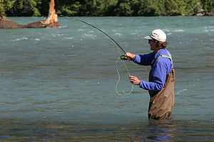 Herb in Russian River since Lolo didn't get any Hope PhotosRather than deal with the gnats, we drove back down the hill into the village to explore. Herb and Han's idea of exploration was checking out the fishing action. To their amazement, this time there actually was fishing action, and lots of it. The Creek was chock full of pink salmon making their way up the Creek. My quaint little historical tour of the village had turned, once again, into a fishing trip.
Oh well. While Herb, Hans, and the boys fished, Michelle, Alexis and I went off to explore. It didn't exactly take very long since "Downtown" Hope is just a cluster of old buildings along Main Street, but this was the kind of place I really love exploring. Since Hope had been an old gold rush community in the late 1800s, much of its history centers around prospecting. There is a Historical and Mining Museum, but unfortunately we got to it just as it was closing. However, we did find a nice gift shop with a very friendly owner, who spoke to us about what it is like to live in such a small, remote community. Like so many other native Alaskans I had met this trip, she seemed so genuinely happy with her life here.
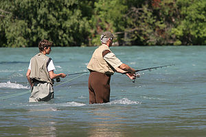 Hans and Jonathan on Russian RiverWe made our way back to the river where we found the men thick in the frenzy of the salmon run they had been hoping for. It was not a totally pretty picture. Andrew and Tommy had their lines completely tangled together, made even worse by the fact that one of them had a fish on the end of their line. Needless to say, they were beginning to get a bit cranky with each other. When I hollered to Herb about what was going on, he merely pointed to his own bent over rod, as if that was explanation enough for his refusal to untangle his sons. Eventually Tom fell in the river with Andrew' line, complete with fish, wrapped around him. Meanwhile, Herb kept yelling for me to get the camera so I could take a picture of him and his stupid fish. Strange things happen to men in a salmon run. When I returned with the camera, Herb kept telling me to get closer so I could get a better shot. I immediately sunk down about 5 inches into river muck completely submerging my new white sneakers. Now I was getting cranky. Andrew, who had managed to untangle himself from Tommy, came over to relieve me of my camera duties. I, and my muck-encrusted feet, returned to the RV to change my shoes. When I returned to the river, making sure to stop just short of the muck. I got a chance to see Herb's really large humpback pink salmon just before he released it back into the river. This was our last night in Alaska, so there was no sense keeping fish than we weren't going to eat. Herb, Hans, and the boys caught so many fish that afternoon, that their arms ached for days afterward.
Hope was a really fitting closure for our trip to Alaska. It would have been a shame to come so far and not experience the excitement of an Alaskan salmon run.
Description
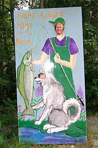 Michelle and Alexis in HopeThe 17-mile Hope Highway leads northwest from Milepost 56.7 on the Seward Highway along Sixmile Creek to the quaint, remote village of Hope at the mouth of Resurrection Creek on the southern shores of the Turnagain Arm. This small village (population 130) was once a thriving gold rush community back in 1896, but its hey-day was short-lived. By 1899, most of the miners left to try their luck in the Klondike. Hope is still the best preserved gold rush community in south-central Alaska, but it has primarily become a place where fishermen and tourists come.
"Downtown" Hope consists of a few old building, some of which date back to its days as a gold rush community, such as the 1896 Seaview Café and the 1902 log Social Hall, which still hosts community events. Right past the post office is the historic Hope Gold Rush B&B, built by gold prospector John Hirshey in 1916. There is also a gift shop, library, and the Historical and Mining Museum.
Right past the village, the Resurrection Creek flows into Turnagain Arm. During the summer salmon runs, fishermen line the shores of the Creek catching the pinks as they make their way in from Turnagain Arm.
There are several camping opportunities in Hope. The Seaview Café has 21 sites (some with electric) right next to the mouth of Resurrection Creek. The U.S. Forest Service Porcupine Campground is up a hill past the creek. There are 24 sites, a few with wonderful views of Turnagain Arm. Two hiking trails, the Gull Rock Trail and the Hope Point Trail, start at the campground.
Miller's Landing - Seward
Sunday, July 23, 2006 - 5:30am by Lolo176 miles and 3.5 hours from our last stop - 3 night stay
Travelogue
 Caine's Head Coastal Trail FishingAs we approached Seward, the fine mist that we had become so used to had now turned to a steady rain. This weather was certainly getting tiresome. We passed right through the town of Seward and headed out to Lowell Point where we had reservations at Miller's Landing. The 3-mile dirt road out to the Point was solid mud and so full of potholes that we had to crawl along at less than 10 mph. I seriously worried whether we would be able to get out of here if the rain continued. Finally, we got to Miller's Landing, a campground right on Resurrection Bay, which would have been wonderful under better conditions. The campground has 30 sites, 15 of which overlook the beach and the mountains and glaciers across the bay. Fortunately, I had reserved the last 2 beach sites. We were assigned one sandwiched between the office and a dumpster. At first I was upset about the aesthetics, but after Herb pulled the RV up a little further (so the dumpster was not right outside our window), our now unimpeded view up the beach became spectacular.
 Gang hiking on Caine's Head Coastal TrailHans was still quite sick with the stomach virus that had been wreaking havoc on our vacation. I can't believe he drove all the way here from Homer. After checking in, we never saw him again until the next morning. Michelle, Jonathan, and Alexis came over to our RV, and we cooked the halibut that Hans and Jon had caught on their Homer charter. With the help of a few bread crumbs, it was absolutely delicious. I was in a hurry to get over to the office, which also served as a lodge, because I had seen a flyer that there was going to be live musical entertainment there that evening--Ken Waldman, the Alaskan fiddling poet. The kids were rather skeptical, but I felt that anything would be better than 7 people cramped in one RV listening to the rain hit the roof. Besides, it was Tom's 15th birthday so we had to do something. I'm sure Tom was the only one of his friends that could say that he got to hear an Alaskan fiddler on his birthday.
 Caine's Head Coastal TrailWe quickly cleaned up dinner and ran through the puddles and mud to get to the lodge. What a transformation! During the day this placed seemed like just a nice campground office and gift shop. However, in the dark with some nice low nautical lighting, it had transformed into a very cozy and warm place to hang out. There were 3 or 4 wooden tables along the windows overlooking the water, but unfortunately, they were all full by the time we got there. Instead, the 7 of us squeezed on a long bench, right next to where Ken Waldman with his fiddle and his friend with a banjo were about to play. I glanced over at the boys and smiled at them with that special look that warned them to keep an open mind and go with the flow.
 Caine's Head Coastal TrailI must say, it truly was a very special and memorable evening. The music style was certainly something different for us, but that made it all the more entertaining and fun. There was a family from Palmer, Alaska that sat at a table across from us that really got into the music. They stomped their feet and sang along with all the songs. Their enthusiasm was contagious. I was starting to envy the people that had chosen Alaska as their home. They all seemed to have a genuine happiness with life, despite the weather. In fact, I was beginning to think that maybe it was even because of the weather. They seemed to find their happiness from within. It really was a fun evening and I found myself humming the lyrics to songs with names like "A Week in Eek", "Burnt Down House", and many more. Ken Waldman was really an interesting character as well. He is a graduate of Duke University that had come to Alaska more than 20 years ago and never left. Well, actually he does leave quite often to perform his music all over the U.S., but he always comes back to his beloved Alaska.
 Caine's Head Coastal TrailBack in the RV, we lit some candles on a birthday cake and sang to Tom. He's had some pretty spectacular birthdays, because they usually occur on one of our trips, and I'm sure this one will be a memorable one for him as well. Tom's a really sensible kid. I think he got the message. He told everyone to stop complaining about the rain and just have a good time. He's right.
The next morning we woke up to more rain beating down on the roof, which made it hard to get out of bed. It was so cozy just lying there listening to it. We turned on the weather radio and found out that the forecast was for rain all day and 13 foot seas. That pretty much ruled out our plan of a boat cruise to see the glaciers. In fact, it pretty much ruled out our plans for any outdoor activities.
Hans reappeared, feeling somewhat better from his bout with the stomach virus that was making its way through our party. At least it only lasted 24 hours, which was some small comfort. Desperate for something to do, we piled into one RV and drove back down that horrible road into Seward.
 Kids playing cards in Miller's Landing lodgeWe spent a good part of the day at the Alaska Sea Life Center, which is a very impressive aquarium and marine research center. The main attraction was the three gigantic tanks, where we saw seals, sea lions, puffins, and other seabirds up close. The rain had slowed down a bit, so we walked from the Sea Life Center along the waterfront towards the harbor. During our walk we discovered that the city of Seward provided numerous places to camp right along the waterfront with wonderful views of the mountains across the bay. In retrospect, it probably would have been a better idea to have camped here--equally wonderful views and easier access to the sights of Seward. However, with good weather, I still think that Miller's Landing would have been spectacular.
We stopped at the National Park Headquarters in town to inquire about the boat cruises to Kenai Fjords. The news wasn't good. The seas were so high that no boats had gone out that day and the same was probably true for tomorrow. There went our chance at what I had really been looking forward to most on our trip to Alaska.
I don't think any of us wanted to spend another night cooking in the RV, so we decided to eat at Ray's Waterfront Restaurant on the harbor. The good food and atmosphere and a few glasses of wine perked us up quite a bit. After dinner, rather than walk back to the motorhome along the waterfront, we went along 4th avenue, where Seward's nicest shops and galleries were.
 Miller's Landing CampgroundThe next day, which was our last in Seward, the weather had improved slightly. Overcast and drizzle was what we had now come to consider good weather. Since we couldn't go on a boat cruise to the fjords, we wanted to at least do something adventurous and outdoors while we were here. The next best option I could come up with was hiking the Caine's Head Coastal Trail, which was listed by Alaska Magazine as one of the 10 best hikes in Alaska. It started right from Lowell Point near where we were camping. The only problem was that some sections of the trail could only be hiked at low tide and our timing was a bit off. We had already missed the 8 a.m. low tide and 8 p.m. would be a bit late. We considered taking a water taxi out to the end, but for 8 of us it would have cost a couple hundred dollars--a bit pricey we felt for a taxi. We decided to just head out and see how far we could get.
The first part of the trail was all upland, through the woods. When we got to the Tonsina Beach Bridge, we could see salmon spawning in the stream. You weren't allowed to fish there as it wouldn't exactly have been very sporting. The salmon were busy doing their biological duty. We actually saw female salmon laying their eggs and the male salmon hanging around waiting to do his part. It was very romantic.
 Millers LandingIn the distance, where this creek flowed into Resurrection Bay, we saw about a dozen fishermen knee-deep in the water. You are allowed to fish in the bay, just not in the streams. We weren't sure just where the trail went from here, so we tried to cut through some tall grass to get over to where the fishermen were. We got about 100 yards before we were stopped by a small creek. A bit of a debate began as to the wisdom of crossing this stream versus turning around and trying to find the real trail. Herb plowed on through the creek--he at least had L.L. Bean boots on, and the rest of us turned back to find the trail. After a few unsuccessful attempts at trail finding, we decided to take the Herb route and proceeded to get our feet and our pants, up to the knees, soaking wet. Some of us--I won't name any name--became very cranky about this. The fishermen were not really catching anything, so we walked along the beach enjoying the views of the Bay and the glaciers across the way. We noticed quite a bit of bear scat around, so we started making plenty of noise so as not to startle any. When we got to the area where the cliffs rose from the beach, we had to turn back because of the tides. Too bad. It would have been nice to have been able to do the whole hike. At the end, there is an old deserted World War II fort and some wonderful views from atop a 650-foot high headland.
 Caine's Head Coastal TrailOn our way back, our group got separated a bit. Herb, Michelle, and I were strolling along behind the others when all of a sudden we stopped dead in our tracks. Up ahead, all we could see was a mass of brown fur blocking the narrow trail. Michelle and I panicked and practically jumped on Herb's shoulders. I'm not sure exactly what that was going to accomplish, but it seemed like a good idea at the time. As we stood paralyzed and clutching each other, the beast started moving towards us. Only then did we see that we had been terrorized by a Golden Retriever. My knees were still shaking a half hour later.
That night, after dinner the kids went back to the lodge to play some cards. It really was quite cozy and warm. I think we were finally starting to get some of that internal Alaskan happiness.
The next morning we awoke to brilliant sunshine streaming through our windows. Not knowing just how long it would last, we ran outside to photograph this rare event. What an absolutely beautiful place!
Description
Seward is located at the end of the Seward Highway, about 127 miles south of Anchorage. Tucked between the waters of Resurrection Bay and the foot of Mt. Marathon, this port town serves as the gateway to Kenai Fjords National Park.
 Michelle and Tommy at Alaskan Sea Life CenterKenai Fjords National Park encompasses 580,000 acres of glaciers, fjords, Icefields, and mountainous coastline and is home to whales, sea otters, and sea lions. The centerpiece of the park is the massive 700 square mile Harding Icefield, which feeds more than 30 glaciers. Eight of these glaciers reach the sea, creating a thundering display of calving icebergs. To view these glaciers and the marine wildlife, most visitors to Seward take one of the many boat tours offered by various tour companies. Half-day tours take you around Resurrection Bay. However, to see glaciers calving you have to go as far as Aialik Bay to Holgate Glacier, which can only be reached on a full-day tour. Take Dramamine along as the unprotected waters outside Resurrection Bay can get quite rough.
The only part of Kenai Fjords National Park accessible by land is Exit Glacier, just 4 miles north of Seward. See the next stop for a detailed description of this part of the park.
The town of Seward itself is quite picturesque with its bustling harbor and historic downtown filled with quaint shops, art galleries, and restaurants. The town was established back in 1903 by railroad surveyors as an ice-free port which could be the southern end of the Alaska railroad. It still has a frontier-town feel to it, with many homes and buildings dating back to that time.
 Millers Landing PorchA very popular destination on the south side of town is the Alaska Sea Life Center. The main attraction is the three gigantic tanks, where visitors can view seals, sea lions, puffins, and other seabirds up close. Also popular is the tidepool touch tank. The Center is also an important center for marine research and the rehabilitation of wildlife.
Most RVers who visit Seward, dry camp in one of the huge gravel lots along the waterfront that are part of the City of Seward Waterfront Campground. The views are spectacular. There are even some sites that have water and electrical hookups.
Another interesting camping alternative is Miller's Landing, just a few miles south of town on Lowell Point. To reach the campground, drive right through Seward and take Lowell Point Road, a poorly maintained gravel road that runs for about 2.2 miles along the shoreline. This beachfront campground has 30 sites, 15 of which overlook the beach and mountains across the bay. Most sites have electric, but there is no water or dump. However, there are hot showers and a laundry. Miller's Landing provides lots of recreational options, such as: fishing charters, sightseeing charters, motor boat rentals, kayak lessons and rentals, and Water Taxi services to remote kayaking and fishing sites throughout Kenai Fjords National Park and Resurrection Bay. You can also fish for salmon right from the campground beach or hike the 5-mile Caine's Head State Park Trail, listed as one of the top ten hikes in Alaska by Alaska Magazine. There are enough activities at Miller's Landing to keep you busy for weeks.
Homer
Thursday, July 20, 2006 - 12:00pm by Lolo42 miles and 1 hour from our last stop - 3 night stay
Travelogue
After leaving Ninilchik, we continued south on the Sterling Highway to the town of Homer, truly the end of the road. Before reaching the town, we made a brief stop at a scenic overlook at mile 170, where there was a tremendous view across Kachemak Bay to the volcanic mountains on the other side. Truly a lovely place, and one which I was dying to see in the sunlight, if this lousy weather would ever leave us.
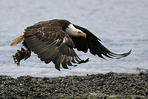 Homer Bald Eagle in flight over beachAs we approached town, we caught our first glimpse of the famous Homer Spit jutting 4 ½ miles out into Kachemak Bay, and I knew that that was where I wanted to be. Unfortunately, in a panic I had made reservations for tomorrow and the next night at the Oceanview RV Park, which was on the edge of the town of Homer rather than on the Spit. I now realized that this was probably a big mistake. We decided to drive out onto the Spit and see what we could find for tonight and then decide what to do about tomorrow.
There were so many camping options along the Spit, ranging anywhere from inexpensive dry city camping to the Heritage RV Park, the most expensive camping I have ever encountered (something like $75 a night). They did have some great amenities--satellite TV, modem hookups, voice mail, etc.--but who the heck cared. I was in Alaska and the last thing I was looking for here was technology that I could get back home. We continued on to the Homer Spit Campground at the very end of the Spit, right across the road from the Salty Dawg Saloon, which would be very convenient if the weather didn't improve.
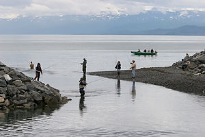 Inlet to Homer's 'Fishing Hole'We were able to get a site, but not on the beach. Too bad, because the beach sites had great views, but the other sites were pretty bad--more like a parking lot. We were right next to the laundry, which although not exactly aesthetically pleasing, was quite convenient as I had about 6 days of dirty clothes to deal with. Herb and Hans took the boys to the end of the Spit to fish while Michelle and I did laundry--how embarrassingly stereotypical. At least the men did produce and manage to catch some fish. Actually, the men didn't catch anything, but the boys did. Jonathan caught a lingcod, Andrew caught a flounder, and Tommy caught a very ugly unidentified fish. They didn't come back until about 10:00 so we had another one of our midnight dinners. We were really having a tough time adjusting to the fact that it didn't get dark until the middle of the night.
The next morning Michelle went to the office first thing, before anyone else was awake, and began to try to finagle our way into a beach site. Michelle is a very persistent person, so if there was anyone that could get us a better site, it was her. Surprisingly, the office told her that several sites on the beach were opening up that day, and if the occupants didn't come in by 11:00 to renew, they were ours. And to think that all this was going on while we were still asleep.
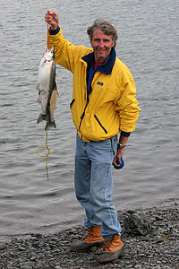 Herb with Salmon DinnerThe only down side to switching sites was that we had to wait around the campground all morning to see who checked out. However, it was well worth it. We wound up getting the two best sites in the whole campground--right on the beach at the very end, next to the Fishermen's Memorial. Michelle was quite pleased with herself and so were we.
After making our claim to the new beach sites, we all piled into the Kalchbrenner motorhome and took a drive back down the Spit towards town and then out on the East End Road, which runs along Kachemak Bay for about 20 miles. We were barely out of town before Hans yelled, "Moose!" Hans has the most incredible knack for spotting wildlife of anyone I know, even when he's the one driving. We pulled over just in time to see the moose leave the front lawn of a house and enter into a nearby woods. Apparently, this is not such a rare sight around here. Moose are Homer lawn ornaments.
The views along the drive would have been great, but we were dealing once again with a very overcast day. This bad weather was starting to get old. To top it off, poor Alexis had caught a pretty awful stomach virus and spent the whole drive just sleeping in the back bedroom. That's the nice part about a motorhome though. If you're not feeling so great, it's pretty much just as comfortable as being home.
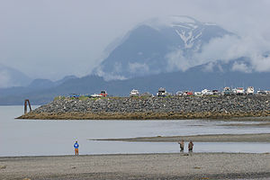 Homer fishingOn the way back towards Homer, we stopped for lunch at the Fritz Creek General Store, which had a very cozy country setting and really good sandwiches and pizza. On the way out, we checked the bulletin board to see what was happening in Homer. These people really know how to have a good time. That night there was going to be a duct tape costume party. This really got Herb's and Hans' imaginations going. Thankfully, we hadn't packed any duct tape.
Back on the Spit, we decided to stop and try our luck at the famous Homer Fishing Hole. Some of us had a little ethical dilemma as to just how sporting this fishing actually was. You see, the Fishing Hole is really sort of a trick played on some unsuspecting salmon. Every year the Alaska Department of Fish and Game stocks this little bight with king and silver salmon smolt. When these little smolt grow up into salmon, they eventually return to their birthplace to spawn. Rather than finding a river to swim up and lay their eggs in, they are greeted with a crowd of anglers lining the banks of the bight. There is nowhere for them to go, but the end of a fisherman's line. Not particularly sporting. However, we really did want to catch salmon while we were in Alaska, so we convinced each other that these fish were just going to die anyway, so we might as well have them for dinner. We walked across the street to the Sports Shed to buy fishing licenses for $55 a piece.
 Gang roasting marshmellows around the beach fireThere definitely was a technique to this, but we didn't have it down yet. We watched one local woman pull in her limit of silvers in less than an hour, while we were still just flogging the water with our lines. Herb tried to have me spy on locals to find out what they were doing, because there definitely was a difference in results between what they were catching and what the tourists were catching. Finally, Jonathan did manage to catch one. Score 1 for the tourists.
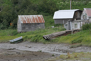
The boys and I finally gave up and went for a run up and down the spit--separately of course. The boys wouldn't be caught dead running with their mother, nor would I be able to keep up with them. I ran along the bike path back towards the town of Homer. I really didn't know what to think of this place. It was a strange mix of charming fishing village and junkyard. There were abandoned rusty cars and old dilapidated boats just left on the side of the road and the beach. There was definitely no pretense here or sprucing up for the tourists. It was very real and I finally decided, very refreshing.
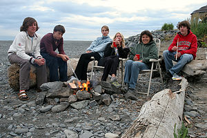
Well, that night we ate the fish Jon had caught, and it was so good that we were determined to crack the code tomorrow and find out the locals' secret technique so we could get some more. The atmosphere for our dining was wonderful as well--right on the beach with a nice campfire going. Alexis was even feeling well enough to join us. I guess it was just a 24 hour virus. Hopefully, no one else would get it.
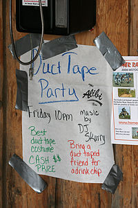 Duct Tape Party at HomerAs we sat by the fire that evening, we would occasionally hear the mournful ringing of the bell from the nearby Fishermen's Memorial. It was sad to think of all the fishermen that have died while fishing these waters. It reminded us too that while for us, fishing was an entertaining pastime, for many of the people of Homer it was their livelihood, and a dangerous one at that.
The next morning Hans and Jonathan went off on a ½-day halibut charter. Herb, Andrew, and Tom are really not into fishing charters, but prefer to fish from shore. So, they decided to stay back and take the ladies out for a day at the Fishing Hole. They certainly do know how to treat a lady.
When we got there, the same local woman that had fished so successfully the day before was back again, so Herb went in for the kill. Surprisingly, she had no problem sharing her technique with him. I guess she didn't consider Herb to be much of a threat. Besides, she was already catching her limit within the first hour of fishing each day. What Herb learned was that you didn't really "catch" these fish with bait or lures, rather you snagged them in the mouth, which was the only place where you were legally allowed to snag a salmon (at least at this time of the season). This woman would come down to the Hole at low tide, when you could actually see the fish. She would set up her rod with a fine green line that the fish couldn't see and simply attach a bobber, a small weight, and just a hook. The hook was wrapped with a small piece of yarn to get around a regulation technicality where you were not allowed to fish with a bare hook. Then she would just wait, and as a salmon swam past her hook, she would snag it in the mouth. Perfectly legal and very effective. Later in the season when the salmon were going to die soon, the regulations would actually be loosened to allow fishermen to snag them not just in the mouth, but anywhere. In the meanwhile, you had to aim for their mouths.
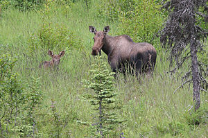 Homer Mama Moose & youngWhile Herb was doing his espionage, Michelle had her own unique technique for fishing success, which was much more entertaining than Herb's. You have to really know Michelle to appreciate this. Michelle is a very attractive and outgoing blonde that loves to talk with everybody she meets. I happened to glance across the Fishing Hole only to see Michelle right in the middle of the most crowded section of the Hole, elbow to elbow with serious fishermen, flailing away with her fishing line, and getting completely tangled in the lines of all around her. While she smiled and chatted, several local fishermen gathered around her, practically tripping over each other trying to help her undo the giant bird's nests she was creating with every flail of her line. It was very entertaining to watch.
Eventually Hans and Jonathan met us after what had been for them a productive halibut charter. They caught their limit and were having it frozen and shipped back to New Jersey. Besides being a great experience, the trip had paid for itself in fish. They kept some of the halibut out for us to eat during the trip.
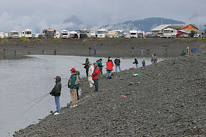 Homer's 'Fishing Hole'After awhile we decided to take a break from the fishing and wander around the Spit. Besides being a fishing village, Homer is also somewhat of an artist community so there were many lovely galleries and shops to explore. The Spit was definitely a very lively and fun place to be. On the walk back to the Fishing Hole, Michelle started to feel a bit queasy. When we got back to the RVs, she disappeared inside and wasn't seen again for another 24 hours. Apparently, this stomach virus wasn't done with us yet. It reminded me a bit of Agatha Christie's And Then There Were None. We all wondered who was going to be next.
Herb, Hans, and the boys employed their new-learned local fishing technique at the Hole and were quite successful--another 3 silver salmons to bring home for dinner. I was not as pleased because I really wanted to go out to dinner. However, the chances of that weren't looking very good right now. According to reports from the Kalchbrenner motorhome, Michelle was feeling pretty awful, and we didn't want to go out to eat without her.
While fishing at the Hole, we discovered another one of Homer's claims to fame--bald eagles. Homer is actually the eagle capital of the world and the place where most of those great eagle photographs in magazines like National Geographic are taken. We were fortunate enough to have one pose for us. Herb and Andrew set up their tripods and took some fabulous photos of an eagle feeding on the beach. Andrew even got a great one of an eagle in flight with its dinner in its talons.
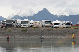 Fishing HoleThat night back at our lovely beach site, we made another campfire and cooked the salmon we had caught that afternoon. It was delicious. There really is a difference in taste with salmon that fresh. Poor Michelle never made an appearance that night, but hopefully, like Alexis, this would only last 24 hours.
I couldn't possibly leave Homer without visiting the infamous Salty Dawg Saloon, so around 11:00 pm on our last night in Homer, Herb and I told the kids we would be back shortly and wandered across the street to this famous Homer landmark. We entered a small, dark room with dirt floors and walls covered in bumperstickers and dollar bills. It was very noisy and crowded, but somehow I managed to squeeze into a seat at the bar sandwiched between two men. Herb and I ordered some Alaskan beers and I got ready for a true Homer experience. We struck up conversations with the men around us, hoping to hear tales of rough days at sea, only to discover that they too were tourists seeking the same Homer essence we were. Oh well. They were nice to talk to anyway and the beer was really good. I felt bad Michelle missed this because she would have loved it. Also, I'm sure she would have been able to find a genuine Homer fisherman or two to chat with.
The next morning Michelle reappeared feeling somewhat better, but now Hans was feeling queasy. We were a bit worried how he was going to manage the 4 hour drive to Seward, but he insisted that he could do it. I think he would have had to have been hospitalized before he would let Michelle behind the wheel.
As we left Homer, I gazed fondly at the Salty Dawg, the Fishing Hole, the galleries, and even the dilapidated boats left on the beach. The unique charm and quaintness of this place had definitely grown on me.
Description
At the end of the Sterling Highway in the southwestern-most corner of the Kenai Peninsula lies the charming and quirky fishing village of Homer, known for its mild climate, large halibut, bald eagles, and art galleries. The town has an undeniably beautiful setting as well--surrounded by a panorama of water and the snow-capped Kenai Mountains across the bay.
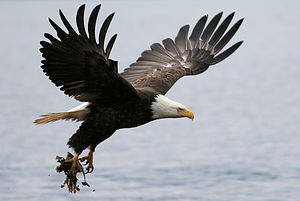 Homer Bald Eagle in flightWhile most of the village lies on the shores of Kachemak Bay, its most famous part, the Homer Spit, is a bar of sand, gravel, and rock that juts 4 ½ miles out into the bay itself. The Spit is where the action is. Its 4 ½ miles are lined with charter boat services, unique gift shops and art galleries, restaurants, the infamous Salty Dawg Saloon, the famous "Fishing Hole," and several public campgrounds. A paved 3-mile bike path starts at the base of the Spit and continues to the Fishing Hole. The Homer Spit is also home to hundreds of bald eagles. In fact, most of the photos you see of bald eagles, including those in National Geographic magazine, were shot here.
Homer calls itself the halibut fishing capital of the world, and with good reason--halibut caught in these waters are not only frequent but their size often exceeds 200 pounds. Tourists flock to Homer to go out on one of the many halibut charters offered on the Spit, and most do not come back empty-handed. There are several companies on the Spit that will flash freeze your catch and ship it so that it's waiting for you upon your arrival home.
For those that want to fish but don't want to go out on a halibut charter, there is great king and silver salmon fishing at the Fishing Hole, right on the Spit. The Alaska Department of Fish & Game stocks this little bight with king and silver salmon smolt. Each year the salmon return, fooled into thinking this is where they are to swim up river and lay their eggs. Instead, they are greeted with a crowd of anglers lining the banks of the bight. Fishing licenses are available right across from the Fishing Hole at the Sport Shed.
There is ample camping along the Spit. The city maintains several camping areas that do not have hookups. In addition to the city campsites, there are three privately run RV parks on the Spit that do have hookups: the Homer Spit Campground near the tip of the spit, the Sportman's Supply near the boat launch, and Heritage RV Park. There is also camping off the spit in the town itself.
The ferry terminal for the Alaska Marine Highway is located near the end of the Spit. From here, ferries run twice a week to Seldovia, three times a week to Kodiak, and once a week to Seward, Valdez, and Cordova. See www.ferryalaska.com for more information regarding ferry schedules and prices.
Ninilchik
Thursday, July 20, 2006 - 5:30am by Lolo140 miles and 3 hours from our last stop
Travelogue
Part of what I like best about traveling is exploring small towns and villages and seeing what it would be like to live in a place so different from my own home. Ninilchik was just what I was looking for.
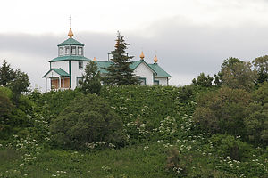 Russian Orthodox ChurchI must admit that my first impression of Ninilchick was not very positive. At first glance, all I saw were the rusty junked cars scattered about and a dilapidated old fishing boat lying half on its side on the beach--definitely not spruced up for the tourist crowd. The only inhabitant in sight was a small boy racing up and down the street on his bicycle. However, when I looked a little closer, I noticed that the houses, although quite small, were neat and cozy, and atop the hill overlooking the village sat a picturesque old Russian Orthodox Church, complete with onion domes. This was the kind of place that definitely grew on you. Today, when I look back on my trip to Alaska, one of the images that first comes to mind is that beautiful old church.
If the weather hadn't been so awful, I would have loved to have stayed the night and camped on Ninilchik Beach. RVs are allowed to camp on the hard-packed sand where the Ninilchik River flows into the Cook Inlet. It really would have been a lovely spot on a nicer day.
 Ninilchik creek?Instead, we decided to just explore the village before continuing on to Homer. Before going up the hill to the church, we stopped in a gift shop adjacent to the footpath. I was shocked. Here in this tiny run-down village in the middle of nowhere was one of the nicest gift shops I have ever seen. No tacky wares here, but beautiful hand-made traditional Russian and Alaskana crafts. The woman who owned the store was so nice and gave us a good feeling for what life was like in this tiny village. She, as did every other Alaskan we met in our travels, absolutely loved her home. I found Alaskans to be some of the happiest people I have ever met. The only other ones that even came close were the people of Newfoundland. It's funny how the happiest people seem to live in the places with the worst weather. I guess happiness must truly come from within.
Next, we wandered up the footpath to the church, which sat atop a bluff with a commanding view of Cook Inlet and the volcanic mountains across the way. Surrounding the church was a small cemetery of white crosses in a field of wildflowers. Even the cemetery seemed to be a happy, or at least a peaceful, sort of place. As we opened the doors to the tiny church, I was startled at first by a bearded, black-robed Russian Orthodox priest, who greeted us and then stood quietly by the door as we gazed at the incredible golden icons lining the walls and altar. It seemed more like a museum than an active church, but every Sunday the Ninilchik villagers still gather here to worship.
Ninilchik means "peaceful settlement by a river." It certainly is.
Description
 Ninilchik villageNinilchik is a quaint old village located where the Ninilchik River flows into the Cook Inlet in the western Kenai. Its name means "peaceful settlement by a river." The original village was settled in the early 1800s by Russian colonists who retired from the Russian-America Company and married local Native women. When the U.S. purchased Alaska, many of these settlers remained. Later, in the mid-1900s the village was relocated about ½ mile away. However, some of the old buildings still exist in the old village and many descendants of the old families still live there. A beautiful 1901 Russian Orthodox Church, which is still used by villagers today, sits atop a hill overlooking the sea and the old village. A footpath next to the old village store leads up to the church. The church is open to the public.
To get to the original old village, you must take a side road at Mile 135 on the Sterling Highway and stay to the right when the road branches. To get to Ninilchik Beach, stay to the left and follow the road that parallels the Ninilchik River out to the "spit," where you can camp with your RV on the hard-packed sand. During the king salmon run in the summer, the Ninilchik River is overrun with fishermen lining its banks. There are many camping opportunities in the area, including 4 Ninilchik State Recreation Area campgrounds.
Beluga Point / Turnagain Arm
Tuesday, July 18, 2006 - 10:30am by Lolo281 miles and 6 hours from our last stop
Travelogue
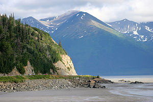 Turnagain ArmSouth of Anchorage, the Seward Highway traces the north shore of the Turnagain Arm and becomes incredibly scenic. If you are fortunate, you'll time your drive to coincide with one of the phenomenal bore tides, in which an 8 foot wall of water rushes in from Cook Inlet covering the exposed mudflats at a speed of 10 mph. Unfortunately, our timing was not so good, but we did get to see it at low tide right before sunset, which was a pretty spectacular sight as well. Herb and the boys must have spent close to an hour photographing the flats.
Description
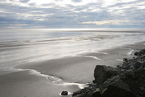 Turnagain Arm mud flatsThe drive along the Seward Highway from Anchorage to Portage traces the north coast of Turnagain Arm. The Turnagain Arm got its name from Captain James Cook in 1778 when instead of finding the Northwest Passage, he was forced to "turn again" when he hit a dead end.
There are many scenic turnouts along the stretch from Milepost 115 to 90. Beluga Point at Milepost 110.4 is one of the best of them. It's called Beluga Point because it's a great place to see the beluga whales chase the salmon into Turnagain Arm in late May and late August.
Turnagain Arm is also known for its phenomenal bore tides. When the incoming tide flows from Cook Inlet into the much shallower and narrower Turnagain Arm, a wall of water as high as 8 feet tall and ½ mile wide across comes surging into the Arm at a speed of 10 mph. The bore tide is best seen between Girdwood and Beluga Point about 2 hours after the Anchorage low tide.
Warning: It is extremely dangerous to wander out onto the mud flats at any time because the mixture of silt and mud acts as a kind of quicksand.
Homestead RV Park
Saturday, July 15, 2006 - 1:30pm by Lolo42 miles and 1 hour from our last stop - 1 night stay
Travelogue
About 35 miles north of Anchorage, we found a pleasant campground overlooking the Matanuska Valley. The views were lovely, even at 10 o'clock at night, as the sun didn't set until well after midnight. In fact, during out entire trip, I can count the times we saw darkness on one hand.
 Boy's running in valleyHerb and I strolled a short distance to a picnic area overlooking the valley and had a glass of wine. As I watched a freight train pass below us through the picturesque valley, I felt quite peaceful and relaxed, despite our long day. I knew I was going to love Alaska.
The next morning before departing for Denali, the boys and I decided to go for a run. Herb, my usual trusty running partner, was still suffering from a pulled hamstring, so I had to go it alone--the boys were just too fast for me. Finding places to run was going to be a challenge for us this trip. Both boys are training for their cross country season and have to get lots of mileage in each day. The problem was that bears are very common in Alaska and they tend to view running mammals as prey. This decision of where and when to run would be the source of some tension during this trip as Andrew wanted to run no matter where he was and Tom, always the more prudent one, often felt it just wasn't worth the risk. Herb and I weren't about to put them in any danger, so we always tried to gain some local knowledge about if and where it would be safe to run. Tom, however, still questioned our parenting and Andrew's sanity.
In any case, the campground manager assured us that this area was not one frequented by bears. The boys and I initially set out together and found ourselves down in that valley that Herb and I had looked down upon the night before. In fact, we could see Herb up above in the picnic area with his tripod and camera pointing down at us. He got some good shots of the boys running together with me huffing and puffing about 100 yards behind.
Before leaving, we took advantage of what the campground manager claimed to be "the cleanest campground showers in Alaska." I think he was right.
Description
64-site Good Sam campground in a beautiful, wooded setting overlooking the scenic Matanuska Valley. Has the "cleanest bathrooms in Alaska," showers, laundry, and jogging trails.
Great Alaskan Holidays RV Rentals
Saturday, July 15, 2006 - 8:00am by Lolo0 miles and 0 hours from our last stop
Travelogue
It was a very long day, as we knew it would be, but we had nothing to complain about--our flights were smooth and on-time, none of our luggage was lost, and we were promptly picked up at the airport by a friendly employee of Great Alaskan Holidays.
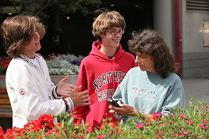 Lolo and boys waiting for pickup at the airportGreat Alaskan Holidays turned out to be as efficient and quality-run as we had hoped it would be. I wouldn't expect anything otherwise. Herb does not do anything without researching it to the fullest, and his inquiries among various RV groups had all pointed to using this organization.
After watching the obligatory 45-minute video on our motorhome (which actually was quite informative), we were given the keys to our 2006 Winnebago and sent on our way. The only extras we asked for were a BBQ, for an additional $18, and a toaster for $5. Everything else--linens, towels, pots and pans, plates, glasses, and utensils, coffeemaker, etc.--was included.
From Great Alaskan, out first stop was food shopping at a Fred Meyer's (similar to a Wal-Mart Supercenter) about 2 miles away. We were so tired and hungry at this point that we went right to the deli, ordered some dinner, and ate it right at dining area there. Now we were ready to get down to some serious food shopping. I always find this part of the trip stressful. It's difficult enough trying to figure out everything you need for the next 4 or 5 days, but it's even worse when you're dealing with an unfamiliar supermarket. We must have run back and forth through each aisle at least 3 times. However, the pleasant surprise was that all the rumors that food in Alaska was so expensive didn't appear to be true. In fact, the prices didn't really seem that much different from back home. Our friends, who were meeting us in a few days, were shipping out a cooler full of meat for this very reason, but it really wasn't necessary after all.
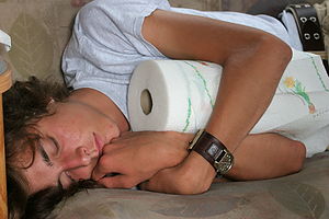 Tired Andrew post travel with paper towelsOne thing I must say about the Winnebago vs. the Lazy Daze is that there is plenty of storage in the bottom compartments. I could have stored enough food there to last the whole 2 weeks. However, there is a price to pay for all that storage. Our Lazy Daze is much more stable, low to the ground, and smoother riding. For now though, I was really grateful to have all that space.
Fully loaded with supplies to last us the next couple of days, we headed north out of Anchorage on the Glenn Highway (Route 1) to look for a place to spend the night.
Description
Great Alaskan Holidays is one of the largest motorhome rental companies in Alaska. It has a large fleet of slide-out and conventional class C late-model Winnebagos which they rent from April 1st to October 5th. Their rental fees are among the lowest in Alaska, and they also offer the greatest number of free essentials, such as housekeeping and linen packages, brand name cookware, color TV/DVD players, lawn chairs, unlimited use of power generator, free cleaning and dumping of holding tanks upon return, and complimentary airport pickup.
They are located at 9800 Old Seward Highway about halfway between Diamond Blvd. and O'Malley Road in Anchorage.
Home
Wednesday, August 3, 2005 - 10:00am by Lolo378 miles and 6.5 hours from our last stop - 1 night stay
Travelogue
Well we made it home safely--exactly 3 weeks on the road. As always, it had been a truly wonderful and priceless experience. I'm not so sure I'm ready for it to be our last long trip with the kids. We'll have to rethink this one carefully.
Description
Our home in Upper Saddle River, a suburb of New York City.
