- Home
- About
- Map
- Trips
- Bringing Boat West
- Migration West
- Solo Motorcycle Ride
- Final Family XC Trip
- Colorado Rockies
- Graduates' XC Trip
- Yosemite & Nevada
- Colorado & Utah
- Best of Utah
- Southern Loop
- Pacific Northwest
- Northern Loop
- Los Angeles to NYC
- East Coast Trips
- 1 Week in Quebec
- Southeast Coast
- NH Backpacking
- Martha's Vineyard
- Canadian Maritimes
- Ocracoke Island
- Edisto Island
- First Landing '02
- Hunting Island '02
- Stowe in Winter
- Hunting Island '01
- Lake Placid
- Chesapeake
- Provincetown
- Hunting Island '00
- Acadia in Winter
- Boston Suburbs
- Niagara Falls
- First Landing '99
- Cape Hatteras
- West Coast Trips
- Maui
- Mojave 4WD Course
- Colorado River Rafting
- Bishop & Death Valley
- Kauai
- Yosemite Fall
- Utah Off-Road
- Lost Coast
- Yosemite Valley
- Arizona and New Mexico
- Pescadero & Capitola
- Bishop & Death Valley
- San Diego, Anza Borrego, Joshua Tree
- Carmel
- Death Valley in Fall
- Yosemite in the Fall
- Pacific Northwest
- Utah Off-Roading
- Southern CA Deserts
- Yosemite & Covid
- Lake Powell Covid
- Eastern Sierra & Covid
- Bishop & Death Valley
- Central & SE Oregon
- Mojave Road
- Eastern Sierra
- Trinity Alps
- Tuolumne Meadows
- Lake Powell Boating
- Eastern Sierra
- Yosemite Winter
- Hawaii
- 4WD Eastern Sierra
- 4WD Death Valley +
- Southern CA Deserts
- Christmas in Tahoe
- Yosemite & Pinnacles
- Totality
- Yosemite & Sierra
- Yosemite Christmas
- Yosemite, San Diego
- Yosemite & North CA
- Seattle to Sierra
- Southwest Deserts
- Yosemite & Sierra
- Pacific Northwest
- Yosemite & South CA
- Pacific Northwest
- Northern California
- Southern Alaska
- Vancouver Island
- International Trips
- Index
- Tips
- Books
- Photos/Videos
- Search
- Contact
Curry Hammock State Park
Saturday, August 15, 2009 - 2:00pm by Lolo53 miles and 1 hour from our last stop - 1 night stay
Travelogue
 Lolo and Boys post Curry Hammock runWe never really intended to come back to Curry Hammock this trip, but the torrential rains in Key West made staying there for sunset pretty pointless. Why go back to a campground that costs $100 a night and just huddle there in the rain, when we could get a little driving north under our belts and spend half the price at a state park campground?
This time we got a campsite right on the water with a lovely view of a mangrove tree out our back window, and the rain even stopped. I found myself hoping that the sun wouldn't come out, because I really would regret having missed out on a classic Key West sunset.
Tomorrow was to be a big driving day. We had two days to drive the 780 miles to Huntington Beach State Park in South Carolina, and I wanted to have some fun along the way. Fortunately, I was prepared with my list of about 10 state parks along the Florida and Georgia coast. We would just drive until we got tired of driving and then turn right to the beach.
Description
 Currry Hammock beachfront campingCurry Hammock State Park is located on Little Crawl Key at Mile Marker 56.2 on the Florida Keys, two miles northeast of Marathon.
The park’s 1,000 acres were set aside as a state park in 1991 to protect its large areas of mangrove swamp, rockland hammock, and seagrass beds, which are essential for the ecosystem of the Florida Keys. The marine grass beds and tidal swamps serve as a crucial nursery for many important species of fish and crustaceans and provide rich feeding grounds for many wading and diving birds.
Although its shallow, seaweedy waters are not ideal for swimming, there are several activities in the park:
- Kayaking/canoeing along the pristine coastline on both the Florida Bay and Atlantic Ocean sides of the island, as well as along a beautiful mangrove creek
- Windsurfing/kiteboarding on the ocean side
- Birding – the park is an important stop for migrating birds. Every fall HawkWatch International conducts a census of raptors passing through.
- Fishing – on both the bay and ocean sides of the park
- Hiking – 1 ½ mile trail through the hammock
The park contains a 28-site, full-facility campground on the oceanfront.
Key West
Friday, August 14, 2009 - 7:15am by Lolo32 miles and 0.75 hours from our last stop - 1 night stay
Travelogue
 Lolo and Tommy at Southernmost Point BuoyWe were very excited about going to Key West. Not being able to do a real full cross country trip this summer had been a real disappointment, so we wanted to see someplace exotic or at least very different from what we were used to. Well, Key West certainly fit the bill.
I had spent a bit of time prior to leaving researching Key West campgrounds, and what I had discovered was that they were extremely expensive. These were not just campgrounds, but “resorts”, costing $130 a night for a family of 4—pretty pricey for a place to park. However, a Google search for Key West Campgrounds brought up a name I hadn’t seen in my old copy of Woodalls: El Mar RV Resort. Their off-season rate for a family of 4 was just $100 ($80 for 2 people plus $20 for the kids). Never in my wildest dreams would I have thought that $100 was a bargain for a campground. I got on the phone to make a reservation. The gentleman was very nice and told me that I didn’t need a reservation that time of year as it was their off season. Being the paranoid trip planner that I am, and the fact that we would be arriving in Key West on a Friday, I decided to book one night anyway and leave the second night as an option. He put me in for a site that was literally two feet from the water.
In actuality, neither this campground nor Boyd’s was actually on Key West, but rather on Stock Island, just over the bridge to Key West. Herb really hates driving the RV through unknown cities and hassling with parking and such, so we were very glad to learn from the campground owner that Key West was a very bicycle friendly city, and we were just 4 miles away from Duval Street and Mallory Square. It actually turned out to be more like 6, but that was okay. We like the exercise anyway.
 Houseboats on bike ride to Key WestI was feeling pretty smug about my campground choice until we actually arrived on Stock Island and couldn’t find it. We had an address: 6700 Maloney Avenue, and we had a GPS, so how hard could this be. Boyd’s address was 6401 Maloney and we had already passed their fancy little entrance with palm trees twice in our search for 6700. I was beginning to think that I had been had and that this campground really didn’t exist. We stopped again at the spot where our GPS’s annoying little voice said, “Arriving at destination.” We sat for a moment outside a white fence which opened onto what looked like a gravel driveway. No welcome sign, no palm trees, and not a tiki bar in sight. We pulled through the gate and realized that this was actually it. There were no other RVs in sight. The only way we could tell that it was actually a campground was by the electric boxes located next to about 15 parking spaces. There was no office, just a small white shed with the door locked. I immediately got on my cell phone and dialed the phone number for El Mar RV, and I use the term loosely, Resort. “We’re here,” I announced to the nice gentleman on the phone. “Oh, just take any site you like and someone will come around later to check you in.” Okay, this was a bit weird, but maybe it was the way they did things in Key West. We drove to the end of the short gravel driveway and took the last site, which was right on an inlet with a 180 degree water view. It was great. Just a little strange.
Rather than try to navigate the RV through the narrow streets of the Old Town, we hopped on our bikes to ride the 5 miles to get there. The first 4 miles or so through New Town were pretty uneventful, like the outskirts of most cities, and it didn’t get very interesting until we reached Whitehead Street, which marks the start of the historic Old Town. It is a very cool place with some very interesting characters on the street. We stopped at Mallory Square, the site of Key West’s famous “Sunset Celebration.” Nothing much was happening there yet, just a few homeless people, getting an early jump on saving a good position for tonight’s show.
 Lolo and Andrew at Zachary Taylor State Park beachIt was pretty hot out, so we decided to save Duval Street for later and ride over to Fort Zachary Taylor State Park, which was rumored to have the nicest beach in Key West, and as the ranger told us at the entrance station, a sunset view to rival Mallory Square. The beach was lovely, with plenty of shade trees at its edge to keep cool and a small café to get a treat. The only problem with the beach was that it was very pebbly at the water’s edge making it difficult for tender-foots such as myself to get in and out while maintaining some grace and dignity. A large rock, a short distance offshore, was a good destination to swim to and a great photo opportunity from shore. We spent a few hours swimming, enjoying the shade, and people watching. We met a very nice 75-year “young” woman traveling the country with her 20-something grandson on a journey to discover what they wanted to do when they grew up. She had quite an interesting past, but very much did not believe that all the good stuff in life was behind her. She was quite refreshing.
The beach was so lovely that we decided that we would come back the next day with the RV—there was plenty of room to park it—and use it as a base camp to explore Key West. We could spend some time in Old Town in the morning, swim in the afternoon, and stay to watch the sunset that night.
After leaving the State Park, we biked to Southernmost Point at the end of Whitehead Street to get in line to take our picture next to the big striped buoy marking the southernmost spot in the continental U.S. Andrew declared it a tourist trap and refused to participate, so Tommy and I got in line behind a large troop of girl scouts, whose leader proceeded to take photographs of them in every possible combination. I got mad at Herb when I found him taking pictures of them too. They really were hogging the buoy and starting to get people a little annoyed. Finally, we got our turn at the buoy and Herb took our picture. It just had to be done.
 Lonely Laze Daze at El Mar RV Resort - AJGWe started to rethink our plan of staying for sunset at Mallory Square that night and then biking back to the campground. The ride through New Town had not been that great and was not something we were looking forward to doing in the dark. We would just catch the sunset tomorrow instead when we had the RV with us to ride back in safely afterwards. Unfortunately, tropical storm Danny would have other ideas for that plan.
On our ride back, Tommy wanted to stop at a bookstore because he had forgotten to pack any books and was getting a little bored just watching us read. We found a great bookstore on Fleming Street right across from a Peep Show advertising that “couples were welcome.” Key West certainly was diverse. The bookstore had some really interesting used and rare books and we could have spent hours there. Herb was probably thinking the same about the Peep Show. Tommy finally settled on some light reading, Stephen Hawking’s A Brief History of Time. Herb the engineer was so proud.
The rest of the ride back was uneventful and we soon arrived back at our still deserted campground. While the boys were out running, someone finally did come over to collect our money for the night. We decided to not commit yet for another night, but to wait and see what we felt like doing after watching sunset in Key West the following night. After all, this place, although inexpensive by Key West standards, was still $100 a night, a lot of money to just pull into to park after sunset. I don’t think we had to worry about the place filling up.
That night in our lonely little campground was great. We set our beach chairs near the wall at the water’s edge, watched the sky fill with stars, and listened to what seemed like a pretty good party going on across the inlet at the Hogfish Bar and Grill.
 Family & Lazy Daze under Key West PalmsThe next day we awoke to some pretty cloudy skies, and the weather radio didn’t make us feel much better about the prospects for our day. Tropical storm Danny was in the neighborhood and we were very likely going to get hit with some rain and big winds. Ironically, after all the days of Florida sunshine, we chose to use as our Christmas card this year, the picture of us taken that morning standing happily in front of the RV framed by palm trees. If you look closely, you can see the ominous clouds approaching us in the background.
We drove into Key West, but by the time we got to the entrance to the State Park it started to rain pretty hard. Rather than pay the admission to sit in the rain all day, we decided to go to the Eco Discovery Center right next door first and hope that the weather improved while we were in there. The Eco Discovery Center was a good way to pass the time on a rainy day, while learning a lot about the Florida Keys’ unique ecosystems. My favorite was the underwater cameras you could peer through to see life on a coral reef.
 Andrew approaching Blue Heaven RestaurantThe rain did not look like it was going to let up any time soon. In fact, it was getting much worse. We decided to put on some rain gear and brave the storm in search of a good place to have lunch. I resisted the temptation of doing the touristy thing and going to Sloppy Joe’s, Ernest Hemingway’s old hangout on Duval Street, and instead steered the family to the much quieter Blue Heaven restaurant on Thomas Street. It actually turns out that Hemingway frequented this place as well, and even refereed cockfights here, but it’s still not as crazy and noisy as Sloppy Joe’s. I had done my homework well. Blue Heaven truly was heaven. It would have been nice to eat in the outdoor dining area, which is considered “the quintessential Keys experience,” but the weather still wasn’t cooperating. We waited for our inside table on the porch behind the restaurant, and watched the chickens freely wandering about as if they owned the place. This Key West free-ranging chicken thing was pretty unique. I knew already what I wasn’t going to order. Needless to say, the food and the atmosphere were great, and our moods were much improved.
We wandered out into the rain again and walked the length of Duval Street. The southern part is fairly quiet and classy, but as you go north towards Mallory Square, things get rowdier and tackier and a bit more interesting. There were plenty of t-shirt shops and bars, and I’m sure that those plastic cups that people were carrying on the street didn’t have fruit juice in them--and this was only mid-afternoon. I couldn’t imagine what went on here at night. There were also some very impressive galleries and some very impressive key lime pie to be had on Duval Street. I’m embarrassed to say that I had never tried Key Lime pie before, and being the chocoholic that I am, I had my doubts, but from everything I’ve heard Key West was the place to try it. Not sure that we would like it, we bought just a slice and each took a bite. It was wonderful. On our drive out of town I made Herb stop at a Publix so that I could buy an entire pie to enjoy on the rest of the trip. It didn’t last more than a day.
It was late afternoon and still raining, so rather than go back to our Key West campground for another $100 night, we decided to start driving north and stay at a more reasonably priced state park.
Description
 Blue Heaven RestaurantKey West is located 150 miles south of Miami at the very tip of the Florida Keys. It is the southernmost point in the continental U.S.
Many of the residents of Key West call themselves Conchs (pronounced 'conks'). Technically, Conchs are people that were born in Key West. Those that merely moved here after they were born can refer to themselves as "Freshwater Conchs" once they have lived in Key West for 7 years.
Conchs pride themselves on their tolerance of all peoples and hosts a large gay population. Its tolerance also extends to chickens, who roam freely through the dining rooms of many restaurants, despite the efforts of state health officials to end this practice.
The primary tourist destination on the island of Key West is the historic Old Town area on the very western part of the island (which most think of as the southern part). An excellent way to cover the sights of the historic district is to take the Old Town Trolley or the Conch Tour Train. Bicycles are another great way to get around the Old Town. Some of the highlights of the Old Town include:
Duval Street
Duval Street, the main touristy street in Key West, runs north-south from the Gulf of Mexico to the Atlantic Ocean. It is the location of many famous restaurants and bars (such as Hemingway's favorite watering hole, Sloppy Joe's), t-shirt shops, and art galleries. It's carnival-like atmosphere lasts until dawn.
Mallory Square
Mallory square is located just west of the northern end of Duval Street, next to the cruise ship port. It is the site of the "Sunset Celebration", a nightly event that attracts hundreds of tourists that gather to watch the sun set over the Gulf of Mexico. The celebration also includes street performers, craft vendors, food carts, and a colorful collection of regular attendees. It begins two hours before sunset, every day of the year.
Eco Discovery Center
This 6,400-square-foot attraction includes replications of a variety of Florida key habitats, touch-screen computer displays, and live underwater cameras showing the coral reefs.
Ernest Hemingway Home and Museum
Ernest Hemingway wrote about 70% of his books while living in this home between 1931 and 1942. 30 minute tours begin every 10 minutes. Admission required.
Fort Zachary Taylor Historic State Park
The state park contains a Civil War era fort as well as the best beach in Key West. There is an adjoining picnic area with barbecue grills and shade trees and a snack bar. The state park is also a popular spot to watch sunset.
Southernmost Point
The Southernmost Point, located at the end of Whitehead Street, is perhaps the most photographed site in Key West. It contains a big striped buoy marking the southernmost spot in the continental U.S.
Bahia Honda State Park
Thursday, August 13, 2009 - 7:15am by Lolo20 miles and 0.5 hours from our last stop - 1 night stay
Travelogue
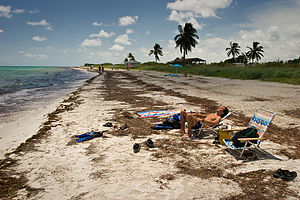 Andrew catching some raysWe were very much looking forward to our stay on Bahia Honda, as it has the well-deserved reputation of being the best beach on the Keys. Fortunately, I had made reservations well in advance, because it is an extremely popular park and one you can’t just show up at and hope to find a site. Another reason we wanted to stay there was the price. Commercial campgrounds on the Keys are extremely expensive, some of them costing more than $100 a night for a family of 4, but since Bahia Honda is a state park, it was a steal at about $40.
With spirits high, we entered the park and headed to beautiful Sandspur Beach on the northern end of the island. None of us commented on what I’m sure we all were wondering: “What was that horrible smell?” Then we saw the sign: Warning, swimming not recommended due to high bacterial levels. Needless to say, we were not pleased that are best beaching experience in the Keys was being thwarted by some foul-smelling, bacteria-ridden, something or other. Did something very large expire on the shoreline? It certainly smelt like it. It turned out that the culprit was far less dramatic—seaweed. Now what? I started fantasizing once again that I was on Martha’s Vineyard rather than Florida in August. Didn’t help, the smell was still there.
Since the section of the beach we were on didn’t have that much seaweed, we unanimously decided that we would go in anyway, but just make sure we didn’t swallow any. There were plenty of other people already doing the same. We played a vigorous and highly exhausting game of running bases in the water, a Gaidus classic which involves 1 pinky ball, 2 people playing base, and 1 poor schmuck running back and forth between the two. Running in water reminds me a lot of running in a dream—lots of desperate motion and very little progress.
The beach really was quite lovely—lots of soft sand and aquamarine water—and we did actually have a very good time.
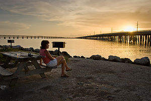 Lolo with sunset wine at Buttonwood CampgroundThat evening we stayed at the Buttonwood Camping Area, one of three campgrounds on the island. This one was located on the Gulf of Mexico side of the island, near the bridge towards Key West. The campground was fine as campgrounds go. Our site was no where near the water, but there was a really premium vacant one right on the Gulf. I immediately hopped on my bike and rode back to the ranger’s office to inquire, but was told that all the sites in the campground were reserved; the lucky owner of the site for that night just hadn’t shown up yet. Herb and I decided to squat on their picnic table with a glass of wine and hope that they didn’t show up until the sun set. Meanwhile the boys went for a run.
After awhile we moved our operation to under the bridge to see if the fishermen were catching anything. That was when the strangest thing happened. A couple and their two daughters approached us and asked if we were the Gaiduses. My heart stopped at first, because the only thing I could think of was that one of the boys had gotten hurt running and had asked these people to find us. They must have seen the startled look on our faces, and quickly informed us that they had recognized our RV and us from our website and had come to find us to tell us how much they enjoyed reading about our travels. It was so weird, knowing that these people knew a heck of a lot more about us than we knew about them. Just then the boys showed up and I introduced them, not realizing that I didn’t really have to, because anyone that has looked at our website has seen them grow up over the 10 years of our travels. I struggled not to say something stupid that would ruin the aura of me being a famous world traveler. This family was really nice and quite adventurous. They had taken the snorkel trip to Looe Key and done quite a bit of fishing during their two week stay on the Keys. In fact, they were on their way to go fishing again that night. I felt less than “extreme” in comparison. They invited us to come along, but since we hadn’t even eaten dinner yet, we declined. Too bad. I’m sure it would have been a lot of fun.
The whole encounter really blew our minds—the first face-to-face contact with an actual “fan” of our “Lolo’s Extreme” website. It was so exciting! We had always joked that someday, during one of our less than pretty family moments, we would be discovered by a reader of our site and exposed as the dysfunctional family we can sometimes be. Fortunately, we weren’t doing anything embarrassing when they found us.
Description
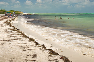 Sandspur BeachBahia Honda State Park is located on Bahia Honda Key between Mile Markers 36 and 37 on the Florida Keys.
Bahia Honda is unique among the other islands in the Keys in that it has long sandy beaches and water deep enough to swim in. There are three beaches, two on the ocean side and one on the Gulf. There is also some underwater life a few hundred feet offshore, which makes for some pretty good snorkeling as well. The channel at the island's west end is one of the deepest natural channels in the Florida Keys.
Activities in the park include:
- Ocean swimming at Sandspur Beach
- Bayside swimming at Calusa Beach
- Daily snorkeling trips to Looe Key National Marine Sanctuary
- Two marinas – one for the public and one for campers
- Kayaking – rentals available
- Tarpon fishing
The park contains three campgrounds, with a total of 80 campsites
Curry Hammock State Park
Wednesday, August 12, 2009 - 1:00pm by Lolo47 miles and 1 hour from our last stop - 1 night stay
Travelogue
 Playing SpitWhat I didn’t realize before coming to the Florida Keys is that there are actually very few beaches to swim at. Most are very pretty, but too shallow or too full of seaweed to actually do anything with but look at, unless you have a boat--and to think that we actually do have a whole flotilla back home. Having a boat would have changed everything. We could have gone fishing, cruised out to the reefs to snorkel, or just kayaked along the shoreline exploring the interesting nooks and crannies. But alas, our entire fleet was home, so we had to satisfy ourselves with just looking, which is not something my hyperactive nature deals well with.
With that being said, Curry Hammock State Park was actually quite nice—very peaceful and serene. We originally heard about this park from a gentleman we met at Gamble Rogers, who said he loved it because it was one of the few state parks in Florida that had a campground right on the water. He was right, and we really did have a lovely view of mangrove trees along the shoreline. Otherwise, without a kayak, there really wasn’t much else to do.
 Curry Hammock Beach - AJGA good part of our evenings revolve around finding a good place for the boys to run. Fortunately, Curry Hammock was located near a portion of the Florida Keys Overseas Heritage Trail, which is a paved bike bath that runs parallel to Route 1 though a good portion of the Keys. Eventually the trail will probably go the entire 106 miles of the Keys, but for now, just certain pieces of it are in place. Fortunately, we were near one of those pieces. Andrew and Herb were both nursing injured knees, so Tommy and I decided to head out together—he on foot and me on bike, so I could keep up. The path was okay, not particularly scenic. There was one nice spot where I went off the path to peek at the Bay side of the Key, but the rest of the way was pretty boring. Eventually we got to the outskirts of the town of Marathon, which is one of the bigger towns on the Keys. I might be prejudiced, but these towns just don’t have the charm of New England, which, I might add, is where I had wanted to spend our two precious weeks of vacation. Oh, and did I mention the heat and humidity? I would have to restrain myself from any “I told you so’s” and make the best of it.
Description
 Curry Hammock Site #2Curry Hammock State Park is located on Little Crawl Key at Mile Marker 56.2 on the Florida Keys, two miles northeast of Marathon.
The park’s 1,000 acres were set aside as a state park in 1991 to protect its large areas of mangrove swamp, rockland hammock, and seagrass beds, which are essential for the ecosystem of the Florida Keys. The marine grass beds and tidal swamps serve as a crucial nursery for many important species of fish and crustaceans and provide rich feeding grounds for many wading and diving birds.
Although its shallow, seaweedy waters are not ideal for swimming, there are several activities in the park:
- Kayaking/canoeing along the pristine coastline on both the Florida Bay and Atlantic Ocean sides of the island, as well as along a beautiful mangrove creek
- Windsurfing/kiteboarding on the ocean side
- Birding – the park is an important stop for migrating birds. Every fall HawkWatch International conducts a census of raptors passing through.
- Fishing – on both the bay and ocean sides of the park
- Hiking – 1 ½ mile trail through the hammock
The park contains a 28-site, full-facility campground on the oceanfront.
John Pennekamp State Park
Tuesday, August 11, 2009 - 2:45pm by Lolo36 miles and 0.75 hours from our last stop - 1 night stay
Travelogue
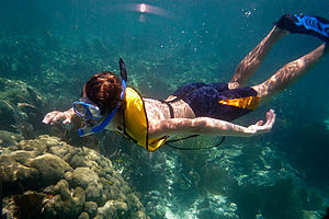 Tommy Snorkeling - AJGI had pretty much planned our trip South around John Pennekamp Coral Reef State Park. Herb had traveled there with a buddy right after high school graduation many, many years ago, and had raved about how great the snorkeling trip out to the reefs was. It was kind of cool that he was returning with our two sons who are older than he was on that first visit.
The park is pretty unique in that most of it is underwater, and it contains the only living coral reef in the continental U.S. There is also a campground and two small beaches to swim at, but the real action in this park is out at sea. They offer glass bottom boat, scuba diving, and snorkeling tours several times a day. This is what draws thousands to the park. It certainly isn’t the camping, because as far as campgrounds go, this one was pretty disappointing. Not only was it nowhere near the water, but the campsites were so small and tightly packed together that our neighbor actually asked us to turn out our little yellow light above our door because it was shining in his eyes when he was trying to sleep. I certainly hoped this guy didn’t snore. It was a good thing I had made reservations well in advance though, because, despite its less than appealing ambiance, it was totally full.
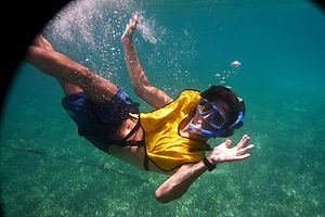 Andrew Snorkeling - TJGAlthough we arrived at the park pretty late in the afternoon because of our side trip to the Everglades, we didn’t feel like hanging around the campground, so we quickly donned our bathing suits, grabbed our snorkeling gear, and biked over to Cannon Beach, where the State Park had placed an authentic reconstruction of a Spanish wreck about 100 feet offshore. This was a perfect place for my first unofficial snorkeling lessons from the boys, whose goal was to prevent me from embarrassing them during the real thing the next day. They were very patient with me—I was starting to enjoy this role reversal thing—and I got the hang of it pretty quickly. We saw a few cannons and some little fishies, which was kind of cool and whet our appetites for seeing some real reefs.
The next day was our official snorkeling trip out to the coral reefs. I had also made this reservation quite a bit in advance, but I think if you just show up early enough on the day of the trip, you’ll probably get on one. The boats, which carry about 50 passengers, go out to different reefs each day, depending on the weather conditions. Fortunately, we had such a calm day that they were able to bring us out to Grecian Reef, which is supposed to be one of the better ones.
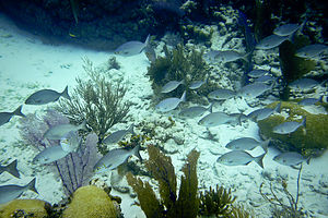 Small school of reef fish - TJGWhen we arrived at the reef, we were given some brief instructions on reef etiquette and how to call for help if needed. We were then each given a life jacket with a buoyancy compensator, which allowed us to blow into it when we wanted to float nearer the surface and let air out when we wanted to dive down. Finally, we were told to select a “buddy,” who we were supposed to stay with the entire time in the water. The boys quickly headed off into the water together, and Herb got stuck with me.
We were given about an hour to spend in the water, which actually gave us plenty of time to really explore the reef. Herb tried to trade me as a buddy about half way through, but the boys quickly swam away. We saw lots of good stuff: barracuda, angel fish, parrot fish, a spiny lobster, some very pretty jellyfish, and lots of other colorful fish that I don’t even know the names of. It was definitely a very cool experience, and I’m very glad that we did it.
However, when we got back from the boat trip, it was only 3:00 in the afternoon, and we really didn’t relish the thought of spending the rest of that afternoon and evening in the campground. There was so much more we wanted to see on the Keys that we decided to forfeit our camping fee for that night and start driving south. Someone at Gamble Rogers had told us that Curry Hammock State Park, about halfway down on the Keys, was very nice and right on the water, so we figured we’d give it a try.
Description
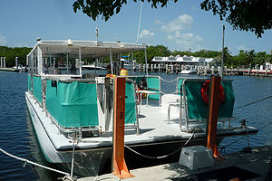 John Pennekamp Dive Boat - TJGJohn Pennekamp Coral Reef State Park is located in Key Largo at Mile Marker 102.5. The park is approximately 25 miles long and extends 3 miles into the Atlantic Ocean. Its 70 nautical square miles contains seagrass beds, mangrove swamps, and a portion of the only living coral reef in the continental U.S. The reefs contain nearly 600 varieties of fish and 40 different species of coral. It is one of the best places to dive and snorkel in Florida.
Activities in the park include:
- Glass bottom boat tours –2 ½ hour tour (3 daily) to the coral reefs
- Snorkel tours – 1 ½ hour tours (3 daily) to the coral reefs
- Scuba diving – two-location, two-tank tours twice a day
- Canoe, kayak, and paddle boat rentals – explore the mangrove wilderness along 2 ½ miles of marked trails
- Swimming/snorkeling at Cannon Beach – remnants of an early Spanish shipwreck approximately 100 feet offshore
The park contains a 47-site campground.
Everglades National Park
Tuesday, August 11, 2009 - 11:30am by Lolo320 miles and 6 hours from our last stop
Travelogue
 Anhinga Trail hikers with storm cloudsI admit to feeling some degree of guilt for not giving this park the justice it deserves, but we just didn’t have the time. We already had a lot of driving to do that day to get to our reserved campsite at John Pennekamp, so stopping here was a bit forced. However, we felt we couldn’t come so close and not at least stop for a quick visit.
I think the real way to see the Everglades would be to go on a boat tour or rent a kayak and actually get out into the mangrove estuaries, but since we didn’t have time we had to settle for a Visitor Center and two short boardwalk trails.
We entered the park through the east entrance near Florida City and drove four miles to the Royal Palm Visitor Center. At the Visitor Center we did see a really wonderful film which let us vicariously tag along with a young women snorkeling through the incredible underwater wonders of the Everglades. The photography was beautiful. If we left it at that, I think we would have come away with a positive feeling about the Everglades. Instead we wandered out of the cool, bug-free Visitor Center to take on the two obligatory boardwalk trails: the Anhinga and the Gumbo Limbo. It was hot, humid, buggy, and alligator-free. We all got cranky, except for Andrew who found the Gumbo Limbo tree forest to be quite peaceful and fascinating. It’s good to know that our tuition dollars towards his Environmental Studies classes at college are having some impact.
Since visiting the Everglades, I have watched the Ken Burns documentary on the National Parks and the wonderful section he had on the struggle to save the Everglades because of its ecological uniqueness. I know it’s an amazing place, but no matter how hard I try, I still think its wonders are better viewed from the comfort of my living room couch or national park visitor center auditorium rather than the reality of its humidity and bugginess.
Description
 Family hiking Gumbo Limbo TrailEverglades National Park is the 3rd largest national park in the lower 48 states, encompassing over 2500 square miles of subtropical wilderness. The park is located at the southern tip of Florida and extends from Florida Bay to Lake Okeechobee.
Unlike what most people think, it is not a swamp, but rather a 50-mile shallow river of grass that gradually flows into Florida Bay and the Gulf of Mexico. Along its 80-mile course, it drops a mere 15 feet, but just enough to keep it from becoming a swamp.
The park’s miles and miles of saw-grass prairie, junglelike hammock, and mangrove swamp make it truly unique. It is the only place of its kind in the United States. Thankfully, some forward-thinking people in the first half of the 20th century recognized its ecological value and saved it from development. It was designated a national park in 1947. Unlike other parks that were established to protect scenery, the Everglades was created to preserve an ecosystem as a wildlife habitat.
The park’s unique mix of tropical and temperate plants and animals, including over 700 plant and 300 bird species, as well as the endangered crocodile, manatee, and Florida panther, has earned it world recognition as a World Heritage Site, an International Biosphere Reserve, and a Wetland of International Importance. It is the only place in the world where alligators and crocodiles live together.
The best way to visit the park is to make the 76 miles round trip from the park entrance near Florida City to Flamingo on Florida Bay, making stops along the way to hike along the park’s boardwalk trails.
At the Royal Palm Visitor Center, just 4 miles into the park, there are two boardwalk trails:
- Anhinga Trail - a .8-mile loop offering the best opportunities to view wildlife, including alligators and birds, up close
- Gumbo Limbo Trail – a .4-mile loop through a dense tropical hardwood hammock of Gumbo Limbo trees
Other stops along the road to Flamingo include:
- Pinelands Trail -.4-mile loop through a subtropical pine forest
- Pa-hay-okee Overlook - .2-mile boardwalk to an observation deck offering a view of a vast saw-grass prairie
- Mahogany Hammock Trail - .4-mile boardwalk through a dense, jungle-like hardwood hammock
- West Lake—.4-mile boardwalk through a mangrove forest
At Flamingo, there are a variety of recreational opportunities:
- Boat tours into Florida Bay and the mangrove estuary
- Canoeing/kayaking on the Nine Mile Pond Trail or into Florida Bay
- Wildlife viewing – birds, alligators and crocodiles
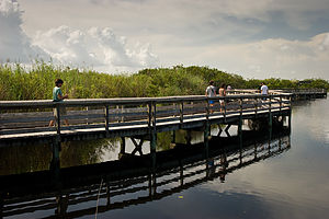 Family hiking Anhinga TrailAnother way to see the park is to drive the 50 miles (one way) Tamiami Trail (Highway 41) along the park’s northern border. The Shark Valley Visitor Center has several short boardwalk trails as well as a 15-mile loop road accessible only on foot, bike, or on a 2-hour narrated tram ride. The Shark Valley Tram Tour provides an introduction to the freshwater Everglades as well as opportunities to view wildlife, such as alligators.
Back on the road, the Tamiami Trail veers northward into Big Cypress National Preserve, which is part of the Everglades ecosystem. At Highway 28, turn south to get to Everglades City where there are boat tours into the mangrove estuary and Ten Thousand Islands. There are also canoe and kayak rentals.
Gamble Rogers State Park
Sunday, August 9, 2009 - 2:30pm by Lolo214 miles and 3.75 hours from our last stop - 2 night stay
Travelogue
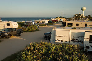 Campground View from Lazy Daze roofWhen we left Savannah on Sunday afternoon, we had no idea where we would be staying that night. It was one of the rare “wing it” parts of my itinerary. However, being the obsessive compulsive trip planner that I am, I had mapped out a list of Georgia and Florida state parks en route from Savannah to John Pennekamp State Park (our next scheduled stop), complete with park descriptions and mileage from Savannah, just so I would be prepared for that inevitable question, “Where are we staying tonight?” I had choices ranging from 20 miles to 400 miles. I was ready.
However, the list was made before I realized that the only criteria I wanted in a state park was easy beach access—not fishing, birding, historical sites, or pristine walks through marshes—just someplace to cool off. After some phone calls to the parks themselves I found out that there was really only one on my list that had a campground right on the beach, and that was Gamble Rogers Memorial State Recreation Area at Flagler Beach. Two problems: it was 215 miles from Savannah (a bit more driving than we had planned for the day), and there were only two campsites left and they couldn’t be reserved on the same day. So it became an anxious drive with me calling the poor park ranger every half hour, asking him “Is there still a campsite for tonight?”
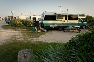 Campsite #8When we finally got there, Herb let me out at the campground gate to try to find out where to check in while he drove into the day-use section of the park on the other side of the road (Highway A1A) to turn around. Well, that turned out to be where the Camper Check-In office was, so Herb wound up going in to inquire about availability rather than me. Herb said it was pretty funny because he could see that the ranger looked a little uncomfortable at the thought of giving away what was now the last campsite to someone other than the crazy lady that had been calling him repeatedly on the phone for the last few hours. He relaxed a bit when Herb told him that his wife had called him several times about a campsite.
The campground really did have a great location, nestled between the Atlantic Ocean on one side and the Intracoastal Waterway on the other, with Highway A1A running in between. The campground was on the ocean side, with 17 campsites directly on the ocean and another 17 across from them. Unfortunately, we didn’t get one of the ones directly on the ocean, but it was still really close to go down to the beach. Meanwhile, on the other side of highway there were nature trails that the boys could go for a run on.
Since it was already close to 7:00 when we arrived, the boys immediately went off for a run, while Herb and I grabbed two glasses of wine and headed down to the beach to hang out until they returned. When they came back they were in great spirits, nothing like the cranky runners of Hunting Island. They said the trails were great and running in the evening was definitely “the ticket.” When they’re happy, I’m happy, so the next morning I went over to the office first thing and booked another night. It would leave us a lot of driving on the following day to get to John Pennekamp State Park, but I know a good thing when I see it, and this place was going to be just what we needed.
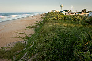 View of beach from campground bluffWe spent the entire next day at the beach, playing in the surf. The waves were much bigger than the kind I really like, because I am a bit of a weenie when it comes to ocean swimming. Usually I’m afraid to go out too far, so I stand waist-deep, looking enviously at everyone else playfully bobbing up and down beyond the break, while getting hammered in the face by these very same waves as they broke right on top of me. The boys, who are really sweet and felt badly that I was missing out on the fun, decided to take me on as their special project and give me some remedial lessons in dealing with the surf.
They introduced me to a game, which I’m sure they just made up, called “washing machine.” The rules were quite simple. The three of us—with me in the middle so I couldn’t escape—sat down in a spot where the water came up to our shoulders. Then we waited, with me clamping my nose shut, for a wave to wash over us and toss us about like laundry in a washing machine. I never had so much fun as I was flipped upside down, sideways, and every which way. Once I had rid myself of some of the fear of what a wave could do to me, they brought me out beyond the breakers, showing me along the way how to just go under a wave if it was about to break on top of me. They were quite proud of my progress.
That day was a total role reversal. As they lay on the beach trying to relax and read, I kept pestering them to come in the water and play “washing machine” with me.
Description
Gamble Rogers is located along Highway A1A in Flagler Beach, nestled between the Atlantic Ocean and the Intracoastal Waterway. The ocean side of the park has a 34-site campground overlooking the Atlantic, with a short walk along a boardwalk to the beach. The Intracoastal Waterway side has a nature trail through a coastal forest of scrub oaks and saw palmettos, a boat ramp, and picnic pavilions along the waterway.
The park is named for Florida folk singer Gamble Rogers who died while attempting to save a drowning man.
Savannah
Sunday, August 9, 2009 - 8:00am by Lolo61 miles and 1.25 hours from our last stop
Travelogue
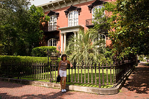 Lolo with Mercer HouseHerb is not a big fan of visiting cities in the RV, so I was very diligent in my planning so as to avoid any possibility of a cranky attack triggered by my navigating him down a narrow cobblestone street, as I once did to him in Salem, Massachusetts. Therefore, prior to our leaving home I confirmed with the Savannah Visitor Center that there was ample room in their parking lot for a motorhome and that it would be a feasible starting point for a bike tour of the city. Unfortunately, I couldn’t avoid the cranky attacks of the boys resulting from my making them bicycle around a city with temperatures in the 90s and about 100% humidity.
The visitor center supplied us with a map of the Historic District and a recommendation as to the best route by bike. I was glad to discover that Savannah was actually quite bike-friendly, which is not often the case in cities. We got to see more than half of the 24 famous squares and also spent some time by the fountain in Forsyth Park. Since I had spent a good portion of my beach time at Hunting Island cramming for our visit to Savannah by reading Midnight in the Garden of Good and Evil, I was pretty anxious to see some of the sites from the book. It makes a visit to a city so much more interesting when you come to intimately know it. Herb and the boys were not nearly as enthusiastic as I was when standing in front of the Mercer House on Bull Street, the scene of the infamous murder in the book.
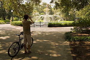 Tom photographing Forsyth Park fountainWe continued our bike tour towards the Riverfront area along the Savannah River. When we got near the river, we had to lug our bikes down a steep set of stairs near Emmet Park. Here we encountered the famous “Waving Girl” statue, which was made to honor a woman named Florence Martus. Legend has it that this woman never missed waving at a passing ship—with a cloth by day and a lantern by night—for the more than forty years between 1887 and 1931. It is said that she wanted to be the first to greet her husband when he returned to port. I find this hard to believe, but romantic none the less. I think I would have given up on Herb after 30 years of being late.
Since River Street is one-way running west to east, and Emmet Park is on the east end, we had to walk our bikes along the Riverfront. A better approach would have been to come in from Factors Walk. However, the bumpy cobblestone streets and the crowds would have made it difficult to ride anyway. The Riverfront was definitely the happening place in Savannah. The parks and squares we had visited earlier had been pretty quiet, as it was a Sunday, but there were plenty of people down by the river where old cotton warehouses had been converted to nice restaurants, shops, and art galleries.
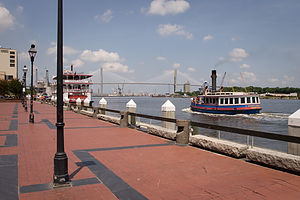 Savannah waterfrontOne of those nice air-conditioned restaurants was exactly what we had in mind about then, so after consulting our Frommer’s guide, we joined the line outside Huey’s in the River Street Inn to put our names on the list to enjoy its highly coveted Sunday brunch. The ½-hour wait was well worth it. The choice of southern-style omelettes was extensive and we each tried something fairly adventurous. The food was delicious.
After lunch we strolled along River Street peering into its many shops and galleries. One window in particular caught Tommy’s eye: the Savannah Candy Kitchen where gooey confections were being manufactured right before his very eyes, and his very sweet tooth. The rest of us were so full from brunch that we couldn’t understand how he could possibly even consider candy at this time, but he has been known to be hungry again within minutes of finishing a meal. Herb and Andrew just couldn’t face it, so I accompanied him into the store. He was like a kid in a candy shop—literally and figuratively. The store was huge and really did have some tempting items for a chocoholic like myself. Tommy is much more into sweeter things, so he finally settled on a large candy apple.
Andrew does not deal well with the heat and was getting pretty annoyed waiting for Tommy as he lingered over his sticky apple. I suggested continuing our bike tour to see more of the city, but was overridden. The consensus was to go back to the RV and get to a beach as quickly as possible.
Description
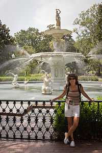 Lolo with Forsyth Park fountainThe city of Savannah is located 18 miles inland on the Savannah River at the South Carolina border.
Savannah was Georgia’s first settlement and became its colonial capital. It was founded in 1733 by James Oglethorpe who designed the city on a grid plan in which every other street had a scenic 1-acre square. There are 24 squares in total.
Today the city is considered one of America’s top 10 tourist cities. That might not have been the case if it hadn’t been for seven Savannah women who banded together in the 1950s to stop the demolition of historic buildings. They formed the Historic Savannah Foundation and began a program of purchasing historical buildings and reselling them to private owners who promised to restore them. As a result of their efforts, more than 800 of Savannah’s 1,100 historic buildings have been restored, and 2 ½ square miles of the old city have been designated a National Historic Landmark District.
The Historic District is the main draw for visitors to the city. One of the most popular areas is the Riverfront. This part of the city was once lined with cotton warehouses, but a massive urban renewal project in the 1970s converted it to a row of restaurants, bars, shops, and art galleries.
A good place to begin a visit to Savannah is the Savannah Visitor Center located at 301 Martin Luther King, Jr. Blvd.
Hunting Island State Park
Friday, August 7, 2009 - 10:15am by Lolo186 miles and 4 hours from our last stop - 2 night stay
Travelogue
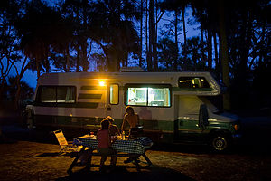 Campsite under palms at duskI know this trip was supposed to be an exploration of new places, but we just couldn’t resist going back to Hunting Island, an old favorite of ours from the days when spring breaks were not consumed by track meets. Besides, the last time we were there the boys were 11 and 13, so I am going to stretch it a bit and count their going back as 18 and 20 year olds as a totally new experience.
Hunting Island is a pretty unique place. The entire 5-mile barrier island is a state park. That means no commercialization of any sort—just pristine beaches, miles of mountain biking trails through maritime forests, boardwalks through the salt marshes, a fishing pier, and even an historic lighthouse to climb. In other words, it’s pretty close to paradise for those that prefer natural untouched beauty to fancy resorts and spas.
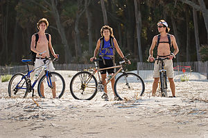 Lolo & Boys getting ready to bike on beachThe campground is probably one of my all-time favorites. It’s situated right next to the beach, which is a rarity in most state parks, and gets plenty of shade from the palmetto trees. There is always a nice sea breeze and you can hear the surf from your campsite. This year we were fortunate enough to get one of the campsites just a mere 20 yards from the beach.
The beach is pretty unique as well, especially for someone coming from New Jersey. The waves are not huge, but rather the kind that seem to roll in forever, making it perfect for boogie boarding. We came very close to not packing the boogie boards at all this year. Andrew said we wouldn’t need them—I guess he thought he was too old—and Herb is always in favor of packing less. Tommy and I chose fun over practicality and packed them anyway. My feeling is that you are never too old to boogie board and I will continue to do so until I become too much of a spectacle—the boys think I’m almost there. I made Andrew suffer for awhile waiting for his chance to use the boogie board, only giving it up when he admitted that “Mom is always right.”
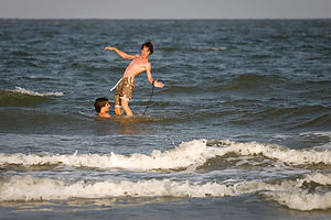 Boys goofing on boogie boardAnother unique feature of this beach is that the sand is hard enough to ride bikes on, which is really a wonderful thing. Also, there are so many fallen palmetto trees on the beach from past storms that it’s kind of fun to weave in and out of them while trying to avoid the surf.
The amount of driftwood on the beach has definitely increased over the years, but I kind of like it. It adds a lot of visual texture. It also provides some privacy if you don’t want the entire beach to see what you’re doing—no not that, I mean exercising. Herb and the boys have been doing this abdominal workout program to give themselves “six packs” and didn’t want vacation to get in the way. So, they settled between two fallen palmettos and went to work. I, however, remained in my beach chair, greatly amused at the occasional sight of their six legs rising and falling in unison above the driftwood. They looked a bit like some giant six-legged crustacean that had been left behind by the tide.
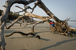 Andrew biking under tree on beachThe next best thing after beaching and swimming on Hunting Island is mountain biking along its wonderful trails. Herb and the boys really wanted to photograph the driftwood on the beach when the sun got low, so we decided to bike the trail through the forest on our way out and then ride back along the beach. The forest trail starts right near the entrance to the campground and winds its way through a forest of oaks, pines, and palmettos. It’s really lots of fun, weaving between trees and jumping over roots. After about 2 miles we came out to the parking lot by the Visitor Center and said hello to the same lonely alligator that’s been the sole occupant of the little swamp outside the center since we started coming here 9 years ago. He appears to be aging well.
From there rather than continue through the forest, we decided to go out to the main road that crosses the island so that we could explore the salt marshes on the west side. I must say that I wasn’t very comfortable riding along the narrow shoulder of the road with cars whizzing past at 60 mph. I definitely wouldn’t recommend this route for families with small children. The salt marshes were nice though and we rode our bikes, probably against state park regulations, out across a long boardwalk to a viewing platform quite a ways out on the marsh. From there we continued on the road to the fishing pier on the southern tip of the island.
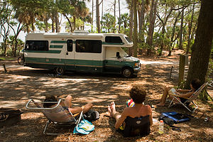 Hunting Island Campsite with Lazy DazeThe best part of the bike ride was the ride back on the beach in the low light. I had always known that there were a few rental cabins on the south end of the island, but I had never seen them before. I admit I was quite surprised to see in what bad condition they were. The cabins closer to the water stood on stilts, but despite this precaution were pretty damaged from storms, and several of them were roped off and not currently in use. Hopefully, they will be repaired because their location is truly stunning. In the meantime, they do make great photographic subjects, as does the driftwood that covers much of this section of the beach.
On the way back to the campground along the beach, we had to do some fancy maneuvering to get through the fallen trees which the surf was now reaching, but except for wet tires we managed just fine.
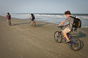 Family biking along shorelineComing back to Hunting Island had been a wonderful experience for us, bringing back some old memories while creating some new ones as well. The only possible negative I have to say about our visit to Hunting Island was the boys’ crankiness about running in the heat and humidity. I knew this trip South would be a problem for their summer training, but I figured that after running here, it would feel really good to run in New England when they got back to school—kind of like when someone’s hitting you in the head, it feels so good when they stop. I don’t think they shared my enthusiasm for this logic. It took us awhile to figure out the running thing. Knowing running mid-day would be unbearable, they decided to run in the mornings. However, their definition of morning was 9:00 pr 10:00, which was already too late. You really had to be out there by 7:00 while the sun was still low. Finally, by the time we hit Florida, they figured out that the sun was also low at 7:00 pm, so they switched their schedule to nighttime. This worked out much better except for the fact that we didn’t have dinner until almost 9:00 every night. So let’s just say, that despite the beautiful trails through the maritime forests, they do not have particularly fond memories of their runs at Hunting Island. Everything else, however, was just great.
Description
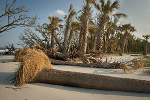 Beach erosion with fallen palmettosHunting Island State Park is located on a 3-mile barrier island just east of Beaufort, South Carolina. It offers one of the most tropical settings to be found on the entire South Carolina coast. This 5000-acre park contains 3 miles of pristine sandy beaches along the Atlantic shoreline, salt marshes, a lagoon, and a dense forest of oak, bayberry, and palmetto. Storms have eroded much of the shoreline, bringing the lush forests closer to the sea.
A good place to begin a trip to the island is at the Visitor Center, which has exhibits on the cultural history of the island, its beach habitats, and the historic lighthouse. Right across from the Visitor Center is a small swamp where you are very likely to spot an alligator or two.
Another interesting stop is the historic Hunting Island lighthouse, the only lighthouse in South Carolina open to the public. For a $2 fee, you can climb its 167 spiral steps for a tremendous view of the Atlantic Ocean and the surrounding marshes. A unique feature of this lighthouse is that it was constructed of cast iron and designed to be dismantled and moved in case of erosion. In 1889, the lighthouse was moved 1 ¼ miles inland to its current location. The lighthouse was in operation until 1933.
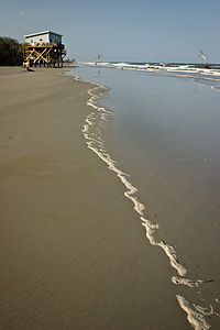 Rental cabin on stiltsFrom the lighthouse, it is a short walk to the beach where there are picnic shelters, restrooms, and a concessionaire. The beaches of Hunting Island are nesting grounds for Loggerhead turtles. Around mid-May, Loggerheads come up on the beach, dig a hole, and lay about 100 – 160 eggs each before returning to the sea. At night, Hunting Island personnel comb the beach for new nests and bring the eggs back to a hatching facility, safe from predators. After hatching, they are released to the sea.
The western part of the island contains the salt marshes, which many people believe to be the most beautiful part of the island. The Hunting Island marsh boardwalk extends across the marsh to a small island with a magnificent platform for observing the wildlife. The wildlife and the beautiful sunsets make this a lovely place to come in the evenings.
On the south end of the island, the beach is sandwiched between the ocean and a long inlet lagoon. The lagoon is home to hundreds of birds and other wildlife species—deer, raccoons, blue herons, egrets, pelicans, sand pipers, etc. It is also a great spot to crab or to fish for trout, bass, and puppy drum. The jungle-like setting of the lagoon was the filming site for the battle scenes in “Forrest Gump.”
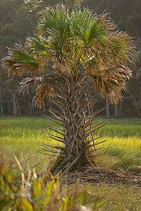 Palmetto Palm TreeNear the lagoon is a 2.3 mile nature trail (good for hiking or biking) that meanders through the maritime forest and along the lagoon.
On the very southern tip of the island is a fishing pier which extends 1,120 feet out into Fripp Inlet. Fishing from the pier is excellent for drum, shark, whiting, trout, and bass. Next to the pier is a Nature Center with exhibits on the local marine life. There are saltwater tanks with live snakes, turtles, and other reptiles.
On the northern tip of the island is a 200-site beachfront campground nestled amidst the palmettos. Each campsite has water and electric.
The island is totally explorable by bike. In addition to the 8 miles of trails, the sand on the beach is hard enough to ride on. From the campground, there is a 1-mile bumpy, dirt trail through a semi-tropical forest to the Visitor Center. From there, a trail continues south along the lagoon and eventually out to the fishing pier.
Flying J - Latta
Thursday, August 6, 2009 - 6:00pm by Lolo641 miles and 12 hours from our last stop - 1 night stay
Travelogue
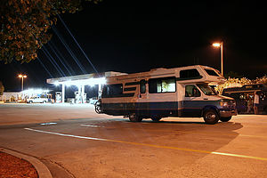 Lazy Daze Camping in Flying JI read once that smell triggers more memories than any other sense. We’ve all been transported back to our grandmas’ kitchens with the mere whiff of an apple pie baking in an oven or to days on the seashore as a kid with the first waft of salt air near the Jersey shore. Less common perhaps is my reaction to noxious fumes of diesel fuel. No matter how old I get, I am sure that a whiff of diesel and the rumble of an 18-wheeler’s generator will make me smile, because for at least a moment I will be transported back to my trusty little motorhome on its first night out on a road trip.
Our trips very often start out with a first night stay at a Flying J Travel Plaza. They’re perfect for long driving days where all you need is a safe place to sleep after a long day of driving—and they’re free. This particular Flying J in Latte, South Carolina, is one that we have often stayed at on our trips South during spring break when the kids were younger. It’s about 12 hours from our home in New Jersey, which is a long enough driving day for me, and it positions us near enough to the fabulous South Carolina coastline, so that we can arrive at our destination—in this case Hunting Island State Park—early enough to enjoy a full day.
One thing we didn’t consider in our planning, however, was that a steamy August night in a truck stop (without electrical hookup) is a lot less inviting than our previous experiences on April nights. We did manage to get through, but it did get me questioning again the wisdom of heading South in August.
Description
Flying J's are Travel Plazas that cater to truckers and RV's. Their numerous services include gas, dump station, propane, fast food restaurant, limited groceries, and even showers and a barber shop. However, the best feature of all is the section for overnight RV parking.
They are conveniently located on most of the interstates (except for the northeast).
