- Home
- About
- Map
- Trips
- Bringing Boat West
- Migration West
- Solo Motorcycle Ride
- Final Family XC Trip
- Colorado Rockies
- Graduates' XC Trip
- Yosemite & Nevada
- Colorado & Utah
- Best of Utah
- Southern Loop
- Pacific Northwest
- Northern Loop
- Los Angeles to NYC
- East Coast Trips
- 1 Week in Quebec
- Southeast Coast
- NH Backpacking
- Martha's Vineyard
- Canadian Maritimes
- Ocracoke Island
- Edisto Island
- First Landing '02
- Hunting Island '02
- Stowe in Winter
- Hunting Island '01
- Lake Placid
- Chesapeake
- Provincetown
- Hunting Island '00
- Acadia in Winter
- Boston Suburbs
- Niagara Falls
- First Landing '99
- Cape Hatteras
- West Coast Trips
- Utah Off-Roading
- Maui
- Mojave 4WD Course
- Colorado River Rafting
- Bishop & Death Valley
- Kauai
- Yosemite Fall
- Utah Off-Road
- Lost Coast
- Yosemite Valley
- Arizona and New Mexico
- Pescadero & Capitola
- Bishop & Death Valley
- San Diego, Anza Borrego, Joshua Tree
- Carmel
- Death Valley in Fall
- Yosemite in the Fall
- Pacific Northwest
- Utah Off-Roading
- Southern CA Deserts
- Yosemite & Covid
- Lake Powell Covid
- Eastern Sierra & Covid
- Bishop & Death Valley
- Central & SE Oregon
- Mojave Road
- Eastern Sierra
- Trinity Alps
- Tuolumne Meadows
- Lake Powell Boating
- Eastern Sierra
- Yosemite Winter
- Hawaii
- 4WD Eastern Sierra
- 4WD Death Valley +
- Southern CA Deserts
- Christmas in Tahoe
- Yosemite & Pinnacles
- Totality
- Yosemite & Sierra
- Yosemite Christmas
- Yosemite, San Diego
- Yosemite & North CA
- Seattle to Sierra
- Southwest Deserts
- Yosemite & Sierra
- Pacific Northwest
- Yosemite & South CA
- Pacific Northwest
- Northern California
- Southern Alaska
- Vancouver Island
- International Trips
- Index
- Tips
- Books
- Photos/Videos
- Search
- Contact
Yosemite National Park
Monday, November 24, 2014 - 12:15pm by Lolo242 miles and 5 hours from our last stop - 7 night stay
Travelogue
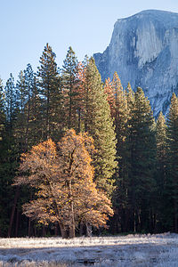 Half Dome with Frosty MeadowWe were back for the Gaidus second annual Thanksgiving in Yosemite!! Last year had been so much fun, that we decided to try it again, but this time we would be having our turkey in the elegant Ahwahnee Dining Room rather than the Yosemite Lodge Mountain Room. Don’t get me wrong – the Mountain Room had been great, but there is just nothing like the Ahwahnee.
Being a veteran of Yosemite Thanksgivings, I made sure I nabbed an Upper Pines campsite as soon as the November booking window became available. Upper Pines is the only campground open all year round, so although there are less people visiting the park in November, there are also less campsites. I booked it for the Tuesday before Thanksgiving through Sunday night, which would give me and Herb a little extra time around the boys stay with us.
Rather than wait until Tuesday, however, Herb suggested that we drive out a day earlier – the more time in Yosemite the better. We just assumed that there would be an available campsite in Upper Pines, thinking that people would be coming in for the holiday later in the week, and that at the very least, our campsite would be empty.
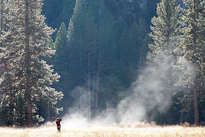 Lolo Photographing Meadow MistWe arrived in Yosemite past the time when anyone is manning the campground booth, so we drove in, saw that our campsite was indeed empty, and settled in. After dinner, we watched a movie and then turned in early.
We were fast asleep when around 10:00 there was a knock on our door. It was two guys saying that we were in their campsite. Deep down, I was kind of afraid this would happen, but when 10:00 came around, I thought for sure that no one would show up anymore. After all, we had the campsite booked for the next day.
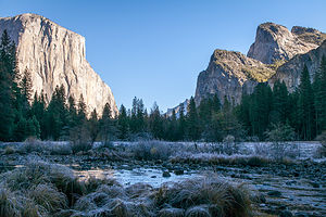 El Capitan in Morning LightThey were nice enough about the misunderstanding, and Herb and I quickly got our jackets on and got ready to move the RV and the car. The problem was, we weren’t sure just where we were going to move it to. Fortunately, a ranger that was driving through the campground saw the commotion and stopped to inquire what was going on. When we told him, he went back to the kiosk and returned with a list of campsites that were empty that night. We thanked him profusely and drove around until we found one on the list that we could comfortably fit into.
The next morning we awoke to sunny skies, but very chilly temperatures. Originally, we were planning to bike ride around the valley, but it was so cold that we decided to drive around in the car instead.
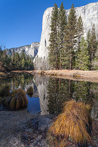 El Capitan Picnic AreaHerb had bought a book entitled “The Photographers’s Guide to Yosemite,” which very specifically details geographical locations, as well as the time of year and time of day, for taking incredible photographs. Many of the locations in the book we already knew about, but there were also several that we did not. We decided to spend the day finding each of the book’s photography hotspots in the Valley, even though we might be hitting them during the wrong season or time of day. At the very least, it would be research for our future trips to Yosemite.
The cold was good for something. I had never seen the Valley so pristinely beautiful, with frost on the meadow grass and steam rising from its floor. It was absolutely breathtaking.
Herb was right. It was nice getting here a day early and just quietly enjoying the beauty of this incredible place, because when the boys arrived, we knew that the pace would pick up significantly.
Tommy flew in from Seattle and arrived in San Francisco around 9:30 Tuesday night. Despite our suggestion that they wait to drive out to Yosemite Wednesday morning, Andrew picked Tommy up at the airport and they just drove, arriving at our campsite around 2:30 in the morning. Vacation is very precious to them now that they are working, so they wanted to make sure that they had a full day Wednesday to climb. Ah…to be young.
Rock Climbing at Swan Slab and Sunnyside Bench and the Ahwahnee Great Lounge
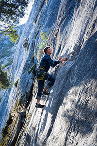 Tom Climbing - LEGBecause of our trip here last Thanksgiving and then again in August, we were much more familiar with climbing areas in the Valley. However, in August, we were looking for walls that were in the shade because the sun heated up the rock too much, but now we wanted the exact opposite.
We began our first day of climbing in Yosemite at Swan Slab, a popular climbing area on the north side of the Valley, between Camp 4 and Lower Yosemite Falls. It’s one of my favorite spots, because the approach is easy and the base area is great for spectators, of which there are usually many. There is even a bench to sit on. Also, if I get bored watching, I can just set off from there on a Valley run.
Tommy led a 5.9 climb called Grant’s Crack and set up a top rope for Herb and Andrew. They could also do some 5.10 climbs from the same top rope. After coming down from his lead, Tommy insisted on setting a top rope up on something that I could do. I said my usual, “Don’t worry about me, I don’t have to climb,” which I repeat so often that they threatened to have a t-shirt printed for me with that on it. It’s become sort of a family joke, but sometimes I mean it. I can’t climb the routes they do, so I don’t want them to have to go out of their way to find something for me, and also, sometimes I am just plain scared. I love gym climbing, but am still somewhat intimidated on read rock. Anyway, I am glad that they never take my whining seriously and push me to climb, because I have really improved a lot and am no longer just an amusing anecdote. I mean I was occasionally getting a 5.7 or 5.8 outdoors.
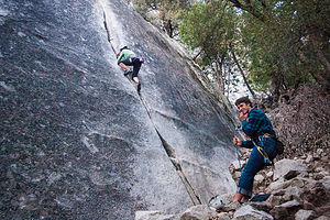 Lolo Climbing - AJGWhile we were at Swan Slab, there was this guy that was just running up the rock on some difficult routes without any rope – known as soloing in the climbing world. Quite honestly, he was making me a little nervous. We talked with him a bit afterwards. His name was Charlie and he had been climbing so many times in Yosemite that he knew most of the routes inside and out. He said that he had done the one he was soloing up literally over 100 times, so while it looked really scary for us, for him it was just like a walk in the park. He was about Herb and my age and had been part of the Yosemite climbing scene since the late 70s. He personally knew and had climbed with many of the Valley’s climbing legends.
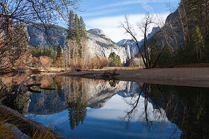 Merced River with North and Half DomesCharlie took a liking to us and volunteered to bring us to another climbing area that we had never been to before – Sunnyside Bench, just a little ways to the right of Lower Yosemite Falls. Tommy led a 5.9 climb called Jamcrack and set up a top rope for Herb and Andrew to follow. From this top rope they were also able to do another 5.10c and 5.10d climb. While this was going on, Charlie was doing it again – scampering up the rock like it was nothing. We finally volunteered to belay him – meaning that he could actually climb with a rope to catch him in case he fell, and he happily accepted. The really funny thing was that he said that being on a rope scared him. I’m not sure I get this guy.
Having Charlie along was like having your own personal Yosemite climbing guide. He knew everything about this place. He asked us if we wanted to meet him to climb the next day, so he could show us some more climbing areas that we hadn’t been to. We would have loved to, but tomorrow was Thanksgiving and we had a big date with the Ahwahnee. We didn’t tell him that we were eating at the Ahwahnee because we didn’t want to sound pretentious.
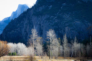 November Birches with Half DomeI felt kind of bad that he didn’t even realize it was Thanksgiving, but he explained that his wife had to work, so he thought he would get away a few days to do some climbing. Okay, that didn’t sound as bad.
He told us that he would probably just solo Royal Arches tomorrow, which just so happens to be the view outside the Ahwahnee Dining Room windows. Charlie and his soloing make me very nervous, so I kind of hoped we wouldn’t ruin our dinner by falling.
That night, rather than hang out in the somewhat chilly motorhome – Herb was trying to conserve propane since our generator wasn’t working – we drove over to the Ahwahnee with our kindles and a deck of cards and settled into a cozy evening in the Great Lounge. Although the Great Lounge is huge, there are so many nooks and crannies and side rooms that we were able to find our own private cozy spot.
Valley Floor Loop, Thanksgiving Dinner, Ice Skating, and Ahwahnee Great Lounge
 Lolo and Boys Enjoying El CapitanOur Thanksgiving Dinner reservation was for 2:00, so there was plenty of time for some pre-feast exercise. We had two bikes along, so we decided that we would do part of the Valley Floor loop – Herb and I on bikes, and Andrew and Tommy in running sneakers.
It was a really brisk morning – the kind that really makes you feel alive. Rather than ride along the road, we followed the dirt paths whenever possible, passing through lovely pristine meadows and along the Merced River. It was very invigorating.
Having worked up a hearty appetite for our feast, we headed over to the Ahwahnee Hotel, a little bit early so we could relax in the lounge first. Originally, I had wanted to make our dinner reservation for 4:00, but the only slot I could get was 2:00. In retrospect I’m glad I wasn’t able to change it, because it gets dark by 4:00 in the Valley, and we wouldn’t have had the spectacular views out the dining room windows. How would I have looked for Charlie?
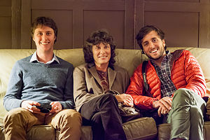 Lolo and Boys before Thanksgiving DinnerAs I have mentioned in previous posts, the Ahwahnee Dining Room, with its 34-foot-high beamed ceilings, granite pillars, chandeliers, and floor-to-ceiling windows, is the perfect venue for a memorable dining experience.
With a setting like this, the food just had to be good enough to do it justice, but that was incredible too. The first course was pickled vegetables and freshly baked bread, followed by butternut squash soup and then salad. I was already full. We were going to have to pace ourselves. Then came the dinner itself – a huge portion of local organic turkey and the usual accompaniments of stuffing, mashed potatoes, gravy, and glazed carrots. Tommy, as he often does, ate only half his meal and had the rest wrapped up for later. Andrew, as he often does, went with much gusto for the whole meal at once. I think Tommy was the wiser man, because Andrew looked like he was going to be sick. He could not even think of participating in one of the delicious deserts, but instead had a slice of pumpkin pie wrapped up for later.
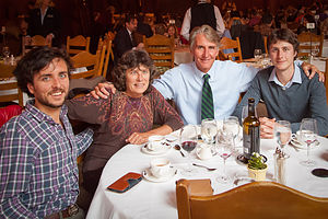 Family at Ahwahnee Thanksgiving DinnerWe walked our dinner off a bit around the lovely grounds afterwards, peering up at Royal Arches to see if by any chance Charlie was up there, but no sighting. Good thing, because it was already getting dark. At this time of year, sunset is so early, but because of the high walls of the Valley, darkness comes even earlier.
To continue our Yosemite Thanksgiving tradition, which is now on its second year, we went back to the motorhome, changed into warm clothing and headed over to the Curry Village ice skating rink. Last year when we had done this, it had been my first time on skates in over 10 years, so I was a lot more confident this time than last.
 Herb Skates TooThe rink wasn’t that crowded, probably because a lot of people were having their Thanksgiving dinners or napping afterwards. We spent a good hour and a half careening around the rink. I had skated a lot when I was a kid, and if I must say so myself, I was pretty decent. While not quite as agile as then, I was still able to impress the boys by skating backwards while doing crossovers, with the occasional spin mixed in. It was so much fun!
The fun wasn’t over yet though. Not only did Tommy get to eat the rest of his delicious Thanksgiving dinner back in the RV in front of us, but we still had three more fun-filled days ahead of us in the Valley.
Rock Climbing on Manure Buttress Pile and Ahwahnee Great Lounge
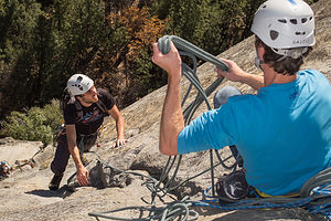 Andrew and Tommy on NutcrackerFor today’s adventure, the boys wanted to take on a multi-pitch climb, which is a bit more involved than top-roping and requires more experience and skill. Unlike top rope climbing, where a climber climbs up and sets the rope through an anchor and then comes down, in a multi pitch climb, the leader climbs up to a belay station (usually a ledge), anchors himself in, and then belays the other climbers up from there. Then the process is repeated up to the next belay station and so one, for the number of pitches in the climb.
Tommy is quite experienced in multi-pitch climbing and Herb is as well, although his experience dates back a few decades. However, both in Yosemite last August and then again a few weeks back in Red Rock Canyon, they had successfully completed several multi-pitch climbs together.
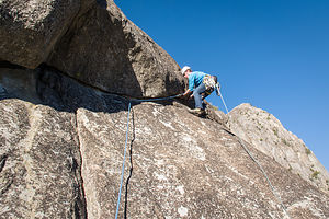 Tommy's Turn to Lead NutcrackerMulti-pitch climbs are more exciting, because you climb hundreds of feet up on the wall and get to look down out over the vast expanse below you, which in this case was the unparalleled Yosemite Valley. Also, there is more a spirit of teamwork as opposed to the more individual efforts of a single-pitch climb. It had father-son bonding written all over it.
For a brief moment they considered including me in this family bonding, and actually looked through the guide book for a multi-pitch climb that I might be able to handle, but I was just too intimidated by the thought of it, and worried that I would only turn what would be a nice comfortable climb for them into an epic. I wish Tommy had made me that “Don’t worry about me, I don’t have to climb” t-shirt, because this time I would have worn it for real.
 Dad and Boys on Last Pitch of Nutcracker - LEGIt was really sweet of them though to even consider hauling their Mom up a big wall in Yosemite. I think they were worried about me being bored, because this climb would take several hours and I would be left far behind on the ground. I assured them that I could not possibly be bored in the Valley and that I gladly welcomed the opportunity to go on a long run.
The climb they chose was Nutcracker, a 5.8 / 5.9, 5-pitch climb, located on the less-than-appealingly-named Manure Buttress Pile Wall, just east of El Cap. This is one of the classic climbs in the Valley, so we were very fortunate to find no one already on it.
The nice thing for me about this location was that we could park the motorhome at the picnic area just a hundred yards or so from the base of the climb. This way I could use it as a base camp while they were gone. Also, despite its name, it was a very pretty area, with not even a hint of manure to be found. The name is actually a holdover from the early days in the park when horses were the only means of transport through the Valley. Where there are horses, there is manure, and this was the place where the park service used to dump it.
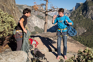 Boys Prepping for Nutcracker Walk OffI hung around at the base of the climb while they did the first pitch. Tommy took the first lead, and then rather than go up through the 5.8 gully-crack, he did the 5.9 variation up a finger crack instead. He set up a top-rope and then Herb and Andrew followed him up. Herb took the second-pitch lead, and when he was safely through that I decided to go for my run, because it was getting more difficult seeing them as they got higher.
I must confess that I was a little nervous, because there would be several hours when I had no idea what was going on. For some reason, I think that as long as I am watching them, everything will be okay – a bit self-important, I guess. Rationally, I knew that worrying was silly, because they are good and cautious climbers and this was a route that they were very capable of doing. I decided to just relax about it and enjoy my own time in the Valley.
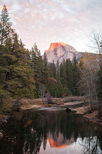 Alpinglow on Half DomeI had a lot of time to kill, so I covered about 12 miles at a nice leisurely pace. I started along the north park road, but found a dirt path to get off onto as soon as I could. Eventually I came to a very narrow, barely visible path through a meadow. It wasn’t marked on the map, which I was clutching because I always get lost. I think it might have just been an animal trail. Feeling adventurous, I decided to follow it and was so glad I did. It was indescribably awesome. Here I was with thousands of other visitors to the Valley, but yet it felt like I had this incredible place all to myself.
That’s something we have discovered over our many trips to Yosemite. No matter how crowded it is, if you are willing to hike more than a mile, or get off the beaten track, you can find total solitude.
Eventually my trail lead me along the river and out to Swinging Bridge and a more established trail. I continued my run on the bike path along the south park road, passing the cute little Yosemite Chapel and then back across to the north side, through the Ahwahnee meadow and Yosemite Village, past Lower Yosemite Falls and Camp 4, and then back to my base camp at Manure Buttress Pile.
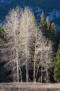 Yosemite Birch TreesI had made several stops along the way to kill a little more time, but I had a feeling I still had a while to wait before Herb and the boys returned. I took a walk along the path to the base of Nutcracker and looked up at the vast wall wondering just where they might be right now. As I gazed up somewhat randomly – I wasn’t sure where their route even led – I spotted a climber, more like a little spec about 400 feet up on the wall, wearing bright neon blue shirt. I knew that shirt!! It was Tommy’s! I can’t believe I spotted them so quickly.
I quickly ran back to the motorhome, ruffled through the drawers to find Herb’s binoculars, grabbed my camera and a Crazy Creek chair, and ran back to the place in the path where I had spotted them. Fortunately, it was a nice sunny spot, because it was really chilly in the shade.
For the next hour, I sat in my Crazy Creek, neck craned back, watching their progress through the binoculars. Although they were too small to see through my camera lens – I wish I had brought a telephoto– I took dozens of photos, hoping that when enlarged, they would be distinguishable. I was so wrapped up in watching them that I didn’t even notice that I was now in the shade and starting to shiver. I didn’t care though. They were close to the top and I wanted to make sure I saw them complete it.
 Frosty Leaves on LogEventually, they disappeared over the edge of the cliff and out of my sight. From the top, they would have to hike down through a gully back to the base. I ran back to the motorhome to warm up, looked in the climbing guide to see where their trail would come out, and then went back out to meet them. I was so excited to see them. “They said the climb was incredible, and they were so glad they did it. They also added that they were glad I didn’t, because it was somewhat intimidating in parts, even for them. I told them I had a fantastic day as well, so I think we all had made the right decision.
Rock Climbing on Church Bowl, Ice Skating, and Ahwahnee Great Lounge
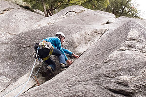 Tommy Leading Church Bowl LiebackToday was Saturday, our last full day together. The weather had turned a bit – overcast and damp. No sun to warm us up today.
We decided to get some climbing in before the rain, so we headed over to the nearby Church Bowl Wall, located right behind a picnic area about halfway between Yosemite Village and the Ahwahnee Hotel. This way if it started to rain or I got bored, I could just walk to the Ahwahnee and hang out there.
Tommy led a 5.8 climb called Church Bowl Lieback and set up a top rope so that they could also do an adjacent 5.10a climb called Pole Position. Afterwards, Tommy convinced me to try a 5.7 called Uncle Fanny, somewhat appropriately named as you will see below.
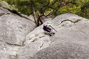 Lolo Crushing Uncle FannyUnfortunately for me, many of the easier climbs in the Valley are what are known as chimneys, which basically means I have to squeeze my entire body through very narrow, damp spaces – so narrow that at times I can actually let go with my hands and still not fall because I am so tightly wedged in by – you got it – my “fanny.” Actually, I am not really sure if that is the source of the climb’s name, but if not, it should be.
I had actually done this climb the last time we were here in August, but I had improved a bit since then, so when I got to the part at the top where there was a choice of squeezing through an even tighter area, or venturing out onto the more exposed rock face, I chose the face. Although it was more intimidating and more difficult technically, I did it. They were so proud of me. I guess if I am ever going to get better at this sport and not always be relegated to chimney climbs, I am going to have to work on the mental part and get more confident.
 Lolo and Boys before Ice SkatingThe weather really wasn’t very nice, so all of us, with the exception of Andrew who still wanted to climb more, suggested that we do something else for the remainder of the day. I suggested that we go back to Curry Village to ice skate, since that is something that should be done in the cold. The boys liked the idea, but Herb said that this time he would just watch and photograph us.
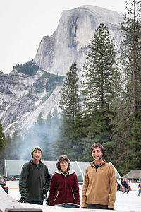 Family Skating with Half Dome ViewWe had never skated here during the daytime before, so we had no idea that there was such an incredible view of Half Dome from the rink. It was hard to take your eyes off of it, which is not a good thing when you are trying to dodge little kids zipping and falling in front of you. We call them squirrels because of the way they just mindlessly dart out in front of you. The rink was much more crowded than on Thanksgiving, so it was difficult getting into a groove.
About half way through the session, it began to drizzle, so we reluctantly called it quits, and went back to the RV to dry out and make dinner. Because of the broken generator and the fear of running low on propane, Herb had been keeping the temperature in the RV pretty low, to the point where Tommy started referring to it as “the meat locker.” Herb kindly threw on another lump of cold.
After dinner, we left the meat locker and headed over to the Ahwahnee for one more cozy night of Hearts. I sure was going to miss this place.
Mirror Lake and Ahwahnee Brunch
 Tommy Building Rock Cairn on LoloI had never hiked to Mirror Lake before, because unlike most other park visitors that throng to it because of its intriguing name, we knew that in fact there was no lake. At its best in spring time, it is little more than a dried up pool. The park service used to dredge the lake of silt each year, but has since changed its policy to let nature take its course. As the silt accumulates, it is gradually turning into a meadow.
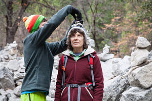
Herb and Andrew had hiked down to Mirror Lake from North Dome last August and said that despite the lack of a lake, it was still a worthy destination. So, we set off from the campground utilizing our most efficient mode of Valley travel – Herb and I on bikes and Andrew and Tommy running. Besides the lovely views of Mt. Watkins and Tenaya Canyon, my favorite thing at Mirror Lake was the cairn garden, where there are literally hundreds of stacked rock statues, ranging anywhere from 6 inches to several feet high.
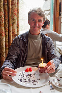 Herb's Ahwahnee Birthday BrunchI only found out later that there is some controversy surrounding these cairns. Cairns are only supposed to be used as trail markers, not as a form of art. This particular cairn garden, which seems to be growing spontaneously as new visitors add their own touches to it, violates the park’s Leave No Trace policy and also disrupts the habitats of small animals.
We didn’t build any of our own. Herb just took pictures of them, and Tommy dismantled one and reassembled it on top of my head.
The boys had to head out soon to get back to work on Monday, so we wrapped up our second annual Yosemite Thanksgiving with the final event – Sunday brunch in the Ahwahnee, something every visitor should partake in at least once. As usual, we requested a table in the alcove at the back of the dining room, where it is a bit more intimate and the views through the floor-to-ceiling windows are lovely. Brunch was delicious and ample as always and the service impeccable
It wasn’t too hard parting with the boys this time, because they would be home in less than three weeks for Christmas.
Herb and I stayed another night and then drove back the next day to our home base at the Petaluma KOA, where we would get ready for our flight back to New Jersey.
Description
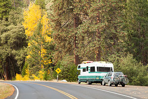 Lazy Daze and Subaru Ready to Leave YosemiteYosemite National Park lies near the eastern border of California in the heart of the Sierra Nevada Mountains. Its spectacular waterfalls, soaring granite cliffs, and lush meadows are just a few of the reasons it is considered by many to be nature’s ultimate masterpiece. In the words of John Muir, “it is surely the brightest and the best of all the Lord has built.”
This description will focus on Yosemite Valley, which is the section of the park we visited. Although the Yosemite Valley is just a small portion of Yosemite’s 761,268 acres, it is part receives 95% of its visitors. In fact, an estimated 4.1 million people visit the Valley each year, making it extremely crowded.
Two one-way roads traverse Yosemite Valley: the east-bound Southside Drive and the west-bound Northside Drive, which wind through woodlands and meadows along the base of the 3,000-foot-high granite cliffs. As of today, cars are still allowed to enter and drive through the valley, but visitors are highly encouraged to park their vehicles and use the park’s free shuttle bus, which stops at the major attractions in the valley.
Virtual Tour of Yosemite Valley Highlights
- As you enter the valley, the first sight you’ll see is the 620-foot Bridalveil Falls flowing down from a hanging valley to the valley floor. From the parking area, a short paved path leads to the base of the falls. This is one of the few falls in Yosemite that does not completely dry up in the summer.
- Just past the Bridalveil Fall parking area, the Southside Drive begins to trace the Merced River. Soon El Capitan comes fully into view. This 3,000 foot high granite cliff is the largest single piece of exposed granite in the world and one of the most famous landmarks in Yosemite. If you look closely, you might see small dots that are actually rock climbers along its face.
- Continuing east on the Southside Drive are two riverside picnic areas and beaches: Cathedral Beach and Sentinel Beach.
- Right after the Sentinel Beach parking area is the trailhead for the 4-Mile trail, which ascends more than 3,200 feet from the valley floor to Glacier Point and one of the most spectacular views of the valley.
- A short distance further is Swinging Bridge, another picnic and swimming area. This area is also the westernmost point of the 8-mile bicycle loop that goes through the eastern part of the valley. From this point on, the bike path parallels the road.
- Next stop is the picturesque tiny Yosemite Chapel where many outdoor enthusiasts choose to exchange wedding vows.
- Now you enter the congested and developed portion of the valley.
- Right past the chapel, you can either take a left onto Sentinel Bridge towards Yosemite Village and the park exit, or you can continue straight towards Curry Village, the campgrounds, and Happy Isles Nature Center. For now, let’s stop at Sentinel Bridge for what is probably the most spectacular Half Dome viewpoint in the park. It’s a great spot for a photograph of Half Dome with the Merced River in the foreground.
- Continuing east on the Southside Drive, you pass Housekeeping Camp and Curry Village. Curry Village has lodging, restaurants, bicycle and raft rentals, a grocery store, and other shops. Curry Village is also one of the main parking areas in the valley.
- From Curry Village you can either take Northside Drive across the Ahwahnee Bridge back to Yosemite Village and the park exit, or continue east to the campgrounds. The Happy Isles Nature Center is also this way, but only shuttle buses are allowed on the road to it.
- The Happy Isles Nature Center features exhibits on the natural history of the park. It also serves as the trailhead for some of the best hikes in Yosemite. 1.5 mile trail leads to the top of Vernal Falls and then continues another 1.5 miles to the top of Nevada Falls (two waterfalls that flow even in the summer time). From there you can continue even further into the backcountry of Yosemite, including the cable route up the back of Half Dome.
- From Curry Village, the Northside Drive crosses the Ahwahnee Meadow, a wonderful spot to gaze at Half Dome during sunset, and enters Yosemite Village, the main center of visitor services in the park. Here you’ll find the park’s main Visitor Center, restaurants, lodging, shops, a grocery store, a post office, a medical clinic, the Ansel Adams Gallery, an Indian Cultural Exhibit and more. It’s also a good place to park your car and jump on the shuttle.
- A short dead end road from Yosemite Village leads to the majestic old Ahwahnee Hotel, which has played host to Queen Elizabeth, President John F. Kennedy, and Clint Eastwood, to name a few. This beautiful six-story rock structure offers tremendous views from every room. Within the hotel is the elegant and quite expensive Ahwahnee Dining Room (jackets required for dinner).
- Back on the Northside Drive heading west from Yosemite Village, the next stop is the Yosemite Falls parking area. At 2,425 feet, Yosemite Falls is the highest waterfall in North America. It is actually three waterfalls in one, with an upper, middle and lower section. A short walk from the parking lot along a paved walk leads to the base of Lower Yosemite Falls. This is the most visited landmark in the valley. Except in summer when the fall temporarily dries up, you’ll be sure to be covered in spray.
- A little further west on the Northside Drive is Yosemite Lodge, which marks the end of the developed area of the park going west.
- Right after Yosemite Lodge is Sunnyside Campground/Camp 4, a place where most rock climbers choose to congregate. From this campground begins the popular and strenuous Yosemite Falls hike, which ascends 2,600 feet from the valley floor to the top of the Upper Falls. The views from the top are incredible.
- Continuing west, there is nothing but woods and meadows from which to enjoy the views. Along the road there are several pullouts where you can stop and walk down to the Merced River for a swim. Just after the El Capitan Bridge, you’ll come to the El Capitan Meadow where you’re sure to find people looking through binoculars at the miniscule rock climbers clinging to the granite face.
- Just to the west of El Capitan, Ribbon Falls plunges over 1,600 feet down to the valley floor. It is the seventh highest waterfall in the world. However, it too dries up in the summer time.
- Finally the road nears the end of the Northside Drive at Valley View where El Capitan, on the left, and Cathedral Rocks, on the right, frame a magnificent valley view.
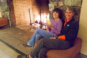 Herb and Amused Lolo in Ahwahnee FireplaceSeveral guided bus tours are also available. The 2-hour Valley Floor Tour is a great way to get acclimated. Visitors ride through the valley in an open tram while a guide leads a informative discussion of Yosemite’s history and geology. There are many photo stops along the way. In addition, there are bus tours out of the valley to Glacier Point, the Mariposa Grove of sequoia trees, and Tuolumne Meadows.
Although much of Yosemite can be enjoyed from the comforts of your car or a shuttle, the best way to truly experience Yosemite is do get out and experience it more directly.
Things to do in Yosemite
- Hike one of the many trails around the valley, ranging from an easy walk to the base of Lower Yosemite Falls to the strenuous 16-mile round trip hike up the back of Half Dome via cables
- Take an overnight backpacking trip
- Bike along the 12 miles of bicycle paths that loop through the Valley. Rentals are available at Curry Village and Yosemite Lodge.
- Rock climb in one of the premier climbing places in the world
- Raft down the calm waters of the Merced River through the valley. Rentals are available at Curry Village.
- Swim or tube in the Merced River. Besides the designated beaches, there are many pullouts along the road from which you can walk down to the river.
- Join one of the many ranger walks, which are offered daily
- Take a free art class at the Yosemite Art and Education Center
- Photograph the amazing scenery of the valley and surrounding granite cliffs
- Browse the Ansel Adams Gallery and see some of the photographs that first made Yosemite famous
- Relax in the meadow while gazing up at Half Dome or El Capitan
- Dine at the 5-star Ahwahnee Hotel, where presidents and royalty have stayed
Although many try to see Yosemite in a day, it is best to devote several days to seeing all the park has to offer. Besides the numerous hotels, lodges, and cabins in the Valley, there are three RV campgrounds: Upper Pines (238 sites), Lower Pines (60 sites), and North Pines (81 sites). That’s less than 400 campsites to accommodate all the people that want to camp here.
Since these campgrounds usually fill-up within the first hour they become available, it is essential to make your reservations as soon as possible. Campground reservations are available in blocks of one month at a time, up to five months in advance, on the 15th of each month at 7 am Pacific time. For example, if your arrival date is July 15 through August 14, the first day you can make reservations is March 15. The National Park Reservation System can be found at www.recreation.gov. Good luck!
Sebastopol and Sonoma County
Friday, November 21, 2014 - 12:15pm by Lolo180 miles and 3.5 hours from our last stop - 3 night stay
Travelogue
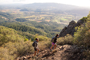 Hiking Hood Mountain Regional ParkWell, we were back in the Berg’s driveway for our second annual pre-Thanksgiving celebration. Once again we managed to back into the driveway without taking out their bushes – just a little minor pruning.
The Bergs are amazing hosts and unbelievable cooks, so the eating portion of the weekend was, as always, beyond compare. While we do not share their expertise in the kitchen, we do share a love of the outdoors, so whenever we get together, we go on a few long hikes.
There are so many wonderful hiking trails in Sonoma County, and Hilda and Paul have probably done most of them, so we always leave it in their capable hands to select one. Also, since we are planning to move out this direction sometime over the next year, they picked two that would help give us an idea of how much there was to do in close proximity to our potential new home.
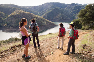 Hikers on Lake Sonoma Canoe TrailOn Saturday, we drove over to Hood Mountain Regional Park, right in neighboring Santa Rosa. To get there, we drove along Highway 12 through the Valley of the Moon, made famous by Jack London’s novel of the same name, and the heart of Sonoma Valley wine country. I never realized that the vineyards change their colors from to gold and red in the fall. I thought only the East Coast had beautiful fall foliage, but this was absolutely stunning.
Along the way we passed a 55+ adult community, and Hilda asked if we would ever consider living there. My immediate response was “No Way!!!” Ironically, later in the trip we would actually look at rental properties there and our “No Way” has changed to “Well, maybe we could try it for a year.” It definitely had location going for it – right smack in the middle of the Valley of the Moon, surrounded by vineyards and two major parks, Hood Mountain Regional Park and Annadel State Park.
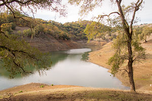 Low Water Levels at Lake SonomaToday, we would hike to the top of Mount Hood, which at 2,730 feet is the highest point in the Mayacama Mountain range which divides Sonoma and Napa Valley. It was a pretty strenuous hike – 3 ½ miles (one way) and over a 2,000 foot elevation gain to reach the Gunsight Rock Overlook. Fortunately, Paul had brought along a pair of binoculars, because we could see San Francisco from the tope, and Andrew and Celeste were having fun identifying different landmarks. The views of wine country below weren’t too shabby either.
Continuing our orientation of Sonoma County, the next day we drove north to the town of Cloverdale – to see if that grabbed us as a place to live – and then onto Lake Sonoma for a hike. Cloverdale was a little too far out there for me. I think I prefer living closer to a bigger city like Santa Rosa.
Lake Sonoma was of interest to us, because we have a boat that we are wondering what to do with when we move West. It was a lovely lake, a little down in depth because of the drought, but still quite boatable. The lake has a marina and boat-in campsites and about 50 miles of shoreline along its two arms to explore. It was good to know that we could still have a place to waterski.
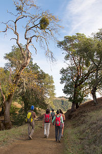 Mistletoe on Lake Sonoma Canoe Trail HikeHowever, today hiking was the plan, so we parked the car and took the 5.1-mile Half a Canoe trail up and down along the lake. Two things about this hike stand out in my mind.
First, the lovely Spanish moss hanging from the tree branches. I thought this was strictly a Georgia coast phenomenon. Geez, first beautiful vineyard fall foliage and now this. I was starting to lose some of my East Coast bragging points.
The second, and far less appealing discovery, was the reason for the churned up dirt alongside the trail. Although we didn’t see the culprits doing the digging, Paul informed us that there are lots of wild pigs in Sonoma County, in this area in particular, and they love to dig up the ground looking for grubs and acorns and such. I knew it. There had to be something wrong with this paradise they call Sonoma County. Just kidding. Actually we thought it was pretty cool and hoped we would come across one, but no luck. We did come across a couple of guys hunting for them, however, which is not only allowed, but encouraged.
Spanish moss and wild pigs aside, we had another lovely hike with the Berg’s and got to experience another Sonoma County gem.
Description
Sebastopol
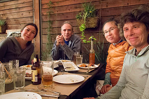 Dining at Diavola PizzeriaSebastopol is a charming town in Sonoma County, 52 miles north of San Francisco and about a 20-minute drive to the coast. Sebastopol is known for its apples and hosts an annual Apple Blossom Festival in April and the Gravenstein Apple Fair in August. Today, however, the apple orchards are becoming vineyards as wine-making moves more and more into the region.
Every Sunday, from April to mid-December, there is a Farmers market in the downtown plaza,
where people congregate to enjoy delicious fresh regional food, live music, and dancing.
Sebastopol is home to the artist, Patrick Amiot, known for his whimsical, cartoon-like, junk-art sculptures. There are over 200 of his wacky, found-object works scattered throughout Sebastopol, especially on Florence Street.
Hood Mountain Regional Park
Located on Pythian Road in Santa Rosa, the Mount Hood Regional Park encompasses 1,750 acres of wilderness with outstanding hiking and mountain biking. It is named for Mount Hood (not the one in Oregon), which at 2,730 feet, is the highest point in the Mayacama Mountain range which divides Sonoma and Napa Valleys.
One of the most popular hikes in Sonoma County is the 3.5 mile (one way) steep trail to Gunsight Rock Overlook. With a 2,000 foot elevation gain, the hike is not for the faint of heart, but for those that make the climb, the views of wine country and the Golden Gate Bridge in the distance are well worth it.
Lake Sonoma
Lake Sonoma is located 13 miles northwest of Healdsburg in the beautiful coastal foothills of northern Sonoma County. It was created in 1983 by the U.S. Army Corps of Engineers construction of the Warm Springs Dam. The lake extends 9 miles on Dry Creek and 4 miles on Warm Springs Creek. It full capacity is has 50 miles of shoreline.
At the park entrance there is a Visitor Center with exhibits telling the story of the Dam as well as the natural and early cultural history of Dry Creek Valley. Behind the Visitor Center is a Fish Hatchery where visitors can learn about the life cycle of the coho salmon, steelhead, and Chinook.
Activities at the lake include boating; swimming; 40 miles of trails for hiking, mountain biking, and horseback riding; hunting; and camping.
There are 9 primitive camping sites accessible by boat or hiking. A backcountry camping permit must be obtained at the Visitor Center. The Liberty Glen Campground has 113 campsites for RVs and tents. Campsites are available on a first-come, first-served basis.
Monterey
Thursday, November 20, 2014 - 12:15pm by Lolo240 miles and 4.5 hours from our last stop - 1 night stay
Travelogue
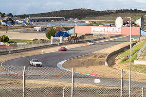 Campsite view at Laguna Seca RacewayIt was Thursday, and we had to be in Sebastopol on Friday night for the start of a pre-Thanksgiving weekend celebration with Andrew and his girlfriend’s family, so we started heading up 101 with the intention of spending the night in or around Monterey.
Although Carmel would have been nice, we didn’t feel we had enough time to do it justice. We would save that for a later trip where we could spend a few days. Instead we chose to camp at the Laguna Seca Recreation Area, about 6 ½ miles inland from Monterey, literally overlooking the famous Laguna Seca Raceway. Herb was surprised that I never heard of the Laguna Seca Raceway, but I am not exactly a NASCAR fan. He said it knew it because it was one of the choices for a race track when he used to play Nintendo racing car games with the boys when they were little.
Although there was no race going on – and if there was, I am sure we would not have been able to get a campsite – it was fun to watch four cars practicing and racing around the track.
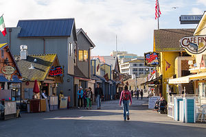 Lolo on Fisherman's WharfThe next morning we drove into Monterey to explore a little. Since we only had a couple of hours, we didn’t go to the world famous Monterey Aquarium, because if you are going to spend $40 each for admission, you should plan to at least spend half a day. We would do that when we on a future trip to this lovely part of the California coast.
You can’t come to Monterey and not visit Fisherman’s wharf, one of the most popular tourist attractions in Monterey. I kind of like tourist traps sometimes – after all, they are popular for a reason. Besides, I have never met a wharf I didn’t like. We ignored the seafood restaurants and souvenir shops and spent our time watching carefree sea lions lounge on a dock just off the pier.
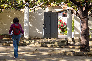
Right by the entrance to the wharf is the old Custom House and the beginning of the 2-mile, self-guided Monterey “Walking Path of History.” It’s part of the Monterey State Historic Park. We are history buffs, but having lived on the East Coast our entire lives we know a lot more about the American Revolution and Civil War than the history of California statehood. We’re planning on moving out here someday soon, so we do try, whenever possible, to learn more about California’s Spanish, Mexican, and early statehood past.
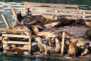 Fisherman's Wharf Sea LionsUnfortunately, tours of the historical homes and buildings along the path are only given on the weekend (at least this time of year), but we were able to wander around them and peek in their windows.
The first building we peeked into was the Customs House. Besides being the oldest government building in California, it also played an important role in California’s statehood in that it was the site where Commodore Sloat raised the American flag in July of 1846 and declared California to be a part of the United States. It was kind of like our Lexington and Concord.
Other buildings we peeked into included: an old tavern that was converted into California’s first theater, the first house in California to be built out of brick first brick house rather than sun-dried mud, and the beautiful Casa Soberanes.
There was much more to explore and do in the Monterey area, but that would have to wait for a future visit.
Description
 Lolo on the Walking Path of HistoryMonterey is a very popular waterfront community located on the central coast of California. It is home to the world-famous Monterey Bay Aquarium located in Cannery Row, where John Steinbeck drew his inspiration for the novel of that name. No longer a place for canning sardines, today’s Cannery Row is lined with hotels, and restaurants, and shops.
Another popular destination in Monterey is Fisherman’s Wharf, where one is sure to see sea lions hanging out on the pilings and buoys in the bay. The wharf was an active wholesale fish market into the 1960s, but today it is a major tourist attraction with seafood restaurants, souvenir shops, and art galleries. It is also the place to hop aboard a deep-sea fishing or whale-watching trip.
At the entrance to the wharf is Custom House Plaza, and the start of a 2-mile self-guided walking tour of historical Monterey. Along the 2-mile "Path of History," you will find the Custom House, the first government building in California, and the Monterey Maritime Museum.
Monterey’s year-round temperate climate makes it a popular place for beaching, surfing, kayaking, and scuba driving.
Carpinteria State Beach / Santa Barbara
Tuesday, November 18, 2014 - 12:00pm by Lolo243 miles and 4.5 hours from our last stop - 2 night stay
Travelogue
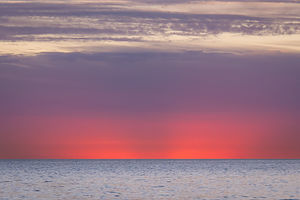 Carpinteria State Beach Double SunsetCarptineria State Beach was quite a find. I am not 100% sure, but I think it might be the only place along the California coast that you can actually camp right on the beach with an RV. The back end of our motorhome was literally hanging over the sand. It was so nice listening to the surf after spending 12 days in the desert.
It wasn’t cheap though. I think we paid $80 a night for a beachfront site with full hookup. However, it was worth every penny. The other nice thing about the location was that it is only 15 miles south of Santa Barbara.
At first we thought we would head right up to Santa Barbara, but the beach was so inviting that we got out our beach chairs and spent the afternoon reading and relaxing. We also took an exploratory run into the town of Carpinteria, which was actually quite nice – the kind of place I could picture living in.
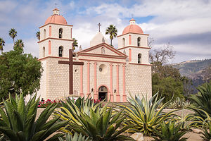 Mission Santa BarbaraDuring our run we passed a community pool that was open all year. Herb loves to swim, and when we are home, he goes 3 times a week to the local YMCA. I stopped in quickly to inquire about their hours and fees, in case Herb wanted to take a swim in the morning. We then continued back along the beach.
Then it was back out to the beach chairs, this time with a glass of wine, to watch the sunset. You could see the Channel Islands off the coast from here as well as about a half a dozen oil rigs. I didn’t realize before just how much oil drilling is done off the California coast. At night, they were lit up like Christmas trees along the horizon.
Originally, we thought we would only stay here one night, but it was so nice that we decided to go for a second. The next morning, Herb went off to the community pool and I went for a run into town and along the beach.
 Santa Barbara Art MuseumAfter lunch, we drove up to Santa Barbara, picking just a few of its many sites to explore. Our first stop was Old Mission Santa Barbara, the 10th mission founded by the Spanish Franciscans in 1786 during their drive to convert the heathen Native Americans to Christianity and establish a presence along the California coast. When Mexico won its independence from Spain, it forced the secularization of all the missions, except for this one. As a result, it still functions as a Franciscan friary and parish church. When we were there and the hour struck, it was very obvious that the bells in the church were not automated, but manually rung by a friar – not in a bad way, but you could just tell.
The mission is open to the public for both self-guided and docent-led tours for an admission fee of $7. We took the self-guided tour and wandered around the church, the old historic cemetery, and the sacred garden ourselves. There was also a very good movie explaining the Spanish mission system and this mission in particular. I recommend watching the movie first, so you have a better understanding of the rest of what you see.
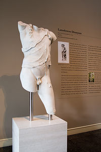
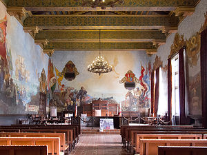 Santa Barbara Courthouse Mural RoomOur next stop was the Santa Barbara Art Museum on State Street. A docent-led tour was starting in a few minutes, so we waited and were fortunate enough to have the docent completely to ourselves – our very own private tour of the museum’s collection of Asian Art (Chinese, Japanese, Indian, and Tibetan), 19th and early 20th century French and English Art, early 20th century American Art, and Photography.
Then it was on to the Santa Barbara Courthouse, probably one of the most beautiful and highly visited courthouses in America. The original building was destroyed by the 1925 earthquake and replaced by this magnificent Spanish-Moorish Revival style building. We caught up with a guided tour in the second-floor Mural Room where the walls are covered by 6,400 square feet of paintings depicting scenes from Santa Barbara’s history – from Conquistadors to John C. Fremont. The murals, which were done by Daniel Sayre Groesbeck, were quite dramatic, not surprising considering the fact that he was a Hollywood studio artist. He worked with Cecil B. DeMille on many films, such as The Ten Commandments.
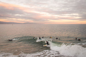 Santa Barbara Beach SurfersThe building was so impressive that it was hard to believe that it was a functioning courthouse, but our guide did take us through the main part of the building where in deed there were jury rooms, court rooms, administrative offices, legal libraries, and all the other things you would expect in a courthouse. Maybe jury duty wouldn’t be as bad if you could do it in a setting like this.
The last part of the tour was up to the top of the 85-foot clock tower where we were treated to panoramic views of the city and the surrounding coast and mountains. We also got a peek at the gears and inner workings of the clock itself, a rare Seth Thomas model 18 tower clock built and installed in 1929.
While there was so much more to see and do in Santa Barbara, we felt that we had at least gotten a little taste of its history and culture. We ended our day in Santa Barbara along the harbor, where we dined al fresco at a little take-out place called On the Alley and then watched the surfers wait for the perfect wave at the end of the pier.
Description
Carpinteria State Beach
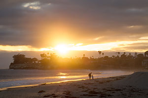 Santa Barbara Beach SunsetJust 12 miles south of Santa Barbara, Carpinteria State Beach offers a mile of beach for beach-side camping, swimming, fishing, and tidepool exploration. It is an extremely popular destination, so camping reservations should be made well in advance.
Harbor seals and sea lions can be seen December through May, along with an occasional gray whale passing through. Tidepools contain sea anemones, starfish, crabs, snails, sea urchins, and octopus. The Channel Islands and oil rigs can also be seen along the horizon.
The campground has over 200 sites with full or partial hookups, many of which are situated right on the edge of the beach. The campground is in walking distance to the lovely little town of Carpinteria.
Santa Barbara
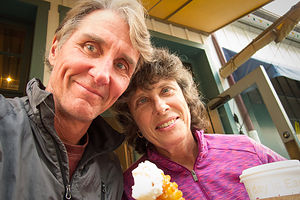 Herb and Lolo Dining at On the AlleyOften referred to as the “American Riviera” because of its Mediterranean-like climate, Santa Barbara lies sandwiched between the Pacific Ocean and the Santa Ynez Mountains. It has the longest section of south-facing coastline on the West Coast, boasting views of both sunrise and sunset. The city was founded by Spanish missionaries in 1786, and its Mission revival style of architecture, with is white stucco buildings with red-tile roofs, is a testament to its Spanish past.
Our stop in Santa Barbara was brief, so this in no way is an attempt to give a thorough description of what to see there. However, the following three sites are what we chose to do during our all too short one day visit:
Mission Santa Barbara lies atop a hill overlooking the town. It was the tenth of the California missions to be founded by the Spanish Franciscans, and was established on the feast of Saint Barbara on December 4, 1786. Being the only mission escape Mexico’s policy of forced secularization, the mission still functions as a Franciscan friary and parish church. The mission offers both self- and docent-guided tours of the church, historic cemetery, and sacred garden. Admission is $7
The Santa Barbara Museum of Art on State Street has an impressive collection, focused on Asian Art (Chinese, Japanese, Indian, and Tibetan), 19th and early 20th century French and English Art, early 20th century American Art, International Modernism, Photography, and Contemporary Art. Admission is $10.
The Santa Barbara Courthouse is probably one of the most visited courthouses in America. This magnificent Spanish-Moorish Revival style building was completed in 1929 as part of a rebuilding process after an earthquake destroyed the smaller Greek-Revival one in 1925. It is considered by many to be the most beautiful government building in America. Visitors can ride an elevator to the top of the 85-foot clock tower for magnificent, panoramic views of the city, coast, and mountains. The other main attraction is the second-floor Mural Room, with 6,400 square feet of paintings by Daniel Sayre Groesbeck, depicting scenes from Santa Barbara’s history. Admission is free..
Joshua Tree National Park
Saturday, November 15, 2014 - 11:30am by Lolo290 miles and 6 hours from our last stop - 3 night stay
Travelogue
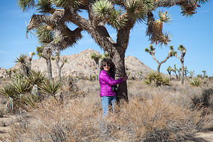 Joshua Tree HuggerContinuing what was becoming a tour of the deserts of the Southwest, we headed south towards Joshua Tree National Park.
It was a Saturday, and since Joshua Tree is a popular weekend destination for LA and San Diego residents (it’s only about 2 ½ hours away from both), a phone call confirmed that all the campgrounds in the park were full. So, we drove to Yucca Valley and stayed at the Yucca Valley RV Park, fairly close to the entrance to the park. This would allow us to get one of the first-come, first-served sites the next morning when the weekend crowd left.
We entered the Park the next morning through the Twentynine Palms entrance, stopping at the Visitor Center and taking the time to walk the Oasis of Mara Interpretive Trail, a short ½-mile paved loop with lovely palm trees and other interesting desert flora. Unfortunately, as we learned, this is no longer a true oasis and today must be partially irrigated due to overuse by the town of Twentynine Palms.
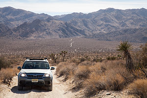 Subaru on 4WD Geology Tour RoadAfter entering the park, we drove straight to the Jumbo Rocks Campground, where we had our choice of sites, because pretty much everyone was packing up and heading out as the weekend came to a close. As we always do, we made several loops through the campground trying to select the perfect site. They all were pretty good, snugly tucked amongst large red boulders – a climber or rock scrambler’s paradise.
We haven’t gotten over the novelty yet of having a tow vehicle along, so we’re still thrilled every time we decouple the Subaru from the motorhome to set out on a day of exploration. It has been very liberating. Not only is it less stressful, but it allows us to go places we never could before, especially unpaved roads, of which there are so many in the western parks.
After leaving the campground, we quickly took the left turn off Park Boulevard onto the dirt Geology Tour road and spent the next 2 hours driving through some of the park’s most interesting geological formations.
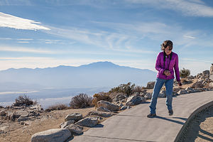 Lolo with Keys View Lookout WindThere are 16 stops along the 18-mile drive, and I made sure Herb listened to me read the description of each from the park brochure. I should have quizzed him at the end, because I am not sure how diligently he was paying attention. He was too busy taking pictures of the fabulous scenery.
Although regular two-wheel drive vehicles have to turnaround at Squaw Tank (Stop #9), we forged on in our 4-wheel drive along what became a bumpier, but still very doable road. Although the official Geology Tour Road only went as far as Pleasant Valley, an even more desolate and bumpy road continued on and up through the Little San Bernadino Mountain Range. We dutifully followed our brochure, and headed back out from whence we came, not passing another car our entire drive back. It was pretty awesome.
Back on Park Boulevard, we headed west and took the turnoff for Keys View, an overlook atop the San Bernadino Mountains with panoramic views of the Coachella Valley and mountains beyond. It was pretty spectacular, but so windy that we literally had difficulty standing upright.
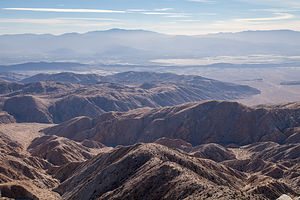 Keys View LookoutSince we are theoretically rock climbers, and Joshua Tree is a very popular rock climbing destination, we decided to spend the rest of the afternoon exploring various climbing areas, and possibly finding something appropriate to climb tomorrow – and by appropriate, I mean easy enough for me. Also, it would have to be something that Herb could set up a top rope on himself, because I have never belayed someone leading a climb before, but only on a top rope. The boys are always there to do that. Where were they when I needed them???
These criteria narrowed our options down significantly. However, we had bought “Best Climbs in Joshua Tree” that morning at the Visitor Center, so we had lots of information about many of the classic climbs in the park, including their difficulty rating and type of climbing (trad, sport, toprope, etc.). We proceeded on our quest for the perfect top-ropable 5.7 or 5.8.
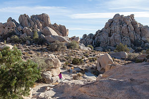 Lolo Hiking Hidden ValleyOur first stop was the Hall of Horrors Wall – that sounds like fun! Seriously, who names these things? We actually found a 5.7 called Lazy Day, which I kind of thought was fate considering the name of our motorhome. We put it on our list of possibilities, but not too high because it was a crack climb, which means having to jam your fingers and/or entire hand into a crack to work your way up the wall – not a type of climbing that is particularly a favorite of ours.
We stopped at Hidden Valley, another very popular climbing area, but for some reason, I can’t remember why, we chose to just do a hike rather than look for climbing options. I think I was getting a bit intimidated by the thought of climbing here. It was a very different type of climbing than I was used to – mostly cracks or slab – not many handholds, which I have come to love. Also, Herb and I have never really climbed just the two of us alone, so this was going to be an interesting challenge, both physically and maritally (if that is even a word).
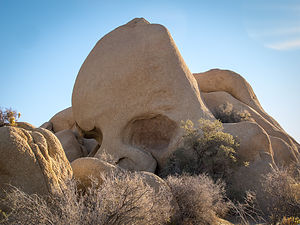 Skull RockHidden Valley was lovely, and I was starting to think that there was nothing wrong with just hiking. This was really more of a stroll though, a 1-mile loop through a small valley surrounded by colorful boulders. The valley, which really is hidden by rock, was once used by cattle and horse rustlers to graze their stolen livestock.
Before returning home, we did check out one more climbing area, called Echo Cove, a bit further north on the side road to Keys Ranch, because the guide book said that there was lots of opportunity for toproping. I really didn’t want my wienieness to hold Herb back from his chance to climb at Joshua Tree. Plus, the boys would be so proud if just the two of us did it.
The area actually did seem pretty interesting. Very easily approachable – you could practically belay from the car – plus there were a few 5.7s and 5.8s that Herb could set up a toprope on. This was probably our best option, so we decided to seriously consider coming back the next day to give it a try.
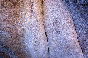 Barker Dam PetroglyphsRather than take Park Boulevard back to the campground, we took the dirt Queens Valley Road which passed through some of the park’s most impressive groves of Joshua Trees. These trees are only found at higher elevations in the Mojave Desert and we were well over 4,000 feet.
These Joshua Trees were really growing on me. Not only were they different from any other tree I’ve ever seen, but each of them was different from each other – kind of like snowflakes. However, they all have in common stubby branches that reach up towards the sky, which prompted the early Morman pioneers to name them “Joshua” trees, because they thought their branches resembled the arms of the prophet raised towards the heavens. They must have been out in the desert too long.
We had been so used to warm desert temperatures over the past week at our previous desert destinations that we were unprepared (not clothing-wise but psychologically) for how cold it got at night. Besides having a cold front move in, Jumbo Rocks Campground was at 4,400 feet, so it dropped down below freezing there at night. To make matters worse, our generator had stopped working, so we had to be somewhat conservative with the heat so that we didn’t run out of propane. Let’s just say that it was cozy. I shouldn’t complain though. At least it was better than being in a tent.
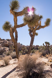 Two Joshua TreesThe Skull Rock Trail starts right in the Jumbo Rock campground, so the next morning we grabbed our cameras and set out on the trail. It was still pretty chilly, but a nice way to start the day. The 1.8-mile trail led through a maze of spectacular rock formations before finally arriving at its namesake, a massive rock in the shape of a human skull. I posed for a picture in its nostril.
When we got back to the motorhome, we made a picnic lunch, gathered our climbing gear, and set out for the day. We took the unpaved Queens Valley Road short-cut again because it was more fun than staying on the main road.
We were going right past the trailhead for the Barker Dam hike, so we decided to stop and hike it. Once again, as in the other hikes we had done so far in Joshua Tree, it was short (1.3 miles), flat, and easy. However, unlike the other hikes, the attraction for this one was man-made. The dam was built over a hundred years ago by ranchers in an attempt to provide water for their livestock. The result is a small reservoir, which because of the season and the California drought, was practically dry.
Towards the end of the hike, we followed a turnoff marked petroglyphs. Usually you have to look pretty hard to see a petroglyph, because they are often faded and blend in with the rock. Well, there was nothing subtle about these. Back in the 1960s, a Hollywood film crew, thinking they weren’t bright enough, painted over them to make them more obvious. They looked ridiculous. To make it even worse, these artifacts were not vandalized in the name of a Hollywood classic, but rather for the filming of a television movie called “Chico the Misunderstood Coyote.” I have nothing more to say.
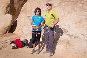 Lolo with Climbing Guide and Author Bob GainesThe day had warmed up nicely, at least when we were in the sun, so we headed over to Echo Cove to try out the climbs we had scouted out the previous day – a 5.7 climb called Swing Low for me and a 5.10d called Pinky Lee for Herb. I was glad to see that there were only two other people climbing on the wall, because I hate making a spectacle of myself.
Unlike the men in my family, I am the kind that likes to ask for directions or have information that I am already pretty sure of confirmed, so despite the fact that I had a climbing guide book with a picture of the wall in front of me, I asked the gentleman belaying a woman to our left whether this was in fact Swing Low.
“Oh, I wrote that book,” he said glancing over at “Best Climbs in Joshua Tree” in my hand. Oh, great. Now I was going to really be self-conscious about my climbing.
When we went back to the car to get our climbing gear, I read the About the Author section of the book and became even more intimidated. This guy (Bob Gaines) was the real deal. Not only was he the owner of one of the best climbing schools in the country, but he was Sylvester Stallone’s climbing instructor for the movie Cliffhanger. Oh, and he also trains Navy Seals.
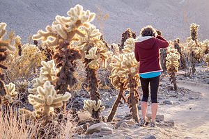 Lolo in Cholla Cactus GardenHowever, I must say that this guy was the nicest, least pretentious, and most helpful person we have ever climbed beside.
As I mentioned previously, the rock at Joshua Tree and the type of climbing it provided was very different from what we were used to. I tend to like something for my hands to grip on to. I don’t ask for much – it doesn’t have to be huge, but just something. Joshua Tree, in contrast, has a lot of crack and slab climbing, and the climb I was going to attempt, Swing Low, was a slab climb.
Just to briefly explain, a slab climb is one where the wall is not strictly vertical, but rather slopes at an angle less than 90 degrees – the lower the angle, the easier the climb. However, the holds, if they exist at all, tend to be really small, so rather than relying on your hands to give you the security and means to ascend, you use the friction of your climbing shoes to smear against the rock, and your hands are really only placed on the rock for balance.
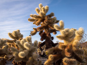 Cholla Cactus at DuskI probably was perfectly capable of doing this climb, but I psychologically freaked out. Rather than trust my feet to do the work, I frantically kept running my fingers across the wall desperately searching for something, just anything, to hold onto. It looked like I was playing the piano. After flailing and falling a few times, I finally did make it to the top, but I wasn’t very happy with myself. Thankfully, our author friend was too busy belaying his client to see my feeble attempt.
Herb did this climb quickly and easily, showing me how it could have gone if I had just used the right part of my shoes and trusted the laws of friction. I then belayed him on a more difficult climb to the right, a 5.10d called Pinky Lee. Although it was a crack climb – not one of Herb’s favorites – he did quite well and got it with just one fall.
Before leaving, however, we did get Bob to autograph the book, and Herb took a picture of me with him. He really was a nice guy and so very knowledgeable about climbing.
Up until now we had only been in the Mojave Desert section of Joshua Tree, which is cooler and wetter because of its higher elevation, so we decided to drive south down the Pinto Basin Road towards the hotter and drier Colorado Desert. As we descended, the Joshua trees began to give way to cacti and creosote bushes – such a different landscape.
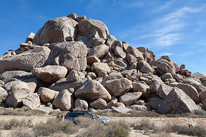 Subaru with Jumbo RocksWe stopped at the Cholla Cactus Garden, which lies in the transition zone between the two desert systems, to take the ¼-mile nature trail through a dense forest of Teddy Bear and Silver Cholla cacti. They are called Teddy Bear for a reason – not for their cuddliness, as their furry little barbs are actually quite painful, but because they are probably the most adorable cacti, or even plant, I have ever seen.
Our timing couldn’t have been any better. The late afternoon low light cast an unbelievable spell over the garden, and I would guess that Herb took more photos of these cacti than he did of me over the entire trip.
During this trip, we had really gotten an opportunity to experience just how beautiful and varied the deserts of the Southwest can be. Each of the four we had visited (Mojave Preserve, Red Rock Canyon, Death Valley, and Joshua Tree) left their own distinct impression in my mind. But we had spent 12 days in the desert, and I was beginning to dream of sea breezes and internet coverage, so we headed West towards Santa Barbara.
Description
Joshua Tree, located 2 ½ hours east of Los Angeles and 2 ½ hours northeast of San Diego, encompasses 800,000 of pristine desert, one of the last great wilderness areas in the continental U.S. Two great desert systems meet within the boundaries of the park – the cooler, wetter, and higher Mojave Desert in the northwest and the hotter and drier Colorado Desert in the southeast.
The park’s namesake Joshua Trees are found in the Mojave section of the park, where they thrive on the cooler temperatures and higher elevation. They were named “Joshua” trees by early Mormon pioneers, who thought their thick, stubby branches resembled the arms of the prophet raised towards the heavens.
There are three visitor centers, one at each of the three entrances to the park: Joshua Tree (West Entrance), Oasis (North Entrance) and Cottonwood (South Entrance). Since there are no services (food, fuel, cell phone, etc.) within the park, visitors should stock up at one of the gateway towns just outside the park.
There are two major paved roads through the park:
- Park Boulevard – 45-minute drive through the northern section of the park, which traverses the most scenic portions of the park, including sweeping desert views, Joshua trees, and unique boulder formations.
- Pinto Basin Road - connects Park Boulevard with the southern portion of the park, passing from the higher Mojave Desert into the lower Colorado Desert.
Stops and activities along Park Boulevard include:
- Trailhead for the Boys Scout Trail (South) and the 7.1 mile round trip hike to Wonderland of Rocks, a maze of jumbled granite boulders with hidden groves of Joshua trees http://www.protrails.com/trail/160/joshua-tree-national-park-willow-hole...
- Hidden Valley - 1-mile loop trail along the interior of a rock-enclosed valley. Rock climbing is popular in this area.
- Keys View – a short side trip (5 miles each way) to an overlook atop the Little San Bernardino Mountains (5,185 feet elevation) with panoramic views of the Coachella Valley and mountains beyond.
- Keys Ranch – a short side trip (2 miles each way) to a 150-acre ranch in a remote rocky canyon. Most of the original buildings – ranch house, schoolhouse, store, and workshop – have been restored to the way they were when William Keyes died in 1969. 90-minute walking tours of the ranch are offered daily.
- Trailhead for 3-mile round trip Ryan Mountain hike, a short but strenuous climb with one of the best panoramic views of Joshua Tree from its summit http://www.protrails.com/trail/155/joshua-tree-national-park-ryan-mountain
- Queen Valley – a side trip through a network of 13.4 miles of dirt roads through the park’s most impressive groves of Joshua trees. This is also the starting point for the Geology Tour Road.
- Geology Tour Road –18-mile dirt road through some of the park’s most distinctive geological formations. There are 16 stops along the way, so allow approximately 2 hours for the round trip. RVs are not allowed, but two-wheel vehicles may go as far as Squaw Tank, stop #9. After that point, only 4-wheel drive vehicles are advised.
- Jumbo Rocks – a wide plateau of boulders, buttes, and domes that glow with fiery hues at sunrise and sunset. The 1.7-mile Skull Rock Nature Loop passes through a maze of spectacular rock formations.
http://www.protrails.com/trail/349/joshua-tree-national-park-skull-rock-... - Junction with Pinto Basin Road – turn right for the Pinto Basin Road towards the southern portion of the park and left towards the North Entrance in the town of Twentynine Palms, where the Oasis Visitor Center is.
- Fortynine Palms Oasis - A short distance from the Oasis Visitor Center on Highway 62 is the turnoff for Canyon Road and the trailhead for the 3.3-mile (round trip) Fortynine Palms Oasis Trail. The moderately strenuous trail climbs up a ridge where barrel cacti grow and then descends a rocky canyon to a pool surrounded by fan palms. At dawn and dusk, bighorn sheep are often seen here.
http://www.protrails.com/trail/211/joshua-tree-national-park-forty-nine-...
Stops and activities along Pinto Basin Road include:
- Trailhead for .3-mile Arch Rock Trail – this short trail leads through a boulder garden to a natural bridge nestled between two large boulders
http://www.protrails.com/trail/213/joshua-tree-national-park-arch-rock-n... - Cholla Cactus Garden – a 1/4 -mile nature trail loops through a dense forest of Teddy Bear Cholla, Silver Cholla, and Creosote. The best time to visit is early morning and late afternoon when the cholla are backlit by the most dramatic lighting.
http://www.protrails.com/trail/265/joshua-tree-national-park-cholla-cact... - Cottonwood Spring – located just 7 miles from the southern entrance to the park. In addition to a Visitor Center, several hikes begin from Cottonwood Spring:
The 3-mile loop trail to Mastodon Peak, a large rock formation that early miners thought looked like the head of a prehistoric Mastodon, with excellent views of the Eagle Mountains and the Salton Sea.
http://www.protrails.com/trail/162/joshua-tree-national-park-mastodon-pe...The 7.2 miles roundtrip trail to the Lost Palms Oasis wherefan palms, large boulders and spring-fed pools line a deep and narrow canyon floor.
http://www.protrails.com/trail/161/joshua-tree-national-park-lost-palms-...
Activities in the park include:
- Hiking - There are more than 191 miles of hiking trails in Joshua Tree, ranging from ¼-mile nature trails to 35 mile multi-day trips. For a list of hikes see:
http://www.protrails.com/area/24/joshua-tree-national-park#Trails - Rock climbing - In addition to its namesake Joshua Trees, the park is also known for its granite boulders that attract rock climbers from around the world. There are more than 4,500 established routes in the park, ranging from bouldering for beginners in the Wonderland of Rocks to multiple pitch climbs at Saddle Rock and Echo Rock. The most famous climb is Hidden Valley’s Sport Challenge Rock.
- Mountain biking and 4-wheel driving - Check out this link for a listing of dirt roads in the park: http://www.gorp.com/parks-guide/travel-ta-joshua-tree-national-park-scen...
There are 9 campgrounds in the park (none of which have hookups)
- Black Rock Canyon Campground (reserveble) - located in the northwest corner of the park at the end of Joshua Lane, 5 miles south of the town of Yucca Valley. Campsites are located on a hillside at the mouth of a canyon surrounded by Joshua trees, cholla cactus, and various desert shrubs. Several hiking trails start from the campground. There are 100 sites for tents or RVs up to 35 feet.
- Indian Cove Campground (reservable) - located in the northern part of the park at the end of 3-mile long Indian Cove Road, 7 miles from the town of Twentynine Palms.The campground is very popular with rock climbers because it lies within the Wonderland of Rocks. There are 101 sites for tents or RVs up to 35 feet.
- Hidden Valley Campground (first-come-first-served) - located in the northern section of the park along Park Boulevard, about 14 miles south of the town of Joshua Tree. Two miles from the campground at Barker Dam is the trailhead for a one-mile loop through the Wonderland of Rocks and a small lake that reflects the rock formations. This campground is very popular with rock climbers. There are 45 sites for tents and RVs up to 25 feet (no hookups).
- Ryan Campground (first-come-first-served) - located on Park Boulevard a few miles south of Hidden Valley Campground. The best hike in the park – the three mile roundtrip to the summit of Ryan -- Mountain starts here. There are 31 sites for tents and RVs up to 25 feet (no hookups).
- Sheep Pass Group Camp (first-come-first-served) - located a few miles east of Ryan Campground. There are six group camps for tents or RVs up to 25 feet.
- Jumbo Rocks Campground (first-come-first-served) - located about 9 miles south of the town of Twentynine Palms on the Utah Trail. Its unique granite rock formations make it a very popular spot for rock climbers. At 4,400 feet, this campground is the highest campground in the park. There are 125 sites for tents and RVs up to 25 feet.
- Belle Campground (first-come-first-served) - located on the Pinto Basin Road about 1.5 miles south of the junction with the Utah Trail. There are 18 sites for tents and RVs up to 35 feet.
- White Tank Campground (first-come-first-served) - located on the Pinto Basin Road about 3 miles south of the junction with the Utah Trail. There are 15 sites for tents and RVs up to 25 feet.
- Cottonwood Campground (first-come-first-served) - located on the Pinto Basin Road about 7 miles north of the Southern Entrance. There are 62 sites for tents and RVs up to 35 feet.
Death Valley National Park
Wednesday, November 12, 2014 - 11:15am by Lolo120 miles and 2.5 hours from our last stop - 3 night stay
Travelogue
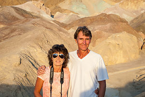 Lolo and Herb at Artist’s PaletteWhat a difference the season makes! When we were here in August of 2007, all I can remember is everyone moaning and groaning about the oppressive heat. But November is a totally different story, with clear sunny days in the mid to upper 70s, and nights falling to a comfortable 50 degrees. Spirits were significantly higher this time than the last.
Despite its large size – Death Valley is the largest National Park outside of Alaska – you can still see quite a bit of it a 2 to 3 day visit. Many of its highlights are quite accessible via a short walk from the car. Other, more remote areas of the park are only accessible with off-road vehicles on some pretty, long bumpy roads.
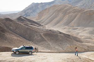 Subaru and Lolo on Twenty Mule Team Canyon RoadWe entered the park from the east on Route 190 and drove directly to the Furnace Creek Campground to ensure that we could get a site for a few nights. Although fairly busy, there fortunately were a few left, so we selected one with nice views, decoupled the Subaru, and then headed back out to explore.
One thing we don’t like about traveling this time of year is how early it gets dark. By 5:00 you’re pretty much done for the day.
We really had time for only one event, so we chose to catch the evening light along the scenic Artists Drive, a 9-miled paved spur road that winds through a colorful display of sedimentary and volcanic rock. Fortunately, we had the Subaru, because RVs longer than 25 feet are not allowed. We stopped at a viewpoint called Artists Pallet, named for the amazing rainbow of colors – red, pink, yellow, orange and brown – that paint the hills.
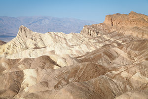 Zabriskie PointThere was a lot of ground to cover over the next 2 days, so we went to bed early and got an early start the next morning to catch the sunrise at Dante’s View, an overlook 5,000 feet above the valley floor, which many consider the best place to watch sunrise in the park. We didn’t quite make it for sunrise, but we were there pretty early. Unfortunately, there was a haze that hung over the valley, obscuring what I am sure would have been a very spectacular view.
We headed back up 190, and turned off onto the one-way dirt Twenty-Mule Team Canyon Road, named for the teams of mules that used to pull wagons loaded with borax mined in these canyons along this road during the 1880s. Borax was big business in Death Valley at that time. Have I mentioned how much we like having a 4-wheel drive tow vehicle? There are so many places in this park that you can’t get to in an RV, or even in a regular car. This road, which wound 2.7 miles through colorful badlands, was awesome, and during our entire time on it, including many stops, we never saw another soul. We just pulled over to the side of the road whenever we wanted to take pictures, which I would have to say was quite often. We probably spent over an hour covering the 3 miles.
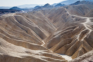 Zabriskie Point OverlookBack on 190, we stopped at Zabriskie Point, another spectacular viewpoint that claims to be the park’s best. From the overlook, the panoramic view of Golden Canyon and the surrounding colorful badlands was truly breathtaking. There was a photographer taking pictures of a solitary girl in a wedding gown – I hesitate to say bride, because there was no groom and I did catch a glimpse of jeans under her gown. What a backdrop for a wedding photo!!
After a quick lunch back at Furnace Creek, we spent the afternoon exploring stops along the road to Badwater Basin. Our first stop was the Devil’s Golf Course, an interesting expanse of jagged rock salt spires, shaped by the erosion of wind and rain – a landscape so harsh and otherworldly that only a devil would think of playing golf on it.
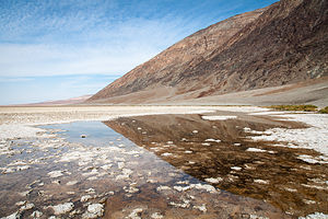 BadwaterWe continued on to Badwater Basin, which at 282 feet below sea level is the lowest, driest, hottest place in North America. After the obligatory pose by the Badwater sign, we headed out across the boardwalk, past a small salt lagoon, and onto the salt flats themselves, a surreal, otherworldly highway made of table salt. You can go on for miles if you choose, all the way to the other side of the Valley, but we chose to go for just about a mile before turning back.
On the way back north from Badwater Basin, we took a 1.5-mile bumpy dirt road to the trailhead for the hike to Natural Bridge, once again feeling grateful to have our Subaru along. From the parking lot, we immediately entered the mouth of a canyon and hiked uphill for about a ½ mile before arriving at our goal, a 50-foot high massive rock that spans the canyon.
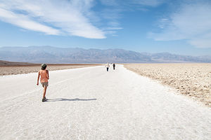 Lolo Hiking Badwater Basin Salt FlatWe were really efficiently knocking off lots of sites in the park. Time for a break. Wanting to flex the Subaru’s off-road capabilities a bit, Herb took the turnoff for the unpaved West Side Road which led further out into the valley, not with any particular destination in mind, but just because he could. Herb likes desolation a lot more than I do and loves getting to places where there isn’t another soul around for miles. Well, this was the place. Although the road goes on for about 40 miles, we pulled over in about 3, got the beach chairs out and just sat. It was so starkly beautiful and totally silent and still. Herb was right. It probably is good to do this once in a while. He just likes doing it longer than me.
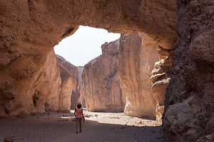 Lolo Hiking Natural BridgeOur last stop in this already full day was the hike through Golden Canyon, which I am convinced, is the absolute best hike in the park. I only wish we had allowed more time to complete the side trip up to Zabriskie Point, but we were only able to do part of it or we would have had to hike out in the dark – I hate these short days.
The first mile of the trail leads through a narrow colorful canyon. An interpretive pamphlet, which we picked up at the trailhead, explained the geological features of each of ten numbered markers in the first mile of the canyon. Rock is not just rock, and it’s much more fun to know a little bit about what you’re seeing.
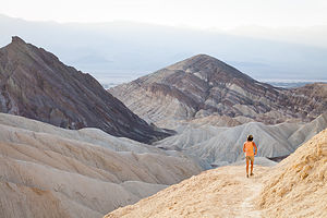 Lolo Hiking Golden CanyonSurprisingly, a paved road used to go through his canyon, but was washed away in a flash flood in 1976. In many places, we could still see chunks of asphalt poking through the ground.
Although the interpretive section of the hike ended at the one mile mark near marker 10, we continued upwards where the canyon eventually opened up to a vista of multi-colored badlands.
We followed the sign towards Zabriskie Point, and almost immediately the trail began to climb more steeply. It was hard to notice though because we were so distracted by the views. At about the 1.6 mile point we passed under a sharp, fin-like formation called Manly Beacon.
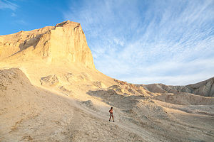 Golden Canyon with Hiking LoloAt 2 miles we came to a junction that was not clearly marked and had to make a decision. Continue steeply upward to Zabriskie Point, which we calculated as only another ½ mile, but then 2 ½ miles back down, hike down on what we thought was the alternative Gower Gulch trail, or turn around and head back the way we came. If it wasn’t so late in the afternoon, we definitely would have chosen to forge on ahead to Zabriskie Point, but because of the late hour and our uncertainly about the Gower Gulch trail, we retraced our steps – still not a bad decision as the view from a different direction and the changing light made it seem like new.
I would have to say that this hike is probably up there in my top 10 all-time favorites. Next time we are here, we will start early enough to do the whole Golden Canyon to Zabriskie Point to Gower Gulch route.
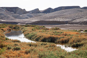 Salt Creek sans PupfishThe next day we decided to explore the northern portion of the park. We began our journey with an interesting man-made point of interest, the Harmony Borax Works. As much as I love natural beauty, I very much enjoy mixing in a little cultural history as well.
Death Valley would have had minimal human history if it wasn’t for the discovery of Borax near what is now the Furnace Creek Ranch. From 1883 through 1888, this was the site of a plant where 40 employees produced three tons of borax each day. From this site, Twenty Mule Teams would haul the borax over the long overland route to Mojave. Today, all that is left of the thriving Harmony Borax Works are some adobe ruins of the plant and an original twenty mule team wagon. We took the short, interpretive trail around the ruins, reading signs explaining its history along the way.
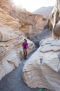 Lolo in Mosaic CanyonA little further north from the Borax Works is the Salt Creek Interpretive Trail, a rare chance to see water in Death Valley. It’s not exactly a hike, but more of a pleasant stroll on a mile-long boardwalk. The tiny little creek here is home to the inch-long Salt Creek Pupfish, a hearty little creature that somehow manages to survive these harsh conditions. Unfortunately, they are usually only visible in the spring, and as much as we tried, there were none to be seen. Still, it was a very pretty stroll, and I did learn to identify pickleweed, a cute little plant that thrives in salty conditions.
We made a short diversion off of 190 through the town, and I use the word “town” loosely, of Stovepipe Wells to get to the trailhead for Mosaic Canyon. It’s amazing how different each canyon in the park is. This one is the drainage for the Tucki Mountain, so it is subject to periodic flash floods that have scoured the rock into a smooth, polished marble, so smooth in places that it is slippery to walk on. Although the canyon continues on for about 2 miles, we stopped at the half mile point, as do most hikers, where the canyon opens up to expansive gravel wash. This marked the top of the lower canyon and the end of the interpretive part of the trail.
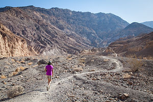 Lolo Hiking Mosaic CanyonBack at the junction for 190, we debated as to whether we should drive the 40 miles all the way up to Scotty’s Castle, since we had already been on a tour of it in 2007. However, we hadn’t been to Ubehebe Crater, which was nearby, so we decided to take the drive. Besides, it really is a very beautiful stretch of road, with desert views to the west and alluvial fans and mountains to the east.
Although we had no intention of taking the tour again, when we got to the junction for Scotty’s Castle and Ubehebe Crater, we decided to head to Scotty’s Castle to have a picnic lunch on what is the greenest part of Death Valley. Water from the springs of Grapevine Canyon actually flow through the grounds, making it a literal oasis in a surrounding desert. It was really nice to sit and hear the sound of flowing water after being in the desert for so long.
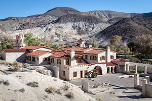 Scotty's CastleAfter lunch, we strolled around the grounds taking photos of this lovely, and lavish, Moorish Castle. The history of this place is truly fascinating, and I very highly recommend anyone visiting to take the tour and learn how Scotty, the con man, never actually lived here at all. I won’t give away the details.
We followed the signs for Scotty’s grave, which led us up a short but steep trail to a cross atop a hill overlooking the castle and surrounding desert. What a view! Scotty would have loved it.
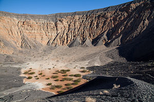 Ubehebe Crater with Tiny LoloOur last stop for the day was the Ubehebe Crater, a half-mile wide, 600-foot deep crater formed by volcanic explosions several thousand years ago. Although you can see the crater just fine from the parking lot, we decided that we needed to hike down to the bottom of it – why? because it was there. It was really steep, and we kind of slipped and slid along the loose cinders. After about 100 yards, Herb realized that sandals were probably not the shoe of choice and hiked back up to the car to change. Watching him take two steps forward and slide one back gave me a preview of just how tough the hike out was going to be. Oh well, we would worry about that when the time came. It really was pretty awesome standing on the flat floor of the crater looking up at its steep, multicolored walls. As with so many other places in this park, it was eerily silent. Quiet is good around a volcano. When it was time to leave, we selected a longer path that had a slightly shallower incline. Still, it was a pretty tough hike, made all the more difficult by the loose cinder surface.
There are two other hiking options at Ubehebe – the 2-mile circuit around the rim and the 1-mile out-and-back to Little Hebe, a much smaller adjacent crater. It was getting late and we had already done what we felt was the hike of choice, so we got in the car and drove back south to Furnace Creek.
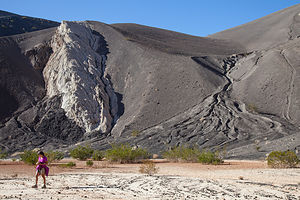 Lolo in Ubehebe CraterBack at the campground, I convinced Herb that he wanted to take me out on the town. Needless to say, our options were fairly limited, so we headed over to the 49er Café located at the Ranch at Furnace Creek. I liked the name and I thought it looked really cozy inside, and I didn’t have to cook in the RV, so spirits were high. Unfortunately, try as I might to like it, it really was a mediocre experience and pretty pricey for burgers and pasta. I guess they don’t have to worry too much about competition.
The night was still young – it gets dark so darn early and I was tired of going to bed at 9:00, so we went over to the Visitor Center to catch the evening program. I was desperate for entertainment. This evening’s show, believe it or not, was a musical performance by the University of Nevada at Las Vegas’ Marimba Band. If anyone had bet me that morning that I would be listening to Wagner's Tannhauser Overture played by a marimba band that evening, I would have said, “you’re on,” but that was exactly how we spent our last evening in Death Valley. It was as surreal as the landscape around us.
Description
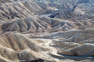 Twenty Mule Team Canyon RoadIn 1994, the Desert Protection Act added an additional 1.2 million acres to Death Valley National Monument and upgraded its status to National Park, making it the largest national park outside of Alaska. The park is located on the eastern border of a remote section of California with some small portions extending into Nevada. Despite its remoteness, it is one of the most highly visited parks in the national park systems. Many of these visitors come all the way from Europe and Japan to experience the extremes of this stunningly beautiful desert.
Death Valley received its name from the unfortunate forty-niners who were forced to cross the burning sands here in order to avoid the severe snowstorns in the nearby Sierra Nevada on their way to the California Gold Rush. Many perished along the way, and those that survived remembered it as a place of suffering and death. The current names of many of the places in Death Valley reflect its harshness: Dead Man Pass, Funeral Mountains, Furnace Creek, Hell’s Gate, Devil’s Golf Course, Starvation Canyon, etc.
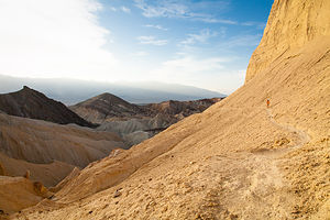 Golden Canyon TrailThe valley itself is over 130 miles long, but only about 12 miles wide, flanked on both sides by unvegetated reddish mountains. From an elevation of about 3,300 feet in the north, the land slopes steadily downward to an elevation of 279 feet below sea level at Badwater, the lowest point in the western hemisphere. In fact, 70 miles of the desert floor is below sea level, accounting for its extremely high termperatures, which can exceed 130°F in summer.
In many ways, not much about the valley has changed since the pioneers first crossed here. Its intense heat, frigid cold, and the driest air imaginable still make it one of the most inhospitable locations on earth. However, today’s visitors can enjoy Death Valley and see most of its highlights from the comfort of their air conditioned cars and stay in comfortable, and even luxurious, hotel rooms at night.
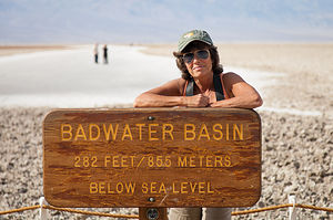 Lolo with Badwater Basin SignThe park is criss-crossed by a network of roads, ranging form washboard dirt ones to paved, well-maintained highways, making the most popular destinations quite accessible. The Furnace Creek Visitor Center, near the center of the park, is a great place to get oriented and to begin an exploration of Death Valley. This greenness of this area is a surprise to most visitors who come to the park expecting to see nothing but miles and miles of sand. Fed by warm springs, this area is a verdant oasis with palm trees as tall as 50 feet. There are also two world-class resorts here: the elegant Furnace Creek Inn and the more down-to-earth Furnace Creek Ranch.
Highlights traveling south from Furnace Creek on Route 190
- About 5 miles south of the Furnace Creek Visitor Center is Zabriskie Point, one of the most spectacular overlooks in the park. A short walk uphill from the parking lot brings you to a panoramic view of Golden Canyon and the surrounding vibrantly colored badlands. The views are particularly stunning in the lowlight of early morning or late afternoon.
- Another 1.5 miles down the highway s the turnout for Twenty-Mule Team Canyon road, a one-way dirt road that rejoins the highway in 2.7 miles. The road winds through Twenty-Mule Team Canyon with close-up views of the same colorful badlands seen from Zabriskie Point. RVs and trailers are not allowed on this road.
- 4.5 miles further south on 190 is a turnoff for Dante’s View (restricted to vehicles less than 25 feet). The road to Dante’s View climbs steeply to an overlook 5,000 feet above the valley floor, where the temperatures average 20° F cooler than in the valley. From this viewpoint, which most consider the most breathtaking in the park, one can see the lowest point (Badwater) and the highest point (Telescope Peak) in the park.
Highlights traveling south from Furnace Creek on Badwater Road
- About 1.8 miles south of the Visitor Center is the turnoff for Badwater Road. 1.5 miles further south on Badwater Road is the parking lot for the popular hike into Golden Canyon. A well-marked nature trail (2 miles RT) leads into the narrow canyon, wedged in by eroded cliffs and the slopes of golden badlands.
- Back on Badwater Road, continue south past Artist Drive (get that on the way back as it is a one-way road going north). Around 9 miles south of Golden Canyon is the turnoff for the unpaved spur road to Devil’s Golf Course. The road leads to an odd and forbidding landscape created by salt and erosion on a lake bed that dried up 2,000 years ago. The result is a jagged terrain of salty white miniature mountains and spires, less than 2 feet high. The name comes from the feeling that “only the devil could play golf on such rough links.”
- About 8 miles south is the Badwater Basin, the hottest and lowest point in Death Valley accessible by car. Surprisingly, its permanent spring-fed pools also make it one of the wettest. Legend says that it got its name from a surveyor whose mule refused to drink it. Although not poisonous, it is similar in composition and taste to Epsom salts. Despite its apparent inhospitableness, it is home to water beetles, insect larvae, and a soft-shelled saltwater snail that slowly adapted to these conditions.
- Turning back north on Badwater Road towards Furnace Creek, in 8 miles you come to the turnout for the one-way, 9-mile paved Artist Drive, which winds through a colorful display of sedimentary and volcanic rock hidden from the main road. It received its name from the rainbow of colors—red, pink, yellow, orange, and brown—that paint these rocky hills. About half-way through the loop is the parking lot for Artists Palette, one of the most colorful areas along the loop. Artist Drive is restricted to vehicles less than 25 feet.
Highlights traveling north from Furnace Creek on Route 190
- About 1.7 miles north of the Furnace Creek Visitor Center are the remains of what was once the Harmony Borax Works. Borax, which the prospectors called “white gold,” was once a big business in Death Valley. In the 1880s, Chinese laborers were hired to rake borax “cottonballs” from the valley floor and bring them to the Harmony Borax works to be purified. From there the refined borax was loaded onto the famous twenty-mule team wagons and transported 165 miles across the desert to the train station in Mojave. From there it was shipped to processing plants where it was used to make soaps, disinfectants, and food preservatives. Between 1883 and 1927, more than $30 million worth of borax was produced in Death Valley. A short trail leads past the ruins of the old borax refinery and some outlying buildings. More information on the mining of borax in Death Valley is available in the Borax Museum at the Furnace Creek Ranch.
- 12 miles further north on 190 is the turnoff for the 1.2 mile gravel road to Salt Creek, home to the famous Death Valley pupfish. When the lake that once covered Death Valley dried up thousands of years ago, the desert pupfish was the only fish that managed to adapt to the harsh conditions here. Isolated from each other in scattered salty pools, springs, and creeks, nine types of pupfish have evolved. A tenth has already become extinct. They are found no place else on earth. The pupfish can often be seen from the short wooden boardwalk nature trail that crisscrosses the stream and marshes.
- About 21 miles north of the Visitor Center, Highway 190 turns west towards Stovepipe Wells and the west entrance to the park. At this point, you can either continue on 190 or head north on the North Highway another 32 miles to Scotty’s Castle, the major man-made attraction in Death Valley.
Highlights along the North Highway (traveling north)
- The drive to Scotty’s Castle on the North Highway is a very scenic one with desert stretching out on the west and mountains rising to the east. About 10 miles north on the North Highway is a pullout with great views of Death Valley’s renowned alluvial fans. These fans are something like an hourglass with debris from the mountains funneling through a narrow opening and spilling out in a wedge shape into the valley. They come in many shapes and sizes. The ones near this viewpoint are smaller and steeper.
- 25 miles further north in the remote Grapevine Canyon looms the unlikely sight of a Moorish Castle. Construction of what was more officially called Death Valley Ranch was begun in 1922 by Chicago millionaire Albert Johnson, whose doctors had advised him to spend more time in a warm, dry climate. However, the mansion is known as Scotty’s Castle, named after Johnson’s unlikely friend, Walter Scott. Walter Scott was a cowboy that had traveled with Buffalo Bill’s Wild West Show in the 1880s before taking up prospecting. Albert Johnson was one of Scotty’s gullible investors in his “secret gold mine” in Death Valley. After several trips west to see the mine, Johnson realized that he was being duped by Scotty. Despite that, Johnson truly enjoyed his new friend and the tall tales he told. Scotty helped Johnson conceive the idea of this vacation villa in Death Valley and lived in it after Johnson’s death.
- In 1970, Scotty’s Castle was purchased by the National Park Service from the foundation to whom Johnson had willed it. Today the colorful history of the castle is brought to life by rangers dressed in 1930s clothing that welcome you as if you were Scotty’s guests. The one-hour guided tour is excellent, both for its inside look at this unusual mansion as well as for the stories about the eccentricities of the two men that built it. Tours depart every 20 minutes from 9 am to 5 pm. Plan to arrive early because they fill up quickly.
- About 1.5 miles down Grapevine Canyon heading back south on the North Highway is the turnoff for the 8 mile road to Ubehebe Crater. This half-mile wide, 600-foot deep crater was formed by volcanic explosions several thousand years ago. Dark cinders and volcanic fragments cover the surrounding countryside. From the parking area there is a steep trail up to the crater’s rim. Be prepared to battle some very gusty winds.
- Because of its remote location, few visitors get to see the famous Death Valley Racetrack, where rocks mysteriously move across the dry lakebed on their own accord. Although no one has actually seen the rocks move, they are known to move because of the trails they leave behind them. After studying the phenomenon for decades, scientists now believe they have solved the mystery. The surface of the lakebed is a fine clay that becomes very slippery when wet. After a rain, heavy winds as high as 70 mph blow the rocks across the slick surface. A 4-wheel drive vehicle is needed to reach the Racetrack, which is 27 miles past Ubehebe Crater on a rough dirt road.
Highlights traveling west along Route 190 from the junction with the North Highway
- Just west of the junction is the parking area for the surrealistic Devil’s Cornfield. On both sides of the road are odd-looking clumps of brush four to ten feet tall that resemble corn stalks. They are actually arrowweed bushes, whose stems were used by Native Americans to make arrow shafts.
- A few miles further west on 190, pull over on the shoulder by a roadside display where the Sand Dunes come close to the highway. These are the highest of a 14-square-mile field of dunes. Although there are no trails to follow, hikers are free to roam the dunes on their own. The best time of day to visit the dunes is in the morning or late afternoon when the temperatures are cooler and the lighting is more dramatic.
- Two miles further west is the village of Stovepipe Wells, Death Valley’s first tourist resort. The village actually got its name from an historic site about 5 miles north where an old stovepipe was sunk into the sand to form the shaft of a well. For years this well was used by travelers as a source for water. Around 1926 a developer planned to build a small resort near the well. However, his lumber trucks got stuck in the sand before he could reach it. Rather than unload and reload his trucks, he decided to try and dig a well where they were. They struck water and stayed. That spot is the current location for Stovepipe Wells. Today the village has a motel, general store, saloon, restaurant, and campground.
Campgrounds that will accomodate RVs in Death Valley
- Furnace Creek Campground (136 sites, no hookups) – located just north of the Visitor Center. Open year round. This is the only park campground that takes reservations.
- Mesquite Spring Campground (30 sites, no hookups) – located 5 miles south of Scotty’s Castle. Open year round.
- Panamint Springs Resort (40 sites, 12 hookups) – located 30 miles west of Stovepipe Wells on Route 190. Open year round. This campground is privately operated and takes reservations.
- Stovepipe Wells Campground (200 sites, 15 hookups) – located in the village of Stovepipe Wells. Open year round.
- Sunset Campground (1000 sites, no hookups) – located .25 miles east of the Furnace Creek Ranch. Open October through April.
- Texas Spring Campground (92 sites, no hookups) – located near Sunset Campground. Open October through April.
- Wildrose Campground (30 sites, no hookups) – located 30 miles south of Stovepipe Wells off the Trona-Wildrose Road. Open year round.
In addition to the park campgrounds, there are two privately-owned campgrounds in the park:
- Furnace Creek Ranch Campground (26 sites, all full hookups) - located at The Ranch just south of the Visitor Center. Open year round. Guests can enjoy the Ranch’s natural spring-fed swimming pool, shower facility, coin operated laundry, tennis courts, shuffleboard, volleyball, Bocci Ball and basketball court.
- Panamint Springs Campground (37 sites, 12 full hookups) - located at the western end of Death Valley National Park on Highway 190 in the town of Panamint Springs
Red Rock Canyon National Conservation Area
Friday, November 7, 2014 - 8:15am by Lolo196 miles and 4 hours from our last stop - 5 night stay
Travelogue
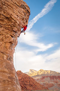 Herb on Caustic Post Crux Clip - TJGTo say that Vegas is not exactly our cup of tea is a bit of an understatement. However, it did, somewhat surprisingly, have something that was – camping proximity to a world-class rock climbing area known as Red Rock Canyon. Although Red Rock does have a campground, it really is only meant for tenters, so the Circus Circus RV Park was the only game in town.
Ironically, Circus Circus, right on the end of the strip, was the first place we ever camped in our brand new motorhome back in 1999, when we had it delivered from the Lazy Daze factory in Montclair, California. So, here we were 15 years later, back in the same asphalt parking lot surrounded by the glitter and glitz that is Vegas. It was like coming home. Well, not exactly, but it would serve our purpose well enough, as a base camp for Red Rock.
The boys and Celeste arrived late Friday night very excited about a break from work and the prospect of spending the next four days climbing. It’s amazing to us how much they have taken to rock climbing, a sport that Herb had been equally obsessed with when he was their age. Now, climbing has become the centerpiece of our family vacations and a wonderful bonding experience for us and our adult children. It’s amazing what trusting your life to the person on the other end of a rope can do for family dynamics.
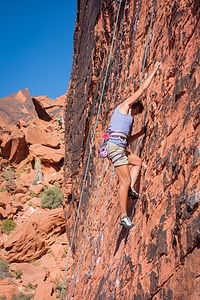 Lolo Climbing at Red Rock - TJGDespite their late arrival and my hopes that they might want to sleep in a little the following morning, they were up bright and early, ready for a full day of climbing.
So, for the next four days, we commuted (during rush hour) from Vegas to Red Rock where we put in a tough 8 or 9-hour day. And they call this vacation???
I was the only one of us that had never been to Red Rock before, so I probably had the most astonished reaction that a place of such natural beauty could be so close to a place of such man-made tackiness. It was like a wonderland of vibrant red rock, just waiting to be scrambled over and climbed.
Unlike other climbing areas we have visited in the past, Red Rock has really long approaches that require climbing up, down, and around giant boulders of rock for over a mile. Many visitors to the park don’t rock climb at all, but come here just to hike and scramble in this red rock playground. Other more sedentary types, enjoy Red Rock Canyon right from their cars, while cruising along the 13-mile scenic drive through the park, stopping at viewpoints along the way.
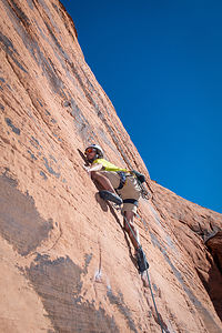 Andrew Climbing at Red RockBut not us. For the next four days straight we would hike/scramble to the base of a wall, climb, then hike/scramble some more to another spot, climb some more, and then hike/scramble back to the car, usually with headlamps on, because it was dark. Then we would sit in the now deserted roadway – because most people had the good sense to have already left and were probably eating dinner by now – talk about the accomplishments of the day and have a celebratory beer.
Since the scenic drive through the park was one way, and we were at the beginning of it, we would then have to drive the 13 miles of winding road just to exit the park. With four days, I thought that maybe just once I would actually be able to see the scenery along the scenic drive, but that never happened, because we never got out of there before nightfall. I guess with youth and limited vacation time, the kids wanted to make the most of each and every day. I just hoped I would survive it. I must say, I have never slept so well in my entire life.
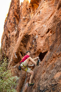 Tommy in Black Corridor of Red Rock CanyonUsually when we got back to the campground, we were too exhausted to do anything but go to sleep. However, one night I did convince everyone that we should walk the Strip. Circus Circus is located all the way at the northern end of the Strip, so we practically had to walk a mile before getting to any of the good stuff. During that first mile, everyone remembered just how much they hated Vegas, so it took all my charm to convince them to continue on, just a little bit further.
Secretly, my goal was to make our way to the Bellagio Hotel to see the fountains dance, as we had on our first trip to Vegas in 1999, when the boys were just 8 and 10. I am quite nostalgic and I must confess to wanting to repeat the feeling that I had back at that moment in time – the excitement of the first night in our new motorhome and these two little boys mesmerized by the choreography and lights of the fountains, accompanied by Andrea Bocelli belting out “Time to Say Goodbye.” I still can’t listen to that song without crying.
Well, as Herb always reminds me, “You can’t go back.”
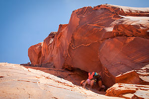 Tommy and Celeste on the Great Red Book - AJGWe did manage to watch the volcano go off in front of the Mirage Hotel and the tacky out-dated Fall of Atlantis Show at Caesar’s Palace before the troops insisted on going back to the motorhome and to bed. If we hadn’t gotten lost inside Caesar’s Palace for 45 minutes, I might have had them. What really got us is how these casinos try to manipulate you and make you walk for what seems like miles before finding an exit. Herb compared it to that old Roach Motel commercial, where “Roaches check in...but they don’t check out.”
 Climbers at Mirage VolcanoI guess I should be glad that the boys are not big Vegas fans and prefer more wholesome activities in the great outdoors, but still, couldn’t I just gamble a little? So one night, Tommy humored me, and off we went to the Circus Circus Casino – just two high rollers out on the town. Actually, I give him a lot of credit for going out to a casino with his mother.
We set the rules up front. That way, things wouldn’t get out of hand – hahaha. The game would be Black Jack and we each set a limit of $20. If we worked that $20 up to $30, we could cash out. If not, we had to keep playing until we lost it. Since $20 is not exactly a vast sum of money in Vegas, we couldn’t play the tables, because we would be done in about 2 minutes. Instead we had to find a $1 Black Jack machine. After wandering the casino for about 15 minutes and not finding one, I asked a security guard, who then proceeded to wander around with us in our search. I am surprised Tommy didn’t just pretend he didn’t know me at that point and head out on his own. But he’s a good boy, and we were in this together.
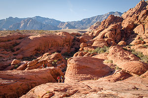 Red Rock Canyon Climbing CommuteFinally, we found a machine and decided that I would play first, while Tommy looked on. I think he was just trying to get some tips from me. My less than sophisticated system required me to double my bet whenever I lost. This worked for a while and I my winnings went up and down. When I got to $27, I said I wanted to cash out, but Tommy held me to our rule of not cashing out until $30. I then proceeded to lose the whole thing.
Tommy stepped up to the machine and had similar results. Oh well, it was fun anyway. On our way out, Tommy decided to take out another $20 (going against our rule), and put it on 25-36 on the roulette table, which would give him a 1 in 3 chance of winning. Well, the little stinker won and walked away with a $60 payout (the $20 he put in, and $40 of winnings). That meant that collectively we were even, and I asked him to give me $20 of his winnings so we would be individually even as well. After all, I explained, we were a team. He reluctantly handed over the $20, but only so he could forever hold it over me how he had to bail me out that time in Vegas.
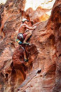 Herb in Black Corridor of Red Rock CanyonI certainly felt like a winner. After all, I got to spend a night out with my son, laughing and having a good time. We returned to the motorhome victorious only to find that the rest of them were already sound asleep, resting up for another day of climbing.
Although the four days of rock climbing in Red Rock Canyon sort of blend together, there were definitely some highlights and firsts that stick out in my mind, such as:
I completed my first outdoor 5.9 climb cleanly and without falling. So sure was everyone that this was beyond my capabilities that Andrew even promised to carry me back to the car on his back if I was able to do it. I am still waiting.
On the final day, Herb completed the most difficult lead of his long climbing career, a 5.11b called Caustic. Even more importantly, the photo of this accomplishment which Andrew posted on Facebook with the caption “Old Man Herb cruising up Caustic” received the most Likes of any photo of Herb to date.
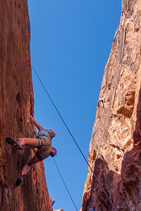 Lolo and Tommy in Black Corridor of Red Rock CanyonTommy, by far the most skilled, willing, and able to lead multi-pitched climbs, herded the four of them (Herb, Andrew, Tommy, and Celeste) up two spectacular ones: the Great Red Book, a 2-pitch 5.8 climb, and the Big Bad Wolf, a 4-pitch 5.9 climb.
Celeste, besides leading several 5.10a and 5.10b routes, and taking the time to set up some easier 5.8 and 5.9 routes for me, completed her first multi-pitch climb. In fact, she completed two.
Besides leading several difficult 5.10 and 5.11 climbs, Andrew led the second pitch of the Big Bad Wolf (his first multi-pitch lead). Andrew also should be credited for the documentation of our Red Rock experience. In an act of dedication to historical accuracy and a bit of anal-retentiveness, he has meticulously recorded on Mountain Project the details of each of our 19 climbs.
Spending time with the boys and Celeste at Red Rock Canyon was an awesome, albeit exhausting experience, but one which I can’t wait to repeat.
Description
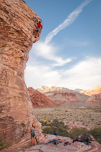 Celeste Belaying Herb on Caustic - TJG Red Rock Canyon, located just 17 miles west of the Las Vegas Strip, encompasses 195,819 acres of towering red cliffs and desert beauty. The park includes a 13-mile scenic drive, over 30 miles of hiking trails, world-class rock climbing, canyoneering, mountain biking, horseback riding, wildlife viewing, and a visitor center.
Because of its unique geological features and wildlife, in 1990 it was designated as Nevada’s first National Conservation Area, and is managed by the BLM.
Red Rock Canyon National Conservation Area has one developed campground. Red Rock Canyon Campground is located two miles east of the Visitor Center on west Charleston Boulevard (State Route 159) and then one mile south on Moenkopi Road. The campground has 72 individual campsites (including 14 walk-in, 5 RV & 3 accessible sites). There are no hookups. http://www.blm.gov/nv/st/en/fo/lvfo/blm_programs/blm_special_areas/red_r...
Mojave National Preserve
Friday, November 7, 2014 - 8:00am by Lolo146 miles and 3 hours from our last stop
Travelogue
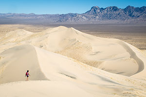 Kelso Dune with Tiny LoloThe Mojave National Preserve makes for an easy side trip when traveling along I15 between Los Angeles and Las Vegas, whether you have just an extra hour or a full day. As I mentioned in the previous stop, the Preserve doesn’t really have any accessible camping options for motorhomes when entering from the north, so we were just going to make this a half-day detour on our way to Vegas.
As recommended by the National Park website, we took the Kelbaker Road exit off of I15 and drove south 34 miles through a barren landscape of cinder cones and lava flows to the Kelso Depot Visitor Center. It was extremely desolate and we passed only about three cars during the entire stretch. Signs kept warning us to “Watch for Tortoise,” but try as I might, no desert tortoises were to be seen. Far too often, these iconic and endangered residents of the Mojave are able to survive some of the most extreme conditions in the world, only to meet their fate under a tourist’s tire. We were extra careful not to do that, but it would have been really cool to see one alongside the road.
 Kelso Depot Visitor CenterThe Kelso Depot Visitor Center was one of the prettiest National Park visitor centers I have seen. This beautiful Mission Revival style building was built in the 1920s to serve as a railroad depot, providing food, recreation, and accommodates for Union Pacific Railroad employees. It was called the “Kelso Depot and Clubhouse,” and it had a conductor’s room, telegraph office, dormitory room for staff, boarding rooms for railroad crewmen, a billiard room, library room, ticket office, and lunch counter.
I would have loved to have had lunch there – and spun around on one of those old stools -- but unfortunately it hasn’t served lunch in many a decade. With progress in diesel technology, fewer and fewer crew members were needed to operate and maintain the line, so the Union Pacific closed the depot in 1985.Fortunately, due to the efforts of local residents and others across the region, the building was saved from demolition and put under the control of the Bureau of Land Management.
 Lolo in Kelso Depot JailWith the passage of the California Desert Protection Act of 1994, the Mojave National Preserve was created, and the Kelso Depot, as well as 1.6 million acres of sand dunes, Joshua tree forests, wildflowers, and volcanic cinder cones, came under the protection of the National Park Service. Renovation was begun on the depot in 2002, and it reopened to the public in 2005 as the Mojave National Preserve Visitor Center.
There are still about a dozen small houses on the other side of the track, where the much smaller crews needed to maintain the line live.
We had time for only one hike, so after a brief debate over the merits of the Kelso Dunes vs. Teutonia Peak, we decided to go with the dunes. I think either choice would have been great.
The Kelso Dunes are located just a short distance from the Visitor Center down the unpaved Kelso Dunes Road. The road was well-graded, so it was perfectly fine for RVs.
 Herb on Kelso Dune SummitThe distances for dune hikes are always deceptive. Three miles might not sound like much, but when you are slogging through soft sand, it can be fairly strenuous. And, did I mention that this is the second highest dune in California?
As those that have hiked on a dune before know, the shifting sands prevent anything resembling a trail from forming, so it is free form – just get to the top any which way you can.
This was one big dune, cover 45 square miles, and rising 650 feet above the desert floor. It made me feel very small and insignificant – just the way Herb likes me – and he captured that in several of his photographs.
The views from the top of the surrounding dunes and peaks of the Mojave were awesome.
 Lolo on Kelso Dune SummitAfter descending and de-sanding ourselves thoroughly, we continued our drive through the Preserve, this time taking the Kelso-Cimo Road northeast back towards I15. At Cima, we bore right onto the Morning Star Mine Road rather than left onto the Cima Road, because a ranger at the Visitor Center warned us that this way would allow us to avoid a very steep section of I15.
As we rose in elevation, we began to see more and more Joshua Trees alongside the road. These trees only grow at above 1,300 feet in the Mojave Desert, so it was kind of cool to see one or two brave ones starting at the lower elevations and then thicker stands of them as we rose even more.
We stopped and took a few photos of them along the way, but we knew that we would have much more opportunity to do that later on during the trip when we visited Joshua Tree National Park.
Description
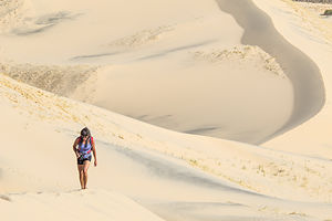 Lolo Hiking up Kelso DuneThe Mojave National Preserve, located in the Mojave Desert between I15 and 140, encompasses 1.6 million acres of sand dunes, Joshua tree forests, wildflowers, and volcanic cinder cones. The Preserve contains three of the four major North American deserts: the Mojave, Great Basin, and Sonoran.
The Preserve was created with the passage of the California Desert Protection Act in 1994, which transferred the lands previously managed by the BLM to the National Park Service.
With elevations in the preserve ranging from 880 feet near Baker to 7,929 feet at Clark Mountain, there is much variety in climate, precipitation, and ecosystems within the Preserve. The best months to visit are October through May, as summer temperatures average from 90 upwards to 105 degrees.
A good way to get an overview of the preserve when traveling between LA and Las Vegas is to exit I15 in the town of Baker, and drive the Kelbaker Road 34 miles south past cinder cones and lava flows to the Kelso Depot Visitor Center. Originally opened as a train station in 1924, Kelso Depot now serves as the Preserve’s visitor center, with exhibits describing its cultural and natural history.
The Kelso Dunes, the second largest dunes in California, are located just a short distance from the visitor center along the well-graded, but unpaved Kelso Dunes Road. The 3-mile round trip hike to the top of the dunes is well worth the effort.
From Kelso, drive north on the Kelso-Cimo Road passing along the Providence Mountains. As you gain elevation, more and more Joshua Trees will appear alongside the road. At Cima, bear right on the Morning Star Mine Road through the Ivanpah Valley and on back to I15, just south of Primm, Nevada.
Camping opportunities in the Mojave National Preserve include roadside camping, backpacking, and two developed campgrounds, both of which are first-come, first-served and have no hookups:
- Hole-In-the-Wall – located at an elevation of 4,400 feet, this campground surrounded by sculptured volcanic rock walls is a great base camp for hikers. There are 35 campsites accommodating RVs and tents.
- Mid Hills – located at an elevation of 5,600 feet, this campground is much cooler than the desert floor below. There are 26 sites. The access road is not recommended for RVs.
There is no lodging or dining within the Preserve.
Afton Canyon Natural Area
Thursday, November 6, 2014 - 7:45am by Lolo187 miles and 3.5 hours from our last stop - 1 night stay
Travelogue
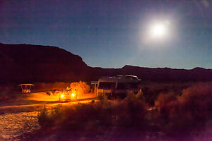 Afton Canyon Campground by MoonlightOne long day of driving without any fun is okay, but not two, so we started looking for something to entertain us along route.
The Mojave National Preserve seemed interesting, but a few phone calls confirmed my suspicions that camping there was not going to be easy. The one developed campground was not easily accessible from the north, and the primitive roadside camping on sandy roads didn’t sound like a great idea with an RV with car in tow.
However, our reliable “Moon West Coast RV Camping” Book gave us another option – Afton Canyon, just 25 miles west of the entrance to the Mojave Preserve. Not only did the Canyon seem interesting in its own right, but it would also allow us to explore Mojave the next day en-route to Las Vegas.
Afton Canyon was only 3 miles off of I15, but it was a very bumpy 3, which made us question a bit the wisdom of our decision. However, the guide book did say that the campground accommodated RVs up to 30 feet, so if they could do it so could we. Just to be safe, we decoupled the car from the motorhome and did the final stretch separately.
The campground was small, only 22 sites, and had only one other occupant. It was pretty desolate, but in a good way. The scenery was nice – colorful canyon walls on one end and an old railroad bridge on the other.
There wasn’t a whole lot to do here, but the guide book did describe a nice hike to a pair of caves in the canyon walls. Unfortunately, the directions for the hike were to follow the Mojave River, which in normal seasons flows above ground through Afton Canyon. However, this was not a normal year, and California’s multi-year draught had taken its toll and the river along with it. We wandered around aimlessly for a while, following what we thought was a dry riverbed, but finally gave up and wandered over to the picturesque railroad bridge and took some photos.
I was a bit frustrated on our failed hiking attempt, but still it was a nice stop – much better than our Flying J the previous night.
Description
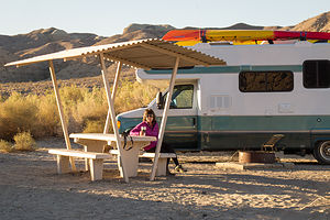 Afton Canyon CampsiteAfton Canyon, located 37 miles northeast of Barstow, is often referred to as the Grand Canyon of the Mojave. This multi-colored canyon was created over 18,000 years ago by a massive flood. Today, it is one of the few places where the Mojave River still flows above ground, making it an ideal location for bird and wildlife viewing. This unique riparian area has been designated as an Area of Critical Environmental Concern.
Activities in the canyon include hiking, 4-wheel driving, rock hounding, hunting, wildlife viewing, and star gazing. .
There is one developed campground, which has no hookups and is first-come-first-served. To reach the canyon, drive 36.6 miles north on I15 to the Afton Road exit. Follow the dirt road for 3.4 miles to the Afton Canyon campground.
Flying J - Bakersfield
Wednesday, November 5, 2014 - 7:30am by Lolo314 miles and 6 hours from our last stop - 1 night stay
Travelogue
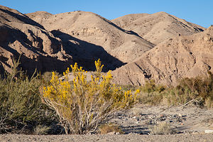 Afton Canyon WallsOn long driving days with no particular fun destination in mind, we often just pull into a Flying J to spend the night. The price is right. They let trucks and motorhomes stay overnight for free.
Another reason we like Flying J’s is that there is a lot of activity going on all night, so they are generally safe. This one, however, had me a bit nervous. Before we even got tucked into our parking place for the night, I had a bit of a scare. Herb was filling the motorhome with gas, and I was walking around looking for a good place to park for the night. As I was crossing the lot, out of the corner of my eye, I saw a guy sort of heading towards me. I changed direction a bit, trying not to make it too obvious that I was trying to avoid him, and headed back towards Herb and the gas pumps.
I heard him mumble, “I’m not gonna kill ya” over and over again -- not Herb, but the strange guy in the lot. Well, that was certainly good to know. I told Herb about the incident and we decided to park under a light with plenty of other RVs around.
That was the first time I was ever nervous sleeping in a Flying J. The next morning, the guy was still wandering around the parking lot mumbling to himself. He was obviously homeless and probably either a drug addict or mentally disabled. I felt really sorry for him.
As we pulled out of the Flying J that morning, we got to experience a bit of what the California draught has done to the Central Valley. A thick haze blocked the sun, reminding me of those pictures you see of the pollution in China -- but it was just dust. “The Grapes of Wrath” came to mind. They better get some rain soon.
Description
Flying J's are Travel Plazas that cater to truckers and RV's. Their numerous services include gas, dump station, propane, fast food restaurant, limited groceries, and even showers and a barber shop. However, the best feature of all is the section for overnight RV parking.
They are conveniently located on most of the interstates (except for the northeast).
