- Home
- About
- Map
- Trips
- Bringing Boat West
- Migration West
- Solo Motorcycle Ride
- Final Family XC Trip
- Colorado Rockies
- Graduates' XC Trip
- Yosemite & Nevada
- Colorado & Utah
- Best of Utah
- Southern Loop
- Pacific Northwest
- Northern Loop
- Los Angeles to NYC
- East Coast Trips
- Martha's Vineyard
- 1 Week in Quebec
- Southeast Coast
- NH Backpacking
- Martha's Vineyard
- Canadian Maritimes
- Ocracoke Island
- Edisto Island
- First Landing '02
- Hunting Island '02
- Stowe in Winter
- Hunting Island '01
- Lake Placid
- Chesapeake
- Provincetown
- Hunting Island '00
- Acadia in Winter
- Boston Suburbs
- Niagara Falls
- First Landing '99
- Cape Hatteras
- West Coast Trips
- Burning Man
- Utah Off-Roading
- Maui
- Mojave 4WD Course
- Colorado River Rafting
- Bishop & Death Valley
- Kauai
- Yosemite Fall
- Utah Off-Road
- Lost Coast
- Yosemite Valley
- Arizona and New Mexico
- Pescadero & Capitola
- Bishop & Death Valley
- San Diego, Anza Borrego, Joshua Tree
- Carmel
- Death Valley in Fall
- Yosemite in the Fall
- Pacific Northwest
- Utah Off-Roading
- Southern CA Deserts
- Yosemite & Covid
- Lake Powell Covid
- Eastern Sierra & Covid
- Bishop & Death Valley
- Central & SE Oregon
- Mojave Road
- Eastern Sierra
- Trinity Alps
- Tuolumne Meadows
- Lake Powell Boating
- Eastern Sierra
- Yosemite Winter
- Hawaii
- 4WD Eastern Sierra
- 4WD Death Valley +
- Southern CA Deserts
- Christmas in Tahoe
- Yosemite & Pinnacles
- Totality
- Yosemite & Sierra
- Yosemite Christmas
- Yosemite, San Diego
- Yosemite & North CA
- Seattle to Sierra
- Southwest Deserts
- Yosemite & Sierra
- Pacific Northwest
- Yosemite & South CA
- Pacific Northwest
- Northern California
- Southern Alaska
- Vancouver Island
- International Trips
- Index
- Tips
- Books
- Photos/Videos
- Search
- Contact
Cape Breton Highlands National Park / Cabot Trail, NS
Thursday, July 15, 2004 - 10:00am by Lolo
288 miles and 6 hours from our last stop - 1 night stay
Travelogue
Our first stop in Nova Scotia was the huge and highly informative Nova Scotia Visitor Center in Amherst, right off Exit 1 of the Trans-Canada Highway. Besides the walls and walls of maps and brochures for each region of Nova Scotia, there was an ice cream stand, and a nice gift shop—both of which the boys made a beeline to. Our only disappointment was that the bagpipers that the guidebook promised were nowhere to be found. I think that perhaps the rain, which was now falling pretty steadily, kept them away.
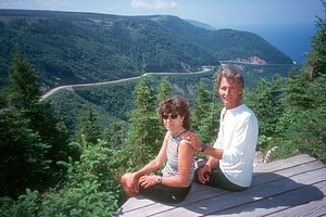
 Lolo and Herb at OverlookWe pretty much knew that we wanted to spend our time in Nova Scotia on the more remote Cape Breton Island, so we concentrated on collecting information for that region. You could tell that Nova Scotia was very good at marketing itself to tourists. Each region and road had a cute name, like the Lighthouse Route, the Evangeline Trail, or Glooscap Trail, etc. They even sold separate hat pins for each of these trails, which we managed to steer the boys away from. Since we pretty much just wanted to get to Cape Breton Island, we decided that our best route would be the Sunrise Trail to the Ceilidh Trail to the Cabot Trail.
The Sunrise Trail along the northern coast of Nova Scotia was very scenic and enjoyable, meandering through rolling farmland with lovely views of the Northumberland Strait. However, since it was quite a bit slower than the unattractively named Route 104, we made a compromise—we enjoyed the scenery along the Trail for the first 90 miles, and then in Pictou we got on Route 104 for the remaining 70 miles to Cape Breton Island. In this way we got to see some of the lovely Nova Scotia landscape, while still managing to get a campsite before nightfall.
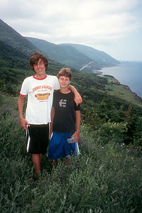
 Boy's on Trout River TrailWe entered Cape Breton Island by crossing the Canso Causeway and then headed north on the Ceilidh Trail through picturesque villages overlooking St. Georges Bay. In the town of Glenville we passed the Glenora Distillery, North America’s only single-malt whiskey distillery. Although tempting, we bypassed the tour—perhaps, we’ll save that for another time, without children.
As it was getting late in the afternoon, we began the search for a place to spend the night. In the town of Inverness, we found a pretty campground on a bluff with fabulous views of the Gulf of St. Lawrence. The only reason we chose not to stay there was that the winds were so fierce that we could barely open the RV door without it being ripped off. So we continued on to the Cheticamp Campground in Cape Breton Highlands National Park. Although still very windy, it was in a much more protected area. The campground was quite nice—large roomy sites with mountains on one side and the Cheticamp River on the other.
At the Visitor Center, we decided to purchase a Canadian Park Pass for $89 (Canadian), which for us, seemed to make sense. Besides spending a few days in this park, we would be spending another 5 or 6 days in Gros Morne and then PEI and Kouchibouguac, so it would pay for itself in no time.
That evening we attended the Ranger Talk at the Visitor Center, as we often find these talks quite informative and sometimes entertaining. Let’s just say that this one was definitely one of the entertaining ones. The subject of the talk was a serious one—the disappearance of the salmon from the once prime salmon rivers in the park. It was entitled, “Where have all the salmon gone.” To present this information, the female park ranger dressed up in a detective outfit and interacted with a film that featured her boyfriend dressed up like a salmon. While I definitely give this ranger high points for enthusiasm and effort, it was hard to keep the boys (and I’m ashamed to admit Herb and me) from cracking up. I think the Canadian Parks give their rangers much more leeway for creativity than the U.S. parks do
The next morning we decided to take a bike ride from our campsite along the Trous de Saumons trail, which runs along the Cheticamp River. We had originally thought that we would get a permit and do some fishing along this river, but last night’s ranger talk put a little damper on that idea. The trail was much rougher and hillier than we expected—better for hiking than biking. There wasn’t just an occasional rock to maneuver over, but rather most of the trail was completely covered with rocks, making for a very tooth jarring ride.
It was now time to set off on the spectacular Cabot Trail, considered by many to be one of the most scenic drives in all of North America. They’re right—it is truly breathtaking, with magnificent highland plateaus, spectacular colorful cliffs overlooking the sea, sandy beaches, and picturesque canyons and waterfalls.
From Cheticamp, the road climbs into the highlands, hugging the coastline with several scenic lookouts over the Gulf of St. Lawrence. After about 10 miles the road turns inland and crosses French Mountain, the first of two mountains along the western coastline. After French Mountain, we stopped at the Skyline Trail trailhead to hike what I now consider to be one of my all-time favorite hikes.
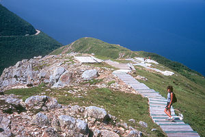
The hike, which was 4.3 miles in total, started out along a boardwalk though an area of wind-stunted spruce and fir trees. We kept our eyes peeled for moose, which theoretically frequented the area. Eventually the trail led out to a dramatic exposed headland overlooking the Gulf of St. Lawrence on one side and the winding Cabot Trail on the other. The view was absolutely spectacular. As we sat on a bench at the very tip of the headland gazing out over the water, we noticed the couple on the next bench getting very excited over something they saw through their binoculars. We took out our binoculars and discovered the source of their excitement. The whitecaps we saw in the water far below us were not whitecaps at all, but rather the splashes of a pod of surfacing whales. They were so far away that without binoculars they would have been very easy to miss.
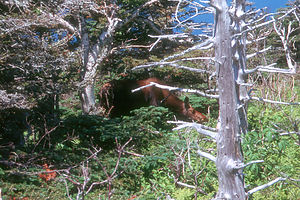
Rather than retrace our steps, we continued on the loop through a forested section where we were rewarded with a very close encounter with a mother moose and her young. They certainly are big animals and although they looked quite placid, we knew enough not to mess with a mother and her young. After all, I’m a mother too. What a truly wonderful hike, complete with excellent scenery and some interesting wildlife.
Back on the Cabot Trail, we continued winding our way over MacKenzie Mountain before returning to the sea once more near the fishing village of Pleasant Bay. A few miles further on, the road turned inland again, climbing over North Mountain, the final mountain along the route. I think both Herb and the RV were quite happy when we finally descended into the beautiful Aspy River Valley. At the village of Cape North, we left the Cabot Trail (for now at least) and headed north towards our destination for the night—Meat Cove at the very northernmost tip of Cape Breton Island.
Description
Cape Breton Highlands National Park is located on the northern and most rugged tip of Cape Breton Island, between the Atlantic Ocean and the Gulf of St. Lawrence. Its 365 square miles have some of the most dramatic scenery in all of Canada---magnificent highland plateaus, spectacular cliffs overlooking the sea, sandy beaches, and picturesque canyons and waterfalls.
 Lolo at Skyline Trail OverlookThe western side of the Cape Breton peninsula along the Gulf of St. Lawrence is the most spectacular. Here the tablelands have eroded into the sea, creating ravines and colorful cliffs down to the sea.
Through the park winds one of the most scenic drives in all of North America—the Cabot Trail. From the park’s west entrance at Cheticamp to the east gate at Ingonish Beach, the total driving distance is 66 miles. Starting in Cheticamp, the road climbs into the highlands, crossing French Mountain, the first of two mountains along the western coastline. After the road turns inland over French Mountain is the trailhead for one of the most magnificent hikes in the park—the Skyline Trail.
This 4.3-mile loop trail starts along a boardwalk through wind-stunted spruce and fir trees, then across the highlands and out onto a dramatic exposed bluff overlooking the Gulf of St. Lawrence. From there the view is spectacular. On one side you can watch tiny cars winding along the Cabot Trail and on the other you can see pods of whales surfacing in the sea. On your way back, keep your eye out for the moose that frequent this area.
 Moose on Skyline Trail HikeContinuing along the Cabot Trail, the road goes further inland over MacKenzie Mountain before returning to the sea near the fishing village of Pleasant Bay. The village, which actually lies right outside the National Park boundaries, offers whale-watching tours and has an interesting whale interpretive center.
Past Pleasant Bay, the Cabot Trail continues inland and climbs North Mountain, the final mountain along the route. The road then descends through some spectacular gorges to Cape North in the beautiful Aspy River Valley. Cape North, which lies outside the national park boundary, is the northernmost point on the Cabot Trail.
From Cape North, there is a very worthwhile side trip off the Cabot Trail to the northernmost tip of Cape Breton Island. The road leads north past Cabot’s Landing Provincial Picnic Park (described in the next stop) near the village of Sugarloaf. At St. Margaret Village the road forks. To the right is the village of Bay St. Lawrence, where you can sign up for a whale-watching cruise. To the left is the incredible cliff-side road to the very remote village Meat Cove—truly the end of the world. The last 3 miles are along a dirt road that runs precariously along the edge of a mountain. (See the description for Meat Cove).
Back on the Cabot Trail at Cape North, the road heads east back into the National Park and eventually meets the Atlantic Ocean at the quaint fishing village of Neil's Harbor. From here the Trail continues south along the coast to the popular resort area of Ingonish. The Cabot Trail continues on after it leaves Cape Breton Highlands National Park near Ingonish Beach.
There are three campgrounds within the National Park that have serviced sites—Cheticamp on the western side and Broad Cove and Ingonish along the eastern side.
- ‹ previous
- 8 of 23
- next ›
Cape Breton Highlands National Park / Cabot Trail location map
Javascript is required to view this map.
