- Home
- About
- Map
- Trips
- Bringing Boat West
- Migration West
- Solo Motorcycle Ride
- Final Family XC Trip
- Colorado Rockies
- Graduates' XC Trip
- Yosemite & Nevada
- Colorado & Utah
- Best of Utah
- Southern Loop
- Pacific Northwest
- Northern Loop
- Los Angeles to NYC
- East Coast Trips
- Martha's Vineyard
- 1 Week in Quebec
- Southeast Coast
- NH Backpacking
- Martha's Vineyard
- Canadian Maritimes
- Ocracoke Island
- Edisto Island
- First Landing '02
- Hunting Island '02
- Stowe in Winter
- Hunting Island '01
- Lake Placid
- Chesapeake
- Provincetown
- Hunting Island '00
- Acadia in Winter
- Boston Suburbs
- Niagara Falls
- First Landing '99
- Cape Hatteras
- West Coast Trips
- Burning Man
- Utah Off-Roading
- Maui
- Mojave 4WD Course
- Colorado River Rafting
- Bishop & Death Valley
- Kauai
- Yosemite Fall
- Utah Off-Road
- Lost Coast
- Yosemite Valley
- Arizona and New Mexico
- Pescadero & Capitola
- Bishop & Death Valley
- San Diego, Anza Borrego, Joshua Tree
- Carmel
- Death Valley in Fall
- Yosemite in the Fall
- Pacific Northwest
- Utah Off-Roading
- Southern CA Deserts
- Yosemite & Covid
- Lake Powell Covid
- Eastern Sierra & Covid
- Bishop & Death Valley
- Central & SE Oregon
- Mojave Road
- Eastern Sierra
- Trinity Alps
- Tuolumne Meadows
- Lake Powell Boating
- Eastern Sierra
- Yosemite Winter
- Hawaii
- 4WD Eastern Sierra
- 4WD Death Valley +
- Southern CA Deserts
- Christmas in Tahoe
- Yosemite & Pinnacles
- Totality
- Yosemite & Sierra
- Yosemite Christmas
- Yosemite, San Diego
- Yosemite & North CA
- Seattle to Sierra
- Southwest Deserts
- Yosemite & Sierra
- Pacific Northwest
- Yosemite & South CA
- Pacific Northwest
- Northern California
- Southern Alaska
- Vancouver Island
- International Trips
- Index
- Tips
- Books
- Photos/Videos
- Search
- Contact
Redwood National and State Parks, CA
Thursday, July 11, 2013 - 1:30pm by Lolo
173 miles and 3.5 hours from our last stop - 1 night stay
Travelogue
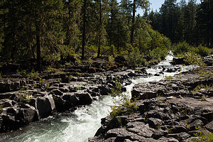
 Rogue River Gorge ViewpointAfter leaving Crater Lake, we made a short stop at the Rogue River Gorge Viewpoint, near the town of Union Creek, about 30 miles southwest of the park. We walked the short 1/4-mile interpretative trail past spectacular views of the wild and churning river as it cascaded through a narrow basalt lava cut canyon.
From there we continued southwest on Route 62 and eventually onto Route 199 into California. From the Oregon border to Crescent City on the coast, Route 199 (also known as the Smith River National Scenic Byway) winds its way for 33 highly scenic miles through spectacular mountain scenery.
The road also passes through Jedediah Smith Redwoods State Park, which along with two other state parks and national park land, makes up Redwood National and State Parks system.
We decided to only go as far as Crescent City that day, so that we could spend the whole next day driving the Redwood Highway and exploring the National and State Parks. Also, we saw in the Woodall’s Guide that there were a few campgrounds located right on the beach, so even if it was too cold to swim, at least we could enjoy the view from the back of the RV. I called ahead and booked a site at Harbor RV Anchorage.
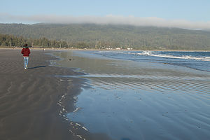
 Lolo on Crescent BeachI must say that the campground and the surrounding area were much more rundown than I expected. Most of the occupants of the sites seemed to be permanent residents. When I told Andrew where we were, his girlfriend’s family, who are from California, said, “What the heck are you doing in Crescent City? That is where the Pelican Bay maximum security prison is.” Oops.
We did manage, however, to get a campsite along the outer perimeter with unobstructed views of the beach, and fortunately, no views of the rest of the campground. It was much too cold to sit out on the beach, so we took a brisk walk instead, and then spent the rest of the afternoon contentedly reading in the back of the motorhome.
The next morning, we headed south on US 101 (also known as the Redwood Highway) to see the giant California redwood trees. Technically, they are called Sequoia sempervirens, and they are the largest and tallest trees on earth, living thousands of years and growing as high as 379 feet tall.
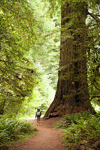
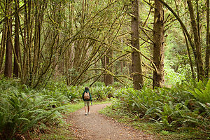
 Hiking Big Tree Loop in Prairie Creek Redwoods State ParkThere was a time when these beautiful coast redwood forests were in jeopardy of being lost forever. After the gold rush, many miners that failed to strike it rich turned to harvesting these giant redwoods. By the early 1900s, these priceless forests were badly threatened by years of unrestricted clear cut logging.
However, today, thanks to the foresight and work of the state of California and the Save the Redwoods League, hundreds of groves have been acquired and protected for our enjoyment. In 1968, Redwood National Park was created for the purpose of cooperative forest management with three other state parks: Jedediah Smith, Del Norte, and Prairie Creek. Today Redwood National and State Parks encompasses 133,000 acres and protects 45% of all remaining coast redwood old-growth forests.
Today visitors to the park can enjoy these majestic groves along the scenic Redwood Highway without ever leaving the comfort of their car. However, to really experience the majesty of these giant trees, you really have to get out of the car and walk among them.
After scanning the hiking options in my new book, Best Short Hikes in Redwood National and State Parks, I chose the Cathedral Trees – Big Tree Loop in Prairie Creek Redwoods State Park because it had two interesting features: a very large (but unimaginatively named) tree and several cathedral tree groupings.
The hike begins at the eastern edge of the Elk Prairie Visitor Center and passes under the Newton B. Drury Scenic Highway through the culvert for Boyes Creek. In .2 miles, we took a right at the Foothill Trail junction and passed several large redwoods. At .4 miles we turned left onto the Cathedral Trees Trail and soon came upon a pair of cathedral tree groupings. I am not exactly sure why they are called “cathedrals.” They look more like a circle of huge brown columns, with each column being an individual redwood tree. The reason that they are so closely clumped together is that they all sprouted from the same ancestral stump.
 Hiking Big Tree Loop in Prairie Creek Redwoods State ParkAt about 1.1 miles, we cross Cal Barrel Road and continued for another ½ mile or so to the junction with the Circle Trail. A quick left brought us to the Big Fella, so big that he needed to be fenced in. It is really very difficult to photograph these trees as they just won’t easily fit in the frame, but Herb tried. We then continued on the trail which paralleled the Parkway, back to the Visitor Center. The hike, which was 2.6 miles in total, had provided us with a wonderful experience in an ancient California redwood forest.
There was so much more to see and do along the Redwood Highway, but once again we were running on a much too aggressive schedule and had to get to Mendocino that evening. Too bad, because there are lots of interesting stops between here and there. Just to name a few: Lady Bird Johnson Grove, Tall Trees Grove, Humboldt Lagoons State Park, Trinidad State Beach, Azalea State Reserve, Humboldt Redwoods State Park, the Avenue of the Giants, and Richardson Grove State Park.
Description
 Lolo at Harbor RV AnchorageIn the 1850s, old growth coastal redwoods covered more than 2 million acres along the northern California coast. These California redwoods, technically called Sequoia sempervirens, are the largest and tallest trees on earth, living thousands of years and growing as high as 379 feet tall.
Unfortunately, following the gold rush, many miners that failed to strike it rich turned to another source of riches – harvesting the giant redwoods. By the early 1900s, these priceless forests were badly threatened by years of unrestricted clear cut logging.
However, thanks to the work of the state of California and the Save the Redwoods League, hundreds of groves have been acquired and protected. The result was the creation of three redwoods state parks: Prairie Creek (1923), Del Norte (1925), and Jedediah Smith (1929). In 1968 Redwood National Park was created for the purpose of cooperative forest management. Its boundary encircled the three state parks to better protect these ancient redwood forests. The combined parks contain 133,000 acres and protect 45% of all remaining coast redwood old-growth forests.
Today visitors can enjoy these majestic groves along the scenic Redwood Highway. The drive (from north to south) starts at the California/Oregon border on US 199 and travels for 33 winding and scenic miles through spectacular mountain scenery until it joins US 101 in Crescent City and continues for another 42 miles to the town or Orick.
Jedediah Smith State Park, along US 199, is the northernmost and least visited of the parks in the National and State Parks system. The redwood stands in the park are so dense that few trails penetrate the park. However, the 11-mile Howland Hill scenic drive provides access to many of the park’s stately groves. Mostly unpaved and often one lane, the road is not recommended for RVs.
10 miles further along US 199 is the town of Crescent City and the junction with US 101. Crescent City had a bit of a rough past, being devastated by two tsunamis – one in 1964 and then again in 2011 after the Japan earthquake. Today the economy depends on shrimp and crab fishing, tourism, and the Pelican Bay maximum security prison. While a good northern base for exploring Redwood National and State Parks, the weather is damp and foggy and the town is a bit lacking in charm. The Park Headquarters is located in Crescent City at 2nd and K Streets.
South of Crescent City on US 101 is Del Norte Coast Redwoods State Park, the second of the state parks in the system. The 6,400 acres of this park stretch all the way to the coast. There are 15 miles of hiking trails both along the foggy coastline and through dense virgin redwood forests.
Continuing south on 101, the parkway crosses the Klamath River, famous for its autumn migrations of Chinook salmon. A short detour off of 101 onto Requa Road leads to the Klamath River Overlook, situated on a bluff above a driftwood-strewn beach. This is one of the best whale watching spots in California as well as one of the most spectacular viewpoint on the North Coast.
South of Klamath is the largest of the state parks, Prairie Creek Redwoods State Park. This 14,000 acre park has over 70 miles of hiking trails and one of the most scenic drives in the park – the 8-mile Newton B. Drury Scenic Parkway, which runs parallel to 101, passing through pristine ancient redwood forests.
For the next 10 miles or so, US 101 passes through the National Park. Noteworthy stops in this section include the Lady Bird Johnson Grove, one of the park’s most spectacular, and the Tall Trees Grove, the location of several of the world’s tallest trees. A free permit is required to drive your car along the rough and unpaved 6 mile road to the Tall Trees Grove parking area. From there it is a 3.7 mile roundtrip hike down to the grove to see the Tall Tree, which stands over 362 feet tall. Permits can be obtained at the park visitor centers. There are only 50 issued per day, and they rarely run out.
The Kuchel Visitor Center is located in the small town of Orick, is located at the southern boundary of the park.
From this point south, you are no longer in Redwoods National & State Parks, but that does not make it any less beautiful. Other interesting places to visit along the Redwood Highway include: Humboldt Lagoons State Park, Trinidad State Beach, Azalea State Reserve, Humboldt Redwoods State Park, the Avenue of the Giants, and Richardson Grove State Park.
.
- ‹ previous
- 12 of 15
- next ›
Redwood National and State Parks location map in "high definition"
Javascript is required to view this map.
