- Home
- About
- Map
- Trips
- Bringing Boat West
- Migration West
- Solo Motorcycle Ride
- Final Family XC Trip
- Colorado Rockies
- Graduates' XC Trip
- Yosemite & Nevada
- Colorado & Utah
- Best of Utah
- Southern Loop
- Pacific Northwest
- Northern Loop
- Los Angeles to NYC
- East Coast Trips
- Martha's Vineyard
- 1 Week in Quebec
- Southeast Coast
- NH Backpacking
- Martha's Vineyard
- Canadian Maritimes
- Ocracoke Island
- Edisto Island
- First Landing '02
- Hunting Island '02
- Stowe in Winter
- Hunting Island '01
- Lake Placid
- Chesapeake
- Provincetown
- Hunting Island '00
- Acadia in Winter
- Boston Suburbs
- Niagara Falls
- First Landing '99
- Cape Hatteras
- West Coast Trips
- Burning Man
- Utah Off-Roading
- Maui
- Mojave 4WD Course
- Colorado River Rafting
- Bishop & Death Valley
- Kauai
- Yosemite Fall
- Utah Off-Road
- Lost Coast
- Yosemite Valley
- Arizona and New Mexico
- Pescadero & Capitola
- Bishop & Death Valley
- San Diego, Anza Borrego, Joshua Tree
- Carmel
- Death Valley in Fall
- Yosemite in the Fall
- Pacific Northwest
- Utah Off-Roading
- Southern CA Deserts
- Yosemite & Covid
- Lake Powell Covid
- Eastern Sierra & Covid
- Bishop & Death Valley
- Central & SE Oregon
- Mojave Road
- Eastern Sierra
- Trinity Alps
- Tuolumne Meadows
- Lake Powell Boating
- Eastern Sierra
- Yosemite Winter
- Hawaii
- 4WD Eastern Sierra
- 4WD Death Valley +
- Southern CA Deserts
- Christmas in Tahoe
- Yosemite & Pinnacles
- Totality
- Yosemite & Sierra
- Yosemite Christmas
- Yosemite, San Diego
- Yosemite & North CA
- Seattle to Sierra
- Southwest Deserts
- Yosemite & Sierra
- Pacific Northwest
- Yosemite & South CA
- Pacific Northwest
- Northern California
- Southern Alaska
- Vancouver Island
- International Trips
- Index
- Tips
- Books
- Photos/Videos
- Search
- Contact
Alvord Desert
Tuesday, September 10, 2019 - 3:30pm by Lolo225 miles and 4.5 hours from our last stop - 1 night stay
Travelogue
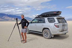 Herb doing what he loves bestBefore last week, I had never even heard of the Alvord Desert, and probably most of you haven’t either. It’s located in a very sparsely populated area of southeastern Oregon, about 20 miles north of the town of FIelds, which I’d also never heard of.
We had found out about this place from a book we had been using to plan our trip, called “Photographing Oregon, a guide to the natural landmarks of Oregon,” by Greg Vaughn. It covers the most photogenic natural locations in the state, like coastal cliffs, waterfalls, volcanic peaks, wildlife refuges, or stark white alkali lake beds such as this.
The playa of the Alvord Desert cover is 20 miles long by 6 miles wide. Once a giant lake with a depth of 200 feet, today it is a dry alkaline flat, totally dry from July through November. When it is dry, you can safely drive on it. However, heavy rains can transform it into a sticky mud that even 4WD vehicles have trouble driving on.
 Dust devils forming on the playaTucked into the Steens Mountain rain shadow, it receives about 6 inches of rain a year, making it one of the most isolated, driest, and unique land formations in the state. Just what Herb loves.
Our original intent was to camp at the Alvord Hot Springs, a family run, rustic spa on the edge of the playa. This being our third night sleeping in the truck, we thought a shower would be nice.
When we pulled into the parking lot of the Hot Springs, we weren’t particularly impressed with the facilities - old corrugated containers used as accommodations and camping in the parking lot. Plus, all we saw was a bathroom and no showers.
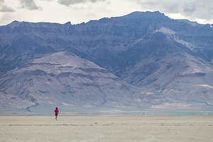 Lolo running on the playaMaybe there were some but we didn’t even stop to ask and just drove along and out onto the playa where we could have the whole vast expanse to ourselves. Soap and wash clothes would have to do for another night.
I tend to get a little antsy just sitting, and that whole playa was just laying out there before me, so I got on my running shorts and headed out. We had parked along the edge of the playa, where some bushes were growing, so I figured it would be easy enough to find. But, just to be safe, I recorded my run, as I do all my runs, on an app called Strava, which not only keeps track of your time, distance, pace, heart rate, etc., but also creates a track on a map so that you can see your route - kind of like bread crumbs. It has saved me from getting lost on many occasions. Not to be a braggy mom, but my son Tommy is one of the software developers for this app, so I can complain to him if I get lost while using it.
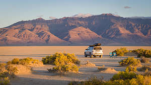 Our home for the night on the Alvord DesertMy original intention was to just run along the edges of the playa, but the middle looked so inviting, so I started heading out towards the other side. Distances are so deceptive on water and I guess dry salt flats. It seemed like I was running forever and getting no closer to the other side. Soon, I noticed some pretty ominous storm clouds building in the distance, so I figured I better get out of the middle of the playa and head back closer to where Herb was. Thank God for Strava, because everything looked the same, and I would have had a really difficult time finding our 4Runner, which was tucked along the bushes near the edge. It certainly was exhilarating though. Tomorrow, I definitely would shower.
The storm never did come to us, but it did provide some pretty dramatic skies that evening.
Description
 Alvord Desert PlayaAbout 20 miles north of the town of Fields, Oregon, lies the vast, stark white alkali lake bed, or “playa,” of the Alvord Desert. Tucked into the Steens Mountain rain shadow, the Alvord Desert is one of the most isolated, driest, and unique land formations in the state.
The Alvord Desert was once a giant lake extending 100 miles with a depth of 200 feet. Today, it is a 20 mile long by 7 mile side alkaline flat that is dry from July through November. When it is dry, you can safely drive on it. However, heavy rains can transform it into a sticky mud that even 4WD vehicles have trouble driving on.
 Sunset over the playaThere are five springs located around the perimeter of the desert: Mickey Hot Springs, Alvord Hot Springs, Tule Springs, Buckbrush Springs, and Borax Lake Hot Springs.
At Alvord Hot Spring, the only one suitable for soaking, there is a rustic spa with two concrete pools with awesome views of the Alvord Desert.
When heading to this area, make sure to fill up on gas in either Burns or Fields.
John Day Fossil Beds National Monument - Sheep Rock Unit
Monday, September 9, 2019 - 10:15pm by Lolo45 miles and 1 hour from our last stop - 1 night stay
Travelogue
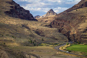 The road to Sheep RockThe next morning we drove east on Highway 26 for about 50 miles to the second of the three units in John Day Fossil Beds National Monument - the Sheep Rock Unit. This is the unit that gives the “fossil” part of Fossil Beds its name, as it has been and still is the site of massive amount of fossil discoveries, dating from over 30 million years ago.
Fossils were first discovered in this area in 1862, when Union cavalry troops guarding wagons of gold noticed fossils in the hills. They collected what they could and took them to Thomas Condon, a Congregationalist minister and avid geologist. Recognizing the importance of these fossils, Condon returned often to the area, which is now the Blue Basin of the Sheep Rock Unit, where he found an abundance of ancient life preserved in the hills. Soon word got out and paleontologists from around the country came to Oregon to search on their own. Researchers are still studying this area and new discoveries are being made to this day.
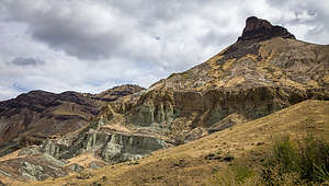 Sheep RockToday, at the Sheep Rock Visitor Center there is a museum with a working laboratory and collections room with over 60,000 fossil specimens. It is appropriately called the Thomas Condon Paleontology Museum as he was the one who first recognized the significance of the fossil beds here and did the first scientific collection and study of the specimens.
Before driving into Sheep Rock, we decided to check out the Bureau of Land Management Mascall Formation Overlook, just a little past the entrance to the park up on Antone Road. Besides the great view of the actual rock formation known as Sheep Rock, we noted the picnic table and restrooms as a possible spot to cook dinner later. No camping is allowed in the parking lot, but since camping is generally permitted pretty much anywhere on BLM land, we drove a little further along a gravel road and found a perfect spot on a ridge with great views. Hopefully, it would still be available when we returned in the evening.
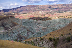 Hike along the Blue Basin Overlook TrailWe started our visit at John Day at the visitor center and strolled through the Thomas Condon Paleontology Museum where there were informative exhibits, fossil displays, and a laboratory.
From the Visitor Center, we took a short walk to an overlook of the park’s namesake Sheep Rock, which rises 1,100 feet above the John Day River. Unlike the colorful reds and yellows we saw in the Painted Hill Units, Sheep Rock and the other formations in this unit are colored in shades of greens and blues, caused by the chemical weathering of a mineral called celadonite. Atop the bands of blues and greens, Sheep Rock is topped by a pointed basalt peak.
We continued driving north through the park along the John Day River, stopping to cook a mid-day lunch at the Blue Basin Trailhead. This section of the road drives along the boundary of the park, so it was interesting to see the stark rock formations juxtaposed by ranches with irrigated green fields.
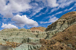 Island in Time Trail along the canyon floor of the Blue BasinAfter lunch we hiked the Blue Basin Overlook Trail, a moderately strenuous hike that rises 760 feet to an overlook of the stunning Blue Basin and the steep canyons cut by the John Day River below. It was an extremely rewarding hike.
Rather than return directly to the parking lot, we turned onto the Island in Time Trail which followed the canyon floor through the blue-green badlands we had just looked down on. Along the way there were several replicas of fossils found along this area.
Continuing north we passed Cathedral Rock, another beautiful formation with multi-colored layers of blues and greens. Unfortunately, it was in the shade by this time of day. The challenge for photography in a place like John Day is being in the right place at the right time.
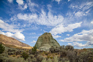 Another blue-green rock formation on Flood of Fire TrailNext we came to the Foree Trailhead where there were two short hikes to colorful rock formations. Unfortunately, they were darkened by clouds. However, we were patient and waited for a bit of sun to paint them in light.
This was the end of the road, so we retraced our way back through the park, stopping once more at the Sheep Rock Overlook to capture it in the glow of pre-sunset light.
What a great park, and like the Painted Hill Unit, so easy to conquer in a day - except if you are a paleontologist spending years digging for fossils.
We made our way back to our BLM campsite on the hill and were delighted to find it still unoccupied. The views over the ridge were lovely - much better than our campsite last night.
Description
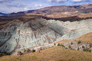 Hike along the Blue Basin Overlook TrailJohn Day Fossil Beds National Monument is divided into three units: Clarno, Painted Hills, and Sheeps Rock.
The Sheep Rock Unit, which is the subject of this stop, is the largest of the three divisions, and is located about 50 miles east of the Painted Hills Unit, on Highway 19, between the towns of Kimberly and Dayville, Oregon.
This is the unit that gives Fossil Beds its name, as it is the site of a massive amount of fossil discoveries dating from over 30 million years ago. The presence of fossils was first discovered in this area in 1862, when Union cavalry troops guarding wagons of gold near Canyon City noticed fossils in the hills. They collected what they could and took them to Thomas Condon, a Congregationalist minister and avid geologist. Recognizing the importance of these fossils, Condon returned often to the area which is now the Blue Basin of the Sheep Rock Unit, where he found an abundance of ancient life preserved in the hills. Soon word got out and paleontologists from around the country came to Oregon to search on their own. Researchers are still studying this area and new discoveries are being made to this day.
Today, the Thomas Condon Paleontology and Visitor Center has a working laboratory and collections room with over 60,000 fossil specimens. In the museum gallery, you can walk through nearly 50 million years of the Age of Mammals.
In addition to this fascinating museum, there are scenic drives and hikes to explore the prehistoric past of the area as well as the colorful rock formations.
Some hikes include:
- Blue Basin Overlook Trail - 3.35-mile hike to an overlook with breath-taking views down into the steep canyons and grand vistas of the John Day River valley.
- Island in Time Trail - 1.3-mile hike along the canyon floor through blue-green badlands. Exhibits and fossil replicas along the trail tell the story of the fossil landscape.
- Flood of Fire Trail - 1/2-mile stroll ending at a dramatic cliff face and view of colorful geological formations
John Day Fossil Beds National Monument - Painted Hills Unit
Sunday, September 8, 2019 - 5:45pm by Lolo85 miles and 1.75 hours from our last stop - 1 night stay
Travelogue
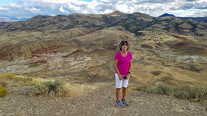 Lolo hits John Day Fossil Beds (Painted Hills)John Day Fossil Beds National Monument was very high on Herb’s list from the start. I had never known that he was so interested in fossils, but apparently, he knew that there was a lot more to John Day than that.
John Day is not just one park, but three separate units, pretty geographically far apart from each other: the Clarno Unit, the Painted HIlls Unit, and the Sheeps Rock Unit.
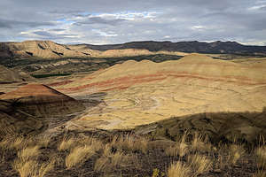 View from the Painted Hills OverlookBefore I get started sharing our experiences, I do what to share an interesting fact I learned about how this National Monument got its name. You might think that John Day was instrumental in the discovery of this area as a treasure trove of fossils, or in its preservation as a National Monument. Well, not exactly. In fact, John day was never anywhere near any of the park’s units. His claim to fame was that when he was a fur trapper, he was robbed and stripped naked by Indians. Everyone loved telling the story so much, that the river near where the robbery took place was named after John Day. Since that river flows through the various units of the park, it too took on the name John Day.
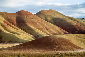 Along the drive through the Painted HillsOk, now onto our journey through the Painted Hills Unit of the John Day Fossil Beds National Monument, which is located just off Highway 26 near the town of MItchell.
Of the three units in the National Monument, this one is the most stunning in terms of photogenic natural beauty, with its colorful, sculptured hills and mounds formed over 35 million years ago by ash layers deposited by ancient volcanic eruptions. Over time, the layers of ash containing different minerals compacted and solidified into the various bands of red, yellow, green, ocher and black seen today. They are incredibly beautiful, especially just before sunset.
 Along the drive through the Painted HillsThe park is very easy to conquer in just one day, or a few hours, as there are only about 6 or 7 miles of roads, from which you can get a great view of the painted hills. However,I strongly advise getting out of your car and hiking along one or more of relatively short trails that bring you to even better views.
The hills are most colorful in evening light, just before sunset, so we spent the afternoon scouting out the best place to experience the evening glow.
We went first to the Painted Hills Overlook, and walked along the half mile trail which had magnificent views all along the way. All the colors - reds, yellows, greens, blacks, and ochres - were on display here. We found the spot where the classic photo of this park was taken, but the light just wasn’t right yet - too harsh and flat.
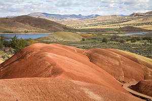 Along the Painted Cove TrailRight across the road from the Overlook, we hiked the 1.5-mile Carroll Rim Trail, which brought us up a few hundred feet to a rimrock ridge that looked out over the entire area. Also, beautiful, but not quite as good as the Overlook Trail.
Since we wanted to be here for evening light, we drove the short distance back to the picnic area by the Visitor Center to cook our simple camping dinner of macaroni and cheese with hot dogs.
Dinner out of the way, we drove back up to the Overlook to enjoy the sunset. Before we entirely lost the light, we drove down to a pullout along the road where the hills were side lit and provided a different perspective.
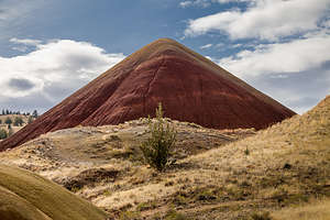 Along the Painted Cove TrailWe still hadn’t figured out where we were going to camp for the night, and it was getting a bit dark. There is no camping allowed in the park, but you can pretty much camp in forest land outside the park, so we found a forest road just a few miles outside the boundaries of the park and pulled over the first place we could. It was a little dark and scary, so I made Herb lock all the doors before I crawled back into my newly designed bed in the back of the 4Runner. In the future, we would have to scout out camping spots earlier in the day.
The next morning we drove pack into the park and hiked the short, but sweet, Painted Cove Trail where we were treated to red and gold claystone hills in the morning light. Lovely.
Description
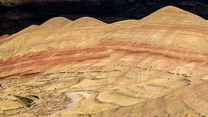 View from the Painted Hills OverlookJohn Day Fossil Beds National Monument includes over 14,000 acres found in 3 widely separated units, the Sheep Rock Unit, Painted Hills Unit, and Clarno Unit. All 3 units are in the John Day River Basin.
The Painted Hills Unit, which is the subject of this stop, is the most naturally stunning of the three areas, with its sculptured hills and mounds formed over 35 million years ago by ash layers deposited by ancient volcanic eruptions. Over time, the layers of ash containing different minerals compacted and solidified into the various bands of red, yellow, green, ocher and black seen today. They are incredibly beautiful, especially just before sunset.
It is located 9 miles northwest of the town of Mitchell, OR, off US 26. There is no camping in the park. However, there are restrooms, water, shaded picnic tables, and trails. The roads in the unit are dirt and gravel.
You can view the colorful hills from your car along the drive through the park, but there are several easy hikes that bring you more up close and personal:
- Overlook Trail - ½ mile trail providing a magnificent overview of the hills
- Carroll Rim Trail - 1.5 mile (RT) hike up a few hundred feet to a rimrock ridge for a birds eye view of the entire area. The trail starts from the parking area for the Overlook Trail
- Painted Cove Trail -1/4-mile stroll through an area of dark red and gold claystone hills
- Leaf Hill Trail - ½ mile trail through the remnants of a 30-million-year-old hardwood forest. While not as photogenic as the other trails, it is educational from a natural history standpoint
Bend
Saturday, September 7, 2019 - 5:00pm by Lolo488 miles and 8.5 hours from our last stop - 1 night stay
Travelogue
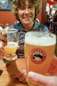 Lolo enjoying the Deschutes BreweryBend seemed like the perfect jumping off point for our excursion through central and southeastern Oregon, and what better place to start than dinner, and a beer of course, at the Deschutes Brewery Pub - always a favorite. As usual, the food was great and the beers were citrusy and refreshing.
Our plan the next day was to drive along the Oregon Cascades Scenic Byway, stopping to hike, take pictures, and camp along the way. I even managed to get 2 of the 30 daily permits issued each day for the Obsidian Limited Access Area of the Three Sisters Wilderness, so that we could hike to the top of the Middle Sister. They are sold for $6 on Recreation.gov. Permits were sold out for today- I guess because it was the weekend - so I got them for tomorrow (Monday). That gave us all day today to explore various stops along the Byway.
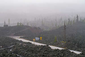 Rainy day along the Oregon Cascades Scenic BywayOur plan was to go as far as Terwilliger (Cougar) Hot Springs for a soak before turning back and camping at Scott Lake, near the trailhead for our Obsidian hike tomorrow. The Hot Springs sounded awesome -- “set in a picturesque canyon in the Willamette National Forest where from a fern-shrouded hole, 108 degree water spills into a pool then cascades into three successive pools, each one cooler than the one above.” That description definitely got our attention.
Following our Lonely Planet “The Pacific Northwest’s 32 Amazing Road Trips” guide, we headed north from Bend for 22 miles on Highway 20 to Sisters before turning onto Highway 242, which led us through the lovely pine forests of the Three Sisters Wilderness Area.
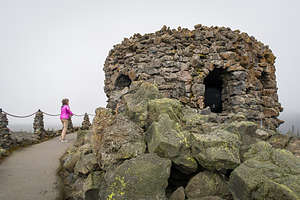 Lava, lava, lava at the Dee Wright ObservatoryAs we started to climb, the weather shifted drastically, from warm sunny skies to a fine, chilling mist. Our first stop was the Dee Wright Observatory, a structure built entirely of lava rock, perched on a giant mound of lava rock, in the middle of a field of lava rock. The windows of the observatory are situated in such a way to highlight all the prominent peaks that can be seen from the summit. Well not today. The clouds were so thick, that the view from each window was the same - a mass of gray. As if that wasn’t disappointed enough, the temperature had dropped about 20 degrees and we were now being pelted with a steady rain.
In denial, we continued along the Scenic Byway, making our next stop at the Scott Lake Campground, near the Obsidian hike trailhead, where we thought we would camp for the night, so we could get an early start in the morning. It was pretty full, but hopefully people would be leaving, as it was a Sunday.
 What should have been a great view through the windows of the Dee Wright Observatory,As we continued along the drive, and the rain didn’t seem to have any intention of letting up, we started questioning just how badly we wanted to do this hike in the morning. A quick check on the forecast showed that tomorrow would be even worse, with the possibility of thunderstorms in the afternoon, something I did not want to experience on the summit of Middle Sister.
We decided to cut our losses short. The nice part about not overplanning a trip is that you can be flexible and make adjustments based on conditions along the way. Well, this was time for one of those itinerary tweakings. The forecast further east at John Day Fossil Beds National Monument was much better, so we turned around and headed that way, but not without stopping for lunch first in the very cute town of Sisters.
I was a bit disappointed about giving up our Obsidian Trail hike up Middle Sister and our soak in Terwilliger Hot Spring, but it would give us a good excuse (as if we needed one) to come back to Bend in the future.
Description
Bend is the largest city in Oregon east of the Cascades. It is located in the high desert, along the banks of the Deschutes River on the eastern edge of the Cascade Range. A major reason for Bend’s popularity, both as a place to live and as a tourist destination, is its sunny skies. With an annual average of 158 clear days, 105 mostly sunny, and the remaining still with some sunshine, it is the sunniest city in the state.
Bend is also an outdoor enthusiast’s mecca and there is so much to do in all four seasons: skiing the powdered slopes of Mt. Bachelor, kayaking or rafting the mighty Deschutes River, hiking the Three Sisters, golfing at one of its many fine courses, fly fishing the lakes and streams, mountain biking the miles of backcountry trails, and on and on.
For the less active, or for those after an exhausting day of outdoor activity, there is the lively downtown area with its many fine restaurants and shops.
About 25 miles north of Bend is Smith Rock State Park, whose jagged peaks of basalt attract rock climbers from around the world. Considered to be the birthplace of American sport climbing, it has over 1,000 bolted climbing routes. Its stunning location in the Crooked River Gorge also makes it an ideal place for hiking or mountain biking along its many miles of trails
Barcelona
Monday, June 17, 2019 - 8:15am by Lolo66 miles and 1.5 hours from our last stop - 1 night stay
Travelogue
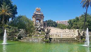 Parc de la Ciutadella's "Cascada," an ornamental fountain designed by GaudiIt had all come full circle and we were back in Motel One in Barcelona where our journey had begun. We had arrived four weeks ago - two wide-eyed, enthusiastic tourists ready to take on Spain. Those eyes were a bit wearier now after a pretty fast-paced month, but our enthusiasm for this lovely country had not diminished.
We had briefly considered staying in an airport hotel for our last night, but it’s so convenient getting to the airport from the city that we decided it would be much more fun to return to Barcelona.
During our 4-day stay at the beginning, we had covered a lot of ground, but there were still a few things we had missed.
 View from our hotel rooftop in BarcelonaOne of those was the Parc de la Ciutadella (Citadel Park), literally right across the street from our hotel. This lovely green oasis is Barcelona’s largest park and the site of the 1888 Barcelona Universal Exposition, Spain’s first International World’s Fair.
So, we decided to take a stroll. One of the most beautiful things in the park is the ornamental fountain, known as “Cascada.” It was designed by the then unknown architect, Antoni Gaudi, who went on to make such a big mark on this city’s incredible architecture. His signature winged dragons guard the fountain.
Just beyond the fountain is a lovely little lake where you can rent rowboats. There is also a zoo, an art museum, a greenhouse, and a winter garden to explore.
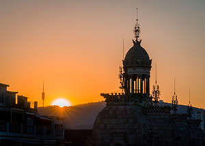 Goodbye lovely BarcelonaWe continued on through the park and eventually wound up on the Barceloneta again, Barcelona’s fabulous man-made beach, where Barcelonians like to recreate.
There were so many places to eat by the Barceloneta and Parc, but we decided to try a quieter neighborhood. Herb looked on TripAdvisor and found a highly rated "creative cuisine" just a short walk from our Motel. It was quite tasty and the ambiance was nice.
When we got back at the hotel, we decided to check out the second thing we had missed on our first visit here - the incredible rooftop bar atop Motel One. Why didn’t we know about this before?? There were dozens of comfy chairs and couches to sit on, and the views of the city were phenomenal. It was magical during the golden hour.
A fitting ending to a really wonderful trip.
Description
While I will not attempt to do an in-depth description of all Barcelona has to offer -- there are numerous guidebooks to do just that -- the following are some interesting sites that we enjoyed:
Las Ramblas pedestrian mall - one hour stroll from Playa de Catalunya to the La Rambla del Mar on the waterfront
- Broad pedestrian boulevard with souvenir hawkers, street artists, mimes, living statues, cafes, and shops
- More charming in the morning - grab breakfast at a market cafe
- Along the way:
- Fountain of Canaletes - ornate black and gold lamp post with a fountain at its base. Legend says that a drink from it ensures you will return to Barcelona one day
- Wavy tile work - represents the stream that once flowed here
- Look up to see the city’s characteristic shallow balconies with floor to ceiling windows
- Chairs fixed to the sidewalk at jaunty angles
- Betlem Church - 17th century Baroque church with sloping roofline, ball-topped pinnacles, corkscrew columns
- Rambla of Flowers - flower stands
- La Boqueria Market
- Plaça de la Boqueria - here you will see the Joan Miro mosaic in red, white, yellow, and blue
- Plaça Reial - dotted with palm trees and surrounded by yellow buildings with white trim this placa has old-fashioned taverns as well as modern bars with patio seating
- Palau Guell - apartment building designed by Antoni Gaudi. This was the first of his Modernista buildings, and you can see his emerging nonlinear style in the arches and doorways
- Christopher Columbus monument
- Rambla del Mar - wavy wooden walkway along the waterfront
Barri Gotic (Historic Gothic Quarter) walk - 1.5 hour self-guided tour from Placa de Catalunya to Placa del Rei
- Stroll the narrow Medieval lanes of Barcelona’s enchanting old quarter
- Relics of ancient Rome, 14th century Gothic churches, cobblestone lanes lined with shops, bars, and restaurants
- Along the way:
- Avinguda del Portal de l’Angel - once a major city gate. The angel statue atop the gate was said to keep Barcelonans safe from plagues and bid voyagers a safe journey
- Church of Santa Ana - 12th century Catalan Gothic church
- Els Quatre Gats - circa 1900 bohemian artist hangout, where Picasso had his first one-man show
- Playa Nova - flanked by two Roman towers that once guarded the entrance ate of the ancient Roman city of Barcino
- Barcelona Cathedral - 14th century Flamboyant-style (donation entrance 7 euros)
- Sardana dances, patriotic dance in which Barcelonans link hands and dance in a circle - on Sunday at 11:15 and many Saturdays at 18:00
- Casa del Ardiaca - old mansion that now functions as the city archives
- Carved mail slot (right of door) carved by a 19th century Modernista architect
- From the courtyard, climb to the balcony for views of the cathedral steeple and gargoyles
- Jewish quarter (El Call) - walk along the narrow passages and alleys where 4,000 Jews were forced to live
- Ruins of Roman Temple of Augustus - site where Romans founded the town of Barcino in 12 BC
- Placa del Rei - reminders of Barcelona’s medieval Golden Age
Barceloneta
- Traditional fishing neighborhood with gritty charm and good seafood restaurants
- Gorgeous man-made beach several miles long
- Stroll 4.5 km promenade - from La Estrella Herida to Peix
- La Estrella Herida - Contemporary 33-ft. beach sculpture of 4 stacked leaning steel cubes with windows, by Rebecca Horn.
- Peix (Fish) - giant copper-like Peix (Fish) sculpture by Frank Gehry glitters in the sunlight
La Sagrada Familia - Antoni Gaudi’s grand masterpiece
- Located in Eixample residential neighborhood, 1.5 miles north of Placa de Catalunya
- Hours: Mon - Sat 9:00 am - 8:00 pm; Sun 10:30 am - 8:00 pm)
- Timed-entry tickets - buy in advance: http://www.sagradafamilia.org/en/
- Gaudi labored on the Sagrada Familia for 43 years, from 1883 until his death in 1926. Work continued after his death and the church is expected to be finished in 2026 (a century after his death)
- Exterior
- Currently there are eight 330-foot spires topped with crosses. When completed there will be 18 - 12 representing the apostles, (over the three entrances), 4 taller ones representing the evangelists, an even higher one designated for the Virgin Mary, and the final 18th one, which will be the highest one in the middle, representing Jesus Christ
- The three facades - Nativity, Passion, and Glory, will chronicle Christ’s life from Birth, to crucifixion, to resurrection. Only the Nativity Facade was completed during Gaudi’s lifetime. The Passion Facade was completed in 2006, and the Glory Facade is still under construction
- Interior
- Floor plan is that of a Latin cross, 300 feet long and 200 feet wide - large enough to ultimately accommodate 8,000 worshippers
- The roof is held up by 56 tree-like columns, complete with branches and leaves, creating the effect of a forest canopy
- Sunlight filtering through stained glass windows creates a hypnotic, magical effect of a dappled rainforest canopy. Morning light shines in through blues, greens, and other cool colors, while evening light flows in reds, oranges and other warm tones.
Park Guell - Gaudi’s most ambitious project after Sagrada Familia
- 30 minute walk from Sagrada Familia
- Fanciful and playful space - two Hansel and Gretel gatehouses, dragon guarding a whimsical staircase, wavy benches, and a panoramic view terrace supported by a forest of columns
- Located 2 miles (uphill) to the northwest of Sagrada Familia
- Much of the park is free, except for the Monumental Zone where all the iconic Gaudi features are
- Zona Monumental (open daily 8:00 am to 8:30 pm)
- 400 visitors allowed in each hour
- Timed entry tickets - buy in advance (€ 10)
https://parkguell.barcelona/en/planning-your-visit/prices-and-times
L’Eixample - heart of Barcelona’s Modernista architectural movement
- Located north of the Old City
- Modernista - Free-flowing organic style that lasted from 1888 to 1906. It is characterized by wave-like curves, asymmetry, brightly colored glass and tile, and vegetal and other organic motifs
- Block of Discord - two of Gaudi’s colorful Modernista facades on Passeig de Gracia near the Metro stop)
- Casa Batllo - designed by Gaudi at his hallucinatory best
- Wave-shaped window frames and balconies, mushroom-shaped fireplace, and roof topped with a fanciful dragon-inspired roof
- Open daily from 9:00 am to 9:00 pm (but currently under renovation)
- Timed entry tickets - buy in advance
(€25)https://www.casabatllo.es/venta-entradas/ - La Pedrera (Casa Mila) - one of Gaudi’s trademark works and an icon of Modernisme
- Half hour walk from Park Guell
- Purist Gaudi interior in Barcelona
- One of the most notable elements of the building is the roof, crowned with skylights, staircase exits, fans, and chimneys.
- Open daily from 9:00 am - 8:30 pm
- Timed-entry ticket - buy in advance http://www.lapedrera.com/es/prepara-la-visita/tarifas
Montjuic - Large hill overlooking the city with Romanesque art, a fort, beautiful gardens, and art galleries and museums
- Fundacio Joan Miro (closed Mondays) - Barcelona’s best-looking gallery, set among gardens overlooking the city
- Tues - Sat 10:00 - 8:00, Sun 10:00 - 3:00
- Tickets: €13 https://www.fmirobcn.org/en/visit-us/opening-hours-and-prices/
- Montjuic Castle - at the top with great views of the city
- Dating from the late 17th century, for most of its dark history it has been used as a political prison and killing ground
- Tickets - €5
Picasso Museum - (closed Mondays)
- Set in five contiguous medieval stone mansions
- The collection, which includes more than 3500 of his works, concentrates on his formative years (from age 14 to 23) in Barcelona (pre-1904)
- Tues - Sun 9:00 am - 7:00 pm
- 12 € for timed-entry ticket (buy ahead of time on the museum website)
Parc de la Ciutadella (Citadel Park) - located in La Ribera section of the city (across the street from Motel One)
- Site of the 1888 Barcelona Universal Exposition, Spain's first International World's Fair
- Barcelona’s largest park - its 70-acre grounds include a small lake with rental rowboats, an ornamental fountain (which Antoni Gaudi helped design), the city zoo, a greenhouse, a winter garden, and plenty of green areas to sit and relax
Camping Las Palmeras
Saturday, June 15, 2019 - 9:15am by Lolo140 miles and 2.5 hours from our last stop - 2 night stay
Travelogue
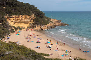 Back to lovely Cala Fonda beachWe were in the final stretch - two more days before we had to return the van. We wanted to be situated somewhat close to MrRent at the end of our trip, so before we left we had reserved two nights at Las Palmeras, a very highly rated campground, right on the Costa Daurada. Herb had even splurged for a beachfront “premium plot” for 29€ per night. He spoils me so.
When we checked in, we were escorted by a campground associate in a golf cart to our site. They weren’t kidding about beachfront. It was not just “front” but actual beach, with pretty deep sand. Our escort, who spoke absolutely no English, waved his arms a lot while trying to direct us to stay on the very edge of the site near the pavement, where we would at least have a fighting chance of getting out again. Oh well, we would worry about that in two days. At least for now we could here, and probably feel, the surf.
Part of Herb’s campground selection process includes finding great beaches nearby, and this one had the Cala Fonda, but locals call it Waikiki Beach. I can see why.
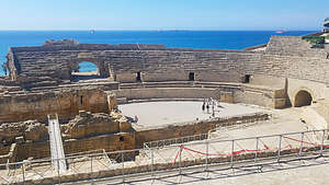 Ruins of a 2nd century AD Roman amphitheater in TarragonaIt required us walking about a mile along the campground beach, which was fairly narrow and very crowded, through a pristine forest, and then a rocky climb down to a sort of secluded cove. It was probably the nicest beach we had been to yet, and that is saying a lot.
We spent the afternoon reading, swimming, and people watching. I was especially fascinated with a group of guys in a circle, kicking a soccer ball around. Normally, I would have been concerned about getting hit, as we were pretty close, but they had amazing skills and control. Everywhere we had gone this trip, whether it was on a beach or in a square, guys (from 4 years old to 30) were always doing this. Soccer is obviously a very big deal here. I wondered though why we didn’t see girls doing the same thing.
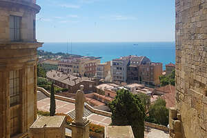 Inside the ruins of a 1st century AD Roman CircusThat evening I took a walk by myself and stumbled upon some campground lively entertainment by the pool. A very enthusiastic dance instructor was leading about 30 very enthusiastic women, of all ages, shapes, and sizes, in some very energetic dance moves. Boy, these people know how to have a good time. I wish Herb had been with me to see it. Maybe he would have wanted to bust a move with the ladies.
The next morning, rather than go directly to the beach, we decided to get some exercise in and some culture as well. Tarragona was once one of the most important cities in the Roman Empire. At that time it was known as Tarraco. Today it has some of the best preserved ruins in all of Spain.
Our mission for the morning was to find them. I went into the campground office to ask for directions and was told that we could get to them by walking for about 5 miles on trails along the beach. Sounded perfect.
It was, but it did get a bit confusing at times. However, eventually we found them.
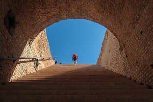 Lolo walking in the footsteps of an ancient Roman gladiatorThe first thing we came across was a pretty well preserved amphitheater cut into a hillside above the beach. The Amfiteatre Roma, as it was known then, was built in the 2nd century AD and used to stage contests and public executions. Since we could pretty much look down on the whole thing, we chose not to take the tour.
We did, however, take the tour (3.30€) of the nearby 1st century AD Roman Circus, or Pretori i Circ Romans in Latin. While most of the ancient circus now lies hidden beneath the city, there were some tunnels to talk through that did let us follow in the footsteps of a charioteer entering the hippodrome, which could hold up to 30,000 spectators. Unfortunately, that too is somewhere beneath the current city. Another highlight was climbing to the top of the Praetorium tower for a wonderful panoramic view of the current city of Tarragona.
We thought about walking back to the campground, but we were kind of anxious to get back to our little Waikiki beach and relax for awhile. After all, it was our last night in the van. Instead we got a taxi. It was absolutely the right thing to do.
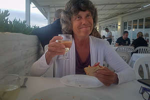 Choosing to have our last dinner in the camper not in the camperWe spent a very pleasant afternoon on our secret cove beach, which wasn’t so secret based on the number of people here.
Afterwards, we did some cleanup of the camper in preparation for its return, and packing in preparation for ours. We did, however, find time to squeeze in a very nice dinner in another very nice campground restaurant.
This van had been our home for the last month, so it was a little sad to think about saying goodbye to it tomorrow.
Description
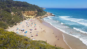 Cala Fonda beach on the Costa DauradaCamping Las Palmeras
Wonderful campground in Tarragona on the Costa Durado. The campground has 2 km of beach on the Mediterranean Sea and is in walking distance to Cala Fonda, a small strip of sandy beach backed by a wooded hill, in a secluded, scenic cove.
There is a restaurant with a terrace overlooking the sea, a lovely pool, and musical entertainment on the weekends.
Roman ruins
Tarragona was once one of the most important cities in the Roman Empire. As a result, it is one of the best places to see Roman ruins in Spain. We visited two of them during our stay:
- Amfiteatre Roma - second century AD Roman amphitheater cut into a hillside above the beach, which was once used to stage gladiator contests and public executions. Cost of entry is 3.30€
- Pretori i Circ Romans - first century Roman circus used to stage chariot races, theater, and circus. It had a seating capacity for 30,000 spectators. Most of the circus now lies hidden beneath the Medieval city center and all that remains are some walls and tunnels, which originally gave access to the hippodrome. The site also includes the Praetorium tower, atop of which are great panoramic views of the city of Tarragona. Cost of entry is 3.30€
Costa Brava - La Gaviota, Salvador Dali Theater and Museum, and Cadaques
Tuesday, June 11, 2019 - 3:30pm by Lolo95 miles and 2 hours from our last stop - 4 night stay
Travelogue
 La Gaviota beachToday, after our two day dip into France, we drove back down the coast into Spain to explore the Costa Brava area.
We had selected Camping La Gaviota, in the small village of Sant Pere Pescador on the Costa Brava, as a base camp for the next couple of days, because of its proximity to two places we really wanted to see: the Salvador Dali Museum in Figueres and the lovely white village of Cadaques. The fact that it was right on a beautiful beach with miles of running paths into town certainly didn’t hurt either.
It was raining when we arrived, so we hung out in the van until it stopped long enough for us to take a stroll on the beach.
Day 1 - Salvador Dali Theater and Museum
 Is it Abraham Lincoln or Dali's beloved Gala (or both)? - zoom in closeThe next morning was very, very windy - similar to the conditions we experienced yesterday on the Narbonne Plage. We later found out that strong winds are very common this time of year on this part of the Mediterranean coast, making it a big draw for kite-surfers. In fact, the campground was full of Germans and Dutch people with trailers full of equipment to do just that. The stronger the wind, the happier they were.
However, today we didn’t care about the wind, because we were heading into Figueres to visit the Salvador Dali Theater and Museum, which is actually the third most visited site in Spain (after the Prada and Bilbao’s Guggenheim). Knowing that, we had had the foresight to go online yesterday and buy tickets (https://www.salvador-dali.org/en/services/tickets/) for 12:30 today.
 Courtyard of the Salvador Dali Theater and MuseumI think almost everyone is familiar with Dali’s surrealistic dream imagery paintings, such as Persistence of Memory, but there is so so much more to him than that. In fact, you won’t find that piece or many of his other more famous works here, as the top museums around the world have acquired them. However, the museum does contain a substantial portion of his life work.
The museum itself is a work of art. In fact, it’s said to be the largest Surrealist art object in the world. Ever the showman, Dali designed it himself to be an all-round sensory and surreal experience, showcasing his life’s work. Everything about it exudes his outrageous public persona. The exterior of the building, which is painted pink, is studded with plaster-covered croissants, and the roof is topped with giant eggs and stylized Oscar-like figures. Unfortunately, renovations were being done, so scaffolding covered much of it.
When we entered the large courtyard, and the first stop on the tour, we were greeted with Dali’s personal 1941 Cadillac, called Rainy Taxi, because it rains inside it if a coin is deposited.
 Dali’s boat, with blue tears made of condoms to express his grief for the loss of his soulmate and wife GalaHanging from the ceiling above his car is Dali’s boat, which he enjoyed using with his soulmate and wife Gala. His sadness upon her death is expressed by the blue tears made of condoms dripping from the bottom of it.
Meanwhile, surrounding the entire perimeter of the atrium are alcoves with life-size golden Oscar statues look down on the scene below. After all, this is not just a museum, but a theater as well.
On the second level there is a stage beneath which Dali is buried. To the left of the stage is a large portrait of his beloved Gala - or is it Abraham Lincoln. Well, it’s both. When you look straight at it, it appears to be a picture of a nude Gala looking at the Mediterranean Sea. If you squint, or look through the telescope at the end of the room, you will see a portrait of Abraham Lincoln instead. Her butt cheeks actually morph into Lincoln’s facial cheeks. At first I thought it was some kind of hologram, but it is actually an illusion created by layering multiple optical scales to create two paintings in one.
 Mae West room with sofa lips, a fireplace nose, and two paintings for her eyes.Another one of our favorites was the Mae West Room. Dali admired her because she was as unconventional as he was, but morally rather than artistically. When we climbed up on the stairs in the room, we looked through a frame with blonde hair draped around it out to a room where a sofa was her lips, a fireplace her nose, and two paintings her eyes. It was really quite clever.
That’s just some of the highlights to be explored in the museum’s 22 exhibit rooms.
We spent the remainder of the day walking on the still windy beach and hanging by the campground pool. I even went for a 5-mile run (my first in Spain after weeks of lots of walking and hiking) into Sant Pere Pescador, a lovely old town with narrow winding alleys and a 14th century castle. On the way back, I ran along the River Fluvià to the beach.
The kiteboarders were still out there doing their thing zipping up and down along the shoreline. It looked so much fun!
Day 2 - Cadaques
 Along the Cap de Creus trailVisiting Cadaques was a bonus for us - the icing atop an already delicious cake. From the moment I started researching Spain and developing a tentative itinerary, I had set my sights on this lovely white fishing village by the sea. However, we didn’t know if we would have enough days left by the time we made it all around Spain and got here.
As disappointed as I was about not being able to hike in the Pyrenees because of the snow, it did give us the extra days to slip it in - not a bad consolation prize.
Although Cadaques was only 21 miles away, it took us close to an hour, because half of the drive was along a windy, nail-biting road with steep drop-offs. Very scenic for me, not so much for Herb as he had to keep his eyes glued to the road.
 Lovely cove along the Cap de Creus trailWhen we got to the village it was easy to see why it is the most painted village in the world. What better recommendation could you get than from the likes of Picasso, Dali, Matisse, Miro, Man Ray, Magritte, and so many more artists. Much more relevant than a Trip Advisor review, although those were pretty good as well.
We passed by the village for now and drove out to Port Lligat and the trailhead for the 7.5 mile hike (out and back) to Cap de Creus, the easternmost point in Spain.
Also at Port Lligat is the Dali house, where he lived with his wife Gala from 1930 to 1982. Unfortunately, we were not able to get tickets to see the interior of the house, so we would just be hiking and visiting the village today.
 The Cap de Creus lighthouse - easternmost point in SpainThe trail led us up through old olive orchards before bringing us to astounding views out over the turquoise waters of horseshoe-shaped Cadaques Bay. For the next few miles we followed the trail up and down along a rocky ridge, with several tempting swimming coves down below. We would have to hit one of those on our way back.
After about 3 ½ miles, we caught our first glimpse of the lighthouse at the highest point of the Cape and near its end - another ½ mile to go. Before we knew it, we were there, along with many others who had taken the easy way by car. There is a restaurant at the lighthouse, but we had packed a picnic lunch instead, which we planned to eat on one of those delightful coves.
Less than a half mile into our hike back, we took a small, rather steep path down to a very pretty cove where we could still see the lighthouse in the background. According to graffiti on a rock, this was a “platja nudista,” which even I with my limited Spanish could figure out. Still, like in any other beach in Spain, there was a whole range of amounts of clothing.
 Cadaques - the most painted village in the worldRefreshed and relaxed, we made our way back to Port Lligat for a quick break before continuing on to the lovely white fishing village.
We walked past the Dali house, asking once again to no avail if there were any tickets available to go inside. We continued down to the harbor waterfront where all the action was - lots of people and plenty of fine restaurants and bars on the water. I would have loved to sit and sip a glass of wine at one of them, but there was that long windy road that we had to navigate back.
The many artists that came here to paint had excellent taste. The whitewashed buildings, craggy coastline, and turquoise waters glimmering in the evening light were absolutely stunning. Made me wish I could paint. Well, at least we had cameras.
We made it safe and sound back to Camping La Gaviota before nightfall.
Day 3 - Hanging out at La Gaviota
 La Gaviota beachThis was a chill day. This campground and the beach were really world-class, so we decided to spend the day just enjoying it. Plus, the wind had died down, so we could spend time on the beach. An afternoon thunderstorm did chase us off the beach though.
After it cleared, Herb went to the pool, and I went for Spain run #2 - a 5.5 miler, this time down the beach and along the River Fluvia into the village of Sant Pere Pescador and back.
That evening we had dinner on the terrace of the campground restaurant. I still can’t believe how wonderful campground restaurants are in Spain.
It was a nice way to start winding down our very long vacation.
Description
Camping La Gaviota is located in the small village of Sant Pere Pescador on the Costa Brava, right on the Playa de La Gaviota, a lovely wide sandy beach on the Costa Brava that is very popular with kitesurfers.
Besides its beautiful beach, it is a great base camp for visiting the Salvador Dali Museum in Figueres and the lovely white village of Cadaques.
Salvador Dali Theater and Museum
 This must be the placeThe Salvador Dali Theater and Museum is a museum in Figueres designed by Dali himself to showcase his life’s works. The museum itself is a work of art. The exterior of the building, which is painted pink, is studded with plaster-covered croissants, and the roof is topped with giant eggs and stylized Oscar-like figures. Inside there are 22 exhibit rooms to explore, each of them exuding his outrageous public persona. It’s an all-round sensory and surreal experience. Some of the highlights include:
Dali’s personal 1941 Cadillac, called Rainy Taxi, because it rains inside it if a coin is deposited.
Hanging from the ceiling above his car is Dali’s boat, which he enjoyed using with his soulmate and wife Gala. His sadness upon her death is expressed by the blue tears made of condoms dripping from the bottom of it. Meanwhile, surrounding the entire perimeter of the atrium are alcoves with life-size golden Oscar statues look down on the scene below.
On the second level there is a stage beneath which Dali is buried. To the left of the stage is a large portrait of his beloved Gala - or is it Abraham Lincoln. Well, it’s both. When you look straight at it, it appears to be a picture of a nude Gala looking at the Mediterranean Sea. If you squint, or look through the telescope at the end of the room, you will see a portrait of Abraham Lincoln instead. Her butt cheeks actually morph into Lincoln’s facial cheeks.
The Mae West Room, where we looked through a frame with blonde hair draped around it out to a room where a sofa was her lips, a fireplace her nose, and two paintings her eyes. It was really quite clever.
It is the third most visited site in Spain (after the Prada and Bilbao’s Guggenheim), so buying tickets ahead of time is essential: (https://www.salvador-dali.org/en/services/tickets/)
Cadaques
 Port Lligat in CadaquesLovely white village, which is the most painted village in the world. Artists such as Picasso, Dali, Matisse, Miro, Man Ray, Magritte, and many more found the whitewashed buildings, craggy coastline, and turquoise waters glimmering in the evening light absolutely stunning.
Past the village is Port Lligat and the Dali house, where he lived with his wife Gala from 1930 to 1982. Today it is a museum, but tickets must be purchased well in advance.
Also at Port Lligat is the trailhead for the 7.5 mile hike (out and back) to Cap de Creus, the easternmost point in Spain. The trail goes through old olive orchards and along a craggy ridge with awesome views the turquoise waters of horseshoe-shaped Cadaques Bay and its many lovely swimming coves. The turnaround point is the lighthouse, at the easternmost point of Spain.
The drive to Cadaques is along a windy, nail-biting road with steep drop-offs. However, it is worth every bit of anxiety along the way.
Narbonne Plage
Sunday, June 9, 2019 - 2:45pm by Lolo312 miles and 6 hours from our last stop - 2 night stay
Travelogue
 Strolling along the Narbonne PlageBefore leaving San Sebastian, I called Camping Bungelows San Anton, a campground in the Spanish Pyrenees, to see if they had room for us the next two nights. It was the nearest campground I could find to the start of the Cola de Caballo (Horsetail Waterfall), another of Spain’s classic hikes that we hoped to do.
Unfortunately, I didn’t do my homework well enough. It wasn’t the season for hiking in the Pyrenees yet -- too cold and too much snow. The campground wasn’t even open yet. Oops.
When we removed the Pyrenees stop from Google Maps, it routed us through southern France to get to the Costa Brava coast of Spain, our next destination. We hadn’t planned to enter France at all and didn’t even have a guidebook. How exciting!
 Lolo taking a break on our Narbonne Plage strollThe drive across southern France on A64 to Toulouse and then A61 to the Mediterranean coast was scenic and very expensive in terms of tolls. I think it was at least 50 €. However, they did have many free aires (places to camp overnight) in rest areas every 20 miles or so. We didn’t want to stay in a parking lot though - we had pretty much done that in San Sebastian last night. Instead we wanted to find something on the Mediterranean coast.
It wasn’t as easy as we thought. apparently, campgrounds in France don't necessarily mean that they have a place for camper vans. Rather you had to rent one of their fancy-smancy RVs or stay in a bungalow. Finally, we had the idea of using our ACSI camping app, which is for people traveling in camper vans, and found Camping Campeole La Cote des Roses on the Narbonne Plage.
 Highway to the MediterraneanIt was perfect. We got a pitch near a pretty lagoon along the access gate to the beach. We grabbed a bottle of wine, some cheese, and a blanket and walked the 400 meters to a beautiful wide beach, where we set up shop alongside a jetty. I even took a swim in the Mediterranean - my first in France.
During the night the winds picked up in a big way, and were still doing so the next morning, precluding our plans of relaxing on the beach. So, we set off on a walk instead, hoping conditions would improve in the afternoon.
As we got out onto the beach, the sand was literally pelting us in the face -- a perfect day for the kiteboarders that were zipping up and down the shoreline. Too bad, because it was a really nice beach.
 Lunch at L'ArlequinWe forged on to the pedestrian promenade, which was a little better because we were off the sand. The Narbonne Plage is a very popular resort area and the promenade had plenty of restaurants and bars to accommodate the large summer crowd.
We stopped at a place called L’Arlequin which had great pizza and sangria. The Harlequin theme seemed to be pretty big in France- not exactly sure why, but I do know that lots of painters through the ages, such as Picasso and Cezanne have used Harlequins as their subjects.
On our walk back to the campground, the wind was still blowing really hard. In fact, the only activity besides kitesurfing going on were people racing up and down the beach on go-carts powered by sails. I guess we would just forget about spending time on the beach today.
Still I do get to add France to my list of countries visited, although I have a feeling a more thorough visit is in our future.
Description
 Jetty along the Narbonne PlageThe Narbonne Plage is a resort area on France’s southern (Mediterranean) coast that lies at the foot of the limestone massif Montagne de la Clape. It is a “blue flag” resort, meaning that it has been recognized for its environmentally conscious economic and tourist development.
Its sandy beach is 5 kilometers long and 150 meters wide and is bordered by a 2.5 km long pedestrian promenade with many restaurants, bars, and shops.
San Sebastian
Saturday, June 8, 2019 - 11:30am by Lolo16 miles and 0.5 hours from our last stop - 1 night stay
Travelogue
 San Sebastian's lovely Playa de La ConchaContinuing our circumnavigation of Spain, we headed next towards the lovely Basque coastal town of San Sebastian, famous for beach and its food - best pintxos (tapas) in Spain.
As in our Bilbao stop, there was no commercial campground in San Sebastian, but fortunately there was an “aires” (place to park an RV overnight), in walking distance to the beach and the old town. It’s called Donastia San Sebastian, which I guess is a bit repetitive as Donastia, is the Basque name for San Sebastian.
All my listening to Spanish tapes before this trip was pretty useless in Basque country as they speak Euskera (Basque) rather than Castellano (Castillian Spanish). Fortunately, all signs in the region are written in both.
 40-foot Jesus statue atop Mount UrgullIt was a Saturday, and the aires had only 40 spots, so we were very, very lucky to get the last one. We were stacked up like cordwood, but we didn’t plan to spend much time here anyway, as there was too much to see and do. Couldn’t complain too much, as we were in an excellent location and out site cost a whopping 6€.
After a quick lunch in the van, we headed out to explore the city. We started by strolling the Concha promenade, which runs for 2 miles along the lovely, crescent-shaped Playa de La Concha beach, considered one of finest city beaches in all the world. The beach is about a mile long and capped on either end by the twin mountain peaks of Mount Igueldo and Mount Urgull, which we planned to climb later.
It was a Saturday afternoon, so as expected the promenade and beach were crowded with people out enjoying the beautiful day.
Coming from New Jersey, where a beach promenade is a boardwalk full of carnival rides and games, tacky souvenirs, and cotton candy and ice cream vendors, this was a very different experience.
 View of La Playa de La Concha from atop Mount UrgullIt was more of an elegant work of art. The white wrought-iron balustrade that runs the length of the promenade was designed by Juan Rafael and is so beautiful that it has become a symbol of the city. There are also elegant lampposts and los relojes” (clocks), which mark the main access to the beach.
On the other side of the street from the beach are upscale businesses and apartments.
The beach was just too tempting to pass up, so we sat for about an hour or two on the towels we had stuffed into our backpacks and people watched.
There was also lots of intricate sand art, many of which made political statements about Basque independence.
 Now that's a lot of jamon - Baztan Pintxos and BarAfter the beach, we continued along the promenade to the Old Town Port Area and the start for the hike up Mount Urgull. There were many turnoffs and options along the way, but we just kept heading up towards the Castillo de La Mota, the 12th century castle on the summit.
We paid to go in, but nothing was in English so it was difficult to understand its history. However, there was a video playing showing the many festivals and events that are held in San Sebastian throughout the year that we were able to understand.
Also, at the summit is a 40-foot-tall statue of Jesus looking out protectively over the harbor. This statue is so large that it can be seen from anywhere on the beach.
The views from the castle of La Concha Bay and the Old Town were stunning.
 Yummy dinner at the Baztan Pintxos and BarThere was lots of activity on the mountain as vendors scurried around with food and beer, preparing for a concert that was to take place later that night.
We headed back down the mountain towards the Parte Vieja, San Sebastian’s charming old town, and began the quest for the perfect pintxos bar. While some looked really good, Herb insisted we continue our search until we found the perfect one. I was getting hungry and cranky, but he was right in holding out, because we eventually found Baztan Pintxos are Bar. It was perfect - Jamon hanging from the ceiling, and dozens of delicious looking pintxos choices covering the entire bar.
It was unbelievable.
Feeling that we had really gotten a good taste (no pun intended) of the beautiful city of San Sebastian, we traced our way back along the Concha Promenade and up past the university to our little home on wheels.
Description
San Sebastian is a coastal city located in the Basque region of Spain, just 12 miles from the French border. Its golden beaches and world-class pinxtos (tapas) bars have made it a very popular tourist destination. It has earned its reputation as the “Pearl” of northern Spain.
Some of its highlights include:
 Looking the other direction on La Playa de La Concha
- The Playa de La Concha is considered one of the finest city beaches in the world, with its magnificent crescent-shaped, golden sand capped by twin mountain peaks at either end. A lovely two-mile beachfront promenade runs the length of the bay.
- The Parte Vieja is San Sebastian’s charming old town, famous for its world-class pintxos (tapas) bars. Its main square, the Plaza de la Constitucion, is one of the most attractive city squares in Basque Country. It was once used as a bullring and the balconies of the houses surrounding it were rented to spectators.
- Mount Urgull rises above the eastern end of the Playa de La Concha. You can walk to its summit by taking a path from Mari Street in San Sebastian’s (aka Donostia’s) Old Town Port Area. At the top you are rewarded with the Castillo de La Mota, a 12th-century fortress; a 40-foot-tall statue of Christ looking out over the harbor; and stunning viewpoints of the Old Town and La Concha Bay.
While there are no official commercial campgrounds in Bilbao, there is an aire (place for campers to park overnight) in the city. It is called Donostia San Sebastian and it is located just 1 km from the Playa de La Concha . It costs 6€ per night.
Getaria
Saturday, June 8, 2019 - 9:45am by Lolo52 miles and 1.25 hours from our last stop
Travelogue
 Tiny fishing village of GetariaRather than drive directly to San Sebastian, which would have been a little over an hour, we exited the AP-8 toll road onto N-634 to take a scenic diversion along the rocky coastline to the tiny fishing village of Getaria.
Rather than drive into the village, which sits high above the harbor, we drove down to the harbor to sniff the sea and look at the fishing boats. While there, we watched a rowing team practicing in the harbor. Rowing is very popular in Spain and even small villages often have their own teams.
It was a lovely diversion, but it did make me a bit homesick for the many fishing villages I loved in the East Coast on Cape Cod and Martha's Vineyard.
Description
 Tiny fishing village of GetariaGetaria is a tiny fishing village on the rocky coastline between Bilbao and San Sebastian. It’s a great example of coastal Basque town. The old village sits above a small harbor where there is a small crescent beach. At the end of the harbor there is a forested island called El Raton (the Mouse).
To reach it, you have to exit the AP-8 toll road onto N-634
