- Home
- About
- Map
- Trips
- Bringing Boat West
- Migration West
- Solo Motorcycle Ride
- Final Family XC Trip
- Colorado Rockies
- Graduates' XC Trip
- Yosemite & Nevada
- Colorado & Utah
- Best of Utah
- Southern Loop
- Pacific Northwest
- Northern Loop
- Los Angeles to NYC
- East Coast Trips
- Martha's Vineyard
- 1 Week in Quebec
- Southeast Coast
- NH Backpacking
- Martha's Vineyard
- Canadian Maritimes
- Ocracoke Island
- Edisto Island
- First Landing '02
- Hunting Island '02
- Stowe in Winter
- Hunting Island '01
- Lake Placid
- Chesapeake
- Provincetown
- Hunting Island '00
- Acadia in Winter
- Boston Suburbs
- Niagara Falls
- First Landing '99
- Cape Hatteras
- West Coast Trips
- Burning Man
- Utah Off-Roading
- Maui
- Mojave 4WD Course
- Colorado River Rafting
- Bishop & Death Valley
- Kauai
- Yosemite Fall
- Utah Off-Road
- Lost Coast
- Yosemite Valley
- Arizona and New Mexico
- Pescadero & Capitola
- Bishop & Death Valley
- San Diego, Anza Borrego, Joshua Tree
- Carmel
- Death Valley in Fall
- Yosemite in the Fall
- Pacific Northwest
- Utah Off-Roading
- Southern CA Deserts
- Yosemite & Covid
- Lake Powell Covid
- Eastern Sierra & Covid
- Bishop & Death Valley
- Central & SE Oregon
- Mojave Road
- Eastern Sierra
- Trinity Alps
- Tuolumne Meadows
- Lake Powell Boating
- Eastern Sierra
- Yosemite Winter
- Hawaii
- 4WD Eastern Sierra
- 4WD Death Valley +
- Southern CA Deserts
- Christmas in Tahoe
- Yosemite & Pinnacles
- Totality
- Yosemite & Sierra
- Yosemite Christmas
- Yosemite, San Diego
- Yosemite & North CA
- Seattle to Sierra
- Southwest Deserts
- Yosemite & Sierra
- Pacific Northwest
- Yosemite & South CA
- Pacific Northwest
- Northern California
- Southern Alaska
- Vancouver Island
- International Trips
- Index
- Tips
- Books
- Photos/Videos
- Search
- Contact
Stanton Park, OR
Monday, June 2, 2014 - 8:45am by Lolo
437 miles and 8 hours from our last stop - 1 night stay
Travelogue
 Lolo Talking with Hospice NurseTommy wasn’t gone 10 minutes before we got a call from the Hospice Nurse at my mom’s nursing home facility. At first I wasn’t too alarmed, because we do keep in close contact when I am away. However, I am the one that usually does the calling, so this time seemed different. She informed me that my mom had taken a serious turn for the worse. She was in a semi-comatose state, no longer eating or drinking, and had been put on oxygen. They didn’t think she would last through the weekend.
I didn’t know what to do. Our return flight was over a week away. The only reason I hesitated at all, was that my Mom has more lives than a cat, and we have gathered around her theoretical death bed many times, only to have her rally and come back to life. How was I to know whether this time was really different?
I called my sister-in-law, who is an ex-nursing home nurse and asked her if she could stop in to see my mome and assess the situation. She did and confirmed Hospice’s prognosis that she was truly near the end.
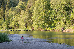
 Lolo on South Umpqua River in Stanton ParkOkay, this was it -- time to start figuring out how to get home. First step, we called United Airlines to see what we could do about switching flights, especially in light of the fact that we didn’t have trip insurance. They were so incredibly nice, and allowed us to move up our flights to 3 days from now, without any charge.
Step two – start driving down I5 to get back to Petaluma to store the motorhome and fly back home.
We made a quick side trip to the Mount St. Helens Visitor Center near Silver Lake, just 5 miles off I5 on the Spirit Lake Highway, to get information for a possible future visit. Unlike other National Park System Visitor Centers, this one is run by the Washington State Park System and charges $5 to see the movie and the exhibits. I must admit I was a bit too distracted to really enjoy it much though and spent most of the time, hiding behind exhibits, talking on my phone to my sister-in-law and brothers about my mom.
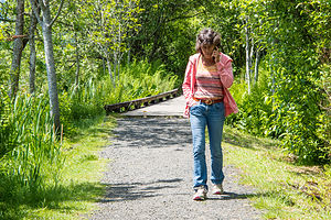
Before leaving, we took a quick stroll along the Silver Lake Trail behind the Visitor Center, a lovely trail that includes boardwalks over marshlands. I pretty much missed that too, spending most of that walk on the phone with the Hospice nurse.
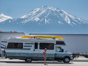
 Lolo and Lazy Daze with Mount Shasta at I-5 Rest StopWe really did not give this place justice at all. I want to come back someday under better circumstances and take the ride out to the Johnston Ridge Observatory, about 50 miles further on, to actually see the 1980 blast zone. The visitor center here is the closest you can get to the mountain by car when driving in from the west. Also, when we come back I would like to stay at the Eco Park Resort, which I believe is the closest you can stay to the mountain. It’s located about halfway between I5 and the Johnston Observatory and has cabins, yurts, and camping.
Vowing to come back on a future trip, we continued our drive down I5 through Oregon. We had never been this way before, and I was quite surprised how scenic it was. Herb was also surprised how hilly it was, and was not really enjoying its many steep ups and downs.
After about another 5 hours of driving, we stopped for the night at Stanton Park, a 40-site campground on the South Umpqua River, just a short distance off I5 in the town of Canyonville, Oregon. It was actually quite nice. After dinner Herb and I took a short stroll down to a rocky beach on the river – very pretty.
Description
 Mount St. Helens Visitor Center Silver Lake TrailStanton Park is part of the Douglas County Park System. The 40-site campground is located on the South Umpqua River at Canyonville off I-5 Exit 99. The park has a picnic area, large pavilion, accessible restrooms with showers, fishing, and playground. Individual sites are available on a first come-first served basis.
- ‹ previous
- 7 of 9
- next ›
Stanton Park location map in "high definition"
Javascript is required to view this map.
