- Home
- About
- Map
- Trips
- Bringing Boat West
- Migration West
- Solo Motorcycle Ride
- Final Family XC Trip
- Colorado Rockies
- Graduates' XC Trip
- Yosemite & Nevada
- Colorado & Utah
- Best of Utah
- Southern Loop
- Pacific Northwest
- Northern Loop
- Los Angeles to NYC
- East Coast Trips
- Martha's Vineyard
- 1 Week in Quebec
- Southeast Coast
- NH Backpacking
- Martha's Vineyard
- Canadian Maritimes
- Ocracoke Island
- Edisto Island
- First Landing '02
- Hunting Island '02
- Stowe in Winter
- Hunting Island '01
- Lake Placid
- Chesapeake
- Provincetown
- Hunting Island '00
- Acadia in Winter
- Boston Suburbs
- Niagara Falls
- First Landing '99
- Cape Hatteras
- West Coast Trips
- Burning Man
- Utah Off-Roading
- Maui
- Mojave 4WD Course
- Colorado River Rafting
- Bishop & Death Valley
- Kauai
- Yosemite Fall
- Utah Off-Road
- Lost Coast
- Yosemite Valley
- Arizona and New Mexico
- Pescadero & Capitola
- Bishop & Death Valley
- San Diego, Anza Borrego, Joshua Tree
- Carmel
- Death Valley in Fall
- Yosemite in the Fall
- Pacific Northwest
- Utah Off-Roading
- Southern CA Deserts
- Yosemite & Covid
- Lake Powell Covid
- Eastern Sierra & Covid
- Bishop & Death Valley
- Central & SE Oregon
- Mojave Road
- Eastern Sierra
- Trinity Alps
- Tuolumne Meadows
- Lake Powell Boating
- Eastern Sierra
- Yosemite Winter
- Hawaii
- 4WD Eastern Sierra
- 4WD Death Valley +
- Southern CA Deserts
- Christmas in Tahoe
- Yosemite & Pinnacles
- Totality
- Yosemite & Sierra
- Yosemite Christmas
- Yosemite, San Diego
- Yosemite & North CA
- Seattle to Sierra
- Southwest Deserts
- Yosemite & Sierra
- Pacific Northwest
- Yosemite & South CA
- Pacific Northwest
- Northern California
- Southern Alaska
- Vancouver Island
- International Trips
- Index
- Tips
- Books
- Photos/Videos
- Search
- Contact
Lassen Volcanic National Park, CA
Thursday, August 20, 2015 - 6:30am by Lolo
213 miles and 4.5 hours from our last stop - 3 night stay
Travelogue
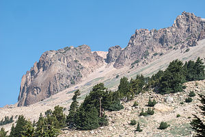 Vulcan Eye of Lassen PeakWhen we had visited Lassen in 2013, the trail to the top of Lassen Peak was closed, because of a multi-year trail restoration project, which was triggered by the tragic death of a 9-year-old boy in 2009 when a retaining wall supporting the trail gave way, hurtling him down the rocky mountainside.
The National Park Service closed the trail to the peak for 6 years while it reconstructed and stabilized the retaining walls and stone steps along the trail. The trail reopened in the summer of 2015.
Lassen Peak had always been on our list of classic hikes in the west, so when we heard the news about the trail reopening, we added Lassen to our trip itinerary. A phone call to the Manzanita Campground confirmed that we would have no trouble getting one of the first-come-first-served RV sites if we arrived on a weekday.
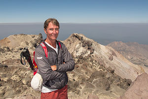 Herb at Lassen Peak OverlookWe left Camp Richardson bright and early on a Thursday morning and made the 5-hour scenic drive up 395 through Reno and west on 44 through Susanville and then down 89 into the Park.
It was too late to start any big hikes, so we stopped at the Visitor Center / Loomis Museum and watched the movie about the park. The National Park Visitor Centers does a very good job at orienting people to the parks, and I find that the movies are always extremely well done, informative, and a pleasure to watch.
Afterwards we selected one of the first-come-first-serve campsites in the nearby Manzanita Lake Campground, where there is a sandy beach, a place to launch kayaks, and a 1.5-mile trail encircling the lake. For this evening, we chose beach chairs and a bottle of wine on the beach.
Hiking to Lassen Peak
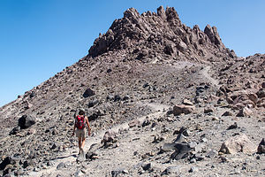 Lolo on Trail between Lassen SummitsThis was the big day – the hike to Lassen Peak and the reason we had returned here.
10,457-foot Lassen is quite a noteworthy geological attraction. Besides being the southernmost active volcano in the Pacific Ring of Fire, a string of 20 volcanoes which stretches 700 miles from southwestern British Columbia, it is the largest plug dome volcano in the world. This type of volcano is formed when the lava is too viscous to flow very far and instead piles up around the vent, creating a big dome
It is also the site of the second most recent eruption in the Cascade Range, which occurred in 1914 to 1917. The explosion spewed rock, gas, and volcanic ash as far away as 200 miles and triggered a mudflow, known as a lahar, which destroyed a 5 square kilometer area, now appropriately named the Devastated Area, which, on a clear day, can seen from the summit.
 Helen Lake View from Lassen Peak HikeOn a really clear day, you can even see Mt. Shasta, 100 miles north, from the summit. However, this was the summer of intense wildfires in Northern California, so we were just hoping that our views from the summit wouldn’t be completely obstructed by the smoke. At least it was a lot clearer than yesterday.
We parked in the huge parking lot at the base of the peak, which sits at an elevation of 8,500 feet – almost 2,000 feet below the summit. This is an extremely popular trail, so we were surprised at how empty the parking lot was. Perhaps it was because it was a weekday. Whatever reason, we were thrilled about having the trail pretty much to ourselves.
From the parking lot, we began the ascent up the south face of Lassen. There aren’t many trees along the way, so there is little shade, but great open expansive views. After about a half mile, the switchbacks started and didn’t let up until the top.
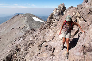 Final Scramble to Lassen PeakAfter about 2.4 miles, we came to what I initially thought was the top, but turned out to be a false summit. I hate when that happens. To reach the official summit, we had to hike down into the saddle between the two summits and then scramble up the talus on the rim of a crater. The correct path to the top was not very clear, so we just went where it felt right. It wasn’t that easy and probably explained why many people just satisfied themselves with the first summit.
The brass geological survey marker we found on top confirmed that we had indeed reached the official summit of Lassen Peak at 10,457 feet above sea level. Thankfully we had been acclimating to higher altitudes for the last couple of days or the scramble to the top would have been much harder. Unfortunately, the skies were still quite smoky from the fires, so we weren’t able to see Mt. Shasta, but the views were still quite incredible.
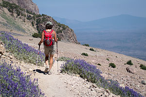 Lolo on Descent from Lassen PeakThe 2.6-mile hike down was much easier aerobically than the way up, but as usual, tougher on the knees. I think we were pretty quick though - an hour and 15 minutes up and 55 minutes down. Much less than the 3-5 hours suggested by the hiking guide books. Well, I guess maybe if you add the time spent on the summit admiring the view, 3 to 5 hours is a pretty good estimate.
On the drive back to the campground, we stopped at the Chaos Crags and Jumbles Scenic Pull-out for our daily cell coverage fix. It was the only place in the park where you could consistently get coverage. Everybody seemed to know about it, and there was always a car or two parked here with the driver yapping on the phone. Providing cell coverage is the one thing (and probably the only thing) that I would change in the national parks.
Chaos Crags was worth a stop even without the coverage. There are hundreds, if not thousands, of boulders strewn over a couple of square miles from an avalanche that occurred 350 years ago from the Chaos Crags lava domes.
Hiking to Mill Creek Falls and Kayaking around Manzanita Lake
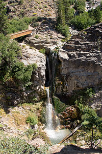 Mill Creek FallsI think the second most popular hike in Lassen Volcanic National Park is the hike to Bumpass Hell, Lassen’s largest hydrothermal area, complete with bubbling hot springs, boiling mud pots, and hissing fumaroles. However, we had done that on our last visit, so we looked at online hiking trail sites for something new.
The 4-mile out and back hike to Mill Creek Falls, the highest waterfall in Lassen Park, was just what we were looking for. Not only would this be a new hike for us, but just getting to the trailhead would have us drive along a section of the scenic, windy park road that we had not been on as of yet. The trailhead is located right behind the amphitheater on the east side of the Kohm Yah-mah-nee Visitor Center parking lot, near the southwest entrance to the park.
We set off on the trail, which led through the Southwest Campground, set in a lovely red fir forest. After about 0.2 miles, we crossed West Sulphur Creek and began climbing a steep sunny hill totally covered with clumps of huge brown leaves shaped like mule ears. We are not botanists by any means, so at the time all we knew was that they were dead and very interesting to photograph. We later learned that they are woolly mules ear wildflowers that blossom with lovely yellow flowers in July. We had just missed them by a month.
From there the trail continued along East Sulphur Creek, constantly going up and down a series of gullies. At about a mile and a half the trail descended steeply and we got our first glimpse of Mill Creek Falls, with a drop of 75 feet.
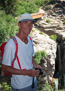 Herb at Mill Creek FallsAlthough the official trail description ends at this point, we continued on and crossed a footbridge directly over the falls and gazed below at the water cascading down a narrow canyon. A second footbridge led over a second creek that fed the falls.
The trail continued on to Conard Meadows and Crumbaugh Lake, but this was our turning around point. Herb took off ahead of me to go back to the viewpoint above to photograph the falls. I thought he wanted me as a subject on the footbridge, so I spent about 10 minutes in various poses before joining him up at the viewpoint, only to learn that he didn’t even know I was on the footbridge. Too bad – it would have been a great photo.
The trail was an out and back, so we returned from whence we came, once again up and down the gullies. Although the waterfall was at about the same elevation as the trailhead, our GPS confirmed what I felt – our elevation gain was close to 1,000 feet.
I used to think that elevation gain was the difference between the elevation at the start and the elevation at the highest point of the hike, but it’s not. Elevation gain is the sum of every gain in elevation you make throughout a hike, and elevation losses don’t count.
It was really surprising to me that the elevation gain on the hike up to the top of Lassen Peak yesterday was 2,082 feet, and our Mill Creek Falls hike today was 949 – almost half. That seemed so crazy.
 Herb Kayaking Manzanita LakeAfter our hike, there was still plenty of time for another activity, so we launched our kayaks in Manzanita Lake. I was so glad that Herb decided to keep the kayaks on the roof of the Subaru rather than going through the contortions required to put them back on top of the motorhome after each usage. This way it wasn’t a big deal to get them down, and we used them so much more. Already in the past week we had kayaked around Tenaya Lake in Yosemite, Mono Lake, Falling Leaf Lake in South Lake Tahoe, and now Manzanita Lake – more times in one trip than we had used them in the entire two years they had lived in California.
It was only a mile and a half paddle around the lake, but a very rewarding one. While there are no expansive views from the launch area, once we got to the far side of the lake, Lassen Peak and Chaos Crags revealed themselves in all their splendor. It was nice to just lie back, float, and take in the surroundings. I think I was really perfecting this technique of kayaking.
For those without kayaks, there’s a trail around the lake that provides the same spectacular views.
Description
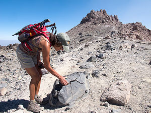 Lolo with Rock on Lassen False SummitLassen Volcanic National Park in northern California contains Lassen Peak, the southernmost volcano in the Cascade Volcanic Arch, which extends for over 700 miles from British Columbia through Washington and Oregon to northern California. The Cascade Volcanoes are part of the Pacific Ring of Fire, the ring of volcanoes and associated mountains around the Pacific Ocean.
10,457 foot Lassen Peak is the largest plug dome volcano in the world. These types of plug or lava domes are formed when the ejected lava is too viscous to flow very far, and instead piles over and around its vent, creating a big dome over the volcano.
Although dormant now, Lassen Peak was the site of the most recent volcanic eruption in northern California. It began in 1914, spewing rock, gas, and hot ash billowing into the atmosphere. In 1915 it blew a cloud of ash almost 6 miles high and triggered a mudflow, known as a lahar, which wiped out a 5 square kilometer area now called the Devastated Area, which can still be seen today. It erupted for seven years before finally settling down in 1921.
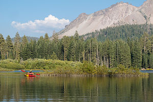 Manzanita Lake with LoloThe park is the only place in the world where all four types of volcano can be found: plug dome, shield, composite, and cinder cone. In addition, in Bumpass Hell in the southern part of the park there are bubbling hot springs, boiling mud pots, and fumaroles in six geothermal fields. It is quite a geologically active place.
If you only have a day to visit the park, the best way to see it is to drive the 30-mile Lassen Volcanic National Park Highway, stopping at various highlights along the way. Starting from the northwest entrance, the following are some very worthwhile stops along the way:
- Manzanita Lake – the iconic photo of the park is Lassen Peak reflected in this beautiful lake. It is also a good place to kayak, fish, or hike around its shores.
- Loomis Museum where one can view artifacts and photographs from the park’s 1914-1915 eruption
- Chaos Crags and Jumbles Scenic Pull-out – the site of an avalanche 350 years ago from the Chaos Crags lava domes, which scattered hundreds of thousands of large rocks over a couple of square miles
- Devastated Area – a ½-mile interpretative trail looks through the devastation caused by Lassen’s 1914 eruption
- Summit Lake – the midpoint between the northern and southern entrances, this is a great place to take a dip in Summit Lake or to stroll around it on the loop trail.
- Kings Creek picnic area – lovely spot to stop for lunch where the Kings Creeks flows through a meadow at the foot of Lassen Peak
- Lassen Peak Parking Area and Viewpoint – this is the highest point on the park road at 8,512 feet. From here you can just enjoy the view or, for the more adventurous, hike the strenuous 2 ½ mile to the summit, where you can look into the rim or out over the entire park. (This trail is currently closed for trail maintenance beyond the halfway point)
- Bumpass Hell – a 3 mile roundtrip hike brings you up close to bubbling hot springs, boiling mud pots, hissing steam vents (fumaroles)
- Sulphur Works Thermal Area – located near the southern entrance to the park, this is the most easily accessible hydrothermal area, where paved walks lead past boiling springs, burbling mudpots, and sulphur-emitting steam vents.
There are three campgrounds along the Lassen Volcanic National Park Highway that accommodate RVs:
- Manzanita Lake Campground – located near the northwest entrance to the park and adjacent to Manzanita Lake. The campground offers swimming, fishing, kayaking, and hiking. It is the largest of the Lassen campgrounds with 179 sites, some of which can be reserved. It is open from the end of May until it snows.
- Crags Campground – located five miles south of Manzanita Lake on the main park road. The campground offers easy access to the Lost Creek and Devastated Areas, in addition to Crags and Manzanita Lake. There are 45 RV sites, and operates on a first-come-first-served basis. It is open from mid-June to mid-September.
- Summit Lake Campgrounds - located 12 miles south of Manzanita Lake. The campground is comprised of a North and South section, each with access to the lake. There are 94 sites, some of which can be reserved. Summit Lake North is open from late June through mid-September and Summit Lake South is open from late June through late October.
- ‹ previous
- 4 of 8
- next ›
Lassen Volcanic National Park location map in "high definition"
Javascript is required to view this map.
