- Home
- About
- Map
- Trips
- Bringing Boat West
- Migration West
- Solo Motorcycle Ride
- Final Family XC Trip
- Colorado Rockies
- Graduates' XC Trip
- Yosemite & Nevada
- Colorado & Utah
- Best of Utah
- Southern Loop
- Pacific Northwest
- Northern Loop
- Los Angeles to NYC
- East Coast Trips
- Martha's Vineyard
- 1 Week in Quebec
- Southeast Coast
- NH Backpacking
- Martha's Vineyard
- Canadian Maritimes
- Ocracoke Island
- Edisto Island
- First Landing '02
- Hunting Island '02
- Stowe in Winter
- Hunting Island '01
- Lake Placid
- Chesapeake
- Provincetown
- Hunting Island '00
- Acadia in Winter
- Boston Suburbs
- Niagara Falls
- First Landing '99
- Cape Hatteras
- West Coast Trips
- Burning Man
- Utah Off-Roading
- Maui
- Mojave 4WD Course
- Colorado River Rafting
- Bishop & Death Valley
- Kauai
- Yosemite Fall
- Utah Off-Road
- Lost Coast
- Yosemite Valley
- Arizona and New Mexico
- Pescadero & Capitola
- Bishop & Death Valley
- San Diego, Anza Borrego, Joshua Tree
- Carmel
- Death Valley in Fall
- Yosemite in the Fall
- Pacific Northwest
- Utah Off-Roading
- Southern CA Deserts
- Yosemite & Covid
- Lake Powell Covid
- Eastern Sierra & Covid
- Bishop & Death Valley
- Central & SE Oregon
- Mojave Road
- Eastern Sierra
- Trinity Alps
- Tuolumne Meadows
- Lake Powell Boating
- Eastern Sierra
- Yosemite Winter
- Hawaii
- 4WD Eastern Sierra
- 4WD Death Valley +
- Southern CA Deserts
- Christmas in Tahoe
- Yosemite & Pinnacles
- Totality
- Yosemite & Sierra
- Yosemite Christmas
- Yosemite, San Diego
- Yosemite & North CA
- Seattle to Sierra
- Southwest Deserts
- Yosemite & Sierra
- Pacific Northwest
- Yosemite & South CA
- Pacific Northwest
- Northern California
- Southern Alaska
- Vancouver Island
- International Trips
- Index
- Tips
- Books
- Photos/Videos
- Search
- Contact
Factory Butte, UT
Wednesday, September 13, 2023 - 10:00pm by Lolo
50 miles and 3 hours from our last stop
Travelogue
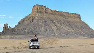
 Factory Butte in the morningOn our way to Moonscape Overlook yesterday, we had passed right by Factory Butte on our left, not because it is unworthy of a stop, but on the contrary, it is worth an entire day of exploration.
It is the most recognizable feature in the area, a cathedral-like sandstone hill, set on a wide, flat badlands plateau, surrounded by a sea of Mancos Shale. It is this shale that gives the area its unique appearance of colorful ripples, root-like combs, and crags that you see so often in the foreground of Factory Butte photos.
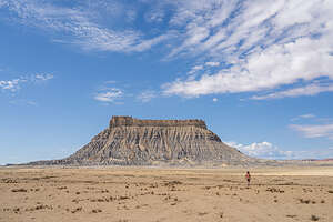
.thumbnail.jpg) Factory ButteIt is best shot at sunrise, but we were too busy photographing the badlands from the Moonscape Overlook. Too bad you can only be at one place at a time for sunrise. Maybe tomorrow morning, as we planned to camp somewhere near the Butte.
Factory ButteIt is best shot at sunrise, but we were too busy photographing the badlands from the Moonscape Overlook. Too bad you can only be at one place at a time for sunrise. Maybe tomorrow morning, as we planned to camp somewhere near the Butte.
Since we camped at the Moonscape Overlook last night, it was a short drive directly west. It’s very hard to miss as it pretty much dominates the landscape, rising to 6,302 feet above a lunar-like badlands.
 Factory ButteIf you haven’t camped and are coming from Hanksville, just follow the same directions we described for the Moonscape Overlook. Drive 10.6 miles west on Utah 24, and then turn right onto Coal Mine Road (also called Factory Butte Road). From there drive about 5.5 miles on the dirt road for a turnoff.
We had missed the morning golden hour, but the Butte was still pretty amazing. Today, we would drive around the entire Butte, attacking it from every angle.
.thumbnail.jpg) Lolo trying to find a way across the ravineThe southern end of Factory Butte is actually an OHV area, so there were lots of dune buggy tracks across the plateau, going in every direction. I was just glad there was none zipping about today, as it would have very much destroyed a very peaceful setting.
Lolo trying to find a way across the ravineThe southern end of Factory Butte is actually an OHV area, so there were lots of dune buggy tracks across the plateau, going in every direction. I was just glad there was none zipping about today, as it would have very much destroyed a very peaceful setting.
Up until then, we had been following what was an obviously established dirt road, but then we went off-off-road a bit and followed their tracks.
Continuing on along our circumnavigation of Factory Butte, going north along its eastern side, we turned left onto a dirt road that Gaia showed that would bring us very close to the Butte. We followed it, hoping we would get some interesting foreground, but the road that Gaia indicated led us to a deep ravine, uncrossable by any vehicle.
.thumbnail.jpg) Factory ButteI got out of the car and crossed it on foot, looking for a possible way we could get across. Meanwhile, I saw Herb start driving the car alongside the ravine, looking for me, but I was pretty deep in there. Eventually, I found a shallower spot to climb out of, but had to report that there was no way to get the car across.
Factory ButteI got out of the car and crossed it on foot, looking for a possible way we could get across. Meanwhile, I saw Herb start driving the car alongside the ravine, looking for me, but I was pretty deep in there. Eventually, I found a shallower spot to climb out of, but had to report that there was no way to get the car across.
Oh well. Gaia is usually really good, but conditions do change, so back out to the main road we went.
 Along the drive around Factory ButteWe continued our counter-clockwise drive around the Butte, starting to think about places to camp for the night. This would break our usual camp 2 nights, stay in a hotel 1 night rule, which Herb has implemented to keep me happy, but I was game, especially because the Goblin Valley Campground had a nice shower.
We rounded the northern end of the Butte and started heading south along its western side, looking for the spot that Herb had marked on Gaia as a possibly good vantage point of Factory Butte’s west side. When we got there, we couldn’t even see the Butte. Then we realized that the steep hill of dirt and shale to our left was blocking us, and the Butte was hiding on the other side.
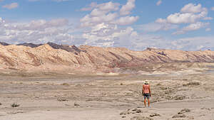
.thumbnail.jpg) West side of Factory ButteSo, we got out of the car and started scrambling up the hill. As we neared the top, the threatening-looking clouds behind us that had been building towards the west got even more ominous, and we saw our first lightning bolt and shortly (too shortly for my comfort) afterwards the thunder clap.
West side of Factory ButteSo, we got out of the car and started scrambling up the hill. As we neared the top, the threatening-looking clouds behind us that had been building towards the west got even more ominous, and we saw our first lightning bolt and shortly (too shortly for my comfort) afterwards the thunder clap.
Let’s get out of here, Herb said as he started scrambling back down the hill. I was still on my way up, only about 20 yards from the top, so I somewhat foolishing continued up and took a photo. Ironically, the skies over the Butte were blue with nice puffy clouds, but when I turned around to start heading back down to the car, it was a very different situation.
.thumbnail.jpg) Storm's comingI ran as fast as I could down the slippery shale, seeing two more lightning strikes on my way. I was so happy to finally reach the safety of the car before it started to rain pretty hard.
Storm's comingI ran as fast as I could down the slippery shale, seeing two more lightning strikes on my way. I was so happy to finally reach the safety of the car before it started to rain pretty hard.
Although we were safe in the car, our problems weren’t over yet, because it’s not good to be driving in an area prone to flash floods, especially when you have to cross several washes. We looked at Gaia and figured we had about 8 miles to drive to get back to the safety of the asphalt of Highway 24. No time to waste, so we high-tailed it out of there as fast as we could.
 Safe and sound at the Whispering Sands HotelSo much for camping tonight. That’s what happens for trying to break the 2 nights camping, 1 night hotel rule.
When we got out to Highway 24, we turned right (west) through Capitol Reef towards Torrey where we thought we would spend the night. Our plans, however, were thwarted when the Fremont River decided to flood the entire road, closing it for hours.
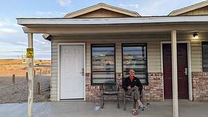
We had no choice but to head back east to Hanksville to hopefully find a place for the night. Luckily, we got the last room at the Whispering Sands Hotel, and who should be there but our good friends Kevin and Mark, sitting in front of their cabin? Didn’t we just see them this morning at the Moonscape sunrise? Obviously, we were traveling in the same circles.
.thumbnail.jpg) Herb and the DukeThis would be the third time we crossed trails. They were going out later that night to do some night sky photography and asked us if we wanted to come along, but we declined, as we had already had a very long day, and we were looking forward to a shower and a nice glass of wine on our fancy porch.
Herb and the DukeThis would be the third time we crossed trails. They were going out later that night to do some night sky photography and asked us if we wanted to come along, but we declined, as we had already had a very long day, and we were looking forward to a shower and a nice glass of wine on our fancy porch.
Plus, we had a night out on the town planned at Duke’s Slickrock Grill. Fortunately, for being the only game in town the food was really good and the portions were very large (Kevin and Mark loved this place), but it was a bit heavy on the meat and light on the vegetable options to support a sustainable healthy lifestyle.
So as they say that Hanksville is a really, really nice place to visit, but I wouldn't want to live here.
- ‹ previous
- 10 of 16
- next ›
Factory Butte location map in "high definition"
Javascript is required to view this map.
