- Home
- About
- Map
- Trips
- Bringing Boat West
- Migration West
- Solo Motorcycle Ride
- Final Family XC Trip
- Colorado Rockies
- Graduates' XC Trip
- Yosemite & Nevada
- Colorado & Utah
- Best of Utah
- Southern Loop
- Pacific Northwest
- Northern Loop
- Los Angeles to NYC
- East Coast Trips
- Martha's Vineyard
- 1 Week in Quebec
- Southeast Coast
- NH Backpacking
- Martha's Vineyard
- Canadian Maritimes
- Ocracoke Island
- Edisto Island
- First Landing '02
- Hunting Island '02
- Stowe in Winter
- Hunting Island '01
- Lake Placid
- Chesapeake
- Provincetown
- Hunting Island '00
- Acadia in Winter
- Boston Suburbs
- Niagara Falls
- First Landing '99
- Cape Hatteras
- West Coast Trips
- Burning Man
- Utah Off-Roading
- Maui
- Mojave 4WD Course
- Colorado River Rafting
- Bishop & Death Valley
- Kauai
- Yosemite Fall
- Utah Off-Road
- Lost Coast
- Yosemite Valley
- Arizona and New Mexico
- Pescadero & Capitola
- Bishop & Death Valley
- San Diego, Anza Borrego, Joshua Tree
- Carmel
- Death Valley in Fall
- Yosemite in the Fall
- Pacific Northwest
- Utah Off-Roading
- Southern CA Deserts
- Yosemite & Covid
- Lake Powell Covid
- Eastern Sierra & Covid
- Bishop & Death Valley
- Central & SE Oregon
- Mojave Road
- Eastern Sierra
- Trinity Alps
- Tuolumne Meadows
- Lake Powell Boating
- Eastern Sierra
- Yosemite Winter
- Hawaii
- 4WD Eastern Sierra
- 4WD Death Valley +
- Southern CA Deserts
- Christmas in Tahoe
- Yosemite & Pinnacles
- Totality
- Yosemite & Sierra
- Yosemite Christmas
- Yosemite, San Diego
- Yosemite & North CA
- Seattle to Sierra
- Southwest Deserts
- Yosemite & Sierra
- Pacific Northwest
- Yosemite & South CA
- Pacific Northwest
- Northern California
- Southern Alaska
- Vancouver Island
- International Trips
- Index
- Tips
- Books
- Photos/Videos
- Search
- Contact
Canyon Creek Trailhead to the Sinks, CA
Tuesday, September 25, 2018 - 9:30pm by Lolo
3 miles and 1.3 hours from our last stop - 1 night stay
Travelogue
 Into the WoodsAs I mentioned in the overview, our trip itinerary was a 3-night backpack along the Canyon Creeks Trail, with a side trip to Boulder Creeks Lake, about a 22-mile adventure.
The drive from our home to the trailhead for the Canyon Creeks Hike was about 5 hours from our home. Getting there was very well spelled out in the guide books. Before getting to the trailhead, we stopped at the Weaverville Ranger Station to pick up a wilderness permit at the self-serve kiosk right outside the building. Herb had already obtained the required campfire permit online. We also signed a registration book where we listed our planned itinerary.
From the town of Weaverville, which is about 45 miles west of Redding, we continued straight on Highway 299 for 8 miles to the tiny town of Junction City, where we turned right onto Canyon Creek Road, and continued another 13.8 miles to a large parking lot at the end of the road, right next to the Ripstein Campground.
We arrived at the trailhead around 4:00 pm, just enough time to do our 3-mile hike into an area called the Sinks, where we planned to camp for the night. Our neighbors, as well as the guide books, had described this as a good place to stop on a first night.
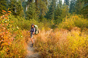
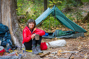
 Our campsite at the SinksWe did the final checking of gear, loaded our packs on our backs, and set off on the trail for Canyon Creek. After a short distance, we came to a junction, Bear Creek to the right and Canyon Creek to the left.
The trail was pretty nondescript - no big views, just a peaceful forest of dogwood, maple, oak, and Douglas fir. We knew we were supposed to come to the Sinks at about the 3-mile point, so when we saw a spur trail off to the left at 2.9 miles, we took it. During the spring, there is supposed to be a little island nestled between two arms of a creek, but now everything was bone dry. We followed a dry creek bed until we found a spot flat enough to camp for the night.
I wasn’t particularly impressed, but Herb said that it was probably quite nice in the spring when water was flowing. We set up the tent and made dinner before it got dark.
- 1 of 4
- next ›
Canyon Creek Trailhead to the Sinks location map in "high definition"
Javascript is required to view this map.
